Skip to content
YearMaps
France · Islands

Largest Islands of France

Corse is the largest of the 22 islands recorded for France, at 16,391 km², ahead of Îles Kerguelen at 13,264 km². The full list follows.

How this list is built: Ranked by mapped area. An island divided between countries is listed under each, with the area of the whole island. It covers the islands indexed in YearMaps, drawn from open geospatial data, and is not an exhaustive national register.

Islands Listed
22
Top Ranked
16,391 km²
Corse
Second
13,264 km²
Îles Kerguelen
Profiled Below
21
Photo, encyclopedia text and figures
Largest Islands of France
#NameArea
1Corse16,391 km²
2Îles Kerguelen13,264 km²
3Îles Crozet2,979 km²
4Reunion2,589 km²
5Tahiti1,038 km²
6Mayotte383 km²
7Hiva Oa342 km²
8Nuku Hiva337 km²
9îles Wallis301 km²
10Raiatea175 km²
11Moorea120 km²
12Ua Pou117 km²
13Fatu Hiva87 km²
14Île Futuna82 km²
15Niau81 km²
16Tatakoto81 km²
17Anaa80 km²
18Tematagi78 km²
19Eiao42 km²
20Huahine29 km²
21Bora Bora17 km²
22Îles Loyauté3 km²

The Islands of France in Detail

The 21 islands above that have an encyclopedia article, in the same order, each with its photograph, figures and the places around it.

Corse
Image via Wikimedia Commons (author and licence on the file page).

Corse

Island · 16,391 km²

Corse is an island in Europe (Mediterranean Sea), covering an estimated 16,391 km².

Corsica is an island in the Mediterranean Sea and one of the 18 regions of France. It is the fourth-largest island in the Mediterranean and lies southeast of the French mainland, west of the Italian Peninsula and immediately north of the Italian island of Sardinia, the nearest land mass. A single chain of mountains makes up two-thirds of the island. As of January 2026, it had a population of 365,636.

The island is a territorial collectivity of France, and is expected to achieve "a form of autonomy" within France in the future. The regional capital is Ajaccio. Although the region is divided into two administrative departments, Haute-Corse and Corse-du-Sud, their respective regional and departmental territorial collectivities were merged on 1 January 2018 to form the single territorial collectivity of Corsica. Corsican autonomy is more extensive than in other regional collectivities of France and the Corsican Assembly is permitted to exercise limited executive powers. Corsica's second largest town is Bastia, located in the prefecture of Haute-Corse.

Corsica was ruled by the Republic of Genoa from 1284 to 1755, when it seceded to become a self-proclaimed, Italian-speaking republic.

Adapted from Wikipedia: Corsica (CC BY-SA 4.0).

Feature class
Island
Mapped extent
16,391 km²
Size rank
#120 of 445 islands
Region
Europe
Subregion
Mediterranean Sea
Coordinates
42.2375°, 9.0734°
Summits:
Mont Agel (140 m), Monte Titano (739 m), Corno Grande (2,912 m)
Ranges:
Appennini (Europe), Alps (Europe)
Settlements:
Ajaccio (45 km), Bastia (60 km), Olbia (152 km)

View on the live map

More about Corse

Geography

Corsica was formed about 250 million years ago with the uplift of a granite backbone on the western side. About 50 million years ago sedimentary rock was pressed against this granite, forming the schists of the eastern side. It is the most mountainous island in the Mediterranean, a "mountain in the sea".

The island is 183 km (114 mi) long at its longest, 83 km (52 mi) wide at its widest, has 1,000 km (620 mi) of coastline, with more than 200 beaches such as Paraguano. Corsica is very mountainous, with Monte Cinto as the highest peak at 2,706 m (8,878 ft), and around 120 other summits of more than 2,000 m (6,600 ft). Mountains comprise two-thirds of the island, forming a single chain. Forests make up 20% of the island.

History

Corsica has been occupied since the Mesolithic era, otherwise known as the Middle Stone Age. The permanent human presence in Corsica is documented in the Neolithic period from the 6th millennium BC.

After a brief occupation by the Carthaginians, colonization by the ancient Greeks, and a slightly longer occupation by the Etruscans, it was incorporated by the Roman Republic at the end of the First Punic War. In 238 BC, along with Sardinia, the islands became a province of the Roman Republic. The Romans established colonies at Mariana and Aléria on the east coast, but they had little control over the interior. The Greeks, who had earlier built a colony in Aléria, considered Corsica to be one of the most backward regions of the Roman world.

Ecology

The island is divided into four major ecological zones, by altitude. Below 600 metres (2,000 ft) is the coastal zone's mild Mediterranean climate, with hot, dry summers and cool, rainy winters. The area's natural vegetation is sparse Mediterranean forest, scrubland, and shrubs. The coastal lowlands are part of the Tyrrhenian-Adriatic sclerophyllous and mixed forests ecoregion, in which forests and woodlands of evergreen sclerophyll oaks predominate, chiefly holm oak (Quercus ilex) and cork oak (Quercus suber). Much of the coastal lowlands have been cleared for agriculture, grazing and logging; these activities have reduced the forest area considerably.

Between 600 and 1,800 m (2,000 and 5,900 ft) is a temperate montane zone.

Economy

The gross domestic product (GDP) of the region was 10 billion euros in 2021.

In 1584 the Republic of Genoa governor ordered all farmers and landowners to plant four trees yearly; a chestnut, olive, ficus, and mulberry tree. Many communities owe their origin and former richness to the ensuing chestnut woods. Chestnut bread keeps fresh for as long as two weeks.

Corsica's main exports are granite and marble, tannic acid, cork, cheese, wine, citrus fruit, olive oil and cigarettes.

Sections adapted from Wikipedia: Corsica (CC BY-SA 4.0).

Corse: Key Facts

Key facts about Corse
Area8,680 km²
Population355,486 (2023)
Highest pointMonte Cinto
Surrounded byMediterranean Sea

Facts from Wikidata Q14112 (CC0).

Îles Kerguelen
Image via Wikimedia Commons (author and licence on the file page).

Îles Kerguelen

Island group · 13,264 km²

Îles Kerguelen is an island group in Seven seas (open ocean) (Southern Indian Ocean), covering an estimated 13,264 km².

The Kerguelen Islands, also known as the Desolation Islands, are a group of islands in the subantarctic region. They are among the most isolated places on Earth, with the closest territory being the Heard Island and McDonald Islands territory of Australia roughly 450 kilometres (240 nautical miles) to the southeast, and the nearest permanently inhabited territory being Madagascar more than 3,300 km (1,800 nmi) away. The islands, along with Adélie Land, the Crozet Islands, Amsterdam and Saint Paul islands, and France's Scattered Islands in the Indian Ocean, are part of the French Southern and Antarctic Lands and are administered as a separate district.

The islands constitute one of the two exposed parts of the Kerguelen Plateau (the other being Heard Island and the McDonald islands), a large igneous province mostly submerged in the southern Indian Ocean. The main island, Grande Terre, is 6,675 km2 (2,577 mi2) in area, about three-quarters of the size of Corsica, and is surrounded by a further 300 smaller islands and islets, forming an archipelago of 7,215 km2 (2,786 mi2). The climate is harsh and chilly with frequent high winds throughout the year.

Adapted from Wikipedia: Kerguelen Islands (CC BY-SA 4.0).

Feature class
Island group
Mapped extent
13,264 km²
Size rank
#130 of 445 islands
Region
Seven seas (open ocean)
Subregion
Southern Indian Ocean
Coordinates
-49.2897°, 69.2618°
Summits:
Mount McMaster (2,830 m), Isachsen Mountain (3,425 m), Piton des Neiges (3,069 m)
Ranges:
Napier Mountains (Antarctica), Prince Charles Mountains (Antarctica)
Settlements:
St.-Benoit (3,371 km), Curepipe (3,393 km), St.-Denis (3,396 km)

View on the live map

More about Îles Kerguelen

History

Before being officially catalogued in 1772, the Kerguelen Islands appear as the "Ile de Nachtegal" on Philippe Buache's 1754 map of the islands of the Southern Ocean. It is possible this early name was after Abel Tasman's ship De Zeeuwsche Nachtegaal. On the Buache map, "Ile de Nachtegal" is located at 43°S, 72°E, about 6° north and 2° east of the actual location of Grande Terre.

The islands were officially discovered by the French navigator Yves-Joseph de Kerguelen-Trémarec on 12 February 1772. The next day, Charles du Boisguehenneuc landed and claimed the island for the French crown. Yves de Kerguelen organised a second expedition in 1773 and arrived at the "baie de l'Oiseau" by December 1773.

Geology

The Kerguelen Islands form an emerged part of the submerged Kerguelen Plateau, which has a total area nearing 949,000 km2 (366,000 sq mi). The plateau was built by volcanic eruptions associated with the Kerguelen hotspot, and now lies on the Antarctic Plate.

The major part of the volcanic formations visible on the islands is characteristic of an effusive volcanism, which caused a trap rock formation to start emerging above the level of the ocean 35 million years ago. The accumulation is of a considerable amount; basalt flows, each with a thickness of three to ten metres, stacked on top of each other, sometimes up to a depth of 1,200 metres (660 fathoms). This form of volcanism creates a monumental relief shaped as stairs of pyramids.

Climate

Kerguelen's climate is oceanic, cold, and extremely windswept. Under the Köppen climate classification, Kerguelen's climate is considered to be an ET or tundra climate, which is technically a form of polar climate, as the average temperature in the warmest month is below 10 °C (50 °F). Comparable climates include the Aleutian Islands, Campbell Island (New Zealand), Iceland, northern Kamchatka Peninsula (Russia), Labrador (Canada), and Wollaston Islands (Chile).

All climate readings come from the Port-aux-Français base, which has one of the more favourable climates in Kerguelen because of its proximity to the coast and its location in a gulf sheltered from the wind.

The average annual temperature is 4.9 °C (40.8 °F) with an annual range of around 6 °C (11 °F).

Economy

Principal activities on the Kerguelen Islands focus on scientific research, mostly earth sciences and biology.

The former sounding rocket range to the east of Port-aux-Français is currently the site of a SuperDARN radar.

Since 1992, the French Centre National d'Études Spatiales (CNES) has operated a satellite and rocket tracking station, located four kilometres (2+1⁄2 mi) east of Port-aux-Français.

Sections adapted from Wikipedia: Kerguelen Islands (CC BY-SA 4.0).

Îles Kerguelen: Key Facts

Key facts about Îles Kerguelen
Area7,215 km²
Population45 (2024)
Highest pointMont Ross
Surrounded byIndian Ocean

Facts from Wikidata Q46772 (CC0).

Îles Crozet
Image via Wikimedia Commons (author and licence on the file page).

Îles Crozet

Island group · 2,979 km²

Îles Crozet is an island group in Seven seas (open ocean) (Southern Indian Ocean), covering an estimated 2,979 km².

The Crozet Islands (French: Îles Crozet French pronunciation: [il kʁozɛ]; or, officially, Archipel Crozet [aʁʃipɛl -]) are a sub-Antarctic archipelago of small islands in the southern Indian Ocean. They form one of the five administrative districts of the French Southern and Antarctic Lands.

Adapted from Wikipedia: Crozet Islands (CC BY-SA 4.0).

Feature class
Island group
Mapped extent
2,979 km²
Size rank
#225 of 445 islands
Region
Seven seas (open ocean)
Subregion
Southern Indian Ocean
Coordinates
-46.3101°, 51.3849°
Summits:
Mount McMaster (2,830 m), Thabana Ntlenyana (3,482 m), Mafadi (3,451 m)
Ranges:
Napier Mountains (Antarctica), Drakensberg (Africa)
Settlements:
East London (2,485 km), Port Shepstone (2,499 km), Bhisho (2,525 km)

View on the live map

More about Îles Crozet

Geography

(1) Group of two major islands (Grande Île—Big Island, and Petite Île—Little Island) and about 20 pinnacle rocks.

The Eastern and Western Groups are 94.5 km (51 nmi) apart (from Île des Pingouins to Île de la Possession).

The Crozet Islands are uninhabited except for the research station Alfred Faure (Port Alfred) on the east side of Île de la Possession, which has been continuously staffed since 1963. Previous scientific stations included La Grande Manchotière and La Petite Manchotière.

The Crozet Islands have a maritime-influenced tundra climate (Köppen climate classification, ET). Monthly temperatures average around 2.9 °C (37 °F) and 7.9 °C (46 °F) in winter and summer, respectively. Precipitation is high, with over 2,000 mm (78.7 in) per year.

History

The Crozet Islands were discovered on 24 January 1772, by the expedition of French explorer Marc-Joseph Marion du Fresne, aboard Le Mascarin. His second-in-command, Julien-Marie Crozet, landed on Île de la Possession, claiming the archipelago for France. In 1776, Crozet met James Cook at Cape Town, at the start of Cook's third voyage. Crozet shared the charts of his ill-fated expedition, and as Cook sailed eastward, he stopped at the islands, naming the western group Marion and the eastern group Crozet. In the following years, sealers visiting the islands referred to both the eastern and western groups as the Crozet Islands, and Marion Island became the name of the larger of the two Prince Edward Islands, which had been discovered by Captain Marion on the same expedition.

Geology

The islands lie on the Antarctic Plate, roughly between the Kerguelen hotspot and Madagascar and southern Africa. The oldest island, Île de l'Est, formed roughly 9 million years ago from a hotspot, which has continued forming islands to the west until, ostensibly, the present. Despite this apparently young age, no volcanic activity has been observed to date on any of the islands.

Sections adapted from Wikipedia: Crozet Islands (CC BY-SA 4.0).

Îles Crozet: Key Facts

Key facts about Îles Crozet
Area352 km²
Highest pointMont Marion-Dufresne
Surrounded byIndian Ocean

Facts from Wikidata Q201698 (CC0).

Visiting Îles Crozet

The Crozet Islands (French and very commonly in English: Îles Crozet) are an uninhabited Subantarctic archipelago that makes up one of the five districts of the French Southern and Antarctic Lands in the southern Indian Ocean. The only sign of human civilisation that exists is 1 Alfred Faure, a research station on Île de la Possession.

The volcanic archipelago is remote – the closest other islands are the Prince Edward Islands a little over 1,050 km (650 mi) to the west, Kerguelen around 1,400 km (870 mi) ESE and the Heard Island and McDonald Islands 1,800 km (1,100 mi) to the southeast, keeping in mind that these islands are mostly uninhabited.

Travel notes adapted from Wikivoyage: Crozet Islands (CC BY-SA 4.0).

Reunion
Image via Wikimedia Commons (author and licence on the file page).

Reunion

Island · 2,589 km²

Reunion is an island in Seven seas (open ocean) (Mascarene Islands), covering an estimated 2,589 km².

Réunion (; French: [la ʁe.ynjɔ̃] ; Reunionese Creole: La Rényon; known as Île Bourbon before 1848) is an island in the Indian Ocean that is an overseas department and region of France within the African region. Part of the Mascarene Islands, it is located approximately 679 kilometres (367 nautical miles) east of the island of Madagascar and 175 kilometres (94 nmi) southwest of the island of Mauritius. As of January 2026, it had a population of 910,985. Its capital and largest city is Saint-Denis.

Before the arrival of French colonial subjects and immigrants in the 17th century, Réunion was an uninhabited island. Its tropical climate led to the development of a plantation economy focused primarily on sugar; slaves from East Africa were imported as fieldworkers, followed by Malays, Vietnamese, Chinese, and Indians as indentured laborers. Today, the greatest proportion of the population is of mixed descent, while the predominant language is Réunion Creole, though French remains the sole official language.

Since 1946, Réunion has been governed as a French region and thus has a similar status to its counterparts in Metropolitan France.

Adapted from Wikipedia: Réunion (CC BY-SA 4.0).

Feature class
Island
Mapped extent
2,589 km²
Size rank
#235 of 445 islands
Region
Seven seas (open ocean)
Subregion
Mascarene Islands
Coordinates
-21.0906°, 55.5096°
Summits:
Piton des Neiges (3,069 m), Maromokotro (2,876 m), Benara (660 m)
Ranges:
Inyanga Mountains (Africa), Lebombo Mountains (Africa)
Settlements:
St.-Benoit (22 km), St.-Denis (24 km), Curepipe (226 km)

View on the live map

More about Reunion

Geography

The island is 63 km (39 mi) long; 45 km (28 mi) wide; and covers 2,512 km2 (970 mi2). It is above a hotspot in the Earth's crust. The Piton de la Fournaise, a shield volcano on the eastern end of Réunion, rises more than 2,631 m (8,632 ft) above sea level and is sometimes called a sister to Hawaiian volcanoes because of the similarity of climate and volcanic nature. It has erupted more than 100 times since 1640, and is under constant monitoring, most recently erupting on 13 February 2026. During another eruption in April 2007, the lava flow was estimated at 3,000,000 m3 (3,900,000 yd3) per day. The hotspot that fuels Piton de la Fournaise also created the islands of Mauritius and Rodrigues.

History

The island has been inhabited since the 17th century, when people from France and Madagascar settled there. Slavery was abolished on 20 December 1848 (a date celebrated yearly on the island), when the Second Republic that had been established months earlier by the February Revolution abolished slavery in the French colonies. However, indentured workers continued to be brought to Réunion from South India, among other places. The island became an overseas department of France in 1946.

مغربي Daniyah/ Maghribīy). The island is possibly featured on a map from 1153 AD by Al Sharif el-Edrisi. The island might also have been visited by Swahili or Austronesian (ancient Indonesian–Malaysian) sailors on their journey to the west from the Malay Archipelago to Madagascar.

Demographics

At the 2022 census, 79.5% of the inhabitants of Réunion were born on the island, 13.4% were born in Metropolitan France, 2.0% were born in Mayotte, 0.3% were born in the rest of Overseas France, and 4.8% were born in foreign countries (44% of them children of French expatriates and settlers born in foreign countries, such as children of Réunionese settlers born in Madagascar during colonial times; the other 56% immigrants, i.e. people born in foreign countries with no French nationality at birth).

Economy

In 2019, the GDP of Réunion at market exchange rates, not at PPP, was estimated at 19.5 billion euros (US$21.8 bn) and the GDP per capita (also at market exchange rates) was 22,629 euros (US$25,333), the highest in sub-Saharan Africa, but only 61.7% of metropolitan France's GDP per capita that year, and 73.5% of the metropolitan French regions outside the Paris Region.

Before the 2008 financial crisis, the economy of Réunion was in a process of catching up with the rest of France. From 1997 to 2007, the economy of Réunion grew by an average of +4.6% per year in real terms, and the GDP per capita rose from 53.7% of metropolitan France's level in 2000 to 61.6% of metropolitan France in 2007.

Sections adapted from Wikipedia: Réunion (CC BY-SA 4.0).

Reunion: Key Facts

Key facts about Reunion
Area2,512 km²
Population889,679 (2023)
Highest pointPiton des Neiges
Surrounded byIndian Ocean

Facts from Wikidata Q17070 (CC0).

Visiting Reunion

Reunion Island (French: Ile de La Réunion) is a French overseas department located in the midst of the Indian Ocean, east of the island of Madagascar and 200 kilometres (120 mi) to the south-west of Mauritius, in East Africa. This enchanting destination is blessed with a tropical climate and beautiful volcanic landscapes, with its appeal being as much due to its white sandy beaches as its mountain scenery. Réunion used to be known as the Isle de Bourbon and Isle Bonaparte.

Travel notes adapted from Wikivoyage: Réunion (CC BY-SA 4.0).

Tahiti
Image via Wikimedia Commons (author and licence on the file page).

Tahiti

Island group · 1,038 km²

Tahiti is an island group in Oceania (Polynesia), covering an estimated 1,038 km². It extends across French Polynesia and France.

Tahiti (English: ; Tahitian: [taˈhiti, ˈthaiti]; French: [ta.iti]) is the largest island of the Windward group of the Society Islands in French Polynesia, an overseas collectivity of France. It is a tropical island located in the central part of the Pacific Ocean. Tahiti is composed of two roughly circular land masses joined by an isthmus: Tahiti Nui and Tahiti Iti. Both are the eroded remnants of now-extinct shield volcanoes. The terrain of Tahiti is mostly high and mountainous, with the beaches and coral reefs that surround the island supporting tourism and fishing industries.

Tahiti's population was 189,517 in 2017, making it by far the most populous island in French Polynesia and accounting for 68.7% of the collectivity's total population; the 2022 Census recorded a population of 191,779. Tahiti is the economic, cultural, and political centre of French Polynesia. The capital of French Polynesia, Papeʻete, is located on the northwest coast of Tahiti. The only international airport in the region, Faʻaʻā International Airport, is on Tahiti near Papeʻete.

Tahiti was originally settled by Polynesians between 900 and 1100 CE.

Adapted from Wikipedia: Tahiti (CC BY-SA 4.0).

Feature class
Island group
Mapped extent
1,038 km²
Size rank
#292 of 445 islands
Region
Oceania
Subregion
Polynesia
Countries
French Polynesia, France
Coordinates
-17.6256°, -149.4671°
Summits:
Mont Orohena (2,241 m), Mont Humboldt (1,618 m), Mont Panié (1,628 m)
Ranges:
Southern Alps (Oceania), Australian Alps (Oceania)
Settlements:
Brest (15,359 km), Cherbourg (15,440 km), St.-Brieuc (15,453 km)

View on the live map

More about Tahiti

Geography, climate and vegetation

Tahiti is the highest and largest island in French Polynesia, and is close to Moʻorea island. It is located 4,400 kilometres (2,376 nautical miles) south of Hawaiʻi, 7,900 km (4,266 nmi) from Chile, 5,700 km (3,078 nmi) from Australia. The nearest major landmass is the North Island of New Zealand, approximately 3,800 kilometres (2,052 nautical miles) to the south-west.

The island is 45 km (28 mi) across at its widest point and covers an area of 1,045 km2 (403 sq mi). The highest peak is Mont Orohena (Mouʻa ʻOrohena) (2,241 m (7,352 ft)). Mount Roonui, or Mount Ronui (Mouʻa Rōnui), in the southeast rises to 1,332 m (4,370 ft). The island consists of two roughly round portions centered on volcanic mountains and connected by a short isthmus of Taravao.

History

The first Tahitians arrived from Western Polynesia into the Society Islands sometime after 900 CE; some studies have proposed slightly later dates, ∼1025–1120 CE. Linguistic, biological and archaeological evidence supports a long migration from Southeast Asia via the Fijian, Samoan and Tongan Archipelagos using outrigger canoes that were up to twenty or thirty metres long and could transport families as well as domestic animals.

Before the arrival of the Europeans, the island was divided into territories, each dominated by a single clan. The most important clans were the closely related Teva i Uta (Teva of the Interior) and the Teva i Tai (Teva of the Sea) whose combined territory extended from the peninsula in the south of Tahiti Nui.

Economy

Tourism is a significant industry, generating 17% of GDP before the COVID-19 pandemic.

The main trading partners are Metropolitan France for about 40% of imports and about 25% of exports. The other main trading partners are China, the US, South Korea, and New Zealand.

Tahitian pearl (Black pearl) farming is also a substantial source of revenue, with most pearls exported to Japan, Europe, and the United States. Tahiti also exports vanilla, fruits, flowers, monoi, fish, copra oil, and noni. Tahiti is also home to a single winery, whose vineyards are located on the Rangiroa atoll.

Unemployment affects about 15% of the active population, especially women and unqualified young people.

Sections adapted from Wikipedia: Tahiti (CC BY-SA 4.0).

Tahiti: Key Facts

Key facts about Tahiti
Area1,042 km²
Population178,133 (2007)
Highest pointMont Orohena
Surrounded byPacific Ocean

Facts from Wikidata Q42000 (CC0).

Hiva Oa
Image via Wikimedia Commons (author and licence on the file page).

Hiva Oa

Island group · 342 km²

Hiva Oa is an island group in Oceania (Polynesia), covering an estimated 342 km². It extends across French Polynesia and France.

With its 320 square kilometres (124 square miles), Hiva Oa (Marquesan: Hivaʻoa) is the second largest island in the Marquesas Islands, in French Polynesia, an overseas territory of France in the Pacific Ocean. It is the largest island of the southern Marquesas group. Around 2,200 people reside on the island. A volcano, Temetiu, is Hiva Oa's highest point, reaching an elevation of 1,269 m (4,163 ft.)

Adapted from Wikipedia: Hiva Oa (CC BY-SA 4.0).

Feature class
Island group
Mapped extent
342 km²
Size rank
#352 of 445 islands
Region
Oceania
Subregion
Polynesia
Countries
French Polynesia, France
Coordinates
-9.7488°, -139.0185°
Summits:
Mont Orohena (2,241 m), Mont Humboldt (1,618 m), Mont Panié (1,628 m)
Ranges:
Sierra Madre Occidental (North America), Sierra Madre Oriental (North America)
Settlements:
Brest (13,993 km), St.-Brieuc (14,094 km), Cherbourg (14,095 km)

View on the live map

More about Hiva Oa

Geography

Hiva Oa is the largest and most fertile of the southern Marquesas islands and second only to Nuku Hiva in size. Similar to all the larger Marquesas, Hiva Oa features cliffs abruptly rising from the ocean to a rugged interior spine of volcanic mountains, ridges, and deep, isolated valleys. Unlike most other Polynesian islands near the equator, no fringing coral reefs protect Hiva Oa from the pounding of the ocean, and only a few sheltered anchorages and sandy beaches are scattered around the coast. Travel along the shoreline is by boat, as most of the coastal terrain is too rugged for roads. A few dirt roads traverse the interior, linking seacoast villages and settlements.

History

The first recorded sighting of Hiva Oa by the Europeans was by the Spanish expedition of Álvaro de Mendaña on 21 July 1595. They charted it as Dominica.

German forces briefly occupied the island under the command of Admiral Von Spee in October 1914.

Economy

Subsistence agriculture, a combination of fishing, pig and chicken farming, and the cultivation of staple crops such as breadfruit, coconut, yam, taro, sweet potatoes, and bananas, remains the basis of the island's economy. Part of the copra is grown for export. Tourism has so far existed only to a small extent, but it is economically important, as otherwise there would be few jobs on the island. The currency is the CFP franc, which is pegged to the euro.

Overview

Administratively, Hiva Oa is part of the commune (municipality) of Hiva-Oa, itself in the administrative subdivision of the Marquesas Islands. Atuona, on the coast of Hiva Oa island, is the administrative centre of the commune. Atuona was formerly the seat of government for all of the Marquesas Islands, but it has been replaced by Taioha'e on Nuku Hiva island.

The island is famous as the final home of French painter Paul Gauguin and Belgian singer Jacques Brel, both of whom are buried in Calvary Cemetery, overlooking Atuona. It is also home to the largest tiki sculptures in French Polynesia.

In late pre-European times, the island was nearly evenly divided into two provinces—Nuku in the west, and Pepane in the east.

Sections adapted from Wikipedia: Hiva Oa (CC BY-SA 4.0).

Hiva Oa: Key Facts

Key facts about Hiva Oa
Area316 km²
Population2,371 (2022)
Highest pointTemetiu
Surrounded byPacific Ocean

Facts from Wikidata Q937908 (CC0).

Nuku Hiva
Image via Wikimedia Commons (author and licence on the file page).

Nuku Hiva

Island group · 337 km²

Nuku Hiva is an island group in Oceania (Polynesia), covering an estimated 337 km². It extends across French Polynesia and France.

Nuku Hiva (sometimes spelled Nukahiva or Nukuhiva) is the largest of the Marquesas Islands in French Polynesia, an overseas country of France in the Pacific Ocean. It was formerly also known as Île Marchand and Madison Island.

Herman Melville wrote his book Typee based on his experiences in the Taipivai valley in the eastern part of Nuku Hiva. Robert Louis Stevenson's first landfall on his voyage on the Casco was at Hatihe'u, on the north side of the island, in 1888.

Adapted from Wikipedia: Nuku Hiva (CC BY-SA 4.0).

Feature class
Island group
Mapped extent
337 km²
Size rank
#354 of 445 islands
Region
Oceania
Subregion
Polynesia
Countries
French Polynesia, France
Coordinates
-8.8570°, -140.1754°
Summits:
Mont Orohena (2,241 m), Mont Humboldt (1,618 m), Mont Panié (1,628 m)
Ranges:
Sierra Madre Occidental (North America), Sierra Nevada (North America)
Settlements:
Brest (13,985 km), Cherbourg (14,081 km), St.-Brieuc (14,084 km)

View on the live map

More about Nuku Hiva

Geography

Western Nuku Hiva is characterized by a steep but fairly regular coastline, indented occasionally by small bays, leading to deep valleys, which in turn lead into the interior. There are no villages on the western side. The coastline of the eastern part of the island has few places to land by sea and takes the brunt of the ocean swells. The northern side, in contrast, is indented by deep bays, the largest of which are Anahō and Hatihe'u. A third bay, 'A'akapa, is smaller and lies next to a village of the same name. The southern side has fewer bays. One is at Taioha'e. Three others, at Taipivai, Ho'oumi, and Hakaui, are part of the larger Baie du Contrôleur. Another two, at Hakau'i and Hakatea, are both accessed by the same narrow entrance.

History

Nuku Hiva was, in historical times, the site of two provinces, Te I'i covering somewhat more than the western two thirds of the island, and Tai Pī, covering the eastern third.

Latest studies indicate that the first people to arrive here came from west Polynesia around 2000 years ago, only later colonizing Tahiti, Hawai'i, The Cook Islands and New Zealand.

The legend has it that 'Ono, the god of creation, promised his wife to build a house in one day, so he gathered together land and created these islands, which are all named after parts of the house, Nuku Hiva being the roof. Everything he had left over he threw to one side and created a dump which is called 'Ua Huka.

Demographics

The population in 2007 was 2,660. This is substantially less than that encountered at the end of the 16th century when the Spaniards first sighted the island. Contacts with Europeans may have brought New World infections such as venereal disease and influenza, causing high mortality. Historical sources are sparse, and it is unclear when various diseases commonly seen in the New World, Europe and Asia first appeared in Nuku Hiva. The population has increased to 3,210 by 2017.

The population is primarily Polynesian with a small proportion of Europeans, mostly from Metropolitan France. At the 2002 census, 92.6% of Nuku Hiva's residents were born in French Polynesia while 148 people, making up 5.6% of Nuku Hiva's residents, were people born in Metropolitan France.

Sections adapted from Wikipedia: Nuku Hiva (CC BY-SA 4.0).

Nuku Hiva: Key Facts

Key facts about Nuku Hiva
Area339 km²
Population2,660 (2007)
Highest pointTekao
Surrounded byPacific Ocean

Facts from Wikidata Q21064 (CC0).

îles Wallis
Image via Wikimedia Commons (author and licence on the file page).

îles Wallis

Island group · 301 km²

îles Wallis is an island group in Oceania (Polynesia), covering an estimated 301 km².

Wallis and Futuna, officially the Territory of the Wallis and Futuna Islands ( ), is a French island collectivity in the South Pacific, situated between Tuvalu to the northwest, Fiji to the southwest, Tonga to the southeast, Samoa to the east, and Tokelau to the northeast.

Mata Utu is its capital and largest city. Wallis and Futuna is associated with the European Union as an overseas country and territory (OCT). The territory's land area is 142.42 km2 (54.99 sq mi). It had a population of 11,151 at the July 2023 census (down from 14,944 at the 2003 census). The territory is made up of three main volcanic tropical islands and a number of tiny islets. It is divided into two island groups that lie about 260 km (160 mi) apart: the Wallis Islands (also known as Uvea) in the northeast; and the Hoorn Islands (also known as the Futuna Islands) in the southwest, including Futuna Island proper and the mostly uninhabited Alofi Island.

Since 28 March 2003, Wallis and Futuna has been a French overseas collectivity (collectivité d'outre-mer, or COM). Between 1961 and 2003, it had the status of a French overseas territory (territoire d'outre-mer, or TOM).

Adapted from Wikipedia: Wallis and Futuna (CC BY-SA 4.0).

Feature class
Island group
Mapped extent
301 km²
Size rank
#360 of 445 islands
Region
Oceania
Subregion
Polynesia
Coordinates
-13.2793°, -176.1592°
Summits:
Mauga Silisili (1,858 m), Lata Mountain (966 m), Tomanivi (1,323 m)
Ranges:
Southern Alps (Oceania), Owen Stanley Range (Oceania)
Settlements:
Apia (482 km), Labasa (592 km), Funafuti (732 km)

View on the live map

More about îles Wallis

Geography and climate

Wallis and Futuna is located at 13°18′S 176°12′W, 360 km (220 mi) west of Samoa and 480 km (300 mi) northeast of Fiji — about one-third of the way northeast from New Zealand towards Hawaii.

The territory includes the island of Uvéa (also called Wallis), which is the most populous; the island of Futuna; the virtually uninhabited island of Alofi; and 20 uninhabited islets. The total area of the territory is 274 km2 (106 sq mi), with 129 km (80 mi) of coastline. The highest point in the territory is Mont Puke, on the island of Futuna, at 524 m (1,719 ft).

The islands have a hot, rainy season from November to April, when tropical cyclones passing over them cause storms.

History

The earliest signs of human habitation on these islands are artifacts characteristic of the Lapita culture, dating roughly to between 850 and 800 BCE. The islands served as natural stopover points for boat traffic, mostly between Fiji and Samoa. During Tongan invasions in the 15th and 16th centuries, the islands defended themselves with varying levels of resistance, but also accepted varying degrees of assimilation. Futuna retained more of its pre-Tongan cultural features, while Wallis underwent greater fundamental changes in its society, language, and culture. The original inhabitants built forts and other identifiable structures on the islands (many of which are in ruins), some of which are still partially intact.

Demographics

The total population of the territory at the July 2023 census was 11,151 (72.5% on the island of Wallis, 27.5% on the island of Futuna), down from 14,944 at the July 2003 census. The vast majority of the population are of Polynesian ethnicity, with a small minority who were born in Metropolitan France or are of French European descent.

Lack of economic opportunities has, since the 1950s, been impelling many young Wallisians and Futunians to migrate to the more prosperous French territory of New Caledonia, where, as French citizens, they are legally entitled to settle and work. Since the mid-2000s, emigration has surged in response to political tensions on the main island of Wallis (Uvea), that have arisen from a feud between rival aristocratic clans, who are supporting competing kings.

Economy

The GDP of Wallis and Futuna in 2019 was US$212 million (at market exchange rates).

The territory's economy consists mostly of traditional subsistence agriculture, with about 80% of the labor force earning its livelihood from agriculture (coconuts and vegetables), livestock (mostly pigs), and fishing. About 4% of the population is employed in government. Additional revenue comes from French government subsidies, licensing of fishing rights to Japan and South Korea, import taxes, and remittances from expatriate workers in New Caledonia, French Polynesia, and France.

Sections adapted from Wikipedia: Wallis and Futuna (CC BY-SA 4.0).

îles Wallis: Key Facts

Key facts about îles Wallis
Area274 km²
Population11,558 (2018)
Highest pointMont Puke

Facts from Wikidata Q35555 (CC0).

Raiatea
Image via Wikimedia Commons (author and licence on the file page).

Raiatea

Island group · 175 km²

Raiatea is an island group in Oceania (Polynesia), covering an estimated 175 km². It extends across French Polynesia and France.

Raʻiātea or Raiatea (Tahitian: Raʻiātea) is the second largest of the Society Islands, after Tahiti, in French Polynesia, in the South Pacific Ocean. The island is widely regarded as the "centre" of the eastern islands in ancient Polynesia, and it is likely that the organised migrations to the Hawaiian Islands, and other parts of East Polynesia, started at Raʻiātea.

A traditional name for the island is Havai'i, homeland of the Māori people. Situated on the southeast coast is the historical Taputapuatea marae, which was established by 1000 CE. The site was the political and religious center of eastern Polynesia for several centuries, and was inscribed on the UNESCO World Heritage List in 2017 for its historical significance.

The main township on Raʻiātea is Uturoa, the administrative centre for the Leeward Islands (French Îles Sous-le-vent). There are also colleges which serve as the main educational location for secondary schools for students from the regional islands of Bora Bora, Tahaa, Huahine and Maupiti.

Adapted from Wikipedia: Raʻiātea (CC BY-SA 4.0).

Feature class
Island group
Mapped extent
175 km²
Size rank
#374 of 445 islands
Region
Oceania
Subregion
Polynesia
Countries
French Polynesia, France
Coordinates
-16.8311°, -151.4375°
Summits:
Mont Orohena (2,241 m), Mont Humboldt (1,618 m), Mont Panié (1,628 m)
Ranges:
Southern Alps (Oceania), Australian Alps (Oceania)
Settlements:
Brest (15,403 km), Cherbourg (15,471 km), St.-Brieuc (15,492 km)

View on the live map

More about Raiatea

Geography

With a total area of 175 km2, it is the second largest island of the Society archipelago, after Tahiti. Tahaa lies north of Raiatea, the two islands are separated by a 3 km strait. According to legend, it is the work of an enchanted moray eel possessed by the spirit of a deceased princess. A coral barrier reef surrounds the islands of Raiatea and Tahaa which share the same lagoon. The boat trip from Raiatea to Tahaa across the lagoon only takes about 20 minutes.

Raiatea's landscape is characterized by rugged peaks, a heavily indented coastline with deeply indented bays, and numerous small, tiny islands located in the lagoon.

There are three main mountain masses on the island, connected by lower ridges. The central mass includes Mount Tefatoaiti (1,017 m), the island's highest peak.

History

The Polynesian navigator Tupaia, who sailed with explorer James Cook, was born in Raiatea around 1725. Cook visited Raiatea in 1769 and again in 1773–1774. He named the island "Ulitea". Omai (c.1751–1780), another young man from Raiatea, travelled with European explorers to London in 1774 and also served as an interpreter to Captain Cook on his second and third journeys.

In ancient times the island was called Havai'i, a sacred name in Polynesian culture and related to the names of Hawaii; Savai'i, in Samoa; and Havaiki, the ancient name for Fakarava in the Tuamotu. According to recent findings, the Society Islands were colonised from Samoa and Tonga around 200 BC, about the same time as the Marquesas.

Economy

The island economy is mainly agricultural with exports of vanilla, pineapple and coconut. The plant Nono (or noni) (Morinda citrifolia) is also grown. Fā'aroa Valley is a large and important agricultural region with the rural economy and the cultivation of vanilla supported by a local research facility. Pearl farming is also an important industry while farming cattle, sheep and pigs has recently decreased. There is less tourism compared to the other islands in the archipelago. The local tourist infrastructure comprises boarding houses, two marinas, a four star hotel, The Hawaiki Nui and a port for visiting cruise ships. There is also a fledgling local industry in the maintenance of yachts and shipbuilding.

Tourism

Although the island has several hotels up to the luxury category, Raiatea is quieter and less developed in terms of tourism compared to Tahiti and Bora Bora. Raiatea is especially attractive to offshore sailors. There are several yacht charter companies, and the island is often referred to as the nautical center of Polynesia. There are marinas with good infrastructure in Uturoa and Baie Faaroa to the west. The island is visited by cruise ships from time to time.

The somewhat sleepy-looking main town of Uturoa offers no special attractions.

Sections adapted from Wikipedia: Raʻiātea (CC BY-SA 4.0).

Raiatea: Key Facts

Key facts about Raiatea
Area175 km²
Population12,245 (2012)
Highest pointMount Temehani
Surrounded byPacific Ocean

Facts from Wikidata Q847008 (CC0).

Moorea
Image via Wikimedia Commons (author and licence on the file page).

Moorea

Island · 120 km²

Moorea is an island in Oceania (Polynesia), covering an estimated 120 km². It extends across French Polynesia and France.

Moʼorea (English: or ; Tahitian: Moʼoreʼa, [moʔore(ʔ)a]), also spelled Moorea, is a volcanic island in French Polynesia lying 17 kilometres (11 mi) northwest of Tahiti. Moʼorea and Tahiti are the largest members of the Windward Islands, a group that is part of the larger Society Islands archipelago.

Moʼoreʼa means 'yellow lizard' in Tahitian: Moʼo = lizard; Reʼa (from reʼareʼa) = yellow. An older name for the island is ʼAimeho, sometimes spelled ʼAimeo or ʼEimeo (among other spellings that were used by early visitors before Tahitian spelling was standardized). Early Western colonists and voyagers also referred to Moʼorea as York Island or Santo Domingo.

Adapted from Wikipedia: Moʼorea (CC BY-SA 4.0).

Feature class
Island
Mapped extent
120 km²
Size rank
#385 of 445 islands
Region
Oceania
Subregion
Polynesia
Countries
French Polynesia, France
Coordinates
-17.5242°, -149.8559°
Summits:
Mont Orohena (2,241 m), Mont Humboldt (1,618 m), Mont Panié (1,628 m)
Ranges:
Southern Alps (Oceania), Australian Alps (Oceania)
Settlements:
Brest (15,373 km), Cherbourg (15,452 km), St.-Brieuc (15,466 km)

View on the live map

More about Moorea

Geography

Moʼorea is about 16 km (10 miles) across. There are two small, nearly symmetrical bays on the north shore. The one to the west is called ʼŌpūnohu Bay. The main surrounding communes of the bay are Pihaʼena in the east and Papetōʼai to the west. The one to the east is Cook's Bay, also called Pao Pao Bay since the largest commune of Moʼorea is at the head of the bay. The other communes are Pihaʼena to the west and busy Maharepa to the east. The highest point is Mount Tohivea, near the center of Moʼorea. It dominates the vista from the two bays and can be seen from Tahiti. Vaiʼare Bay is another small inlet, smaller than the two main bays, on the east shore where there is a ferry terminal with services to and from Tahiti.

History

According to recent archaeological evidence, the Society Islands were probably settled from Samoa and Tonga around 200 CE.

Nine tribal principalities emerged in the enclosed valleys, which in turn were subdivided into individual clans. The stratified society was characterized by a hierarchical leadership whose elite combined both political and religious power. The leading families of Moʼorea remained linked by marriage and kinship for centuries with those of the neighboring island of Tahiti. These connections led to important alliances, but at other times were also the source of bloody conflicts.

Economy

This island is one of the main tourist destinations in French Polynesia, where there are several luxury resorts.

Transportation to this island is usually done from Tahiti by air transport in flights of about 5 minutes or through numerous ferries that move from the port of Papeʼete to Moʼorea. It is also possible to hire a private boat for transport.

Moʼorea is visited by many western tourists who travel to French Polynesia. Especially popular as a honeymoon destination, Moʼorea can often be seen in advertisements in American wedding magazines.

Arthur Frommer declared in Frommer's travel guide that he considered it "the most beautiful island in the world".

The main source of income has been tourism since the 1960s.

Sections adapted from Wikipedia: Moʼorea (CC BY-SA 4.0).

Moorea: Key Facts

Key facts about Moorea
Area134 km²
Population16,191 (2007)
Highest pointMount Tohivea
Surrounded byPacific Ocean, Opunohu Bay

Facts from Wikidata Q673400 (CC0).

Ua Pou
Image via Wikimedia Commons (author and licence on the file page).

Ua Pou

Island · 117 km²

Ua Pou is an island in Oceania (Polynesia), covering an estimated 117 km². It extends across French Polynesia and France.

Ua Pou (French: Ua Pou, North Marquesan: ’uapou) is the third-largest of the Marquesas Islands, in French Polynesia, an overseas territory of France in the Pacific Ocean.

Adapted from Wikipedia: Ua Pou (CC BY-SA 4.0).

Feature class
Island
Mapped extent
117 km²
Size rank
#386 of 445 islands
Region
Oceania
Subregion
Polynesia
Countries
French Polynesia, France
Coordinates
-9.3789°, -140.0927°
Summits:
Mont Orohena (2,241 m), Mont Humboldt (1,618 m), Mont Panié (1,628 m)
Ranges:
Sierra Madre Occidental (North America), Sierra Nevada (North America)
Settlements:
Brest (14,027 km), Cherbourg (14,125 km), St.-Brieuc (14,127 km)

View on the live map

More about Ua Pou

Geography

It is located about 50 km (30 mi.) south of Nuku Hiva, in the northern Marquesas. The center of the island is characterized by four high basalt pillars that reach high above the surrounding mountains. The highest of these pillars, Mount Oave (Mont Oave), reaches to 1,230 m (4,040 ft) above sea level and is the highest elevation in the Marquesas.

The island covers an area of 105.6 square kilometres (41 square miles), and is located just northwest of the small island of Motu Oa. The largest settlement is Hakahau, on Hakahau Bay, on the northeast coast.

With 2,200 inhabitants in the 2002 census, and 2,168 at the 2022 census, it is the most densely populated island of the archipelago.

History

Ua Pou is the only major island that was unified under a single monarch prior to the arrival of European explorers.

Prior to the island's unification, reportedly about 1585, there is evidence that the tribes of Ua Pou were sometimes united in war with the tribes of Te I'i on Nuku Hiva against those of Tai Pi Vai. Despite the fact that tribes from both the eastern and western halves of Ua Pou were often united in war against each other, however, it appears that such differences among them were not considered when members of tribes from either side of the island sought refuge among the tribes of Te I'i on Nuku Hiva.

Economy

The inhabitants live mainly from subsistence agriculture. The main foods are still fish and other marine animals, as well as yams, taro, breadfruit, coconuts, bananas and other tropical and subtropical fruits.

Although there are some private guesthouses with modest amenities, tourism plays only a minor role from an economic point of view.

In Hakahau, there is a small museum with a collection of art and objects of worship of the island. Next to it, a traditional Marquesan dwelling (tenai paepae) has been reconstructed on a habitable platform.

In several valleys are the remains of Polynesian aboriginal settlements, recognizable by their densely covered paepae (house platforms). Little has been discovered or restored.

Sections adapted from Wikipedia: Ua Pou (CC BY-SA 4.0).

Ua Pou: Key Facts

Key facts about Ua Pou
Area105 km²
Population2,157 (2007)
Highest pointMount Oave
Surrounded byPacific Ocean

Facts from Wikidata Q614645 (CC0).

Fatu Hiva
Image via Wikimedia Commons (author and licence on the file page).

Fatu Hiva

Island · 87 km²

Fatu Hiva is an island in Oceania (Polynesia), covering an estimated 87 km². It extends across French Polynesia and France.

Fatu-Hiva (the "H" is not pronounced, see name section below) is the southernmost island of the Marquesas Islands in French Polynesia, an overseas territory of France in the Pacific Ocean. With Motu Nao as its closest neighbour, it is also the most isolated of the inhabited islands.

Fatu Hiva is also the title of a book by explorer and archaeologist Thor Heyerdahl, in which he describes his stay on the island in the 1930s.

Adapted from Wikipedia: Fatu-Hiva (CC BY-SA 4.0).

Feature class
Island
Mapped extent
87 km²
Size rank
#391 of 445 islands
Region
Oceania
Subregion
Polynesia
Countries
French Polynesia, France
Coordinates
-10.5014°, -138.6549°
Summits:
Mont Orohena (2,241 m), Mont Humboldt (1,618 m), Mont Panié (1,628 m)
Ranges:
Sierra Madre Occidental (North America), Sierra Madre Oriental (North America)
Settlements:
Brest (14,037 km), St.-Brieuc (14,139 km), Cherbourg (14,143 km)

View on the live map

More about Fatu Hiva

Geography

The eastern coastline of Fatu-Hiva is characterized by a number of narrow valleys, carved by streams that lead to the interior. Between these valleys are headlands which terminate in cliffs that plunge directly into the sea, making travel between them possible only by crossing the high mountain ridges, or by boat. The largest of these valleys is at Uia.

The western coastline has two significant bays, Hana Vave (also known as Bay of Virgins or Baie des Vierges) in the north, one of the most picturesque sites in the South Pacific, and the well-protected harbor of Omoa near the south. There are several smaller valleys between these two.

The centre of the island is a plateau which is covered largely by tall grasses and pandanus trees.

History

Like the other islands of the archipelago, Fatu Iva was originally populated by Polynesians, who probably came from Western Polynesia.

Rivalries between the different valleys were frequent. In one case, some time around the middle of the 19th century, the Anainoapa tribe of Hanavave and the Tiu of Omoa confronted each other. The latter, defeated, fled the island on bamboo rafts and ended up in the Tuamotus, on Napuka Atoll, where their descendants still live. The Tiu sorcerer, who remained on Fatu Iva, revealed to the victors the names of the places in the valley (a way of acknowledging their sovereignty), and had himself buried alive, head down, symbolizing his defeat and the end of his tribe.

Demographics

Fatu-Hiva's population was 584 at the 2002 census, 611 in 2012, and 600 in 2022. Its main villages are Omoa, which is the capital and is situated in Omoa bay, and Hanavave, which is in Hanavave bay. The population lives mainly on agriculture, handicrafts and tourism. The island's orography does not allow the construction of an airstrip; it is accessible only by boat.

School emigration: as there is no secondary school on the island, young people must leave at a young age—first to Hiva Oa, then to Papeete—to pursue their studies. Many do not return to Fatu-Hiva afterwards.

Economic emigration: the island's development prospects are limited by its isolation, as it is the most remote of the islands of the archipelago, and its rugged terrain prevents the building of an airstrip.

Economy

The primary sector is still predominant in Fatu-Hiva, with a focus on fishing, especially tuna, mackerel, bonito, swordfish and marlin, as well as crayfish. The municipality has a cold storage facility that allows fish to be stored while waiting for cargo ships to sell the merchandise. Copra cultivation is still very important, as is the more recent cultivation of noni. Coffee cultivation was practically abandoned in the second half of the 20th century.

Sections adapted from Wikipedia: Fatu-Hiva (CC BY-SA 4.0).

Fatu Hiva: Key Facts

Key facts about Fatu Hiva
Area84 km²
Population587 (2007)
Surrounded byPacific Ocean

Facts from Wikidata Q632061 (CC0).

Île Futuna
Image via Wikimedia Commons (author and licence on the file page).

Île Futuna

Island · 82 km²

Île Futuna is an island in Oceania (Polynesia), covering an estimated 82 km².

Futuna (; French: [fu.tu.na]) is the largest island in Hoorn Islands or Îles Horne, located in the Pacific Ocean, part of the French overseas collectivity (collectivité d'outre-mer) of Wallis and Futuna. The island occupies an area of 80 km2 (30 sq mi) and as of 2018 it has a population of 3,225.

Futuna is a local name, the etymology of which is unknown.

Adapted from Wikipedia: Futuna (Wallis and Futuna) (CC BY-SA 4.0).

Feature class
Island
Mapped extent
82 km²
Size rank
#407 of 445 islands
Region
Oceania
Subregion
Polynesia
Coordinates
-14.2741°, -178.1431°
Summits:
Tomanivi (1,323 m), Mauga Silisili (1,858 m), Lata Mountain (966 m)
Ranges:
Southern Alps (Oceania), Owen Stanley Range (Oceania)
Settlements:
Labasa (356 km), Suva (562 km), Lautoka (598 km)

View on the live map

More about Île Futuna

Geography

Futuna and Alofi are both remnants of the same extinct volcano, now bordering with a fringing reef. Futuna's highest point is Mont Puke at 524 m (1,719 ft) above sea level, and the island has an area of 83 km2 (32 sq mi), with 53 km2 (20 sq mi) in Sigave and 30 km2 (12 sq mi) in Alo. It is separated from Wallis Island to the north by water deeper than 4,500 m (14,800 ft) in the Vitiaz Trench.

Futuna island has large Upper Pliocene volcanic lava flows, as well as breccias and hyaloclastite deposits from underwater eruptions.

Futuna is on the Futuna Ridge (Futuna–Alofi volcanic ridge) that lies along a boundary of interaction between the colliding Pacific and Australia plate, between the North Fiji transform fault to the south and the now inactive tectonically Vitiaz Trench.

History

The first Europeans to map Futuna and Alofi were Willem Schouten and Jacob Le Maire in 1616 during their circumnavigation of the globe on the ship Eendracht. After sailing to Niuafoʻou, they suddenly changed course from west to northwest, thereby bringing them to these two islands. The islands were given the exonym Hoorn Eylanden, after the city of Hoorn, Schouten's birthplace. This became Horne in French and English. They also discovered a natural harbor along the southwest coast of Futuna, which they named Eendrachts baai (Unity Bay) after their ship. It is thought that their landing place was the site of the Anse de Sigave near what is today called Leava.

Schouten and Le Maire had learned from earlier experiences how to approach islanders successfully.

Demographics

As of the 2018 census, the population of the island was 3,225, with 1,950 residing in the Alo district and 1,275 in Sigave. Futuna makes up approximately 27.9% of the population of Wallis and Futuna. The most spoken languages on Futuna are Futunan (94.5%), French (5.3%), and Wallisian (0.2%).

Sections adapted from Wikipedia: Futuna (Wallis and Futuna) (CC BY-SA 4.0).

Île Futuna: Key Facts

Key facts about Île Futuna
Area46.3 km²
Population3,612
Highest pointMont Puke
Surrounded byPacific Ocean

Facts from Wikidata Q664321 (CC0).

Niau
Image via Wikimedia Commons (author and licence on the file page).

Niau

Island · 81 km²

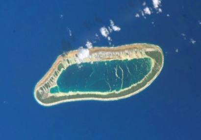
Niau is an island in Oceania (Polynesia), covering an estimated 81 km².

Niau is a small atoll in French Polynesia, in the commune of Fakarava (Tuamotu archipelago). This atoll has a broad fringing reef, a diameter of 8 km and an area of 53 km2.

Niau's lagoon is swampy, hypersaline and entirely enclosed. The narrow strip of land surrounding the lagoon is covered by marsh vegetation. The enclosed lagoon area is 33 km2, making the land size at 20 km2.

The only human settlement on Niau is Tupana, population 226 (as of 2012).

Adapted from Wikipedia: Niau (CC BY-SA 4.0).

Feature class
Island
Mapped extent
81 km²
Size rank
#409 of 445 islands
Region
Oceania
Subregion
Polynesia
Coordinates
-16.1377°, -146.3714°
Summits:
Mont Orohena (2,241 m), Lata Mountain (966 m), Mauga Silisili (1,858 m)
Ranges:
Southern Alps (Oceania), Sierra Madre Occidental (North America)
Settlements:
Papeete (374 km), Apia (2,735 km), Nukualofa (3,086 km)

View on the live map

More about Niau

Ecology

Niau is one of the few locations where the original Tuamotu tropical moist forests ecosystem (known locally as feo) has been preserved. This mixed broadleaf forest ecosystem has disappeared on almost all other atolls. The forest has been preserved in the central parts of the island. It contains several endemic species of plants and animals.

The small Niau kingfisher Todiramphus gertrudae lives now exclusively in the island of Niau. This critically endangered bird disappeared from the Gambier Islands long ago.

Sections adapted from Wikipedia: Niau (CC BY-SA 4.0).

Niau: Key Facts

Key facts about Niau
Area33 km²
Population246 (2017)
Surrounded byPacific Ocean

Facts from Wikidata Q1984650 (CC0).

Tatakoto
Image via Wikimedia Commons (author and licence on the file page).

Tatakoto

Island · 81 km²

Tatakoto is an island in Oceania (Polynesia), covering an estimated 81 km².

Tatakoto is an atoll in the Tuamotu group in French Polynesia.

Tatakoto is one of the more isolated atolls of the Tuamotus. It is situated in the east of the archipelago, 1,182 kilometres (734 miles) from Tahiti. This atoll is 14 kilometres (9 miles) long and 3.5 kilometres (2 miles) wide. It has one large island and 65 islets separated by numerous channels on the reef surrounding the lagoon. The islands are mostly located on its windward side (south). All the islands are flat, not much higher than the ocean level. Its land area is about 7.3 km2, and the lagoon area is about 20 km2.

The main settlement is Tumukuru, and the total population was 180 in the 2022 census.

Adapted from Wikipedia: Tatakoto (CC BY-SA 4.0).

Feature class
Island
Mapped extent
81 km²
Size rank
#412 of 445 islands
Region
Oceania
Subregion
Polynesia
Coordinates
-17.3356°, -138.4448°
Summits:
Mont Orohena (2,241 m), Lata Mountain (966 m), Mauga Silisili (1,858 m)
Ranges:
Southern Alps (Oceania), Sierra Madre Occidental (North America)
Settlements:
Papeete (1,180 km), Apia (3,583 km), Nukualofa (3,876 km)

View on the live map

More about Tatakoto

History

Tatakoto Atoll was sighted the same day by two Spaniards. In the second expedition of the Águila, the two captains, Domingo de Bonechea and José Andía y Varela, separated when leaving Peru and did not see each other until reaching Tahiti. On 29 October 1774 (the day of Saint Narcissus) the two disembarked on Tatakoto without meeting. They named the island "San Narciso". Historically the island was also known as "d'Augier".

Chronicler José Andía described the atoll as "extremely agreeable to the eyes by being very populated by shrubs." At the beginning of the twentieth century France established a colony and replanted the island with coconut palms, which still cover the island.

Sections adapted from Wikipedia: Tatakoto (CC BY-SA 4.0).

Tatakoto: Key Facts

Key facts about Tatakoto
Area20 km²
Surrounded byPacific Ocean

Facts from Wikidata Q953358 (CC0).

Anaa
Image via Wikimedia Commons (author and licence on the file page).

Anaa

Island · 80 km²

Anaa is an island in Oceania (Polynesia), covering an estimated 80 km².

Anaa, Nganaa-nui (or Ara-ura) is an atoll in the Tuamotu archipelago, in French Polynesia. It is located in the north-west of the archipelago, 350 km to the east of Tahiti. It is oval in shape, 29.5 km in length and 6.5 km wide, with a total land area of 38 km2 and a population of 504. The atoll is made up by eleven small barren islands with deeper and more fertile soil than other atolls in the Tuamotus. The lagoon is shallow, without entrance, and formed by three main basins. Although it does not have any navigable access, the water of the lagoon renews by several small channels that can be crossed walking.

Adapted from Wikipedia: Anaa (CC BY-SA 4.0).

Feature class
Island
Mapped extent
80 km²
Size rank
#417 of 445 islands
Region
Oceania
Subregion
Polynesia
Coordinates
-17.4398°, -145.4129°
Summits:
Mont Orohena (2,241 m), Lata Mountain (966 m), Mauga Silisili (1,858 m)
Ranges:
Southern Alps (Oceania), Sierra Madre Occidental (North America)
Settlements:
Papeete (441 km), Apia (2,845 km), Nukualofa (3,151 km)

View on the live map

More about Anaa

Geography

Kereteki, Mania, Omanaotika, Oparari, Otepipi, Putuahara, Teharie, Tematahoa and Tukuhora.

The lagoon is shallow, with no navigable passages to the ocean, and consists of 3 main basins. Although it has no navigable passages, the lagoon water is renewed by several shallow channels that can be crossed on foot.

Geologically, the atoll is the coral outgrowth (105 meters) of the top of a large volcanic seamount of the same name (the "Anaa Ridge", 11,438 m3), measuring 3,415 meters from the seafloor, formed some 52.5-59.6 million years ago.

The atoll is home to an endemic population of long-billed warblers and its lagoon has colonies of Cardium fragum.

The main village is Tuuhora, also called Tukuhora or Anaa, with a population of about 350.

History

The atoll of Anaa was known by the legendary cruelty of its soldiers who in the seventeenth century, dominated the north-west of the Tuamotus.

The Spanish expedition of Pedro Fernández de Quirós landed on Conversión de San Pablo on 10 February 1606, since identified as either Anaa or Hao. The sighting of Anaa was recorded by French explorer Louis Antoine de Bougainville in 1768. James Cook sighted it in 1769. Because of its shape, he called it Chain Island. Later, Anaa was visited by Spanish explorer Domingo de Bonechea, on November 1 of 1772, who called it Isla de Todos los Santos (All Saints Island) because they arrived on All Saints' Day.

At the beginning of the nineteenth century, control of the atoll went to the Pomaré of Tahiti.

Economy

Most of the atoll's economic activity is related to fishing and fish farming, as well as copra production, with coconut plantations cultivated on virtually every motus (islets).

Anaa has an airfield (IATA code: AAA) near the main town of Tukuhora with a runway 1,400 meters long. On average, it handles about 140 flights and 3,500 passengers per year.

Sections adapted from Wikipedia: Anaa (CC BY-SA 4.0).

Anaa: Key Facts

Key facts about Anaa
Area90 km²
Surrounded byPacific Ocean

Facts from Wikidata Q483126 (CC0).

Tematagi
Image via Wikimedia Commons (author and licence on the file page).

Tematagi

Island · 78 km²

Tematagi is an island in Oceania (Polynesia), covering an estimated 78 km².

Tematagi or Tematangi is an atoll in the southeastern area of the Tuamotu Archipelago, French Polynesia. Tematagi's nearest neighbour is Mururoa, which is located 161 kilometres (100 miles) to the ESE.

Tematagi is a medium-sized atoll. It measures approximately 11.5 kilometres (7.1 miles) in length and has a maximum width of 7 kilometres (4.3 miles) with a land area of almost 8 square kilometres (3.1 square miles). As its reef completely encloses the deep lagoon, which is 61 square kilometres (24 square miles), there is no navigable pass to enter the lagoon.

There are many relatively large islands on Tematagi's reef, as well as a few small motu. The main village is Tuihana. There were 58 inhabitants on Tematagi in the last census.

Adapted from Wikipedia: Tematagi (CC BY-SA 4.0).

Feature class
Island
Mapped extent
78 km²
Size rank
#421 of 445 islands
Region
Oceania
Subregion
Polynesia
Coordinates
-21.6843°, -140.6510°
Summits:
Mont Orohena (2,241 m), Lata Mountain (966 m), Mauga Silisili (1,858 m)
Ranges:
Southern Alps (Oceania), Flood Range (Antarctica)
Settlements:
Papeete (1,041 km), Apia (3,399 km), Nukualofa (3,572 km)

View on the live map

More about Tematagi

History

The first recorded European to visit this atoll was Captain William Bligh on the ship Providence on April 5, 1792. At the time of Bligh's visit, it was uninhabited. Tematagi Atoll appears in some maps as "Bligh's Lagoon Island".

When Frederick Beechey visited Tematagi in 1826 he found inhabitants there. In 1857, the captain of the Julia, coasting along Tematagi Atoll saw armed natives follow the course of his schooner... "clad in many-coloured stuffs".

Sections adapted from Wikipedia: Tematagi (CC BY-SA 4.0).

Tematagi: Key Facts

Key facts about Tematagi
Area61 km²
Population0 (2007)
Surrounded byPacific Ocean

Facts from Wikidata Q1531438 (CC0).

Eiao
Image via Wikimedia Commons (author and licence on the file page).

Eiao

Island · 42 km²

Eiao is an island in Oceania (Polynesia), covering an estimated 42 km².

Eiao is the largest of the extreme northwestern Marquesas Islands. The island is uninhabited, but is administratively part of the commune (municipality) of Nuku-Hiva, itself in the administrative subdivision of the Marquesas Islands.

As of 2022, the only settlement on the island is a small shelter on the north coast of Vaithua Bay with a water tap. There are some small artificial structures in the north of the island, most likely for archeological purposes. There is a small shrine of Mother Mary somewhere along a trail to the plateau at the top of the island.

Adapted from Wikipedia: Eiao (CC BY-SA 4.0).

Feature class
Island
Mapped extent
42 km²
Size rank
#435 of 445 islands
Region
Oceania
Subregion
Polynesia
Coordinates
-7.9966°, -140.7081°
Summits:
Mont Orohena (2,241 m), Lata Mountain (966 m), Mauna Kea (4,205 m)
Ranges:
Sierra Madre Occidental (North America), Sierra Nevada (North America)
Settlements:
Papeete (1,430 km), Apia (3,447 km), Hilo (3,459 km)

View on the live map

More about Eiao

Geography

Eiao is a remnant of a caldera wall in a 5 million-year-old volcano, which measured 25 km (16 mi). The island is a 12 km (7.5 mi) long and 4 km (2.5 mi) wide crescent shape, measuring 50 square kilometres (12,000 acres).

The center of this island is the high Tohuanui plateau, rising on the east side to 576 m (1,890 ft) above sea level, much of which has been devastated by herds of feral sheep and other animals brought here by humans. This plateau is a red desert which covers around 50–60% of the island. The Hanataaitoki Valley is contained in this plateau.

The rest of the island is mainly filled with tropical fauna, including coconut and candlenut trees. There is one good anchorage, found on the western side of the island at Vaituha.

History

In pre-European times, the bodies of chiefs from parts of Te I'i were taken to Eiao for burial.

Eiao was once home to a Marquesan tribe called the Tuametaki. Archaeological investigations have discovered workshops for the production of stone tools, especially adzes, made from local basalt. These tools have been found in archaeological sites on other islands as far as Kiribati, providing evidence for prehistoric inter-island voyaging within this island group. In sites around Polynesia, it was estimated that around 50% of adzes came from Eiao at the peak. Broken adzes and unused chips of basalt were found all across the southern part of the island and plateau. Much of the production settlements were located along the northern plateau, primarily in the Hanataaitoki valley.

Sections adapted from Wikipedia: Eiao (CC BY-SA 4.0).

Eiao: Key Facts

Key facts about Eiao
Area43.8 km²
Population0
Surrounded byPacific Ocean

Facts from Wikidata Q1301066 (CC0).

Huahine
Image via Wikimedia Commons (author and licence on the file page).

Huahine

Island · 29 km²

Huahine is an island in Oceania (Polynesia), covering an estimated 29 km².

Huahine is an island located among the Society Islands, in French Polynesia, an overseas territory of France in the South Pacific Ocean. It is part of the Leeward Islands group (Îles sous le Vent). At the 2022 census, it had a population of 6,263.

Adapted from Wikipedia: Huahine (CC BY-SA 4.0).

Feature class
Island
Mapped extent
29 km²
Size rank
#436 of 445 islands
Region
Oceania
Subregion
Polynesia
Coordinates
-16.7928°, -151.0112°
Summits:
Mont Orohena (2,241 m), Lata Mountain (966 m), Mauga Silisili (1,858 m)
Ranges:
Southern Alps (Oceania), Australian Alps (Oceania)
Settlements:
Papeete (174 km), Apia (2,246 km), Nukualofa (2,588 km)

View on the live map

More about Huahine

Geography

Huahine measures 16 km (10 mi) in length, with a maximum width of 13 km (8 mi). It is made up of two main islands surrounded by a fringing coral reef with several islets, or motu. Huahine Nui (Big Huahine) lies to the north and Huahine Iti (Little Huahine) to the south. The total land area is 75 km2 (29 sq mi). The two islands are separated by a few hundred metres of water and joined by a sandspit at low tide. A small bridge was built to connect Huahine Nui and Huahine Iti. Its highest point is Turi at 669 m elevation.

In the northwest of Huahine Nui lies a 375-hectare (930-acre) brackish lake known as Lac Fauna Nui (Lac Maeva). This lake is all that remains of the ancient atoll lagoon. Air transportation is available via Huahine airport, located on the northern shore of Huahine Nui.

History

Human presence on Huahine dates back at least a millennium, as evinced by the numerous Marae on the island. Archaeologists estimate that the ancient Tahitian Maʻohi people colonized Huahine from at least the 9th century AD. Huahine is home to one of the largest concentrations of Polynesian archaeological remains dated between 850 AD and 1100 AD.

The Hau-moʻo-rere dynasty was founded in the 17th century; its last representative was Queen Tehaʻapapa I, whom Captain Cook met in 1769. She maintained the cohesion and independence of her kingdom.

The Tamatoa dynasty has its origins in Tehaʻapapa I and her husband, Mato a Tamatoa, a member of the Tamatoa family of Raiatea. They were the founders of the Tamatoa branch of Huahine. This dynasty reigned until 1854.

Demographics

The total population was 5,999 inhabitants in the 2007 census, increasing to 6,263 in 2022, distributed across eight villages: Fare (the capital), Maeva, Faie, Fitii, Parea, Tefarerii, Haapu, and Maroe.

The main activities are vanilla cultivation, copra production, fishing, and tourism.

In terms of sports, Huahine is, along with neighboring Bora Bora, Tahaa and Raiatea, one of the four islands among which the Hawaiki Nui Vaʻa, an international Polynesian canoe (vaʻa) competition, is held.

Most of the population follows Christianity due to missionary activity by both the Catholic Church and various Protestant groups, as well as European colonization.

In 1809 the island had its first contact with Protestant Christian missionaries.

Economy

The inhabitants of the island are engaged in activities such as agriculture and fishing. Agricultural products include vanilla (Vanilla × tahitensis species) and various types of melons. Thanks to the lush coconut forest, copra production is also a very important activity for the local economy.

Tourism through cruise ship passengers calling at the atoll and the airport is another important economic sector.

Sections adapted from Wikipedia: Huahine (CC BY-SA 4.0).

Huahine: Key Facts

Key facts about Huahine
Area77.6 km²
Surrounded byPacific Ocean

Facts from Wikidata Q521020 (CC0).

Bora Bora
Image via Wikimedia Commons (author and licence on the file page).

Bora Bora

Island · 17 km²

Bora Bora is an island in Oceania (Polynesia), covering an estimated 17 km².

Bora Bora Island is a 19.91 km2 (8 sq mi) island in the Bora Bora Islands Group, within the Society Islands of French Polynesia. It is the main island of the commune of the same name. Together with its surrounding islands of Tapu, Ahuna, Tevairoa, Tane, Mute, Tufari, Tehotu, Pitiaau, Sofitel, Toopua, and Toopuaiti, it forms the group of Bora Bora.

Adapted from Wikipedia: Bora Bora Island (CC BY-SA 4.0).

Feature class
Island
Mapped extent
17 km²
Size rank
#438 of 445 islands
Region
Oceania
Subregion
Polynesia
Coordinates
-16.4908°, -151.7679°
Summits:
Mont Orohena (2,241 m), Lata Mountain (966 m), Mauga Silisili (1,858 m)
Ranges:
Southern Alps (Oceania), Australian Alps (Oceania)
Settlements:
Papeete (261 km), Apia (2,162 km), Nukualofa (2,519 km)

View on the live map

More about Bora Bora

Bora Bora: Key Facts

Key facts about Bora Bora
Area19.9 km²

Facts from Wikidata Q31929310 (CC0).

Îles Loyauté
Image via Wikimedia Commons (author and licence on the file page).

Îles Loyauté

Island group · 3 km²

Îles Loyauté is an island group in Oceania (Melanesia), covering an estimated 3 km².

Loyalty Islands Province (French: Province des îles Loyauté, pronounced [pʁɔvɛ̃s dez‿il lwajote]) is one of the three top-level administrative subdivisions of New Caledonia. It encompasses the Loyalty Islands (French: Îles Loyauté) archipelago in the Pacific Ocean, located northeast of the New Caledonian mainland of Grande Terre.

The provincial government seat is at Lifou. The Loyalty Islands are a collectivité territoriale of France. The province's 2019 population was approximately 18,353 inhabitants living on almost 2,000 km2 (770 sq mi). The native inhabitants are Melanesians who speak various Kanak languages and Polynesians who speak the Fagauvea language.

Adapted from Wikipedia: Loyalty Islands Province (CC BY-SA 4.0).

Feature class
Island group
Mapped extent
3 km²
Size rank
#443 of 445 islands
Region
Oceania
Subregion
Melanesia
Coordinates
-20.2386°, 166.8028°
Summits:
Mont Humboldt (1,618 m), Mont Panié (1,628 m), Mount Tabwemasana (1,877 m)
Ranges:
Great Dividing Range (Oceania), Owen Stanley Range (Oceania)
Settlements:
Nouméa (228 km), Port Vila (321 km), Nandi (1,148 km)

View on the live map

More about Îles Loyauté

Geography

The archipelago consists of six inhabited islands – Lifou Island, Maré Island, Tiga Island, Ouvéa Island, Mouli Island, and Faiava Island – and several smaller uninhabited islands and islets. Their combined land area is 1,981 km2 (765 sq mi). The highest elevation is at 138 m (453 ft) above sea level on Maré Island. The islands are part of the New Caledonia rain forests ecoregion. The chief export of the Loyalty Islands is copra.

An earthquake of moment magnitude 7.7 was reported just after midnight on 11 February 2021 in an area south-east of the islands, with several aftershocks.

History

The first Western contact on record is attributed to British Captain William Raven of the whaler Britannia, who was on his way in 1793 from Norfolk Island to Batavia (now called Jakarta). It is very likely, however, that the discovery and name originated with officials on the London ship Loyalty, which was on a Pacific Ocean trading voyage from 1789 to 1790.

The French Government demanded the removal of missionaries from the London Missionary Society led by Rev. Samuel Macfarlane from the Loyalty Islands and New Caledonia in 1869. This led to the missionaries travelling to the Torres Strait Islands on the vessel Surprise, in an event still celebrated as "The Coming of the Light", on 1 July 1871.

Demographics

The people of the Loyalty Islands are of mixed Melanesian and Polynesian ancestry, with a small European minority. The population numbered 17,436 in the 2009 census, a 7.9% reduction from the 22,080 in the preceding 2004 census. In 2014 the population grew to 18,297, an increase of 4.9%, and in 2019 the population grew a further 0.1% to 18,353.

Several thousand more Loyalty Islanders live on New Caledonia, especially in Nouméa, the capital, and in the mining areas of the main island.

Sections adapted from Wikipedia: Loyalty Islands Province (CC BY-SA 4.0).

Îles Loyauté: Key Facts

Key facts about Îles Loyauté
Area1,981 km²
Population18,671 (2025)

Facts from Wikidata Q18655787 (CC0).

More on France

Quick Answers

What is the largest island in France?
Corse, at 16,391 km². Îles Kerguelen is second at 13,264 km². Rankings cover the islands indexed in YearMaps.
How many islands are there in France?
YearMaps lists 22 islands for France. This is the number mapped in the atlas, not an official national count.