Skip to content
YearMaps
Antarctica · Landforms

Mountain Ranges, Deserts and Landforms of Antarctica

Antarctica is the largest of the 72 mountain ranges, deserts and other landforms recorded for Antarctica, at 11.93M km², ahead of Antarctic Ice Sheet at 5.66M km². The full list follows.

How this list is built: Ranked by mapped area. Covers mountain ranges, deserts, plateaus, named glaciers, plains, basins, peninsulas and capes. One that crosses a border is listed under every country it lies in, with the area of the whole feature. It covers the mountain ranges, deserts and other landforms indexed in YearMaps, drawn from open geospatial data, and is not an exhaustive national register.

Landforms Listed
72
Top Ranked
11.93M km²
Antarctica
Second
5.66M km²
Antarctic Ice Sheet
Profiled Below
58
Photo, encyclopedia text and figures
Mountain Ranges, Deserts and Landforms of Antarctica
#NameArea
1Antarctica11.93M km²
2Antarctic Ice Sheet5.66M km²
3Antarctic Ice Sheet3.86M km²
4Antarctic Ice Sheet2.53M km²
5East Antarctica884,951 km²
6Polar Plateau845,287 km²
7Queen Maud Land334,849 km²
8Enderby Land287,658 km²
9Rockefeller Plateau265,550 km²
10Transantarctic Mountains182,884 km²
11Transantarctic Mountains179,989 km²
12Ellsworth Land178,823 km²
13Kemp Land174,899 km²
14Marie Byrd Land82,546 km²
15Dome C (Charlie)71,278 km²
16Dome F (Fuji)60,827 km²
17Hollick-Kenyon Plateau56,948 km²
18West Antarctica48,513 km²
19Dome A (Argus)46,378 km²
20MacRobertson Land29,896 km²
21Wilkes Land27,785 km²
22Flood Range22,076 km²
23Ford Ranges21,086 km²
24Shackleton Range19,824 km²
25Talos Dome18,855 km²
26Ellsworth Mountains15,159 km²
27Gould Coast13,330 km²
28Napier Mountains12,688 km²
29Prince Albert Mountains8,218 km²
30Executive Committee Range8,050 km²
31Queen Alexandra Range7,893 km²
32Graham Land5,898 km²
33Antarctic Peninsula5,581 km²
34Jones Mountains5,502 km²
35Scott Mountains4,594 km²
36Princess Ragnhild Coast3,074 km²
37Palmer Land2,554 km²
38Queen Mary Coast2,161 km²
39Sabrina Coast1,999 km²
40Adélie Coast1,949 km²
41Prince Harald Coast1,698 km²
42Wilhelm II Coast1,625 km²
43Walgreen Coast1,612 km²
44New Schawbenland1,423 km²
45Banzare Coast1,365 km²
46Smith Peninsula1,108 km²
47Princess Martha Coast780 km²
48George V Coast736 km²
49Coats Land702 km²
50Victoria Land665 km²
51Knox Coast649 km²
52Budd Coast599 km²
53Admiralty Mountains573 km²
54Edward VII Peninsula271 km²
55Martin Peninsula236 km²
56Pensacola Mountains167 km²
57Kemp Peninsula154 km²
58Canisteo Peninsula137 km²
59Shackleton Coast116 km²
60Mawson Peninsula85 km²
61Mawson Coast75 km²
62Clarie Coast57 km²
63King Peninsula36 km²
64Fletcher Peninsula30 km²
65Princess Astrid Coast20 km²
66Queen Maude Mountains13 km²
67Prince Olav Coast8 km²
68Riiser-Larsen Peninsula2 km²
69Prince Charles Mountains—
70American Highland—
71Ingrid Christensen Coast—
72Bear Peninsula—

The Landforms of Antarctica in Detail

The 58 mountain ranges, deserts and other landforms above that have an encyclopedia article, in the same order, each with its photograph, figures and the places around it.

East Antarctica
Image via Wikimedia Commons (author and licence on the file page).

East Antarctica

Geoarea · 884,951 km²

East Antarctica is a geoarea in Antarctica, covering an estimated 884,951 km². It is the 18th-largest of the 231 landforms with a mapped extent in YearMaps.

East Antarctica, also called Greater Antarctica, constitutes the majority (two-thirds) of the Antarctic continent, lying primarily in the Eastern Hemisphere south of the Indian Ocean, and separated from West Antarctica by the Transantarctic Mountains. It is generally greater in elevation than West Antarctica, and includes the Gamburtsev Mountain Range in the center. The geographic South Pole is located within East Antarctica.

Apart from small areas of the coast, East Antarctica is permanently covered by ice and it has relatively low biodiversity, with only a small number of species of terrestrial plants, animals, algae, and lichens. The coasts are the breeding ground for various seabirds and penguins, and the leopard seal, Weddell seal, elephant seal, crabeater seal and Ross seal breed on the surrounding pack ice in summer.

Adapted from Wikipedia: East Antarctica (CC BY-SA 4.0).

Feature class
Geoarea
Mapped extent
884,951 km²
Size rank
#18 of 231 landforms
Region
Antarctica
Coordinates
-81.5516°, 17.0344°
Summits:
Isachsen Mountain (3,425 m), Anderson Summit (2,810 m), Faure Peak (3,940 m)
Ranges:
Shackleton Range (Antarctica), Pensacola Mountains (Antarctica)
Settlements:
Ushuaia (3,937 km), Rio Grande (4,035 km), Punta Arenas (4,155 km)

View on the live map

More about East Antarctica

Location and description

Almost completely covered in thick, permanent ice, East Antarctica comprises Coats Land, Queen Maud Land, Enderby Land, Kemp Land, Mac. Robertson Land, Princess Elizabeth Land, Wilhelm II Land, Queen Mary Land, Wilkes Land, Adélie Land, George V Land, Oates Land and Victoria Land. All but a small portion of this region lies within the Eastern Hemisphere, a fact that has suggested the name. The name has been in existence for more than 110 years (Balch, 1902; Nordenskjöld, 1904), but its greatest use followed the International Geophysical Year (1957–58) and explorations disclosing that the Transantarctic Mountains provide a useful regional separation of East Antarctica and West Antarctica.

Sections adapted from Wikipedia: East Antarctica (CC BY-SA 4.0).

East Antarctica: Key Facts

Key facts about East Antarctica
OnWeddell Sea, Ross Sea

Facts from Wikidata Q866405 (CC0).

Queen Maud Land
Image via Wikimedia Commons (author and licence on the file page).

Queen Maud Land

Geoarea · 334,849 km²

Queen Maud Land is a geoarea in Antarctica, covering an estimated 334,849 km². It extends across Antarctica and Norway.

Queen Maud Land (Norwegian: Dronning Maud Land) is a roughly 2.7-million-square-kilometre (1.0-million-square-mile) region of Antarctica claimed by Norway as a dependent territory. It borders the claimed British Antarctic Territory 20° west, specifically the Caird Coast, Coats Land on the West, and the Australian Antarctic Territory 45° east, specifically Enderby Land on the East. In addition, a small unclaimed area from 1939 was annexed in June 2015. Positioned in East Antarctica, it makes out about one-fifth of the continent, and is named after the Norwegian Queen Maud (1869–1938).

In 1930, the Norwegian Hjalmar Riiser-Larsen was the first person known to have set foot in the territory. On 14 January 1939, the territory was claimed by Norway. On 23 June 1961, Queen Maud Land became part of the Antarctic Treaty System, making it a demilitarised zone. It is one of two Antarctic claims made by Norway, the other being Peter I Island. They are administered by the Polar Affairs Department of the Norwegian Ministry of Justice and Public Security in Oslo.

Most of the territory is covered by the east Antarctic ice sheet, and a tall ice wall stretches throughout its coast.

Adapted from Wikipedia: Queen Maud Land (CC BY-SA 4.0).

Feature class
Geoarea
Mapped extent
334,849 km²
Size rank
#31 of 231 landforms
Region
Antarctica
Countries
Antarctica, Norway
Coordinates
-81.6001°, 39.3594°
Summits:
Isachsen Mountain (3,425 m), Anderson Summit (2,810 m), Mount McMaster (2,830 m)
Ranges:
Shackleton Range (Antarctica), Pensacola Mountains (Antarctica)

View on the live map

More about Queen Maud Land

Geography

Queen Maud Land extends from the boundary with Coats Land in the west to the boundary with Enderby Land in the east, and is divided into the Princess Martha Coast, Princess Astrid Coast, Princess Ragnhild Coast, Prince Harald Coast and Prince Olav Coast. The territory is estimated to cover around 2,700,000 square kilometres (1,000,000 sq mi), which roughly corresponds to the sizes of India, Argentina or Kazakhstan. The limits of the claim, put forth in 1939, did not fix the northern and southern limits other than as "the mainland beach in Antarctica... with the land that lies beyond this beach and the sea beyond". The sea that extends off the coast between the longitudinal limits of Queen Maud Land is generally called King Haakon VII Sea.

History

Queen Maud Land was the first part of Antarctica to be sighted, on 27 January 1820 by Fabian von Bellingshausen. However, it was among the last to be explored, as it required aircraft in combination with ships to undertake systematic exploration. Early Norwegian research activities in Antarctica rested entirely on whaling and sealing expeditions funded by ship owners, particularly by Christen Christensen and his son Lars. The first two Norwegian expeditions were carried out by sealing ships in 1892–93 and 1893–94. While they were primarily sent for exploring, sealing, and whaling possibilities, they also performed scientific research. Further Norwegian expeditions were mounted into the first decades of the 20th century.

Sections adapted from Wikipedia: Queen Maud Land (CC BY-SA 4.0).

Queen Maud Land: Key Facts

Key facts about Queen Maud Land
Area2,500,000 km²

Facts from Wikidata Q189999 (CC0).

Rockefeller Plateau

Plateau · 265,550 km²

Rockefeller Plateau is a plateau in Antarctica, covering an estimated 265,550 km². It is the 13th-largest of the 69 plateaus with a mapped extent in YearMaps.

The Rockefeller Plateau in Antarctica is the portion of the interior ice plateau of Marie Byrd Land lying eastward of the Shirase Coast and Siple Coast and southward of the Ford Ranges, Flood Range and the Executive Committee Range, centering near the coordinates given above. Much of its extensive, ice-covered surface is from 1,000 meters to 1,500 meters above sea level. It was discovered by Rear Admiral Richard E. Byrd in 1934 and named for John D. Rockefeller Jr., patron of the Byrd expeditions.

Adapted from Wikipedia: Rockefeller Plateau (CC BY-SA 4.0).

Feature class
Plateau
Mapped extent
265,550 km²
Size rank
#13 of 69 plateaus
Region
Antarctica
Coordinates
-80.5522°, -136.1851°
Summits:
Mount Sidley (4,285 m), Mount Seelig (3,022 m), Faure Peak (3,940 m)
Ranges:
Ford Ranges (Antarctica), Executive Committee Range (Antarctica)
Settlements:
Ushuaia (3,635 km), Rio Grande (3,753 km), Punta Arenas (3,761 km)

View on the live map

Ellsworth Land
Image via Wikimedia Commons (author and licence on the file page).

Ellsworth Land

Geoarea · 178,823 km²

Ellsworth Land is a geoarea in Antarctica, covering an estimated 178,823 km².

Ellsworth Land is a portion of the Antarctic continent bounded on the west by Marie Byrd Land, on the north by the Bellingshausen Sea, on the northeast by the base of the Antarctic Peninsula, and on the east by the western margin of the Filchner–Ronne Ice Shelf. It extends between 103°24'W and 79°45'W. The area west of 90°W is unclaimed, the area between 84°W and 90°W is claimed by Chile only, and the remainder by Chile and the United Kingdom as a part of the British Antarctic Territory. Eights Coast stretches between 103°24'W and 89°35'W, and Bryan Coast between 89°35'W and 79°45'W.

It is largely a high ice plateau, but includes the Ellsworth Mountains and a number of scattered mountain groups: Hudson, Jones, Behrendt, Hauberg, Merrick, Sweeney and Scaife Mountains.

This land lies near the center of the area traversed by American explorer Lincoln Ellsworth on an airplane flight during November–December 1935. It was named for him by the Advisory Committee on Antarctic Names in 1962 to commemorate that historic transcontinental flight from Dundee Island to the Ross Ice Shelf.

Adapted from Wikipedia: Ellsworth Land (CC BY-SA 4.0).

Feature class
Geoarea
Mapped extent
178,823 km²
Size rank
#45 of 231 landforms
Region
Antarctica
Coordinates
-78.3800°, -95.7538°
Summits:
Vinson Massif (4,892 m), Mount Takahe (3,460 m), Mount Seelig (3,022 m)
Ranges:
Ellsworth Mountains (Antarctica), Jones Mountains (Antarctica)
Settlements:
Ushuaia (2,824 km), Rio Grande (2,941 km), Punta Arenas (2,966 km)

View on the live map

Kemp Land
Image via Wikimedia Commons (author and licence on the file page).

Kemp Land

Geoarea · 174,899 km²

Kemp Land is a geoarea in Antarctica, covering an estimated 174,899 km².

Kemp Land is a thin sliver of Antarctica including, and lying inland from, the Kemp Coast. Part of the Australian Antarctic claim, it is defined as lying between 56° 25' E and 59° 34' E, and, as with other sectors of the Antarctic, is deemed being limited by the 60° S parallel. It is bounded in the east by Mac. Robertson Land and in the west by Enderby Land. Kemp Land includes one major group of islands, the Øygarden Group.

It reaches a height of 3,346 feet above sea level.

Adapted from Wikipedia: Kemp Land (CC BY-SA 4.0).

Feature class
Geoarea
Mapped extent
174,899 km²
Size rank
#47 of 231 landforms
Region
Antarctica
Coordinates
-68.9601°, 61.6627°
Summits:
Mount McMaster (2,830 m), Isachsen Mountain (3,425 m), Mount Kirkpatrick (4,528 m)
Ranges:
Napier Mountains (Antarctica), Prince Charles Mountains (Antarctica)
Settlements:
Port Elizabeth (4,486 km), Uitenhage (4,514 km), East London (4,525 km)

View on the live map

Marie Byrd Land
Image via Wikimedia Commons (author and licence on the file page).

Marie Byrd Land

Geoarea · 82,546 km²

Marie Byrd Land is a geoarea in Antarctica, covering an estimated 82,546 km².

Marie Byrd Land (MBL) is an unclaimed region of Antarctica. With an area of 1,610,000 km2 (620,000 sq mi), it is the largest unclaimed territory on Earth. It was named after the wife of American naval officer Richard E. Byrd, who explored the region in the early 20th century.

The territory lies in West Antarctica, east of the Ross Ice Shelf and the Ross Sea and south of the Pacific Ocean portion of the Antarctic or Southern Ocean, extending eastward approximately to a line between the head of the Ross Ice Shelf and Eights Coast. It stretches between 158°W and 103°24'W. The inclusion of the area between the Rockefeller Plateau and Eights Coast is based upon Byrd's exploration.

Adapted from Wikipedia: Marie Byrd Land (CC BY-SA 4.0).

Feature class
Geoarea
Mapped extent
82,546 km²
Size rank
#72 of 231 landforms
Region
Antarctica
Coordinates
-77.4032°, -106.1185°
Summits:
Mount Takahe (3,460 m), Vinson Massif (4,892 m), Mount Sidley (4,285 m)
Ranges:
Executive Committee Range (Antarctica), Jones Mountains (Antarctica)
Settlements:
Ushuaia (2,921 km), Rio Grande (3,039 km), Punta Arenas (3,045 km)

View on the live map

More about Marie Byrd Land

Geography and geology

Adjacent to the continent, Marie Byrd Land is bordered by the Amundsen Sea in the east and the Ross Sea and Ross Ice Shelf in the west. Mountain ranges are prominent along and near the coastline with a few exceptions. Marie Byrd Land is covered by the vast West Antarctic Ice Sheet (WAIS). The WAIS in Marie Byrd Land drains off the continent to the east into the Ross Ice Shelf via seven ice streams. Along the coast of the Southern Ocean and the Amundsen Sea, ice drains via glaciers, the major one being the Thwaites. West Antarctica and Marie Byrd Land have elevations of up to 1.5 to 2 kilometers on the surface of the WAIS. In contrast, East Antarctica has interior elevations on its ice sheet of over 4 kilometers.

Overview

Because of its remoteness, even by Antarctic standards, most of Marie Byrd Land (the portion east of 150°W) has not been claimed by any sovereign state. It is by far the largest single unclaimed territory on Earth, with an area of 1,610,000 km2 (620,000 sq mi), including Eights Coast, immediately east of Marie Byrd Land. In 1939, United States President Franklin D. Roosevelt instructed members of the United States Antarctic Service Expedition to take steps to claim some of Antarctica as United States territory. Although this appears to have been done by members of this and subsequent expeditions, these do not appear to have been formalized prior to 1959, when the Antarctic Treaty System was set up.

Sections adapted from Wikipedia: Marie Byrd Land (CC BY-SA 4.0).

Marie Byrd Land: Key Facts

Key facts about Marie Byrd Land
Area1,610,000 km²

Facts from Wikidata Q745767 (CC0).

Dome C (Charlie)
Image via Wikimedia Commons (author and licence on the file page).

Dome C (Charlie)

Plateau · 71,278 km²

Dome C (Charlie) is a plateau in Antarctica, covering an estimated 71,278 km².

Dome C, also known as dôme Circe, Dome Charlie (US) or dôme Concordia, is located at Antarctica at an elevation of 3,233 metres (10,607 ft) above sea level, on one of several domes of the Antarctic Ice Sheet. Dome C is located on the Antarctic Plateau, 1,100 kilometres (680 mi) inland from the French research station at Dumont D'Urville, 1,100 kilometres (680 mi) inland from the Australian Casey Station and 1,200 kilometres (750 mi) inland from the Italian Zucchelli Station at Terra Nova Bay. Russia's Vostok Station is 560 kilometres (350 mi) away. Dome C is the site of the Concordia Research Station, jointly operated by France and Italy.

Adapted from Wikipedia: Dome C (CC BY-SA 4.0).

Feature class
Plateau
Mapped extent
71,278 km²
Size rank
#38 of 69 plateaus
Region
Antarctica
Coordinates
-75.1026°, 123.3770°
Summits:
Mount Lister (4,023 m), Mount Erebus (3,795 m), Mount Kirkpatrick (4,528 m)
Ranges:
Prince Albert Mountains (Antarctica), Queen Alexandra Range (Antarctica)
Settlements:
Hobart (3,775 km), Invercargill (3,823 km), Launceston (3,926 km)

View on the live map

More about Dome C (Charlie)

Climate

Dome C is one of the coldest places on Earth. Temperatures hardly rise above −25 °C (−13 °F) in summer and can fall below −80 °C (−112 °F) in winter. The annual average air temperature is −54.5 °C (−66.1 °F). Humidity is low and it is also very dry, with very little or no precipitation throughout the year.

Dome C does not experience the katabatic winds typical of the coastal regions of Antarctica because of its elevated location and its relative distance from the edges of the Antarctic Plateau. Typical wind speed in winter is 2.8 m/s (6 mph).

Dome C is situated on top of the Antarctic Polar Plateau, the world's largest frozen desert. No animals or plants live at a distance of more than a few hundred meters from the Southern Ocean.

History

In the 1970s, dome C was the site of ice core drilling by field teams of several nations. Designated Dome Charlie (NATO Phonetic Alphabet code for the letter C) by the U.S. Naval Support Force, Antarctica, and its Squadron VXE-6, which provided logistical support to the field teams, in January and November 1975, three LC-130 Hercules aircraft suffered severe damage during attempted takeoffs. In November 1975 and November 1976, the U.S. Navy established field camps on Dome Charlie to recover the aircraft. Following major structural repairs and replacement of engines in the field, the three LC-130s were flown to McMurdo Station on December 26, 1975, January 14, 1976, and Christmas Day 1976.

Sections adapted from Wikipedia: Dome C (CC BY-SA 4.0).

Dome C (Charlie): Key Facts

Key facts about Dome C (Charlie)
Elevation3,200 m

Facts from Wikidata Q3045552 (CC0).

Hollick-Kenyon Plateau

Plateau · 56,948 km²

Hollick-Kenyon Plateau is a plateau in Antarctica, covering an estimated 56,948 km².

Hollick-Kenyon Plateau (78°S 105°W) is a large, relatively featureless snow plateau in Antarctica, 1,200 to 1,800 metres (4,000 to 6,000 ft) above sea level, located between the northern portion of the Ellsworth Mountains, to the east, and Mount Takahe and the Crary Mountains, to the west. It was discovered by Lincoln Ellsworth on his trans-Antarctic airplane flight during November–December 1935, and named by Ellsworth for his pilot, Herbert Hollick-Kenyon.

Adapted from Wikipedia: Hollick-Kenyon Plateau (CC BY-SA 4.0).

Feature class
Plateau
Mapped extent
56,948 km²
Size rank
#45 of 69 plateaus
Region
Antarctica
Coordinates
-80.8908°, -96.7363°
Summits:
Mount Seelig (3,022 m), Vinson Massif (4,892 m), Anderson Summit (2,810 m)
Ranges:
Ellsworth Mountains (Antarctica), Executive Committee Range (Antarctica)
Settlements:
Ushuaia (3,058 km), Rio Grande (3,174 km), Punta Arenas (3,210 km)

View on the live map

Dome A (Argus)

Plateau · 46,378 km²

Dome A (Argus) is a plateau in Antarctica, covering an estimated 46,378 km².

Dome A or Dome Argus is the highest ice dome on the Antarctic Plateau, located 1,200 km (750 mi) inland. It is thought to be the coldest naturally occurring place on Earth, with temperatures believed to reach −90 to −98 °C (−130 to −144 °F). It is the highest ice feature in Antarctica, consisting of an ice dome or eminence 4,087 m (13,409 ft) above sea level. It is located near the center of East Antarctica, approximately midway between the enormous head of Lambert Glacier and the geographic South Pole, within the Australian claim.

Adapted from Wikipedia: Dome A (CC BY-SA 4.0).

Feature class
Plateau
Mapped extent
46,378 km²
Size rank
#49 of 69 plateaus
Region
Antarctica
Coordinates
-80.3704°, 77.3710°
Summits:
Mount Kirkpatrick (4,528 m), Mount Kaplan (4,230 m), Mount Fridtjof Nansen (4,069 m)
Ranges:
Prince Charles Mountains (Antarctica), Queen Alexandra Range (Antarctica)
Settlements:
Ushuaia (4,832 km), Rio Grande (4,937 km), Hobart (4,954 km)

View on the live map

More about Dome A (Argus)

Description

Dome Argus is located on the massive East Antarctic Ice Sheet and is the highest ice feature of Antarctica. Dome A is a lofty ice prominence, the highest rooftop of the Antarctic Plateau, and the elevation visually is not noticeable. Below this enormous dome, underneath at least 2,400 m (7,900 ft) of ice sheet, lies the Gamburtsev Mountain Range, about the size of the European Alps.

The name "Dome Argus" was given by the Scott Polar Research Institute from Greek mythology. Argus built the ship Argo, in which Jason and the Argonauts traveled to Colchis in search of the Golden Fleece.

This site is one of the driest locations on Earth and receives 1 to 3 cm (0.4 to 1.2 in) of snow per year.

Sections adapted from Wikipedia: Dome A (CC BY-SA 4.0).

Dome A (Argus): Key Facts

Key facts about Dome A (Argus)
Elevation4,093 m

Facts from Wikidata Q593197 (CC0).

MacRobertson Land
Image via Wikimedia Commons (author and licence on the file page).

MacRobertson Land

Geoarea · 29,896 km²

MacRobertson Land is a geoarea in Antarctica, covering an estimated 29,896 km².

Mac. Robertson Land is the portion of Antarctica lying southward of the coast between William Scoresby Bay and Cape Darnley. It is located at 70°00′S 65°00′E. In the east, Mac. Robertson Land includes the Prince Charles Mountains. It was named by the British Australian and New Zealand Antarctic Research Expedition (BANZARE) (1929–1931), under Sir Douglas Mawson, after Sir Macpherson Robertson of Melbourne, a patron of the expedition.

From 1965 onward, members of the SAE (Soviet Antarctic Expeditions) began undertaking geological fieldwork in the Prince Charles Mountains, eventually establishing a base, Soyuz Station, on the eastern shore of Beaver Lake in the northern Prince Charles Mountains.

Adapted from Wikipedia: Mac. Robertson Land (CC BY-SA 4.0).

Feature class
Geoarea
Mapped extent
29,896 km²
Size rank
#96 of 231 landforms
Region
Antarctica
Coordinates
-72.8519°, 65.5028°
Summits:
Mount McMaster (2,830 m), Isachsen Mountain (3,425 m), Mount Kirkpatrick (4,528 m)
Ranges:
Prince Charles Mountains (Antarctica), Napier Mountains (Antarctica)
Settlements:
Port Elizabeth (4,873 km), Uitenhage (4,901 km), Grahamstown (4,922 km)

View on the live map

Wilkes Land
Image via Wikimedia Commons (author and licence on the file page).

Wilkes Land

Geoarea · 27,785 km²

Wilkes Land is a geoarea in Antarctica, covering an estimated 27,785 km².

Wilkes Land is a large district of land in eastern Antarctica, formally claimed by Australia as part of the Australian Antarctic Territory, though this claim has been held in abeyance for the period of the operation of the Antarctic Treaty, to which Australia is a signatory.

Adapted from Wikipedia: Wilkes Land (CC BY-SA 4.0).

Feature class
Geoarea
Mapped extent
27,785 km²
Size rank
#98 of 231 landforms
Region
Antarctica
Coordinates
-69.9841°, 101.1279°
Summits:
Mount Lister (4,023 m), Mount McMaster (2,830 m), Mount Kirkpatrick (4,528 m)
Ranges:
Prince Charles Mountains (Antarctica), Napier Mountains (Antarctica)
Settlements:
Hobart (3,962 km), Albany (4,019 km), Launceston (4,098 km)

View on the live map

More about Wilkes Land

Geography

Wilkes Land fronts on the southern Indian Ocean between Queen Mary Coast and Adelie Land, extending from Cape Hordern in 100°31' E to Pourquoi Pas Point, in 136°11' E. The region extends as a sector about 2600 km towards the South Pole, with an estimated land area of 2,600,000 km², mostly glaciated.

In a wider sense, Wilkes Land extends further East to Point Alden in 142°02' E, thereby including Adélie Land, which is claimed by France.

Geology

In 2006, a team of researchers led by Ralph von Frese and Laramie Potts used gravity measurements by NASA's GRACE satellites to discover the 300-mile-wide Wilkes Land crater, which probably formed about 250 million years ago.

Sections adapted from Wikipedia: Wilkes Land (CC BY-SA 4.0).

Flood Range

Range/mtn · 22,076 km²

Flood Range is a range/mtn in Antarctica, covering an estimated 22,076 km².

The Flood Range (76°03′S 134°30′W) is a range of large snow-covered mountains extending in an east–west direction for about 60 nautical miles (110 km; 69 mi) and forming a right angle with the southern end of the Ames Range in Marie Byrd Land, Antarctica.

Adapted from Wikipedia: Flood Range (CC BY-SA 4.0).

Feature class
Range/mtn
Mapped extent
22,076 km²
Size rank
#122 of 216 mountain ranges
Region
Antarctica
Coordinates
-75.9728°, -133.6761°
Summits:
Mount Sidley (4,285 m), Mount Takahe (3,460 m), Mount Seelig (3,022 m)
Adjacent ranges:
Executive Committee Range (Antarctica), Ford Ranges (Antarctica)
Settlements:
Ushuaia (3,523 km), Punta Arenas (3,618 km), Rio Grande (3,641 km)

View on the live map

More about Flood Range

Geology

The Flood Range consists of a linear volcanic chain of peaks in which there have been systematic migrations of felsic activity. This activity has moved 90 km from east to west between 9 million and 2.5 million years ago, and 154 km northward from the south end of the Ames Range toward Shepard Island between 12.7 and 0.6 million years ago.

Location

The Flood Range is south of the Hull Glacier and Kirkpatrick Glacier, which drain into Hull Bay on the Southern Ocean coast of Marie Byrd Land.

There are no named features in the ice sheet to the south of the range.

The north slopes of the range form the western end of the Usas Escarpment.

Sections adapted from Wikipedia: Flood Range (CC BY-SA 4.0).

Flood Range: Key Facts

Key facts about Flood Range
Highest pointMount Berlin

Facts from Wikidata Q5460053 (CC0).

Ford Ranges
Image via Wikimedia Commons (author and licence on the file page).

Ford Ranges

Range/mtn · 21,086 km²

Ford Ranges is a range/mtn in Antarctica, covering an estimated 21,086 km².

The Ford Ranges (77°0′S 144°0′W) are a collection of mountain groups and ranges standing east of Sulzberger Ice Shelf and Block Bay in the northwest part of Marie Byrd Land, Antarctica.

Adapted from Wikipedia: Ford Ranges (CC BY-SA 4.0).

Feature class
Range/mtn
Mapped extent
21,086 km²
Size rank
#123 of 216 mountain ranges
Region
Antarctica
Coordinates
-78.1318°, -146.9032°
Summits:
Mount Sidley (4,285 m), Mount Fridtjof Nansen (4,069 m), Mount Takahe (3,460 m)
Adjacent ranges:
Flood Range (Antarctica), Executive Committee Range (Antarctica)
Settlements:
Ushuaia (3,849 km), Punta Arenas (3,958 km), Rio Grande (3,966 km)

View on the live map

More about Ford Ranges

Location

The Ford Ranges lie along the coast of Marie Byrd Land to the south and east of the Sulzberger Ice Shelf and to the east of Block Bay.

The ranges and major glaciers are, from southwest to northeast, Hershey Ridge, Haines Mountains, Hammond Glacier, Swope Glacier, Mackay Mountains, Boyd Glacier, Sarnoff Mountains, Allegheny Mountains, Clark Mountains, Arthur Glacier, Denfeld Mountains, Crevasse Valley Glacier, Chester Mountains, Fosdick Mountains, Balchen Glacier and Phillips Mountains.

A 1945 report defines the Southern Ford Ranges as the ranges between McKinley Peak and the Balchen Glacier, which excludes the Phillips Mountains.

Sections adapted from Wikipedia: Ford Ranges (CC BY-SA 4.0).

Shackleton Range
Image via Wikimedia Commons (author and licence on the file page).

Shackleton Range

Range/mtn · 19,824 km²

Shackleton Range is a range/mtn in Antarctica, covering an estimated 19,824 km².

The Shackleton Range (80°30′S 25°00′W) is a mountain range in Antarctica that rises to 1,875 metres (6,152 ft) and extends in an east–west direction for about 100 miles (160 km) between the Slessor and Recovery Glaciers.

Adapted from Wikipedia: Shackleton Range (CC BY-SA 4.0).

Feature class
Range/mtn
Mapped extent
19,824 km²
Size rank
#125 of 216 mountain ranges
Region
Antarctica
Coordinates
-80.5285°, -23.1570°
Summits:
Anderson Summit (2,810 m), Vinson Massif (4,892 m), Mount Seelig (3,022 m)
Adjacent ranges:
Pensacola Mountains (Antarctica), Ellsworth Mountains (Antarctica)
Settlements:
Ushuaia (3,248 km), Rio Grande (3,347 km), Punta Arenas (3,465 km)

View on the live map

More about Shackleton Range

Geology

To the west of the Shackleton Range, the Transantarctic Mountains run from north to south.

These mountains formed around 500 million years ago during the Pan-African Ross Orogony along the former Pacific edge of the East Antarctic Craton.

The two ranges differ in structural trends, being almost at right angles to each, and in rock types.

It is commonly thought that the Shackleton Range was caused by an oblique collision between the East Antarctic and Kalahari cratons that closed the Mozambique Ocean.

The Haskard Group and Turnpike Bluff Group rest unconformably on the Archean-Middle Proterozoic Shackleton Range Metamorphic Complex. The Ordovician-Early Devonian Blaiklock Glacier Group (475 Ma) also unconformably overlies the Shackleton Range Metamorphic Complex.

Tectonic history

The range comprises three separate terranes with very different histories.

Analysis of geochronological data in these terranes implies that East Antarctica finally came together during the Pan-African orogeny, and its components were separate earlier in the Mesoproterozoic.

The southern belt, exposed in the Read Mountains, has medium- to high-grade metamorphic rocks classified as the Read Group. They are mainly composed of partly migmatised quartzitic, basic, calcareous and pelitic rocks. In places they are interlayered with gneissic granites, and intruded by granites and basic rocks.

Dating of the metagranites gives ages of around 1,760 and 1,600 million years.

Sections adapted from Wikipedia: Shackleton Range (CC BY-SA 4.0).

Shackleton Range: Key Facts

Key facts about Shackleton Range
Length240 km
Area14,000 km²
Highest pointHolmes Summit
Part ofTransantarctic Mountains

Facts from Wikidata Q1550766 (CC0).

Talos Dome
Image via Wikimedia Commons (author and licence on the file page).

Talos Dome

Plateau · 18,855 km²

Talos Dome is a plateau in Antarctica, covering an estimated 18,855 km².

Talos Dome (73°0′S 158°0′E; sometimes spelled Thalos Dome) is a large ice dome rising to 2,300 m (7,500 ft) to the southwest of the Usarp Mountains in Antarctica.

The dome overlies the east margin of the Wilkes Subglacial Basin. The feature was delineated by the Scott Polar Research Institute-National Science Foundation-Technical University of Denmark airborne radio echo sounding program, 1967–1979.

The dome was named after Talos of Greek mythology, who assisted Minos in the defense of Crete.

Adapted from Wikipedia: Talos Dome (CC BY-SA 4.0).

Feature class
Plateau
Mapped extent
18,855 km²
Size rank
#57 of 69 plateaus
Region
Antarctica
Coordinates
-71.0850°, 154.3381°
Summits:
Mount Erebus (3,795 m), Mount Lister (4,023 m), Mount Kirkpatrick (4,528 m)
Ranges:
Admiralty Mountains (Antarctica), Prince Albert Mountains (Antarctica)
Settlements:
Invercargill (2,844 km), Dunedin (2,933 km), Timaru (3,107 km)

View on the live map

More about Talos Dome

Talos Dome: Key Facts

Key facts about Talos Dome
Elevation2,315 m

Facts from Wikidata Q7680307 (CC0).

Ellsworth Mountains
Image via Wikimedia Commons (author and licence on the file page).

Ellsworth Mountains

Range/mtn · 15,159 km²

Ellsworth Mountains is a range/mtn in Antarctica, covering an estimated 15,159 km².

The Ellsworth Mountains are the highest mountain ranges in Antarctica, forming a 350 km (217 mi) long and 48 km (30 mi) wide chain of mountains in a north to south configuration on the western margin of the Ronne Ice Shelf in Marie Byrd Land. They are bisected by Minnesota Glacier to form the Sentinel Range to the north and the Heritage Range to the south. The former is by far the higher and more spectacular with Mount Vinson (4,892 meters (16,050 ft)) constituting the highest point on the continent. The mountains are located within the Chilean Antarctic territorial claim but outside of the Argentinian and British ones.

Adapted from Wikipedia: Ellsworth Mountains (CC BY-SA 4.0).

Feature class
Range/mtn
Mapped extent
15,159 km²
Size rank
#139 of 216 mountain ranges
Region
Antarctica
Coordinates
-80.6207°, -78.8155°
Summits:
Vinson Massif (4,892 m), Mount Seelig (3,022 m), Anderson Summit (2,810 m)
Adjacent ranges:
Pensacola Mountains (Antarctica), Jones Mountains (Antarctica)
Settlements:
Ushuaia (2,895 km), Rio Grande (3,009 km), Punta Arenas (3,066 km)

View on the live map

More about Ellsworth Mountains

Geology

Geologically, the Ellsworth Mountains occupy a discrete block of continental crust known as the Ellsworth-Whitmore Mountain terrane. This terrane was part of the early Paleozoic amalgamation of Gondwana and consists of a 13,000 meters (43,000 ft) thick section of folded Cambrian–Permian strata, which accumulated on Grenville-age continental crust. It was likely once part of the Cape Fold Belt that was detached from southern Africa during the breakup of Gondwana and later incorporated into Antarctica.

Climate

Temperatures in the Ellsworth Mountains average around −30 °C or −22 °F. The best time for expeditions is November through January, mid-summer in the Southern Hemisphere. Arranging an outing here is a difficult task, requiring either official scientific sponsorship or considerable financial resources.

Sections adapted from Wikipedia: Ellsworth Mountains (CC BY-SA 4.0).

Ellsworth Mountains: Key Facts

Key facts about Ellsworth Mountains
Length360 km
Area31,400 km²
Highest pointMount Vinson

Facts from Wikidata Q1139110 (CC0).

Gould Coast
Image via Wikimedia Commons (author and licence on the file page).

Gould Coast

Coast · 13,330 km²

Gould Coast is a coast in Antarctica, covering an estimated 13,330 km².

The Gould Coast (84°30′S 150°0′W) is a portion of the coast of Antarctica along the eastern margin of the Ross Ice Shelf at Amundsen Coast between the west side of Scott Glacier and the south end of the Siple Coast (83°30′S 153°0′W). It was named by the New Zealand Antarctic Place-Names Committee in 1961 for Laurence M. Gould, a geologist who was second-in-command of the Byrd Antarctic Expedition, 1928–30. Gould led the Geological Party which in 1929 mapped 175 miles (280 km) of this coast. While president of Carleton College, Northfield, Minnesota, he was appointed Chairman of the U.S. National Committee for the International Geophysical Year and took a prominent part in planning the United States research program for Antarctica.

Adapted from Wikipedia: Gould Coast (CC BY-SA 4.0).

Feature class
Coast
Mapped extent
13,330 km²
Size rank
#112 of 231 landforms
Region
Antarctica
Coordinates
-83.7724°, -161.6418°
Summits:
Mount Fridtjof Nansen (4,069 m), Mount Kaplan (4,230 m), Mount Kirkpatrick (4,528 m)
Ranges:
Queen Alexandra Range (Antarctica), Ford Ranges (Antarctica)
Settlements:
Ushuaia (4,008 km), Rio Grande (4,124 km), Punta Arenas (4,154 km)

View on the live map

Napier Mountains

Range/mtn · 12,688 km²

Napier Mountains is a range/mtn in Antarctica, covering an estimated 12,688 km².

The Napier Mountains are a group of close set peaks, the highest being Mount Elkins, at about 2,300 meters above sea level. This mountain range is located in Enderby Land, in the claimed Australian Antarctic Territory, East Antarctica.

Adapted from Wikipedia: Napier Mountains (CC BY-SA 4.0).

Feature class
Range/mtn
Mapped extent
12,688 km²
Size rank
#144 of 216 mountain ranges
Region
Antarctica
Coordinates
-66.6637°, 54.6487°
Summits:
Mount McMaster (2,830 m), Isachsen Mountain (3,425 m), Mount Kirkpatrick (4,528 m)
Adjacent ranges:
Prince Charles Mountains (Antarctica), Shackleton Range (Antarctica)
Settlements:
Port Elizabeth (4,097 km), Uitenhage (4,126 km), East London (4,138 km)

View on the live map

More about Napier Mountains

Geology and orogeny

Much of the East Antarctic craton was formed in the Precambrian by a series of tectonothermal orogenic events. Napier orogeny formed the cratonic nucleus approximately 4 Ga. Mount Elkins is a classic example of Napier orogeny. Napier orogeny is characterized by high-grade metamorphism and plate tectonics. The orogenic events which resulted in the formation of the Napier complex (including Mount Elkins) have been dated to the Archean. Radiometrically dated to as old as 3.8 billion years, some of the zircons collected from the orthogneisses of Mount Sones are among the oldest rock specimens found on Earth. Billions of years of erosion and tectonic deformation have exposed the metamorphic rock core of these ancient mountains.

Location

The Napier Mountains are roughly four degrees west of Cape Boothby, Edward VIII Bay and Edward VIII Ice Shelf, and 3.5 degrees east of Amundsen Bay. The Napier Mountains are centered about 64 km south of Cape Batterbee in Enderby Land, East Antarctica. It extends about 64 km in a northwest–southeast direction from Mount Codrington and includes Mount Kjerringa and the Young Nunataks.

Sections adapted from Wikipedia: Napier Mountains (CC BY-SA 4.0).

Napier Mountains: Key Facts

Key facts about Napier Mountains
Highest pointMount Elkins

Facts from Wikidata Q5306381 (CC0).

Prince Albert Mountains
Image via Wikimedia Commons (author and licence on the file page).

Prince Albert Mountains

Range/mtn · 8,218 km²

Prince Albert Mountains is a range/mtn in Antarctica, covering an estimated 8,218 km².

The Prince Albert Mountains (76°00′S 161°30′E) are a major mountain group in Antarctica over 200 nautical miles (370 km; 230 mi) long.

Located in Victoria Land, they run north–south between the Priestley Glacier to the north and Ferrar Glacier to the south.

They are south of the Deep Freeze Range and north of the Kirkwood Range.

Adapted from Wikipedia: Prince Albert Mountains (CC BY-SA 4.0).

Feature class
Range/mtn
Mapped extent
8,218 km²
Size rank
#154 of 216 mountain ranges
Region
Antarctica
Coordinates
-76.6149°, 161.1687°
Summits:
Mount Lister (4,023 m), Mount Erebus (3,795 m), Mount Kirkpatrick (4,528 m)
Adjacent ranges:
Admiralty Mountains (Antarctica), Queen Alexandra Range (Antarctica)
Settlements:
Invercargill (3,375 km), Dunedin (3,443 km), Timaru (3,613 km)

View on the live map

More about Prince Albert Mountains

Location

The northeastern section of the Prince Albert Mountains extends across the Reeves Glacier north to the Priestley Glacier.

The Ricker Hills are in the northwest of the range, between Hollingsworth Glacier and upper David Glacier.

Sections adapted from Wikipedia: Prince Albert Mountains (CC BY-SA 4.0).

Prince Albert Mountains: Key Facts

Key facts about Prince Albert Mountains
Length320 km
Highest pointMount Mackintosh
Part ofTransantarctic Mountains

Facts from Wikidata Q3861086 (CC0).

Executive Committee Range
Image via Wikimedia Commons (author and licence on the file page).

Executive Committee Range

Range/mtn · 8,050 km²

Executive Committee Range is a range/mtn in Antarctica, covering an estimated 8,050 km².

The Executive Committee Range (76°50′S 126°00′W) is a range consisting of five major volcanoes, which trends north-south for 50 nautical miles (93 km; 58 mi) along the 126th meridian west, in Marie Byrd Land, Antarctica.

Adapted from Wikipedia: Executive Committee Range (CC BY-SA 4.0).

Feature class
Range/mtn
Mapped extent
8,050 km²
Size rank
#156 of 216 mountain ranges
Region
Antarctica
Coordinates
-76.9869°, -126.1110°
Summits:
Mount Sidley (4,285 m), Mount Takahe (3,460 m), Mount Seelig (3,022 m)
Adjacent ranges:
Flood Range (Antarctica), Ford Ranges (Antarctica)
Settlements:
Ushuaia (3,346 km), Punta Arenas (3,450 km), Rio Grande (3,464 km)

View on the live map

More about Executive Committee Range

Location

The Executive Committee Range is south of the eastern end of the Usas Escarpment. The mountains, from north to south, are Mount Hampton, Mount Camming, Mount Hartigan, Mount Sidley, and Mount Waesche. Named features of Mount Hampton include Whitney Peak and Marks Peak. Named features of Mount Cuming include Annexstad Peak, Le Vaux Peak, and Woolam Peak. Named features of Mount Hartigan include Lavris Peak, Boudette Peaks, Tusing Peak, and Mintz Peak. Named features of Mount Sidley include Feyerharm Knoll, Weiss Amphitheater, Parks Glacier, and Doumani Peak. Named features of Mout Waescher include Bennett Saddle and Chang Peak.

Sections adapted from Wikipedia: Executive Committee Range (CC BY-SA 4.0).

Executive Committee Range: Key Facts

Key facts about Executive Committee Range
Highest pointMount Sidley

Facts from Wikidata Q3544493 (CC0).

Queen Alexandra Range

Range/mtn · 7,893 km²

Queen Alexandra Range is a range/mtn in Antarctica, covering an estimated 7,893 km².

The Queen Alexandra Range (84°00′S 168°00′E) is a major mountain range about 100 nautical miles (190 km; 120 mi) long, bordering the entire western side of Beardmore Glacier from the Polar Plateau to the Ross Ice Shelf.

The range is in the Transantarctic Mountains System, and is located in the Ross Dependency region of Antarctica.

Adapted from Wikipedia: Queen Alexandra Range (CC BY-SA 4.0).

Feature class
Range/mtn
Mapped extent
7,893 km²
Size rank
#157 of 216 mountain ranges
Region
Antarctica
Coordinates
-83.9339°, 167.7455°
Summits:
Mount Kirkpatrick (4,528 m), Mount Kaplan (4,230 m), Mount Fridtjof Nansen (4,069 m)
Adjacent ranges:
Prince Albert Mountains (Antarctica), Ford Ranges (Antarctica)
Settlements:
Invercargill (4,173 km), Dunedin (4,232 km), Ushuaia (4,323 km)

View on the live map

More about Queen Alexandra Range

Location

The Queen Alexandra Range is bounded by the Beardmore Glacier along its southeast edge, which divides it from the Commonwealth Range of the Queen Maud Mountains to the east.

The west of the range is bounded by the Antarctic Plateau in the south.

Further north it is bounded by the Walcott Névé to the east, which separates the range from the Colbert Hills.

The Walcott Névé joins the Law Glacier in the Bowden Névé which feeds the Lennox-King Glacier.

This glacier bounds the northwest part of the range, and separates it from the Holland Range to the north.

The northern tip of the range extends to the Ross Ice Shelf between the Lennox King Glaciers and Beardmore Glacier.

Sections adapted from Wikipedia: Queen Alexandra Range (CC BY-SA 4.0).

Queen Alexandra Range: Key Facts

Key facts about Queen Alexandra Range
Length160 km
Area18,600 km²
Highest pointMount Kirkpatrick
Part ofQueen Alexandra Mountains

Facts from Wikidata Q1478409 (CC0).

Graham Land
Image via Wikimedia Commons (author and licence on the file page).

Graham Land

Geoarea · 5,898 km²

Graham Land is a geoarea in Antarctica, covering an estimated 5,898 km².

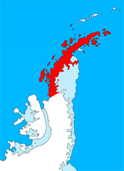
Graham Land is the portion of the Antarctic Peninsula that lies north of a line joining Cape Jeremy and Cape Agassiz. This description of Graham Land is consistent with the 1964 agreement between the British Antarctic Place-names Committee and the US Advisory Committee on Antarctic Names, in which the name "Antarctic Peninsula" was approved for the major peninsula of Antarctica, and the names Graham Land and Palmer Land for the northern and southern portions, respectively. The line dividing them is roughly 69 degrees south.

Graham Land is claimed by Argentina (as part of Argentine Antarctica), Britain (as part of the British Antarctic Territory) and Chile (as part of the Chilean Antarctic Territory).

Graham Land is the closest part of Antarctica to South America. Thus, it is the usual destination for small ships taking paying visitors on Antarctic trips from South America. (Larger ships are not allowed to disembark passengers.)

The mountains of Graham Land are the last range of the American Cordillera, the almost continuous sequence of mountain ranges forming the western "backbone" of North America, Central America, South America and the Antarctic Peninsula.

Adapted from Wikipedia: Graham Land (CC BY-SA 4.0).

Feature class
Geoarea
Mapped extent
5,898 km²
Size rank
#129 of 231 landforms
Region
Antarctica
Coordinates
-65.3659°, -64.1439°
Summits:
Mount Usborne (705 m), Vinson Massif (4,892 m), Torres del Paine (2,500 m)
Ranges:
Jones Mountains (Antarctica), Ellsworth Mountains (Antarctica)
Settlements:
Ushuaia (1,198 km), Rio Grande (1,302 km), Punta Arenas (1,409 km)

View on the live map

More about Graham Land

History

Graham Land's creation was volcanic and happened over 200 million years ago. However, volcanic activity eventually ceased, leaving behind ridges and mountains. Specific rocks dated on Graham Land are believed to be older than the land itself, dating to 486 million years in the past.

Geochronology dates certain rocks to specific time periods. Granite in Graham Land, for example, has been dated to the Triassic period. Most of the outcrop, however, consists of igneous rock dating to the Mesozoic and Tertiary periods. Other rocks in Graham Land include adamellite, diorite, rhyolite, dacite, and rhyodacite.

Until the discoveries of the British Graham Land Expedition of 1934–1937, it was generally believed to be an archipelago rather than a peninsula.

Sections adapted from Wikipedia: Graham Land (CC BY-SA 4.0).

Antarctic Peninsula
Image via Wikimedia Commons (author and licence on the file page).

Antarctic Peninsula

Peninsula · 5,581 km²

Antarctic Peninsula is a peninsula in Antarctica, covering an estimated 5,581 km².

The Antarctic Peninsula, known as O'Higgins Land in Chile and Tierra de San Martin in Argentina, and originally as Graham Land in the United Kingdom and the Palmer Peninsula in the United States, is the northernmost part of mainland Antarctica.

The Antarctic Peninsula is part of the larger peninsula of West Antarctica, protruding 1,300 km (810 miles) from a line between Cape Adams (Weddell Sea) and a point on the mainland south of the Eklund Islands. Beneath the ice sheet that covers it, the Antarctic Peninsula consists of a string of bedrock islands; these are separated by deep channels whose bottoms lie at depths considerably below current sea level. They are joined by a grounded ice sheet. Tierra del Fuego, the southernmost tip of South America, is about 1,000 km (620 miles) away across the Drake Passage.

The Antarctic Peninsula is 522,000 square kilometres (202,000 sq mi) in area and 80% ice-covered.

The marine ecosystem around the western continental shelf of the Antarctic Peninsula (WAP) has been subjected to rapid climate change. Over the past 50 years, the warm, moist maritime climate of the northern WAP has shifted south.

Adapted from Wikipedia: Antarctic Peninsula (CC BY-SA 4.0).

Feature class
Peninsula
Mapped extent
5,581 km²
Size rank
#132 of 231 landforms
Region
Antarctica
Coordinates
-64.9323°, -61.1068°
Summits:
Mount Usborne (705 m), Torres del Paine (2,500 m), Vinson Massif (4,892 m)
Ranges:
Jones Mountains (Antarctica), Ellsworth Mountains (Antarctica)
Settlements:
Ushuaia (1,196 km), Rio Grande (1,292 km), Punta Arenas (1,420 km)

View on the live map

More about Antarctic Peninsula

Geography

The peninsula is very mountainous, its highest peaks rising to about 2,800 m (9,200 ft). Notable peaks on the peninsula include Deschanel Peak, Mounts Castro, Coman, Gilbert, Jackson, William, Owen, Scott, and Hope, which is the highest point at 3,239 m (10,627 ft),. These mountains are considered to be a continuation of the Andes of South America, with a submarine spine or ridge connecting the two. This is the basis for the position advanced by Chile and Argentina for their territorial claims. The Scotia Arc is the island arc system that links the mountains of the Antarctic Peninsula to those of Tierra del Fuego.

There are various volcanoes in the islands around the Antarctic Peninsula.

Geology

Antarctica was once part of the Gondwana supercontinent. Outcrops from this time include Ordovician and Devonian granites and gneiss found in the Scar Inlet and Joerg Peninsula, while the Carboniferous-Triassic Trinity Peninsula Group are sedimentary rocks that outcrop in Hope Bay and Prince Gustav Channel. Ring of Fire volcanic rocks erupted in the Jurassic, with the breakup of Gondwana, and outcrop in eastern Graham Land as volcanic ash deposits. Volcanism along western Graham Land dates from the Cretaceous to present times, and outcrops are found along the Gerlache Strait, the Lemaire Channel, Argentine Islands, and Adelaide Island. These rocks in western Graham Land include andesite lavas and granite from the magma, and indicate Graham Land was a continuation of the Andes.

Climate

Because the Antarctic Peninsula, which reaches north of the Antarctic Circle, is the most northerly part of Antarctica, it has the mildest climates within this continent. Its climate is therefore classified as a tundra, rather than an ice cap. Its temperatures are warmest in January, averaging 1 to 2 °C (34 to 36 °F), and coldest in June, averages from −15 to −20 °C (5 to −4 °F). Its west coast from the tip of the Antarctic Peninsula south to 68° S, which has a maritime Antarctic climate, is the mildest part of the Antarctic Peninsula. Within this part of the Antarctic Peninsula, temperatures exceed 0 °C (32 °F) for 3 or 4 months during the summer, and rarely fall below −10 °C (14 °F) during the winter.

History

The most likely first sighting of the Antarctic Peninsula, and therefore also of any part of the Antarctic mainland, was on 1604 by an expedition led by Gabriel de Castilla according the testimony of the Dutch sailor Laurenz Claesz who participated in it. Since the sight was not registered on the found archives, historians debate about it.

Three days later, on 30 January 1820, Edward Bransfield and William Smith, with a British expedition, were the first to chart part of the Antarctic Peninsula.

Sections adapted from Wikipedia: Antarctic Peninsula (CC BY-SA 4.0).

Antarctic Peninsula: Key Facts

Key facts about Antarctic Peninsula
OnSouthern Ocean

Facts from Wikidata Q185605 (CC0).

Jones Mountains

Range/mtn · 5,502 km²

Jones Mountains is a range/mtn in Antarctica, covering an estimated 5,502 km².

The Jones Mountains (73°32′S 94°00′W) are an isolated group of mountains, trending generally east–west for 27 nautical miles (50 km; 31 mi), situated on the Eights Coast, Ellsworth Land, Antarctica, about 50 nautical miles (93 km; 58 mi) south of Dustin Island.

Adapted from Wikipedia: Jones Mountains (CC BY-SA 4.0).

Feature class
Range/mtn
Mapped extent
5,502 km²
Size rank
#161 of 216 mountain ranges
Region
Antarctica
Coordinates
-73.6108°, -94.0169°
Summits:
Vinson Massif (4,892 m), Mount Takahe (3,460 m), Mount Sidley (4,285 m)
Adjacent ranges:
Ellsworth Mountains (Antarctica), Executive Committee Range (Antarctica)
Settlements:
Ushuaia (2,390 km), Rio Grande (2,508 km), Punta Arenas (2,509 km)

View on the live map

More about Jones Mountains

Location

The Jones Mountains lie to the south of the Eights Coast, south of the Abbot Ice Shelf and southeast of Thurston Island.

Features of the southern part include, from west to east, Miller Crag, Sutley Peak, Walk Glacier, Forbidden Rocks and Christoffersen Heights.

Features of the northern part include, from west to east, Pillsbury Tower, Bonnabeau Dome, Cache Heights, Inspiration Rocks, Gopher Glacier, Anderson Dome and Mount Loweth.

Sections adapted from Wikipedia: Jones Mountains (CC BY-SA 4.0).

Princess Ragnhild Coast
Image via Wikimedia Commons (author and licence on the file page).

Princess Ragnhild Coast

Coast · 3,074 km²

Princess Ragnhild Coast is a coast in Antarctica, covering an estimated 3,074 km².

Princess Ragnhild Coast (Norwegian: Prinsesse Ragnhild Kyst) is the portion of the coast of Queen Maud Land in Antarctica lying between 20° E and the Riiser-Larsen Peninsula, at 34° E. All but the eastern end of the coast is fringed by ice shelves. It was discovered by Capt. Hjalmar Riiser-Larsen and Capt. Nils Larsen in aerial flights from the ship Norvegia on February 16, 1931, and named for Princess Ragnhild of Norway. Vestvika Bay is a large bay on the west side of Riiser-Larsen Peninsula; it was mapped from air photos taken by the Lars Christensen Expedition, 1936–37, and named Vestvika, meaning "west bay."

Adapted from Wikipedia: Princess Ragnhild Coast (CC BY-SA 4.0).

Feature class
Coast
Mapped extent
3,074 km²
Size rank
#145 of 231 landforms
Region
Antarctica
Coordinates
-69.8241°, 23.0741°
Summits:
Isachsen Mountain (3,425 m), Mount McMaster (2,830 m), Olavtoppen (780 m)
Ranges:
Napier Mountains (Antarctica), Prince Charles Mountains (Antarctica)
Settlements:
Hermanus (3,945 km), Knysna (3,980 km), George (3,989 km)

View on the live map

Palmer Land
Image via Wikimedia Commons (author and licence on the file page).

Palmer Land

Geoarea · 2,554 km²

Palmer Land is a geoarea in Antarctica, covering an estimated 2,554 km².

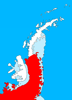
Palmer Land (71°30′S 065°00′W) is the portion of the Antarctic Peninsula, Antarctica that lies south of a line joining Cape Jeremy and Cape Agassiz. This application of Palmer Land is consistent with the 1964 agreement between the Advisory Committee on Antarctic Names and the UK Antarctic Place-Names Committee, in which the name Antarctic Peninsula was approved for the major peninsula of Antarctica, and the names Graham Land and Palmer Land for the northern and southern portions, respectively. The line dividing them is roughly 69° S.

Adapted from Wikipedia: Palmer Land (CC BY-SA 4.0).

Feature class
Geoarea
Mapped extent
2,554 km²
Size rank
#150 of 231 landforms
Region
Antarctica
Coordinates
-73.0571°, -60.8389°
Summits:
Vinson Massif (4,892 m), Mount Seelig (3,022 m), Anderson Summit (2,810 m)
Ranges:
Ellsworth Mountains (Antarctica), Jones Mountains (Antarctica)
Settlements:
Ushuaia (2,060 km), Rio Grande (2,166 km), Punta Arenas (2,262 km)

View on the live map

Queen Mary Coast
Image via Wikimedia Commons (author and licence on the file page).

Queen Mary Coast

Coast · 2,161 km²

Queen Mary Coast is a coast in Antarctica, covering an estimated 2,161 km².

Queen Mary Land or the Queen Mary Coast (66°45′S 96°0′E) is the portion of the coast of Antarctica lying between Cape Filchner, in 91° 54' E, and Cape Hordern, at 100° 30' E. It is claimed by Australia as part of the Australian Antarctic Territory.

It was discovered in February 1912 by the Australasian Antarctic Expedition (1911–14) under the leadership of Douglas Mawson, who named it for Mary of Teck, queen consort of George V.

Adapted from Wikipedia: Queen Mary Land (CC BY-SA 4.0).

Feature class
Coast
Mapped extent
2,161 km²
Size rank
#154 of 231 landforms
Region
Antarctica
Coordinates
-66.4186°, 92.6027°
Summits:
Mount McMaster (2,830 m), Mount Lister (4,023 m), Mount Kirkpatrick (4,528 m)
Ranges:
Prince Charles Mountains (Antarctica), Napier Mountains (Antarctica)
Settlements:
Albany (3,859 km), Bunbury (3,978 km), Mandurah (4,069 km)

View on the live map

Sabrina Coast
Image via Wikimedia Commons (author and licence on the file page).

Sabrina Coast

Coast · 1,999 km²

Sabrina Coast is a coast in Antarctica, covering an estimated 1,999 km².

Sabrina Coast (67°20′S 119°0′E) is that portion of the coast of Wilkes Land, Antarctica, lying between Cape Waldron, at 115° 33' E, and Cape Southard, at 122° 05' E. John Balleny has long been credited with having seen land in March 1839 at about 117° E.

The United States Exploring Expedition under Lt. Charles Wilkes approached this coast in February 1840 and indicated its general configuration as shown in part by "Totten High Land" on his 1840 chart. In 1931 the British Australian New Zealand Antarctic Research Expedition (BANZARE) under Douglas Mawson saw what appeared to be land in this longitude about one degree farther south than that reported by Balleny and Wilkes. In recognition of Balleny's effort, Mawson retained the name of the cutter Sabrina, one of Balleny's ships which was lost in a storm at 95°E in the latter part of March 1839.

Adapted from Wikipedia: Sabrina Coast (CC BY-SA 4.0).

Feature class
Coast
Mapped extent
1,999 km²
Size rank
#159 of 231 landforms
Region
Antarctica
Coordinates
-66.5210°, 121.9611°
Summits:
Mount Lister (4,023 m), Mount Erebus (3,795 m), Mount Kirkpatrick (4,528 m)
Ranges:
Prince Albert Mountains (Antarctica), Admiralty Mountains (Antarctica)
Settlements:
Hobart (3,047 km), Launceston (3,188 km), Warrnambool (3,387 km)

View on the live map

Prince Harald Coast

Coast · 1,698 km²

Prince Harald Coast is a coast in Antarctica, covering an estimated 1,698 km².

Prince Harald Coast (Norwegian: Prins Harald Kyst) is a portion of the coast of Queen Maud Land, Antarctica, encompassing Lutzow-Holm Bay, lying between Riiser-Larsen Peninsula, at 34° E, and the east entrance point of Lützow-Holm Bay, marked by the coastal angle at 40° E. It was discovered during a flight on February 4, 1937, by Viggo Widerøe, Nils Romnaes, and Mrs. Ingrid Christensen of the Lars Christensen Expedition, 1936–1937, and named after the infant son of the Crown Prince of Norway. The portion of the coast to the east of it is the Prince Olav Coast.

Adapted from Wikipedia: Prince Harald Coast (CC BY-SA 4.0).

Feature class
Coast
Mapped extent
1,698 km²
Size rank
#164 of 231 landforms
Region
Antarctica
Coordinates
-73.3244°, 34.1227°
Summits:
Isachsen Mountain (3,425 m), Mount McMaster (2,830 m), Anderson Summit (2,810 m)
Ranges:
Prince Charles Mountains (Antarctica), Napier Mountains (Antarctica)
Settlements:
Port Elizabeth (4,403 km), Hermanus (4,407 km), Knysna (4,413 km)

View on the live map

Wilhelm II Coast
Image via Wikimedia Commons (author and licence on the file page).

Wilhelm II Coast

Coast · 1,625 km²

Wilhelm II Coast is a coast in Antarctica, covering an estimated 1,625 km².

Kaiser Wilhelm II Land is a region of East Antarctica, situated between Cape Penck and Cape Filchner, within the sector claimed by Australia as part of the Australian Antarctic Territory. This claim, however, is not universally recognized due to the Antarctic Treaty System, which designates Antarctica for peaceful scientific research and prohibits new territorial assertions. The land was discovered in 1902 during the German Gauss expedition, which was funded by the German Emperor Wilhelm II and was subsequently named in his honor. It is geographically positioned between Princess Elizabeth Land to its west and Queen Mary Land to its east.

The topography of Kaiser Wilhelm II Land is predominantly characterized by the vast Antarctic ice sheet, with elevations gradually increasing towards the interior from the coast. The region's coastal areas support Antarctic wildlife, notably including Adélie penguins, which establish breeding colonies there, alongside various marine species adapted to the extreme polar environment.

Adapted from Wikipedia: Kaiser Wilhelm II Land (CC BY-SA 4.0).

Feature class
Coast
Mapped extent
1,625 km²
Size rank
#167 of 231 landforms
Region
Antarctica
Coordinates
-66.4265°, 91.8050°
Summits:
Mount McMaster (2,830 m), Mount Lister (4,023 m), Isachsen Mountain (3,425 m)
Ranges:
Prince Charles Mountains (Antarctica), Napier Mountains (Antarctica)
Settlements:
Albany (3,881 km), Bunbury (3,999 km), Mandurah (4,089 km)

View on the live map

More about Wilhelm II Coast

Geography

Kaiser Wilhelm II Land is a sector of Antarctica situated in East Antarctica. It is geographically defined as the region between Cape Penck (approximately 87°43'E) and Cape Filchner (approximately 91°54'E). The area is claimed to be a part of the Australian Antarctic Territory, however, is not universally recognized due to the Antarctic Treaty System, which designates Antarctica for peaceful scientific research and prohibits new territorial assertions. The topography of Kaiser Wilhelm II Land is predominantly characterized by the immense Antarctic ice sheet, which covers the vast majority of the continent. Elevations within the region generally increase as one moves inland from the coast. Gaussberg is a notable topological feature in the region.

Sections adapted from Wikipedia: Kaiser Wilhelm II Land (CC BY-SA 4.0).

Walgreen Coast
Image via Wikimedia Commons (author and licence on the file page).

Walgreen Coast

Coast · 1,612 km²

Walgreen Coast is a coast in Antarctica, covering an estimated 1,612 km².

The Walgreen Coast (75°30′S 107°0′W) is a portion of the coast of Antarctica between Cape Herlacher and Cape Waite, or between Eights Coast on the east and Bakutis Coast in the west. It is part of Marie Byrd Land. It extends from 103°24'W to 114°12'W. It was discovered by Richard E. Byrd and members of the US Antarctic Service (USAS) by flights from the USS Bear during February 1940.

The Walgreen Coast was named by Byrd after Charles R. Walgreen, president of the retail company Walgreens at the time, who was a funder of the Byrd Antarctic Expedition, 1933–1935, and assisted in equipping the Bear for the USAS, 1939–1941. This coast was mapped in detail by the United States Geological Survey from ground surveys and U.S. Navy air photographs, 1959–66.

It contains Thwaites Glacier, also known as the "Doomsday Glacier", for its major contributions to sea level rise as a result of climate change.

Adapted from Wikipedia: Walgreen Coast (CC BY-SA 4.0).

Feature class
Coast
Mapped extent
1,612 km²
Size rank
#168 of 231 landforms
Region
Antarctica
Coordinates
-74.6876°, -106.4147°
Summits:
Mount Takahe (3,460 m), Mount Sidley (4,285 m), Vinson Massif (4,892 m)
Ranges:
Jones Mountains (Antarctica), Executive Committee Range (Antarctica)
Settlements:
Ushuaia (2,756 km), Punta Arenas (2,861 km), Rio Grande (2,874 km)

View on the live map

Banzare Coast
Image via Wikimedia Commons (author and licence on the file page).

Banzare Coast

Coast · 1,365 km²

Banzare Coast is a coast in Antarctica, covering an estimated 1,365 km².

Banzare Coast (67°S 126°E), part of Wilkes Land, is that portion of the coast of Antarctica lying between Cape Southard, at 122°05′E, and Cape Morse, at 130°10′E.

This coast was spotted by the US Exploring Expedition in Feb. 1840.

It was seen from the air by the British-Australian-New Zealand Antarctic Research Expedition, in 1930–1931, led by Douglas Mawson. The name by Mawson is an acronym of the expedition title.

Adapted from Wikipedia: Banzare Coast (CC BY-SA 4.0).

Feature class
Coast
Mapped extent
1,365 km²
Size rank
#170 of 231 landforms
Region
Antarctica
Coordinates
-66.4940°, 122.2857°
Summits:
Mount Lister (4,023 m), Mount Erebus (3,795 m), Mount Kirkpatrick (4,528 m)
Ranges:
Prince Albert Mountains (Antarctica), Admiralty Mountains (Antarctica)
Settlements:
Hobart (3,035 km), Launceston (3,176 km), Warrnambool (3,377 km)

View on the live map

Smith Peninsula

Peninsula · 1,108 km²

Smith Peninsula is a peninsula in Antarctica, covering an estimated 1,108 km².

The Smith Peninsula (74°25′S 61°15′W) is an ice-covered, "dog-legged" peninsula 25 nautical miles (46 km; 29 mi) long and 10 nautical miles (19 km; 12 mi) wide, extending in an easterly direction between Keller Inlet and Nantucket Inlet from the east coast of Palmer Land, Antarctica.

Adapted from Wikipedia: Smith Peninsula (CC BY-SA 4.0).

Feature class
Peninsula
Mapped extent
1,108 km²
Size rank
#175 of 231 landforms
Region
Antarctica
Coordinates
-74.3917°, -61.2877°
Summits:
Vinson Massif (4,892 m), Mount Seelig (3,022 m), Anderson Summit (2,810 m)
Ranges:
Ellsworth Mountains (Antarctica), Jones Mountains (Antarctica)
Settlements:
Ushuaia (2,202 km), Rio Grande (2,309 km), Punta Arenas (2,400 km)

View on the live map

More about Smith Peninsula

Location

The Smith Peninsula is in southeast Palmer Land, on the Lassiter Coast of the Weddell Sea.

It lies between Nantucket Inlet to the southwest and Keller Inlet to the northeast.

Johnston Glacier flows past the west of the peninsula to Nantucket Inlet.

Sections adapted from Wikipedia: Smith Peninsula (CC BY-SA 4.0).

Princess Martha Coast

Coast · 780 km²

Princess Martha Coast is a coast in Antarctica, covering an estimated 780 km².

Princess Martha Coast (Norwegian: Kronprinsesse Märtha Kyst) is the portion of the coast of Queen Maud Land lying between 05° E and the terminus of Stancomb-Wills Glacier, at 20° W. The entire coastline is bounded by ice shelves with ice cliffs 20 to 35 metres (66 to 115 ft) high.

Princess Martha Coast was the first portion of Antarctic mainland discovered by a human, Fabian von Bellingshausen and Mikhail Lazarev in 1820. The name "Crown Princess Martha Land" was originally applied by Capt. Hjalmar Riiser-Larsen to that section of the coast in the vicinity of Cape Norvegia which he discovered from the Norvegia and roughly charted from the air during February 1930.

On 19 January 1939 Nazi Germany reached the Martha Coast, as part of the German Antarctic Expedition.

It is named in honour of Crown Princess Märtha of Norway.

Troll is located in the eastern part, 235 kilometres (146 mi) from the coast. Explora Escarpment is an undersea escarpment off the coast.

Adapted from Wikipedia: Princess Martha Coast (CC BY-SA 4.0).

Feature class
Coast
Mapped extent
780 km²
Size rank
#179 of 231 landforms
Region
Antarctica
Coordinates
-70.8037°, -10.1443°
Summits:
Isachsen Mountain (3,425 m), Olavtoppen (780 m), Anderson Summit (2,810 m)
Ranges:
Shackleton Range (Antarctica), Pensacola Mountains (Antarctica)
Settlements:
Ushuaia (3,264 km), Rio Grande (3,333 km), Punta Arenas (3,510 km)

View on the live map

George V Coast

Coast · 736 km²

George V Coast is a coast in Antarctica, covering an estimated 736 km².

George V Coast (68°30′S 148°0′E) is that portion of the coast of Antarctica lying between Point Alden, at 148°2′E, and Cape Hudson, at 153°45′E.

Portions of this coast were sighted by the US Exploring Expedition in 1840. It was explored by members of the Main Base party of the Australasian Antarctic Expedition (1911–14) under Douglas Mawson who named this feature for King George V of the United Kingdom.

The segment of land between these lines of longitude is referred to as George V Land. Mertz Glacier is located in this area.

Adapted from Wikipedia: George V Coast (CC BY-SA 4.0).

Feature class
Coast
Mapped extent
736 km²
Size rank
#180 of 231 landforms
Region
Antarctica
Coordinates
-66.7034°, 142.1374°
Summits:
Mount Lister (4,023 m), Mount Erebus (3,795 m), Mount Kirkpatrick (4,528 m)
Ranges:
Admiralty Mountains (Antarctica), Prince Albert Mountains (Antarctica)
Settlements:
Hobart (2,671 km), Invercargill (2,726 km), Launceston (2,825 km)

View on the live map

Coats Land
Image via Wikimedia Commons (author and licence on the file page).

Coats Land

Geoarea · 702 km²

Coats Land is a geoarea in Antarctica, covering an estimated 702 km².

Coats Land is a region in Antarctica which lies westward of Queen Maud Land and forms the eastern shore of the Weddell Sea, extending in a general northeast–southwest direction between 20°00′W and 36°00′W. The northeast part was discovered from the Scotia by William Speirs Bruce, leader of the Scottish National Antarctic Expedition, 1902–1904. He gave the name Coats Land for James Coats, Jr., and Major Andrew Coats, the two chief supporters of the expedition.

Adapted from Wikipedia: Coats Land (CC BY-SA 4.0).

Feature class
Geoarea
Mapped extent
702 km²
Size rank
#182 of 231 landforms
Region
Antarctica
Coordinates
-78.1748°, -36.1682°
Summits:
Vinson Massif (4,892 m), Anderson Summit (2,810 m), Mount Seelig (3,022 m)
Ranges:
Shackleton Range (Antarctica), Pensacola Mountains (Antarctica)
Settlements:
Ushuaia (2,877 km), Rio Grande (2,975 km), Punta Arenas (3,095 km)

View on the live map

Victoria Land
Image via Wikimedia Commons (author and licence on the file page).

Victoria Land

Geoarea · 665 km²

Victoria Land is a geoarea in Antarctica, covering an estimated 665 km².

Victoria Land is a region in eastern Antarctica which fronts the western side of the Ross Sea and the Ross Ice Shelf, extending southward from about 70°30'S to 78°00'S, and westward from the Ross Sea to the edge of the Antarctic Plateau. It was discovered by Captain James Clark Ross in January 1841 and named after Queen Victoria. The rocky promontory of Minna Bluff is often regarded as the southernmost point of Victoria Land, and separates the Scott Coast to the north from the Hillary Coast of the Ross Dependency to the south.

Adapted from Wikipedia: Victoria Land (CC BY-SA 4.0).

Feature class
Geoarea
Mapped extent
665 km²
Size rank
#184 of 231 landforms
Region
Antarctica
Coordinates
-73.9265°, 165.6473°
Summits:
Mount Erebus (3,795 m), Mount Lister (4,023 m), Mount Kirkpatrick (4,528 m)
Ranges:
Admiralty Mountains (Antarctica), Prince Albert Mountains (Antarctica)
Settlements:
Invercargill (3,063 km), Dunedin (3,127 km), Timaru (3,296 km)

View on the live map

More about Victoria Land

Geography

The region includes ranges of the Transantarctic Mountains and the McMurdo Dry Valleys (the highest point being Mount Abbott in the Northern Foothills), and the flatlands known as the Labyrinth. The 2,700-metre (9,000 ft) Mount Melbourne is an active volcano in Victoria Land.

History

Early explorers of Victoria Land include James Clark Ross and Douglas Mawson.

In 1979, scientists discovered a group of 309 meteorites in Antarctica, some of which were found near the Allan Hills in Victoria Land. The meteorites appeared to have undergone little change since they were formed at what scientists believe was the birth of the Solar System.

In 1981, lichens found at Victoria Land attracted the attention of NASA because lichens may give clues about where to look for the existence of extraterrestrial life. Dr. George Denton, a glaciologist at the University of New Hampshire, looked for microorganisms on Mount Lister, one of the highest in Antarctica; it has the same kind of sandstone in which lichens grow.

Sections adapted from Wikipedia: Victoria Land (CC BY-SA 4.0).

Victoria Land: Key Facts

Key facts about Victoria Land
OnRoss Sea

Facts from Wikidata Q208965 (CC0).

Knox Coast
Image via Wikimedia Commons (author and licence on the file page).

Knox Coast

Coast · 649 km²

Knox Coast is a coast in Antarctica, covering an estimated 649 km².

Knox Coast, part of Wilkes Land, is that portion of the coast of Antarctica lying between Cape Hordern, at 100°31′E, and the Hatch Islands, at 109°16′E.

Adapted from Wikipedia: Knox Coast (CC BY-SA 4.0).

Feature class
Coast
Mapped extent
649 km²
Size rank
#185 of 231 landforms
Region
Antarctica
Coordinates
-65.5353°, 100.9384°
Summits:
Mount McMaster (2,830 m), Mount Lister (4,023 m), Mount Erebus (3,795 m)
Ranges:
Prince Charles Mountains (Antarctica), Napier Mountains (Antarctica)
Settlements:
Albany (3,574 km), Bunbury (3,713 km), Hobart (3,786 km)

View on the live map

More about Knox Coast

History

The coast was discovered in February 1840 by the U.S. Exploring Expedition (1838–42) under Lieutenant Charles Wilkes, and named by Wilkes for Lieutenant Samuel R. Knox, U.S. Navy, captain of the Flying Fish, who served as acting master on the Vincennes during the Antarctic cruise.

Sections adapted from Wikipedia: Knox Coast (CC BY-SA 4.0).

Budd Coast
Image via Wikimedia Commons (author and licence on the file page).

Budd Coast

Coast · 599 km²

Budd Coast is a coast in Antarctica, covering an estimated 599 km².

Budd Coast (66°30′S 112°0′E), part of Wilkes Land, is that portion of the coast of Antarctica lying between the Hatch Islands, at 109°16'E, and Cape Waldron, at 115°33'E. It was discovered in February 1840 by the U.S. Exploring Expedition (1838–42) under the leadership of Lieutenant Charles Wilkes, and named by Wilkes for Thomas A. Budd, Acting Master of the sloop Peacock, one of the ships used on the expedition. A portion of the Puget Sound, Budd Inlet, is also named for Thomas Budd.

Adapted from Wikipedia: Budd Coast (CC BY-SA 4.0).

Feature class
Coast
Mapped extent
599 km²
Size rank
#187 of 231 landforms
Region
Antarctica
Coordinates
-66.2682°, 115.4229°
Summits:
Mount Lister (4,023 m), Mount Erebus (3,795 m), Mount Kirkpatrick (4,528 m)
Ranges:
Prince Albert Mountains (Antarctica), Prince Charles Mountains (Antarctica)
Settlements:
Hobart (3,244 km), Launceston (3,379 km), Albany (3,479 km)

View on the live map

Admiralty Mountains
Image via Wikimedia Commons (author and licence on the file page).

Admiralty Mountains

Range/mtn · 573 km²

Admiralty Mountains is a range/mtn in Antarctica, covering an estimated 573 km².

The Admiralty Mountains (alternatively Admiralty Range) is a large group of high mountains and individually named ranges and ridges in northeastern Victoria Land, Antarctica.

This mountain group is bounded by the sea (Ross Sea and Southern Ocean), and by the Dennistoun Glacier, Ebbe Glacier, and Tucker Glacier.

Adapted from Wikipedia: Admiralty Mountains (CC BY-SA 4.0).

Feature class
Range/mtn
Mapped extent
573 km²
Size rank
#192 of 216 mountain ranges
Region
Antarctica
Coordinates
-71.6846°, 169.9264°
Summits:
Mount Erebus (3,795 m), Mount Lister (4,023 m), Mount Kirkpatrick (4,528 m)
Adjacent ranges:
Prince Albert Mountains (Antarctica), Queen Alexandra Range (Antarctica)
Settlements:
Invercargill (2,812 km), Dunedin (2,869 km), Timaru (3,035 km)

View on the live map

More about Admiralty Mountains

Location

The Admiralty Mountains lie to the east of the Concord Mountains and the Victory Mountains, separated from them by the Ebbe Glacier in the north and the Tucker Glacier further south, which flows into the Ross Sea. They are to the south of the Anare Mountains, separated from them by the Anare Pass and the Dennistoun Glacier, which flow east to the Southern Ocean. To their east they are bounded by the Southern Ocean, Robertson Bay, the Adare Peninsula and the Ross Sea.

The Dennistoun Glacier which flows past the northeastern section of the Admiralty Mountains, separates then from the Quam Heights and Hedgpeth Heights in the Anare Mountains to the north.

The Robinson Heights in the northwest Admiralty Mountains are separated from the Anare Mountains to the north by the Anare Pass.

Sections adapted from Wikipedia: Admiralty Mountains (CC BY-SA 4.0).

Admiralty Mountains: Key Facts

Key facts about Admiralty Mountains
Length169 km
Area14,700 km²
Highest pointMount Minto
Part ofTransantarctic Mountains

Facts from Wikidata Q359194 (CC0).

Edward VII Peninsula
Image via Wikimedia Commons (author and licence on the file page).

Edward VII Peninsula

Peninsula · 271 km²

Edward VII Peninsula is a peninsula in Antarctica, covering an estimated 271 km².

King Edward VII Land or King Edward VII Peninsula is a large, ice-covered peninsula which forms the northwestern extremity of Marie Byrd Land in Antarctica. The peninsula projects into the Ross Sea between Sulzberger Bay and the northeast corner of the Ross Ice Shelf, and forms part of the Ross Dependency. Edward VII Peninsula is defined by the Ross Ice Shelf on the southwest, Okuma Bay on the west, and to the east by Sulzberger Bay and the Saunders Coast, all essentially on the Ross Sea / Southern Ocean in Antarctica. The northwest extremity of the peninsula is Cape Colbeck. Edward VII Peninsula is located at 77°40′S 155°00′W.

The western coast is Shirase Coast. In the north and east the Swinburne Ice Shelf is located.

Edward VII Peninsula was discovered on 30 January 1902 by the British National Antarctic Expedition (BrNAE) (1901–1904) under Robert Falcon Scott, who named it King Edward VII Land for King Edward VII of the United Kingdom. The coastline was further explored by the Nimrod Expedition under Ernest Shackleton in 1908–09, and the first landfall was made by a party of the Japanese Antarctic Expedition led by Shirase Nobu in 1912.

Adapted from Wikipedia: King Edward VII Land (CC BY-SA 4.0).

Feature class
Peninsula
Mapped extent
271 km²
Size rank
#196 of 231 landforms
Region
Antarctica
Coordinates
-78.5761°, -149.0668°
Summits:
Mount Sidley (4,285 m), Mount Fridtjof Nansen (4,069 m), Faure Peak (3,940 m)
Ranges:
Ford Ranges (Antarctica), Flood Range (Antarctica)
Settlements:
Ushuaia (3,891 km), Invercargill (3,987 km), Punta Arenas (4,004 km)

View on the live map

More about Edward VII Peninsula

Edward VII Peninsula: Key Facts

Key facts about Edward VII Peninsula
OnRoss Sea

Facts from Wikidata Q1253855 (CC0).

Martin Peninsula

Peninsula · 236 km²

Martin Peninsula is a peninsula in Antarctica, covering an estimated 236 km².

Martin Peninsula (74°20′S 114°30′W) is a peninsula about 60 nautical miles (110 km; 69 mi) long and 20 nautical miles (37 km; 23 mi) wide that is ice-covered except for a few rock outcrops along its margins, located between Getz Ice Shelf and Dotson Ice Shelf on the coast of Marie Byrd Land, Antarctica.

The farthest point of the peninsula is Jacobsen Head.

Adapted from Wikipedia: Martin Peninsula (CC BY-SA 4.0).

Feature class
Peninsula
Mapped extent
236 km²
Size rank
#199 of 231 landforms
Region
Antarctica
Coordinates
-73.8259°, -114.1596°
Summits:
Mount Takahe (3,460 m), Mount Sidley (4,285 m), Vinson Massif (4,892 m)
Ranges:
Executive Committee Range (Antarctica), Flood Range (Antarctica)
Settlements:
Ushuaia (2,923 km), Punta Arenas (3,011 km), Rio Grande (3,040 km)

View on the live map

More about Martin Peninsula

Location

The Martin Peninsula extends north from the coast of Marie Byrd Land into the Amundsen Sea.

It defines the boundary between the Bakutis Coast to the west of Cape Herlacher, and the Walgreen Coast to the east.

Glade Bay and Sweeny Inlet are on its west side, which is the eastern limit of the Getz Ice Shelf. The Dotson Ice Shelf extends east from its eastern side.

Martin Peninsula projects about 70 miles northward from the mainland terminating in two smaller peninsulas formed by an inlet 15 miles long. Cape Harlacher is the northern extremity of the northwestern peninsula. From Cape Herlacher to Cape Flying Fish, about 190 miles westward, the coast is indented by a very large bay and a smaller bay, the two separated by an anvil-shaped peninsula 65 miles broad in its seaward front.

Sections adapted from Wikipedia: Martin Peninsula (CC BY-SA 4.0).

Martin Peninsula: Key Facts

Key facts about Martin Peninsula
OnAmundsen Sea

Facts from Wikidata Q649354 (CC0).

Pensacola Mountains
Image via Wikimedia Commons (author and licence on the file page).

Pensacola Mountains

Range/mtn · 167 km²

Pensacola Mountains is a range/mtn in Antarctica, covering an estimated 167 km².

The Pensacola Mountains (82°37′S 52°49′W) are a large group of mountain ranges and peaks that extend 280 nautical miles (520 km; 320 mi) in a northeast–southwest direction in the Transantarctic Mountains System, Queen Elizabeth Land region of Antarctica.

They comprise the Argentina Range, Forrestal Range, Dufek Massif, Cordiner Peaks, Neptune Range, Patuxent Range, Rambo Nunataks and Pecora Escarpment.

These mountain units lie astride the extensive Foundation Ice Stream and Support Force Glacier which drain northward to the Ronne Ice Shelf.

Adapted from Wikipedia: Pensacola Mountains (CC BY-SA 4.0).

Feature class
Range/mtn
Mapped extent
167 km²
Size rank
#202 of 216 mountain ranges
Region
Antarctica
Coordinates
-83.2294°, -48.9490°
Summits:
Anderson Summit (2,810 m), Mount Seelig (3,022 m), Vinson Massif (4,892 m)
Adjacent ranges:
Shackleton Range (Antarctica), Ellsworth Mountains (Antarctica)
Settlements:
Ushuaia (3,213 km), Rio Grande (3,321 km), Punta Arenas (3,408 km)

View on the live map

More about Pensacola Mountains

Geology

The Pensacola Mountains were originally continuous with the Ventana Mountains near Bahía Blanca in Argentina, Cape Fold Belt in South Africa, the Ellsworth Mountains (West Antarctica) and the Hunter-Bowen orogeny in eastern Australia.

The Ordovician-Devonian Neptune Group rests unconformably on a Cambrian succession, and is overlain disconformably by the Dover Sandstone of the Beacon Supergroup. Within the Neptune Group is the Brown Ridge Conglomerate, Elliott Sandstone, Elbow Formation, and the Heiser Sandstone.

Sections adapted from Wikipedia: Pensacola Mountains (CC BY-SA 4.0).

Pensacola Mountains: Key Facts

Key facts about Pensacola Mountains
Length504 km
Area86,850 km²
Highest pointDufek Massif
Part ofTransantarctic Mountains

Facts from Wikidata Q2913098 (CC0).

Kemp Peninsula

Peninsula · 154 km²

Kemp Peninsula is a peninsula in Antarctica, covering an estimated 154 km².

Kemp Peninsula (73°8′S 60°15′W) is an irregular ice-covered peninsula 26 nautical miles (48 km; 30 mi) long in a north–south direction and 5 to 12 nautical miles (9.3 to 22.2 km; 5.8 to 13.8 mi) wide.

The peninsula rises gently to 305 metres (1,001 ft) and projects east between the heads of Mason Inlet and Mossman Inlet, on the east coast of Palmer Land, Antarctica.

Adapted from Wikipedia: Kemp Peninsula (CC BY-SA 4.0).

Feature class
Peninsula
Mapped extent
154 km²
Size rank
#208 of 231 landforms
Region
Antarctica
Coordinates
-72.9368°, -60.0042°
Summits:
Vinson Massif (4,892 m), Mount Seelig (3,022 m), Anderson Summit (2,810 m)
Ranges:
Ellsworth Mountains (Antarctica), Jones Mountains (Antarctica)
Settlements:
Ushuaia (2,054 km), Rio Grande (2,159 km), Punta Arenas (2,258 km)

View on the live map

More about Kemp Peninsula

Location

The Kemp Peninsula is on the Lassiter Coast of southern Palmer Land, beside the Weddell Sea to the east.

The coastal ice sheet extends north from Mason Inlet to Cape Herdman, at the south of the mouth of Violante Inlet.

Mossman Inlet is to the south, just north of New Bedford Inlet and east of Mount Pawson and Mohn Peaks on the mainland.

Sections adapted from Wikipedia: Kemp Peninsula (CC BY-SA 4.0).

Canisteo Peninsula

Peninsula · 137 km²

Canisteo Peninsula is a peninsula in Antarctica, covering an estimated 137 km².

Canisteo Peninsula (73°48′S 102°20′W) is an ice-covered peninsula, about 30 nautical miles (56 km; 35 mi) long and 20 nautical miles (37 km; 23 mi) wide, which projects between Ferrero Bay and Cranton Bay into the eastern extremity of the Amundsen Sea.

Adapted from Wikipedia: Canisteo Peninsula (CC BY-SA 4.0).

Feature class
Peninsula
Mapped extent
137 km²
Size rank
#209 of 231 landforms
Region
Antarctica
Coordinates
-73.7960°, -102.7692°
Summits:
Mount Takahe (3,460 m), Vinson Massif (4,892 m), Mount Sidley (4,285 m)
Ranges:
Jones Mountains (Antarctica), Executive Committee Range (Antarctica)
Settlements:
Ushuaia (2,610 km), Punta Arenas (2,713 km), Rio Grande (2,728 km)

View on the live map

More about Canisteo Peninsula

Location

The Canisteo Peninsula extends westward into the Amundsen Sea from the Walgreen Coast of Ellsworth Land.

Ferrero Bay and the Cosgrove Ice Shelf are to the north, and Cranton Bay is to the south.

The Lindsey Islands, Sterrett Islands and Edwards Islands lie just west of the peninsula.

Sections adapted from Wikipedia: Canisteo Peninsula (CC BY-SA 4.0).

Shackleton Coast
Image via Wikimedia Commons (author and licence on the file page).

Shackleton Coast

Coast · 116 km²

Shackleton Coast is a coast in Antarctica, covering an estimated 116 km².

Shackleton Coast is the portion of the coast along the west side of the Ross Ice Shelf between Cape Selborne and Airdrop Peak at the east side of Beardmore Glacier in Antarctica.

It was named by the New Zealand Antarctic Place-Names Committee (NZ-APC) in 1961 after Sir Ernest Shackleton. He accompanied Scott on the southern journey during the Discovery expedition (1901–04) and subsequently led three Antarctic expeditions. On the British Antarctic Expedition (1907–09), Shackleton discovered the area beyond Shackleton Inlet to the Beardmore Glacier, and was the first to find a practicable route to the South Pole. Lack of food stopped him 97 miles (180 km) from his goal.

Adapted from Wikipedia: Shackleton Coast (CC BY-SA 4.0).

Feature class
Coast
Mapped extent
116 km²
Size rank
#212 of 231 landforms
Region
Antarctica
Coordinates
-82.5223°, 165.0724°
Summits:
Mount Kirkpatrick (4,528 m), Mount Kaplan (4,230 m), Mount Fridtjof Nansen (4,069 m)
Ranges:
Queen Alexandra Range (Antarctica), Prince Albert Mountains (Antarctica)
Settlements:
Invercargill (4,017 km), Dunedin (4,078 km), Timaru (4,245 km)

View on the live map

Mawson Peninsula

Peninsula · 85 km²

Mawson Peninsula is a peninsula in Antarctica, covering an estimated 85 km².

Mawson Peninsula (68°35′S 154°11′E) is a high (455-metre (1,500 ft)), narrow, ice-covered peninsula on the George V Coast, on the west side of the Slava Ice Shelf, Antarctica, terminating in Cape Hudson. It extends for over 30 nautical miles (56 km) in a northwesterly direction. The peninsula was photographed from the air by U.S. Navy Operation Highjump, 1946–47, and was sketched and photographed by Phillip Law of the Australian National Antarctic Research Expeditions who flew along it to its northern end in February 1959. It was named by the Antarctic Names Committee of Australia for Sir Douglas Mawson.

Cape Hudson (68°20′S 153°45′E) is the north cape of Mawson Peninsula. Land was sighted in this area on January 19, 1840, by the crew of Lt. William L. Hudson's USS Peacock during the United States Exploring Expedition (1838–42) under Charles Wilkes, who applied the name Cape Hudson. An analysis by B.P. Lambert and P.G. Law of the USEE chart, and of the photographs taken by USN Operation Highjump (1946–47) and ANARE (Australian National Antarctic Research Expeditions) (1959), suggests that the north cape of Mawson Peninsula is Wilkes' Cape Hudson.

Adapted from Wikipedia: Mawson Peninsula (CC BY-SA 4.0).

Feature class
Peninsula
Mapped extent
85 km²
Size rank
#216 of 231 landforms
Region
Antarctica
Coordinates
-68.6439°, 154.6756°
Summits:
Mount Erebus (3,795 m), Mount Lister (4,023 m), Mount Kirkpatrick (4,528 m)
Ranges:
Admiralty Mountains (Antarctica), Prince Albert Mountains (Antarctica)
Settlements:
Invercargill (2,590 km), Dunedin (2,684 km), Timaru (2,859 km)

View on the live map

Mawson Coast

Coast · 75 km²

Mawson Coast is a coast in Antarctica, covering an estimated 75 km².

The Mawson Coast is that portion of the coast of Mac. Robertson Land, Antarctica, lying between William Scoresby Bay, at 59°34′E, and Murray Monolith, at 66°54′E. The coast was sighted during the British Australian New Zealand Antarctic Research Expedition (BANZARE), 1929–30, under Sir Douglas Mawson. Further exploration and landings at Cape Bruce and Scullin Monolith were made during BANZARE, 1930–31. Mawson Coast was named by the Antarctic Names Committee of Australia after Mawson in recognition of his great contribution to Antarctic exploration.

Trethewry Point is a rocky promontory 120 m (390 ft) high, projecting from the coast 4 nmi (7.4 km; 4.6 mi) east of William Scoresby Bay on the Mawson Coast. It was discovered and named in February 1936 by DI personnel on the William Scoresby.

Adapted from Wikipedia: Mawson Coast (CC BY-SA 4.0).

Feature class
Coast
Mapped extent
75 km²
Size rank
#218 of 231 landforms
Region
Antarctica
Coordinates
-68.9681°, 66.0947°
Summits:
Mount McMaster (2,830 m), Isachsen Mountain (3,425 m), Mount Kirkpatrick (4,528 m)
Ranges:
Napier Mountains (Antarctica), Prince Charles Mountains (Antarctica)
Settlements:
Port Elizabeth (4,625 km), Uitenhage (4,654 km), East London (4,657 km)

View on the live map

More about Mawson Coast

Mawson Coast: Key Facts

Key facts about Mawson Coast
Area73,829 km²

Facts from Wikidata Q2607094 (CC0).

Clarie Coast
Image via Wikimedia Commons (author and licence on the file page).

Clarie Coast

Coast · 57 km²

Clarie Coast is a coast in Antarctica, covering an estimated 57 km².

Clarie Coast, called Wilkes Coast by Australia, (66°30′S 133°0′E) is that portion of the coast of Wilkes Land lying between Cape Morse, at 130°10′E, and Pourquoi Pas Point, at 136°11′E. It was discovered in January 1840 by Captain Jules Dumont d'Urville, who recognized the existence of land lying south of the ice cliffs to which he applied the name Côte de Clarie, after the wife (Claire-Fortunée Roze) of Charles Jacquinot, the captain of his second ship, the Zélée.

It was also spotted by the US Exploring Expedition in February 1840.

Adapted from Wikipedia: Clarie Coast (CC BY-SA 4.0).

Feature class
Coast
Mapped extent
57 km²
Size rank
#220 of 231 landforms
Region
Antarctica
Coordinates
-66.1106°, 135.8313°
Summits:
Mount Lister (4,023 m), Mount Erebus (3,795 m), Mount Kirkpatrick (4,528 m)
Ranges:
Prince Albert Mountains (Antarctica), Admiralty Mountains (Antarctica)
Settlements:
Hobart (2,680 km), Launceston (2,831 km), Invercargill (2,908 km)

View on the live map

King Peninsula

Peninsula · 36 km²

King Peninsula is a peninsula in Antarctica, covering an estimated 36 km².

King Peninsula (73°12′S 101°00′W) is an ice-covered peninsula, 100 nautical miles (190 km; 120 mi) long and 20 nautical miles (37 km; 23 mi) wide, lying south of Thurston Island and forming the south side of Peacock Sound, Antarctica.

It projects from the continental ice sheet and trends west between the Abbot Ice Shelf and Cosgrove Ice Shelf to terminate at the Amundsen Sea.

Adapted from Wikipedia: King Peninsula (CC BY-SA 4.0).

Feature class
Peninsula
Mapped extent
36 km²
Size rank
#222 of 231 landforms
Region
Antarctica
Coordinates
-73.0004°, -103.2325°
Summits:
Mount Takahe (3,460 m), Vinson Massif (4,892 m), Mount Sidley (4,285 m)
Ranges:
Jones Mountains (Antarctica), Executive Committee Range (Antarctica)
Settlements:
Ushuaia (2,573 km), Punta Arenas (2,668 km), Rio Grande (2,690 km)

View on the live map

More about King Peninsula

Location

The north shore of the King Peninsula is the western end of the Eights Coast, while the west and southern shore is in the Walgreen Coast.

Peacock Sound is to the north, completely filled by the western part of the Abbot Ice Shelf.

Burke Island is in the sea to the west. The Waite Islands are off Cape Waite, the northwest extremity of the peninsula.

Marelli Glacier drains northeast from the peninsula into the Abbot Ice Shelf.

Sections adapted from Wikipedia: King Peninsula (CC BY-SA 4.0).

King Peninsula: Key Facts

Key facts about King Peninsula
OnBellingshausen Sea

Facts from Wikidata Q2646966 (CC0).

Fletcher Peninsula

Peninsula · 30 km²

Fletcher Peninsula is a peninsula in Antarctica, covering an estimated 30 km².

Fletcher Peninsula is a broad ice-covered peninsula which extends into the Bellingshausen Sea between the Abbot and Venable ice shelves in Antarctica. It was mapped by the United States Geological Survey from surveys and U.S. Navy air photos, 1961–66, and was named by the Advisory Committee on Antarctic Names for Fred C. Fletcher of Boston, a contributor to the United States Antarctic Service, 1939–41.

Adapted from Wikipedia: Fletcher Peninsula (CC BY-SA 4.0).

Feature class
Peninsula
Mapped extent
30 km²
Size rank
#223 of 231 landforms
Region
Antarctica
Coordinates
-72.6757°, -88.2666°
Summits:
Vinson Massif (4,892 m), Mount Takahe (3,460 m), Mount Seelig (3,022 m)
Ranges:
Jones Mountains (Antarctica), Ellsworth Mountains (Antarctica)
Settlements:
Ushuaia (2,193 km), Rio Grande (2,310 km), Punta Arenas (2,319 km)

View on the live map

More about Fletcher Peninsula

Fletcher Peninsula: Key Facts

Key facts about Fletcher Peninsula
OnBellingshausen Sea

Facts from Wikidata Q2646682 (CC0).

Princess Astrid Coast
Image via Wikimedia Commons (author and licence on the file page).

Princess Astrid Coast

Coast · 20 km²

Princess Astrid Coast is a coast in Antarctica, covering an estimated 20 km².

Princess Astrid Coast (Norwegian: Prinsesse Astrid Kyst) is a portion of the coast of Queen Maud Land, Antarctica, lying between 5° and 20° E. The entire coast is bordered by ice shelves. The region was discovered by Capt. H. Halvorsen of the Sevilla (ship) in March 1931 and in 1932 was named for Princess Astrid of Norway. The ice of the continental glacier is up to 4,000 meters thick in the interior. These thick glaciers are held in place by coastal mountain ranges. On the Princess Astrid Coast, some of the ice does flow through the mountains, spilling onto the relatively flat land on the Princess Astrid Coast. Also, the cold air spills over the mountains, creating very strong and persistent winds, which makes the snow scour off the tops of the glaciers leaving pale blue patches of bare ice. On top of the coastal line is the ice shelf, which is much smoother. The glacial ice floats on the sea surface which is beyond the chaotic surface of the sea ice which has been solidifying all winter long.

Off the Princess Astrid Coast are the Lazarev Sea and Riiser-Larsen Sea, both marginal seas of the Southern Ocean.

Adapted from Wikipedia: Princess Astrid Coast (CC BY-SA 4.0).

Feature class
Coast
Mapped extent
20 km²
Size rank
#225 of 231 landforms
Region
Antarctica
Coordinates
-69.6843°, 20.0977°
Summits:
Isachsen Mountain (3,425 m), Mount McMaster (2,830 m), Olavtoppen (780 m)
Ranges:
Napier Mountains (Antarctica), Prince Charles Mountains (Antarctica)
Settlements:
Hermanus (3,923 km), Knysna (3,968 km), George (3,976 km)

View on the live map

Prince Olav Coast

Coast · 8 km²

Prince Olav Coast is a coast in Antarctica, covering an estimated 8 km².

Prince Olav Coast (Norwegian: Kronprins Olav Kyst) is that portion of the coast of Queen Maud Land between the east entrance point of Lützow-Holm Bay, marked by the coastal angle at 40° E, and Shinnan Glacier at 44° 38' E. It was discovered by Capt. Hjalmar Riiser-Larsen in January 1930 on a flight from the Norvegia, and named for the future King Olav V of Norway. To the west of it is the Prince Harald Coast.

Adapted from Wikipedia: Prince Olav Coast (CC BY-SA 4.0).

Feature class
Coast
Mapped extent
8 km²
Size rank
#230 of 231 landforms
Region
Antarctica
Coordinates
-68.6734°, 57.4612°
Summits:
Mount McMaster (2,830 m), Isachsen Mountain (3,425 m), Mount Kirkpatrick (4,528 m)
Ranges:
Napier Mountains (Antarctica), Prince Charles Mountains (Antarctica)
Settlements:
Port Elizabeth (4,342 km), Uitenhage (4,370 km), East London (4,386 km)

View on the live map

Riiser-Larsen Peninsula
Image via Wikimedia Commons (author and licence on the file page).

Riiser-Larsen Peninsula

Peninsula · 2 km²

Riiser-Larsen Peninsula is a peninsula in Antarctica, covering an estimated 2 km².

The Riiser-Larsen Peninsula (Norwegian: Riiser-Larsenhalvøya) is a large peninsula which forms the western portal to Lützow-Holm Bay and marks the separation of the Princess Ragnhild and Prince Harald Coasts. It was named after Captain Hjalmar Riiser-Larsen who discovered the peninsula in a flight from the Norvegia on 21 February 21 1931.

Adapted from Wikipedia: Riiser-Larsen Peninsula (CC BY-SA 4.0).

Feature class
Peninsula
Mapped extent
2 km²
Size rank
#231 of 231 landforms
Region
Antarctica
Coordinates
-68.6804°, 34.1262°
Summits:
Isachsen Mountain (3,425 m), Mount McMaster (2,830 m), Olavtoppen (780 m)
Ranges:
Napier Mountains (Antarctica), Prince Charles Mountains (Antarctica)
Settlements:
Port Elizabeth (3,897 km), Knysna (3,915 km), Uitenhage (3,922 km)

View on the live map

Prince Charles Mountains
Image via Wikimedia Commons (author and licence on the file page).

Prince Charles Mountains

Range/mtn

Prince Charles Mountains is a range/mtn in Antarctica.

The Prince Charles Mountains are a major group of mountains in Mac. Robertson Land in Antarctica, including the Athos Range, the Porthos Range, and the Aramis Range. The highest peak is Mount Menzies, with a height of 3,228 m (10,591 ft). Other prominent peaks are Mount Izabelle and Mount Stinear (1,950 m; 6,400 ft). These mountains, together with other scattered peaks, form an arc about 420 km (260 mi) long, extending from the vicinity of Mount Starlight in the north to Goodspeed Nunataks in the south.

These mountains were first observed and photographed from a distance by airmen of USN Operation Highjump, 1946–47. They were examined by several ANARE (Australian National Antarctic Research Expeditions) parties and mapped in the years 1954–61. They have been found to contain large deposits of iron ore. They were named by ANCA in 1956 for King Charles III, then the eight-year-old Prince Charles and son of Queen Elizabeth II.

Adapted from Wikipedia: Prince Charles Mountains (CC BY-SA 4.0).

Feature class
Range/mtn
Region
Antarctica
Coordinates
-73.9420°, 64.8090°
Summits:
Mount McMaster (2,830 m), Isachsen Mountain (3,425 m), Mount Kirkpatrick (4,528 m)
Adjacent ranges:
Napier Mountains (Antarctica), Shackleton Range (Antarctica)
Settlements:
Port Elizabeth (4,935 km), Uitenhage (4,962 km), Grahamstown (4,986 km)

View on the live map

More about Prince Charles Mountains

Prince Charles Mountains: Key Facts

Key facts about Prince Charles Mountains
Length667 km
Area114,027 km²
Highest pointMount Menzies

Facts from Wikidata Q1641485 (CC0).

American Highland

Plateau

American Highland is a plateau in Antarctica.

The American Highland is the portion of Antarctica back of the Ingrid Christensen Coast and eastward of Lambert Glacier, consisting of an upland snow surface at 2,800 metres (9,200 ft) except for a group of nunataks (the Grove Mountains) near 75°E. The area was discovered and named by Lincoln Ellsworth on January 11, 1939, in an aerial flight from his ship, and by Australian National Antarctic Research Expeditions (1956 and 1957), the latter group making a landing to obtain an astrofix at Grove Mountains, 1958.

Adapted from Wikipedia: American Highland (CC BY-SA 4.0).

Feature class
Plateau
Region
Antarctica
Coordinates
-72.0538°, 72.0158°
Summits:
Mount McMaster (2,830 m), Isachsen Mountain (3,425 m), Mount Kirkpatrick (4,528 m)
Ranges:
Prince Charles Mountains (Antarctica), Napier Mountains (Antarctica)
Settlements:
Albany (4,872 km), Bunbury (4,985 km), Port Elizabeth (4,998 km)

View on the live map

Ingrid Christensen Coast

Coast

Ingrid Christensen Coast is a coast in Antarctica.

The Ingrid Christensen Coast is that portion of the coast of Antarctica lying between Jennings Promontory, in 72°33′E, and the western end of the West Ice Shelf in 81°24′E. It is located in the western half of Princess Elizabeth Land, just east of the Amery Ice Shelf.

Adapted from Wikipedia: Ingrid Christensen Coast (CC BY-SA 4.0).

Feature class
Coast
Region
Antarctica
Coordinates
-68.6366°, 72.5455°
Summits:
Mount McMaster (2,830 m), Isachsen Mountain (3,425 m), Mount Kirkpatrick (4,528 m)
Ranges:
Prince Charles Mountains (Antarctica), Napier Mountains (Antarctica)
Settlements:
Albany (4,661 km), Bunbury (4,756 km), Port Elizabeth (4,826 km)

View on the live map

Bear Peninsula
Image via Wikimedia Commons (author and licence on the file page).

Bear Peninsula

Peninsula

Bear Peninsula is a peninsula in Antarctica.

Bear Peninsula (74°35′S 111°00′W) is a peninsula about 50 nautical miles (93 km; 58 mi) long and 25 nautical miles (46 km; 29 mi) wide which is ice-covered except for several isolated rock bluffs and outcrops along its margins, lying 3 nautical miles (5.6 km; 3.5 mi) east of Martin Peninsula on Walgreen Coast, Marie Byrd Land, Antarctica.

Adapted from Wikipedia: Bear Peninsula (CC BY-SA 4.0).

Feature class
Peninsula
Region
Antarctica
Coordinates
-74.2712°, -110.4485°
Summits:
Mount Takahe (3,460 m), Mount Sidley (4,285 m), Vinson Massif (4,892 m)
Ranges:
Jones Mountains (Antarctica), Executive Committee Range (Antarctica)
Settlements:
Ushuaia (2,839 km), Punta Arenas (2,935 km), Rio Grande (2,956 km)

View on the live map

More about Bear Peninsula

Location

The Bear Peninsula extends in a northeast direction from the Walgreen Coast of Marie Byrd Land between the Dotson Ice Shelf to the west and Smith Glacier and the Crosson Ice Shelf to the southeast.

Western features include, from south to north, Boschert Glacier, Hayden Peak, Gerrish Peaks, True Glacier, Hunt Bluff, Mount Bodziony, Zuniga Glacier, Jeffrey Head, Brush Glacier, Webster Pass, Rogers Spur and Sorenson Glacier.

Northern features include, from west to east, Moore Dome, Koloc Point, Park Glacier, Harmon Bay, Gurnon Peninsula, Garwood Point and Hummer Point.

Eastern features include, from north to south, Bunner Glacier, Hamilton Ice Piedmont, Merrick Point, Wyatt Hill, Grimes Ridge, Goepfert Bluff, Holt Glacier, Wright Pass, Jones Bluff, Barnes Bluff, Eckman Bluff and Mayo Peak.

Sections adapted from Wikipedia: Bear Peninsula (CC BY-SA 4.0).

Bear Peninsula: Key Facts

Key facts about Bear Peninsula
OnAmundsen Sea

Facts from Wikidata Q2646673 (CC0).

More on Antarctica

Quick Answers

What is the largest landform in Antarctica?
Antarctica, at 11.93M km². Antarctic Ice Sheet is second at 5.66M km². Rankings cover the mountain ranges, deserts and other landforms indexed in YearMaps.
How many mountain ranges, deserts and other landforms are there in Antarctica?
YearMaps lists 72 mountain ranges, deserts and other landforms for Antarctica. This is the number mapped in the atlas, not an official national count.