
UNESCO World Heritage Sites in France
France has 51 sites on the UNESCO World Heritage List (43 cultural, 6 natural and 2 mixed), the first inscribed in 1979 (Mont-Saint-Michel and its Bay). The map below plots every one of them alongside the rest of the List, and each site is written up in full further down the page.
- World Heritage Sites
- 51
- Cultural
- 43
- Natural and Mixed
- 8
- First Inscribed
- 1979
Map of World Heritage Sites in France
CulturalNaturalMixedIn DangerLarge dots are in France. Click a dot to read about the site.

Mont-Saint-Michel and its Bay
France · 48.6356° N, 1.5106° W · 66 km² · 61 km from Rennes
Perched on a rocky islet in the midst of vast sandbanks exposed to powerful tides between Normandy and Brittany stand the 'Wonder of the West', a Gothic-style Benedictine abbey dedicated to the archangel St Michael, and the village that grew up in the shadow of its great walls. Built between the 11th and 16th centuries, the abbey is a technical and artistic tour de force , having had to adapt to the problems posed by this unique natural site.
Description from the UNESCO World Heritage Centre (CC BY-SA IGO 3.0).
Why Mont-Saint-Michel and its Bay Is Listed
- (i)
- A masterpiece of human creative genius.
- (iii)
- A unique testimony to a cultural tradition or civilisation.
- (vi)
- A direct association with events, ideas or beliefs of universal significance.

Notre-Dame de Chartres
France · 48.4478° N, 1.4878° E · 62 km from Versailles
Chartres Cathedral (French: Cathédrale Notre-Dame de Chartres, lit. 'Cathedral of Our Lady of Chartres') is a Catholic cathedral in Chartres, France, about 80 km (50 miles) southwest of Paris, and is the seat of the Bishop of Chartres. Dedicated in honour of the Virgin Mary ('Our Lady'), it was mostly constructed between 1194 and 1220. It stands on the site of at least five cathedrals that have occupied the site since the Diocese of Chartres was formed as an episcopal see in the 4th century. It is one of the best-known and most influential examples of High Gothic and Classic Gothic architecture. It was built above earlier Romanesque basements, while its north spire is more recent (1507–1513) and is built in the more ornate Flamboyant style.
"[O]ne of the most beautiful and historically significant cathedrals in all of Europe," it was designated a World Heritage Site by UNESCO in 1979, which called it "the high point of French Gothic art" and a "masterpiece".
The cathedral has been well-preserved and restored: the majority of the original stained glass windows survive intact, while the architecture has seen only minor changes since the early 13th century.
Adapted from Wikipedia: Chartres Cathedral (CC BY-SA 4.0).
Why Notre-Dame de Chartres Is Listed
- (i)
- A masterpiece of human creative genius.
- (ii)
- An important interchange of human values.
- (iv)
- An outstanding example of a type of building or landscape.
More about Notre-Dame de Chartres
UNESCO's Description
Partly built starting in 1145, and then reconstructed over a 26-year period after the fire of 1194, Chartres Cathedral marks the high point of French Gothic art. The vast nave, in pure ogival style, the porches adorned with fine sculptures from the middle of the 12th century, and the magnificent 12th- and 13th-century stained-glass windows, all in remarkable condition, combine to make it a masterpiece.
From the UNESCO World Heritage Centre (CC BY-SA IGO 3.0).
History
At least five cathedrals have stood on this site, each replacing an earlier building damaged by war or fire. The first church dated from no later than the 4th century and was located at the base of a Gallo-Roman wall; this was put to the torch in 743 on the orders of the Duke of Aquitaine. The second church on the site was set on fire by Danish pirates in 858. This was then reconstructed and enlarged by Bishop Gislebert, but was itself destroyed by fire in 1020. A vestige of this church, now known as Saint Lubin Chapel, remains, underneath the apse of the present cathedral. It took its name from Lubinus, the mid-6th-century Bishop of Chartres. It is lower than the rest of the crypt and may have been the shrine of a local saint, prior to the church's rededication to the Virgin Mary.
Description
The plan, like other Gothic cathedrals, is in the form of a cross and was determined by the shape and size of the 11th-century Romanesque cathedral, whose crypt and vestiges are underneath it. A two-bay narthex at the western end opens into a seven bay nave leading to the crossing, from which wide transepts extend three bays each to north and south. East of the crossing are four rectangular bays terminating in a semicircular apse. The nave and transepts are flanked by single aisles, broadening to a double-aisled ambulatory around the choir and apse. From the ambulatory three deep semi-circular chapels radiate (overlying the deep chapels of Fulbert's 11th-century crypt).
Sections adapted from Wikipedia: Chartres Cathedral (CC BY-SA 4.0).
Key Facts
| Established | 1145 |
|---|---|
| Area | 0 km² |
| Architectural style | classic gothic |
Facts from Wikidata Q180274 (CC0).

Palace of Versailles
France · 48.8047° N, 2.1203° E · 11 km² · 1 km from Versailles
The Palace of Versailles (French: Château de Versailles) is a château and historic monument in Versailles in the Yvelines department of France, southwest of Paris. It served as the principal residence of the French kings Louis XIV, Louis XV, and Louis XVI.
The king, the court, and the royal government lived there permanently from 6 May 1682 until 6 October 1789, except during the Regency years (1715–1723). Conceived by Louis XIV to glorify the French monarchy, the palace became the most important architectural project of his reign and is considered one of the masterpieces of French classical architecture. It exerted major influence across Europe in the 18th and 19th centuries in architecture and the decorative arts.
The palace forms a vast and complex ensemble of courtyards and buildings designed to maintain architectural harmony. It covers about 63,154 square metres and contains roughly 2,300 rooms, around 1,000 of which belong to the National Museum of the History of France housed in the Palace and the Trianons.
The park of the Palace of Versailles covers 815 hectares today, compared with more than 8,000 hectares before the French Revolution.
Adapted from Wikipedia: Palace of Versailles (CC BY-SA 4.0).
Why Palace of Versailles Is Listed
- (i)
- A masterpiece of human creative genius.
- (ii)
- An important interchange of human values.
- (vi)
- A direct association with events, ideas or beliefs of universal significance.
More about Palace of Versailles
UNESCO's Description
The Palace of Versailles was the principal residence of the French kings from the time of Louis XIV to Louis XVI. Embellished by several generations of architects, sculptors, decorators and landscape architects, it provided Europe with a model of the ideal royal residence for over a century.
From the UNESCO World Heritage Centre (CC BY-SA IGO 3.0).
History
The site of Versailles is first mentioned in 1038 in a charter of the Abbey of Saint‑Père de Chartres. During the Middle Ages, the area consisted of small villages, farmland, and woodland. In the 16th century, the lands that would become Versailles were owned by the Gondi family, who were influential at the French court. Louis XIII acquired part of the land in 1623 and purchased the remainder in 1632.
Before the later palace existed, Louis XIII built a modest brick‑and‑stone hunting lodge in 1623. The building consisted of a central block flanked by two wings and measured about 35 metres in length.
Museum of the History of France
Shortly after becoming king in 1830, Louis Philippe I decided to transform the palace into a museum devoted to "All the Glories of France," with paintings and sculpture depicting famous French victories and heroes.
Location
The Palace of Versailles is located in the north‑west part of the commune of Versailles, on the Place d’Armes, about 16 kilometres south‑west of Paris. The term “Palace of Versailles” refers both to the main palace building and its immediate surroundings, as well as to the entire Versailles estate, which includes — among other elements — the Grand Trianon, the Petit Trianon, the Grand Canal, and the palace park.
Sections adapted from Wikipedia: Palace of Versailles (CC BY-SA 4.0).
Key Facts
| Established | 1661 |
|---|---|
| Area | 0.1 km² |
| Architectural style | French Baroque architecture |
Facts from Wikidata Q2946 (CC0).
Visiting Palace of Versailles
Versailles is a city on the western edge of the French capital city Paris, now part of the sprawling metropolis within the Île-de-France region. Versailles is best known for being the site of the vast royal palace and gardens built by King Louis XIV on what had been the grounds of a royal hunting lodge. It is also one of the wealthiest cities near Paris.
Travel notes adapted from Wikivoyage: Versailles (CC BY-SA 4.0).

Prehistoric Sites and Decorated Caves of the Vézère Valley
France · 45.0575° N, 1.1700° E · 1 km² · 30 km from Brive
The Prehistoric Sites and Decorated Caves of the Vézère Valley is a UNESCO World Heritage Site in France since 1979. It specifically lists 15 prehistoric sites in the Vézère valley in the Dordogne department, mostly in and around Les Eyzies-de-Tayac-Sireuil, which has been called the "Capital of Prehistory". This valley is exceptionally rich in prehistoric sites, with more than 150 known sites including 25 decorated caves, and has played an essential role in the study of the Paleolithic era and its art. Three of the sites are the namesakes for prehistoric periods; the Micoquien (named after La Micoque), Mousterian (after Le Moustier), and Magdalenian (after Abri de la Madeleine). Furthermore, the Cro-Magnon rock shelter gave its name to the Cro-Magnon, the generic name for the European early modern humans. Many of the sites were discovered or first recognised as significant and scientifically explored by the archaeologists Henri Breuil and Denis Peyrony in the early twentieth century, while Lascaux, which has the most exceptional rock art of these, was discovered in 1940.
Adapted from Wikipedia: Prehistoric Sites and Decorated Caves of the Vézère Valley (CC BY-SA 4.0).
Why Prehistoric Sites and Decorated Caves of the Vézère Valley Is Listed
- (i)
- A masterpiece of human creative genius.
- (iii)
- A unique testimony to a cultural tradition or civilisation.
More about Prehistoric Sites and Decorated Caves of the Vézère Valley
UNESCO's Description
The Vézère valley contains 147 prehistoric sites dating from the Palaeolithic and 25 decorated caves. It is particularly interesting from an ethnological and anthropological, as well as an aesthetic point of view because of its cave paintings, especially those of the Lascaux Cave, whose discovery in 1940 was of great importance for the history of prehistoric art. The hunting scenes show some 100 animal figures, which are remarkable for their detail, rich colours and lifelike quality.
From the UNESCO World Heritage Centre (CC BY-SA IGO 3.0).
History of archaeological research in the region
The sites cover a period of nearly 400,000 years of human habitation, starting at La Micoque (inhabited from ca. 400,000 years ago until 100,000 years ago) and ending about 8,000 years ago. Excavations in the Dordogne region started in 1810, but only in 1863 were the first scientific researches made by the paleontologist Edouard Lartet together with the Englishman Henry Christy; in a period of five months they visited numerous sites in Les Eyzies, including the Grotte Richard, some shelters in the Gorge d'Enfer, Laugerie Basse, Laugerie Haute, La Madeleine and Le Moustier. In 1872 the latter two became the eponymous sites for the Magdalenian and Micoquian cultures, so-called by Gabriel de Mortillet.
Sections adapted from Wikipedia: Prehistoric Sites and Decorated Caves of the Vézère Valley (CC BY-SA 4.0).

Vézelay, Church and Hill
France · 47.4664° N, 3.7483° E · 2 km² · 40 km from Auxerre
Shortly after its foundation in the 9th century, the Benedictine abbey of Vézelay acquired the relics of St Mary Magdalene and since then it has been an important place of pilgrimage. St Bernard preached the Second Crusade there in 1146 and Richard the Lion-Hearted and Philip II Augustus met there to leave for the Third Crusade in 1190. With its sculpted capitals and portal, the Madeleine of Vézelay – a 12th-century monastic church – is a masterpiece of Burgundian Romanesque art and architecture.
Description from the UNESCO World Heritage Centre (CC BY-SA IGO 3.0).
Why Vézelay, Church and Hill Is Listed
- (i)
- A masterpiece of human creative genius.
- (iv)
- An outstanding example of a type of building or landscape.
- (vi)
- A direct association with events, ideas or beliefs of universal significance.

Abbey of Fontenay
France · 47.6397° N, 4.3893° E · 59 km from Dijon
The Abbey of Fontenay is a former Cistercian abbey located in the commune of Marmagne, near Montbard, in the département of Côte-d'Or in France. It was founded by Saint Bernard of Clairvaux in 1118, and built in the Romanesque style. It is one of the oldest and most complete Cistercian abbeys in Europe, and became a UNESCO World Heritage Site in 1981.
Of the original complex comprising church, dormitory, cloister, chapter house, caldarium, refectory, dovecote and the so-called "forge", all remain intact except the refectory and are well maintained. The Abbey of Fontenay, along with other Cistercian abbeys, forms a connecting link between Romanesque and Gothic architecture.
Adapted from Wikipedia: Abbey of Fontenay (CC BY-SA 4.0).
Why Abbey of Fontenay Is Listed
- (iv)
- An outstanding example of a type of building or landscape.
More about Abbey of Fontenay
UNESCO's Description
This stark Burgundian monastery was founded by St Bernard in 1119. With its church, cloister, refectory, sleeping quarters, bakery and ironworks, it is an excellent illustration of the ideal of self-sufficiency as practised by the earliest communities of Cistercian monks.
From the UNESCO World Heritage Centre (CC BY-SA IGO 3.0).
History
In the late 11th century during the heyday of the great church of Cluny III (a magnificent Benedictine monastery in Cluny, France), although Cluny had numerous followers, Saint Robert of Molesme, the subsequent founder of Cîteaux Abbey, led a strong reaction against it. Saint Robert thought that Cluny was against the actual Rule of Saint Benedict: “to work is to pray”. As a result, Saint Robert, along with a group of monks who shared this belief, detached from Cluny.
Saint Robert established the Order of Cistercians in Citeaux, France. The new order strictly observed the Rule of Saint Benedict. As part of this rule, monks had to be poor and live a simple life.
Sections adapted from Wikipedia: Abbey of Fontenay (CC BY-SA 4.0).
Key Facts
| Established | 1118 |
|---|---|
| Area | 0.1 km² |
| Architectural style | Cistercian architecture |
Facts from Wikidata Q464918 (CC0).

Arles, Roman and Romanesque Monuments
France · 43.6776° N, 4.6307° E · 1 km² · 28 km from Nîmes
Arles, Roman and Romanesque Monuments (French: Arles, monuments romains et romans) is an area containing a collection of monuments in the city centre of Arles, France, that has been listed as a UNESCO World Heritage Site since 1981.
The official brief description for this as a World Heritage Site is:
Arles is a good example of the adaptation of an ancient city to medieval European civilization. It has some impressive Roman monuments, of which the earliest—the arena, the Roman theatre and the cryptoporticus (subterranean galleries)—date back to the 1st century B.C. During the 4th century Arles experienced a second golden age, as attested by the baths of Constantine and the necropolis of Alyscamps. In the 11th and 12th centuries, Arles once again became one of the most attractive cities in the Mediterranean. Within the city walls, Saint-Trophime, with its cloister, is one of Provence's major Romanesque monuments.
The protected area covers 65 hectares (160 acres).
Adapted from Wikipedia: Arles, Roman and Romanesque Monuments (CC BY-SA 4.0).
Why Arles, Roman and Romanesque Monuments Is Listed
- (ii)
- An important interchange of human values.
- (iv)
- An outstanding example of a type of building or landscape.
More about Arles, Roman and Romanesque Monuments
UNESCO's Description
Arles is a good example of the adaptation of an ancient city to medieval European civilization. It has some impressive Roman monuments, of which the earliest – the arena, the Roman theatre and the cryptoporticus (subterranean galleries) – date back to the 1st century B.C. During the 4th century Arles experienced a second golden age, as attested by the baths of Constantine and the necropolis of Alyscamps. In the 11th and 12th centuries, Arles once again became one of the most attractive cities in the Mediterranean. Within the city walls, Saint-Trophime, with its cloister, is one of Provence's major Romanesque monuments.
From the UNESCO World Heritage Centre (CC BY-SA IGO 3.0).
Key Facts
| Area | 0.7 km² |
|---|
Facts from Wikidata Q1279597 (CC0).

Notre-Dame d'Amiens
France · 49.8946° N, 2.3021° E · 1 km from Amiens
The Cathedral of Our Lady of Amiens (French: Cathédrale Notre-Dame d'Amiens; Picard: Cathédrale Noter-Danme d'Anmiens), or simply Amiens Cathedral, is a Catholic cathedral. The cathedral is the seat of the Bishop of Amiens. It is situated on a slight ridge overlooking the River Somme in Amiens, the administrative capital of the Picardy region of France, some 120 kilometres (75 miles) north of Paris.
The cathedral was built almost entirely between 1220 and c. 1270, a remarkably short period of time for a Gothic cathedral, giving it an unusual unity of style. Amiens is an early example of the High Gothic period, and the Rayonnant style of Gothic architecture. The Rayonnant appeared in the triforium and clerestory, which were begun in 1236, and in the enlarged high windows of the choir, added in the mid-1250s.
Its builders were trying to maximize the internal dimensions in order to reach for the heavens and bring in more light. As a result, Amiens Cathedral is the largest by volume in France, 200,000 cubic metres (260,000 cu yd), more than double the volume of Notre Dame of Paris.
The cathedral has been listed as a UNESCO World Heritage Site since 1981.
Adapted from Wikipedia: Amiens Cathedral (CC BY-SA 4.0).
Why Notre-Dame d'Amiens Is Listed
- (i)
- A masterpiece of human creative genius.
- (ii)
- An important interchange of human values.
More about Notre-Dame d'Amiens
UNESCO's Description
Amiens Cathedral, in the heart of Picardy, is one of the largest 'classic' Gothic churches of the 13th century. It is notable for the coherence of its plan, the beauty of its three-tier interior elevation and the particularly fine display of sculptures on the principal facade and in the south transept.
From the UNESCO World Heritage Centre (CC BY-SA IGO 3.0).
History
According to local tradition, Christianity was brought to Amiens in the third century A.D. by two Christian martyrs, known as Firmin the Martyr and Firmin the Confessor. Saint Martin was baptised in Amiens in 334. The church was suppressed by the invasions of the Vandals, and did not recommence until the end of the fifth century, with the baptism of Clovis I in 498 or 499. The first Bishop of Amiens was Edibus, who participated in a Council in 511. An early cathedral with two churches dedicated to the two Fermins is said in documents to have existed on the site of the present church, but there is no archaeological evidence. Salvius, bishop of Amiens around 600, is credited with building this cathedral, but his Life is of very dubious accuracy.
Sections adapted from Wikipedia: Amiens Cathedral (CC BY-SA 4.0).
Key Facts
| Established | 1220 |
|---|---|
| Area | 0 km² |
| Architectural style | classic gothic, Gothic architecture |
Facts from Wikidata Q106934 (CC0).

Palace of Fontainebleau
France · 48.4022° N, 2.7006° E · 1 km² · 15 km from Melun
Palace of Fontainebleau ( FON-tin-bloh, US also -bloo; French: Château de Fontainebleau [ʃɑto d(ə) fɔ̃tɛnblo]), located 55 kilometers (34 miles) southeast of the center of Paris, in the commune of Fontainebleau, is one of the largest French royal châteaux. It served as a hunting lodge and autumn residence for many of the French monarchs, including Louis VII, Francis I, Henry II, Louis-Philippe, Napoleon I, and Napoleon III. Though the monarchs only resided there for a few months of the year, they gradually transformed it into a genuine palace, filled with art and decoration. It became a national museum in 1927 and was designated a UNESCO World Heritage Site in 1981 for its unique architecture and historical importance.
Adapted from Wikipedia: Palace of Fontainebleau (CC BY-SA 4.0).
Why Palace of Fontainebleau Is Listed
- (ii)
- An important interchange of human values.
- (vi)
- A direct association with events, ideas or beliefs of universal significance.
More about Palace of Fontainebleau
UNESCO's Description
Used by the kings of France from the 12th century, the medieval royal hunting lodge of Fontainebleau, standing at the heart of a vast forest in the Ile-de-France, was transformed, enlarged and embellished in the 16th century by François I, who wanted to make a 'New Rome' of it. Surrounded by an immense park, the Italianate palace combines Renaissance and French artistic traditions.
From the UNESCO World Heritage Centre (CC BY-SA IGO 3.0).
History
"Fontainebleau" took its name from the "Fontaine Belle-Eau", a natural fresh water spring located in the English garden not far from the château. In 1622 Henry Peacham wrote it “is the purest and fairest fountaine esteemed in the world, wherefore it was called Belle eauë.” In the 19th century the spring was rebuilt with an octagonal stone basin, as it appears today.
The earliest reference to a royal residence at Fontainebleau dates to 1137 under King Louis VII the Younger, but it had probably been built earlier, during the reign of Philip I of France (1060 to 1108), when the Gâtinais region was annexed from the Duchy of Burgundy. It became a favorite autumn residence and hunting lodge of the kings of France because of the abundant game and many springs in the surrounding forest.
Sections adapted from Wikipedia: Palace of Fontainebleau (CC BY-SA 4.0).
Key Facts
| Area | 1.4 km² |
|---|---|
| Architectural style | Renaissance architecture |
Facts from Wikidata Q201428 (CC0).

Roman Theatre and its Surroundings and the "Triumphal Arch" of Orange
France · 44.1357° N, 4.8084° E · 50 km from Nîmes
Situated in the Rhone valley, the ancient theatre of Orange, with its 103-m-long facade, is one of the best preserved of all the great Roman theatres. Built between A.D. 10 and 25, the Roman arch is one of the most beautiful and interesting surviving examples of a provincial triumphal arch from the reign of Augustus. It is decorated with low reliefs commemorating the establishment of the Pax Romana.
Description from the UNESCO World Heritage Centre (CC BY-SA IGO 3.0).
Why Roman Theatre and its Surroundings and the "Triumphal Arch" of Orange Is Listed
- (iii)
- A unique testimony to a cultural tradition or civilisation.
- (vi)
- A direct association with events, ideas or beliefs of universal significance.

From the Great Saltworks of Salins-les-Bains to the Royal Saltworks of Arc-et-Senans, the Production of Open-pan Salt
France · 46.9375° N, 5.8764° E · 35 km from Besançon
The Royal Saltworks of Arc-et-Senans, near Besançon, was built by Claude Nicolas Ledoux. Its construction, begun in 1775 during the reign of Louis XVI, was the first major achievement of industrial architecture, reflecting the ideal of progress of the Enlightenment. The vast, semicircular complex was designed to permit a rational and hierarchical organization of work and was to have been followed by the building of an ideal city, a project that was never realized. The Great Saltworks of Salins-les-Bains was active for at least 1200 years until stopping activity in 1962. From 1780 to 1895, its salt water travelled through 21 km of wood pipes to the Royal Saltworks of Arc-et-Senans. It was built near the immense Chaux Forest to ensure its supply of wood for fuel. The Saltworks of Salins shelters an underground gallery from the 13 th century including a hydraulic pump from the 19 th century that still functions. The boiler house demonstrates the difficulty of the saltworkers’ labour to collect the “White Gold”.
Description from the UNESCO World Heritage Centre (CC BY-SA IGO 3.0).
Why From the Great Saltworks of Salins-les-Bains to the Royal Saltworks of Arc-et-Senans, the Production of Open-pan Salt Is Listed
- (i)
- A masterpiece of human creative genius.
- (ii)
- An important interchange of human values.
- (iv)
- An outstanding example of a type of building or landscape.

Abbey Church of Saint-Savin-sur-Gartempe
France · 46.5648° N, 0.8660° E · 41 km from Poitier
The Abbey Church of Saint-Savin-sur-Gartempe is a Roman Catholic church located in Saint-Savin-sur-Gartempe, in Poitou, France. The Romanesque church was begun in the mid-11th century and contains many beautiful 11th- and 12th-century murals which are still in a remarkable state of preservation. The church is often referred to as the "Romanesque Sistine Chapel" and has been a UNESCO World Heritage Site since 1983.
Adapted from Wikipedia: Abbey Church of Saint-Savin-sur-Gartempe (CC BY-SA 4.0).
Why Abbey Church of Saint-Savin-sur-Gartempe Is Listed
- (i)
- A masterpiece of human creative genius.
- (iii)
- A unique testimony to a cultural tradition or civilisation.
More about Abbey Church of Saint-Savin-sur-Gartempe
UNESCO's Description
Known as the 'Romanesque Sistine Chapel', the Abbey-Church of Saint-Savin contains many beautiful 11th- and 12th-century murals which are still in a remarkable state of preservation.
From the UNESCO World Heritage Centre (CC BY-SA IGO 3.0).
History
The Abbey Church of Saint-Savin sur Gartempe was an ancient abbey that is thought to have been founded by Saint Benoît d’Aniane under the protection of Charlemagne and his immediate successors, although its early history remains obscure. The church was rebuilt starting in 1023. The paintings in the main church are believed to have been painted between 1095 and 1115.
Description
The cruciform church carries a square tower over its crossing. The transept was built first, then the choir with its ambulatory with five radial chapels in the polygonal apse. In the next building campaign, three bays of the nave were added, the bell tower and its porch, and finally the last six bays of the nave. The bell tower is finished by a fine stone spire more than 80 meters high, added in the 14th century and restored in the 19th century. The barrel vaulted nave is supported on magnificently-scaled columns with foliate capitals.
Nearly all parts of church are covered in painted murals, depicting scenes from across the Bible. The murals in the doorway describe the Apocalypse, while the gallery holds scenes from the Passion of Christ.
Sections adapted from Wikipedia: Abbey Church of Saint-Savin-sur-Gartempe (CC BY-SA 4.0).
Key Facts
| Established | 11th century |
|---|---|
| Area | 0 km² |
| Architectural style | Romanesque art |
Facts from Wikidata Q1774129 (CC0).

Gulf of Porto: Calanche of Piana, Gulf of Girolata, Scandola Reserve
France · 42.3252° N, 8.6288° E · 118 km² · 45 km from Ajaccio
The nature reserve, which is part of the Regional Natural Park of Corsica, occupies the Scandola peninsula, an impressive, porphyritic rock mass. The vegetation is an outstanding example of scrubland. Seagulls, cormorants and sea eagles can be found there. The clear waters, with their islets and inaccessible caves, host a rich marine life.
Description from the UNESCO World Heritage Centre (CC BY-SA IGO 3.0).
Why Gulf of Porto: Calanche of Piana, Gulf of Girolata, Scandola Reserve Is Listed
- (vii)
- Superlative natural phenomena or exceptional natural beauty.
- (viii)
- An outstanding example of major stages of the Earth's history.
- (x)
- The most important natural habitats for conserving biodiversity.

Place Stanislas, Place de la Carrière and Place d'Alliance in Nancy
France · 48.6936° N, 6.1833° E · 2 km from Nancy
Nancy, the temporary residence of a king without a kingdom – Stanislas Leszczynski, later to become Duke of Lorraine – is paradoxically the oldest and most typical example of a modern capital where an enlightened monarch proved to be sensitive to the needs of the public. Built between 1752 and 1756 by a brilliant team led by the architect Héré, this was a carefully conceived project that succeeded in creating a capital that not only enhanced the sovereign's prestige but was also functional.
Description from the UNESCO World Heritage Centre (CC BY-SA IGO 3.0).
Why Place Stanislas, Place de la Carrière and Place d'Alliance in Nancy Is Listed
- (i)
- A masterpiece of human creative genius.
- (iv)
- An outstanding example of a type of building or landscape.

Pont du Gard
France · 43.9473° N, 4.5355° E · 20 km from Nîmes
The Pont du Gard is an ancient Roman aqueduct bridge built in the first century AD to carry water over 50 km (31 mi) to the Roman colony of Nemausus (Nîmes). It crosses the river Gardon near the town of Vers-Pont-du-Gard in southern France. The Pont du Gard is one of the best preserved Roman aqueduct bridges. It was added to UNESCO's list of World Heritage sites in 1985 because of its exceptional preservation, historical importance, and architectural ingenuity.
Adapted from Wikipedia: Pont du Gard (CC BY-SA 4.0).
Why Pont du Gard Is Listed
- (i)
- A masterpiece of human creative genius.
- (iii)
- A unique testimony to a cultural tradition or civilisation.
- (iv)
- An outstanding example of a type of building or landscape.
Archaeological Record: Pont du Gard & Nemausus
Three-tiered 49-meter-high stone aqueduct bridge crossing the Gardon River, supplying 40,000 m³ of spring water daily to Roman Nîmes.
- Site type
- Aqueduct & Colony
- Ancient name
- Nemausus (Nîmes)
- Ancient province
- Gallia Narbonensis
- Occupation
- 20 BCE to 400 CE
Pleiades gazetteer: 148143
More about Pont du Gard
UNESCO's Description
The Pont du Gard was built shortly before the Christian era to allow the aqueduct of Nîmes (which is almost 50 km long) to cross the Gard river. The Roman architects and hydraulic engineers who designed this bridge, which stands almost 50 m high and is on three levels – the longest measuring 275 m – created a technical as well as an artistic masterpiece.
From the UNESCO World Heritage Centre (CC BY-SA IGO 3.0).
History
The construction of the aqueduct has long been credited to the Roman emperor Augustus's son-in-law and aide, Marcus Vipsanius Agrippa, around the year 19 BC. At the time, he was serving as aedile, the senior magistrate responsible for managing the water supply of Rome and its colonies. Espérandieu, writing in 1926, linked the construction of the aqueduct with Agrippa's visit to Narbonensis in that year. Newer excavations suggest the construction may have taken place between 40 and 60 AD. Tunnels dating from the time of Augustus had to be bypassed by the builders of the Nîmes aqueduct, and coins discovered in the outflow in Nîmes are no older than the reign of the emperor Claudius (41–54 AD).
Description
The bridge has three tiers of arches made from Shelly limestone and stands 48.8 m (160 ft) high. The aqueduct formerly carried an estimated 40,000 m3 (8,800,000 imp gal; 11,000,000 US gal) of water a day over 50 km (31 mi) to the fountains, baths and homes of the citizens of Nemausus (Nîmes). The structure's precise construction allowed an average gradient of 1 cm (0.39 in) in 182.4 m (598 ft). It may have been in use as late as the 6th century, with some parts used for significantly longer, but lack of maintenance after the 4th century led to clogging by mineral deposits and debris that eventually stopped the flow of water.
After the Roman Empire collapsed and the aqueduct fell into disuse, the Pont du Gard remained largely intact with a secondary function as a toll bridge.
Tourism
The Pont du Gard has been a tourist attraction for centuries. The outstanding quality of the bridge's masonry led to it becoming an obligatory stop for French journeyman masons on their traditional tour around the country (see Compagnons du Tour de France), many of whom have left their names on the stonework. From the 18th century onwards, particularly after the construction of the new road bridge, it became a famous staging-post for travellers on the Grand Tour and became increasingly renowned as an object of historical importance and French national pride.
The bridge has had a long association with French monarchs seeking to associate themselves with a symbol of Roman imperial power.
Sections adapted from Wikipedia: Pont du Gard (CC BY-SA 4.0).
Key Facts
| Established | 1st century |
|---|---|
| Area | 0 km² |
Facts from Wikidata Q189764 (CC0).

Strasbourg: from Grande-île to Neustadt, a European urban scene
France · 48.5844° N, 7.7489° E · 2 km² · 1 km from Strasbourg
The initial property, inscribed in 1988 on the World Heritage List, was formed by the Grande-Île, the historic centre of Strasbourg, structured around the cathedral. The extension concerns the Neustadt , new town, designed and built under the German administration (1871-1918). The Neustadt draws the inspiration for its urban layout partially from the Haussmannian model, while adopting an architectural idiom of Germanic inspiration. This dual influence has enabled the creation of an urban space that is specific to Strasbourg, where the perspectives created around the cathedral open to a unified landscape around the rivers and canals.
Description from the UNESCO World Heritage Centre (CC BY-SA IGO 3.0).
Why Strasbourg: from Grande-île to Neustadt, a European urban scene Is Listed
- (ii)
- An important interchange of human values.
- (iv)
- An outstanding example of a type of building or landscape.

banks of the Seine
France · 48.8500° N, 2.3589° E · 5 km² · 3 km from Paris
From the Louvre to the Eiffel Tower, from the Place de la Concorde to the Grand and Petit Palais, the evolution of Paris and its history can be seen from the River Seine. The Cathedral of Notre-Dame and the Sainte Chapelle are architectural masterpieces while Haussmann's wide squares and boulevards influenced late 19th- and 20th-century town planning the world over.
Description from the UNESCO World Heritage Centre (CC BY-SA IGO 3.0).
Why banks of the Seine Is Listed
- (i)
- A masterpiece of human creative genius.
- (ii)
- An important interchange of human values.
- (iv)
- An outstanding example of a type of building or landscape.

Cathedral of Notre-Dame, Former Abbey of Saint-Rémi and Palace of Tau, Reims
France · 49.2533° N, 4.0328° E · 0 km from Reims
The outstanding handling of new architectural techniques in the 13th century, and the harmonious marriage of sculptural decoration with architecture, has made Notre-Dame in Reims one of the masterpieces of Gothic art. The former abbey still has its beautiful 9th-century nave, in which lie the remains of Archbishop St Rémi (440–533), who instituted the Holy Anointing of the kings of France. The former archiepiscopal palace known as the Tau Palace, which played an important role in religious ceremonies, was almost entirely rebuilt in the 17th century.
Description from the UNESCO World Heritage Centre (CC BY-SA IGO 3.0).
Why Cathedral of Notre-Dame, Former Abbey of Saint-Rémi and Palace of Tau, Reims Is Listed
- (i)
- A masterpiece of human creative genius.
- (ii)
- An important interchange of human values.
- (vi)
- A direct association with events, ideas or beliefs of universal significance.

Bourges Cathedral
France · 47.0822° N, 2.3992° E · 0 km from Bourges
Bourges Cathedral or the Cathedral of Saint Stephen of Bourges (French: Cathédrale Saint-Étienne de Bourges) is a Roman Catholic church located in Bourges, France. The cathedral is dedicated to Saint Stephen and is the seat of the Archbishop of Bourges. Built atop an earlier Romanesque church from 1195 until 1230, it is largely in the High Gothic or Classic Gothic architectural style and was constructed at about the same time as Chartres Cathedral. The cathedral is particularly known for the great size and unity of its interior, the sculptural decoration of its portals, and the large collection of 13th century stained glass windows. Owing to its quintessential Gothic architecture, the cathedral was declared a UNESCO World Heritage Site in 1992.
Adapted from Wikipedia: Bourges Cathedral (CC BY-SA 4.0).
Why Bourges Cathedral Is Listed
- (i)
- A masterpiece of human creative genius.
- (iv)
- An outstanding example of a type of building or landscape.
More about Bourges Cathedral
UNESCO's Description
The Cathedral of St Etienne of Bourges, built between the late 12th and late 13th centuries, is one of the great masterpieces of Gothic art and is admired for its proportions and the unity of its design. The tympanum, sculptures and stained-glass windows are particularly striking. Apart from the beauty of the architecture, it attests to the power of Christianity in medieval France.
From the UNESCO World Heritage Centre (CC BY-SA IGO 3.0).
History
The walled city of Avaricum, the capital of the Gallic tribe of the Bituriges, was conquered by Julius Caesar in 54 B.C. and became the capital of the Gallo-Roman province of Aquitaine. Christianity was brought by Saint Ursinus of Bourges in about 300 A.D.; He is considered the first Bishop. A "magnificent" church building is mentioned by Gregory of Tours in the 6th century. In the 9th century, Raoul de Turenne reconstructed the older building. Between 1013 and 1030 a new and larger cathedral was constructed by the Bishop Gauzelin. Like the earlier churches, it was built against the city wall, and vestiges of it can be found under the present cathedral.
In about 1100, King Philip I of France added Bourges and its province to his growing kingdom.
Sections adapted from Wikipedia: Bourges Cathedral (CC BY-SA 4.0).
Key Facts
| Established | 1195 |
|---|---|
| Area | 0 km² |
| Architectural style | classic gothic |
Facts from Wikidata Q207985 (CC0).

Canal du Midi
France · 43.6111° N, 1.4183° E · 20 km² · 3 km from Toulouse
The Canal du Midi (French pronunciation: [kanal dy midi]; Occitan: Canal de las Doas Mars, Canal del Miègjorn [ka'nal del mjɛdˈd͡ʒuɾ]) is a 240 km (150 mi) long canal in Southern France (French: le Midi). Originally named the Canal Royal en Languedoc (Royal Canal in Languedoc) and renamed by French revolutionaries to Canal du Midi in 1789, the canal is considered one of the greatest construction works of the 17th century.
The canal connects the Garonne to the Étang de Thau on the Mediterranean and, along with the 193 km (120 mi) long Canal de Garonne, forms the Canal des Deux Mers, joining the Atlantic to the Mediterranean.
Strictly speaking, "Canal du Midi" refers to the portion initially constructed from Toulouse to the Mediterranean – the Deux-Mers canal project aimed to link together several sections of navigable waterways to join the Mediterranean and the Atlantic: first the Canal du Midi, then the Garonne which was more or less navigable between Toulouse and Bordeaux, then the Garonne Lateral Canal built later, and finally the Gironde estuary after Bordeaux.
Adapted from Wikipedia: Canal du Midi (CC BY-SA 4.0).
Why Canal du Midi Is Listed
- (i)
- A masterpiece of human creative genius.
- (ii)
- An important interchange of human values.
- (iv)
- An outstanding example of a type of building or landscape.
- (vi)
- A direct association with events, ideas or beliefs of universal significance.
More about Canal du Midi
UNESCO's Description
This 360-km network of navigable waterways linking the Mediterranean and the Atlantic through 328 structures (locks, aqueducts, bridges, tunnels, etc.) is one of the most remarkable feats of civil engineering in modern times. Built between 1667 and 1694, it paved the way for the Industrial Revolution. The care that its creator, Pierre-Paul Riquet, took in the design and the way it blends with its surroundings turned a technical achievement into a work of art.
From the UNESCO World Heritage Centre (CC BY-SA IGO 3.0).
History
The building of a canal was an old idea. Numerous and sometimes utopian projects were devised to build a canal between the Atlantic Ocean and the Mediterranean Sea. Leaders such as Augustus, Nero, Charlemagne, François I, Charles IX and Henry IV had dreamed of it, as it is a true political and economic issue. King François I brought Leonardo da Vinci to France in 1516 and commissioned a survey of a route from the Garonne at Toulouse to the Aude at Carcassonne.
The construction of such a structure would save vessels (of trade but also the king's galleys) and goods from sailing around the Iberian Peninsula which could take a month to complete. At that time shipping was fraught with dangers such as piracy and the Barbary pirates.
Operational history of the canal
Once used to transport goods and people, the Canal du Midi is now mainly used by boaters and other tourists.
Initially, the canal appears to have been mainly used by small sailing barges with easily lowered masts, bow-hauled by gangs of men. By the middle of the 18th century, horse towing had largely taken over and steam tugs came in 1834 to cross the Étang. By 1838 273 vessels were regularly working the canal and passenger and packet boats for mail continued a brisk trade until the coming of the railways in 1857.
A "malle-poste" postal service was set up on boats along the canal. As for the Stagecoach for the mail, the boats were pulled by horses on towpaths.
Sections adapted from Wikipedia: Canal du Midi (CC BY-SA 4.0).

Cité de Carcassonne
France · 43.2064° N, 2.3638° E · 70 km from Béziers
The Cité de Carcassonne (Occitan: Ciutat de Carcassona [siwˈtat de kaɾkaˈsunɔ]) is a medieval citadel located in the French city of Carcassonne, in the Aude department, Occitania region. It is situated on a hill on the right bank of the river Aude, in the south-eastern part of the city proper.
The citadel was restored at the end of the 19th century by the theorist and architect Eugène Viollet-le-Duc. In 1997, it was added to the UNESCO list of World Heritage Sites because of its exceptional testimony to the architecture and planning of a medieval fortress town.
Adapted from Wikipedia: Cité de Carcassonne (CC BY-SA 4.0).
Why Cité de Carcassonne Is Listed
- (ii)
- An important interchange of human values.
- (iv)
- An outstanding example of a type of building or landscape.
More about Cité de Carcassonne
UNESCO's Description
Since the pre-Roman period, a fortified settlement has existed on the hill where Carcassonne now stands. In its present form it is an outstanding example of a medieval fortified town, with its massive defences encircling the castle and the surrounding buildings, its streets and its fine Gothic cathedral. Carcassonne is also of exceptional importance because of the lengthy restoration campaign undertaken by Viollet-le-Duc, one of the founders of the modern science of conservation.
From the UNESCO World Heritage Centre (CC BY-SA IGO 3.0).
History
Founded during the Gallo-Roman period, the citadel derives its reputation from its 3 kilometres (1.9 mi) long double surrounding walls interspersed by 52 towers. The town has about 2,500 years of history and has been occupied in different ages by Romans, Visigoths, and Crusaders. At the beginning of its history it was a Gaulish settlement; in the 3rd century CE, the Romans decided to transform it into a fortified town. The Roman defences were in place by 333 CE, when the town is described as a castellum. The original walls were supported by between 34 and 40 towers, spaced from 18 to 30 metres apart along the curtain wall. Each tower was semicircular in plan and about 14 metres tall. There were probably 40 main entrances to the town.
Sections adapted from Wikipedia: Cité de Carcassonne (CC BY-SA 4.0).

Vieux Lyon
France · 45.7631° N, 4.8281° E · 4 km² · 1 km from Lyon
Vieux Lyon (French pronunciation: [vjø ljɔ̃], lit. 'Old Lyon') is the largest Renaissance district of Lyon. In 1964, Vieux-Lyon, the city's oldest district, became the first site in France to be protected under the Malraux law to protect France's cultural sites. Covering an area of 24 hectares between the Fourvière hill and the river Saône, it is one of Europe's most extensive Renaissance neighborhoods. There are three distinct sections: Saint Jean, Saint Paul and Saint Georges. In 1998, Vieux Lyon was inscribed on the UNESCO World Heritage List along with other districts in Lyon because of its historical importance and architecture.
The Saint Jean quarter in the Middle Ages was the focus of political and religious power. The Cathedral of St Jean, seat of the archbishop of Lyon (also known as the Primate of Gaul), is a good example of Gothic architecture. The Manécanterie adjoining the cathedral is one of Lyon's few extant Romanesque buildings. Formerly a choir school, it now houses the museum of the cathedral's treasures. Saint Jean is also home to the Museum of Miniatures and Film Sets, located in a building that was the Golden Cross Inn in the 15th century.
Adapted from Wikipedia: Vieux Lyon (CC BY-SA 4.0).
Why Vieux Lyon Is Listed
- (ii)
- An important interchange of human values.
- (iv)
- An outstanding example of a type of building or landscape.
More about Vieux Lyon
UNESCO's Description
The long history of Lyon, which was founded by the Romans in the 1st century B.C. as the capital of the Three Gauls and has continued to play a major role in Europe's political, cultural and economic development ever since, is vividly illustrated by its urban fabric and the many fine historic buildings from all periods.
From the UNESCO World Heritage Centre (CC BY-SA IGO 3.0).

Way of Saint James UNESCO World Heritage Sites in France
France · 45.1841° N, 0.7229° W · 1 km² · 38 km from Bordeaux
UNESCO designated the Routes of Santiago de Compostela in France as a World Heritage Site in December 1998. The routes pass through the following regions of France: Aquitaine, Auvergne, Basse-Normandie, Bourgogne, Centre, Champagne-Ardenne, Ile-de-France, Languedoc-Roussillon, Limousin, Midi-Pyrénées, Picardie, Poitou-Charentes, and Provence-Alpes-Côte d'Azur. UNESCO cites the routes' role in "religious and cultural exchange", the development of "specialized edifices" along the routes, and their "exceptional witness to the power and influence of Christian faith among people of all classes and countries in Europe during the Middle Ages".
UNESCO designated 71 structures along the routes and seven stretches of the Chemin du Puy as a World Heritage Site. The structures are largely monuments, churches, or hospitals that provided services to pilgrims headed to Santiago de Compostela in Spain. Some are places of pilgrimage in their own right. Other structures include a tower, a bridge, and a city gate.
Adapted from Wikipedia: Routes of Santiago de Compostela in France (CC BY-SA 4.0).
Why Way of Saint James UNESCO World Heritage Sites in France Is Listed
- (ii)
- An important interchange of human values.
- (iv)
- An outstanding example of a type of building or landscape.
- (vi)
- A direct association with events, ideas or beliefs of universal significance.
More about Way of Saint James UNESCO World Heritage Sites in France
UNESCO's Description
Santiago de Compostela was the supreme goal for countless thousands of pious pilgrims who converged there from all over Europe throughout the Middle Ages. To reach Spain pilgrims had to pass through France, and the group of important historical monuments included in this inscription marks out the four routes by which they did so.
From the UNESCO World Heritage Centre (CC BY-SA IGO 3.0).
Key Facts
| Area | 1 km² |
|---|
Facts from Wikidata Q2962473 (CC0).

Jurisdiction of Saint-Emilion
France · 44.8947° N, 0.1553° E · 78 km² · 59 km from Bordeaux
Viticulture was introduced to this fertile region of Aquitaine by the Romans, and intensified in the Middle Ages. The Saint-Emilion area benefited from its location on the pilgrimage route to Santiago de Compostela and many churches, monasteries and hospices were built there from the 11th century onwards. It was granted the special status of a 'jurisdiction' during the period of English rule in the 12th century. It is an exceptional landscape devoted entirely to wine-growing, with many fine historic monuments in its towns and villages.
Description from the UNESCO World Heritage Centre (CC BY-SA IGO 3.0).
Why Jurisdiction of Saint-Emilion Is Listed
- (iii)
- A unique testimony to a cultural tradition or civilisation.
- (iv)
- An outstanding example of a type of building or landscape.

The Loire Valley between Sully-sur-Loire and Chalonnes
France · 47.2163° N, 0.0622° E · 860 km² · 51 km from Tours
The Loire Valley is an outstanding cultural landscape of great beauty, containing historic towns and villages, great architectural monuments (the châteaux), and cultivated lands formed by many centuries of interaction between their population and the physical environment, primarily the river Loire itself.
Description from the UNESCO World Heritage Centre (CC BY-SA IGO 3.0).
Why The Loire Valley between Sully-sur-Loire and Chalonnes Is Listed
- (i)
- A masterpiece of human creative genius.
- (ii)
- An important interchange of human values.
- (iv)
- An outstanding example of a type of building or landscape.

Provins
France · 48.5597° N, 3.2989° E · 1 km² · 47 km from Melun
The fortified medieval town of Provins is situated in the former territory of the powerful Counts of Champagne. It bears witness to early developments in the organization of international trading fairs and the wool industry. The urban structure of Provins, which was built specifically to host the fairs and related activities, has been well preserved.
Description from the UNESCO World Heritage Centre (CC BY-SA IGO 3.0).
Why Provins Is Listed
- (ii)
- An important interchange of human values.
- (iv)
- An outstanding example of a type of building or landscape.

reconstructed center of Le Havre
France · 49.4891° N, 0.1152° E · 1 km² · 2 km from Le Havre
The city of Le Havre, on the English Channel in Normandy, was severely bombed during the Second World War. The destroyed area was rebuilt according to the plan of a team headed by Auguste Perret, from 1945 to 1964. The site forms the administrative, commercial and cultural centre of Le Havre. Le Havre is exceptional among many reconstructed cities for its unity and integrity. It combines a reflection of the earlier pattern of the town and its extant historic structures with the new ideas of town planning and construction technology. It is an outstanding post-war example of urban planning and architecture based on the unity of methodology and the use of prefabrication, the systematic utilization of a modular grid, and the innovative exploitation of the potential of concrete.
Description from the UNESCO World Heritage Centre (CC BY-SA IGO 3.0).
Why reconstructed center of Le Havre Is Listed
- (ii)
- An important interchange of human values.
- (iv)
- An outstanding example of a type of building or landscape.

port of the Moon
France · 44.8389° N, 0.5722° W · 17 km² · 2 km from Bordeaux
The Port of the Moon, port city of Bordeaux in south-west France, is inscribed as an inhabited historic city, an outstanding urban and architectural ensemble, created in the age of the Enlightenment, whose values continued up to the first half of the 20th century, with more protected buildings than any other French city except Paris. It is also recognized for its historic role as a place of exchange of cultural values over more than 2,000 years, particularly since the 12th century due to commercial links with Britain and the Low Lands. Urban plans and architectural ensembles of the early 18th century onwards place the city as an outstanding example of innovative classical and neoclassical trends and give it an exceptional urban and architectural unity and coherence. Its urban form represents the success of philosophers who wanted to make towns into melting pots of humanism, universality and culture.
Description from the UNESCO World Heritage Centre (CC BY-SA IGO 3.0).
Why port of the Moon Is Listed
- (ii)
- An important interchange of human values.
- (iv)
- An outstanding example of a type of building or landscape.

Fortifications of Vauban
France · 50.2825° N, 2.7589° E · 12 km² · 2 km from Arras
Fortifications of Vauban consists of 12 groups of fortified buildings and sites along the western, northern and eastern borders of France. They represent the finest examples of the work of Sébastien Le Prestre de Vauban (1633-1707), a military engineer of King Louis XIV. The serial property includes towns built from scratch by Vauban, citadels, urban bastion walls and bastion towers. There are also mountain forts, sea forts, a mountain battery and two mountain communication structures. This property is inscribed as bearing witness to the peak of classic fortifications, typical of western military architecture. Vauban also played a major role in the history of fortification in Europe and on other continents until the mid-19th century.
Description from the UNESCO World Heritage Centre (CC BY-SA IGO 3.0).
Why Fortifications of Vauban Is Listed
- (i)
- A masterpiece of human creative genius.
- (ii)
- An important interchange of human values.
- (iv)
- An outstanding example of a type of building or landscape.

New Caledonia Barrier Reef
France · 20.4119° S, 164.5664° E · 15,743 km²
The New Caledonian barrier reef is a barrier reef located in New Caledonia in the South Pacific, being the longest continuous barrier reef in the world and the third largest after the Great Barrier Reef of Australia and the Mesoamerican Barrier Reef.
The New Caledonian barrier reef surrounds Grande Terre, New Caledonia's largest island, as well as the Ile des Pins and several smaller islands, reaching a length of 1,500 kilometres (930 mi). The reef encloses a lagoon of 24,000 square kilometres (9,300 sq mi), which has an average depth of 25 metres (82 ft). The reefs lie up to 30 kilometres (19 mi) from the shore, but extend almost 200 kilometres (120 mi) to the Entrecasteaux reefs in the northwest. This northwestern extension encloses the Belep Islands and other sand cays. Several natural passages open out to the ocean. The Boulari passage, which leads to Nouméa, the capital and chief port of New Caledonia, is marked by the Amédée lighthouse.
Adapted from Wikipedia: New Caledonian barrier reef (CC BY-SA 4.0).
Why New Caledonia Barrier Reef Is Listed
- (vii)
- Superlative natural phenomena or exceptional natural beauty.
- (ix)
- An outstanding example of ongoing ecological and biological processes.
- (x)
- The most important natural habitats for conserving biodiversity.
More about New Caledonia Barrier Reef
UNESCO's Description
This serial site comprises six marine clusters that represent the main diversity of coral reefs and associated ecosystems in the French Pacific Ocean archipelago of New Caledonia and one of the three most extensive reef systems in the world. These Lagoons are of exceptional natural beauty. They feature an exceptional diversity of coral and fish species and a continuum of habitats from mangroves to seagrasses with the world’s most diverse concentration of reef structures. The Lagoons of New Caledonia display intact ecosystems, with healthy populations of large predators, and a great number and diversity of big fish. They provide habitat to a number of emblematic or threatened marine species such as turtles, whales or dugongs whose population here is the third largest in the world.
From the UNESCO World Heritage Centre (CC BY-SA IGO 3.0).
Ecology
The reef systems of New Caledonia are considered to be the second largest in the world after the Great Barrier Reef of Australia, the longest continuous barrier reef in the world with a length of 1,600 km and its lagoon, the largest in the world with an area of 24,000 square kilometers. This ecosystem hosts along with Fiji, the world's most diverse concentration of reef structures, 146 types based on a global classification system, and they equal or even surpass the much larger Great Barrier Reef in coral and fish diversity.
The reef has great species diversity with a high level of endemism. In total, there have been 2328 fish species observed in the reef, belonging to 248 families.
Sections adapted from Wikipedia: New Caledonian barrier reef (CC BY-SA 4.0).
Key Facts
| Area | 15,743 km² |
|---|
Facts from Wikidata Q1330981 (CC0).

Episcopal City of Albi
France · 43.9283° N, 2.1425° E · 65 km from Toulouse
On the banks of the Tarn river in south-west France, the old city of Albi reflects the culmination of a medieval architectural and urban ensemble. Today the Old Bridge (Pont-Vieux), the Saint-Salvi quarter and its church are testimony to its initial development (10th -11th centuries). Following the Albigensian Crusade against the Cathar heretics (13th century) it became a powerful episcopal city. Built in a unique southern French Gothic style from local brick in characteristic red and orange colours, the lofty fortified Cathedral (late 13th century) dominates the city, demonstrating the power regained by the Roman Catholic clergy. Alongside the Cathedral is the vast bishop’s Palais de la Berbie, overlooking the river and surrounded by residential quarters that date back to the Middle Ages. The Episcopal City of Albi forms a coherent and homogeneous ensemble of monuments and quarters that has remained largely unchanged over the centuries.
Description from the UNESCO World Heritage Centre (CC BY-SA IGO 3.0).
Why Episcopal City of Albi Is Listed
- (iv)
- An outstanding example of a type of building or landscape.
- (v)
- An outstanding example of traditional human settlement or land use.

Pitons, cirques and remparts of Reunion Island
France · 21.0994° S, 55.4800° E · 1,058 km² · 25 km from St.-Denis
The Pitons, cirques and remparts of Reunion Island site coincides with the core zone of La Réunion National Park. The property covers more than 100,000 ha or 40 % of La Réunion, an island comprising two adjoining volcanic massifs located in the south-west of the Indian Ocean. Dominated by two towering volcanic peaks, massive walls and three cliff-rimmed cirques, the property includes a great variety of rugged terrain and impressive escarpments, forested gorges and basins creating a visually striking landscape. It is the natural habitat for a wide diversity of plants, presenting a high level of endemism. There are subtropical rainforests, cloud forests and heaths creating a remarkable and visually appealing mosaic of ecosystems and landscape features.
Description from the UNESCO World Heritage Centre (CC BY-SA IGO 3.0).
Why Pitons, cirques and remparts of Reunion Island Is Listed
- (vii)
- Superlative natural phenomena or exceptional natural beauty.
- (x)
- The most important natural habitats for conserving biodiversity.

The Causses and the Cévennes, Mediterranean agro-pastoral Cultural Landscape
France · 44.2203° N, 3.4731° E · 3,023 km² · 75 km from Montpellier
The Causses and the Cévennes, Mediterranean agro-pastoral Cultural Landscape (French: Les Causses et Les Cévennes, paysage culturel de l'agro-pastoralisme méditerranéen) is a UNESCO World Heritage Site located in the southern part of central France with over three millennia of agro-pastoral history.
Located in the Massif Central, the region is mountainous with numerous narrow valleys, making conditions poorly suited to host cities, but well-suited for pastoralism. Consequently, the landscape of Causses and Cévennes evolved over time to reflect all types of Mediterranean agro-pastoral systems, including silvopasture, transhumance, and sedentary pastoralism. In fact, Mont Lozère is one of the last places where summer transhumance is still practiced in the traditional way.
Adapted from Wikipedia: Causses and Cévennes (CC BY-SA 4.0).
Why The Causses and the Cévennes, Mediterranean agro-pastoral Cultural Landscape Is Listed
- (iii)
- A unique testimony to a cultural tradition or civilisation.
- (v)
- An outstanding example of traditional human settlement or land use.
More about The Causses and the Cévennes, Mediterranean agro-pastoral Cultural Landscape
UNESCO's Description
This 302,319 ha property, in the southern part of central France, is a mountain landscape interspersed by deep valleys that is representative of the relationship between agro-pastoral systems and their biophysical environment, notably through drailles or drove roads. Villages and substantial stone farmhouses on deep terraces of the Causses reflect the organization of large abbeys from the 11th century. Mont Lozère, inside the property, is one of the last places where summer transhumance is still practiced in the traditional way, using the drailles.
From the UNESCO World Heritage Centre (CC BY-SA IGO 3.0).
History
The Causses and the Cévennes retain numerous testimonies of this evolution of pastoralism over 3000 years. During the Bronze Age, large sections of the forested areas were clearcut to allow for sheep and cattle pastures. Between the 12th and 14th centuries monastic orders took control of the area, putting stronger irrigation systems and a road system in place. The founding of these religious orders and development of nearby cities in the surrounding plains throughout the Middle Ages reinforced the agro-pastoral systems, and they are still present in the area today. Between the 16th and 18th centuries, Cévennes became renowned for its chestnut, sheep, and silk production, which led to a boom in population and the building of large farmhouses.
Site description
The world heritage site encompasses many of the structures vital for the continued pastoralism in the area. The irrigation systems, developed and controlled first by Benedictine abbeys in the early Middle Ages, divert runoff from the higher mountains into a system of conduits and underground channels which then irrigate stone terraces at each farm. This irrigation method is still in use today. In addition, the agricultural advances made by the Knights Templar in the area during the Middle Ages are still operational today, including roof cisterns, ponds, and granaries. The road system developed in the 12th century for the droving of sheep and cattle is likewise still used by farmers. In total, there are 300 kilometers of the medieval droving roads within the site.
Inscription history and criteria
The site was originally added to France's Tentative List in 2002 and was considered for inscription by the Committee at its 30th session in Vilnius, Lithuania under criteria (v) and (vi). ICOMOS recommending deferring inscription. France framed Criterion (v) for the site as being the "last bastion of the agropastoral system in Western Europe" while ICOMOS considered this to not be the case. Criterion (vi) was framed as the site "keeps alive the memory of episodes related to the diffusion of French Protestantism, fights with the Catholic Church, and the development of ideas of liberty and freedom".
Sections adapted from Wikipedia: Causses and Cévennes (CC BY-SA 4.0).
Key Facts
| Area | 3,023 km² |
|---|
Facts from Wikidata Q10444176 (CC0).

northern French coal mining region
France · 50.4625° N, 3.5461° E · 39 km² · 28 km from Mons
The Nord-Pas-de-Calais Mining Basin is a mining basin in Northern France that stretches across the Nord and Pas-de-Calais departments. The region is famous for its long history of coal extraction and its testimony to a significant period in the history of industrialisation in Europe, and as a result it was inscribed on the UNESCO World Heritage List in 2012. This area has been shaped by three centuries of coal extraction from the late 17th century through the 20th century, and demonstrates the evolution of coal mining techniques and worker conditions during that time.
Adapted from Wikipedia: Nord-Pas de Calais Mining Basin (CC BY-SA 4.0).
Why northern French coal mining region Is Listed
- (ii)
- An important interchange of human values.
- (iv)
- An outstanding example of a type of building or landscape.
- (vi)
- A direct association with events, ideas or beliefs of universal significance.
More about northern French coal mining region
UNESCO's Description
Remarkable as a landscape shaped over three centuries of coal extraction from the 1700s to the 1900s, the site consists of 109 separate components over 120,000 ha. It features mining pits (the oldest of which dates from 1850) and lift infrastructure, slag heaps (some of which cover 90 ha and exceed 140 m in height), coal transport infrastructure, railway stations, workers’ estates and mining villages including social habitat, schools, religious buildings, health and community facilities, company premises, owners and managers’ houses, town halls and more. The site bears testimony to the quest to create model workers’ cities from the mid 19th century to the 1960s and further illustrates a significant period in the history of industrial Europe. It documents the living conditions of workers and the solidarity to which it gave rise.
From the UNESCO World Heritage Centre (CC BY-SA IGO 3.0).
Description and history
The Nord-Pas-de-Calais Mining Basin is the western part of a coal-rich sedimentary basin that continues across the Belgian border. In France, the basin covers 1,200 square kilometers, including the cities of Béthune, Lens, Douai, and Valenciennes. Because of its long history of mining as the predominant industry, the region's architecture and landscape are unique.
Although coal was first discovered in the basin in 1660 and the first pit was dug around 1692, there was little coal extraction in the north of France until the mid-18th century.
In 1815 the First French Empire collapsed. The population grew, there was a widespread Holznot and the Industrial Revolution began. In the 1830s, rail transport in France began.
Sections adapted from Wikipedia: Nord-Pas de Calais Mining Basin (CC BY-SA 4.0).
Key Facts
| Area | 39.4 km² |
|---|
Facts from Wikidata Q392215 (CC0).

Chauvet Cave
France · 44.3881° N, 4.4161° E · 62 km from Nîmes
The Chauvet-Pont-d'Arc Cave (French: Grotte Chauvet-Pont d'Arc [ɡʁɔt ʃovɛ pɔ̃ daʁk]) in the Ardèche department of southeastern France is a cave that contains some of the best-preserved figurative cave paintings in the world, as well as other evidence of Upper Paleolithic life. It is located near the commune of Vallon-Pont-d'Arc on a limestone cliff above the former bed of the river Ardèche, in the Gorges de l'Ardèche.
Rediscovered on 18 December 1994, it is considered one of the most important prehistoric art sites, and on 22 June 2014 the UN's cultural agency UNESCO granted it World Heritage status. The cave was first explored by a group of three speleologists: Eliette Brunel-Deschamps, Christian Hillaire, and Jean-Marie Chauvet (for whom the cave was named) six months after an aperture now known as "Le Trou de Baba" ('Baba's Hole') was discovered by Michel Rosa (Baba). At a later date the group returned to the cave. Another member of this group, Michel Chabaud, along with two others, travelled further into the cave and discovered the Gallery of the Lions, the End Chamber. Chauvet has his own detailed account of the discovery.
Adapted from Wikipedia: Chauvet Cave (CC BY-SA 4.0).
Why Chauvet Cave Is Listed
- (i)
- A masterpiece of human creative genius.
- (iii)
- A unique testimony to a cultural tradition or civilisation.
More about Chauvet Cave
UNESCO's Description
Located in a limestone plateau of the Ardèche River in southern France, the property contains the earliest-known and best-preserved figurative drawings in the world, dating back as early as the Aurignacian period (30,000–32,000 BP), making it an exceptional testimony of prehistoric art. The cave was closed off by a rock fall approximately 20,000 years BP and remained sealed until its discovery in 1994, which helped to keep it in pristine condition. Over 1,000 images have so far been inventoried on its walls, combining a variety of anthropomorphic and animal motifs. Of exceptional aesthetic quality, they demonstrate a range of techniques including the skilful use of shading, combinations of paint and engraving, anatomical precision, three-dimensionality and movement. They include several dangerous animal species difficult to observe at that time, such as mammoth, bear, cave lion, rhino, bison and auroch, as well as 4,000 inventoried remains of prehistoric fauna and a variety of human footprints.
From the UNESCO World Heritage Centre (CC BY-SA IGO 3.0).

Champagne hillsides, houses and cellars
France · 49.0775° N, 3.9461° E · 11 km² · 20 km from Reims
Champagne hillsides, houses and cellars is the name given to several sites in the Champagne region of France inscribed to the UNESCO World Heritage List in 2015 for their historical ties to the production and sale of champagne, as well as their testimony to the development of an internationally renowned agro-industrial enterprise.
Adapted from Wikipedia: Champagne hillsides, houses and cellars (CC BY-SA 4.0).
Why Champagne hillsides, houses and cellars Is Listed
- (iii)
- A unique testimony to a cultural tradition or civilisation.
- (iv)
- An outstanding example of a type of building or landscape.
- (vi)
- A direct association with events, ideas or beliefs of universal significance.
More about Champagne hillsides, houses and cellars
UNESCO's Description
The property encompasses sites where the method of producing sparkling wines was developed on the principle of secondary fermentation in the bottle since the early 17 th century to its early industrialization in the 19 th century. The property is made up of three distinct ensembles: the historic vineyards of Hautvillers, Aÿ and Mareuil-sur-Aÿ, Saint-Nicaise Hill in Reims, and the Avenue de Champagne and Fort Chabrol in Epernay. These three components – the supply basin formed by the historic hillsides, the production sites (with their underground cellars) and the sales and distribution centres (the Champagne Houses) - illustrate the entire champagne production process. The property bears clear testimony to the development of a very specialized artisan activity that has become an agro-industrial enterprise.
From the UNESCO World Heritage Centre (CC BY-SA IGO 3.0).
Description
The historic vineyards of Hautvillers, Aÿ, and Mareuil-sur-Aÿ, and their corresponding cellars, where the grapes have been cultivated and fermented since at least 1673.
Saint-Nicaise Hill in Reims, an urban vineyard with its own cellars that is combined with public spaces and parks.
Avenue de Champagne and Fort Chabrol in Épernay, the most well-known location for showcasing and selling the champagne.
The vineyards at Hautvillers, Aÿ, and Mareuil-sur-Aÿ include the on-site harvest huts and presses, used to process the grapes with minimal transportation. The cellars beneath the villages and vineyards, dug into the chalky hillsides in the 17th and 18th centuries, run uphill from the vineyards. However, the most extensive cellars are found at Saint-Nicaise Hill.
Sections adapted from Wikipedia: Champagne hillsides, houses and cellars (CC BY-SA 4.0).
Key Facts
| Area | 11 km² |
|---|
Facts from Wikidata Q20650698 (CC0).

Climats, terroirs of Burgundy
France · 47.0581° N, 4.8644° E · 132 km² · 33 km from Dijon
Climats, terroirs of Burgundy is a cultural landscape and a series of sites that exemplify the viticulture practices of the Burgundy wine region. The climats are small, precisely delimited land parcels that differ from each other in microclimate, geography, soil, and grape type. The Burgundy climats are the birthplace of the terroir system of French wine, where each geographical region has its own unique wine. The region was inscribed on the UNESCO World Heritage List in 2015 because of its historic significance and its importance in the production and development of wine.
Adapted from Wikipedia: Climats, terroirs of Burgundy (CC BY-SA 4.0).
Why Climats, terroirs of Burgundy Is Listed
- (iii)
- A unique testimony to a cultural tradition or civilisation.
- (v)
- An outstanding example of traditional human settlement or land use.
More about Climats, terroirs of Burgundy
UNESCO's Description
The climates are precisely delimited vineyard parcels on the slopes of the Côte de Nuits and the Côte de Beaune south of the city of Dijon. They differ from one another due to specific natural conditions (geology and exposure) as well as vine types and have been shaped by human cultivation. Over time they came to be recognized by the wine they produce. This cultural landscape consists of two parts. Firstly, the vineyards and associated production units including villages and the town of Beaune, which together represent the commercial dimension of the production system. The second part includes the historic centre of Dijon, which embodies the political regulatory impetus that gave birth to the climats system. The site is an outstanding example of grape cultivation and wine production developed since the High Middle Ages.
From the UNESCO World Heritage Centre (CC BY-SA IGO 3.0).
Description and History
The world heritage site consists of two parts: The first is the historic center of Dijon, where the precisely parceled climats have been defined and regulated since the Middle Ages. The second part of the site encompasses the vineyards and wine production sites near the town of Beaune and the Côte de Nuits and Côte de Beaune regions south of Dijon. The region is dominated by clay-limestone soils, but the extreme variance in soil composition, microclimate, and geography has led to a wide diversity of wines. In total, roughly 1247 different Climats exist, each with their own particular definition and certification by the Appellation d'origine contrôlée (AOC). Many of the boundaries of these parcels (marked by paths, stone walls, or fences) were built in 1938 and are still visible today.
Sections adapted from Wikipedia: Climats, terroirs of Burgundy (CC BY-SA 4.0).
Key Facts
| Area | 132 km² |
|---|
Facts from Wikidata Q20650612 (CC0).

Taputapuatea marae
France · 16.8361° S, 151.3592° W · 21 km²
Marae Taputapuatea is a large marae complex at Opoa in Taputapuatea, on the eastern coast of Raiatea. The site features a number of marae and other stone structures and was once considered the central temple and religious center of Eastern Polynesia. In 2017, the Taputapuatea area and the marae complex were inscribed on the UNESCO World Heritage List because of its political and religious significance and its testimony to traditional eastern Polynesian culture.
Adapted from Wikipedia: Taputapuatea marae (CC BY-SA 4.0).
Why Taputapuatea marae Is Listed
- (iii)
- A unique testimony to a cultural tradition or civilisation.
- (iv)
- An outstanding example of a type of building or landscape.
- (vi)
- A direct association with events, ideas or beliefs of universal significance.
More about Taputapuatea marae
UNESCO's Description
Taputapuātea on Ra’iātea Island is at the centre of the ‘Polynesian Triangle’, a vast portion of the Pacific Ocean, dotted with islands, and the last part of the globe to be settled by humans. The property includes two forested valleys, a portion of lagoon and coral reef and a strip of open ocean. At the heart of the property is the Taputapuātea marae complex, a political, ceremonial and funerary centre. It is characterized by several marae, with different functions. Widespread in Polynesia, the marae were places where the world of the living intersected the world of the ancestors and the gods. Taputapuātea is an exceptional testimony to 1,000 years of mā'ohi civilization .
From the UNESCO World Heritage Centre (CC BY-SA IGO 3.0).
History
The sacred area of Cape Matahira-i-te-ra'i is called Te Po, where the gods reside. The original marae was dedicated to Ta'aroa (the supreme creator), although eventually the worship of 'Oro (the god of life and death) prevailed. According to legend, 'Oro's descendant Hiro built the marae, giving it the name Taputapuatea, 'Sacrifices from afar'. The drum Ta'imoana was used during human sacrifices. The white rock Te Papatea-o-Ru'ea on the nearby beach (currently part of marae Hauviri) was used to invest the chiefs of Ra'iatea with the red feather girdle maro 'ura. The three foot high image of the god was called 'Oro-maro-'ura, 'Oro of the red feather girdle. Taputapuatea became the center of a voyaging network as the cult of 'Oro spread.
Description
The marae complex is positioned at the end of a peninsula that juts into the lagoon surrounding Raiatea. The center of the complex contains the marae itself: a rectangular courtyard paved with basalt and measuring 44 by 60 metres (144 by 197 ft). At the east end of the marae is the ahu, a basalt and coral platform used for ceremonies. Other marae are within the marae complex, including marae Hauviri, which was used for the naming of chiefs.
Sections adapted from Wikipedia: Taputapuatea marae (CC BY-SA 4.0).

French Southern and Antarctic Lands nature reserve
France · 49.1397° S, 69.5811° E · 1,662,671 km²
The French Austral Lands and Seas comprise the largest of the rare emerged landmasses in the southern Indian Ocean: the Crozet Archipelago, the Kerguelen Islands, Saint-Paul and Amsterdam Islands as well as 60 small sub-Antarctic islands. This ‘oasis’ in the middle of the Southern Ocean covers an area of more than 166 million ha and supports one of the highest concentrations of birds and marine mammals in the world. In particular, it has the largest population of King Penguins and Yellow-nosed albatrosses in the world. The remoteness of these islands from centres of human activity makes them extremely well-preserved showcases of biological evolution and a unique terrain for scientific research.
Description from the UNESCO World Heritage Centre (CC BY-SA IGO 3.0).
Why French Southern and Antarctic Lands nature reserve Is Listed
- (vii)
- Superlative natural phenomena or exceptional natural beauty.
- (ix)
- An outstanding example of ongoing ecological and biological processes.
- (x)
- The most important natural habitats for conserving biodiversity.

Cordouan Lighthouse
France · 45.5863° N, 1.1733° W · 236 km² · 65 km from La Rochelle
Cordouan lighthouse (French pronunciation: [kɔʁdwɑ̃]) is an active lighthouse located 7 kilometres (4.3 miles) at sea, near the mouth of the Gironde estuary in France. At a height of 67.5 metres (221 ft), it is the tenth-tallest "traditional lighthouse" in the world.
The Tour de Cordouan, the 'Patriarch of Lighthouses' is by far the oldest lighthouse in France, with construction starting in 1584 and finishing in 1611. Designed by leading Paris architect Louis de Foix, the lighthouse is something of a Renaissance masterpiece, drawing inspiration from Roman mausoleums, and the palaces, cathedrals, and forts of the Renaissance. Three stories were added in the 18th century.
Because of its outstanding Renaissance architecture and its testimony to the development of lighthouses, the Cordouan Lighthouse was listed as a historic monument in 1862, and recognized by UNESCO as a World Heritage Site in 2021.
Adapted from Wikipedia: Cordouan Lighthouse (CC BY-SA 4.0).
Why Cordouan Lighthouse Is Listed
- (i)
- A masterpiece of human creative genius.
- (iv)
- An outstanding example of a type of building or landscape.
More about Cordouan Lighthouse
UNESCO's Description
The Lighthouse of Cordouan rises up on a shallow rocky plateau in the Atlantic Ocean at the mouth of the Gironde estuary in the Nouvelle-Aquitaine region, in a highly exposed and hostile environment. Built in white limestone dressed blocks at the turn of the 16th and 17th centuries, it was designed by engineer Louis de Foix and remodelled by engineer Joseph Teulère in the late 18th century. A masterpiece of maritime signalling, Cordouan’s monumental tower is decorated with pilasters, columns modillions and gargoyles. It embodies the great stages of the architectural and technological history of lighthouses and was built with the ambition of continuing the tradition of famous beacons of antiquity, illustrating the art of building lighthouses in a period of renewed navigation, when beacons played an important role as territorial markers and as instruments of safety. Finally, the increase of its height, in the late 18th century, and the changes to its light chamber, attest to the progress of science and technology of the period. Its architectural forms drew inspiration from ancient models, Renaissance Mannerism and the specific architectural language of France’s engineering school École des Ponts et Chaussées .
From the UNESCO World Heritage Centre (CC BY-SA IGO 3.0).
History
Small beacon towers had existed on the islet since 880, but the first proper structure was implemented by Edward, the Black Prince, as Guienne was then an English province. It was 16 metres (52 ft) high, with a platform on top where a wood fire could be kept burning, and occupied by a hermit. Passing ships paid two groats to pass - the first known instance of lighthouse dues. In addition to the tower, a small chapel was built on the islet. By the second half of the 16th century the tower had fallen into disrepair and the hazard to navigation threatened the Bordeaux wine trade. This led to the construction of the current Tour de Cordouan.
Sections adapted from Wikipedia: Cordouan Lighthouse (CC BY-SA 4.0).
Key Facts
| Established | 1615 |
|---|---|
| Area | 170 km² |
Facts from Wikidata Q199234 (CC0).

Nice, Winter Resort Town of the Riviera
France · 43.7017° N, 7.2723° E · 5 km² · 2 km from Nice
Nice, located on the Mediterranean, at the foot of the Alps, near the Italian border, in the Provence-Alpes-Côte d’Azur region, reflects the development of a city devoted to winter tourism, making the most of its mild climate and its coastal situation, between sea and mountains. From the mid-18th century, the site attracted growing numbers of aristocratic and upper-class families, mainly British, who developed the habit of spending their winters there. In 1832, Nice, then part of the Kingdom of Sardinia, set up the “Consiglio d’Ornato” which drew up a city planning scheme and architectural requirements designed to make the city attractive to foreigners. Thus, the “Camin dei Ingles”, a modest path which had been created along the coastline by British winter visitors in 1824, subsequently became the prestigious Promenade des Anglais. After the city was ceded to France in 1860, and thanks to its connection to the European rail network, an increasing number of winter visitors from all countries flocked to the city. This led to successive phases of development of new districts beyond the medieval old town. The diverse cultural influences of the winter visitors and the desire to make the most of the weather conditions and the coastal landscape have shaped the urban development and eclectic architectural styles of these districts, contributing to Nice’s reputation as a cosmopolitan winter resort.
Description from the UNESCO World Heritage Centre (CC BY-SA IGO 3.0).
Why Nice, Winter Resort Town of the Riviera Is Listed
- (ii)
- An important interchange of human values.

Maison Carrée
France · 43.8382° N, 4.3561° E · 1 km from Nîmes
The Maison carrée (French pronunciation: [mɛzɔ̃ kaʁe]; French for "square house") is an ancient Roman temple in Nîmes, southern France; it is one of the best-preserved Roman temples to survive in the territory of the former Roman Empire. It is a mid-sized Augustan provincial temple of the Imperial cult, a caesareum.
The Maison carrée inspired the neoclassical Église de la Madeleine in Paris, St. Marcellinus Church in Rogalin, Poland, and in the United States the Virginia State Capitol, which was designed by Thomas Jefferson, who had a stucco model made of the Maison carrée while he was minister to France in 1785.
In September 2023, the Maison carrée of Nîmes was inscribed on the UNESCO World Heritage List.
Adapted from Wikipedia: Maison carrée (CC BY-SA 4.0).
Why Maison Carrée Is Listed
- (iv)
- An outstanding example of a type of building or landscape.
More about Maison Carrée
UNESCO's Description
Built in the 1st century AD in the Roman colony of Nemausus – today’s city of Nîmes in the Occitanie region– the Maison Carrée is one of the earliest examples of a Roman temple which can be connected to the imperial worship in the provinces of Rome. Dedicated to the presumptive heirs of Augustus, the princes of Youth, prematurely deceased, this building confirmed the control of Rome on the conquered territory while expressing in a symbolic way the allegiance and attachment of the people from the city of Nemausus to Augustus’ dynasty. The architecture of the Maison Carrée and its sophisticated decoration took part, symbolically, in the dissemination of Augustus ideologic program which turned the Ancient Rome from republic to empire, thus opening a new golden age bearer of promises of peace, prosperity and stability known by the name of Pax Romana .
From the UNESCO World Heritage Centre (CC BY-SA IGO 3.0).
History
In about 4–7 AD, the Maison carrée was dedicated or rededicated to Gaius and Lucius Caesar, grandsons and adopted heirs of Augustus who both died young. The inscription dedicating the temple to Gaius and Lucius was removed in medieval times. However, a local scholar, Jean-François Séguier, was able to reconstruct the inscription in 1758 from the order and number of the holes on the front frieze and architrave, to which the bronze letters had been affixed by projecting tines. According to Séguier's reconstruction, the text of the dedication read (in translation): "To Gaius Caesar, son of Augustus, Consul; to Lucius Caesar, son of Augustus, Consul designate; to the princes of youth." Another inscription was found nearby but is now lost.
Sections adapted from Wikipedia: Maison carrée (CC BY-SA 4.0).
Key Facts
| Architectural style | ancient Roman architecture, Corinthian order |
|---|
Facts from Wikidata Q677659 (CC0).
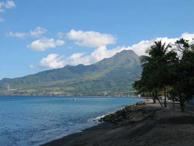
Volcanoes and Forests of Mount Pelée and the Pitons of Northern Martinique
France · 14.7582° N, 61.0731° W · 140 km² · 16 km from Fort-de-France
The global significance of Mount Pelée and Pitons du Carbet is based on its representation of volcanic processes and forest types. The 1902 eruption is considered the deadliest volcanic event of the 20th century, and a worldwide reference for the history of volcanology. All the forest types and the diversity of endemic plants of the Lesser Antilles are represented in the serial property, within forest continuums ranging from the seashore to the volcanic summits. The property is home to globally threatened species such as the Martinique Volcano Frog ( Allobates chalcopis ) and the Martinique Oriole ( Icterus bonana ), two strict endemics.
Description from the UNESCO World Heritage Centre (CC BY-SA IGO 3.0).
Why Volcanoes and Forests of Mount Pelée and the Pitons of Northern Martinique Is Listed
- (viii)
- An outstanding example of major stages of the Earth's history.
- (x)
- The most important natural habitats for conserving biodiversity.

Marquesas Islands
France · 8.9000° S, 139.6000° W · 3,457 km²
The Marquesas Islands ( mar-KAY-səss; French: Îles Marquises or Archipel des Marquises or Marquises [maʁkiz]; Marquesan: Te Henua ʻEnana (North Marquesan) and Te Fenua ʻEnata (South Marquesan), both meaning "the land of men") are a group of volcanic islands in French Polynesia, an overseas collectivity of France in the southern Pacific Ocean. Their highest point is the peak of Mount Oave (French: Mont Oave) on Ua Pou island, at 1,230 m (4,035 ft) above sea level.
Archaeological research suggests the islands were settled in the 10th century AD by voyagers from West Polynesia. Over the centuries that followed, the islands have maintained a "remarkably uniform culture, biology and language". The Marquesas were named after the 16th-century Spanish Viceroy of Peru, the Marquis of Cañete (Spanish: Marqués de Cañete), by navigator Álvaro de Mendaña, who visited them in 1595.
The Marquesas Islands constitute one of the five administrative divisions (subdivisions administratives) of French Polynesia. The capital of the Marquesas Islands' administrative subdivision is the town of Taioha'e, on the island of Nuku Hiva.
Adapted from Wikipedia: Marquesas Islands (CC BY-SA 4.0).
Why Marquesas Islands Is Listed
- (iii)
- A unique testimony to a cultural tradition or civilisation.
- (v)
- An outstanding example of traditional human settlement or land use.
- (vii)
- Superlative natural phenomena or exceptional natural beauty.
- (ix)
- An outstanding example of ongoing ecological and biological processes.
- (x)
- The most important natural habitats for conserving biodiversity.
More about Marquesas Islands
UNESCO's Description
Located in the South Pacific Ocean, this mixed serial property bears an exceptional testimony to the territorial occupation of the Marquesas archipelago by a human civilisation that arrived by sea around the year 1000 CE and developed on these isolated islands between the 10th and the 19th centuries. It is also a hotspot of biodiversity that combines irreplaceable and exceptionally well conserved marine and terrestrial ecosystems. Marked by sharp ridges, impressive peaks and cliffs rising abruptly above the ocean, the landscapes of the archipelago are unparalleled in these tropical latitudes. The archipelago is a major centre of endemism, home to rare and diverse flora, a diversity of emblematic marine species, and one of the most diverse seabird assemblages in the South Pacific. Virtually free from human exploitation, Marquesan waters are among the world’s last marine wilderness areas. The property also includes archaeological sites ranging from monumental dry-stone structures to lithic sculptures and engravings.
From the UNESCO World Heritage Centre (CC BY-SA IGO 3.0).
Geography
The Marquesas Islands group is one of the most remote in the world. It lies about 1,370 kilometres (850 mi) northeast of Tahiti and about 4,800 kilometres (3,000 mi) southwest of Mexico (the nearest continental land mass). It is thought to have been formed by a centre of upwelling magma, called the Marquesas hotspot. The islands in the group fall naturally into two geographical divisions. One is the northern group, consisting of Eiao, Hatutu (Hatutaa), Motu One, and the islands surrounding the large island of Nuku Hiva: Motu Iti, also called Hatu Iti; Ua Pou; Motu Oa; and Ua Huka. The other is the southern group, consisting of Fatu Uku, Tahuata, Moho Tani (Motane), Terihi, Fatu Hiva, and Motu Nao (also called Thomasset Rock), which are clustered around the main island of Hiva ʻOa.
History
The first recorded settlers of the Marquesas were Polynesians who arrived from West Polynesia, descendants of the Lapita Culture. Early attempts to carbon-date evidence from the site suggested they arrived before 100 AD, with other estimates proposing settlement from 600 AD, but several more recent independent studies suggest that they arrived more recently.
Sections adapted from Wikipedia: Marquesas Islands (CC BY-SA 4.0).

Megaliths of Carnac and of the shores of Morbihan
France · 47.6161° N, 3.0872° W · 196 km² · 26 km from Lorient
This serial property in Brittany, France, features a dense concentration of megalithic structures built during the Neolithic period (c. 5000–2300 BCE), carefully aligned with the area’s unique geomorphology. These monumental stone constructions—arranged in relation to one another and to natural features like terrain and waterways—reflect a sophisticated understanding of the environment. Rich engravings and associated artifacts further illustrate the cultural complexity of the societies that inhabited this part of the European Atlantic coast.
Description from the UNESCO World Heritage Centre (CC BY-SA IGO 3.0).
Why Megaliths of Carnac and of the shores of Morbihan Is Listed
- (i)
- A masterpiece of human creative genius.
- (iv)
- An outstanding example of a type of building or landscape.

Beaches of the D-Day Landings, Normandy, 1944
France · 49.3708° N, 0.8796° W · 42 km² · 44 km from Caen
The Normandy landings were the landing operations and associated airborne operations on 6 June 1944 of the Allied invasion of Normandy in Operation Overlord during the Second World War. Codenamed Operation Neptune and often referred to as D-Day (after the military term), it is the largest seaborne invasion in history. The operation began the liberation of France and the rest of Western Europe, and laid the foundations for the Allied victory on the Western Front.
Planning for the operation began in 1943. In the months leading up to the invasion, the Allies conducted a substantial military deception, codenamed Operation Bodyguard, to mislead the Germans as to the date and location of the main Allied landings. The weather on the day selected for D-Day was not ideal, and the operation had to be delayed 24 hours; a further postponement would have meant a delay of at least two weeks, as the planners had requirements for the phase of the moon, the tides, and time of day that meant only a few days each month were deemed suitable.
Adapted from Wikipedia: Normandy landings (CC BY-SA 4.0).
Why Beaches of the D-Day Landings, Normandy, 1944 Is Listed
- (vi)
- A direct association with events, ideas or beliefs of universal significance.
More about Beaches of the D-Day Landings, Normandy, 1944
UNESCO's Description
The serial property comprises six component parts along approximately 80 km of the Normandy coastline, encompassing Utah, Omaha, Gold, Juno, and Sword Beaches, as well as Pointe du Hoc. These sites are directly associated with the Allied landings of 6 June 1944, the opening phase of Operation Overlord, which marked the beginning of the liberation of Western Europe from Nazi occupation during the Second World War. The property preserves significant remains of the German Atlantic Wall, including casemates, artillery batteries, fire‑control posts, and resistance nests, alongside battlefield traces, original wartime equipment, and major commemorative landscapes such as the American Cemetery at Colleville‑sur‑Mer. Together, these elements form an exceptional cultural landscape shaped both by the events of 1944 and by their enduring remembrance.
From the UNESCO World Heritage Centre (CC BY-SA IGO 3.0).
Background
After the German Army invaded the Soviet Union in June 1941, the Soviet leader Joseph Stalin began pressing his new allies for the creation of a second front in western Europe. In late May 1942, the Soviet Union and the United States made a joint announcement that a "... full understanding was reached with regard to the urgent tasks of creating a second front in Europe in 1942." However, British Prime Minister Winston Churchill persuaded US President Franklin D. Roosevelt to postpone the promised invasion as, even with US help, the Allies did not have adequate forces for such an activity.
Instead of an immediate return to France, the western Allies staged offensives in the Mediterranean Theatre of Operations, where British troops were already stationed.
War memorials and tourism
At Omaha Beach, parts of the Mulberry harbour are still visible, and a few of the beach obstacles remain. A memorial to the US National Guard sits at the location of a former German strongpoint. Pointe du Hoc is little changed from 1944, with the terrain covered with bomb craters and most of the concrete bunkers still in place. The Normandy American Cemetery and Memorial is nearby, in Colleville-sur-Mer. A museum about the Utah landings is located at Sainte-Marie-du-Mont, and there is one dedicated to the activities of the US airmen at Sainte-Mère-Église. Two German military cemeteries are located nearby.
Pegasus Bridge, a target of the British 6th Airborne, was the site of some of the earliest action of the Normandy landings.
Sections adapted from Wikipedia: Normandy landings (CC BY-SA 4.0).
Shared With Neighbouring Countries
These sites cross the border. Each is written up on the page of the country UNESCO lists first.
 Pyrénées – Mont Perdu World Heritage SiteMixed · 1997 · Spain, FranceRead on the Spain page →
 Belfries of Belgium and FranceCultural · 1999 · Belgium, FranceRead on the Belgium page →
 Ancient and Primeval Beech Forests of the Carpathians and Other Regions of EuropeNatural · 2007 · Albania, Austria, Bosnia and Herzegovina, Bulgaria, Switzerland, Czechia, Germany, Spain, France, Croatia, Italy, North Macedonia, Poland, Slovenia, Slovakia, UkraineRead on the Albania page →
 prehistoric pile dwellings around the AlpsCultural · 2011 · Austria, Switzerland, Germany, France, Italy, SloveniaRead on the Austria page →
 The Great Spa Towns of EuropeCultural · 2021 · Austria, Czechia, Germany, France, United Kingdom, ItalyRead on the Austria page →
World Heritage in France: Quick Answers
- How many UNESCO World Heritage Sites are in France?
- France has 51 World Heritage Sites: 43 cultural, 6 natural and 2 mixed. 5 of them are shared with a neighbouring country.
- What was the first World Heritage Site in France?
- Mont-Saint-Michel and its Bay, inscribed in 1979. The most recent is Beaches of the D-Day Landings, Normandy, 1944, inscribed in 2026.
- What are the natural World Heritage Sites in France?
- Gulf of Porto: Calanche of Piana, Gulf of Girolata, Scandola Reserve, Pyrénées – Mont Perdu World Heritage Site (mixed), Ancient and Primeval Beech Forests of the Carpathians and Other Regions of Europe, New Caledonia Barrier Reef, Pitons, cirques and remparts of Reunion Island, French Southern and Antarctic Lands nature reserve, Volcanoes and Forests of Mount Pelée and the Pitons of Northern Martinique, Marquesas Islands (mixed).
- Are any World Heritage Sites in France in danger?
- None of the World Heritage Sites in France is on UNESCO's List of World Heritage in Danger.