Every day from Sarajevo to Versailles: alliances, occupations, front lines and battles as they happened.
Loading map…
Allied Powers (Entente)Central PowersNeutral / not at warOccupiedFront line
191419151916191719181919
Drag the slider or press ←→ to move a day (Shift for a month) · Space to play
How to use the World War I map
This interactive map follows World War I one day at a time, from the assassination in Sarajevo on 28 June 1914 to the signing of the Treaty of Versailles on 28 June 1919. Drag the slider and the map redraws: each country takes the colour of its alliance on that date, occupied countries are hatched, and the front lines move as they did on the Western, Eastern, Italian, Balkan and Romanian fronts.
The panel beside the map lists every recorded battle, campaign, naval action and political turning point that began that day, along with the operations still running. Select any event to read a short summary, see where it happened and who took part.
1,827 days, 1914-06-28 to 1919-06-28
893 dated events
46 states and territories at war
43 changes of alignment
Turning points of World War I
Each turning point below opens the map on the day it happened.
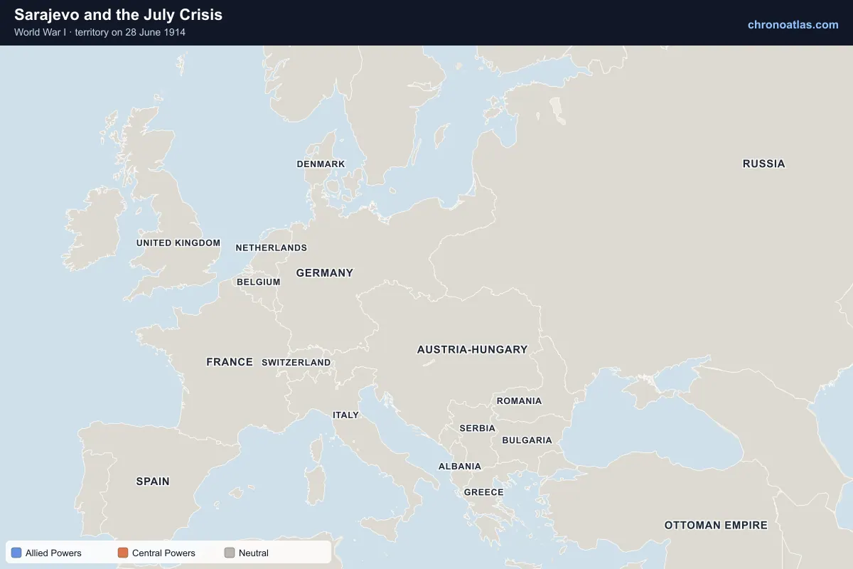
Sarajevo and the July Crisis
Europe, 28 June 1914: territory held by each side.
Archduke Franz Ferdinand, heir to the Austro-Hungarian throne, was shot in Sarajevo by Gavrilo Princip. Austria-Hungary blamed Serbia and, backed by Germany, issued an ultimatum on 23 July. Its declaration of war on 28 July set the alliance system in motion: Russia mobilised to support Serbia, Germany declared war on Russia on 1 August and on France on 3 August. Within a week a Balkan quarrel had become a continental war.
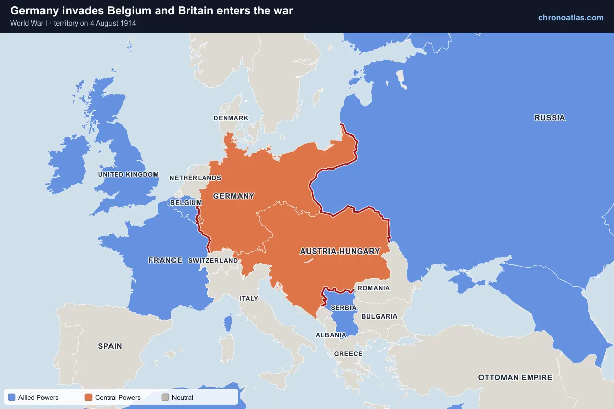
Germany invades Belgium and Britain enters the war
Europe, 4 August 1914: territory held by each side.
Germany’s war plan aimed to defeat France quickly by sweeping through neutral Belgium before turning east against Russia. The invasion on 4 August brought Britain into the war the same day. Liège’s forts fell to heavy siege guns, Brussels was occupied on 20 August, and the Battle of the Frontiers cost the French army more than a quarter of a million casualties in a few weeks. On the map, Belgium turns from Entente blue to occupied as the German armies pass through.
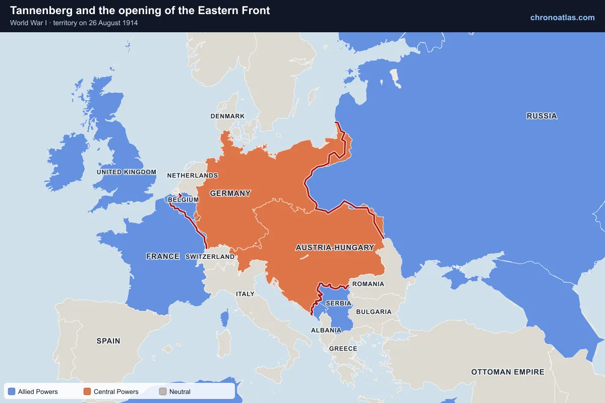
Europe, 26 August 1914: territory held by each side.
Russia attacked East Prussia sooner than Germany expected, but at Tannenberg (26–30 August) the German Eighth Army encircled and destroyed the Russian Second Army. Further south, Russia had more success against Austria-Hungary in Galicia, taking Lemberg (Lviv) and besieging the fortress of Przemyśl. The Eastern Front stayed far more mobile than the Western Front throughout the war, which the shifting front line on the map shows clearly.
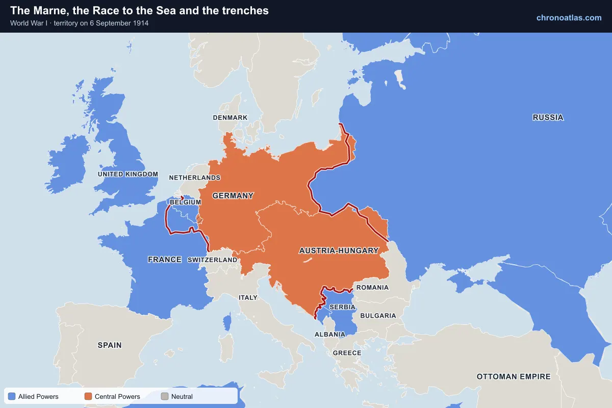
Europe, 6 September 1914: territory held by each side.
French and British forces halted the German advance on the Marne, less than 50 km from Paris, between 6 and 12 September. Both sides then tried to outflank each other northwards in the “Race to the Sea”, ending at the Belgian coast after the First Battle of Ypres. By the end of 1914 a continuous line of trenches ran from the North Sea to Switzerland. It would move only a few kilometres in most places for the next three and a half years.
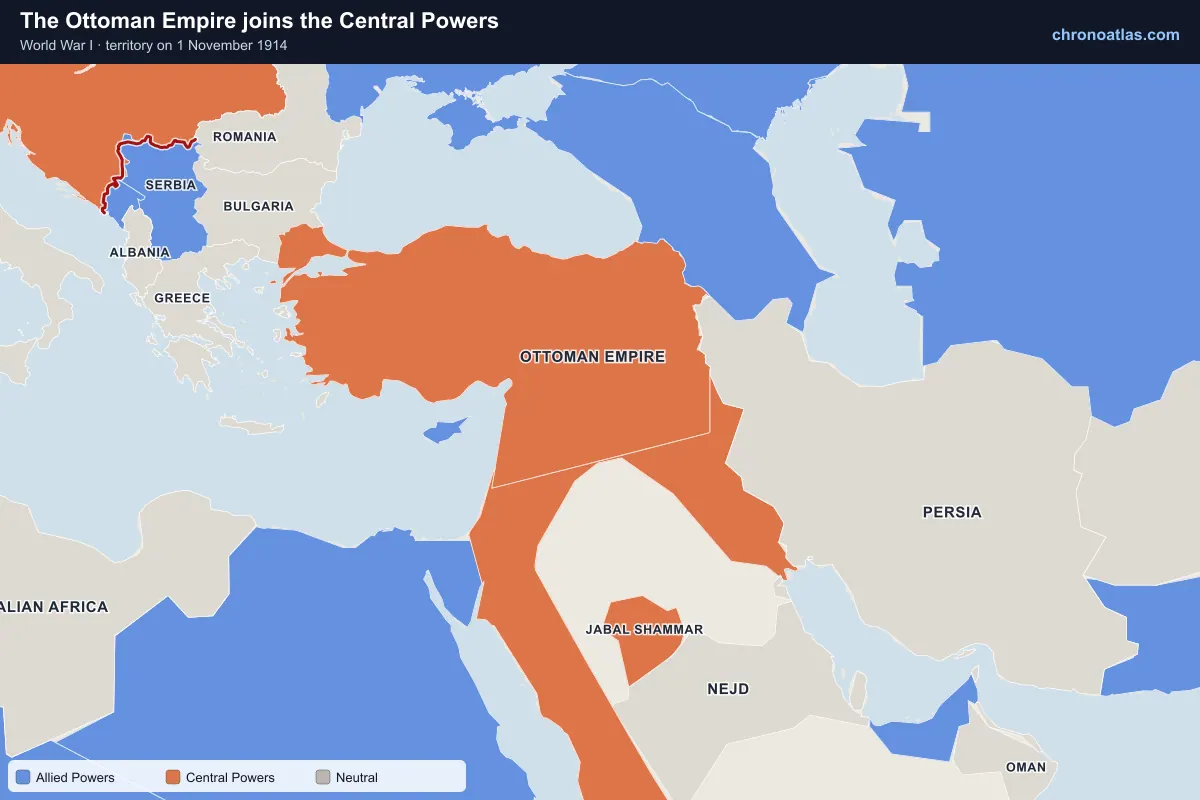
the Balkans and the Middle East, 1 November 1914: territory held by each side.
After its fleet bombarded Russian Black Sea ports, the Ottoman Empire entered the war on Germany’s side. That opened new fronts in the Caucasus, Mesopotamia, Sinai and Palestine, and closed the Dardanelles, Russia’s main sea route for trade and supplies. Fighting in the Middle East drew in British, Indian, Australian and New Zealand troops and, from 1916, the Arab Revolt.
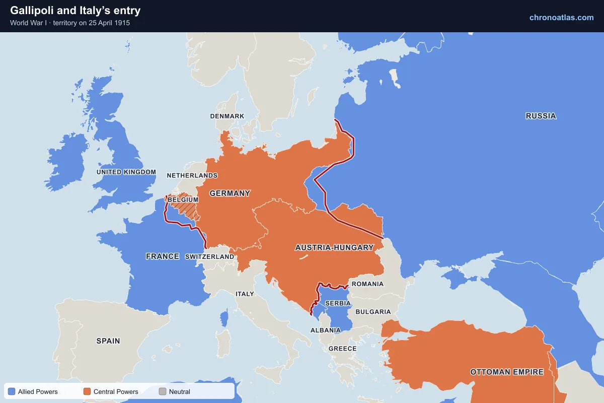
Europe, 25 April 1915: territory held by each side.
Allied troops landed on the Gallipoli peninsula on 25 April 1915, hoping to force the Dardanelles and knock the Ottoman Empire out of the war. The campaign stalled on the beaches and was abandoned in January 1916. In May 1915 Italy, previously neutral, joined the Entente under the Treaty of London and opened a new front along the Isonzo river and in the Alps against Austria-Hungary.
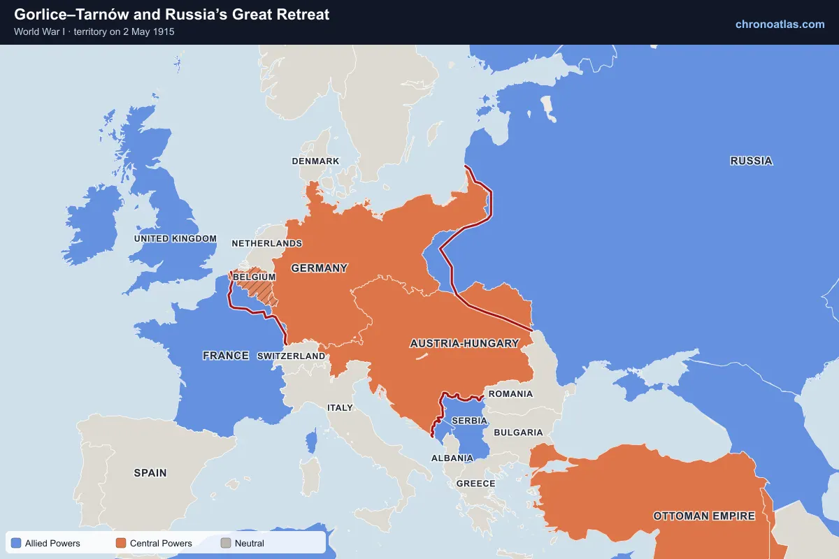
A combined German and Austro-Hungarian breakthrough at Gorlice–Tarnów in May 1915 broke the Russian line in Galicia. Over the summer Russia gave up Russian Poland, Lithuania and parts of Belarus; Warsaw fell on 5 August. Watch the Eastern Front line on the map sweep hundreds of kilometres east between May and September 1915.
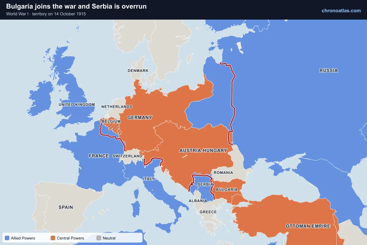
Europe, 14 October 1915: territory held by each side.
Bulgaria entered the war on the side of the Central Powers in October 1915. Attacked from the north by German and Austro-Hungarian armies and from the east by Bulgaria, the Serbian army retreated across the mountains of Albania and Montenegro to the Adriatic coast in winter. Serbia, then Montenegro and Albania, appear as occupied on the map from late 1915.
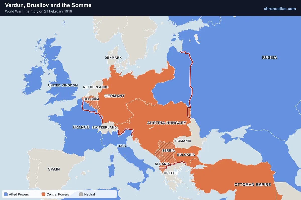
Europe, 21 February 1916: territory held by each side.
1916 was the year of the great battles of attrition. Germany attacked Verdun in February; the battle lasted ten months. Russia’s Brusilov Offensive in June was one of the most successful attacks of the war and nearly broke Austria-Hungary. The British-led attack on the Somme began on 1 July with the worst single day in British military history and ended in November having advanced about 10 km.
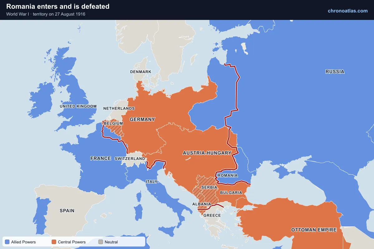
Europe, 27 August 1916: territory held by each side.
Encouraged by Brusilov’s success, Romania declared war on Austria-Hungary and invaded Transylvania in August 1916. A German, Austro-Hungarian, Bulgarian and Ottoman counter-offensive followed, and Bucharest fell on 6 December. Romania held out in Moldavia until Russia’s collapse forced it to sign an armistice in December 1917.
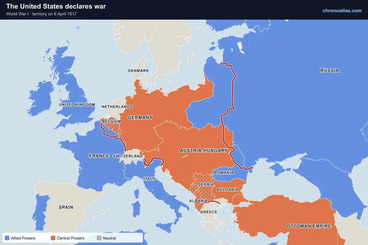
Europe, 6 April 1917: territory held by each side.
Germany’s return to unrestricted submarine warfare and the Zimmermann Telegram, which proposed a German alliance with Mexico, led the United States to declare war on Germany on 6 April 1917. American troops arrived in France in growing numbers through 1918. Several Latin American countries, China, Siam and Liberia also joined the Allies in 1917–18, which the map shows as they change colour.
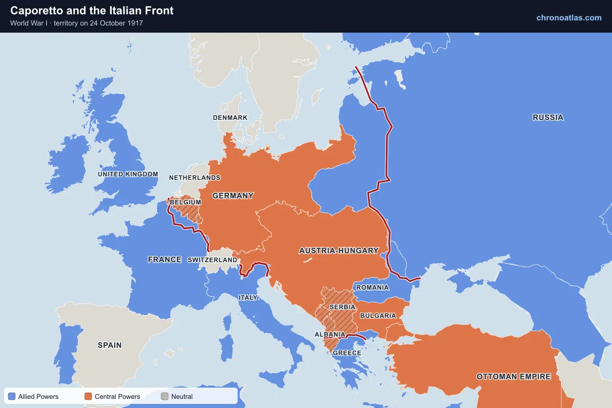
Europe, 24 October 1917: territory held by each side.
With German help, Austro-Hungarian forces broke through at Caporetto in October 1917 and drove the Italian army back to the Piave river, close to Venice. The line held, and a year later the Italian victory at Vittorio Veneto (24 October – 3 November 1918) completed the collapse of Austria-Hungary.
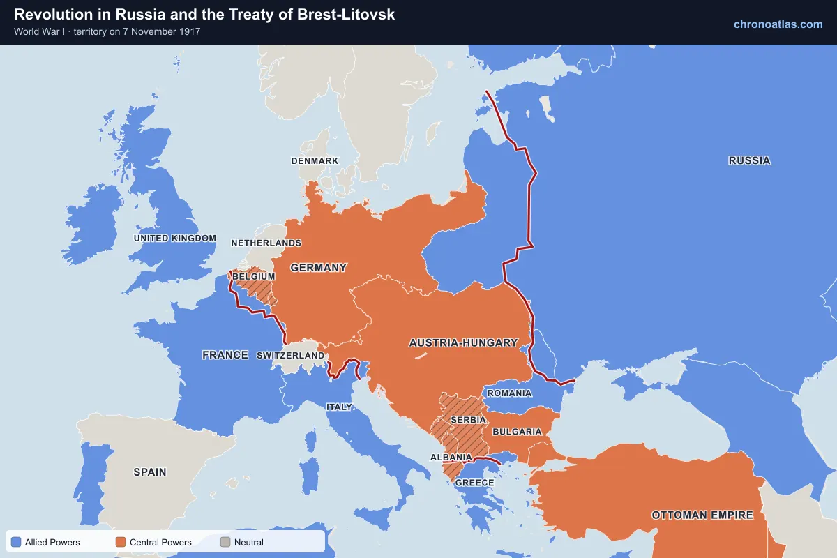
Revolution in Russia and the Treaty of Brest-Litovsk
Europe, 7 November 1917: territory held by each side.
The February Revolution of 1917 ended the monarchy; the Bolsheviks took power in the October Revolution (7 November in the Western calendar) and sought peace. An armistice followed in December, and on 3 March 1918 Soviet Russia signed the Treaty of Brest-Litovsk, giving up Poland, the Baltic lands, Ukraine and Finland. Russia leaves the war on the map from that date.
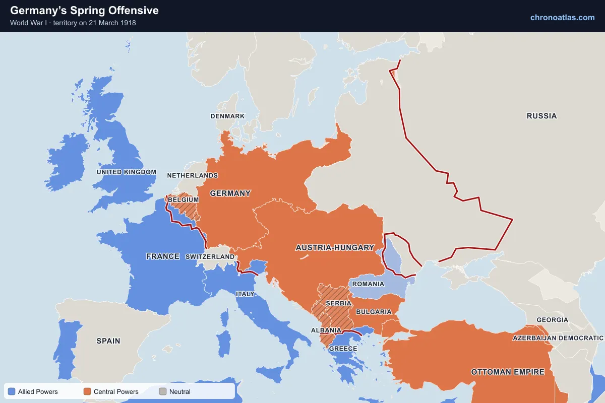
Europe, 21 March 1918: territory held by each side.
Freed from the Eastern Front, Germany launched a series of offensives in France from 21 March 1918, starting with Operation Michael. They gained more ground than any attack since 1914 and brought German guns within range of Paris, but at enormous cost and without breaking the Allied line. Follow the Western Front line on the map bulging west from March to July 1918.
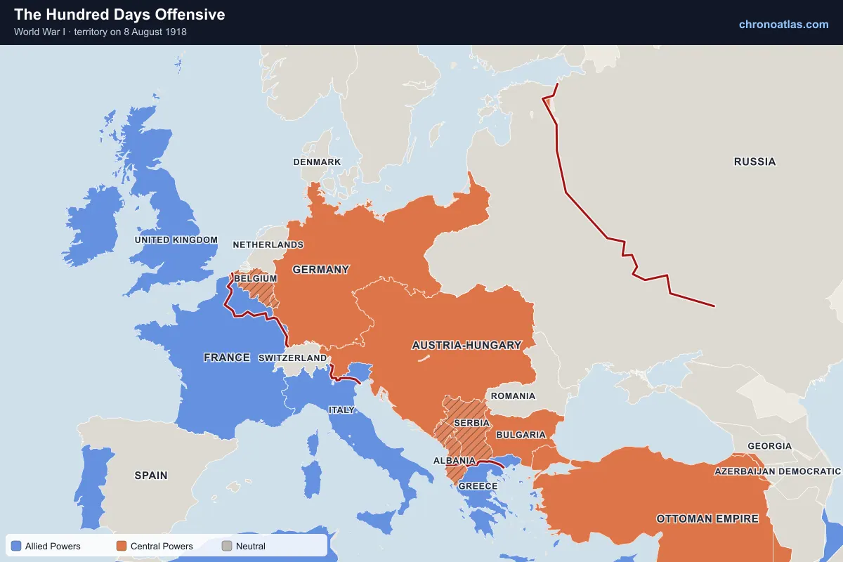
Europe, 8 August 1918: territory held by each side.
The Allied attack at Amiens on 8 August 1918 began a continuous advance that pushed the German army back across France and into Belgium. Germany’s allies collapsed in turn: Bulgaria signed an armistice on 29 September, the Ottoman Empire on 30 October and Austria-Hungary on 3 November.
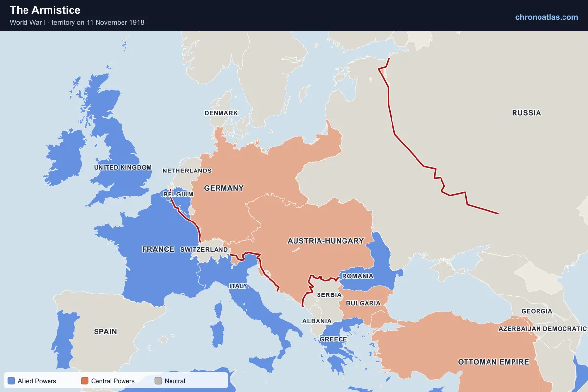
Europe, 11 November 1918: territory held by each side.
Facing defeat, revolution at home and the abdication of the Kaiser, Germany signed the Armistice at Compiègne, effective at 11 a.m. on 11 November 1918. Fighting stopped along the Western Front. The map marks the Central Powers as defeated from their armistice dates.
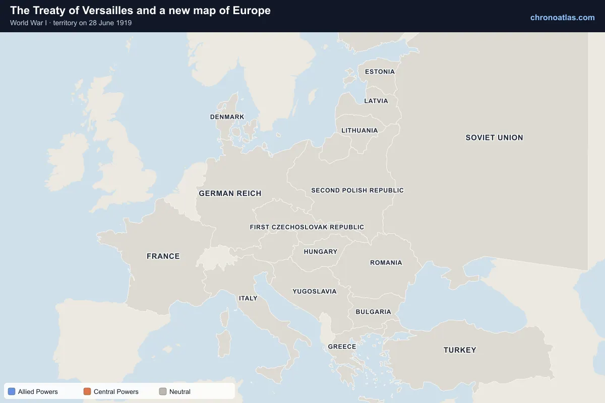
Europe, 28 June 1919: territory held by each side.
The Paris Peace Conference opened in January 1919, and Germany signed the Treaty of Versailles on 28 June, five years to the day after Sarajevo. On the last day of the timeline the map switches to the post-war borders: Poland, Czechoslovakia, Yugoslavia, the Baltic states and Finland appear, and Austria-Hungary is gone.
Every state and territory the map shows at war, with the date it entered and the date it left the war (armistice, surrender or peace). Dates link to the map.
World War I began on 28 July 1914, when Austria-Hungary declared war on Serbia, and fighting ended with the Armistice of 11 November 1918. The war formally ended for Germany with the Treaty of Versailles, signed on 28 June 1919.
Who were the Allied Powers and the Central Powers?
The Allied (Entente) Powers were led by France, the British Empire and Russia, joined by Serbia, Belgium, Japan, Italy (1915), Romania (1916), the United States (1917), Greece and others. The Central Powers were Germany, Austria-Hungary, the Ottoman Empire and Bulgaria.
What started World War I?
The immediate trigger was the assassination of Archduke Franz Ferdinand in Sarajevo on 28 June 1914. Alliance commitments, mobilisation plans, imperial rivalry and nationalism turned Austria-Hungary’s war on Serbia into a European war within a week.
How many people died in World War I?
Estimates of total deaths range from roughly 15 to 22 million, including around 9 to 11 million soldiers. Figures vary depending on whether civilian deaths from famine and disease are counted; the 1918 influenza pandemic is usually counted separately.
Where was the Western Front?
The Western Front ran about 700 km from the Belgian coast near Nieuport, through Ypres, Arras, the Somme, the Aisne and Verdun, to the Swiss border. Turn on the front lines layer and move the slider to see how little it moved between late 1914 and spring 1918.
Which countries stayed neutral in World War I?
Neutral countries in Europe included Spain, Switzerland, the Netherlands, Denmark, Norway and Sweden. On the map they stay grey throughout the war.
How did the map of Europe change after World War I?
Four empires fell: the German, Austro-Hungarian, Russian and Ottoman. New or restored states included Poland, Czechoslovakia, Yugoslavia, Austria, Hungary, Finland, Estonia, Latvia and Lithuania. Move the slider to the last day to see the post-war borders.
How do I use this World War I map?
Drag the date slider, use the arrow keys to move a day at a time, or press play. Select any event in the panel or on the map to read about it. Every view has its own link: copy the address bar to share the exact day and event.
Sources and method
Country alignments in Europe, the five front lines and the battle areas come from WWI Explorer by Xiaokai Ye (MIT License). Front lines change on the dates they were mapped there, typically every few weeks, and hold until the next mapped date. Inside Europe, 1914 borders are used throughout the war, as in the source; the post-war map appears on the final day.
Outside Europe, territory comes from Cliopatria (Seshat Global History Databank, CC BY 4.0). Its borders change once a year, so colonial campaigns in Africa, the Middle East and the Pacific are shown at yearly resolution. Each state takes its alliance colour from the date it declared war or entered hostilities.
Events are every battle, campaign, naval action and political event that Wikidata records as part of World War I with a known day or month, merged with the WWI Explorer timeline. Event summaries are the opening sentences of the matching English Wikipedia article (CC BY-SA 4.0). Events known only to the month are listed as ongoing for that month rather than pinned to a day.
Front lines and borders are simplified for a world-scale map. They show the broad course of the war, not the exact position of every trench.
WWI Explorer (Xiaokai Ye) — European borders, alignments, front lines, battle areas, timeline (MIT License)
Wikipedia — event summaries and images (CC BY-SA 4.0)
Natural Earth — coastlines and lakes (Public domain)
Last updated .
↑↓ to navigate↵ to open
12,754 Planetary Entities Indexed
We use Google Analytics cookies to understand which pages are useful. Necessary storage only keeps your theme and this choice on your device. Privacy policy