Skip to content
YearMaps
Australia · Landforms

Mountain Ranges, Deserts and Landforms of Australia

Australia is the largest of the 32 mountain ranges, deserts and other landforms recorded for Australia, at 8.82M km², ahead of Western Plateau at 1.75M km². The full list follows.

How this list is built: Ranked by mapped area. Covers mountain ranges, deserts, plateaus, named glaciers, plains, basins, peninsulas and capes. One that crosses a border is listed under every country it lies in, with the area of the whole feature. It covers the mountain ranges, deserts and other landforms indexed in YearMaps, drawn from open geospatial data, and is not an exhaustive national register.

Landforms Listed
32
Top Ranked
8.82M km²
Australia
Second
1.75M km²
Western Plateau
Profiled Below
25
Photo, encyclopedia text and figures
Mountain Ranges, Deserts and Landforms of Australia
#NameArea
1Australia8.82M km²
2Western Plateau1.75M km²
3Great Artesian Basin1.03M km²
4Great Dividing Range793,951 km²
5Murray-Darling Basin691,792 km²
6Nullarbor Plain167,047 km²
7Great Sandy Desert161,048 km²
8Arnhem Land127,209 km²
9Kimberley Plateau117,820 km²
10Barkly Tableland117,367 km²
11Gibson Desert105,825 km²
12Great Victoria Desert72,565 km²
13Strzelecki Desert67,844 km²
14CAPE YORK Peninsula63,720 km²
15Tanami Desert55,897 km²
16MacDonnell Ranges36,765 km²
17Darling Range34,280 km²
18Flinders Ranges31,296 km²
19Dampier Land16,349 km²
20Selwyn Range16,090 km²
21Australian Alps15,948 km²
22Buckland Tableland15,062 km²
23Gregory Range8,668 km²
24Eighty Mile Beach5,813 km²
25Blue Mountains5,055 km²
26Atherton Tableland2,606 km²
27Cobourg Peninsula2,336 km²
28Riverina896 km²
29Wilsons Promontory618 km²
30Hamersley Range597 km²
31Darling Downs113 km²
32Simpson Desert78 km²

The Landforms of Australia in Detail

The 25 mountain ranges, deserts and other landforms above that have an encyclopedia article, in the same order, each with its photograph, figures and the places around it.

Australia
Image via Wikimedia Commons (author and licence on the file page).

Australia

Continent · 8.82M km²

Australia is a continent in Oceania (Australasia), covering an estimated 8.82M km². It is the 7th-largest of the 231 landforms with a mapped extent in YearMaps.

Australia, officially the Commonwealth of Australia, is a country comprising the mainland of the Australian continent, the island of Tasmania and numerous smaller islands. It has a land area of 7,688,287 km2 (2,968,464 sq mi), making it the sixth-largest country in the world, and is the world's flattest and driest inhabited continent. It is a megadiverse country, and its size gives it a wide variety of landscapes and climates, including large deserts centrally and tropical rainforests along the coast.

The ancestors of Aboriginal Australians began arriving from Southeast Asia 50,000 to 65,000 years ago, during the Last Glacial Period. By the time of British settlement, Aboriginal Australians spoke more than 250 distinct languages and had one of the oldest living cultures in the world. Australia's written history commenced with Dutch exploration of most of the coastline in the 17th century. British colonisation began in 1788 with the establishment of the penal colony of New South Wales.

Adapted from Wikipedia: Australia (CC BY-SA 4.0).

Feature class
Continent
Mapped extent
8.82M km²
Size rank
#7 of 231 landforms
Region
Oceania
Subregion
Australasia
Coordinates
-31.3572°, 135.5022°
Summits:
Mount Zeil (1,531 m), Mount Buller (1,805 m), Mount Bogong (1,986 m)
Ranges:
Flinders Ranges (Oceania), MacDonnell Ranges (Oceania)
Settlements:
Whyalla (268 km), Adelaide (491 km), Mildura (696 km)

View on the live map

More about Australia

Geography

Australia consists of the mainland Australian continent, the island of Tasmania, numerous smaller offshore islands, and the remote offshore territories of Ashmore and Cartier Islands, Christmas Island, Cocos (Keeling) Islands, Coral Sea Islands, Heard and McDonald Islands, and Norfolk Island. Australia also claims about 42% of Antarctica as the Australian Antarctic Territory, but this claim is only recognised by four other countries.

Mainland Australia lies between latitudes 9° and 44° south, and longitudes 112° and 154° east. Surrounded by the Indian and Pacific oceans, Australia is separated from Asia by the Arafura and Timor seas, with the Coral Sea lying off the Queensland coast, and the Tasman Sea lying between Australia and New Zealand.

History

Human habitation of the Australian continent is estimated to have begun 50,000 to 65,000 years ago, with the migration of people by land bridges and short sea crossings from what is now Southeast Asia. It is uncertain how many waves of immigration may have contributed to these ancestors of modern Aboriginal Australians. The Madjedbebe rock shelter in Arnhem Land is possibly the oldest site showing the presence of humans in Australia. The oldest human remains found are the Lake Mungo remains, which have been dated to approximately 42,000 years ago.

Aboriginal Australian culture is one of the oldest continuous cultures on Earth.

Economy

Australia's mixed-market economy is highly developed and rich in natural resources. It is the world's twelfth largest by nominal terms and the twenty-third largest by PPP. As of 2021, Australia has the second-highest amount of wealth per adult, after Luxembourg, and the thirteenth-highest financial assets per capita, as well as one of the highest per capita incomes globally. It has a labour force of some 14.6 million, with an unemployment rate of 4.2% as of December 2025. According to the Australian Council of Social Service, the poverty rate of Australia exceeds 13.6% of the population, encompassing over 3.2 million. It also estimated that there were 774,000 (17.7%) children under the age of 15 living in relative poverty.

Sections adapted from Wikipedia: Australia (CC BY-SA 4.0).

Australia: Key Facts

Key facts about Australia
Area7,692,024 km²
Highest pointMawson Peak
OnIndian Ocean, South Pacific Ocean

Facts from Wikidata Q408 (CC0).

Western Plateau

Plateau · 1.75M km²

Western Plateau is a plateau in Oceania (Australasia), covering an estimated 1.75M km². It is the 3rd-largest of the 69 plateaus with a mapped extent in YearMaps.

The Western Plateau is Australia's largest drainage division and is composed predominantly of the remains of the ancient rock shield of Gondwana. It covers two thirds of the continent; 2,700,000 square kilometres (1,000,000 sq mi) of arid land, including large parts of Western Australia, South Australia, and the Northern Territory. For comparison, it is roughly the same size as the whole of continental Europe from Western Poland to Portugal.

The western plateau extends from the Gulf of Carpentaria to Onslow, covering the cities of Perth and Albany. The Western Plateau occupies almost two-thirds of the land surface of Australia and it covers parts of Western Australia, Northern Territory and South Australia

Rain rarely falls in this region and aside from a handful of permanent waterholes, surface water is absent at all times except after heavy rain. Most of the territory is flat sandy or stony desert with a sparse covering of shrubs or tussock grasses. Average rainfall varies from one area to another and is quoted at 189 millimetres (7.4 in) to 398 millimetres (15.7 in) per year, but is highly unpredictable.

Adapted from Wikipedia: Western Plateau (CC BY-SA 4.0).

Feature class
Plateau
Mapped extent
1.75M km²
Size rank
#3 of 69 plateaus
Region
Oceania
Subregion
Australasia
Coordinates
-25.8327°, 119.5762°
Summits:
Mount Meharry (1,253 m), Bluff Knoll (1,096 m), Mount Zeil (1,531 m)
Ranges:
Hamersley Range (Oceania), Darling Range (Oceania)
Settlements:
Kalgoorlie (575 km), Geraldton (590 km), Perth (772 km)

View on the live map

Great Artesian Basin
Image via Wikimedia Commons (author and licence on the file page).

Great Artesian Basin

Basin · 1.03M km²

Great Artesian Basin is a basin in Oceania (Australasia), covering an estimated 1.03M km². It is the 16th-largest of the 231 landforms with a mapped extent in YearMaps.

The Great Artesian Basin (GAB) of Australia is the largest and deepest artesian basin in the world, extending over 1,700,000 square kilometres (660,000 sq mi). Measured water temperatures range from 30 to 100 °C (86 to 212 °F). The basin provides the only source of fresh water through much of inland Australia.

The basin underlies 22% of the Australian continent, including most of Queensland, the south-east corner of the Northern Territory, north-eastern South Australia, and northern New South Wales. It is 3000 metres (9800 feet) deep in places and is estimated to contain 64,900 cubic kilometres (15,600 cubic miles) of groundwater. The Great Artesian Basin Coordinating Committee (GABCC) coordinates activity between federal, state/territory, and local levels of government and community organisations.

Adapted from Wikipedia: Great Artesian Basin (CC BY-SA 4.0).

Feature class
Basin
Mapped extent
1.03M km²
Size rank
#16 of 231 landforms
Region
Oceania
Subregion
Australasia
Coordinates
-25.0586°, 142.0559°
Summits:
Mount Bartle Frere (1,622 m), Mount Zeil (1,531 m), Mount Warning (1,156 m)
Ranges:
Great Dividing Range (Oceania), MacDonnell Ranges (Oceania)
Settlements:
Mount Isa (549 km), Townsville (808 km), Alice Springs (842 km)

View on the live map

Great Dividing Range
Image via Wikimedia Commons (author and licence on the file page).

Great Dividing Range

Range/mtn · 793,951 km²

Great Dividing Range is a range/mtn in Oceania (Australasia), covering an estimated 793,951 km². It is the 3rd-largest of the 216 mountain ranges with a mapped extent in YearMaps.

The Great Dividing Range, also known as the East Australian Cordillera or the Eastern Highlands, is a cordillera system in eastern Australia consisting of an expansive collection of mountain ranges, plateaus and rolling hills. It runs roughly parallel to the east coast of Australia and forms the fifth-longest land-based mountain chain in the world, and the longest entirely within a single country. It is mainland Australia's most substantial topographic feature and serves as the definitive watershed for the river systems in eastern Australia, hence the name.

The Great Dividing Range stretches more than 3,500 kilometres (2,175 mi) from Dauan Island in the Torres Strait off the northern tip of Cape York Peninsula, running the entire length of the eastern coastline through Queensland and New South Wales, then turning west across Victoria before finally fading into the Wimmera plains as rolling hills west of the Grampians region. The width of the Range varies from about 160 km (100 mi) to over 300 km (190 mi). The Greater Blue Mountains Area, Gondwana Rainforests and Wet Tropics of Queensland World Heritage Areas are located in the Range.

Adapted from Wikipedia: Great Dividing Range (CC BY-SA 4.0).

Feature class
Range/mtn
Mapped extent
793,951 km²
Size rank
#3 of 216 mountain ranges
Region
Oceania
Subregion
Australasia
Coordinates
-22.0389°, 147.0960°
Summits:
Mount Bartle Frere (1,622 m), Mount Warning (1,156 m), Mount Zeil (1,531 m)
Adjacent ranges:
MacDonnell Ranges (Oceania), Owen Stanley Range (Oceania)
Settlements:
Mackay (235 km), Townsville (312 km), Rockhampton (381 km)

View on the live map

More about Great Dividing Range

Geography

The Dividing Range does not consist of a single continuous mountain chain, but is rather a combined complex (cordillera) of mountain ranges, plateaus, hilly upland areas and escarpments with an ancient and complex geological history. The physiographic division name for the landmass is called the East Australian Cordillera. In some places the terrain is relatively flat, consisting of very low hills. Typically the highlands range from 300 to 1,600 metres (980 to 5,250 ft) in height. The mountains and plateaus, which consist of limestones, sandstone, quartzite, schists and dolomite, have been created by faulting and folding processes.

Climate

The sharp rise between the coastal lowlands and the eastern uplands has affected Australia's climate, mainly due to orographic precipitation, and these areas of highest relief have revealed an impressive gorge country. Areas to the east of the mountain range in southern NSW usually experience a Föhn effect, which is a dry wind originating from the Great Dividing Range that abruptly raises the air temperature in the lee of that mountain range and reduces atmospheric moisture. This dry wind, which elevates fire danger in the warm months, occurs because of the partial orographic obstruction of relatively damp low-level air and the subsiding of drier upper-level air in leeward of the mountains.

History

The Great Dividing Range was formed during the Carboniferous period—over 300 million years ago—when Australia collided with what are now parts of South America and New Zealand. The range has experienced significant erosion since. (See Geology of Australia.)

For tens of thousands of years prior to British colonisation the ranges were home to various Aboriginal Australian peoples. Evidence remains in some places of their traditional way of life including decorated caves, campsites and trails used to travel between the coastal and inland regions. Many descendants of these early inhabitants still exist today, and some remain the traditional owners and custodians of their lands.

After British colonisation in 1788, the ranges were an obstacle to exploration and settlement by European settlers.

Sections adapted from Wikipedia: Great Dividing Range (CC BY-SA 4.0).

Great Dividing Range: Key Facts

Key facts about Great Dividing Range
Length3,500 km
Highest pointMount Kosciuszko

Facts from Wikidata Q192583 (CC0).

Murray-Darling Basin
Image via Wikimedia Commons (author and licence on the file page).

Murray-Darling Basin

Basin · 691,792 km²

Murray-Darling Basin is a basin in Oceania (Australasia), covering an estimated 691,792 km². It is the 22nd-largest of the 231 landforms with a mapped extent in YearMaps.

The Murray–Darling Basin is a geographical area in the interior of south-east Australia, encompassing the drainage basin of the tributaries of the Murray River, Australia's longest river, and the Darling River, a right tributary of the Murray and Australia's third-longest river. The Basin, which includes six of Australia's seven longest rivers and covers around one-seventh of the Australian landmass, is one of the country's most significant agricultural areas providing one-third of Australia's food supply. Located west of the Great Dividing Range, it drains southwest into the Great Australian Bight and spans most of the states of New South Wales and Victoria, the Australian Capital Territory, and parts of the states of Queensland (the lower third) and South Australia (the southeastern corner).

The Basin is 3,375 kilometres (2,097 mi) in length, with the Murray River being 2,508 km (1,558 mi) long. Most of the 1,061,469 km2 (409,835 sq mi) basin is flat, low-lying and far inland, and receives little direct rainfall. The many rivers it contains tend to be long and slow-flowing, and carry a volume of water that is large only by Australian standards.

Adapted from Wikipedia: Murray–Darling basin (CC BY-SA 4.0).

Feature class
Basin
Mapped extent
691,792 km²
Size rank
#22 of 231 landforms
Region
Oceania
Subregion
Australasia
Coordinates
-33.6038°, 144.7160°
Summits:
Mount Bogong (1,986 m), Mount Buller (1,805 m), Mount Kosciuszko (2,228 m)
Ranges:
Australian Alps (Oceania), Flinders Ranges (Oceania)
Settlements:
Mildura (245 km), Wagga Wagga (294 km), Shepparton (314 km)

View on the live map

More about Murray-Darling Basin

Murray-Darling Basin: Key Facts

Key facts about Murray-Darling Basin
Area1,061,469 km²
Highest pointMount Kosciuszko
OnMurray River, Murrumbidgee River

Facts from Wikidata Q534290 (CC0).

Nullarbor Plain
Image via Wikimedia Commons (author and licence on the file page).

Nullarbor Plain

Plain · 167,047 km²

Nullarbor Plain is a plain in Oceania (Australasia), covering an estimated 167,047 km².

The Nullarbor Plain ( NUL-ər-bor; Latin: nulla feminine of nullus 'no' and arbor 'tree') is part of the area of flat, almost treeless, arid or semi-arid country of southern Australia, located on the Great Australian Bight coast with the Great Victoria Desert to its north. It is the world's largest single exposure of limestone bedrock, and occupies an area of about 200,000 square kilometres (77,000 sq mi). At its widest point, it stretches about 1,100 kilometres (684 mi) from east to west across the border between South Australia and Western Australia.

Adapted from Wikipedia: Nullarbor Plain (CC BY-SA 4.0).

Feature class
Plain
Mapped extent
167,047 km²
Size rank
#48 of 231 landforms
Region
Oceania
Subregion
Australasia
Coordinates
-31.1701°, 126.8663°
Summits:
Bluff Knoll (1,096 m), Mount Zeil (1,531 m), Mount Meharry (1,253 m)
Ranges:
Darling Range (Oceania), Flinders Ranges (Oceania)
Settlements:
Kalgoorlie (518 km), Albany (939 km), Whyalla (1,028 km)

View on the live map

More about Nullarbor Plain

Geology and geography

The Nullarbor Plain is a former shallow seabed, as indicated by the presence of bryozoans, foraminifera, echinoids and red algae calcareous skeletons that make up the limestone. The region is also the location of "Nullarbor limestone" and it has a reputation as a significant karst region with Oligocene and Miocene cave formations.

the Toolinna Limestone does not cover the whole Nullarbor and is extant only in the extreme east beside the Abrakurrie formation which lies in a depression.

One theory is that the whole area was uplifted by crustal movements in the Miocene, and since then, erosion by wind and rain has reduced its thickness. The plain has most likely never had any major defining topographic features, resulting in the extremely flat terrain across the plain today.

Climate

The Nullarbor includes desert and semi-arid climate zones. Using updated versions of the Köppen climate classifications, the plain most closely fits the Köppen BWk "cold desert" and BSk "cold semi-arid" taxons (rather than the BWh "hot desert" type found in central Australia). While summer days can be scorching hot, with daytime temperatures close to 50 °C (122 °F), in winter nights frequently drop well below freezing. Close to the coast, temperatures are more moderate and more rain falls in the winter months, compared to the most inland parts of Australia. The mean annual rainfall at Cook is 184.1 millimetres (7.25 in), with most rain falling between May and August.

History

Historically, the Nullarbor was seasonally occupied by Indigenous Australian people, the Mirning clans and Yinyila people. Traditionally, the area was called Oondiri, which is said to mean 'the waterless'.

The first Europeans known to have sighted and mapped the Nullarbor coast were Captain François Thijssen and Councillor of the Indies, Pieter Nuyts, on the Dutch East Indiaman 't Gulden Zeepaert (the Golden Seahorse). In 1626–1627, they charted a stretch of the southern Australian coast east of Cape Leeuwin and extending to longitude 133 30'E. While the interior remained little known to Europeans over the next two centuries, the stretch of coast adjoining the Great Australian Bight was named for Nuyts, and maps subsequent to 1627 bore the legend "Landt van P. Nuyts" or "Terre de Nuyts".

Sections adapted from Wikipedia: Nullarbor Plain (CC BY-SA 4.0).

Great Sandy Desert
Image via Wikimedia Commons (author and licence on the file page).

Great Sandy Desert

Desert · 161,048 km²

Great Sandy Desert is a desert in Oceania (Australasia), covering an estimated 161,048 km². It is the 12th-largest of the 58 deserts with a mapped extent in YearMaps.

The Great Sandy Desert is an interim Australian bioregion, located in the northeast of Western Australia straddling the Pilbara and southern Kimberley regions and extending east into the Northern Territory. It is the second largest desert in Australia after the Great Victoria Desert and encompasses an area of 284,993 km2 (110,036 sq mi). The Gibson Desert lies to the south and the Tanami Desert lies to the east of the Great Sandy Desert.

Adapted from Wikipedia: Great Sandy Desert (CC BY-SA 4.0).

Feature class
Desert
Mapped extent
161,048 km²
Size rank
#12 of 58 deserts
Region
Oceania
Subregion
Australasia
Coordinates
-19.7649°, 124.6760°
Summits:
Mount Meharry (1,253 m), Mount Zeil (1,531 m), Gunung Tambora (2,722 m)
Ranges:
Hamersley Range (Oceania), MacDonnell Ranges (Oceania)
Settlements:
Alice Springs (1,046 km), Darwin (1,049 km), Kupang (1,072 km)

View on the live map

More about Great Sandy Desert

Climate

Rainfall is low throughout the coast and, especially further north, is strongly seasonal. Areas near the Kimberley have an average rainfall that exceeds 300 mm (12 in), but can be patchy. Many dry years end with a monsoon cloud mass or a tropical cyclone. Like many of Australia's deserts, precipitation is high by desert standards, but with the driest regions recording total rainfall a little below 250 mm (9.8 in). The heat of Australia’s ground surface, in turn, creates a massive evaporation cycle, which partially explains the higher-than-normal desert rainfall. This region is one which gives rise to the heat lows, which help drive the NW monsoon. Almost all the rain regionally comes from monsoon thunderstorms, or the occasional tropical cyclone rain depression.

Economy

Indigenous art is a huge industry in central Australia. Mines, most importantly the Telfer gold mine and Nifty copper mine, and cattle stations are found in the far west. Telfer is one of the largest gold mines in Australia. The undeveloped Kintyre uranium deposit lies south of Telfer.

Sections adapted from Wikipedia: Great Sandy Desert (CC BY-SA 4.0).

Great Sandy Desert: Key Facts

Key facts about Great Sandy Desert
Area284,993 km²

Facts from Wikidata Q326896 (CC0).

Arnhem Land
Image via Wikimedia Commons (author and licence on the file page).

Arnhem Land

Pen/cape · 127,209 km²

Arnhem Land is a pen/cape in Oceania (Australasia), covering an estimated 127,209 km².

Arnhem Land is a region of the Northern Territory of Australia. It is located in the north-eastern corner of the territory and is around 500 km (310 mi) from the territorial capital, Darwin. In 1623, Dutch East India Company captain Willem Joosten van Colster (or Coolsteerdt) sailed into the Gulf of Carpentaria and Cape Arnhem is named after his ship, the Arnhem, which itself was named after the city of Arnhem in the Netherlands.

The area covers about 97,000 km2 (37,000 sq mi). Two regions are often distinguished as East Arnhem (Land) and West Arnhem (Land). The region's service hub is Nhulunbuy, 600 km (370 mi) east of Darwin, set up in the early 1970s as a mining town for bauxite. Other major population centres are Yirrkala (just outside Nhulunbuy), Gunbalanya (formerly Oenpelli), Ramingining, and Maningrida.

A substantial proportion of the population, who are mostly Aboriginal, live on small outstations or homelands. This outstation movement started in the early 1980s. Many Aboriginal groups moved to usually very small settlements on their traditional lands, often to escape the problems of the larger towns.

Adapted from Wikipedia: Arnhem Land (CC BY-SA 4.0).

Feature class
Pen/cape
Mapped extent
127,209 km²
Size rank
#57 of 231 landforms
Region
Oceania
Subregion
Australasia
Coordinates
-13.4822°, 133.9092°
Summits:
Puncak Jaya (4,884 m), Mount Zeil (1,531 m), Gunung Binaiya (3,027 m)
Ranges:
Maoke Mountains (Oceania), MacDonnell Ranges (Oceania)
Settlements:
Darwin (352 km), Merauke (900 km), Mount Isa (1,000 km)

View on the live map

More about Arnhem Land

Geography

The area is from Port Roper on the Gulf of Carpentaria around the coast to the East Alligator River, where it adjoins Kakadu National Park. The major centres are Jabiru on the Kakadu National Park border, Maningrida at the Liverpool River mouth, and Nhulunbuy (also known as Gove) in the far north-east, on the Gove Peninsula. Gove is the site of large-scale bauxite mining with an associated alumina refinery. Its administrative centre is the town of Nhulunbuy, the fourth-largest population centre in the Northern Territory.

The climate of Arnhem Land is tropical monsoon with a wet and dry season.

History

The Yolŋu culture in East Arnhem Land is possibly one of the oldest living cultures on Earth; humans are known to have inhabited the region for about 60,000 years. DNA studies have confirmed that "Aboriginal Australians are one of the oldest living populations in the world, certainly the oldest outside of Africa"; their descendants left the African continent 75,000 years ago. They may have the oldest continuous culture on earth. Oral histories comprising complex narratives have been passed down through hundreds of generations, and the Aboriginal rock art, dated by modern techniques, shows continuity of their culture.

Arnhem Land is the location of the oldest-known (as of 2010) stone axe of its kind, which scholars believe to be 35,500 years old.

Economy

In 2013–14, the entire region contributed around A$1.3 billion or 7% to the Northern Territory's gross state product, mainly through bauxite mining.

In 2019, it was announced that NASA had chosen Arnhem Land as the location for a space launch facility. The Arnhem Space Centre was built near Nhulunbuy, employing mostly local labour, and on 27 June 2022, NASA launched the first rocket there, which was the first rocket launch from a commercial spaceport outside the US. Two further launches followed, the third on 11 July. The facility ceased operations in 2024.

Sections adapted from Wikipedia: Arnhem Land (CC BY-SA 4.0).

Barkly Tableland
Image via Wikimedia Commons (author and licence on the file page).

Barkly Tableland

Plateau · 117,367 km²

Barkly Tableland is a plateau in Oceania (Australasia), covering an estimated 117,367 km².

The Barkly Tableland is a region in the Central East of the Northern Territory, extending into Western Queensland. The region was named after Sir Henry Barkly. The epithet "Tableland" is inaccurate, since the region is neither elevated relative to adjacent landforms, nor are the boundaries marked by a distinct change in elevation.

The Barkly Tableland is a poorly defined region. The name Barkly Tableland properly applies only to the areas of largely treeless, cracking-clay soils supporting grasslands dominated by Mitchell grass (Astrebla spp.).

A variety of terms, such as "Barkly Tablelands Region" and "Barkly Region", have come into common use for referring to various circumscriptions of the region. All include portions of the Barkly Tablelands proper, along with varying adjoining landforms and vegetation types.

Varying definitions of the Barkly regions encompass:

An area from Dunmarra south to Barrow Creek, and from the Tanami Desert to the Queensland border.

The Barkly Tableland proper, the associated Gulf Country, the upper Georgina River basin, and portions of the inland desert country.

Adapted from Wikipedia: Barkly Tableland (CC BY-SA 4.0).

Feature class
Plateau
Mapped extent
117,367 km²
Size rank
#30 of 69 plateaus
Region
Oceania
Subregion
Australasia
Coordinates
-17.6602°, 136.8575°
Summits:
Mount Zeil (1,531 m), Mount Bartle Frere (1,622 m), Puncak Jaya (4,884 m)
Ranges:
MacDonnell Ranges (Oceania), Great Dividing Range (Oceania)
Settlements:
Mount Isa (439 km), Alice Springs (740 km), Darwin (869 km)

View on the live map

More about Barkly Tableland

Geography

Black soil plains cover much of the Barkly Tableland. Rainfall in this inland area is low (350mm per year) and subject to extreme seasonal fluctuations with rains occurring from November to March during the hot (up to 40 °C) summer. Winters are cool and frost may occur, especially in the southern section of the plain in Queensland.

The Barkly Tableland is a distinct physiographic province of the larger West Australian Shield division. It includes the Mueller Plateau and Sandover-Pituri Platform physiographic sections between the desert uplands in the west and Mount Isa, Queensland in the east.

Ecology

The dominant flora of the Tableland is semi-arid savanna of Mitchell grass. The grasslands are mostly used for cattle grazing and are home to some threatened species of plants and animals.

Mitchell grass is hardy with long roots so is well adapted to dry soils and periods of drought. The grasslands support other distinctive plants alongside the grasses but there are no areas of thick woodland, only acacia trees scattered across the plain, and red river gum along watercourses.

The habitat of the Mitchell Grass Downs is mostly a uniform cover of grassland and therefore does not support a great variety of wildlife.

History

William Landsborough was the first non-Indigenous Australian person to explore the tableland, and named it after Sir Henry Barkly, then governor of Victoria.

In 1877 the overlander, Nathaniel Buchanan and Sam Croker crossed the Barkly Tableland and rode on to the Overland Telegraph Line opening new land for settlement. It was not until the introduction of generous leasing arrangements on the Barkly in the late 1870s that the region became more settled.

Sections adapted from Wikipedia: Barkly Tableland (CC BY-SA 4.0).

Barkly Tableland: Key Facts

Key facts about Barkly Tableland
Elevation247 m

Facts from Wikidata Q2671409 (CC0).

Gibson Desert
Image via Wikimedia Commons (author and licence on the file page).

Gibson Desert

Desert · 105,825 km²

Gibson Desert is a desert in Oceania (Australasia), covering an estimated 105,825 km². It is the 21st-largest of the 58 deserts with a mapped extent in YearMaps.

The Gibson Desert is a large desert in Western Australia, mainly in an almost pristine state. It is about 155,000 square kilometres (60,000 sq mi) in size, making it the fifth largest desert in Australia, after the Great Victoria, Great Sandy, Tanami and Simpson deserts. The Gibson Desert is both an interim Australian bioregion and desert ecoregion. It is inhabited by a small group of Indigenous Australians.

Adapted from Wikipedia: Gibson Desert (CC BY-SA 4.0).

Feature class
Desert
Mapped extent
105,825 km²
Size rank
#21 of 58 deserts
Region
Oceania
Subregion
Australasia
Coordinates
-24.4297°, 124.8462°
Summits:
Mount Meharry (1,253 m), Mount Zeil (1,531 m), Bluff Knoll (1,096 m)
Ranges:
Hamersley Range (Oceania), MacDonnell Ranges (Oceania)
Settlements:
Kalgoorlie (776 km), Alice Springs (921 km), Geraldton (1,126 km)

View on the live map

More about Gibson Desert

Climate

Rainfall in the Gibson Desert ranges from 200 to 250 millimetres (7.9 to 9.8 in) annually, while evaporation rates are in the range of 3,600 millimetres (140 in) per year. The climate is generally hot; summer maximum temperatures rise above 40 °C (104 °F) whilst in winter the maximum may fall to 18 °C (64 °F) and minimum winter temperatures dip to 6 °C (43 °F).

Location and description

The Gibson Desert is between the saline Kumpupintil Lake and Lake Macdonald along the Tropic of Capricorn, south of the Great Sandy Desert, east of the Little Sandy Desert, and north of the Great Victoria Desert. The altitude rises to just above 500 metres (1,600 ft) in places. As noted by early Australian explorers such as Ernest Giles, large portions of the desert are characterized by gravel-covered terrains covered in thin desert grasses, and it also contains extensive areas of undulating red sand plains and dunefields, low rocky/gravelly ridges and substantial upland portions with a high degree of laterite formation. The sandy soil of the lateritic buckshot plains is rich in iron.

Sections adapted from Wikipedia: Gibson Desert (CC BY-SA 4.0).

Gibson Desert: Key Facts

Key facts about Gibson Desert
Area155,000 km²

Facts from Wikidata Q272577 (CC0).

Great Victoria Desert
Image via Wikimedia Commons (author and licence on the file page).

Great Victoria Desert

Desert · 72,565 km²

Great Victoria Desert is a desert in Oceania (Australasia), covering an estimated 72,565 km². It is the 25th-largest of the 58 deserts with a mapped extent in YearMaps.

The Great Victoria Desert is a sparsely populated desert ecoregion and interim Australian bioregion in Western Australia and South Australia.

Adapted from Wikipedia: Great Victoria Desert (CC BY-SA 4.0).

Feature class
Desert
Mapped extent
72,565 km²
Size rank
#25 of 58 deserts
Region
Oceania
Subregion
Australasia
Coordinates
-29.2363°, 129.1360°
Summits:
Mount Zeil (1,531 m), Bluff Knoll (1,096 m), Mount Meharry (1,253 m)
Ranges:
MacDonnell Ranges (Oceania), Flinders Ranges (Oceania)
Settlements:
Kalgoorlie (758 km), Alice Springs (776 km), Whyalla (905 km)

View on the live map

More about Great Victoria Desert

History

In 1875, British-born Australian explorer Ernest Giles became the first European to cross the desert. He named the desert after the then-reigning monarch, Queen Victoria. In 1891, David Lindsey's expedition travelled across this area from north to south. Frank Hann was looking for gold in this area between 1903 and 1908. Len Beadell explored the area in the 1960s.

Location and description

The Great Victoria is the largest desert in Australia, and consists of many small sandhills, grassland plains, areas with a closely packed surface of pebbles (called desert pavement or gibber plains), and salt lakes. It is over 700 km (430 mi) wide (from west to east) and covers an area of 348,750 km2 (134,650 sq mi) from the Eastern Goldfields region of Western Australia to the Gawler Ranges in South Australia. The Western Australian mulga shrublands ecoregion lies to the west, the Little Sandy Desert to the northwest, the Gibson Desert and the Central Ranges xeric shrublands to the north, the Tirari-Sturt stony desert to the east, and the Nullarbor Plain to the south separates it from the Southern Ocean.

Sections adapted from Wikipedia: Great Victoria Desert (CC BY-SA 4.0).

Great Victoria Desert: Key Facts

Key facts about Great Victoria Desert
Area348,750 km²

Facts from Wikidata Q145165 (CC0).

Strzelecki Desert
Image via Wikimedia Commons (author and licence on the file page).

Strzelecki Desert

Desert · 67,844 km²

Strzelecki Desert is a desert in Oceania (Australasia), covering an estimated 67,844 km².

The Strzelecki Desert ( strə-ZEL-ih-kee; Polish: [stʂɛˈlɛt͡skʲi]) is located in the Far North Region of South Australia, South West Queensland and western New South Wales. It is positioned in the northeast of the Lake Eyre Basin, and north of the Flinders Ranges. Two other deserts occupy other parts of the Lake Eyre Basin: the Tirari Desert and the Simpson Desert.

Adapted from Wikipedia: Strzelecki Desert (CC BY-SA 4.0).

Feature class
Desert
Mapped extent
67,844 km²
Size rank
#28 of 58 deserts
Region
Oceania
Subregion
Australasia
Coordinates
-29.6411°, 141.5449°
Summits:
Mount Buller (1,805 m), Mount Bogong (1,986 m), Mount Kosciuszko (2,228 m)
Ranges:
Flinders Ranges (Oceania), MacDonnell Ranges (Oceania)
Settlements:
Mildura (508 km), Whyalla (534 km), Adelaide (650 km)

View on the live map

More about Strzelecki Desert

Geography

The desert covers 80,250 km2 making it Australia's seventh largest desert. The Dingo Fence, Birdsville Track, the Strzelecki Track, the Diamantina River, Cooper Creek and the Strzelecki Creek all pass through the Desert. The desert is characterised by extensive dune fields and is home to three wilderness areas.

Much of the desert is preserved within the Strzelecki Regional Reserve in South Australia. Parts of the eastern sections of the desert are protected by the Sturt National Park in New South Wales. A population of the endangered Dusky Hopping Mouse lives in the desert.

Sections adapted from Wikipedia: Strzelecki Desert (CC BY-SA 4.0).

Strzelecki Desert: Key Facts

Key facts about Strzelecki Desert
Area80,250 km²

Facts from Wikidata Q1350167 (CC0).

Tanami Desert
Image via Wikimedia Commons (author and licence on the file page).

Tanami Desert

Desert · 55,897 km²

Tanami Desert is a desert in Oceania (Australasia), covering an estimated 55,897 km².

The Tanami Desert (Warlpiri: Jarnami) is a desert in northern Australia, situated in the Northern Territory and Western Australia.

It has a rocky terrain and small hills. The Tanami was the Northern Territory's final frontier and was not fully explored by Australians of European descent until well into the twentieth century. It is traversed by the Tanami Track.

The name Tanami is thought to be an anglicisation of the Warlpiri name for the area, "Jarnami", meaning "never die". This referred to certain rock holes in the desert which were said never to run dry.

Under the name Tanami, the desert is classified as an interim Australian bioregion, comprising 25,997,277 hectares (64,240,670 acres).

Adapted from Wikipedia: Tanami Desert (CC BY-SA 4.0).

Feature class
Desert
Mapped extent
55,897 km²
Size rank
#30 of 58 deserts
Region
Oceania
Subregion
Australasia
Coordinates
-19.6518°, 131.6165°
Summits:
Mount Zeil (1,531 m), Mount Meharry (1,253 m), Mount Bartle Frere (1,622 m)
Ranges:
MacDonnell Ranges (Oceania), Flinders Ranges (Oceania)
Settlements:
Alice Springs (507 km), Darwin (808 km), Mount Isa (830 km)

View on the live map

More about Tanami Desert

Tanami Desert: Key Facts

Key facts about Tanami Desert
Area184,500 km²

Facts from Wikidata Q674262 (CC0).

MacDonnell Ranges
Image via Wikimedia Commons (author and licence on the file page).

MacDonnell Ranges

Range/mtn · 36,765 km²

MacDonnell Ranges is a range/mtn in Oceania (Australasia), covering an estimated 36,765 km².

The MacDonnell Ranges, or Tjoritja in the Arrernte language, is a mountain range in southern Northern Territory. MacDonnell Ranges is also the name given to an interim Australian bioregion broadly encompassing the mountain range, with an area of 3,929,444 hectares (9,709,870 acres). The range is a 644 km (400 mi) long series of mountains in central Australia, consisting of parallel ridges running to the east and west of Alice Springs. The mountain range contains many spectacular gaps and gorges as well as areas of Aboriginal significance.

The ranges were named after Sir Richard MacDonnell (the Governor of South Australia at the time) by John McDouall Stuart, whose 1860 expedition reached them in April of that year. The Horn Expedition investigated the ranges as part of the scientific expedition into central Australia. Other explorers of the range included David Lindsay and John Ross.

The MacDonnell Ranges were often depicted in the paintings of Albert Namatjira.

Adapted from Wikipedia: MacDonnell Ranges (CC BY-SA 4.0).

Feature class
Range/mtn
Mapped extent
36,765 km²
Size rank
#96 of 216 mountain ranges
Region
Oceania
Subregion
Australasia
Coordinates
-23.4004°, 134.5861°
Summits:
Mount Zeil (1,531 m), Mount Bartle Frere (1,622 m), Mount Meharry (1,253 m)
Adjacent ranges:
Flinders Ranges (Oceania), Great Dividing Range (Oceania)
Settlements:
Alice Springs (79 km), Mount Isa (586 km), Whyalla (1,109 km)

View on the live map

More about MacDonnell Ranges

Geography

The highest peaks are Mount Zeil with an elevation of 1,531 metres (5,023 ft) AHD, Mount Edward at 1,423 metres (4,669 ft), Mount Giles at 1,389 metres (4,557 ft) Mount Sonder at 1,380 metres (4,530 ft) AHD and Mount Liebig at 1,249 metres (4,098 ft) AHD, the five highest mountains in the Northern Territory. The headwaters of the Todd, Finke and Sandover rivers form in the MacDonnell Ranges. The range is crossed by the Australian Overland Telegraph Line, the Stuart Highway and the Adelaide–Darwin rail corridor at the Heavitree Gap, a water gap created by the Todd River, at the southern entrance to Alice Springs.

Geology

Some 300-350 million years ago a mountain building event created the MacDonnell Ranges. Since that time, folding, faulting and erosion have shaped the range and created numerous gaps and gorges. The ranges are composed of many rock types, but are most famous for their red quartzite peaks and gorges. Other rock types include granite, limestone, sandstone and siltstone. Some of the valleys of the range contain fossil evidence of the inland sea that once covered central Australia.

Ecology

Part of the Central Ranges xeric scrub ecoregion of dry scrubby grassland, the ranges are home to a large number of endemic species that includes the centralian tree frog Litoria gilleni. This is mostly due to the micro climates that are found around the cold rock pools.

Sections adapted from Wikipedia: MacDonnell Ranges (CC BY-SA 4.0).

MacDonnell Ranges: Key Facts

Key facts about MacDonnell Ranges
Length644 km
Highest pointMount Liebig

Facts from Wikidata Q1475441 (CC0).

Darling Range
Image via Wikimedia Commons (author and licence on the file page).

Darling Range

Range/mtn · 34,280 km²

Darling Range is a range/mtn in Oceania (Australasia), covering an estimated 34,280 km².

The Darling Scarp (Nyungar: Katta Moorda), also referred to as the Darling Range or Darling Ranges, is a low escarpment running north–south to the east of the Swan Coastal Plain and Perth, Western Australia. The escarpment extends generally north of Bindoon, to the south of Pemberton. The adjacent Darling Plateau goes easterly to include Mount Bakewell near York and Mount Saddleback near Boddington. It was named after the Governor of New South Wales, Lieutenant-General Ralph Darling.

Adapted from Wikipedia: Darling Scarp (CC BY-SA 4.0).

Feature class
Range/mtn
Mapped extent
34,280 km²
Size rank
#100 of 216 mountain ranges
Region
Oceania
Subregion
Australasia
Coordinates
-32.2218°, 116.3059°
Summits:
Bluff Knoll (1,096 m), Mount Meharry (1,253 m), Mount Zeil (1,531 m)
Adjacent ranges:
Hamersley Range (Oceania), MacDonnell Ranges (Oceania)
Settlements:
Kwinana (50 km), Perth (53 km), Mandurah (62 km)

View on the live map

More about Darling Range

Geology

The Darling Scarp originated as the local expression, in the Perth area, of the extensive Darling Fault, a major and ancient geological discontinuity separating the Archaean Yilgarn craton in the east from the younger Pinjarra Orogen and overlying Phanerozoic Perth Basin to the west. The Darling Fault is exposed for over 1,000 kilometres (620 mi), from the area east of Shark Bay, to the southern coast of Western Australia east of Albany. The location of the scarp must once have coincided with the location of the fault, but the scarp has since eroded about 15 kilometres (9.3 mi) eastwards. The original location of the scarp is indicated in places by an unusual landform known as the Ridge Hill Shelf.

The Darling Plateau is covered by lateritic materials that cover the underlying geology.

History

The feature was first recorded as General Darling Range by Charles Fraser, Government Botanist with Captain James Stirling aboard HMS Success in March 1827.

Maps from the 1830s show the scarp labelled General Darlings Range; this later became Darling Range, a name by which the formation was still commonly known in the late 20th century despite common understanding of it being an escarpment. There is also a tendency to identify the locations on or to the east of the scarp as being in the Perth Hills (or simply The Hills), despite extending over hundreds of kilometers.

The earliest traverses by British settlers in the Swan River Colony occurred in the 1830s.

Sections adapted from Wikipedia: Darling Scarp (CC BY-SA 4.0).

Darling Range: Key Facts

Key facts about Darling Range
Highest pointMount Cooke

Facts from Wikidata Q1166369 (CC0).

Flinders Ranges
Image via Wikimedia Commons (author and licence on the file page).

Flinders Ranges

Range/mtn · 31,296 km²

Flinders Ranges is a range/mtn in Oceania (Australasia), covering an estimated 31,296 km².

The Flinders Ranges are the largest mountain ranges in South Australia, which starts about 200 km (125 mi) north of Adelaide. The ranges stretch for over 430 km (265 mi) from Port Pirie to Lake Callabonna.

The Adnyamathanha people are the Aboriginal group who have inhabited the range for tens of thousands of years.

Its most well-known landmark is Wilpena Pound / Ikara, a formation that creates a natural amphitheatre covering 80 km2 (31 sq mi) and containing the range's highest peak, St Mary Peak (1,171 m (3,842 ft)). The ranges include several national parks, the largest being the Ikara-Flinders Ranges National Park, as well as other protected areas.

It is an area of great geological and palaeontological significance, and includes the oldest fossil evidence of animal life discovered. It presents a major stage of Earth’s history, a complete record in rock layers of "the dawn of animal life". The Ediacaran Period and Ediacaran biota take their name from the Ediacara Hills within the ranges. In April 2021, a nomination for seven sites in the Flinders Ranges to be named a World Heritage Site was lodged. as of August 2025 it remains on the tentative list, due to be voted on in 2026.

Adapted from Wikipedia: Flinders Ranges (CC BY-SA 4.0).

Feature class
Range/mtn
Mapped extent
31,296 km²
Size rank
#105 of 216 mountain ranges
Region
Oceania
Subregion
Australasia
Coordinates
-32.4137°, 138.5567°
Summits:
Mount Buller (1,805 m), Mount Bogong (1,986 m), Mount Kosciuszko (2,228 m)
Adjacent ranges:
Australian Alps (Oceania), MacDonnell Ranges (Oceania)
Settlements:
Whyalla (115 km), Adelaide (280 km), Mildura (388 km)

View on the live map

More about Flinders Ranges

Geology

The Flinders Ranges are composed largely of folded and faulted sediments of the Adelaide Geosyncline. This very thick sequence was deposited in a large basin during the Neoproterozoic on the passive margin of the ancient continent of Rodinia. During the Cambrian (about 540 million years ago) the area underwent the Delamerian orogeny, when this sequence of rocks was folded and faulted into a large mountain range. The area has undergone subsequent erosion resulting in the relatively low ranges today.

Most of the high ground and ridgetops are sequences of quartzites that outcrop along strike. The high walls of Wilpena Pound are formed by the outcropping beds of the eponymous Pound Quartzite in a synclinal structure.

Climate

The region has a semi-arid climate with hot dry summers and cool winters. Summer temperatures usually exceed 38 °C (100 °F), while winters have highs around 13–16 °C (55–61 °F), depending on the elevation. Although rainfall is erratic, most of the precipitation falls in winter. There are also some monsoonal showers and storms that move in from the north during the summer. The area gets around 250 mm (9.8 in) of rain annually, with the highest at Wilpena Pound, at 350 mm (14 in). Frost is common on winter mornings and temperatures have dropped as low as −8 °C (18 °F). Snow has even been recorded in the Wilpena Pound and at Blinman. As of 2013, the last significant snowfall was in 1995.

History

The first humans to inhabit the Flinders Ranges were the Adnyamathanha people (meaning "hill people" or "rock people") whose descendants still reside in the area, and the Ngadjuri (Ndajurri) people, They inhabited the range for tens of thousands of years before being dispersed by European settlement after colonisation. Cave paintings, rock engravings and other cultural artefacts indicate that the Adnyamathana and Ndajurri lived in the Flinders Ranges for tens of thousands of years. Occupation of the Warratyi rock shelter dates back approximately 49,000 years.

The first European explorers were an exploration party from Matthew Flinders' seagoing visit to upper Spencer Gulf aboard HMS Investigator. They climbed Mount Brown in March 1802.

Sections adapted from Wikipedia: Flinders Ranges (CC BY-SA 4.0).

Flinders Ranges: Key Facts

Key facts about Flinders Ranges
Length430 km
Highest pointSt Mary Peak

Facts from Wikidata Q745846 (CC0).

Australian Alps
Image via Wikimedia Commons (author and licence on the file page).

Australian Alps

Range/mtn · 15,948 km²

Australian Alps is a range/mtn in Oceania (Australasia), covering an estimated 15,948 km².

The Australian Alps are a mountain range in southeast Australia. The range comprises an interim Australian bioregion, and is the highest mountain range on mainland Australia. The range straddles the borders of eastern Victoria, southeastern New South Wales, and the Australian Capital Territory. It contains the only peaks exceeding 2,000 m (6,600 ft) in elevation on the Australian mainland, and is the only bioregion on the Australian mainland in which deep snow falls annually. The range comprises an area of 1,232,981 ha (3,046,760 acres).

The Australian Alps are part of the Great Dividing Range, the series of mountain and hill ranges and tablelands that runs about 3,000 km (1,900 mi) from northern Queensland, through New South Wales, and into the northern part of Victoria. This chain of highlands divides the drainage of the rivers that flow to the east into the Pacific Ocean from those that flow west into the drainage of the Murray–Darling Basin (and thence to the Southern Ocean) or into inland waters, such as Lake Eyre, which lie below sea level, or else evaporate rapidly.

Adapted from Wikipedia: Australian Alps (CC BY-SA 4.0).

Feature class
Range/mtn
Mapped extent
15,948 km²
Size rank
#136 of 216 mountain ranges
Region
Oceania
Subregion
Australasia
Coordinates
-37.1164°, 147.5813°
Summits:
Mount Bogong (1,986 m), Mount Kosciuszko (2,228 m), Mount Buller (1,805 m)
Adjacent ranges:
Flinders Ranges (Oceania), Great Dividing Range (Oceania)
Settlements:
Sale (120 km), Albury (131 km), Shepparton (212 km)

View on the live map

More about Australian Alps

Geology

Unlike the high mountain ranges found in places like the Rockies (highest peak 4,401 m (14,439 ft)), the European Alps (highest peak 4,808 m (15,774 ft)) or the Himalayas (highest peak 8,848 m (29,029 ft)), the Australian Alps were not formed by two continental plates colliding and pushing up the Earth's rocky mantle to form jagged, rocky peaks. Instead, the Australian Alps consist of a high plateau, with significantly softer rolling hills spread across a long, wide plateau that was lifted thousands of feet up by the movement of magma when Gondwana began to break up between 130 and 160 million years ago. The highest peak in the Australian Alps is Mount Kosciuszko (2,228 metres (7,310 ft)).

Ecology

The Australian Alps are important for conservation, recreation, and as a water drainage basin, with much of the range's eastern slopes having its runoff diverted artificially into the Murray River and its tributary the Murrumbidgee River through the civil engineering project of the Snowy Mountains Scheme.

The range's natural ecology is protected by large national parks, in particular the Kosciuszko National Park in New South Wales and the adjoining Alpine National Park in Victoria. These are managed cooperatively as the Australian Alps National Parks by agencies of the Australian government and the state governments of this region.

The Australian Alps also contain the only skiing areas of mainland Australia.

Sections adapted from Wikipedia: Australian Alps (CC BY-SA 4.0).

Australian Alps: Key Facts

Key facts about Australian Alps
Highest pointMount Kosciuszko
Part ofGreat Dividing Range

Facts from Wikidata Q390226 (CC0).

Eighty Mile Beach
Image via Wikimedia Commons (author and licence on the file page).

Eighty Mile Beach

Coast · 5,813 km²

Eighty Mile Beach is a coast in Oceania (Australasia), covering an estimated 5,813 km².

Eighty Mile Beach also spelled Eighty-mile Beach or 80-mile Beach, and formerly called 90-mile Beach, lies along the north-west coast of Western Australia about half-way between the towns of Broome and Port Hedland. Despite its name, it is some 220 kilometres (140 miles) in length, forming the coastline where the Great Sandy Desert approaches the Indian Ocean; this makes it arguably the longest beach in the world, although the coastline paradox makes this practically impossible to determine for sure, with Praia do Cassino in Brazil possibly being longer. It is one of the most important sites for migratory shorebirds, or waders, in Australia, and is recognised as a wetland of international importance under the Ramsar Convention on Wetlands.

Adapted from Wikipedia: Eighty Mile Beach (CC BY-SA 4.0).

Feature class
Coast
Mapped extent
5,813 km²
Size rank
#130 of 231 landforms
Region
Oceania
Subregion
Australasia
Coordinates
-19.9270°, 120.2262°
Summits:
Mount Meharry (1,253 m), Mount Zeil (1,531 m), Gunung Tambora (2,722 m)
Ranges:
Hamersley Range (Oceania), Darling Range (Oceania)
Settlements:
Geraldton (1,136 km), Kupang (1,142 km), Waingapu (1,142 km)

View on the live map

More about Eighty Mile Beach

History

The southern section of Eighty Mile Beach is part of the traditional territory of the Nyangumarta people, who maintain a strong connection to the area with many songs, stories and ceremonies associated with sites along and in the vicinity of the beach. In June 2009 the Federal Court of Australia determined that the Nyangumarta People were the valid native title holders of that section of the beach. The judgement of the Court was delivered on country at Nyiyamarri Pukurl, a site adjacent to the Eighty Mile Beach Caravan Park.

Traditional ownership of the northern part of Eighty Mile Beach, within the vicinity of the Anna Plains pastoral lease, is shared between the Nyangumarta People and the Karajarri (or Garadjari) People.

Description

Eighty Mile Beach lies in the Shire of Broome in the Kimberley region of Western Australia, in the Dampierland bioregion. It extends south-west from Cape Missiessy 19°03′S 121°31′E in a shallow curve to Cape Keraudren 19°58′S 119°46′E, with its midpoint at 19°37′S 120°59′E. The beach is about 100 m wide and has a gentle gradient. It consists of sand with a high proportion of shelly material, and experiences a very large tidal range with an amplitude of up to 9 m. The adjoining tidal mudflats vary from 1 to 5 km in width. On the landward side it is bordered by dunes, a narrow floodplain and, further inland, by a strip of pindan woodland or shrubland.

Tourism and access

Eighty Mile Beach is subject to a relatively low but increasing amount of tourism. A caravan park has been established on Wallal Downs at one of the access points to the beach, 250 km north of Port Hedland and 365 km south of Broome. It is used for fishing, seashell collecting and other beach-based recreation.

Sections adapted from Wikipedia: Eighty Mile Beach (CC BY-SA 4.0).

Eighty Mile Beach: Key Facts

Key facts about Eighty Mile Beach
Area1,755 km²
OnIndian Ocean

Facts from Wikidata Q4167946 (CC0).

Atherton Tableland
Image via Wikimedia Commons (author and licence on the file page).

Atherton Tableland

Plateau · 2,606 km²

Atherton Tableland is a plateau in Oceania (Australasia), covering an estimated 2,606 km².

The Atherton Tableland is a fertile plateau, which is part of the Great Dividing Range in Queensland, Australia. It has very deep, rich basaltic soils and the main industry is agriculture. The principal river flowing across the plateau is the Barron River, which was dammed to form the irrigation reservoir named Lake Tinaroo. Unlike many other rural areas, the Tablelands is experiencing a significant growth in population.

Adapted from Wikipedia: Atherton Tableland (CC BY-SA 4.0).

Feature class
Plateau
Mapped extent
2,606 km²
Size rank
#67 of 69 plateaus
Region
Oceania
Subregion
Australasia
Coordinates
-17.6621°, 146.0154°
Summits:
Mount Bartle Frere (1,622 m), Mount Wilhelm (4,509 m), Mount Warning (1,156 m)
Ranges:
Great Dividing Range (Oceania), Owen Stanley Range (Oceania)
Settlements:
Cairns (90 km), Townsville (194 km), Mackay (508 km)

View on the live map

More about Atherton Tableland

History

The Atherton Tableland has a long history of Indigenous occupation. Aspects of traditional Aboriginal land use and culture have been documented from the period of first contact to present. Aboriginal people with ties to the region seek to maintain their culture today, despite a long period of forced removal from their lands following European occupation in the late 19th-early 20th century.

Yidinji (also known as Yidinj, Yidiny, and Idindji) is a local Australian Aboriginal language. Its traditional region is within the local government areas of Cairns Region and Tablelands Region, in such localities as Cairns, Gordonvale, and the Mulgrave River, and the southern part of the Atherton Tableland including Atherton and Kairi.

Sections adapted from Wikipedia: Atherton Tableland (CC BY-SA 4.0).

Atherton Tableland: Key Facts

Key facts about Atherton Tableland
Elevation486 m
Highest pointMount Bartle Frere

Facts from Wikidata Q755509 (CC0).

Cobourg Peninsula
Image via Wikimedia Commons (author and licence on the file page).

Cobourg Peninsula

Pen/cape · 2,336 km²

Cobourg Peninsula is a pen/cape in Oceania (Australasia), covering an estimated 2,336 km².

The Cobourg Peninsula is a peninsula located 350 kilometres (217 mi) east of Darwin in the Northern Territory, Australia.

Adapted from Wikipedia: Cobourg Peninsula (CC BY-SA 4.0).

Feature class
Pen/cape
Mapped extent
2,336 km²
Size rank
#152 of 231 landforms
Region
Oceania
Subregion
Australasia
Coordinates
-11.2795°, 132.0129°
Summits:
Gunung Binaiya (3,027 m), Puncak Jaya (4,884 m), Mount Zeil (1,531 m)
Ranges:
Maoke Mountains (Oceania), MacDonnell Ranges (Oceania)
Settlements:
Darwin (180 km), Dili (767 km), Timika (921 km)

View on the live map

More about Cobourg Peninsula

Geography

The peninsula is deeply indented with coves and bays, covers a land area of about 2,100 square kilometres (811 sq mi), and is virtually uninhabited with a population ranging from about 20 to 30 in five family outstations, but without any notable settlement or village.

It is separated from Croker Island in the east by Bowen Strait, which is 2.5 kilometres (1.3 nmi; 1.6 mi) wide in the south and up to 7 kilometres (3.8 nmi; 4.3 mi) in the north, and 8.5 kilometres (4.6 nmi; 5.3 mi) long. In the west, it is separated from Melville Island by Dundas Strait. From Cape Don, the western point of the peninsula, to Soldier Point in the east of Melville Island, the distance is 28 kilometres (17 mi). In the north is the Arafura Sea, and in the south the Van Diemen Gulf.

History

The Cobourg Peninsula has been the country of the Iwaidja and the associated Marrgu, Garig and Wurrugu Indigenous Australian people for at least 40,000 years.

European interest in the region began in the 1636 when the Dutch explorer Pieter Pieterszoon sailed along the peninsula's coastline, while Abel Tasman also surveyed the area in 1644. Dutch interest lapsed until 1705 when the Dutch East India Company ordered Captain Maarten van Delft to prepare a fleet of three vessels to make a closer inspection of the region. He remained for three months at the Tiwi Islands before surveying part of the peninsula. He named Maarten Van Delft Bay after himself, which is now known as Port Essington.

Sections adapted from Wikipedia: Cobourg Peninsula (CC BY-SA 4.0).

Cobourg Peninsula: Key Facts

Key facts about Cobourg Peninsula
Area2,265 km²
OnArafura Sea

Facts from Wikidata Q1104735 (CC0).

Riverina
Image via Wikimedia Commons (author and licence on the file page).

Riverina

Geoarea · 896 km²

Riverina is a geoarea in Oceania (Australasia), covering an estimated 896 km².

is an agricultural region of south-western New South Wales, Australia. The Riverina is distinguished from other Australian regions by the combination of flat plains, a climate with significant seasonal variation and an ample supply of water for irrigation. This combination has allowed the Riverina to develop into one of the most productive and agriculturally diverse areas of Australia. Bordered on the south by the state of Victoria and on the east by the Great Dividing Range, the Riverina covers those areas of New South Wales in the Murray and Murrumbidgee drainage zones to their confluence in the west.

Home to Aboriginal groups including the Wiradjuri people for over 40,000 years, the Riverina was colonised by Europeans in the mid-19th century as a pastoral region providing beef and wool to markets in Australia and beyond. In the 20th century, the development of major irrigation areas in the Murray and Murrumbidgee valleys has led to the introduction of crops such as rice and wine grapes. The Riverina has strong cultural ties to Victoria, and the region was the source of much of the impetus behind the federation of Australian colonies.

Adapted from Wikipedia: Riverina (CC BY-SA 4.0).

Feature class
Geoarea
Mapped extent
896 km²
Size rank
#178 of 231 landforms
Region
Oceania
Subregion
Australasia
Coordinates
-35.9480°, 147.2163°
Summits:
Mount Bogong (1,986 m), Mount Kosciuszko (2,228 m), Mount Buller (1,805 m)
Ranges:
Australian Alps (Oceania), Flinders Ranges (Oceania)
Settlements:
Albury (29 km), Wagga Wagga (93 km), Shepparton (171 km)

View on the live map

More about Riverina

Geography

The delineation of the Riverina region varies by government agency or body. Common official boundaries include the Australian Bureau of Statistics' Statistical Area Level 4 Riverina region, Australian Electoral Commission's Federal Election Boundary called Riverina, Natural Resource Management Regions Riverina region, Regional Development Australia's Riverina region and Interim Biogeographic Regionalisation for Australia's Riverina region.

In common usage the Riverina generally comprises the agricultural and pastoral areas of New South Wales, west of the Great Dividing Range and in the drainage basin of the snow-fed Murray and Murrumbidgee Rivers. The northern boundary beyond the Riverina is determined by the Lachlan River catchment area and is referred to as the Central West.

History

Aboriginal people are thought to have inhabited the Riverina for at least 40,000 years. The Wiradjuri people were the original inhabitants of much of south western New South Wales including much of the Riverina region along the Murrumbidgee and Lachlan rivers. Other groups living along the Murrumbidgee included the Nari-Nari on the western plains where the town of Hay, the Muthi-Muthi along the Lowbidgee, Gurendji and the Yida-Yida of Oxley. Along both sides of the Murray River lived the Yorta Yorta people inhabiting the area of the Riverina as far east as the present day city of Albury and as far north as the Finley and Deniliquin districts. The Murray was also home to other groups such as the Bangerang, Baraba-Baraba, Wemba-Wemba, Wadi-Wadi, Dadi-Dadi and Paarkantji communities.

Sections adapted from Wikipedia: Riverina (CC BY-SA 4.0).

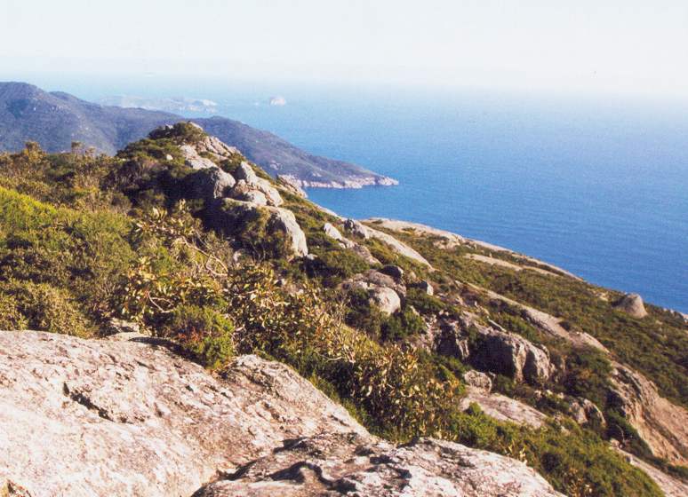
Wilsons Promontory
Image via Wikimedia Commons (author and licence on the file page).

Wilsons Promontory

Pen/cape · 618 km²

Wilsons Promontory is a pen/cape in Oceania (Australasia), covering an estimated 618 km².

Wilsons Promontory, colloquially known as Wilsons Prom or The Prom, is a peninsula that forms the southernmost part of the Australian mainland, located in the state of Victoria.

South Point at 39°08′06″S 146°22′32″E is the southernmost tip of Wilsons Promontory and hence of mainland Australia. Located at nearby South East Point, (39°07′S 146°25′E) is the Wilsons Promontory Lighthouse. Most of the peninsula is protected by the Wilsons Promontory National Park and the Wilsons Promontory Marine National Park.

Adapted from Wikipedia: Wilsons Promontory (CC BY-SA 4.0).

Feature class
Pen/cape
Mapped extent
618 km²
Size rank
#186 of 231 landforms
Region
Oceania
Subregion
Australasia
Coordinates
-38.9415°, 146.3633°
Summits:
Mount Buller (1,805 m), Mount Bogong (1,986 m), Mount Kosciuszko (2,228 m)
Ranges:
Australian Alps (Oceania), Flinders Ranges (Oceania)
Settlements:
Sale (111 km), Cranbourne (133 km), Melbourne (174 km)

View on the live map

More about Wilsons Promontory

Geography and wildlife

Coastal features include expansive intertidal mudflats, sandy beaches and sheltered coves interrupted by prominent headlands and plunging granite cliffs in the south, backed by coastal dunes and swamps. The promontory is surrounded by a scatter of small granite islands which, collectively, form the Wilsons Promontory Islands Important Bird Area, identified as such by BirdLife International because of its importance for breeding seabirds.

Tidal River is the main river in Wilsons Promontory. The river runs into Norman Bay and swells with the tide. The river is a very fascinating colour, a purple-yellow. This is due to the large number of tea trees in the location, which stain the water with tannin, giving it a tea-like appearance.

Climate

Wilsons Promontory has an Oceanic climate (Cfb) heavily influenced by the Roaring Forties, bringing summer temperatures far below what is the norm on mainland Australia at sea level. Winters and springs are dominated by low-pressure systems and high rainfall.

Human history

The promontory was first occupied by indigenous Koori people at least 6,500 years prior to European arrival. Middens along the western coast indicate that the inhabitants subsisted on a seafood diet.

The promontory is mentioned in dreamtime stories, including the Bollum-Baukan, Loo-errn and Tiddalik myths. It is considered the home of the spirit ancestor of the Brataualung clan - Loo-errn. The area remains highly significant to the Gunai/Kurnai and the Boon wurrung people, who consider the promontory to be their traditional country/land.

The first European to see the promontory was George Bass in January 1798. He initially referred to it as "Furneaux's Land" in his diary, believing it to be what Captain Furneaux had previously seen.

Sections adapted from Wikipedia: Wilsons Promontory (CC BY-SA 4.0).

Hamersley Range
Image via Wikimedia Commons (author and licence on the file page).

Hamersley Range

Range/mtn · 597 km²

Hamersley Range is a range/mtn in Oceania (Australasia), covering an estimated 597 km².

The Hamersley Range is a mountainous region of the Pilbara region of Western Australia. The range was named on 12 June 1861 by explorer Francis Thomas Gregory after Edward Hamersley, a prominent promoter of his exploration expedition to the northwest.

The range is one of the oldest mountain ranges on Earth and primarily consists of ancient rock formations, including banded iron formations (BIFs), that are about 2.5 billion years old. The Pilbara Craton, which underlies the Hamersley Range, dates back to around 3.4 billion years, but the range itself is younger than that. The deformation that began uplift of the region and created the tightly folded rocks of the range began around 2.2 billion years ago, during the Ophthalmia Orogeny. This would make it approximately the 6th oldest mountain range in the world.

Karijini National Park (formerly known as Hamersley Range National Park) lies within the range.

Adapted from Wikipedia: Hamersley Range (CC BY-SA 4.0).

Feature class
Range/mtn
Mapped extent
597 km²
Size rank
#189 of 216 mountain ranges
Region
Oceania
Subregion
Australasia
Coordinates
-21.7431°, 116.2956°
Summits:
Mount Meharry (1,253 m), Bluff Knoll (1,096 m), Gunung Rinjani (3,726 m)
Adjacent ranges:
Darling Range (Oceania), MacDonnell Ranges (Oceania)
Settlements:
Geraldton (799 km), Kalgoorlie (1,124 km), Perth (1,136 km)

View on the live map

More about Hamersley Range

Geography

The range runs from the Fortescue River in the northeast, 460 kilometres (290 mi) to the south. The range contains Western Australia's highest point, Mount Meharry, which reaches approximately 1,249 metres (4,098 ft) AHD. There are many extensively eroded gorges, such as Wittenoom Gorge. The twenty highest peaks in Western Australia are in the Hamersley Range. Peaks in the range include Mount Bruce (1,234 metres (4,049 ft)), Mount Nameless/Jarndunmunha (1,115 metres (3,658 ft)), Mount Reeder Nichols (1,109 metres (3,638 ft)), Mount Samson (1,107 metres (3,632 ft)), Mount Truchanas (1,148 metres (3,766 ft)) and Mount Tom Price (775 metres (2,543 ft)).

Karijini National Park (formerly Hamersley National Park), one of Australia's largest national parks, is centred in the range.

History

The traditional Aboriginal owners of the area that the range runs through are the Puutu Kunti Kurrama and Pinikura peoples.

In 1999 a small range within the Hamersley was named the Hancock Range after the Hancock family, who were pioneers in the area. The Hancock range is east of Karijini National Park in a region of broad valleys and peaks that rise to almost 1,200 metres (3,937 ft). The Hancock Range is close to Mulga Downs Station, a property owned by the Hancock family and where Lang Hancock is buried.

Sections adapted from Wikipedia: Hamersley Range (CC BY-SA 4.0).

Hamersley Range: Key Facts

Key facts about Hamersley Range
Length460 km
Area7,313 km²
Highest pointMount Meharry

Facts from Wikidata Q1573394 (CC0).

Darling Downs
Image via Wikimedia Commons (author and licence on the file page).

Darling Downs

Plain · 113 km²

Darling Downs is a plain in Oceania (Australasia), covering an estimated 113 km².

The Darling Downs is a farming region on the western slopes of the Great Dividing Range in southern Queensland, Australia. The Downs are to the west of South East Queensland and are one of the major regions of Queensland. The name was generally applied to an area approximating to that of the Condamine River catchment upstream of Condamine township but is now applied to a wider region comprising the Southern Downs, Western Downs, Toowoomba and Goondiwindi local authority areas. The name Darling Downs was given in 1827 by Allan Cunningham, the first European explorer to reach the area and recognises the then Governor of New South Wales, Ralph Darling.

The region has developed a strong and diverse agricultural industry largely due to the extensive areas of vertosols (cracking clay soils), particularly black vertosols, of moderate to high fertility and available water capacity. Manufacturing and mining, particularly coal mining are also important, and coal seam gas extraction experienced significant growth in the decade up to 2016.

Adapted from Wikipedia: Darling Downs (CC BY-SA 4.0).

Feature class
Plain
Mapped extent
113 km²
Size rank
#213 of 231 landforms
Region
Oceania
Subregion
Australasia
Coordinates
-27.4087°, 151.5363°
Summits:
Mount Warning (1,156 m), Mount Kosciuszko (2,228 m), Mount Bogong (1,986 m)
Ranges:
Great Dividing Range (Oceania), Australian Alps (Oceania)
Settlements:
Toowoomba (45 km), Caboolture (144 km), Brisbane (148 km)

View on the live map

More about Darling Downs

Geography

The largest city and commercial centre of the Darling Downs is Toowoomba about 132 kilometres (82 mi) west of Brisbane. Other towns situated on what is now called The Downs include Dalby, Warwick, Stanthorpe, Wallangarra, Goondiwindi, Oakey, Miles, Pittsworth, Allora, Clifton, Cecil Plains, Drayton, Millmerran, Nobby, and Chinchilla. The New England Highway, Gore Highway and the Warrego Highway traverse the region. The Toowoomba Second Range Crossing has been constructed so that heavy traffic can avoid passing through Toowoomba. Coolmunda Dam, Leslie Dam, Cooby Dam, Perseverance Dam, Cressbrook Dam, Storm King Dam and the Glenlyon Dam are some of the major water storage facilities in the area. West of Toowoomba is the Toowoomba Wellcamp Airport.

History

Baranggum (also known as Barrunggam, Barunggam Parrungoom, Murrumgama) is an Australian Aboriginal language spoken by the Baranggum people. The Baranggum language region includes the landscape within the local government boundaries of the Western Downs Regional Council, particularly Dalby, Tara, Jandowae and west towards Chinchilla.

Originally, the Darling Downs was covered with a wealth of indigenous grasses which created an ideal verdure for stock eight months of the year. The Darling Downs Aboriginals had an annual burning season at the time when the indigenous grasses were ripe and dry. The annual fires gave the local Aboriginals of the Darling Downs the name "or "Fire Blacks" – "goonnee" being a name for fire and "burra" a generic word the Moreton Bay area.

Sections adapted from Wikipedia: Darling Downs (CC BY-SA 4.0).

Simpson Desert
Image via Wikimedia Commons (author and licence on the file page).

Simpson Desert

Desert · 78 km²

Simpson Desert is a desert in Oceania (Australasia), covering an estimated 78 km².

The Simpson Desert is a large area of dry, red sandy plain and dunes in the Northern Territory, South Australia and Queensland in central Australia. It is the fourth-largest Australian desert, with an area of 176,500 km2 (68,100 sq mi).

The Wangkangurru Yarluyandi people know this area as Munga-Thirri.

The desert is underlain by the Great Artesian Basin, one of the largest inland drainage areas in the world. Water from the basin rises to the surface at numerous natural springs, including Dalhousie Springs, and at bores drilled along stock routes, or during petroleum exploration. As a result of exploitation by such bores, the flow of water to springs has been steadily decreasing in recent years. It is also part of the Lake Eyre basin.

The Simpson Desert is an erg that contains the world's longest parallel sand dunes. These north-south oriented dunes are static, held in position by vegetation. They vary in height from 3 m (9.8 ft) in the west to around 30 m (98 ft) on the eastern side. The largest dune, Nappanerica or Big Red, is 40 m (130 ft) in height.

Adapted from Wikipedia: Simpson Desert (CC BY-SA 4.0).

Feature class
Desert
Mapped extent
78 km²
Size rank
#55 of 58 deserts
Region
Oceania
Subregion
Australasia
Coordinates
-24.5986°, 135.7831°
Summits:
Mount Zeil (1,531 m), Mount Bartle Frere (1,622 m), Mount Buller (1,805 m)
Ranges:
MacDonnell Ranges (Oceania), Flinders Ranges (Oceania)
Settlements:
Alice Springs (217 km), Mount Isa (575 km), Whyalla (953 km)

View on the live map

More about Simpson Desert

Climate

The area has an extremely hot, dry desert climate. Rainfall is minimal, averaging only about 150 mm per year and falling mainly in summer. The average summer temperature in the desert is 28 degrees Celsius and it can go as high as 50 degrees. Large sand storms are common. Winters are generally cool, but heatwaves even in the middle of July are not unheard of.

Some of the heaviest rain in decades occurred during 2009–2010, and caused the Simpson Desert to burst into life and colour. In early March 2010, Birdsville recorded more rain in 24 hours than is usual in a whole year. Rain inundated Queensland's north-west and Gulf regions. In total, 17 million megalitres of water entered the State's western river systems, leading to Lake Eyre.

Ecology

The Simpson Desert is also a large part of the World Wildlife Fund ecoregion of the same name, which consists of the Channel Country and the Simpson Strzelecki Dunefields bioregions of the Interim Biogeographic Regionalisation for Australia (IBRA).

The flora of the Simpson Desert ecoregion is limited to drought-resistant shrubs and grasses, especially Zygochloa paradoxa grass that holds the dunes together and the spinifex and other tough grasses of side slopes and sandy desert floor between the dunes. The Channel Country section of the ecoregion lies to the northeast of the desert proper around the towns of Bedourie and Windorah in Queensland, and consists of low hills covered with Mitchell grass cut through with rivers lined with coolabah trees.

History

Aboriginal peoples have lived in the Simpson Desert for at least 5000 years and continue to do so today. However, when Europeans came to the area in the late 19th century, they thought that it was an uninhabitable desert that wasn't suitable for human life. The Lower Southern Arrernte and Eastern Arrernte communities inhabited the western regions, while the Karangura and Wanggamala resided in the east. The Wangkangurru people lived in the Simpson Desert using hand-dug wells called mikiri from long before European colonization until the Federation Drought. The diet of the Aboriginal peoples in the Simpson Desert before colonization consisted of breads and seed patties made out of Nardoo (Marsilea drummondii) and Pigweed (Aizoon quadrifidum) seeds.

Sections adapted from Wikipedia: Simpson Desert (CC BY-SA 4.0).

Simpson Desert: Key Facts

Key facts about Simpson Desert
Area176,500 km²

Facts from Wikidata Q211839 (CC0).

More on Australia

Quick Answers

What is the largest landform in Australia?
Australia, at 8.82M km². Western Plateau is second at 1.75M km². Rankings cover the mountain ranges, deserts and other landforms indexed in YearMaps.
How many mountain ranges, deserts and other landforms are there in Australia?
YearMaps lists 32 mountain ranges, deserts and other landforms for Australia. This is the number mapped in the atlas, not an official national count.