Skip to content
YearMaps
United States · Islands

Largest Islands of United States

Alexander Archipelago is the largest of the 30 islands recorded for United States, at 59,623 km², ahead of Aleutian Islands at 39,914 km². The full list follows.

How this list is built: Ranked by mapped area. An island divided between countries is listed under each, with the area of the whole island. It covers the islands indexed in YearMaps, drawn from open geospatial data, and is not an exhaustive national register.

Islands Listed
30
Top Ranked
59,623 km²
Alexander Archipelago
Second
39,914 km²
Aleutian Islands
Profiled Below
27
Photo, encyclopedia text and figures
Largest Islands of United States
#NameArea
1Alexander Archipelago59,623 km²
2Aleutian Islands39,914 km²
3Channel Islands18,071 km²
4Kodiak Island11,207 km²
5Hawai‘i10,471 km²
6Puerto Rico8,885 km²
7St. Lawrence Island4,843 km²
8Unimak Island4,172 km²
9Long Island4,103 km²
10Nunivak Island3,930 km²
11Maui1,898 km²
12O‘ahu1,581 km²
13Kaua‘i1,439 km²
14Atka1,129 km²
15Adak797 km²
16Pribilof Islands736 km²
17Moloka‘i676 km²
18St. Matthew Island487 km²
19Läna‘i336 km²
20Ni‘ihau197 km²
21Saipan133 km²
22Tutuila132 km²
23Rota97 km²
24Baker Island84 km²
25Johnston Atoll81 km²
26Anatahan81 km²
27Midway Islands79 km²
28Nihoa78 km²
29Gardner Pinnacles76 km²
30Lisianski76 km²

The Islands of United States in Detail

The 27 islands above that have an encyclopedia article, in the same order, each with its photograph, figures and the places around it.

Alexander Archipelago
Image via Wikimedia Commons (author and licence on the file page).

Alexander Archipelago

Island group · 59,623 km²

Alexander Archipelago is an island group in North America, covering an estimated 59,623 km².

The Alexander Archipelago (Russian: Архипелаг Александра) is a 300-mile-long (480 km) archipelago in North America lying off the southeastern coast of Alaska. It contains about 1,100 islands, the tops of submerged coastal mountains that rise steeply from the Pacific Ocean. Deep channels and fjords separate the islands and cut them off from the mainland. The islands shelter the northern part of the Inside Passage as it winds its way among them.

The islands have steep, irregular coasts and dense evergreen and temperate rain forests; most are accessible only by boat or by airplane. The vast majority of the islands are part of the Tongass National Forest.

In order of land area, the largest islands are Prince of Wales Island, Chichagof Island, Admiralty Island, Baranof Island, Revillagigedo Island, Kupreanof Island, Kuiu Island, Etolin Island, Dall Island, Wrangell Island, Mitkof Island, Zarembo Island, Kosciusko Island, Kruzof Island, Annette Island, Gravina Island, and Yakobi Island. All the islands are rugged, densely forested, and have an abundance of wildlife.

The Tlingit and Kaigani Haida people are native to the area.

Adapted from Wikipedia: Alexander Archipelago (CC BY-SA 4.0).

Feature class
Island group
Mapped extent
59,623 km²
Size rank
#72 of 445 islands
Region
North America
Coordinates
56.1416°, -133.3226°
Summits:
Devils Paw (2,593 m), Mount Moresby (1,164 m), Mount Fairweather (4,671 m)
Ranges:
Cassiar Mountains (North America), Wrangell Mountains (North America)
Settlements:
Juneau (250 km), Whitehorse (519 km), Prince George (716 km)

View on the live map

More about Alexander Archipelago

History

The first European to visit the archipelago was the Russian navigator Aleksei Chirikov in 1741, who sighted the coasts of Noyes and Baker Islands (both off the west coast of Prince of Wales Island), as well as Baranof, Chichagof, Kruzof, and Yakobi Islands. In 1774, Juan José Pérez Hernández sighted the south coast of Dall Island, while Juan Francisco de la Bodega y Quadra entered Bucareli Bay off Prince of Wales Island the following year. In 1792, Jacinto Caamaño sighted Revillagigedo Island and the Gravina Islands, discovering Clarence Strait.

Sections adapted from Wikipedia: Alexander Archipelago (CC BY-SA 4.0).

Alexander Archipelago: Key Facts

Key facts about Alexander Archipelago
Area35,000 km²
Surrounded byPacific Ocean

Facts from Wikidata Q140510 (CC0).

Kodiak Island
Image via Wikimedia Commons (author and licence on the file page).

Kodiak Island

Island · 11,207 km²

Kodiak Island is an island in North America, covering an estimated 11,207 km².

Kodiak Island (Alutiiq: Qikertaq; Russian: Кадьяк, romanized: Kadyak) is a large island on the south coast of the U.S. state of Alaska, separated from the Alaska mainland by the Shelikof Strait. The largest island in the Kodiak Archipelago, Kodiak Island is the second largest island in the United States and the 80th largest island in the world, with an area of 3,595.09 sq mi (9,311.2 km2), slightly larger than Cyprus. It is 160 km (99 miles) long and in width ranges from 16 to 97 kilometers (10 to 60 mi). The largest community on the island is the city of Kodiak, Alaska.

Kodiak Island is mountainous and heavily forested in the north and east, but fairly treeless in the south. The island has many deep, ice-free bays that provide sheltered anchorages for boats. The southwestern two-thirds of the island, like much of the Kodiak Archipelago, is part of Kodiak National Wildlife Refuge.

Kodiak Island is part of the Kodiak Island Borough and Kodiak Archipelago of Alaska. The town of Kodiak is one of seven communities on Kodiak Island and is the island's main city.

Adapted from Wikipedia: Kodiak Island (CC BY-SA 4.0).

Feature class
Island
Mapped extent
11,207 km²
Size rank
#146 of 445 islands
Region
North America
Coordinates
57.4426°, -153.5241°
Summits:
Mount Katmai (2,047 m), Redoubt Volcano (3,108 m), Denali (6,194 m)
Ranges:
Alaska Range (North America), Wrangell Mountains (North America)
Settlements:
Anchorage (467 km), Fairbanks (879 km), Whitehorse (1,112 km)

View on the live map

More about Kodiak Island

History

Kodiak is the ancestral land of the Sugpiaq, an Alutiiq nation of Native Americans. The original inhabitants subsisted by hunting marine mammals, fishing, and gathering. The European discoverer of Kodiak Island was the Russian fur trader Stepan Glotov (1793).

The first outsiders to settle on the island were Russian explorers under Grigory Shelikhov, a fur trader, who founded a Russian settlement on Kodiak Island at Three Saints Bay in 1784; the present-day village of Old Harbor developed near there. In 1792, the settlement was moved to the site of present-day Kodiak and became the center of Russian fur trading with the Alaska Natives.

Sections adapted from Wikipedia: Kodiak Island (CC BY-SA 4.0).

Kodiak Island: Key Facts

Key facts about Kodiak Island
Area9,310 km²
Population13,592 (2010)
Surrounded byPacific Ocean

Facts from Wikidata Q204387 (CC0).

Visiting Kodiak Island

Kodiak Island is in southwestern Alaska, in the Gulf of Alaska, 250 miles south of Anchorage. It is Alaska's largest island and second largest in the US, after the Big Island in Hawaii. The City of Kodiak is situated on the east shore of Kodiak Island.

Travel notes adapted from Wikivoyage: Kodiak (CC BY-SA 4.0).

Hawai‘i
Image via Wikimedia Commons (author and licence on the file page).

Hawai‘i

Island group · 10,471 km²

Hawai‘i is an island group in Oceania (Polynesia), covering an estimated 10,471 km².

Hawaiʻi, sometimes written Hawaii, is the largest island in the United States, located in the state of Hawaii. It is the southeasternmost of the Hawaiian Islands, a chain of volcanic islands in the North Pacific Ocean. With an area of 4,028 square miles (10,430 km2), it has 63% of the Hawaiian archipelago's combined landmass. However, it has only 13% of the archipelago's population. The island of Hawaiʻi is the third largest island in Polynesia, behind the North and South Islands of New Zealand.

The official name of the island is Island of Hawaiʻi (often shortened to Hawaiʻi Island) to distinguish it from the state. It is also referred to as the Big Island, due to its size relative to the other Hawaiian Islands. In Hawaiian, the island is sometimes called Moku o Keawe. The word keawe has several meanings. One definition, "southern cross", is said to be the name of an ancient chief. Another definition is "the bearer".

Hawaiʻi County is the local administrative unit. As of the 2020 census, the population was 200,629. The county seat and largest community is Hilo. Hawaiʻi County has no incorporated cities.

Adapted from Wikipedia: Hawaiʻi (island) (CC BY-SA 4.0).

Feature class
Island group
Mapped extent
10,471 km²
Size rank
#152 of 445 islands
Region
Oceania
Subregion
Polynesia
Coordinates
19.6747°, -155.5148°
Summits:
Mauna Kea (4,205 m), Haleakalā (3,055 m), Mount Vsevidof (2,149 m)
Ranges:
Klamath Mountains (North America), Sierra Nevada (North America)
Settlements:
Hilo (45 km), Wailuku (170 km), Honolulu (304 km)

View on the live map

More about Hawai‘i

Geology and geography

According to the U.S. Census Bureau, the county has a total area of 5,086 square miles (13,170 km2), of which 4,028 sq mi (10,430 km2) is land and 1,058 sq mi (2,740 km2) (20.8%) is water. The county's land area comprises 62.7 percent of the state's land area. It is the highest percentage by any county in the United States. Delaware's Sussex County comes in second at 48.0 percent, while Rhode Island's Providence County is third at 39.6 percent.

At its greatest dimension, the island is 93 miles (150 km) across. Measured from its sea floor base to its highest peak, Mauna Kea at 10,000 metres (33,000 ft) is the world's tallest mountain, taller than even Mount Everest, since the base of Mount Everest is above sea level.

History

Hawaiʻi is allegedly named after Hawaiʻiloa, a legendary Polynesian navigator who is said to have discovered the island. Other accounts attribute the name to the legendary realm of Hawaiki, a place from which some Polynesians are said to have originated, the place where they transition to in the afterlife, or the realm of the gods and goddesses. The indigenous Hawaiian name of the island was originally rendered and published as "Owyhee" or "Owhyhee".

It is uncertain when Hawaiʻi was first discovered by humans. Early archaeological studies suggested that Polynesian explorers from the Marquesas Islands or Society Islands may have arrived in the Hawaiian islands as early as the 3rd century AD, possibly with a second wave arriving from Tahiti around 1100.

Economy

Sugarcane was the backbone of the island economy for more than a century. In the mid-20th century, sugarcane plantations began to downsize, and in 1995 the island's last plantation closed.

Most of the island's economy depends on tourism, centered primarily in resort areas on the western coast of the island in the North Kona and South Kohala districts. Sustainable tourism is increasing.

Diversified agriculture is a growth sector. Major crops include macadamia nuts, papaya, flowers, tropical and temperate vegetables, aquaculture, and coffee beans. The island's orchid production is the state's largest. The island is home to one of the United States' largest cattle ranches: Parker Ranch, on 175,000 acres (708 km2) in Waimea.

Sections adapted from Wikipedia: Hawaiʻi (island) (CC BY-SA 4.0).

Hawai‘i: Key Facts

Key facts about Hawai‘i
Area10,434 km²
Population198,449 (2016)
Highest pointMauna Kea
Surrounded byPacific Ocean

Facts from Wikidata Q68740 (CC0).

Puerto Rico
Image via Wikimedia Commons (author and licence on the file page).

Puerto Rico

Island · 8,885 km²

Puerto Rico is an island in North America (West Indies), covering an estimated 8,885 km². It extends across Puerto Rico and the United States.

Puerto Rico (abbreviated PR), officially the Commonwealth of Puerto Rico, is a self-governing Caribbean archipelago and island organized as an unincorporated territory of the United States under the designation of commonwealth. Located about 1,000 miles (1,600 km) southeast of Miami, Florida, between the Dominican Republic in the Greater Antilles and the U.S. Virgin Islands in the Lesser Antilles, it consists of the eponymous main island and numerous smaller islands, including Vieques, Culebra, and Mona. With approximately 3.2 million people, it is divided into 78 municipalities, of which the most populous is the capital municipality of San Juan, followed by those within the San Juan metropolitan area. Spanish and English are the official languages of its government, though Spanish predominates, as it is culturally part of Latin America.

Puerto Rico was settled by a succession of Indigenous peoples of the Americas beginning 2,000 to 4,000 years ago; these included the Ortoiroid, Saladoid, and Taíno. It was claimed by Spain following the arrival of Christopher Columbus in 1493 and subsequently colonized by Juan Ponce de León in 1508.

Adapted from Wikipedia: Puerto Rico (CC BY-SA 4.0).

Feature class
Island
Mapped extent
8,885 km²
Size rank
#158 of 445 islands
Region
North America
Subregion
West Indies
Countries
Puerto Rico, United States
Coordinates
18.1975°, -66.2166°
Summits:
Cerro de Punta (1,338 m), Mount Mitchell (2,037 m), Mount Rogers (1,746 m)
Ranges:
Wilhelmina Gebergte (South America), Tumuc-Humac Mountains (South America)
Settlements:
Miami Beach (1,664 km), Miami (1,671 km), Coral Gables (1,673 km)

View on the live map

More about Puerto Rico

Geography

Puerto Rico consists of the main island and various smaller islands, including Vieques, Culebra, Mona, Desecheo, and Caja de Muertos. Of these, only Culebra and Vieques are inhabited year-round. Mona, which has played a key role in maritime history, is uninhabited most of the year except for employees of the Puerto Rico Department of Natural Resources. There are many other islets, like Monito, located near Mona, and Isla de Cabras and La Isleta de San Juan, both located on the San Juan Bay. The latter is the only inhabited islet with communities like Old San Juan and Puerta de Tierra, which are connected to the main island by bridges.

The Commonwealth of Puerto Rico has an area of 3,515 square miles (9,100 km2), of which 3,459 sq mi (8,960 km2) is land and 56 sq mi (150 km2) is water.

History

The history of Puerto Rico began with the settlement of the Ortoiroid culture, an Archaic population characterized by a hunter-gatherer subsistence strategy and a pre-ceramic material culture. Archaeological evidence suggests that these early populations may have been present in Puerto Rico as early as c. 4000 years before present.

Around 500–200 BC, Saladoid populations originating from the Orinoco River basin migrated to Puerto Rico, introducing sedentary agriculture and ceramics. Genetic evidence suggests that this migration was associated with a major demographic transition in which Saladoid-related ancestry became predominant in later Ceramic Age populations that developed into the Taíno.

Demographics

The population of Puerto Rico reflects influences from initial Amerindian settlement, European colonization, slavery, economic migration, and the archipelago's status as unincorporated territory of the United States. Puerto Ricans are characterized by a high degree of ethnic and cultural diversity, as well as a long history of intermarriage and acculturation among different demographics; racial and ethnic identity is subsequently complex and often nebulous, shaped by the broader attitudes and policies of the Spanish colonial period, 20th century American racial politics, and modern trends in cultural and identity in the 21st century United States.

According to the most recent 2020 United States census, Puerto Rico had 3,285,874 residents, an 11.8% decrease since 2010.

Economy

Puerto Rico is classified as a high income economy by the World Bank and International Monetary Fund. It is considered the most competitive economy in Latin America by the World Economic Forum and ranks highly on the Human Development Index. According to World Bank, gross national income per capita in Puerto Rico in 2020 was $21,740.

Sections adapted from Wikipedia: Puerto Rico (CC BY-SA 4.0).

Puerto Rico: Key Facts

Key facts about Puerto Rico
Area9,104 km²
Population3,285,874 (2020)
Highest pointCerro de Punta
Surrounded byAtlantic Ocean, Caribbean Sea

Facts from Wikidata Q1183 (CC0).

Visiting Puerto Rico

Puerto Rico is a Caribbean island. Its white sandy beaches can compete with any in the world and vary from metropolitan cocktail heavens and bustling surfing hotspots to quiet island getaways. Easily accessible diving and snorkeling spots and the excellent bioluminescent bays offer great maritime experiences. Still, there's more to this tropical island than sunny beach life. The Spanish-American influences make for a fun melting pot of culture with an abundance of heritage to explore and some delightful food to enjoy.

As Puerto Rico is a self-governing commonwealth, an insular area of the United States of America, it's a particularly hassle-free and therefore popular destination for US citizens, but well worth any trip to get there. It is known as the "Island of Enchantment".

Travel notes adapted from Wikivoyage: Puerto Rico (CC BY-SA 4.0).

St. Lawrence Island
Image via Wikimedia Commons (author and licence on the file page).

St. Lawrence Island

Island · 4,843 km²

St. Lawrence Island is an island in North America, covering an estimated 4,843 km².

St. Lawrence Island (Central Siberian Yupik: Sivuqaq; Inupiaq: Siuġaq or Sivuġaq) Russian: Остров Святого Лаврентия, romanized: Ostrov Svyatogo Lavrentiya) is located west of mainland Alaska in the Bering Sea, just south of the Bering Strait. The village of Gambell, located on the northwest cape of the island, is 50 nautical miles (95 kilometers) from the Chukchi Peninsula in the Russian Far East. The island is part of Alaska, but closer to Russia and Asia than to the Alaskan and North American mainland. St. Lawrence Island is thought to be one of the last exposed portions of the land bridge that once joined Asia with North America during the Pleistocene period. It is the sixth largest island in the United States and the 113th largest island in the world. It is considered part of the Bering Sea Volcanic Province. The Saint Lawrence Island shrew (Sorex jacksoni) is a species of shrew endemic to St. Lawrence Island. The island is jointly owned by the predominantly Siberian Yupik villages of Gambell and Savoonga, the two main settlements on the island.

Adapted from Wikipedia: St. Lawrence Island (CC BY-SA 4.0).

Feature class
Island
Mapped extent
4,843 km²
Size rank
#193 of 445 islands
Region
North America
Coordinates
63.5194°, -170.5094°
Summits:
Mount Osborn (1,437 m), Denali (6,194 m), Redoubt Volcano (3,108 m)
Ranges:
Brooks Range (North America), Alaska Range (North America)
Settlements:
Anchorage (1,088 km), Fairbanks (1,108 km), Whitehorse (1,845 km)

View on the live map

More about St. Lawrence Island

Geography

The United States Census Bureau defines St. Lawrence Island as Block Group 6, Census Tract 1 of Nome Census Area, Alaska. As of the 2000 census there were 1,292 people living on a land area of 1,791.56 sq mi (4,640.1 km2). The island is about 90 mi (140 km) long and 8–22 mi (13–35 km) wide. The island has no trees, and the only woody plants are Arctic willow, standing no more than a foot (30 cm) high.

The island's abundance of seabirds and marine mammals is due largely to the influence of the Anadyr Current, an ocean current which brings cold, nutrient-rich water from the deep waters of the Bering Sea shelf edge.

To the south of the island there was a persistent polynya in 1999, formed when the prevailing winds from the north and east blow the migrating ice away from the coast.

History

In St. Lawrence Island, earliest evidence of habitation dates from 2,000 to 2,500 years ago. Artifacts resemble the Okvik (oogfik) style. Archaeological sites on the Punuk Islands, off the eastern end of St. Lawrence Island, at Kukulik, near Savoonga and on hill slopes above Gambell, all indicate evidence of Okvik habitation. Okvik decorative style is zoomorphic and elaborate, sometimes incorporating crude engraving, with greater variation than the Old Bering Sea and Punuk styles.

Okvik habitation, influenced by Old Bering Sea habitation of 2000 to 700 years ago, is characterized by the simpler and more homogeneous Punuk style. Stone artifacts changed from chipped stone to ground slate; carved ivory harpoon heads are smaller and simpler in design.

Sections adapted from Wikipedia: St. Lawrence Island (CC BY-SA 4.0).

St. Lawrence Island: Key Facts

Key facts about St. Lawrence Island
Area5,135 km²
Population1,352 (2010)
Surrounded byBering Sea

Facts from Wikidata Q638407 (CC0).

Unimak Island
Image via Wikimedia Commons (author and licence on the file page).

Unimak Island

Island · 4,172 km²

Unimak Island is an island in North America, covering an estimated 4,172 km².

Unimak Island (Aleut: Unimax; Russian: Унимак) is the largest island in the Aleutian Islands chain of the U.S. state of Alaska.

Adapted from Wikipedia: Unimak Island (CC BY-SA 4.0).

Feature class
Island
Mapped extent
4,172 km²
Size rank
#202 of 445 islands
Region
North America
Coordinates
54.8337°, -163.7622°
Summits:
Mount Vsevidof (2,149 m), Mount Katmai (2,047 m), Redoubt Volcano (3,108 m)
Ranges:
Alaska Range (North America), Wrangell Mountains (North America)
Settlements:
Anchorage (1,078 km), Fairbanks (1,420 km), Whitehorse (1,806 km)

View on the live map

More about Unimak Island

Geography

It is the easternmost island in the Aleutians and, with an area of 1,571.41 square miles (4,069.93 square kilometers), the 9th largest island in the United States and the 134th largest island in the world. It is home to Mount Shishaldin, one of the ten most active volcanoes in the world. According to the United States Census Bureau, 64 people were living on Unimak as of the 2000 census, all of them in the city of False Pass at the eastern end of the island. Cape Lutke is a headland on the island. Cape Pankof is located at the extreme southwest of the island.

The Fisher Caldera is a volcanic crater in the west-central part of Unimak. Some characteristics include many volcanic cones and undrained lakes.

Natural history

When the Alaska National Interest Lands Conservation Act was passed on 2 December 1980, 910,000 acres (370,000 ha) of the island was designated as wilderness. This area is managed by the United States Fish and Wildlife Service as part of the Alaska Maritime National Wildlife Refuge.

As a faunal extension of the Alaska Peninsula, Unimak has a relatively diverse assemblage of terrestrial mammals, including Alaska Peninsula brown bears and barren-ground caribou. West of Unimak Island, the largest native mammal in the Aleutians is the red fox.

Sections adapted from Wikipedia: Unimak Island (CC BY-SA 4.0).

Unimak Island: Key Facts

Key facts about Unimak Island
Area4,119 km²
Population64
Highest pointMount Shishaldin
Surrounded byPacific Ocean

Facts from Wikidata Q375615 (CC0).

Long Island
Image via Wikimedia Commons (author and licence on the file page).

Long Island

Island · 4,103 km²

Long Island is an island in North America, covering an estimated 4,103 km².

Long Island is a densely populated island in southeastern New York State, extending eastward into the Atlantic Ocean. Geographically, Long Island comprises four counties: Kings (Brooklyn), Queens, Nassau, and Suffolk. Kings and Queens counties form the western portion of the island and are boroughs of New York City, while Nassau and Suffolk counties occupy the central and eastern portions.

Long Island extends about 120 miles (190 km) from New York Harbor eastward into the Atlantic Ocean and reaches a maximum width of about 23 miles (37 km). It has a total area of approximately 1,400 square miles (3,600 km2). The island was shaped largely by glacial processes during the Pleistocene, including the formation of terminal moraines and outwash plains.

Long Island is divided among four counties. Kings County, also known as Brooklyn, and Queens County occupy the western portion of the island and are two of the five boroughs of New York City. Nassau County occupies the central portion, while Suffolk County occupies most of the eastern portion.

Adapted from Wikipedia: Long Island (CC BY-SA 4.0).

Feature class
Island
Mapped extent
4,103 km²
Size rank
#204 of 445 islands
Region
North America
Coordinates
40.7926°, -73.5342°
Summits:
Mount Marcy (1,269 m), Mount Washington (1,917 m), Spruce Knob (1,482 m)
Ranges:
Blue Ridge (North America), Ouachita Mountains (North America)
Settlements:
Stamford (29 km), New York (38 km), Bridgeport (51 km)

View on the live map

More about Long Island

Geography

The westernmost end of Long Island contains the New York City boroughs of Brooklyn (Kings County) and Queens (Queens County). The central and eastern portions contain the suburban Nassau and Suffolk counties. However, colloquial usage of the term "Long Island" usually refers only to Nassau and Suffolk counties. For example, the Federal Reserve Bank of New York has a district named "Long Island (Nassau-Suffolk Metro Division)." At least as late as 1911, locations in Queens were still commonly referred to as being on Long Island. Some institutions in the New York City section of the island use the island's names, like Long Island University and Long Island Jewish Medical Center.

In 1985, the U.S. Supreme Court ruled in United States v.

History

As the last Ice Age waned with Wisconsin glaciation, early Paleo-Indians ventured into the evolving landscapes of present-day Long Island, marking a significant environmental shift and laying the groundwork for the region's rich ecosystems. The nomadic hunter-gatherers, equipped with stone tools, navigated the newly emerging landscapes, hunting large game and gathering from the abundant natural resources.

After the Paleo-Indian period, the Archaic Period marked a broadening of subsistence strategies. The inhabitants of Long Island diversified their diet, exploiting the rich marine and terrestrial environments. The main source of protein came from the sea, consisting of fish and shellfish, with oysters being of particular importance.

Demographics

Long Island is the most populous island and one of the most densely populated regions in the United States. At the 2020 U.S. census, the total population of all four counties of Long Island was 8,063,232, comprising 40% of the population of the State of New York. As of 2020, the proportion of New York City residents (total 8,804,190) living on Long Island had risen to 58.4%, given the 5,141,538 residents living in Brooklyn and Queens.

Economy

Long Island has played a prominent role in scientific research and in engineering. It is the home of the Brookhaven National Laboratory in nuclear physics and Department of Energy research. Long Island is also home to the Cold Spring Harbor Laboratory, which was directed for 35 years by James D. Watson (who, along with Francis Crick and Rosalind Franklin, discovered the double helix structure of DNA). Companies such as Sperry Corporation, Computer Associates (headquartered in Islandia), Zebra Technologies (now occupying the former headquarters of Symbol Technologies, and a former Grumman plant in Holtsville), have made Long Island a center for the computer industry. Stony Brook University and New York Institute of Technology conduct advanced medical and technological research.

Sections adapted from Wikipedia: Long Island (CC BY-SA 4.0).

Long Island: Key Facts

Key facts about Long Island
Area3,566 km²
Population7,804,968 (2014)
Surrounded byAtlantic Ocean, Long Island Sound

Facts from Wikidata Q18438 (CC0).

Visiting Long Island

Long Island stretches eastward from New York City in the Metro New York region. The island is approximately 115 mi (185 km) long from Brooklyn and Queens at the western end, to Montauk at the easternmost point. At its widest, the island is about 20 mi (32 km) from north to south. While Long Island geographically includes the New York City boroughs of Brooklyn and Queens, and the more suburban counties of Nassau and Suffolk, colloquially the term is often applied only to Nassau and Suffolk counties in New York State.

While Long Island is home to seven million year-round locals, many commuting in and out of New York City, the Island is home to a lot of discreet tourism (concentrated in certain towns—Huntington, Fire Island, Montauk) and also serves as the zip code for the vacation homes of many wealthy city dwellers, particularly in the Hamptons.

Travel notes adapted from Wikivoyage: Long Island (CC BY-SA 4.0).

Nunivak Island
Image via Wikimedia Commons (author and licence on the file page).

Nunivak Island

Island · 3,930 km²

Nunivak Island is an island in North America, covering an estimated 3,930 km².

Nunivak Island (Central Alaskan Yup'ik: Nunivaaq; Nunivak Cup'ig: Nuniwar; Russian: Нунивак, romanized: Nunivak) is a permafrost-covered volcanic island lying about 30 miles (48 km) offshore from the delta of the Yukon and Kuskokwim rivers in the US state of Alaska, at a latitude of about 60°N. The island is 1,631.97 square miles (4,226.8 km2) in area, making it the second-largest island in the Bering Sea and eighth-largest island in the United States. It is 76.2 kilometers (47.3 mi) long and 106 kilometers (66 mi) wide. It has a population of 191 persons as of the 2010 census, down from 210 in 2000. The island's entire population lives in the north coast city of Mekoryuk.

Adapted from Wikipedia: Nunivak Island (CC BY-SA 4.0).

Feature class
Island
Mapped extent
3,930 km²
Size rank
#206 of 445 islands
Region
North America
Coordinates
60.1120°, -166.2475°
Summits:
Mount Osborn (1,437 m), Mount Katmai (2,047 m), Redoubt Volcano (3,108 m)
Ranges:
Alaska Range (North America), Brooks Range (North America)
Settlements:
Anchorage (897 km), Fairbanks (1,082 km), Whitehorse (1,698 km)

View on the live map

More about Nunivak Island

Geology and natural history

Nunivak Island is volcanic in origin; most of the island is dominated by volcanic plateau 500 ft (160 m) or more above sea level. The island is dotted with about 60 cinder cones and four maars. Much of its surface consists of widespread, thin flows of pahoehoe lava from small shield volcanoes, which spread over sedimentary rock of the Cretaceous period. Volcanic eruptions took place during 5 periods of activity beginning 6.1 million years ago. Most of the volcanic field was formed during the two most recent eruptive periods during the Pleistocene ending about 300,000 years ago. Because of the history of volcanic activity, it is considered part of the Bering Sea Volcanic Province. The Ibkilwit Lava Bed is located on Nunivak Island.

Demographics

Nunivak Island first reported on the 1880 U.S. Census as an unincorporated island, with 400 Yupik residents. In 1890, the villages on the island reported separately. It next reported in 1910 for the entire island through to 1940. Since 1950, any settlements on the island have reported separately again, though all residents now reside in Mekoryuk as of 2000 and 2010.

Sections adapted from Wikipedia: Nunivak Island (CC BY-SA 4.0).

Nunivak Island: Key Facts

Key facts about Nunivak Island
Area4,209 km²
Population191
Surrounded byBering Sea

Facts from Wikidata Q530454 (CC0).

Maui
Image via Wikimedia Commons (author and licence on the file page).

Maui

Island group · 1,898 km²

Maui is an island group in Oceania (Polynesia), covering an estimated 1,898 km².

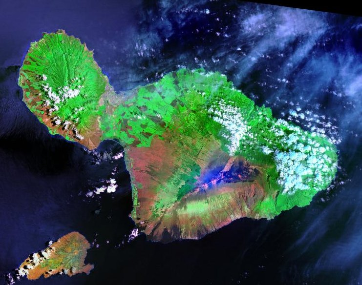
Maui is the second-largest island in the Hawaiian archipelago, at 727.2 square miles (1,883 km2). It is the 17th-largest in the United States. Maui is one of Maui County's four sizable islands, along with Molokaʻi, Lānaʻi, and Kahoʻolawe.

In 2020, Maui had a population of 168,307, the third-highest of the Hawaiian Islands, behind Oʻahu and Hawaiʻi Island. Kahului is the largest census-designated place (CDP) on the island, with a 2020 population of 28,219. It is Maui's commercial and financial hub. Wailuku is the county seat and was the third-largest CDP as of 2010. Other significant populated areas include Kīhei (including Wailea and Makena in the Kihei Town CDP), Lāhainā (including Kāʻanapali and Kapalua in the Lāhainā Town CDP), and Upcountry Maui (including Makawao, Pukalani, Kula, and Ulupalakua), although Lāhainā was mostly destroyed by fire in 2023.

Once part of Maui Nui, Maui is dominated by two volcanic features: Haleakalā in the southeast, and the West Maui Mountains in the northwest. The two are connected by an isthmus about six miles wide that gives the island its nickname, the Valley Isle.

Adapted from Wikipedia: Maui (CC BY-SA 4.0).

Feature class
Island group
Mapped extent
1,898 km²
Size rank
#254 of 445 islands
Region
Oceania
Subregion
Polynesia
Coordinates
20.7738°, -156.2943°
Summits:
Haleakalā (3,055 m), Mauna Kea (4,205 m), Mount Vsevidof (2,149 m)
Ranges:
Klamath Mountains (North America), Sierra Nevada (North America)
Settlements:
Wailuku (25 km), Honolulu (173 km), Hilo (173 km)

View on the live map

More about Maui

History

Polynesians from Tahiti were Maui's original inhabitants. They introduced the kapu system, a strict social order that affected all aspects of life and became the core of Hawaiian culture. Modern Hawaiian history began in the mid-18th century. Kamehameha I, king Hawaiʻi island, invaded Maui in 1790 and fought the inconclusive Battle of Kepaniwai. He returned to Hawaiʻi to battle a rival, subduing Maui a few years later.

On November 26, 1778, explorer James Cook became the first European to see Maui. Cook never set foot on the island, because he was unable to find a suitable landing. The first European to come ashore was French admiral Jean-François de Galaup, comte de Lapérouse, who landed on the shores of what became La Perouse Bay on May 29, 1786.

Geology

Like all other Hawaiian Islands, Maui was formed from the volcanism associated with the Hawaii hotspot.

The islands' volcanic cones are formed from basalt, a dark, iron-rich/silica-poor rock, which poured out of thousands of vents as fluid lava over millions of years. Some of its volcanoes were close enough to each other that lava flows on their flanks overlapped, merging into a single island. Maui is one such "volcanic doublet," formed from two shield volcanoes that overlapped to form Maui.

The older, western volcano has eroded considerably, forming the peaks of the West Maui Mountains (in Hawaiian, Mauna Kahalawai). Puʻu Kukui is the highest, at 5,788 ft (1,764 m).

Climate

The climate is characterized by a two-season year, tropical and uniform temperatures at any given elevation, geographic differences in rainfall, high relative humidity, extensive cloud formations (except on the leeward coasts and at the highest elevations), and dominant trade wind flow (especially at lower elevations).

Half of the land is within 5 mi (8 km) of the coast, creating a strong marine influence.

Macro weather patterns are typically determined by elevation and orientation towards the trade winds (the prevailing air flow from the northeast).

Maui's rugged, irregular topography drives variations in conditions. Air swept inland on the trade winds is redirected by the mountains, valleys, and vast open slopes.

Economy

Tourism is Maui's major industry. Other large sectors include development, retail, business services, health care, and government. Maui has a growing presence in agriculture and information technology.

Unemployment tends to be well below the US average, e.g., 1.7% in December 2006, rising to only 9% in March 2009 before falling to 2.1% in January, 2018. The 2023 fires upended that norm, raising unemployment above the Hawaii and US figures.

Maui's primary agriculture products are corn and other seeds, fruits, cattle, wine, and vegetables. Maui has a history of producing pineapples and sugar cane.

Sections adapted from Wikipedia: Maui (CC BY-SA 4.0).

Maui: Key Facts

Key facts about Maui
Area1,883 km²
Population144,444 (2010)
Highest pointHaleakalā
Surrounded byPacific Ocean

Facts from Wikidata Q188705 (CC0).

O‘ahu
Image via Wikimedia Commons (author and licence on the file page).

O‘ahu

Island group · 1,581 km²

O‘ahu is an island group in Oceania (Polynesia), covering an estimated 1,581 km².

Oʻahu, sometimes written Oahu, is the third-largest and most populated island of the Hawaiian Islands and of the U.S. state of Hawaii. The state capital, Honolulu, is on Oʻahu's southeastern coast. The island of Oʻahu and the uninhabited Northwestern Hawaiian Islands constitute the City and County of Honolulu. In 2025, Oʻahu had a population of 988,703, a decline of 27,791 (2.7%) from 1,016,494 in 2020 (approximately 70% of the total 1,455,271 population of the Hawaiian Islands, with approximately 81% of those living in or near the Honolulu urban area).

Oʻahu is 44 miles (71 km) long from east to west and roughly 30 mi (48 km) across its longest north-south distance. Its shoreline is 227 mi (365 km) long. Including small associated islands such as Ford Island, plus those in Kāneʻohe Bay and off the eastern (windward) coast, the area of Oʻahu is 596.7 square miles (1,545.4 km2), making it the 20th-largest island in the United States.

Well-known features of Oʻahu include Waikīkī, Pearl Harbor, Diamond Head, Hanauma Bay, Kāneʻohe Bay, Kailua Bay, and the North Shore.

Adapted from Wikipedia: Oʻahu (CC BY-SA 4.0).

Feature class
Island group
Mapped extent
1,581 km²
Size rank
#266 of 445 islands
Region
Oceania
Subregion
Polynesia
Coordinates
21.5251°, -158.0056°
Summits:
Haleakalā (3,055 m), Mauna Kea (4,205 m), Mount Vsevidof (2,149 m)
Ranges:
Klamath Mountains (North America), Sierra Nevada (North America)
Settlements:
Wahiawa (3 km), Honolulu (28 km), Wailuku (171 km)

View on the live map

More about O‘ahu

Geography and climate

Like all other Hawaiian Islands, Oʻahu was formed from the volcanism associated with the Hawaii hotspot; it started to grow from the sea floor 4 million years ago. Today, the island is composed of the remnants of two extinct and extensively eroded shield volcanoes: the Waiʻanae and Koʻolau Ranges, with a broad valley or saddle between them. The highest point is Kaʻala in the Waiʻanae Range, rising to 4,003 feet (1,220 m) above sea level.

Oʻahu is known for having the longest rain shower in recorded history. Kāneʻohe Ranch reported 247 straight days of rain from August 27, 1993, to April 30, 1994. The average temperature in Oʻahu is around 70–85 °F (21–29 °C). The island is the warmest from June through October.

History

It is uncertain when Oʻahu was first settled by humans. Early archaeological studies suggested that Polynesian explorers from the Marquesas may have arrived as early as the 3rd century A.D., possibly with a second wave arriving from Tahiti around 1100 A.D. However, more modern analyses indicate that the first settlers probably arrived around 900–1200 A.D.

The first great king of Oʻahu was Maʻilikūkahi, the lawmaker, who initiated a 304-year dynasty of monarchs. Kualiʻi was the first of the warlike kings and was succeeded by his sons. In 1773, the throne fell upon Kahahana, the son of Elani of Ewa.

On January 19, 1778, Oʻahu was the first of the Hawaiian Islands to be sighted by Captain James Cook during his third voyage of discovery.

Tourism

Oʻahu, along with the rest of the State of Hawaii, relies on tourism as a driving force of the local economy. Popular tourists attractions include beaches such as Ala Moana Beach, Hanauma Bay, Kāneʻohe Bay, Ko Olina Beach Park, Waikīkī Beach, among others. Other tourist attractions include Ala Moana Center, Bishop Museum, the Honolulu Museum of Art, ʻIolani Palace, Diamond Head, and Kualoa Ranch.

Sections adapted from Wikipedia: Oʻahu (CC BY-SA 4.0).

O‘ahu: Key Facts

Key facts about O‘ahu
Area1,545 km²
Population976,372 (2012)
Highest pointKaʻala
Surrounded byPacific Ocean

Facts from Wikidata Q131347 (CC0).

Kaua‘i
Image via Wikimedia Commons (author and licence on the file page).

Kaua‘i

Island group · 1,439 km²

Kaua‘i is an island group in Oceania (Polynesia), covering an estimated 1,439 km².

Kauaʻi, sometimes written Kauai, is one of the main Hawaiian Islands. It has an area of 562.3 square miles (1,456.4 km2), making it the fourth largest of the islands and the 21st largest island in the United States. Kauaʻi is 73 mi (117 km) northwest of Oʻahu, across the Kauaʻi Channel. The island's 2020 population was 73,298.

Styling itself the "Garden Isle", Kauaʻi is the site of Waimea Canyon State Park and Nā Pali Coast State Park. It forms the bulk of Kauaʻi County, which includes Niʻihau as well as the small nearby islands of Kaʻula and Lehua.

Adapted from Wikipedia: Kauaʻi (CC BY-SA 4.0).

Feature class
Island group
Mapped extent
1,439 km²
Size rank
#274 of 445 islands
Region
Oceania
Subregion
Polynesia
Coordinates
22.0599°, -159.5070°
Summits:
Haleakalā (3,055 m), Mauna Kea (4,205 m), Mount Vsevidof (2,149 m)
Ranges:
Klamath Mountains (North America), Sierra Nevada (North America)
Settlements:
Wahiawa (165 km), Honolulu (190 km), Wailuku (337 km)

View on the live map

More about Kaua‘i

Geography

The five-million-year-old island, the oldest of the main islands (Niʻihau is older), was formed volcanically as the Pacific Plate passed over the Hawaiʻi hotspot. It consists of an eroded shield volcano with a 9.3–12.4-mile-diameter-summit (15.0–20.0 km) caldera and two flanking calderas. Rejuvenation of the volcano 0.6–1.40 million years ago left lava flows and cones over the eastern two-thirds of the island.

Kauaʻi's highest peak is Kawaikini, at 5,243 ft (1,598 m). The second-highest is Mount Waiʻaleʻale, near the center of the island, 5,148 ft (1,569 m) above sea level. One of the wettest spots on earth, with an annual average rainfall of 460 in (38.3 ft; 11.7 m), is on the east side of Mount Waiʻaleʻale.

History

I never saw [indigenous people] so astonished at entering a ship. Their eyes were continually flying from object to object, the wildness of their looks and actions fully expressed their surprise and astonishment.

Later, while investigating a location for the ships to anchor, a shore party was mobbed by a crowd, a shot was fired, and one Kauaian was killed. The next day, January 20, 1778, the two ships anchored in Waimea Bay on the southwest coast, where the expedition spent days obtaining fresh water and trading for fresh food. The local people especially valued iron: even small amounts, such as a single nail, could be traded for plentiful food supplies. Within two weeks, Cook left the vicinity of the Hawaiian Islands to continue his original mission.

Economy

Tourism is Kauaʻi's largest industry. In 2007, 1,271,000 people visited. The two largest groups were from the continental United States (84% of all visitors) and Japan (3%). As of 2003, approximately 27,000 jobs existed on Kauaʻi. The largest sector was accommodation/food services (26%, 6,800 jobs), followed by government (15%) and retail (14.5%), with agriculture accounting for 2.9% (780 jobs) and educational services providing 0.7% (183 jobs). The visitors' industry accounted for one third of Kauaʻi's income. Employment is dominated by small businesses, with 87% of all non-farm businesses having fewer than 20 employees. As of 2003, Kauaʻi's poverty rate was 10.5%, compared to the mainland at 10.7%.

Land in Kauaʻi is very fertile; farmers raise many varieties of fruit and other crops.

Sections adapted from Wikipedia: Kauaʻi (CC BY-SA 4.0).

Kaua‘i: Key Facts

Key facts about Kaua‘i
Area1,435 km²
Population66,921 (2010)
Highest pointMount Waialeale
Surrounded byPacific Ocean

Facts from Wikidata Q201026 (CC0).

Visiting Kaua‘i

Kauai is the most northwestern of Hawaii's major islands and is the 4th largest by size and population. Nicknamed the Garden Island, it is covered with lush greenery and tropical plants, watered regularly by abundant rainfall. As the oldest of the islands, it has been changed the most by the forces of erosion, and this has resulted in natural wonders such as Waimea Canyon and the Na Pali Coast. As a consequence of its age, Kauai also has more miles of sandy coastline than the other Hawaiian islands.

Travel notes adapted from Wikivoyage: Kauai (CC BY-SA 4.0).

Atka
Image via Wikimedia Commons (author and licence on the file page).

Atka

Island · 1,129 km²

Atka is an island in North America, covering an estimated 1,129 km².

Atka Island (Aleut: Atx̂ax̂, Russian: Атка остров) is the largest island in the Andreanof Islands of the Aleutian Islands of Alaska. The island is 50 miles (80 km) east of Adak Island. It is 65 miles (105 km) long and 2–20 miles (3–30 km) wide with a land area of 404.6 square miles (1,048 km2), making it the 22nd largest island in the United States. The northeast of Atka Island contains the Korovin volcano which reaches a peak of 5,030 feet (1,533 m). Oglodak Island is located 3.4 miles (3.0 nmi; 5.5 km) off Cape Kigun, Atka's westernmost point.

The city of Atka, Alaska is on the east side of the island. The 2000 census population of the island was 95 persons, almost all in the city of Atka.

After the second World War, survivors from Attu Island were relocated 200 miles (170 nmi; 320 km), to Atka.

On December 5, 2008, President George W. Bush created the World War II Valor in the Pacific National Monument. A crashed B-24 Liberator on Atka is one of the nine sites included in the monument.

As of July 2021 Atka is having a new modular medical clinic and quarantine shelter with a morgue being erected.

Adapted from Wikipedia: Atka Island (CC BY-SA 4.0).

Feature class
Island
Mapped extent
1,129 km²
Size rank
#286 of 445 islands
Region
North America
Coordinates
52.2377°, -174.2641°
Summits:
Mount Vsevidof (2,149 m), Mount Katmai (2,047 m), Mount Osborn (1,437 m)
Ranges:
Alaska Range (North America), Kolyma Range (Asia)
Settlements:
Anchorage (1,774 km), Petropavlovsk Kamchatskiy (1,820 km), Fairbanks (2,054 km)

View on the live map

More about Atka

Atka: Key Facts

Key facts about Atka
Area1,061 km²
Population95 (2000)
Highest pointKorovin Volcano
Surrounded byPacific Ocean

Facts from Wikidata Q756016 (CC0).

Adak

Island · 797 km²

Adak is an island in North America, covering an estimated 797 km².

Adak Island (Aleut: Adaax, pronounced [ˈaðɑχ]; Russian: Адак) or Father Island, is an island near the western extent of the Andreanof Islands group of the Aleutian Islands in Alaska. Alaska's southernmost city, Adak, is located on the island. The island has a land area of 274.59 square miles (711.18 km2), measuring 33.9 miles (54.5 km) long and 22 miles (35 km) wide, making it the 25th largest island in the United States.

Due to harsh winds, frequent cloud cover, and cold temperatures, vegetation is mostly tundra (grasses, mosses, berries, low-lying flowering plants) at lower elevations. The highest point is Mount Moffett, near the northwest end of the island, at an elevation of 3,924 feet (1,196 m). It is snow covered the greater part of the year. Adak is its largest and principal city.

The word Adak is from the Aleut word adaq, which means "father".

Adapted from Wikipedia: Adak Island (CC BY-SA 4.0).

Feature class
Island
Mapped extent
797 km²
Size rank
#310 of 445 islands
Region
North America
Coordinates
51.7691°, -176.6614°
Summits:
Mount Vsevidof (2,149 m), Mount Katmai (2,047 m), Klyuchevskaya Sopka (4,750 m)
Ranges:
Kolyma Range (Asia), Alaska Range (North America)
Settlements:
Petropavlovsk Kamchatskiy (1,674 km), Anchorage (1,929 km), Magadan (2,189 km)

View on the live map

More about Adak

History

Adak Island has been the home to Aleut peoples since antiquity. Russian explorers in the 18th century also visited the island but made no permanent settlements. During World War II, the Imperial Japanese Army took control of two of the westernmost Aleutian Islands, Attu and Kiska, in the incorporated territory of Alaska, the first foreign enemy to occupy American soil since the War of 1812. The Japanese also attacked the American base at Dutch Harbor by air. The Japanese campaign coincided with the more well-known Battle of Midway. In response, the United States military began a campaign to oust the Japanese.

Climate

Adak has a subpolar oceanic climate (Koppen Cfc), characterized by persistently overcast skies, moderated temperatures, high winds, significant precipitation and frequent cyclonic storms.

At Adak, overcast conditions average nearly 75 percent of the time during June and July, dropping back to approximately 50 percent of the time from October through February. Adak averages 173 days per year with fog. The foggiest months are July and August, when an average of 26 of the 31 days have fog. This number drops dramatically toward the winter season, where the months of December through March have, on average, fewer than ten days with fog during any one month.

Gales occur in all months of the year at Adak, with the greatest chances being from December through March.

Economy

A land exchange between Alaska Native Regional Corporations, the U.S. Navy, and the Department of the Interior has transferred most of the naval facilities to the Aleut Corp. A portion of the Island will remain within the National Maritime National Wildlife Refuge, managed by U.S. Fish and Wildlife. Adak currently provides a fueling port and crew transfer facility for foreign fishing fleets—an airport, docks, housing facilities and food services are available. A grocery and ship supply store and restaurant opened in February 1999. Aleut Corporation maintains the facilities. Contractors are performing an environmental clean-up. Alaskan-owned Norquest-Adak Seafood Co. processes Pacific cod, pollock, mackerel, halibut, albacore and brown king crab.

Sections adapted from Wikipedia: Adak Island (CC BY-SA 4.0).

Adak: Key Facts

Key facts about Adak
Area711 km²
Population316
Highest pointMount Moffett
Surrounded byBering Sea

Facts from Wikidata Q176381 (CC0).

Pribilof Islands
Image via Wikimedia Commons (author and licence on the file page).

Pribilof Islands

Island · 736 km²

Pribilof Islands is an island in North America, covering an estimated 736 km².

The Pribilof Islands (formerly the Northern Fur Seal Islands; Aleut: Amix̂, Russian: Острова Прибылова, romanized: Ostrova Pribylova) are a group of four volcanic islands off the coast of mainland Alaska, in the Bering Sea, about 200 miles (320 km) north of Unalaska and 200 miles (320 km) southwest of Cape Newenham. The islands are part of the Alaska Maritime National Wildlife Refuge. The Siberian coast is roughly 500 miles (800 km) northwest. About 75 square miles (194 km2) in total area, they are mostly rocky and are covered with tundra, with a population of 572 as of the 2010 census.

Adapted from Wikipedia: Pribilof Islands (CC BY-SA 4.0).

Feature class
Island
Mapped extent
736 km²
Size rank
#313 of 445 islands
Region
North America
Coordinates
56.6695°, -169.7502°
Summits:
Mount Vsevidof (2,149 m), Mount Katmai (2,047 m), Mount Osborn (1,437 m)
Ranges:
Alaska Range (North America), Brooks Range (North America)
Settlements:
Anchorage (1,240 km), Fairbanks (1,490 km), Whitehorse (2,029 km)

View on the live map

More about Pribilof Islands

History

Despite being about 200 miles north of the closest Aleutian island, oral traditions of the Aleut people indicate that the islands were known but sparingly visited and not permanently inhabited, as "no ethnohistoric or archaeological evidence points to the use or occupation of the Pribilof Islands... by any native people before the Russian period in Alaska."

The first European account of the islands is attributed to an employee of the Lebedev-Lastochkin Company, Gavriil Pribylov, who located St. George Island in 1786 while searching for the breeding grounds of northern fur seals. St. Paul Island was reached the following year. Seals swam north through the Aleutian Islands and returned in the autumn with newly born pups.

Sections adapted from Wikipedia: Pribilof Islands (CC BY-SA 4.0).

Pribilof Islands: Key Facts

Key facts about Pribilof Islands
Area194 km²
Surrounded byBering Sea

Facts from Wikidata Q1144173 (CC0).

Moloka‘i
Image via Wikimedia Commons (author and licence on the file page).

Moloka‘i

Island · 676 km²

Moloka‘i is an island in Oceania (Polynesia), covering an estimated 676 km².

Molokaʻi or Molokai is the fifth most populated of the eight major islands that make up the Hawaiian Islands archipelago in the middle of the Pacific Ocean. It is 38 by 10 miles (61 by 16 km) at its greatest length and width with a usable land area of 260 mi2 (673.40 km2), making it the fifth largest in size of the main Hawaiian Islands and the 27th-largest island in the United States. It lies southeast of Oʻahu across the 25-mile-wide (40 km) Kaʻiwi Channel and north of Lānaʻi, separated from it by the Kalohi Channel.

The island's agrarian economy has been driven primarily by cattle ranching, pineapple production, sugarcane production and small-scale farming. Tourism comprises a small fraction of the island's economy, and much of the infrastructure related to tourism was closed and barricaded in the early 2000s when the primary landowner, Molokai Ranch, ceased operations due to substantial revenue losses. In Kalawao County, on the Kalaupapa Peninsula on the north coast, settlements were established in 1866 for quarantined treatment of persons with leprosy; these operated until 1969. The Kalaupapa National Historical Park now preserves this entire county and area.

Adapted from Wikipedia: Molokaʻi (CC BY-SA 4.0).

Feature class
Island
Mapped extent
676 km²
Size rank
#318 of 445 islands
Region
Oceania
Subregion
Polynesia
Coordinates
21.1600°, -157.2056°
Summits:
Haleakalā (3,055 m), Mauna Kea (4,205 m), Mount Vsevidof (2,149 m)
Ranges:
Klamath Mountains (North America), Sierra Nevada (North America)
Settlements:
Honolulu (70 km), Wailuku (79 km), Wahiawa (93 km)

View on the live map

More about Moloka‘i

Geography

Molokaʻi developed from two distinct shield volcanoes known as East Molokaʻi and the much smaller West Molokaʻi. The highest point is Kamakou on East Molokaʻi, at 4,970 ft (1,510 m). Today, East Molokaʻi volcano, like the Koʻolau Range on Oʻahu, is what remains of the southern half of the original mountain. The northern half suffered a catastrophic collapse about 1.5 million years ago and now lies as a debris field scattered northward across the bottom of the Pacific Ocean. What remains of the volcano on the island include the highest sea cliffs in the world. The south shore of Molokaʻi boasts the longest fringing reef in the U.S. and its holdings—nearly 25 mi (40 km) long.

History

It used to be thought that Molokaʻi was first settled around AD 650 by indigenous peoples most likely from the Marquesas Islands. However, a 2010 study using revised, high-precision radiocarbon dating based on more reliable samples has established that the period of eastern Polynesian colonization of the Marquesas Islands took place much later, in a shorter time frame of two waves: the "earliest in the Society Islands c. 1025–1120, four centuries later than previously assumed; then after 70 to 265 years, dispersal continued in one major pulse to all remaining islands c. 1190–1290." Later migrants likely came from Tahiti and other south Pacific islands.

Ecology

Molokaʻi is split into two main geographical areas. The low western half is very dry and the soil is heavily denuded due to poor land management practices, which allowed over-grazing by deer and goats. It lacks significant ground cover and virtually the entire section is covered in non-native kiawe (Prosopis pallida) trees. One of the few natural areas remaining almost intact are the coastal dunes of Moʻomomi, which are part of a Nature Conservancy preserve.

The eastern half of the island is a high plateau rising up to an elevation of 4,900 ft (1,500 m) on Kamakou peak and includes the 2,774-acre (11.23 km2; 4.334 mi2) Molokai Forest Reserve. The eastern half is covered with lush wet forests that get more than 300 in (7,600 mm) of rain per year.

Economy

Over the years Molokai Ranch has also acted as a developer, establishing hotels and related amenities for resort tourists on their property. The local indigenous community fought for many decades to inhibit the development by Molokai Ranch in order to preserve their community and unique way of life. In some cases, protests have become violent, such as fence cutting, poisoning of the Ranch's exotic African Safari animals in 1994, an arson attack in Kaupoa in 1995, and the destruction of 5 mi (8 km) of Ranch water pipes in 1996.

In 2007, community residents organized the "Save Laʻau Point" movement to oppose Molokai Ranch's attempt to expand its resort operation.

Sections adapted from Wikipedia: Molokaʻi (CC BY-SA 4.0).

Moloka‘i: Key Facts

Key facts about Moloka‘i
Area673 km²
Population7,345 (2010)
Highest pointKamakou
Surrounded byPacific Ocean

Facts from Wikidata Q193253 (CC0).

St. Matthew Island
Image via Wikimedia Commons (author and licence on the file page).

St. Matthew Island

Island · 487 km²

St. Matthew Island is an island in North America, covering an estimated 487 km².

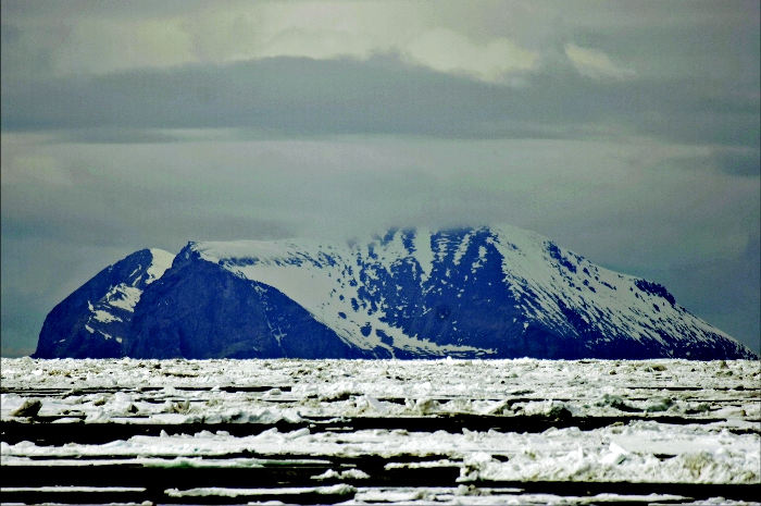
St. Matthew Island (Russian: Остров Святого Матвея, romanized: Ostrov Svyatogo Matveya) is an uninhabited, remote island in the Bering Sea in Alaska, 183 miles (295 km) west-northwest of Nunivak Island. The entire island's natural scenery and wildlife is protected, as it is part of the Bering Sea unit of the Alaska Maritime National Wildlife Refuge and as the Bering Sea Wilderness.

The island has a land area of 137.857 sq mi (357.05 km2), making it the 44th-largest island of the United States. Its most southern point is Cape Upright, which features cliff faces exceeding 1,000 feet (300 m) in height. Similar heights are found at Glory of Russia Cape on the north, and the highest point, 1,476 feet (450 m) above sea level, lies south from the island center.

There is a small island off its northwestern point called Hall Island. The 3.1 miles (5.0 km) wide sound between the two islands is called Sarichef Strait. A small rocky islet called Pinnacle Rock lies 9.3 miles (15.0 km) to the south of Saint Matthew Island.

The United States Coast Guard maintained a staffed LORAN transmitter station on the island during the 1940s.

Adapted from Wikipedia: St. Matthew Island (CC BY-SA 4.0).

Feature class
Island
Mapped extent
487 km²
Size rank
#332 of 445 islands
Region
North America
Coordinates
60.5152°, -172.9128°
Summits:
Mount Osborn (1,437 m), Mount Vsevidof (2,149 m), Mount Katmai (2,047 m)
Ranges:
Brooks Range (North America), Alaska Range (North America)
Settlements:
Anchorage (1,242 km), Fairbanks (1,362 km), Petropavlovsk Kamchatskiy (1,901 km)

View on the live map

More about St. Matthew Island

Geology and climate

The climatic conditions in the entire Bering Sea Area, according to National Climatic Data Center (1986), is reported as maritime with "considerable wind and cool, humid and cloudy conditions" with mean annual temperature of 37.8 °F (3.2 °C) and annual precipitation of 15.3 in (390 mm) on St. Matthew Island. The geological formation recorded on St. Matthew Island consists of calc-alkaline volcanic rocks of Late Cretaceous and earliest tertiary age with Pergelic Cryaquolls and Pergelic Cryoborolls soil types.

Sections adapted from Wikipedia: St. Matthew Island (CC BY-SA 4.0).

St. Matthew Island: Key Facts

Key facts about St. Matthew Island
Area375 km²
Population0
Surrounded byBering Sea

Facts from Wikidata Q1655937 (CC0).

Ni‘ihau
Image via Wikimedia Commons (author and licence on the file page).

Ni‘ihau

Island · 197 km²

Ni‘ihau is an island in Oceania (Polynesia), covering an estimated 197 km².

Niʻihau, sometimes written Niihau, is the seventh largest island in Hawaii and the westernmost of the main islands. It is 17.5 miles (28.2 km) southwest of Kauaʻi across the Kaulakahi Channel. Its area is 69.5 square miles (180 km2). Several intermittent playa lakes provide wetland habitats for the Hawaiian coot, the Hawaiian stilt, and the Hawaiian duck. The island is designated as critical habitat for Brighamia insignis, an endemic and endangered species of Hawaiian lobelioid. The United States Census Bureau defines Niihau and the neighboring island and State Seabird Sanctuary of Lehua as Census Tract 410 of Kauaʻi County, Hawaii. Its 2010 census population was 170, most of them Native Hawaiians. As of the 2020 census, the population had fallen to 84. The people of Niʻihau are noted for their gemlike lei pūpū (shell lei) craftsmanship. They speak Hawaiian as a primary language, being the only place where Hawaiian has not been in any way displaced by English.

The Scottish plantation owner Elizabeth Sinclair purchased Niʻihau from the Kingdom of Hawaiʻi in 1864 for $10,000 US dollars (equivalent to $212,000 as of 2026).

Adapted from Wikipedia: Niʻihau (CC BY-SA 4.0).

Feature class
Island
Mapped extent
197 km²
Size rank
#370 of 445 islands
Region
Oceania
Subregion
Polynesia
Coordinates
21.9310°, -160.1210°
Summits:
Haleakalā (3,055 m), Mauna Kea (4,205 m), Mount Vsevidof (2,149 m)
Ranges:
Klamath Mountains (North America), Sierra Nevada (North America)
Settlements:
Wahiawa (222 km), Honolulu (244 km), Wailuku (392 km)

View on the live map

More about Ni‘ihau

Geography

Niʻihau is located about 18 miles (29 km) west of Kauaʻi, and the tiny, uninhabited island of Lehua lies 0.7 miles (0.61 nmi; 1.1 km) north of Niʻihau. Niʻihau's dimensions are 6.2 miles by 18.6 miles (10km × 30km). The maximum elevation, Pānīʻau, is 1,280 feet (390 m). The island is about 6 million years old, making it geologically older than the 5.8-million-year-old neighboring island of Kauaʻi to the northeast. Niʻihau is the remnant of the southwestern slope of what was once a much larger volcano. The entire summit and other slopes collapsed into the ocean in a giant prehistoric landslide.

The island is relatively arid because it lies in the rain shadow of Kauaʻi and lacks the elevation needed to catch significant amounts of trade wind rainfall.

History

Prior to the unification of the Kingdom of Hawaiʻi under Kamehameha I, Niʻihau was ruled by the aliʻi. Kahelelani was the first of the Niʻihau aliʻi. His name is now used to refer to the Niʻihau kahelelani, the puka shell of the wart turbans (Leptothyra verruca), used to make exquisite Niʻihau shell jewelry. Kāʻeokūlani was a ruler of northern Niʻihau who unified the island after defeating his rival, a chief named Kawaihoa. A stone wall (Pāpōhaku) across a quarter of the island's southern end marked the boundaries of the two chiefs: Kāʻeo's land was identified by black stones and Kawaihoa's by white stones. Eventually, a great battle took place, known as Pali Kamakaui.

Economy

Approximately 80% of Niʻihau's income comes from a small Navy installation atop 1,300-foot-high cliffs. Remote-controlled tracking devices are used for testing and training with Kaua'i's Pacific Missile Range Facility. Modern missile defense tests are conducted at the site for the U.S. and its allies. The installation brings in millions of dollars a year, and provides the island with a stable economic base without the complexity of tourism or industrial development.

The sale of shells and shell jewelry is an additional source of income. Its beaches are known for their pūpū, tiny shells that wash onto shore during winter months. Species used for shell leis includes momi (Euplica varians), laiki or rice shells (Mitrella margarita) and kahelelani (Leptothyra verruca).

Sections adapted from Wikipedia: Niʻihau (CC BY-SA 4.0).

Ni‘ihau: Key Facts

Key facts about Ni‘ihau
Area180 km²
Population130 (2009)
Highest pointPānīʻau
Surrounded byPacific Ocean

Facts from Wikidata Q239743 (CC0).

Saipan
Image via Wikimedia Commons (author and licence on the file page).

Saipan

Island · 133 km²

Saipan is an island in Oceania (Micronesia), covering an estimated 133 km². It extends across the Northern Mariana Islands and the United States.

Saipan () is the largest island and capital of the Northern Mariana Islands, an unincorporated territory of the United States in the western Pacific Ocean. According to 2020 estimates by the United States Census Bureau, the population of Saipan was 43,385. Its people have been United States citizens since the 1980s. Saipan is one of the main homes of the Chamorro and the Carolinians, the indigenous people of the Mariana Islands.

From the 17th century, the island experienced Spanish occupation and rule until the Spanish–American War of 1898, when Saipan was briefly occupied by the United States, before being formally sold to Germany. About 15 years of German rule were followed by 30 years of Japanese rule, which was ended by the Battle of Saipan, as the United States began to take control of the Philippine Sea. Following World War II, Saipan became part of the Trust Territory of the Pacific Islands, and was administered by the United States, along with the rest of the Northern Marianas. In 1978, Saipan formally joined the United States as part of the Commonwealth of the Northern Mariana Islands.

Today, Saipan is home to about 90% of the population of the Northern Mariana Islands.

Adapted from Wikipedia: Saipan, Northern Mariana Islands (CC BY-SA 4.0).

Feature class
Island
Mapped extent
133 km²
Size rank
#379 of 445 islands
Region
Oceania
Subregion
Micronesia
Countries
Northern Mariana Islands, United States
Coordinates
15.1887°, 145.7345°
Summits:
Mount Lamlam (406 m), Mount Vsevidof (2,149 m), Lata Mountain (966 m)
Ranges:
New Guinea Highlands (Oceania), Maoke Mountains (Oceania)
Settlements:
Wahiawa (5,948 km), Honolulu (5,966 km), Wailuku (6,109 km)

View on the live map

More about Saipan

Geography

Saipan is the largest island in the Northern Mariana Islands. It is about 120 mi (190 km) north of Guam and 5 nautical miles (9.3 km) northeast of Tinian, from which it is separated by the Saipan Channel. Saipan is about 12 mi (19 km) long and 5.6 mi (9.0 km) wide, with a land area of 115.38 km2 (44.55 sq mi).

The western side of the island is lined with sandy beaches and an offshore coral reef creates a large lagoon. The eastern shore is composed primarily of rugged rocky cliffs and a reef. A narrow underwater bank of Marpi Reef lies 28 mi (45 km) north of Saipan, and CK Reef lies in the west of the island.

The highest elevation on Saipan is a limestone-covered mountain called Mount Tapochau at 1,560 ft (480 m).

History

Traces of human settlements on Saipan have been found by archaeologists ranging over 4,000 years, including petroglyphs, ancient Latte Stones, and other artifacts pointing to cultural affinities with Melanesia and with similar stone monuments in Micronesia and Palau.

Saipan, together with Tinian, was possibly first sighted by Europeans during the Spanish expedition of Ferdinand Magellan, when it made a landing in the southern Marianas on March 6, 1521. It is likely Saipan was sighted by Gonzalo Gómez de Espinosa in 1522 on board the Spanish ship Trinidad, which he commanded after the death of Ferdinand Magellan in the Battle of Mactan in Cebu, Philippines. This is likely to have occurred after the sighting of the Maug Islands between the end of August and the end of September 1522.

Demographics

According to the 2010 United States census, Saipan's population was 48,220, a drop of 22.7% from the 2000 US Census; the population decrease is largely attributed to working immigrants and their families either returning to their home countries after the collapse of the garment industry or moving to other locations with economic opportunities such as Guam and the United States mainland. The population of Saipan corresponds to approximately 90% of the population of the Northern Mariana Islands.

Large numbers of Filipino, Chinese, Bangladeshi, Nepalese and smaller numbers of Sri Lankan and Burmese unskilled workers and professionals migrated to the Northern Mariana Islands including Saipan during the late 1900s, mostly during the 1980s and 1990s.

Economy

Tourism had traditionally been a vital source of the island's revenue and economic activities. But in the 1980s, garment manufacturing became one of the main economic driving forces in Saipan when the U.S. government agreed that the CNMI would be exempted from certain federal minimum wage and immigration laws.

Sections adapted from Wikipedia: Saipan, Northern Mariana Islands (CC BY-SA 4.0).

Saipan: Key Facts

Key facts about Saipan
Area115 km²
Population48,220 (2010)
Highest pointMount Tapochau
Surrounded byPacific Ocean

Facts from Wikidata Q51679 (CC0).

Tutuila
Image via Wikimedia Commons (author and licence on the file page).

Tutuila

Island · 132 km²

Tutuila is an island in Oceania (Polynesia), covering an estimated 132 km². It extends across American Samoa and the United States.

Tutuila is the largest and most populous island of American Samoa and is part of the archipelago of the Samoan Islands. It is the third largest island in the Samoan Islands chain of the Central Pacific. It is located roughly 4,000 kilometers (2,500 mi) northeast of Brisbane, Australia and lies over 1,200 kilometers (750 mi) to the northeast of Fiji. It contains a large, natural harbor, Pago Pago Harbor, where Pago Pago, the capital of American Samoa, is situated. Pago Pago International Airport is also located on Tutuila. The island's land expanse is about 68% of the total land area of American Samoa. With 56,000 inhabitants, it is also home to 95% of the population of American Samoa. The island has six terrestrial and three marine ecosystems.

Tutuila has mountainous regions, the highest point of which is 653 meters (2,142 feet). The island is attractive to tourists because of its beaches, coral reefs, and World War II relics, as well as its suitability for sporting activities such as scuba diving, snorkeling, and hiking.

Adapted from Wikipedia: Tutuila (CC BY-SA 4.0).

Feature class
Island
Mapped extent
132 km²
Size rank
#380 of 445 islands
Region
Oceania
Subregion
Polynesia
Countries
American Samoa, United States
Coordinates
-14.3267°, -170.7487°
Summits:
Lata Mountain (966 m), Mauna Kea (4,205 m), Haleakalā (3,055 m)
Ranges:
Southern Alps (Oceania), Owen Stanley Range (Oceania)
Settlements:
Hilo (4,153 km), Honolulu (4,205 km), Wailuku (4,214 km)

View on the live map

More about Tutuila

Geography

Tutuila lies in the Pacific Ocean, roughly 4,000 km (2,500 mi) northeast of Brisbane, Australia. The village of Fagatogo is situated 1,238 km (769 mi) northeast of Suva, Fiji. The island lies roughly 530 km (330 mi) north of Niue and roughly 580 km (360 mi) south of Tokelau and roughly 100 km (62 mi) southeast of the Samoan island of Upolu.

Tutuila is a fairly small and narrow island, measuring roughly 33 km (21 mi) across and little more than 3 mi (4.8 km) from north to south at its widest point. The area of this volcanic island of early Pliocene age is 142.3 km2 (54.9 sq mi) with a shore line of 101.3 km (62.9 mi). The hill range which runs from west to east is rugged and winding with the northern coast line having steep cliffs and unusual coast line.

History

The Polynesians first reached Samoa around 1000 BC. By 600 BC, they had established a settlement on Tutuila at Tula. Over the centuries, the Samoans on Tutuila kept in contact with the inhabitants of the neighboring islands of Western Polynesia, Tonga, and Fiji.

Tutuila served as a place of exile for warriors and chiefs who had been defeated in the wars that ravaged much of Upolu for centuries. It was also used as a place to which Upolu rulers banished political opponents.

Around 1200 A.D., during the reign of Momo, the tenth Tuʻi Tonga, the Tongans invaded and occupied Tutuila and other Samoan Islands. Their rule lasted for nearly two centuries under five successive kings.

Sections adapted from Wikipedia: Tutuila (CC BY-SA 4.0).

Tutuila: Key Facts

Key facts about Tutuila
Area140 km²
Population54,359
Highest pointMatafao Peak
Surrounded byPacific Ocean

Facts from Wikidata Q269205 (CC0).

Visiting Tutuila

Tutuila is the most populous island in American Samoa, and is home to its capital, Pago Pago, and principal airport.

Tutuila is a fairly small and narrow island, measuring roughly 33 km (21 mi) across and little more than 3 mi (4.8 km) from north to south at its widest point.

Travel notes adapted from Wikivoyage: Tutuila (CC BY-SA 4.0).

Rota
Image via Wikimedia Commons (author and licence on the file page).

Rota

Island · 97 km²

Rota is an island in Oceania (Micronesia), covering an estimated 97 km². It extends across the Northern Mariana Islands and the United States.

Rota (Chamorro: Luta), also known as the "Friendly Island", is the southernmost island of the United States Commonwealth of the Northern Mariana Islands (CNMI) and the third southernmost of the Marianas Archipelago (the first being Cocos Island). Early Spanish records called it Zarpana; the name Rota may have come from the Andalusian municipality of Rota. It lies approximately 40 nautical miles (74 km) north-northeast of the separately administered United States territory of Guam. Sinapalo village is the largest and most populated, followed by Songsong village. Rota functions as one of the four municipalities of the CNMI.

Adapted from Wikipedia: Rota, Northern Mariana Islands (CC BY-SA 4.0).

Feature class
Island
Mapped extent
97 km²
Size rank
#389 of 445 islands
Region
Oceania
Subregion
Micronesia
Countries
Northern Mariana Islands, United States
Coordinates
14.1496°, 145.2090°
Summits:
Mount Lamlam (406 m), Lata Mountain (966 m), Mount Vsevidof (2,149 m)
Ranges:
New Guinea Highlands (Oceania), Maoke Mountains (Oceania)
Settlements:
Wahiawa (6,034 km), Honolulu (6,052 km), Wailuku (6,195 km)

View on the live map

More about Rota

Geography

Rota is 12.3 miles (19.8 km) long and 4.2 mi (6.8 km) wide. Its coastline is about 38 mi (61 km) long. The highest point on Rota is Mt. Sabana which is 495.56 meters (1,625.9 ft). Rota is 47 nmi (87 km) north of Guam, 63 nmi (117 km) south of Tinian and 73 nmi (135 km) south of Saipan.

Rota has diverse flora and fauna including the endemic and endangered Rota white-eye, Mariana crow, and Mariana fruit bat. Much of the island, especially where there are remnants of native forest, have been recognised as forming an Important Bird Area (IBA) by BirdLife International. Four wildlife conservations areas have been designated on Rota: Mariana Crow Conservation Area, Sabana Protected Area, I'Chenchon Park Wildlife Conservation Area, and Liyo Conservation Area.

History

In 1521, the first European to see Rota was the lookout on Ferdinand Magellan's ship Victoria, Lope Navarro. However, Magellan's armada of three ships did not stop until they reached Guam, so the first European to arrive in Rota (in 1524), was the Spanish navigator Juan Sebastián Elcano, who annexed it together with the rest of the Mariana Islands on behalf of the Spanish Empire.

As with the other islands of the northern Marianas, Rota was sold to the German Empire under the German–Spanish Treaty of 1899. In World War I, the islands were occupied by the Empire of Japan. In 1919, the League of Nations formally recognized Japanese control under the South Seas Mandate.

Sections adapted from Wikipedia: Rota, Northern Mariana Islands (CC BY-SA 4.0).

Rota: Key Facts

Key facts about Rota
Area85.4 km²
Population3,283
Surrounded byPacific Ocean

Facts from Wikidata Q949090 (CC0).

Baker Island
Image via Wikimedia Commons (author and licence on the file page).

Baker Island

Island · 84 km²

Baker Island is an island in Oceania (Polynesia), covering an estimated 84 km².

Baker Island, once known as New Nantucket in the early 19th century, is a small, uninhabited atoll located just north of the Equator in the central Pacific Ocean, approximately 1,920 miles (3,090 kilometres) southwest of Honolulu. Positioned almost halfway between Hawaii and Australia, its closest neighbor is Howland Island, situated 42 mi (68 km) to the north-northwest. Both Baker and Howland Islands have been claimed as territories of the United States since 1857, though the United Kingdom regarded them as part of the British Empire between 1897 and 1936 but did not actually annex them. They were not being used when a U.S. colonization attempt was started in 1935, and the next year formal reassertion of U.S. sovereignty was issued. During World War II the Japanese Empire attacked the island, and it was evacuated and a small military base was established. The island was an important navigation beacon in the remote Pacific waters during and after World War II. In the 1970s it was made into a nature preserve and has remained so into the 21st century.

Adapted from Wikipedia: Baker Island (CC BY-SA 4.0).

Feature class
Island
Mapped extent
84 km²
Size rank
#394 of 445 islands
Region
Oceania
Subregion
Polynesia
Coordinates
0.1962°, -176.4795°
Summits:
Mauga Silisili (1,858 m), Lata Mountain (966 m), Tomanivi (1,323 m)
Ranges:
Owen Stanley Range (Oceania), New Guinea Highlands (Oceania)
Settlements:
Funafuti (1,080 km), Tarawa (1,175 km), Majuro (1,550 km)

View on the live map

More about Baker Island

History

Baker Island was first discovered in 1818 by Captain Elisha Folger of the Nantucket whaling ship Equator, who named the island "New Nantucket". In August 1825, it was sighted again by Captain Obed Starbuck aboard the Loper, another Nantucket whaler. The island later took its name from Captain Michael Baker, who visited it in 1834. Some accounts suggest that Baker visited the island earlier, in 1832, and returned on August 14, 1839, aboard the whaler Gideon Howland, where he reportedly buried an American seaman. Captain Baker formerly claimed the island in 1855 and subsequently sold his interest to a group that later established the American Guano Company.

The United States officially took possession of Baker Island in 1857 under the Guano Islands Act of 1856.

Description

A cemetery and remnants from previous settlements are located near the middle of Baker Island's west coast, where the boat landing area is situated. There are no ports or harbors on the island, and offshore anchorage is prohibited. The narrow fringing reef surrounding Baker Island presents a significant maritime hazard, making access to the shore difficult. To aid in navigation, a day beacon is positioned near the site of the former village.

Baker Island's abandoned World War II runway, which measures 5,463 ft (1,665 m) in length, is now completely overgrown with vegetation and is unserviceable.

The United States asserts an exclusive economic zone (EEZ) extending 200 nautical miles (370 km) and a territorial sea of 12 nmi (22 km) around the Island.

Sections adapted from Wikipedia: Baker Island (CC BY-SA 4.0).

Baker Island: Key Facts

Key facts about Baker Island
Area2.1 km²
Population0 (2018)
Surrounded byPacific Ocean

Facts from Wikidata Q46879 (CC0).

Visiting Baker Island

Baker Island is an uninhabited unincorporated territory of the United States—one of the smallest U.S. Minor Outlying Islands. It is in Polynesia, a region of the Pacific Ocean, north of Kiribati, roughly halfway between Hawaii and mainland Australia.

Travel notes adapted from Wikivoyage: Baker Island (CC BY-SA 4.0).

Johnston Atoll
Image via Wikimedia Commons (author and licence on the file page).

Johnston Atoll

Island · 81 km²

Johnston Atoll is an island in Oceania (Polynesia), covering an estimated 81 km².

Johnston Atoll is an unincorporated territory of the United States, under the jurisdiction of the United States Air Force (USAF). The island is closed to public entry, and limited access for management needs is only granted by a letter of authorization from the USAF. A special use permit is also required from the United States Fish and Wildlife Service (USFWS) to access the island by boat or enter the waters surrounding the island, which are designated as a National Wildlife Refuge and part of the Pacific Islands Heritage Marine National Monument. The Johnston Atoll National Wildlife Refuge extends from the shore out to 12 nautical miles, continuing as part of the National Wildlife Refuge System out to 200 nautical miles. The Pacific Remote Islands Marine National Monument extends from the shore out to 200 nautical miles.

The isolated atoll has been under the control of the U.S. military since 1934. During that time, it has been used as a naval refueling depot, an airbase, a testing site for nuclear and biological weapons, a secret missile base, and a site for the storage and disposal of chemical weapons and Agent Orange.

Adapted from Wikipedia: Johnston Atoll (CC BY-SA 4.0).

Feature class
Island
Mapped extent
81 km²
Size rank
#410 of 445 islands
Region
Oceania
Subregion
Polynesia
Coordinates
16.7584°, -169.5309°
Summits:
Haleakalā (3,055 m), Mauna Kea (4,205 m), Mauga Silisili (1,858 m)
Ranges:
Klamath Mountains (North America), Alaska Range (North America)
Settlements:
Wahiawa (1,318 km), Honolulu (1,326 km), Wailuku (1,445 km)

View on the live map

More about Johnston Atoll

Geography

Johnston Atoll is a 1,300-hectare (3,200-acre) atoll in the North Pacific Ocean, located about 750 nautical miles (1,390 km; 860 mi) southwest of the island of Hawaiʻi, and is grouped as one of the United States Minor Outlying Islands. The atoll, which is located on a coral reef platform, has four islands. Johnston Island and Sand Island are both enlarged natural features, while Akau (North) and Hikina (East) are two artificial islands formed by coral dredging. By 1964, dredge and fill operations had increased the size of Johnston Island to 596 acres (241 ha) from its original 46 acres (19 ha), increased the size of Sand Island from 10 to 22 acres (4.0 to 8.9 ha), and added the two new islands, North and East, of 25 and 18 acres (10.1 and 7.3 ha) respectively.

History

The first Western record of the atoll was on September 2, 1796, when the Boston-based American brig Sally accidentally grounded on a shoal near the islands. The ship's captain, Joseph Pierpont, published his experience in several American newspapers the following year, accurately portraying Johnston and Sand Island along with part of the reef. Still, he did not name or lay claim to the area. The islands were not named until after they were sighted on December 14, 1807, from HMS Cornwallis of the Royal Navy, commanded by Captain Charles James Johnston. The ship's journal recorded: "on the 14th [December] made a new discovery, viz. two very low islands, in lat. 16° 52′ N. long. 190° 26′ E., having a dangerous reef to the east of them, and the whole not exceeding four miles in extent".

Climate

The climate is tropical but generally dry. Northeast trade winds are consistent. There is little seasonal temperature variation. With elevation ranging from sea level to 5 m (16 ft) at Summit Peak, the islands contain some low-growing vegetation and palm trees on mostly flat terrain, and no natural freshwater resources.

Johnston Atoll has a hot semi-arid climate (Köppen: BSh; Trewartha: BSha). It is a dry atoll with just over 26 inches (660 mm) of annual rainfall.

Demographics

Johnston Atoll has never had any indigenous inhabitants. However, during the late part of the 20th century, averages of about 300 American military personnel and 1,000 civilian contractors were present at any given time. Today, it is uninhabited except for a handful of workers with the Crazy Ant Strike Team project, who live on the island for six months at a time with little outside contact.

The primary means of transportation to this island was the airport, which had a paved military runway, or by ship via a pier and ship channel through the atoll's coral reef system.

Sections adapted from Wikipedia: Johnston Atoll (CC BY-SA 4.0).

Johnston Atoll: Key Facts

Key facts about Johnston Atoll
Area2.7 km²
Population0 (2018)
Highest pointSand Island
Surrounded byPacific Ocean

Facts from Wikidata Q131008 (CC0).

Anatahan
Image via Wikimedia Commons (author and licence on the file page).

Anatahan

Island · 81 km²

Anatahan is an island in Oceania (Micronesia), covering an estimated 81 km². It extends across the Northern Mariana Islands and the United States.

Anatahan is a volcanic island in the Northern Mariana Islands in the Pacific Ocean, and has one of the most active volcanoes of the archipelago. Formerly inhabited, the island is currently uninhabited due to the constant danger of volcanic eruptions. Anatahan is located 60 kilometers (37 mi; 32 nmi) northwest of Farallon de Medinilla and 120 km (75 mi; 65 nmi) north of Saipan. It last erupted between 2007 and 2008, and also erupted in 2003.

Anatahan is the site of a curious World War II tale in which about 30 Japanese soldiers stayed here, holding out after the war ended in 1945 until 1951 before surrendering; during that time, they lived with a local woman until 1950. Afterwards, the island was inhabited until 1990, when an earthquake struck, leading to its evacuation.

Adapted from Wikipedia: Anatahan (CC BY-SA 4.0).

Feature class
Island
Mapped extent
81 km²
Size rank
#413 of 445 islands
Region
Oceania
Subregion
Micronesia
Countries
Northern Mariana Islands, United States
Coordinates
16.3638°, 145.6714°
Summits:
Mount Lamlam (406 m), Mount Vsevidof (2,149 m), Lata Mountain (966 m)
Ranges:
New Guinea Highlands (Oceania), Maoke Mountains (Oceania)
Settlements:
Wahiawa (5,920 km), Honolulu (5,938 km), Wailuku (6,083 km)

View on the live map

More about Anatahan

Geography

Anatahan is roughly elliptical in shape, with a length of 9 kilometers (5.6 mi) and a width of 4 km (2.5 mi) and an area of 33.9 km2 (13.1 sq mi). The island is the summit of a stratovolcano which reaches an altitude of 790 m (2,592 ft) above sea level at its highest peak.

The volcano is topped by a caldera, 2.3 km (1.4 mi) wide, which is divided into an eastern and western portion, with the eastern portion around 250 m (820 ft) lower than the western. Sparseness of vegetation in the most recent lava flows on Anatahan indicated that they were of Holocene age. In April 1990, the inhabitants of the western coast of the island were evacuated after earthquake swarms and active fumaroles indicated that an eruption might be imminent, but no eruption occurred at that time.

History

The island was first charted by Europeans in late October 1543 by Spanish explorer Bernardo de la Torre on board of the carrack San Juan de Letrán when trying to return from Sarangani to New Spain. At the time, the island was settled by the Chamorros. In 1695, the natives were forcibly removed to Saipan and, three years later, to Guam. Under Spanish rule, coconut plantations were developed for the production of copra. In 1884, an estimated 125 tons were exported.

Following the sale of the Northern Marianas by Spain to the German Empire in 1899, Anatahan was administered as part of German New Guinea. However, by May 1901 the island was reported as uninhabited.

Demographics

In 1980, the population of Anatahan was one family. The people resided on Anatahan when school was not in session.

The island was evacuated in 1990 after an earthquake, and 2010 and 2020 census data both showed its population as 0.

Sections adapted from Wikipedia: Anatahan (CC BY-SA 4.0).

Anatahan: Key Facts

Key facts about Anatahan
Area33.9 km²
Population23 (1990)
Surrounded byPacific Ocean

Facts from Wikidata Q487319 (CC0).

Midway Islands
Image via Wikimedia Commons (author and licence on the file page).

Midway Islands

Island group · 79 km²

Midway Islands is an island group in Oceania, covering an estimated 79 km².

Midway Atoll (colloquial: Midway Islands; Hawaiian: Kuaihelani, lit. 'the backbone of heaven'; Pihemanu, 'the loud din of birds') is a 2.4 sq mi (6.2 km2) atoll in the North Pacific Ocean. Midway Atoll is an insular area of the United States, and is an unorganized and unincorporated territory of the U.S.

Midway Atoll consists of three islands. The largest island is Sand Island, which is inhabited and has an airstrip. Immediately east of Sand Island, across the narrow Brooks Channel, is Eastern Island, which is uninhabited and no longer has any facilities. Forming a rough, incomplete circle around the two main islands and creating Midway Lagoon is a third island, Spit Island, a narrow reef.

Roughly equidistant between North America and Asia, the islands of the Midway Atoll are the only three islands in the Hawaiian Islands not part of the state of Hawaii. Unlike the other Hawaiian islands, Midway observes Samoa Time (UTC−11:00, i.e., eleven hours behind Coordinated Universal Time), which is one hour behind the time in the Hawaii–Aleutian Time Zone used in Hawaii. For statistical purposes, Midway is grouped as one of the United States Minor Outlying Islands.

Adapted from Wikipedia: Midway Atoll (CC BY-SA 4.0).

Feature class
Island group
Mapped extent
79 km²
Size rank
#418 of 445 islands
Region
Oceania
Coordinates
28.2055°, -177.3776°
Summits:
Haleakalā (3,055 m), Mauna Kea (4,205 m), Mount Vsevidof (2,149 m)
Ranges:
Alaska Range (North America), Kolyma Range (Asia)
Settlements:
Wahiawa (2,087 km), Honolulu (2,111 km), Wailuku (2,258 km)

View on the live map

More about Midway Islands

Geography and geology

Midway Atoll is part of a chain of volcanic islands, atolls, and seamounts extending from near the Island of Hawaii up to the area of the Aleutian Islands and known as the Hawaiian–Emperor seamount chain, between Pearl and Hermes Atoll and Kure Atoll in the Northwestern Hawaiian Islands. It consists of a ring-shaped barrier reef nearly 5 mi (8.0 km) in diameter and several sand islets. The two significant pieces of land, Sand Island and Eastern Island, provide a habitat for millions of seabirds. The island sizes are shown in the table above.

Midway was formed roughly 28 million years ago when the seabed underneath it was over the same hotspot from which the Island of Hawaii is now being formed. Midway was once a shield volcano, perhaps as large as the island of Lanai.

History

Midway has no indigenous inhabitants and was uninhabited until the 19th century.

The atoll was sighted on July 5, 1859, by Captain N.C. Brooks, of the sealing ship Gambia. The islands were named the "Middlebrook Islands". Brooks claimed Midway for the United States under the Guano Islands Act of 1856, which authorized Americans to occupy uninhabited islands temporarily to obtain guano. There is no record of any attempt to mine guano on the island. On August 28, 1867, Captain William Reynolds of USS Lackawanna formally took possession of the atoll for the United States; the name changed to "Midway" some time after this. The atoll was the first Pacific island annexed by the United States as the Unincorporated Territory of Midway Island and was administered by the United States Navy.

Climate

Despite being located at 28°12′ N, which is north of the Tropic of Cancer, Midway Atoll has a tropical savanna climate (Köppen As) bordering a subtropical climate (Cfa) and a tropical rainforest climate (Af), with very pleasant year-round temperatures. Rainfall is fairly evenly distributed throughout the year, with only one month (June) having an average annual precipitation of less than 60 mm (2.4 in).

Location

As its name suggests, Midway is roughly equidistant between North America and Asia and lies almost halfway around the world longitudinally from Greenwich, England. It is near the northwestern end of the Hawaiian archipelago, 1,310 miles (2,110 km) northwest of Honolulu, Hawaii, and about one-third of the way from Honolulu to Tokyo, Japan. Unlike the rest of the Northwestern Hawaiian Islands, Midway is not part of the State of Hawaii due to the Hawaiian Organic Act of 1900 that formally annexed Hawaii to the United States as a territory, which defined Hawaii as "the islands acquired by the United States of America under an Act of Congress entitled 'Joint resolution to provide for annexing the Hawaiian Islands to the United States,'" referring to the Newlands Resolution of 1898.

Sections adapted from Wikipedia: Midway Atoll (CC BY-SA 4.0).

Midway Islands: Key Facts

Key facts about Midway Islands
Area6.2 km²
Population14 (2014)
Highest pointSand Island
Surrounded byPacific Ocean

Facts from Wikidata Q47863 (CC0).

Visiting Midway Islands

The Midway Islands or Midway Atoll is a wildlife refuge in the north Pacific Ocean, roughly "midway" between the USA and East Asia, just east of the International Date Line. As of 2026, Midway Atoll National Wildlife Refuge and Battle of Midway National Memorial are closed to public visitation. The airport now only provides service for emergency landings. The following content is provided for historical reference.

Travel notes adapted from Wikivoyage: Midway Islands (CC BY-SA 4.0).

Nihoa
Image via Wikimedia Commons (author and licence on the file page).

Nihoa

Island · 78 km²

Nihoa is an island in Oceania (Polynesia), covering an estimated 78 km².

Nīhoa, also written Nihoa and also known as Bird Island or Moku Manu, is the tallest of ten islands and atolls in the uninhabited Northwestern Hawaiian Islands (NWHI). The island is located at the southern end of the NWHI chain, 296 km (160 nmi) southeast of Necker Island. Nīhoa is the closest NWHI in proximity to the eight main windward Hawaiian Islands at approximately 240 km (130 nmi) northwest of the island of Kauaʻi. The island has two peaks, 272 m (892 ft) Miller's Peak in the west, and 259 m (850 ft) Tanager Peak in the east. Nīhoa's area is about 171 acres (0.69 km2) and is surrounded by a 142,000-acre (57,000 ha) coral reef. Its jagged outline gives the island its name, from Hawaiian nīhoa "toothed, serrated".

The island is home to 25 species of plants and several animals, making it the most diverse island in the entirety of the NWHI. Endemic birds like the Nīhoa finch and Nīhoa millerbird, and endemic plants like Pritchardia remota and Schiedea verticillata are found only on Nīhoa. Amaranthus brownii was considered the rarest plant on Nīhoa and has not been directly observed on the island since 1983, and is now considered to be extinct.

Adapted from Wikipedia: Nīhoa (CC BY-SA 4.0).

Feature class
Island
Mapped extent
78 km²
Size rank
#419 of 445 islands
Region
Oceania
Subregion
Polynesia
Coordinates
23.0448°, -161.9440°
Summits:
Haleakalā (3,055 m), Mauna Kea (4,205 m), Mount Vsevidof (2,149 m)
Ranges:
Klamath Mountains (North America), Sierra Nevada (North America)
Settlements:
Wahiawa (438 km), Honolulu (463 km), Wailuku (610 km)

View on the live map

More about Nihoa

Geology and geography

Nīhoa is part of the Hawaiian – Emperor seamount chain of volcanic islands, atolls, and seamounts starting from the island of Hawaiʻi in the southeast to the Aleutian Islands in the northwest. It is the youngest of ten islands in the uninhabited Northwestern Hawaiian Islands (NWHI), having formed 7.2 million years ago; the oldest, Kure Atoll, formed 30 million years ago. Over the millennia, Nīhoa has experienced significant erosion; along with Necker, French Frigate Shoals, and Gardner Pinnacles, Nīhoa is one of only four islands in the NWHI that still has an exposed basalt rock substrate. Six valleys slant down from north to south, meeting at the south side of the island: West Valley, West Palm Valley, Miller Valley, Middle Valley, East Palm Valley, and East Valley.

Ancient history

Nīhoa was well known to the early Hawaiians. Archaeological expeditions found extensive prehistoric agricultural terraces and house sites. At least one site has been dated to around the 1st millennium AD, sometime between 867 and 1037. There is some doubt as to the number of people that lived on Nīhoa, because while the large terraces suggest a considerable number, there is scant fresh water to be found. Archaeologists Kenneth Emory and Paul Cleghorn estimate that water could support as many as 100 people, although if the island were previously forested, this would have increased fresh water supplies relative to its current state.

Ecology

Nīhoa's inaccessibility and lack of major guano deposits made the island unattractive to humans, helping to preserve its endemic species from extinction. Because of Nīhoa's small size, most of its endemic organisms are endangered, as one single disaster, such as an island-wide fire or an introduction of invasive species, could wipe out the whole population. One such invasive species is the gray bird grasshopper, Schistocerca nitens; from the period between 1999 and 2003, grasshoppers devastated much of the vegetation on the island and posed a real threat to the continued health of plants on Nīhoa. The following year, the numbers decreased and the vegetation became lush again. The grasshoppers probably came to Nīhoa by way of wind from Kauaʻi.

Sections adapted from Wikipedia: Nīhoa (CC BY-SA 4.0).

Nihoa: Key Facts

Key facts about Nihoa
Area0.7 km²
Population0
Surrounded byPacific Ocean

Facts from Wikidata Q843411 (CC0).

Gardner Pinnacles
Image via Wikimedia Commons (author and licence on the file page).

Gardner Pinnacles

Island · 76 km²

Gardner Pinnacles is an island in Oceania, covering an estimated 76 km².

The Gardner Pinnacles (Hawaiian: Pūhāhonu) are two barren rock outcrops surrounded by a reef and located in the Northwestern Hawaiian Islands. The large and small rocks have been named ʻŌnūnui and ʻŌnūiki, respectively.

The Pūhāhonu volcano responsible for the pinnacles is 511 nautical miles (946 km; 588 mi) northwest of Honolulu and 108 miles (94 nmi; 174 km) from French Frigate Shoals. The total area of the two small islets, remnants of an ancient shield volcano, the world's largest, is 5.939 acres (24,030 m2). The highest peak is 170 feet (52 meters). The surrounding reef has an area in excess of 1,904 square kilometres (470,000 acres; 735 sq mi).

The Gardner Pinnacles were discovered and named in 1820 by the whaling ship Maro. The island may be the last remnant of one of the largest volcanoes on Earth. It holds the record for the largest and hottest shield volcano.

Adapted from Wikipedia: Gardner Pinnacles (CC BY-SA 4.0).

Feature class
Island
Mapped extent
76 km²
Size rank
#425 of 445 islands
Region
Oceania
Coordinates
25.0126°, -167.9988°
Summits:
Haleakalā (3,055 m), Mauna Kea (4,205 m), Mount Vsevidof (2,149 m)
Ranges:
Alaska Range (North America), Klamath Mountains (North America)
Settlements:
Wahiawa (1,091 km), Honolulu (1,115 km), Wailuku (1,262 km)

View on the live map

More about Gardner Pinnacles

History

The Gardner Pinnacles were first discovered on June 2, 1820, by the American whaler Maro, commanded by Captain Joseph Allen.

In 1859, the position of the Gardner Pinnacles was determined by the survey schooner USS Fenimore Cooper.

The Gardner Pinnacles are home to the giant opihi (Cellana talcosa), a limpet known in Hawaiian as the 'opihi ko'ele, which is not found anywhere else in the world outside the Hawaiian Islands. Numerous insects live on the island.

In 1903 the Gardner Pinnacles became a part of the Hawaiian Islands Bird Reservation. In 1940 it became a part of the Hawaiian Islands National Wildlife Refuge. In the 21st century it is part of Papahānaumokuākea Marine National Monument wildlife refuge.

Geology

The island is made up of basalt rock, which comes from lava erupted between 14 and 12 million years ago. The rock is dark grey and dense, and has a high forsterite content implying the magma source was at 1,703 ± 56 °C (3,097 ± 101 °F).

According to a 2020 report in Earth and Planetary Science Letters, Pūhāhonu contains approximately 150,000 cubic kilometres (36,000 cu mi) of rock, based on a 2014 sonar survey. This would make it Earth's largest single volcano. Only about one-third of that volume is exposed above the sea floor while the rest is buried beneath a ring of debris, broken coral, and other material that has eroded from the peak.

Ecology

The island has one plant known to grow on it, the succulent sea purslane. However, there are over a dozen species of bird observed here, many nesting. There is also a variety of insect species on the island.

In the surrounding waters there is a variety of sealife, which is noted as habitat for a limpet, the giant ophi which lives in tidal areas of the rocky island. There are many species of fish and coral life in the nearby waters.

The large numbers of birds have coated many surfaces of the island in guano, giving it a whitish appearance.

Some of the fish species in the nearby waters include red lip parrotfish, doublebar goatfish, and reef triggerfish.

Sections adapted from Wikipedia: Gardner Pinnacles (CC BY-SA 4.0).

Gardner Pinnacles: Key Facts

Key facts about Gardner Pinnacles
Area0 km²
Surrounded byPacific Ocean

Facts from Wikidata Q1494164 (CC0).

Lisianski
Image via Wikimedia Commons (author and licence on the file page).

Lisianski

Island · 76 km²

Lisianski is an island in Oceania, covering an estimated 76 km².

Lisianski Island (Hawaiian: Papaʻāpoho) is one of the Northwestern Hawaiian Islands, with a land area of 384.425 acres (155.571 ha) and a maximum elevation of 40 feet (12 m) above sea level. It is a low, flat sand and coral island about 905 nautical miles (1,041 mi; 1,676 km) northwest of Honolulu, Hawaii. The island is surrounded by reefs and shoals, including the extensive Neva Shoals. Access to the island is possible only by helicopter or by boat via a narrow sandy inlet on the southeastern side of the island.

Adapted from Wikipedia: Lisianski Island (CC BY-SA 4.0).

Feature class
Island
Mapped extent
76 km²
Size rank
#427 of 445 islands
Region
Oceania
Coordinates
26.0626°, -173.9627°
Summits:
Haleakalā (3,055 m), Mauna Kea (4,205 m), Mount Vsevidof (2,149 m)
Ranges:
Alaska Range (North America), Kolyma Range (Asia)
Settlements:
Wahiawa (1,698 km), Honolulu (1,721 km), Wailuku (1,869 km)

View on the live map

More about Lisianski

History

Lisianski Island is named after Yuri Lisyansky, a Russian Imperial explorer and an officer in the Imperial Russian Navy. Lisyansky was the commanding officer of the Russian-American Company's merchant sloop Neva, which was on an exploration mission as part of the first Russian circumnavigation of the world when she ran aground on the island in 1805. Lisyansky reported the island to be of little interest, except insofar as its surrounding reefs and shoals posed a threat to passing vessels.

King Kamehameha IV claimed the island for the Kingdom of Hawaii on 10 May 1857. In 1890, the North Pacific Phosphate and Fertilizer Company acquired a twenty-year lease on the island from the Kingdom of Hawaii.

Geology and topography

Lisianski Island is made of limestone that caps the submerged summit of an extinct shield volcano that was active about 20 million years ago. Lisianski Island is undergoing the slow process of erosion, and features a depression between two tall sand dunes, that is thought to once have been a lagoon like the one on Laysan, its nearest neighbor. For this reason, the island's selected Hawaiian name, Papa‘āpoho, means "island with a depression". Over three-quarters of the Bonin petrels that nest in Hawaii nest here. Recent discovery of subfossils on the island indicate that Laysan duck populations once occurred on the island, possibly inhabiting the former lagoon.

Sections adapted from Wikipedia: Lisianski Island (CC BY-SA 4.0).

Lisianski: Key Facts

Key facts about Lisianski
Area1.6 km²
Population1
Surrounded byPacific Ocean

Facts from Wikidata Q661708 (CC0).

More on United States

Quick Answers

What is the largest island in United States?
Alexander Archipelago, at 59,623 km². Aleutian Islands is second at 39,914 km². Rankings cover the islands indexed in YearMaps.
How many islands are there in United States?
YearMaps lists 30 islands for United States. This is the number mapped in the atlas, not an official national count.