Skip to content
YearMaps
Canada · Mountains

Highest Mountains in Canada

Mount Logan is the highest of the 31 mountains recorded for Canada, at 5,959 m, ahead of Mount Fairweather at 4,671 m. The full list follows.

How this list is built: Ranked by summit elevation above sea level. A summit on a border is listed under both countries. It covers the mountains indexed in YearMaps, drawn from open geospatial data, and is not an exhaustive national register.

Mountains Listed
31
Top Ranked
5,959 m
Mount Logan
Second
4,671 m
Mount Fairweather
Profiled Below
19
Photo, encyclopedia text and figures
Highest Mountains in Canada
#NameElevation
1Mount Logan5,959 m
2Mount Fairweather4,671 m
3Mount Waddington4,019 m
4Mount Robson3,954 m
5Mount Sir Sandford3,519 m
6Ulysses Mountain3,024 m
7Mount Roosevelt2,972 m
8Keele Peak2,952 m
9Mount Nirvana2,773 m
10Mount Macdonald2,760 m
11Howson Pk2,759 m
12Thudaka Mountain2,748 m
13Barbeau Pk2,616 m
14Devils Paw2,593 m
15Fox Mountain2,404 m
16Mount Frank Rae2,347 m
17Outlook Pk2,210 m
18Golden Hinde2,195 m
19Mount Odin2,143 m
20Qiajivik Mtn1,963 m
21Mount Caubvick1,652 m
22Mont Jacques-Cartier1,268 m
23Mount Moresby1,164 m
24Mont Yapeitso1,128 m
25Chilkoot Pass1,067 m
26Mont Tremblant968 m
27Baldy Mt831 m
28Gros Morne806 m
29Durham Heights724 m
30Ishpatina Ridge693 m
31White Hill535 m

The Mountains of Canada in Detail

The 19 mountains above that have an encyclopedia article, in the same order, each with its photograph, figures and the places around it.

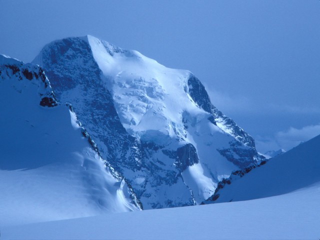
Mount Logan
Image via Wikimedia Commons (author and licence on the file page).

Mount Logan

Mountain · 5,959 m

Mount Logan is a mountain rising to 5,959 metres (19,551 ft) in Canada, in the North America region.

Mount Logan ( LOH-ghən) is the highest mountain in Canada, and the second-highest peak in North America after Denali. The mountain was named after Sir William Edmond Logan, a Canadian geologist and founder of the Geological Survey of Canada (GSC). Mount Logan is located within Kluane National Park and Reserve in southwestern Yukon, less than 40 kilometres (25 miles) north of the Yukon–Alaska border. Mount Logan is the source of the Hubbard and Logan glaciers. Although many shield volcanoes are much larger in size and mass, Mount Logan is believed to have the largest base circumference of any non-volcanic mountain on Earth, including a massif with eleven peaks over 5,000 metres (16,000 feet). Mount Logan is the 6th most topographically prominent peak on Earth.

Due to active tectonic uplifting, Mount Logan is still rising in height (approximately 0.35 millimetres (0.014 in) per year). Before 1992, the exact elevation of Mount Logan was unknown and measurements ranged from 5,959 to 6,050 metres (19,551 to 19,849 ft). In May 1992, a GSC expedition climbed Mount Logan and fixed the current height of 5,959 metres (19,551 ft) using GPS.

Adapted from Wikipedia: Mount Logan (CC BY-SA 4.0).

Elevation
5,959 m (19,551 ft)
Global rank
#44 of 641 indexed
Region
North America (#2)
Country
Canada
Coordinates
60.5798°, -140.4120°

Of the 641 named summits indexed in YearMaps, Mount Logan ranks #44 by elevation, below Aucanquilcha (6,176 m) and above Mount Kilimanjaro (5,895 m).

Ranges:
Wrangell Mountains (North America), Ogilvie Mountains (North America)
Neighbouring summits:
Mount Blackburn (4,996 m), Mount Fairweather (4,671 m), Chilkoot Pass (1,067 m)
Settlements below:
Whitehorse (293 km), Juneau (422 km), Anchorage (518 km)

View on the live map

More about Mount Logan

Mount Logan: Key Facts

Key facts about Mount Logan
Topographic prominence5,250 m
Mountain rangeSaint Elias Mountains

Facts from Wikidata Q120306 (CC0).
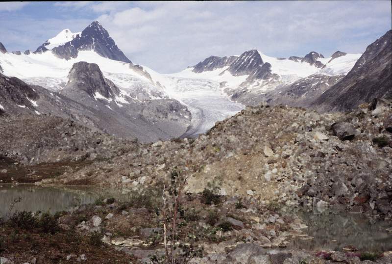
Mount Fairweather
Image via Wikimedia Commons (author and licence on the file page).

Mount Fairweather

Mountain · 4,671 m

Mount Fairweather is a mountain rising to 4,671 metres (15,325 ft) in Canada and the United States, in the North America region. The summit stands on the border between them.

Mount Fairweather is a mountain located 20 km (12 mi) east of the Pacific Ocean on the Canada–United States border. With an elevation of 4,653 metres (15,266 ft), it is the tallest mountain in British Columbia and the seventh-tallest mountain in both Alaska and the United States.

Fairweather is part of the Saint Elias Mountains and mostly lies within Glacier Bay National Park and Preserve, though the summit borders Tatshenshini-Alsek Provincial Park. After a failed attempt in 1926, Fairweather was first climbed in 1931 by Allen Carpé and Terris Moore.

Adapted from Wikipedia: Mount Fairweather (CC BY-SA 4.0).

Elevation
4,671 m (15,325 ft)
Global rank
#72 of 641 indexed
Region
North America (#6)
Countries
Canada, United States
Coordinates
58.9071°, -137.5266°

Of the 641 named summits indexed in YearMaps, Mount Fairweather ranks #72 by elevation, below Volcán Domuyo (4,709 m) and above Monte Rosa (4,634 m).

Ranges:
Cassiar Mountains (North America), Wrangell Mountains (North America)
Neighbouring summits:
Chilkoot Pass (1,067 m), Devils Paw (2,593 m), Mount Logan (5,959 m)
Settlements below:
Whitehorse (244 km), Prince George (1,061 km), Grand Prairie (1,202 km)

View on the live map

More about Mount Fairweather

Geography

Mount Fairweather is located right above Glacier Bay in the Fairweather Range of the Saint Elias Mountains. Mount Fairweather also marks the northwest extremity of the Alaska Panhandle.

Like many peaks in the St. Elias Mountains, Mount Fairweather has great vertical relief due to its dramatic rise from Glacier Bay. However, due to often inclement weather in the area, this effect is usually obscured with the clouds which often hides the summit from view.

Climbing history

No documented attempt at climbing the mountain had been successful until 1931.

1926 Allen Carpe, Andy Taylor and W.S. Ladd reached 2,890 m (9,480 ft) on the West Ridge, but were forced back due to a steep notch in the ridge that made ferrying supplies very difficult.

1930 Bradford Washburn also made an attempt on the West Ridge but traveling conditions forced a retreat at 2,040 metres (6,690 ft).

1958 Paddy Sherman and 7 other Canadians reached the summit via the SE Ridge on June 26, 1958.

1973 Southwest Ridge, Peter Metcalf, Henry Florschutz, Toby O'Brien and Lincoln Stoller. Summit reached on July 10, 1973.

1981 Southeast Ridge from the ocean, Gary Clark, Kim Grandfield, David Lunn. 19 days from Sea Otter Beach and back, Summit reached on May 31, bivouac in crevasse under summit.

Sections adapted from Wikipedia: Mount Fairweather (CC BY-SA 4.0).

Mount Fairweather: Key Facts

Key facts about Mount Fairweather
Topographic prominence3,951 m
Mountain rangeFairweather Range

Facts from Wikidata Q1544340 (CC0).

Mount Waddington
Image via Wikimedia Commons (author and licence on the file page).

Mount Waddington

Mountain · 4,019 m

Mount Waddington is a mountain rising to 4,019 metres (13,186 ft) in Canada, in the North America region.

Mount Waddington, once known as Mystery Mountain, is the highest peak in the Coast Mountains of British Columbia, Canada. Although it is lower than Mount Fairweather and Mount Quincy Adams, which straddle the United States border between Alaska and British Columbia, Mount Waddington is the highest peak that lies entirely within British Columbia. It and the subrange which surround it, known as the Waddington Range, stand at the heart of the Pacific Ranges, a remote and extremely rugged set of mountains and river valleys.

Although Mount Waddington is not located in the High Arctic, its elevation and maritime climate produce severe alpine conditions. The massif is known for steep relief, extensive glaciation and technically demanding mountaineering routes. Mount Waddington and its attendant peaks are known for some of the most serious expedition mountaineering challenges in North America.

Adapted from Wikipedia: Mount Waddington (CC BY-SA 4.0).

Elevation
4,019 m (13,186 ft)
Global rank
#125 of 641 indexed
Region
North America (#20)
Country
Canada
Coordinates
51.3724°, -125.2622°

Of the 641 named summits indexed in YearMaps, Mount Waddington ranks #125 by elevation, below Mount Lister (4,023 m) and above Lesatima (4,001 m).

Ranges:
Coast Mountains (North America), Cascade Range (North America)
Neighbouring summits:
Golden Hinde (2,195 m), Mount Baker (3,286 m), Mount Robson (3,954 m)
Settlements below:
Campbell River (151 km), Courtenay (189 km), Nanaimo (265 km)

View on the live map

More about Mount Waddington

Climate

The Waddington Range massif is known for fierce as well as unpredictable weather, located as it is at the brunt of the warm, wet winds that soak the British Columbia Coast, of which it is the highest point. Precipitation levels in the area of the peak are among the highest in the Coast Mountains. The peak has an ice cap climate (EF).

In 2010 and again in 2023, scientists successfully drilled ice cores at Combatant Col, the saddle between Mt. Waddington and Combatant Mountain, to obtain a climate and environmental record from the ice covering the last few hundred years. The 2023 core reached 219 m (719 ft) in depth, at or near the base of the ice.

Sections adapted from Wikipedia: Mount Waddington (CC BY-SA 4.0).

Mount Waddington: Key Facts

Key facts about Mount Waddington
Topographic prominence3,289 m
Mountain rangeWaddington Range

Facts from Wikidata Q1737059 (CC0).

Mount Robson
Image via Wikimedia Commons (author and licence on the file page).

Mount Robson

Mountain · 3,954 m

Mount Robson is a mountain rising to 3,954 metres (12,972 ft) in Canada, in the North America region.

Mount Robson is the most prominent mountain in North America's Rocky Mountain range; it is also the highest point in the Canadian Rockies.

The mountain is located entirely within Mount Robson Provincial Park of British Columbia, and is part of the Rainbow Range.

Mount Robson is the second highest peak entirely in British Columbia, behind Mount Waddington in the Coast Range.

The south face of Mount Robson is clearly visible from the Yellowhead Highway (Highway 16), and is commonly photographed along this route.

Mount Robson was likely named after Colin Robertson, who worked for both the North West Company and the Hudson's Bay Company at various times in the early 19th century, though there was confusion over the name as many assumed it to have been named for John Robson, an early premier of British Columbia.

The Texqa’kallt, a Secwepemc people and the earliest known inhabitants of the area, call it Yexyexéscen (striped rock), spelled in Dawson 1891 as Yuh-hai-has-kun, The Mountain of the Spiral Road.

Other unofficial names include Cloud Cap Mountain.

Adapted from Wikipedia: Mount Robson (CC BY-SA 4.0).

Elevation
3,954 m (12,972 ft)
Global rank
#131 of 641 indexed
Region
North America (#23)
Country
Canada
Coordinates
53.1105°, -119.1550°

Of the 641 named summits indexed in YearMaps, Mount Robson ranks #131 by elevation, below Tergun Bogd (3,957 m) and above Yu Shan (3,952 m).

Ranges:
Coast Mountains (North America), Cascade Range (North America)
Neighbouring summits:
Mount Sir Sandford (3,519 m), Mount Waddington (4,019 m), Mount Baker (3,286 m)
Settlements below:
Grand Prairie (230 km), Prince George (255 km), Kamloops (284 km)

View on the live map

More about Mount Robson

Geography and climate

Mount Robson boasts great vertical relief over the local terrain. From Kinney Lake, the south-west side of the mountain rises 2,975 m (9,760 ft) to the summit.

The north face of Mount Robson is heavily glaciated and 800 m (2,600 ft) of ice extends from the summit to the Berg Glacier.

The north face can be seen from Berg Lake, and reached by a 19 km (12 mi) hike. The lake is approximately 2 km long and lies at 1,646 m (5,400 ft) elevation. There are backcountry campgrounds at each end of the lake and a log shelter on its banks, named Hargreaves Shelter in honor of the Hargreaves family who operated the Mount Robson Ranch across the Fraser River from the mountain and who outfitted most of the early trips into Berg Lake. The Berg Glacier calves directly into the lake.

History

In 1893, 5 years after the expedition of A.P. Coleman to Athabasca Pass and the final settling of the mistaken elevations of Mount Hooker and Mount Brown, Mount Robson was first surveyed by James McEvoy and determined to be the highest peak in the Canadian Rockies.

The first documented ascent of Mount Robson, led by the young guide Conrad Kain, at its time the hardest ice face to be climbed on the continent, was achieved during the 1913 annual expedition organized by a large party of Alpine Club of Canada members who made use of the newly completed Grand Trunk Pacific railway to access the area.

Sections adapted from Wikipedia: Mount Robson (CC BY-SA 4.0).

Mount Robson: Key Facts

Key facts about Mount Robson
Topographic prominence2,829 m
Mountain rangeRainbow Range

Facts from Wikidata Q1161258 (CC0).

Mount Sir Sandford
Image via Wikimedia Commons (author and licence on the file page).

Mount Sir Sandford

Mountain · 3,519 m

Mount Sir Sandford is a mountain rising to 3,519 metres (11,545 ft) in Canada, in the North America region. From PeakBagger.com, with kind permission..

Mount Sir Sandford is the highest mountain of the Sir Sandford Range and the highest mountain in the Selkirk Mountains of southeastern British Columbia, Canada. It is the 12th highest peak in the province. The mountain was named after Sir Sandford Fleming, a railway engineer for the Canadian Pacific Railway.

The mountain was first summited in 1912 after several attempts in prior years by a party of four, led by Edward W. D. Holway and including Howard Palmer, Edward Feuz Jr. and Rudolph Aemmer.

Adapted from Wikipedia: Mount Sir Sandford (CC BY-SA 4.0).

Elevation
3,519 m (11,545 ft)
Global rank
#166 of 641 indexed
Region
North America (#32)
Country
Canada
Coordinates
51.6640°, -117.8859°

Of the 641 named summits indexed in YearMaps, Mount Sir Sandford ranks #166 by elevation, below Helan Shan (3,540 m) and above San Gorgonio Mt (3,505 m).

Ranges:
Coast Mountains (North America), Cascade Range (North America)
Neighbouring summits:
Mount Robson (3,954 m), Mount Baker (3,286 m), Mount Waddington (4,019 m)
Settlements below:
Kamloops (204 km), Kelowna (226 km), Penticton (269 km)

View on the live map

More about Mount Sir Sandford

Mount Sir Sandford: Key Facts

Key facts about Mount Sir Sandford
Topographic prominence2,707 m
Mountain rangeSelkirk Mountains

Facts from Wikidata Q3862020 (CC0).

Ulysses Mountain

Mountain · 3,024 m

Ulysses Mountain is a mountain rising to 3,024 metres (9,921 ft) in Canada, in the North America region. From PeakBagger.com, with kind permission..

Mount Ulysses, is the highest mountain in the Muskwa Ranges of the Northern Canadian Rockies in British Columbia. It and neighbouring peaks are part of a group of names drawing on the epic poem The Odyssey, in which here Ulysses wanders for 10 years before being able to return home to Ithaca.

Located north of the headwaters of the Akie River and to the south of Sikanni Chief Lake, its very high prominence of 2,289 m (7,510 ft) is relative to Grand Pacific Pass, with its parent peak being an unnamed summit in the Fairweather Range, near Mount Fairweather.

Adapted from Wikipedia: Mount Ulysses (CC BY-SA 4.0).

Elevation
3,024 m (9,921 ft)
Global rank
#226 of 641 indexed
Region
North America (#50)
Country
Canada
Coordinates
57.3500°, -124.0900°

Of the 641 named summits indexed in YearMaps, Ulysses Mountain ranks #226 by elevation, below Gunung Binaiya (3,027 m) and above Mount Seelig (3,022 m).

Ranges:
Cassiar Mountains (North America), Coast Mountains (North America)
Neighbouring summits:
Mount Nirvana (2,773 m), Mount Robson (3,954 m), Devils Paw (2,593 m)
Settlements below:
Prince George (391 km), Grand Prairie (407 km), Juneau (620 km)

View on the live map

More about Ulysses Mountain

Ulysses Mountain: Key Facts

Key facts about Ulysses Mountain
Topographic prominence2,289 m
Mountain rangeMuskwa Ranges

Facts from Wikidata Q3548164 (CC0).

Keele Peak
Image via Wikimedia Commons (author and licence on the file page).

Keele Peak

Mountain · 2,952 m

Keele Peak is a mountain rising to 2,952 metres (9,685 ft) in Canada, in the North America region. From PeakBagger.com, with kind permission..

Keele Peak, in Yukon, Canada is the highest peak in the Mackenzie Mountains at 2,952 metres (9,685 ft). With a prominence measure of 2,157 m (7,077 ft) it is one of Canada's most prominent peaks. It is located about 25 km from the Canol Road not far from the Northwest Territories border.

The peak was named for Joseph Keele, an explorer and geologist who had moved to Canada from his native Ireland.

Adapted from Wikipedia: Keele Peak (CC BY-SA 4.0).

Elevation
2,952 m (9,685 ft)
Global rank
#251 of 641 indexed
Region
North America (#54)
Country
Canada
Coordinates
63.4300°, -130.3200°

Of the 641 named summits indexed in YearMaps, Keele Peak ranks #251 by elevation, below Mount Apo (2,954 m) and above Pic de Coma Pedrosa (2,943 m).

Ranges:
Ogilvie Mountains (North America), Cassiar Mountains (North America)
Neighbouring summits:
Mount Nirvana (2,773 m), Mount Frank Rae (2,347 m), Chilkoot Pass (1,067 m)
Settlements below:
Whitehorse (389 km), Juneau (610 km), Fairbanks (855 km)

View on the live map

More about Keele Peak

Keele Peak: Key Facts

Key facts about Keele Peak
Topographic prominence2,177 m
Mountain rangeMackenzie Mountains

Facts from Wikidata Q1737731 (CC0).

Mount Nirvana
Image via Wikimedia Commons (author and licence on the file page).

Mount Nirvana

Mountain · 2,773 m

Mount Nirvana is a mountain rising to 2,773 metres (9,098 ft) in Canada, in the North America region.

Mount Nirvana, at 2,773 m (9,098 ft) is the unofficial name of the highest mountain in the Northwest Territories, Canada. The mountain is a part of Nahanni National Park Reserve, the largest national park in the Northwest Territories.

Adapted from Wikipedia: Mount Nirvana (CC BY-SA 4.0).

Elevation
2,773 m (9,098 ft)
Global rank
#278 of 641 indexed
Region
North America (#58)
Country
Canada
Coordinates
61.8689°, -127.6873°

Of the 641 named summits indexed in YearMaps, Mount Nirvana ranks #278 by elevation, below Cerro Grande (2,780 m) and above Mount Roraima (2,772 m).

Ranges:
Cassiar Mountains (North America), Ogilvie Mountains (North America)
Neighbouring summits:
Keele Peak (2,952 m), Chilkoot Pass (1,067 m), Devils Paw (2,593 m)
Settlements below:
Whitehorse (413 km), Juneau (543 km), Grand Prairie (905 km)

View on the live map

More about Mount Nirvana

History

Part of the Mackenzie Mountains, it was first climbed by Bill Buckingham and Lew Surdam in July 1965. Buckingham gave the mountain the moniker of "Mount Nirvana" at that time.

Before 2016, only five successful ascents were recorded, all with the assistance of helicopters or floatplane. In June 2016, Nirvana was climbed without assistance for the first time.

Sections adapted from Wikipedia: Mount Nirvana (CC BY-SA 4.0).

Mount Nirvana: Key Facts

Key facts about Mount Nirvana
Topographic prominence1,663 m
Mountain rangeMackenzie Mountains

Facts from Wikidata Q1500146 (CC0).

Devils Paw
Image via Wikimedia Commons (author and licence on the file page).

Devils Paw

Mountain · 2,593 m

Devils Paw is a mountain rising to 2,593 metres (8,507 ft) in Canada and the United States, in the North America region. The summit stands on the border between them.

Devils Paw (or Devil's Paw, or Boundary Peak 93) is the high point of the Juneau Icefield, on the Alaska–British Columbia border. It is a part of the Boundary Ranges of the Coast Mountains. It is notable for its steep rise above the low local terrain. Its height is sometimes given as 8,507 feet (2,593 m)[2].

Devils Paw is located on the northeast side of the Juneau Icefield, and its north slopes feed Tulsequah Lake and the Tulsequah Glacier. Its south slope forms the head of the picturesquely-named "Hades Highway", which is the eastern extremity of the Icefield.

To illustrate the steepness of the peak: the north face drops 7,000 ft (2,130 m) in approximately three miles (4.8 km), and the southeast side drops 8,000 ft (2,440 m) in about seven miles (11 km).

Adapted from Wikipedia: Devils Paw (CC BY-SA 4.0).

Elevation
2,593 m (8,507 ft)
Global rank
#318 of 641 indexed
Region
North America (#68)
Countries
Canada, United States
Coordinates
58.7414°, -133.8624°

Of the 641 named summits indexed in YearMaps, Devils Paw ranks #318 by elevation, below Ngoc Linh (2,598 m) and above Inyangani (2,592 m).

Ranges:
Cassiar Mountains (North America), Wrangell Mountains (North America)
Neighbouring summits:
Chilkoot Pass (1,067 m), Mount Fairweather (4,671 m), Mount Logan (5,959 m)
Settlements below:
Whitehorse (230 km), Prince George (868 km), Grand Prairie (993 km)

View on the live map

More about Devils Paw

Climate

Based on the Köppen climate classification, Devils Paw is located in a subpolar oceanic climate zone, with long, cold, snowy winters, and cool summers. Temperatures can drop below −20 °C with wind chill factors below −30 °C.

Sections adapted from Wikipedia: Devils Paw (CC BY-SA 4.0).

Devils Paw: Key Facts

Key facts about Devils Paw
Topographic prominence1,733 m
Mountain rangeBoundary Ranges

Facts from Wikidata Q5267436 (CC0).

Mount Frank Rae
Image via Wikimedia Commons (author and licence on the file page).

Mount Frank Rae

Mountain · 2,347 m

Mount Frank Rae is a mountain rising to 2,347 metres (7,700 ft) in Canada, in the North America region.

Mount Frank Rae (2,360 m) is the highest mountain of the Ogilvie Mountains in central Yukon, Canada, located 62 km (39 mi) northeast of Dawson City.

Adapted from Wikipedia: Mount Frank Rae (CC BY-SA 4.0).

Elevation
2,347 m (7,700 ft)
Global rank
#358 of 641 indexed
Region
North America (#72)
Country
Canada
Coordinates
64.4951°, -138.5388°

Of the 641 named summits indexed in YearMaps, Mount Frank Rae ranks #358 by elevation, below Pico Alto (2,351 m) and above Vulkan Alaid (2,339 m).

Ranges:
Ogilvie Mountains (North America), Wrangell Mountains (North America)
Neighbouring summits:
Mount Blackburn (4,996 m), Keele Peak (2,952 m), Mount Logan (5,959 m)
Settlements below:
Fairbanks (438 km), Whitehorse (456 km), Anchorage (680 km)

View on the live map

More about Mount Frank Rae

Mount Frank Rae: Key Facts

Key facts about Mount Frank Rae
Topographic prominence1,365 m
Mountain rangeOgilvie Mountains

Facts from Wikidata Q6920797 (CC0).

Golden Hinde
Image via Wikimedia Commons (author and licence on the file page).

Golden Hinde

Mountain · 2,195 m

Golden Hinde is a mountain rising to 2,195 metres (7,201 ft) in Canada, in the North America region.

The Golden Hinde is a mountain located in the Vancouver Island Ranges on Vancouver Island, British Columbia, Canada. At 2,195 metres (7,201 ft), it is the highest peak on the island. The peak is popular with experienced backcountry-climbers, having been first ascended in 1913. The mountain is made of basalt which is part of the Karmutsen Formation.

Adapted from Wikipedia: Golden Hinde (mountain) (CC BY-SA 4.0).

Elevation
2,195 m (7,201 ft)
Global rank
#384 of 641 indexed
Region
North America (#77)
Country
Canada
Coordinates
49.6765°, -125.7586°

Of the 641 named summits indexed in YearMaps, Golden Hinde ranks #384 by elevation, below Harney Pk (2,207 m) and above Gunung Tahan (2,190 m).

Ranges:
Coast Mountains (North America), Cascade Range (North America)
Neighbouring summits:
Mount Waddington (4,019 m), Mount Baker (3,286 m), Mount Rainier (4,392 m)
Settlements below:
Campbell River (53 km), Courtenay (55 km), Nanaimo (145 km)

View on the live map

More about Golden Hinde

Geography

The mountain is located near the geographic centre of Vancouver Island, as well as near the centre of 2,450 km2 (605,408 acres) Strathcona Provincial Park, at the head of the Wolf River and to the west of Buttle Lake, about 25 kilometres (16 mi) east of the community of Gold River.

Sections adapted from Wikipedia: Golden Hinde (mountain) (CC BY-SA 4.0).

Golden Hinde: Key Facts

Key facts about Golden Hinde
Topographic prominence2,195 m
Mountain rangeVancouver Island Ranges

Facts from Wikidata Q1633809 (CC0).

Mount Odin
Image via Wikimedia Commons (author and licence on the file page).

Mount Odin

Mountain · 2,143 m

Mount Odin is a mountain rising to 2,143 metres (7,031 ft) in Canada, in the North America region.

Mount Odin is a mountain in Qikiqtaaluk, Nunavut, Canada. It is located in Auyuittuq National Park along the Akshayuk Pass, 46 km (29 mi) north of Pangnirtung and south of Mount Asgard. Mount Odin is the highest mountain on Baffin Island.

Mount Odin is the highest mountain within the Baffin Mountains as well as the fifth-highest in the Arctic Cordillera. It has a topographic prominence of 2,147 m (7,044 ft), greater than any other mountain within the Baffin Mountains and on Baffin Island, making Odin the third-highest mountain in Nunavut by topographic prominence.

Comparing absolute peaks, Mount Odin is the fifth-highest in Nunavut. The higher points in Nunavut are: Barbeau Peak on Ellesmere Island (the highest point in Nunavut at 2,616 m), two unnamed peaks on Ellesmere Island, (one at 2,347 m located at 78° 48' N, 79° 34' W and one at

2,201 m located at 80° 17' N, 75° 05' W) and Outlook Peak on Axel Heiberg Island, which at 2210 m is just 63 m higher than Mount Odin.

The mountain is named after Odin, the chief of the gods in Norse mythology and Norse paganism.

Adapted from Wikipedia: Mount Odin (CC BY-SA 4.0).

Elevation
2,143 m (7,031 ft)
Global rank
#392 of 641 indexed
Region
North America (#79)
Subregion
Arctic Archipelago
Country
Canada
Coordinates
66.5647°, -65.4381°

Of the 641 named summits indexed in YearMaps, Mount Odin ranks #392 by elevation, below Mount Vsevidof (2,149 m) and above Nanfengmian (2,140 m).

Ranges:
Ogilvie Mountains (North America), Cassiar Mountains (North America)
Neighbouring summits:
Mount Caubvick (1,652 m), Mount Forel (3,360 m), Gunnbjørn Fjeld (3,694 m)
Settlements below:
Sept-Îles (1,808 km), Reykjavík (1,992 km), Corner Brook (2,005 km)

View on the live map

More about Mount Odin

Mount Odin: Key Facts

Key facts about Mount Odin
Topographic prominence2,147 m
Mountain rangeBaffin Mountains

Facts from Wikidata Q1439530 (CC0).

Mount Caubvick
Image via Wikimedia Commons (author and licence on the file page).

Mount Caubvick

Mountain · 1,652 m

Mount Caubvick is a mountain rising to 1,652 metres (5,420 ft) in Canada, in the North America region.

Mount Caubvick (1646 m, known as Mont D'Iberville in Quebec) is a mountain located in Canada on the border between Labrador and Quebec in the Selamiut Range of the Torngat Mountains. It is the highest point in Quebec, Newfoundland and Labrador, and mainland Canada east of the Rockies. The mountain contains a massive peak that rises sharply from nearby sea level. Craggy ridges, steep cirques and glaciers are prominent features of the peak.

The alp was named Mont D'Iberville by the Quebec government in 1971. It remained nameless on the Labrador side for several years; it became known unofficially as L1, L for Labrador and 1 for highest. In 1981, at the suggestion of Dr. Peter Neary, the provincial government named the mountain after Caubvick, one of the five Inuit who accompanied George Cartwright to England in 1772.

Mount Caubvick also hosts the highest point in both the province of Newfoundland and Labrador and Quebec, although the summit itself lies about 10 metres (33 ft) northeast of the Quebec provincial border and is entirely within Labrador.

Adapted from Wikipedia: Mount Caubvick (CC BY-SA 4.0).

Elevation
1,652 m (5,420 ft)
Global rank
#470 of 641 indexed
Region
North America (#92)
Country
Canada
Coordinates
58.8969°, -63.7249°

Of the 641 named summits indexed in YearMaps, Mount Caubvick ranks #470 by elevation, below Hunsberge (1,655 m) and above Cerro de Los Inocentes (1,650 m).

Ranges:
Blue Ridge (North America), Black Hills (North America)
Neighbouring summits:
Mont Yapeitso (1,128 m), Mount Odin (2,143 m), Mont Jacques-Cartier (1,268 m)
Settlements below:
Sept-Îles (969 km), Corner Brook (1,168 km), Rimouski (1,205 km)

View on the live map

More about Mount Caubvick

Mount Caubvick: Key Facts

Key facts about Mount Caubvick
Topographic prominence1,367 m
Mountain rangeSelamiut Range

Facts from Wikidata Q3321804 (CC0).

Mont Jacques-Cartier
Image via Wikimedia Commons (author and licence on the file page).

Mont Jacques-Cartier

Mountain · 1,268 m

Mont Jacques-Cartier is a mountain rising to 1,268 metres (4,160 ft) in Canada, in the North America region.

Mount Jacques-Cartier (French: Mont Jacques-Cartier, pronounced [mɔ̃ ʒak kaʁtje]) is a mountain in the Chic-Choc Mountains range in eastern Quebec, Canada. At 1,268 m (4,160 ft), it is the tallest mountain in southern Quebec, the highest mountain in the Canadian Appalachians, and the most prominent mountain in Quebec. The mountain is named after Jacques Cartier, the French maritime explorer of North America.

Located in the Gaspé Peninsula, the mountain is protected within a Quebec provincial park called Gaspésie National Park, and is host to the last remaining population of woodland caribou south of the Saint Lawrence River. The summit can be accessed by a hiking trail.

Adapted from Wikipedia: Mount Jacques-Cartier (CC BY-SA 4.0).

Elevation
1,268 m (4,160 ft)
Global rank
#522 of 641 indexed
Region
North America (#105)
Country
Canada
Coordinates
48.9967°, -65.9562°

Of the 641 named summits indexed in YearMaps, Mont Jacques-Cartier ranks #522 by elevation, below Mount Marcy (1,269 m) and above Hongtu Zhang (1,265 m).

Ranges:
Blue Ridge (North America), Ouachita Mountains (North America)
Neighbouring summits:
Mount Katahdin (1,606 m), Mont Yapeitso (1,128 m), Mount Washington (1,917 m)
Settlements below:
Sept-Îles (150 km), Rimouski (198 km), Moncton (336 km)

View on the live map

More about Mont Jacques-Cartier

Mont Jacques-Cartier: Key Facts

Key facts about Mont Jacques-Cartier
Mountain rangeMcGerrigle Mountains

Facts from Wikidata Q1628389 (CC0).

Mount Moresby
Image via Wikimedia Commons (author and licence on the file page).

Mount Moresby

Mountain · 1,164 m

Mount Moresby is a mountain rising to 1,164 metres (3,819 ft) in Canada, in the North America region.

Mount Moresby is the highest mountain (1,164 metres (3,819 ft)) of the Queen Charlotte Mountains, located 26 kilometres (16 mi) south of Daajing Giids (formerly Queen Charlotte) on Moresby Island in British Columbia, Canada.

The mountain is located around 53 degrees N on Haida Gwaii (formerly the Queen Charlotte Islands).

Adapted from Wikipedia: Mount Moresby (CC BY-SA 4.0).

Elevation
1,164 m (3,819 ft)
Global rank
#537 of 641 indexed
Region
North America (#109)
Country
Canada
Coordinates
53.0260°, -132.0828°

Of the 641 named summits indexed in YearMaps, Mount Moresby ranks #537 by elevation, below Saint Mary Peak (1,171 m) and above Seraya (1,162 m).

Ranges:
Coast Mountains (North America), Cassiar Mountains (North America)
Neighbouring summits:
Mount Waddington (4,019 m), Golden Hinde (2,195 m), Devils Paw (2,593 m)
Settlements below:
Campbell River (579 km), Juneau (606 km), Courtenay (616 km)

View on the live map

More about Mount Moresby

Geography

Mount Moresby is located on Moresby Island, which is the more southern of the two main islands of Haida Gwaii. There are two lakes near it.

Mount Moresby has a wide range of climate sub-types and environments. The flatland around the mountain is at the seaside and have abundant birdlife (they are within a key migratory route). The lower slopes boast wind-sculpted cedar, pine and western hemlock forests, grading to sub-alpine moorland with stunted mountain hemlocks (and a subpolar oceanic climate) on the higher slopes near the summit.

The mountain and the sounds around it are home to abundant wildlife, such as black bears, whales, orcas, sea lions, and hundreds of thousands of seabirds.

Sections adapted from Wikipedia: Mount Moresby (CC BY-SA 4.0).

Mount Moresby: Key Facts

Key facts about Mount Moresby
Topographic prominence1,164 m
Mountain rangeQueen Charlotte Mountains

Facts from Wikidata Q6922253 (CC0).

Mont Yapeitso

Mountain · 1,128 m

Mont Yapeitso is a mountain rising to 1,128 metres (3,701 ft) in Canada, in the North America region.

Mount Yapeitso is located in the unorganized territory of Mont-Valin, in the Le Fjord-du-Saguenay Regional County Municipality, in the administrative region of Saguenay–Lac-Saint-Jean, in Quebec, in Canada.

Adapted from Wikipedia: Mount Yapeitso (CC BY-SA 4.0).

Elevation
1,128 m (3,701 ft)
Global rank
#544 of 641 indexed
Region
North America (#111)
Country
Canada
Coordinates
52.3149°, -70.4565°

Of the 641 named summits indexed in YearMaps, Mont Yapeitso ranks #544 by elevation, below Brocken (1,141 m) and above Sakurajima (1,117 m).

Ranges:
Blue Ridge (North America), Black Hills (North America)
Neighbouring summits:
Mont Jacques-Cartier (1,268 m), Mount Katahdin (1,606 m), Mont Tremblant (968 m)
Settlements below:
Sept-Îles (361 km), Chicoutimi (434 km), Rimouski (453 km)

View on the live map

More about Mont Yapeitso

Geography

Culminating at 1,128 metres (3,701 ft) above sea level, Mount Yapeitso stands on the south-eastern flank of the Otish Mountains, about 230 km west of Fermont, located in the Côte-Nord region. It straddles the boundaries of the municipality of Eeyou Istchee James Bay and the MRC of Le Fjord-du-Saguenay Regional County Municipality.

Sections adapted from Wikipedia: Mount Yapeitso (CC BY-SA 4.0).

Mont Yapeitso: Key Facts

Key facts about Mont Yapeitso
Mountain rangeOtish Mountains

Facts from Wikidata Q17635322 (CC0).

Chilkoot Pass
Image via Wikimedia Commons (author and licence on the file page).

Chilkoot Pass

Pass · 1,067 m

Chilkoot Pass is a pass rising to 1,067 metres (3,501 ft) in Canada and the United States, in the North America region. The summit stands on the border between them.

Chilkoot Pass (el. 3,759 feet or 1,146 metres) is a high mountain pass through the Boundary Ranges of the Coast Mountains in the U.S. state of Alaska and British Columbia, Canada. It is the highest point along the Chilkoot Trail, which leads from Dyea, Alaska, to Bennett Lake, British Columbia. The Chilkoot Trail was long a route used by the Tlingit for trade.

During the Klondike Gold Rush of the late 19th century, it was used by prospectors and packers to get through the mountains. During the gold rush, three aerial tramways and several surface hoists were constructed and operated briefly over the pass. When the White Pass and Yukon Route railroad was built in neighboring White Pass, the Chilkoot Pass route fell out of favor with miners.

The Pass and the Trail are administered by the national park services of the U.S. and Canada. On the B.C. side, it is administered as Chilkoot Trail National Historic Site. On the Alaska side, it is one unit of the Klondike Gold Rush National Historical Park. In the summer of 1998, the Site and the Park united to form Klondike Gold Rush International Historical Park.

Adapted from Wikipedia: Chilkoot Pass (CC BY-SA 4.0).

Elevation
1,067 m (3,501 ft)
Global rank
#551 of 641 indexed
Region
North America (#112)
Countries
Canada, United States
Coordinates
59.7037°, -135.2951°

Of the 641 named summits indexed in YearMaps, Chilkoot Pass ranks #551 by elevation, below Khyber Pass (1,070 m) and above Pico El Yunque (1,055 m).

Ranges:
Cassiar Mountains (North America), Wrangell Mountains (North America)
Neighbouring summits:
Devils Paw (2,593 m), Mount Fairweather (4,671 m), Mount Logan (5,959 m)
Settlements below:
Whitehorse (113 km), Prince George (995 km), Grand Prairie (1,105 km)

View on the live map

More about Chilkoot Pass

Background

The Klondike Gold Rush began on August 16, 1896, on Bonanza Creek, near Dawson, about 50 miles (80 kilometers) east of the Alaskan border.

The Chilkoot Trail is reported to have spanned between 28 and 33 miles (45 and 53 km) from sea level at Dyea, Alaska, to Lake Bennett, British Columbia, elevation 2602 ft. (642 m).

The Chilkoot Pass was an important milestone that travellers had to conquer in order to reach the Klondike. The travellers were called 'stampeders', and some had earlier sought the riches of the 1889 gold rush in Alaska.

To be allowed to enter the Klondike and take part in the gold rush, Canadian officials required that stampeders take one ton of provisions with them, to try to ensure they were prepared to survive on the frontier.

Sections adapted from Wikipedia: Chilkoot Pass (CC BY-SA 4.0).

Chilkoot Pass: Key Facts

Key facts about Chilkoot Pass
Mountain rangeBoundary Ranges

Facts from Wikidata Q1072958 (CC0).

Mont Tremblant
Image via Wikimedia Commons (author and licence on the file page).

Mont Tremblant

Mountain · 968 m

Mont Tremblant is a mountain rising to 968 metres (3,176 ft) in Canada, in the North America region.

Mont Tremblant (French pronunciation: [mɔ̃ tʁɑ̃blɑ̃]) is a mountain of the Laurentian Mountains, reaching an altitude of 932 metres. It is located in the province of Quebec, Canada, in Mont-Tremblant National Park, about 15 km northeast of the town of Mont-Tremblant and east of Lake Tremblant in the Laurentides region north of Montreal. It is one of the tallest peaks of the Laurentian range. It hosts the Mont Tremblant Resort.

The Algonquin people called the mountain Manitonga Soutana ("Mountain of Spirits"), and described the mountain as emitting rumblings and swaying under their feet. This gave rise to the French name montagne Tremblante or mont Tremblant, literally "trembling mountain."

The first resort was founded on the mountain slopes in 1939.

Adapted from Wikipedia: Mont Tremblant (CC BY-SA 4.0).

Elevation
968 m (3,176 ft)
Global rank
#561 of 641 indexed
Region
North America (#114)
Country
Canada
Coordinates
46.2587°, -74.5732°

Of the 641 named summits indexed in YearMaps, Mont Tremblant ranks #561 by elevation, below Mont Agou (968 m) and above Lata Mountain (966 m).

Ranges:
Blue Ridge (North America), Ouachita Mountains (North America)
Neighbouring summits:
Mount Marcy (1,269 m), Mount Washington (1,917 m), Mount Katahdin (1,606 m)
Settlements below:
St.-Jerome (70 km), Joliette (91 km), Montréal (114 km)

View on the live map

More about Mont Tremblant

Mont Tremblant: Key Facts

Key facts about Mont Tremblant
Mountain rangeMassif du mont Tremblant

Facts from Wikidata Q3322162 (CC0).

Ishpatina Ridge
Image via Wikimedia Commons (author and licence on the file page).

Ishpatina Ridge

Mountain · 693 m

Ishpatina Ridge is a mountain rising to 693 metres (2,274 ft) in Canada, in the North America region.

Ishpatina Ridge is the highest point of land in the Canadian province of Ontario, at an estimated 693 m (2,274 ft) above sea level. Ishpatina Ridge rises approximately 300 m (984 ft) above the immediate area. It was only truly recognized as Ontario's highest point after topographical mapping by the Government of Canada revealed this fact in the 1970s. Before then, the more popular Maple Mountain was thought to be higher.

The ridge lies in Lady Evelyn-Smoothwater Provincial Park. Due to its remote location, Ishpatina Ridge is a challenge to reach. The closest major highway, Highway 560, is more than 30 km north. There are a few logging roads and trails in the remote area, but they are difficult to travel in poor weather. The most popular approach route to Ishpatina is by canoe/portage via a logging road to the south out of the town of Capreol north of Sudbury. While a northern route exists (out of Gowganda, the nearest community), there are numerous portages making it particularly onerous. This route has traditionally been used for a winter-time approach by ski/snowshoe.

Adapted from Wikipedia: Ishpatina Ridge (CC BY-SA 4.0).

Elevation
693 m (2,274 ft)
Global rank
#599 of 641 indexed
Region
North America (#125)
Country
Canada
Coordinates
47.3363°, -80.7577°

Of the 641 named summits indexed in YearMaps, Ishpatina Ridge ranks #599 by elevation, below Signal de Botrange (694 m) and above Benara (660 m).

Ranges:
Blue Ridge (North America), Ouachita Mountains (North America)
Neighbouring summits:
Mont Tremblant (968 m), Mount Marcy (1,269 m), Mount Washington (1,917 m)
Settlements below:
Sudbury (94 km), Timmins (133 km), North Bay (152 km)

View on the live map

More about Ishpatina Ridge

Ishpatina Ridge: Key Facts

Key facts about Ishpatina Ridge
Topographic prominence394 m
Mountain rangeCanadian Shield

Facts from Wikidata Q1514665 (CC0).

More on Canada

Quick Answers

What is the highest mountain in Canada?
Mount Logan, at 5,959 m. Mount Fairweather is second at 4,671 m. Rankings cover the mountains indexed in YearMaps.
How many mountains are there in Canada?
YearMaps lists 31 mountains for Canada. This is the number mapped in the atlas, not an official national count.