Skip to content
YearMaps
Russia · Landforms

Mountain Ranges, Deserts and Landforms of Russia

Asia is the largest of the 66 mountain ranges, deserts and other landforms recorded for Russia, at 46.28M km², ahead of Europe at 11.24M km². The full list follows.

How this list is built: Ranked by mapped area. Covers mountain ranges, deserts, plateaus, named glaciers, plains, basins, peninsulas and capes. One that crosses a border is listed under every country it lies in, with the area of the whole feature. It covers the mountain ranges, deserts and other landforms indexed in YearMaps, drawn from open geospatial data, and is not an exhaustive national register.

Landforms Listed
66
Top Ranked
46.28M km²
Asia
Second
11.24M km²
Europe
Profiled Below
37
Photo, encyclopedia text and figures
Mountain Ranges, Deserts and Landforms of Russia
#NameArea
1Asia46.28M km²
2Europe11.24M km²
3Siberia8.73M km²
4Central Siberian Plateau2.18M km²
5Northern European Plain774,604 km²
6Altay Mountains404,274 km²
7Kamchatka Peninsula304,865 km²
8Kazakh Steppe272,208 km²
9Mongolian Plateau249,115 km²
10Karelia200,349 km²
11Stanovoy Upland197,390 km²
12EASTERN SAYAN Mountains192,999 km²
13Sikhote-Alin’ Range167,514 km²
14Verkhoyansk Range167,254 km²
15Central Russian Upland165,976 km²
16Taymyr Peninsula133,273 km²
17Yamal Peninsula116,075 km²
18Kolyma Lowland111,820 km²
19Hentiyn Mountains111,707 km²
20Pontic Steppe102,190 km²
21Chukchi Peninsula98,448 km²
22Western Siberian Plain93,486 km²
23Kola Peninsula89,704 km²
24Putorana Plateau80,463 km²
25Lesser Khingan Range80,374 km²
26Koryak Range71,290 km²
27Cherskiy Range65,480 km²
28Sredinnyy Range63,699 km²
29Aldan Upland55,408 km²
30Kolyma Range54,560 km²
31Western Sayan Mountains53,108 km²
32Gyda Peninsula49,006 km²
33Stavropol’ Plateau41,370 km²
34Lapland37,144 km²
35Momskiy Mountains34,748 km²
36Suntar-Khayata Range34,012 km²
37Taz Peninsula33,291 km²
38Crimea25,759 km²
39Lena Delta23,024 km²
40Taygonos Peninsula21,242 km²
41Abakanskiy Range17,490 km²
42Vychegda Lowland16,182 km²
43Yam Alin’ Range16,109 km²
44Bureinskiy Range14,223 km²
45Volga Upland10,157 km²
46Bol’shezemel’skaya Tundra9,619 km²
47Caspian Depression7,242 km²
48Tannu-Ola Range5,703 km²
49Academy of Sciences Ice Cap5,673 km²
50Okhotsk-Kolyma Upland4,601 km²
51Karpinsky Ice Cap4,253 km²
52Stanovoy Range3,925 km²
53P’yagina Peninsula3,136 km²
54Koni Peninsula2,212 km²
55Cape Zhelaniya2,150 km²
56North Siberian Lowland1,822 km²
57University Ice Cap1,773 km²
58Volga Delta1,630 km²
59Kanin Peninsula1,299 km²
60Rusanov Ice Cap1,020 km²
61Albanov Ice Cap391 km²
62Vavilov Ice Cap360 km²
63Ural Mountains316 km²
64Chukchi Range238 km²
65Cape Chelyuskin125 km²
66Dzhugdzhur Range48 km²

The Landforms of Russia in Detail

The 37 mountain ranges, deserts and other landforms above that have an encyclopedia article, in the same order, each with its photograph, figures and the places around it.

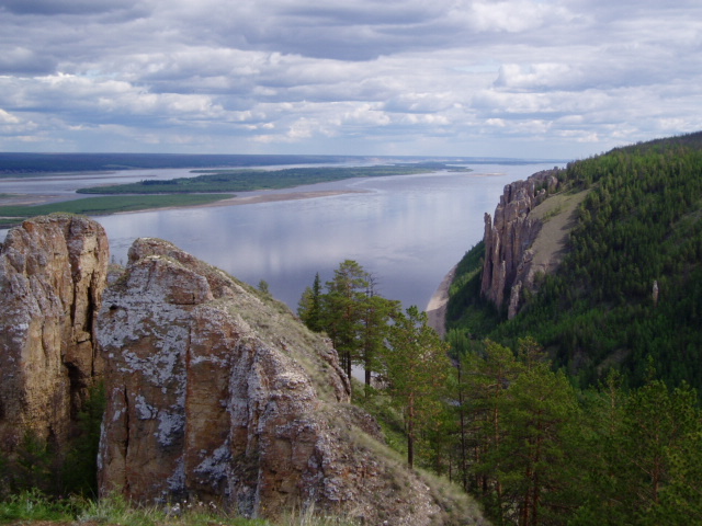
Siberia
Image via Wikimedia Commons (author and licence on the file page).

Siberia

Geoarea · 8.73M km²

Siberia is a geoarea in Asia, covering an estimated 8.73M km². It is the 8th-largest of the 231 landforms with a mapped extent in YearMaps.

Siberia ( sy-BEER-ee-ə; Russian: Сибирь, romanized: Sibir', IPA: [sʲɪˈbʲirʲ] ) is an extensive geographical region comprising all of North Asia, from the Ural Mountains in the west (with the Ural River usually forming the southernmost portion of its western boundary) to the Pacific Ocean in the east. It has formed a part of the sovereign territory of Russia since the lengthy conquest of Siberia, which began with the fall of the Khanate of Sibir in 1582 and concluded with the annexation of Chukotka in 1778. Siberia is vast and sparsely populated, covering an area of over 13.1 million square kilometres (5,100,000 mi2) – about three-quarters of Russia's total area, but home to roughly a quarter of Russia's population. Novosibirsk, Krasnoyarsk, and Omsk are its largest cities.

Because Siberia is a geographic and historic concept and not a political entity, there is no single precise definition of its territorial borders. It is further defined as stretching from the territories within the Arctic Circle in the north to the northern borders of Kazakhstan, Mongolia, and China in the south, although the hills of north-central Kazakhstan are also commonly included.

Adapted from Wikipedia: Siberia (CC BY-SA 4.0).

Feature class
Geoarea
Mapped extent
8.73M km²
Size rank
#8 of 231 landforms
Region
Asia
Coordinates
60.7859°, 79.7050°
Summits:
Gora Narodnaya (1,895 m), Belukha (4,506 m), Tavan Bogd Uul (4,374 m)
Ranges:
Ural Mountains (Europe), Altay Mountains (Asia)
Settlements:
Strezhevoy (116 km), Nizhenvartovsk (170 km), Megion (197 km)

View on the live map

More about Siberia

Geography

Siberia spans an area of 13.1 million square kilometres (5,100,000 mi2), covering most of Russia's total territory and almost 9% of Earth's land surface (148,940,000 km2, 57,510,000 sq mi). It geographically falls in Asia but is culturally and politically considered European, since it is a part of Russia. Major geographical zones include the West Siberian Plain and the Central Siberian Plateau.

Eastern and central Sakha comprises numerous north–south mountain ranges of various ages. These mountains rise to almost 3,000 metres (9,800 ft), but above a few hundred metres they are almost completely devoid of vegetation. The Verkhoyansk Range was extensively glaciated in the Pleistocene, but the climate was too dry for glaciation to extend to low elevations.

History

Siberia in Paleozoic times formed the continent of Siberia/Angaraland, which fused to Euramerica during the Late Carboniferous, as part of the formation of Pangea. The Siberian Traps were formed by one of the largest-known volcanic events of the last 251 million years of Earth's geological history. Their activity continued for a million years, and some scientists consider it a possible cause of the "Great Dying" about 250 million years ago, estimated to have killed 90% of species existing at the time.

The region has paleontological significance, as it contains bodies of prehistoric animals from the Pleistocene Epoch, preserved in ice or permafrost.

Economy

Novosibirsk is the most important city for the Siberian economy; with an extra boost since 2000 when it was designated a regional center for the executive bureaucracy (Siberian Federal District). Russia's largest oil refinery is the Omsk Refinery.

Siberia is extraordinarily rich in minerals, containing ores of almost all economically valuable metals. It has some of the world's largest deposits of nickel, gold, lead, coal, molybdenum, gypsum, diamonds, diopside, silver and zinc, as well as extensive unexploited resources of oil and natural gas. Around 70% of Russia's developed oil fields are in the Khanty-Mansiysk region. Russia contains about 40% of the world's known resources of nickel at the Norilsk deposit in Siberia. Norilsk Nickel is the world's largest nickel and palladium producer.

Sections adapted from Wikipedia: Siberia (CC BY-SA 4.0).

Siberia: Key Facts

Key facts about Siberia
Area13,488,500 km²
OnArctic Ocean, Pacific Ocean

Facts from Wikidata Q5428 (CC0).

Central Siberian Plateau
Image via Wikimedia Commons (author and licence on the file page).

Central Siberian Plateau

Plateau · 2.18M km²

Central Siberian Plateau is a plateau in Asia, covering an estimated 2.18M km². It is the 2nd-largest of the 69 plateaus with a mapped extent in YearMaps.

The Central Siberian Plateau (Russian: Среднесибирское плоскогорье, romanized: Srednesibirskoye ploskogorye; Yakut: Орто Сибиир хаптал хайалаах сирэ, romanized: Orto Sibîr xaptal xayalâx sire) is a vast mountainous area in Siberia, one of the Great Russian Regions.

Adapted from Wikipedia: Central Siberian Plateau (CC BY-SA 4.0).

Feature class
Plateau
Mapped extent
2.18M km²
Size rank
#2 of 69 plateaus
Region
Asia
Coordinates
64.3392°, 114.2192°
Summits:
Pik BAM (3,072 m), Gora Chen (2,690 m), Gora Munku-Sardyk (3,491 m)
Ranges:
Verkhoyansk Range (Asia), Cherskiy Range (Asia)
Settlements:
Mirnyy (200 km), Lensk (404 km), Yakutsk (817 km)

View on the live map

More about Central Siberian Plateau

Geography

The plateau occupies a great part of central Siberia between the Yenisei and Lena rivers. It is located in the Siberian Platform and extends over an area of 3,500,000 km2 (1,400,000 sq mi), between the Yenisei in the west and the Central Yakutian Lowland in the east. To the south, it is bound by the Altai Mountains, Salair Ridge, Kuznetsk Alatau, Eastern and Western Sayan Mountains and other mountains of Tuva, as well as the North Baikal Highlands and Baikal Mountains. To the north of the plateau lies the North Siberian Lowland, and to the east the plateau gives way to the Central Yakutian Lowland and the Lena Plateau.

The surface of the Central Siberian Plateau is characterized by the alternation of wide plateaus and ridges, some of the latter sharply jagged.

Climate

The climate is continental with short warm summers and long and severely cold winters. Most of the territory is covered with conifer forests (larch is especially abundant). The plateau's major river is the Lower Tunguska. Known geologically as the Siberian Traps, mineral resources here are very rich and include coal, iron ore, gold, platinum, diamonds and natural gas.

Sections adapted from Wikipedia: Central Siberian Plateau (CC BY-SA 4.0).

Central Siberian Plateau: Key Facts

Key facts about Central Siberian Plateau
Area3,500,000 km²
Elevation1,701 m
Highest pointMount Kamen

Facts from Wikidata Q155197 (CC0).

Altay Mountains
Image via Wikimedia Commons (author and licence on the file page).

Altay Mountains

Range/mtn · 404,274 km²

Altay Mountains is a range/mtn in Asia, covering an estimated 404,274 km². It extends across Mongolia, Russia, China and Kazakhstan. It is the 7th-largest of the 216 mountain ranges with a mapped extent in YearMaps.

The Altai Mountains ( ahl-TY) are a mountain range in Central Asia, where Russia, China, Mongolia, and Kazakhstan converge, and where the rivers Irtysh and Ob have their headwaters. The highest summit of the range is Belukha, whose summit reaches 4,506 m (14,783 ft) above sea level. The massif merges with the Sayan Mountains in the northeast, and gradually becomes lower in the southeast, where it merges into the high plateau of the Gobi Desert. In the southwest, it is separated from the higher Tian Shan range by the Junggar Basin. It spans from about 45° to 52° N and from about 84° to 99° E.

The region is inhabited by a sparse but ethnically diverse population, including Turkic peoples, Mongols, and Volga Germans, though predominantly represented by indigenous ethnic minorities of semi-nomadic people. The local economy is based on bovine, sheep, horse husbandry, hunting, agriculture, forestry, and mining. The now discredited Altaic language family takes its name from this mountain range.

Adapted from Wikipedia: Altai Mountains (CC BY-SA 4.0).

Feature class
Range/mtn
Mapped extent
404,274 km²
Size rank
#7 of 216 mountain ranges
Region
Asia
Countries
Mongolia, Russia, China, Kazakhstan
Coordinates
49.8171°, 85.9828°
Summits:
Belukha (4,506 m), Tavan Bogd Uul (4,374 m), Gora Munku-Sardyk (3,491 m)
Adjacent ranges:
Tannu-Ola Range (Asia), Borohoro Mountains (Asia)
Settlements:
Gorno Altaysk (138 km), Biysk (208 km), Tashtagol (268 km)

View on the live map

More about Altay Mountains

Geography

The Altai Mountains are a system of remote mountains in central Asia that cover an area of 845,000 km2 (326,000 sq mi). The mountains stretch for 2,525 km (1,569 mi) from northwest to southeast.

In the north of the region is the Sailughem Mountains, also known as Kolyvan Altai, which stretch northeast from 49° N and 86° E towards the western extremity of the Sayan Mountains in 51° 60' N and 89° E. Their mean elevation is 1,500–1,750 m (4,920–5,740 ft). The snow-line runs at 2,000 m (6,600 ft) on the northern side and at 2,400 m (7,900 ft) on the southern, and above it the peaks rise some 1,000 m (3,300 ft) higher.

Geology

The Siberian Altai represents the northernmost region affected by the tectonic collision of India into Asia. Extensive fault systems run through the area, including the Kurai fault zone and the recently identified Tashanta fault zone. These fault systems are typically thrusts or right lateral strike-slip faults, some of which are tectonically active. Rock types in the mountains are typically granites and metamorphic schists, and some are highly sheared near to fault zones.

Geologist Victor R. Baker "has discovered past cataclysmic floods in the Altai Mountains of Siberia" from "an even larger glacial lake" than Lake Missoula, which was once thought to have been "the largest ice-dammed lake in the world".

History

The Altai mountains have retained a remarkably stable climate, changing little since the last ice age. In addition the mix of mammals has remained largely the same, with a few exceptions such as extinct mammoths, making it one of the few places on Earth to retain an ice age fauna. Genetic analysis in 2026 also determined that the Altai region served as a likely primary refugium for the woolly rhinoceros, which had originated during the Penultimate Glacial Period, during the warmer period of the Last Interglacial.

The Altai mountains were home to the Denisovan branch of hominids who were contemporaries of Neanderthals and of Homo sapiens (modern humans), descended from Hominids who reached Asia earlier than modern humans.

Sections adapted from Wikipedia: Altai Mountains (CC BY-SA 4.0).

Altay Mountains: Key Facts

Key facts about Altay Mountains
Length2,000 km
Highest pointBelukha Mountain

Facts from Wikidata Q5955 (CC0).

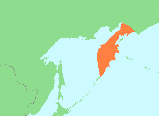
Kamchatka Peninsula
Image via Wikimedia Commons (author and licence on the file page).

Kamchatka Peninsula

Pen/cape · 304,865 km²

Kamchatka Peninsula is a pen/cape in Asia, covering an estimated 304,865 km².

The Kamchatka Peninsula is a 1,250-kilometre-long (777 mi) peninsula in the Russian Far East, with an area of about 270,000 km2 (100,000 sq mi). The Sea of Okhotsk bounds the peninsula's western coastline, immediately offshore of the peninsula and below the Bering Sea runs the 9,600-metre-deep (31,496 ft) Kuril–Kamchatka Trench. Its eastern coastline is the Bering Sea, part of the Pacific Ocean.

The Kamchatka Peninsula, the Commander Islands, and Karaginsky Island constitute Kamchatka Krai of the Russian Federation. The majority of the 322,079 inhabitants are ethnic Russians, with about 13,000 being Koryaks (2014). More than half of the population lives in Petropavlovsk-Kamchatsky (179,526 in 2010) and nearby Yelizovo (38,980). The Kamchatka Peninsula contains the volcanoes of Kamchatka, a UNESCO World Heritage Site, that form part of the Ring of Fire.

Adapted from Wikipedia: Kamchatka Peninsula (CC BY-SA 4.0).

Feature class
Pen/cape
Mapped extent
304,865 km²
Size rank
#32 of 231 landforms
Region
Asia
Coordinates
55.2861°, 160.3332°
Summits:
Klyuchevskaya Sopka (4,750 m), Koryakskaya Sopka (3,456 m), Gora Khuvkhoitun (2,616 m)
Ranges:
Kolyma Range (Asia), Suntar-Khayata Range (Asia)
Settlements:
Petropavlovsk Kamchatskiy (271 km), Magadan (742 km), Palatka (774 km)

View on the live map

More about Kamchatka Peninsula

Geography

Politically, the peninsula forms part of Kamchatka Krai. The southern tip is called Cape Lopatka. (Lopatka is Russian for spade.) The circular bay to the north of this on the Pacific side is Avacha Bay, home to the capital, Petropavlovsk-Kamchatsky. Northward up the Pacific side, the four peninsulas are called Shipunsky Point, Kronotsky Point, Kamchatsky Point, and Ozernoy Point. North of Ozernoy Point is the large Karaginsky Bay, which features Karaginsky Island. Northeast of this (off the displayed map) lies Korfa Bay with the town of Tilichiki. On the opposite side is the Shelikhov Gulf.

The Kamchatka or Central (Sredinny) Range forms the spine of the peninsula. Along the southeast coast runs the Eastern Range (Vostochny). Between these lies the central valley.

Geology

The Kamchatka River and the surrounding central side valley are flanked by large volcanic belts containing around 160 volcanoes, 29 of them still active. The peninsula has a high density of volcanoes and associated volcanic phenomena, with 19 active volcanoes included in the six UNESCO World Heritage List sites in the Volcanoes of Kamchatka group, most of them on the Kamchatka Peninsula, the most volcanic area of the Eurasian continent, with many active cones. The Kamchatka Peninsula is also known as the "land of fire and ice".

The highest volcano is Klyuchevskaya Sopka (4,750 m or 15,584 ft), the largest active volcano in the Northern Hemisphere.

History and exploration

Prior to Russian exploration, the peninsula was inhabited by various Chukotko-Kamchatkan peoples (specifically the Itelmen, Koryak, and Alyutor). The southern tip of the peninsula was also the northernmost extent of Ainu settlement.

When the Russian explorer Ivan Moskvitin reached the Sea of Okhotsk in 1639, further exploration was impeded by the lack of skills and equipment to build seagoing ships and by the harsh land to the northeast inhabited by the warlike Koryak people. Consequently, Russians entered Kamchatka from the north. In 1651, after having assisted in the foundation of the Anadyrsk ostrog, the explorer Mikhail Stadukhin went south and followed the coast of the Sea of Okhotsk from Penzhina Bay to Okhotsk. From about 1667 there were reports of a Kamchatka River to the south.

Tourism

Points of interest on the Kamchatka Peninsula include thermal and mineral springs, volcanoes, glaciers, a diversity of plants and animals, and other natural features largely untouched by civilization. Activities include sport fishing, alpine tourism, heliskiing, snowboarding, dog sledding, and surfing.

Sections adapted from Wikipedia: Kamchatka Peninsula (CC BY-SA 4.0).

Kamchatka Peninsula: Key Facts

Key facts about Kamchatka Peninsula
Area270,000 km²
Highest pointKlyuchevskaya Sopka
OnSea of Okhotsk

Facts from Wikidata Q993 (CC0).

Kazakh Steppe
Image via Wikimedia Commons (author and licence on the file page).

Kazakh Steppe

Plain · 272,208 km²

Kazakh Steppe is a plain in Asia, covering an estimated 272,208 km². It extends across Kazakhstan and Russia.

The Kazakh Steppe (Kazakh: Қазақ даласы, romanized: Qazaq dalasy [qɑˈzɑq dɑɫɑˈsə]), also known as the Great Steppe or Great Dala (Kazakh: Ұлы дала, romanized: Ūly dala [ʊˈɫɤ dɑˈɫɑ]), is a vast region of open grassland in Central Asia, covering areas in northern Kazakhstan and adjacent areas of Russia. It lies east of the Pontic–Caspian steppe and west of the Emin Valley steppe, with which it forms the central and western part of the Eurasian steppe. The Kazakh Steppe is an ecoregion of the temperate grasslands, savannas, and shrublands biome in the Palearctic realm. Before the mid-19th century, it was called the Kirghiz steppe, 'Kirghiz' being an old Russian word for the Kazakhs.

Adapted from Wikipedia: Kazakh Steppe (CC BY-SA 4.0).

Feature class
Plain
Mapped extent
272,208 km²
Size rank
#38 of 231 landforms
Region
Asia
Countries
Kazakhstan, Russia
Coordinates
48.9044°, 72.2606°
Summits:
Belukha (4,506 m), Tavan Bogd Uul (4,374 m), Gora Munku-Sardyk (3,491 m)
Ranges:
Altay Mountains (Asia), Tannu-Ola Range (Asia)
Settlements:
Rubtsovsk (40 km), Aleysk (114 km), Kamenna Obi (217 km)

View on the live map

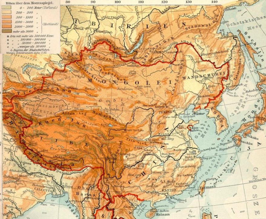
Mongolian Plateau
Image via Wikimedia Commons (author and licence on the file page).

Mongolian Plateau

Plateau · 249,115 km²

Mongolian Plateau is a plateau in Asia, covering an estimated 249,115 km². It extends across Mongolia, Russia and China. It is the 14th-largest of the 69 plateaus with a mapped extent in YearMaps.

The Mongolian Plateau or Altai Plateau is an inland plateau in East Asia covering approximately 3,200,000 square kilometers (1,200,000 mi2). It is bounded by the Greater Hinggan Mountains in the east, the Yin Mountains to the south, the Altai Mountains to the west, and the Sayan and Khentii mountains to the north. The plateau includes the Gobi Desert as well as dry steppe regions. It has an elevation of roughly 1,000 to 1,500 meters (3,300 to 4,900 ft), with the lowest point in Hulunbuir and the highest point in the Altai.

Politically, the plateau spans all of Mongolia, along with parts of China and Russia. Inner Mongolia and parts of the Dzungarian Basin in Xinjiang encompass the Chinese portion of the plateau. In Russia, the plateau forms Transbaikal, part of Buryatia, and the southern Irkutsk Oblast. The Mongolian Plateau comprises the majority of the area known as the Mongol heartland.

Adapted from Wikipedia: Mongolian Plateau (CC BY-SA 4.0).

Feature class
Plateau
Mapped extent
249,115 km²
Size rank
#14 of 69 plateaus
Region
Asia
Countries
Mongolia, Russia, China
Coordinates
46.8553°, 104.3787°
Summits:
Gora Munku-Sardyk (3,491 m), Pik BAM (3,072 m), Tavan Bogd Uul (4,374 m)
Ranges:
Greater Khingan Range (Asia), Yin Mountains (Asia)
Settlements:
Petrovsk Zabaykalskiy (148 km), Ulan Ude (246 km), Gusinoozyorsk (269 km)

View on the live map

More about Mongolian Plateau

Geography

The average elevation of the Mongolian Plateau ranges from 915 to 1,525 meters (3,002 to 5,003 ft) above sea level. The highest point in the plateau is found in Tavan Bogd at 4,374 meters (14,350 ft) above sea level.

Ecology

The ecology of Mongolia is complex, having varying regions of highland and lowland areas. Grazing species such as yaks, Przewalski's horses, domesticated sheep, saiga antelope, Siberian ibex and Argali are common. Predator species include the Eurasian lynx, snow leopards, Corsac foxes as well as carnivorous birds such as the bearded vulture, saker falcon, and the cinereous vulture. Marmots are common throughout the region including the Tarbagan marmot with large parts of its range located in the Mongolian plateau.

History

The plateau was inhabited and conquered by various groups, including (chronologically) the Xiongnu, Xianbei, Göktürks, Tang dynasty, Liao dynasty, Mongol Empire, Yuan dynasty, Northern Yuan dynasty, and Qing dynasty.

Sections adapted from Wikipedia: Mongolian Plateau (CC BY-SA 4.0).

Karelia
Image via Wikimedia Commons (author and licence on the file page).

Karelia

Geoarea · 200,349 km²

Karelia is a geoarea in Europe, covering an estimated 200,349 km². It extends across Russia and Finland.

Karelia (; Karelian and Finnish: Karjala [ˈkɑrjɑlɑ]; Livvi: Karjal; Russian: Каре́лия, romanized: Kareliya [kɐˈrʲelʲɪjə], historically Коре́ла, Korela [kɐˈrʲelʲə]; Swedish: Karelen [kɑˈreːlen]) is a cultural region and area in Northern Europe of historical significance for Russia (including the Soviet era), Finland, and Sweden. It is divided between northwestern Russia (the federal subjects of the Republic of Karelia and Leningrad Oblast) and Finland (the regions of South Karelia, North Karelia, and the eastern portion of Kymenlaakso).

Adapted from Wikipedia: Karelia (CC BY-SA 4.0).

Feature class
Geoarea
Mapped extent
200,349 km²
Size rank
#41 of 231 landforms
Region
Europe
Countries
Russia, Finland
Coordinates
62.1296°, 32.6811°
Summits:
Gora Narodnaya (1,895 m), Gora Elbrus (5,642 m), Dombai-Ulgen (4,038 m)
Ranges:
Ural Mountains (Europe), Tatra Mountains (Europe)
Settlements:
Segezha (110 km), Kondopoga (159 km), Petrozavodsk (192 km)

View on the live map

More about Karelia

Geography

Karelia stretches from the White Sea coast to the Gulf of Finland. It contains the two largest lakes in Europe, Lake Ladoga and Lake Onega. The Karelian Isthmus is located between the Gulf of Finland and Lake Ladoga. The highest point of Karelia, the 576-metre-high (1,890 ft) Nuorunen, is located on the Russian side of the Maanselkä hill region.

The border between Karelia and Ingria, the land of the closely related Ingrian people, had originally been the Neva River itself but later on it was moved northward into the Karelian isthmus to follow the Sestra River (Russian: Сестра), today in the Saint Petersburg metropolitan area, but in 1812–1940 the Russo-Finnish border.

History

During the Early Middle Ages, settlers from western Finland mixed with the local population to form the Karelian ethnic group. Possible migration from elsewhere may also have contributed to the Karelian ethnic composition.

Archeological evidence indicates that Karelian inhabitation was highest along the western shore of Lake Ladoga and the Karelian Isthmus, with multiple cemeteries and other archeological discoveries dating from AD 600 to AD 800. In South Karelia, the number of archeological discoveries from this time period is lower, though permanent inhabitation was nonetheless present. Lappee, South Karelia has been continuously inhabited for approximately 2,000 years. In North Karelia, only one archeological discovery from this time period has been found, dating to the eighth century.

Tourism

Russian Karelia is a regular destination for international tourism due to its unique architectural, cultural and historical sites such as Kizhi and Valaam. The region is visited by tourists in both summer and winter when possible activities include riding in a sled behind a dog team and running from the banya to an ice hole and back. Summer hikers can visit the Kivach waterfall or the Demon's Chair plateau.

In South Karelia, Lappeenranta is a popular destination for Russian tourists, with 1.5 million visiting annually. Imatrankoski in Imatra has been a tourist attraction since the late 18th century, when the Empress of Russia Catherine the Great visited the site in 1772.

Koli National Park in North Karelia began receiving tourists when Karelianism became a major trend.

Sections adapted from Wikipedia: Karelia (CC BY-SA 4.0).

Karelia: Key Facts

Key facts about Karelia
OnBaltic Sea, White Sea

Facts from Wikidata Q192273 (CC0).

Verkhoyansk Range
Image via Wikimedia Commons (author and licence on the file page).

Verkhoyansk Range

Range/mtn · 167,254 km²

Verkhoyansk Range is a range/mtn in Asia, covering an estimated 167,254 km².

The Verkhoyansk Range (Russian: Верхоянский хребет, Verhoyanskiy Khrebet; Yakut: Үөһээ Дьааҥы сис хайата, romanized: Üöhee Caañı sis xayata) is a mountain range in the Sakha Republic, Russia, near the settlement of Verkhoyansk, known for its frigid climate. It is part of the East Siberian Mountains.

The range lies just west of the boundary of the Eurasian and the North American tectonic plates. The mountains were formed by folding, and represent an anticline.

The Verkhoyansk Range was covered by glaciers during the Last Glacial Period, and the mountains in the northern section, such as the Orulgan Range, display a typical Alpine relief.

There are coal, silver, lead, tin, and zinc deposits in the mountains.

Adapted from Wikipedia: Verkhoyansk Range (CC BY-SA 4.0).

Feature class
Range/mtn
Mapped extent
167,254 km²
Size rank
#26 of 216 mountain ranges
Region
Asia
Coordinates
65.0829°, 129.2637°
Summits:
Gora Chen (2,690 m), Pik BAM (3,072 m), Gora Khuvkhoitun (2,616 m)
Adjacent ranges:
Cherskiy Range (Asia), Suntar-Khayata Range (Asia)
Settlements:
Yakutsk (340 km), Aldan (748 km), Mirnyy (800 km)

View on the live map

More about Verkhoyansk Range

Geography

Rising from the shores of the Buor-Khaya Gulf in the north, it runs southwards spanning roughly 1,000 kilometres (600 mi) across Yakutia, east of the Central Yakutian Lowland, and west of the Chersky Range, reaching the Lena Plateau to the south and the Yudoma-Maya Highlands to the southeast. It forms a vast arc between the Lena and Aldan rivers to the west and the Yana River to the east.

The Verkhoyansk Range has a higher southeastern prolongation than the Suntar-Khayata Range, which is occasionally considered as a separate range system. Thus the highest point of the range in a restricted geographical sense is an unnamed 2,409-metre-high (7,904 ft) peak in the Orulgan Range.

Climate and flora

The world's lowest temperatures for inhabited places have been recorded in this region at Verkhoyansk (−67.8 °C; −90.0 °F) and Oymyakon (−67.7 °C; −89.9 °F), and there is quite deep snow cover for most of the year.

The mountain range is home to an alpine tundra, supporting various species of mosses and lichens. Some sparsely-wooded forests of mainly larch and dwarf Siberian pine are found on smooth slopes.

Sections adapted from Wikipedia: Verkhoyansk Range (CC BY-SA 4.0).

Verkhoyansk Range: Key Facts

Key facts about Verkhoyansk Range
Length1,200 km
Highest pointMus-Khaya
Part ofEastern Siberian Bergland

Facts from Wikidata Q215917 (CC0).

Central Russian Upland
Image via Wikimedia Commons (author and licence on the file page).

Central Russian Upland

Plateau · 165,976 km²

Central Russian Upland is a plateau in Europe, covering an estimated 165,976 km². It extends across Russia and Ukraine. It is the 24th-largest of the 69 plateaus with a mapped extent in YearMaps.

The Central Russian Upland (also: Middle Russian Upland (Russian: Среднерусская возвышенность, romanized: Srednerusskaya vozvyshennost') and East European Upland) is an upland area of the East European Plain and is an undulating plateau with an average elevation of 230–250 m (750–820 ft). Its highest peak is measured at 293 m (961 ft). The southeastern portion of the upland is known as the Kalach Upland. The Central Upland is built of Precambrian deposits of the crystalline Voronezh Massif.

Adapted from Wikipedia: Central Russian Upland (CC BY-SA 4.0).

Feature class
Plateau
Mapped extent
165,976 km²
Size rank
#24 of 69 plateaus
Region
Europe
Countries
Russia, Ukraine
Coordinates
52.2636°, 36.8385°
Summits:
Dombai-Ulgen (4,038 m), Gora Elbrus (5,642 m), Gora Narodnaya (1,895 m)
Ranges:
Carpathian Mountains (Europe), Transylvanian Alps (Europe)
Settlements:
Livny (52 km), Orel (69 km), Mountainsensk (78 km)

View on the live map

More about Central Russian Upland

History

The Kostroma river and the city of the same name suggest that the area in Central Russia is an important reference point for the original home of the Slavic tribes. The river and city bear the same name as the Slavic goddess Kostroma.

Location

It spans approximately 180,000 miles² (480,000 km2) in central and southern European Russia northeast of Ukraine, extending from the Oka river to the Donets river. The upland stretches across a number of regions in Ukraine and the European portion of the Russian Federation. Its north and northwest borders are considered to be the Oka River and an imaginary line Kaluga-Ryazan. To the southeast towards the Donets River, the upland changes into the Donets Lowland. To the east its natural border is defined by the Oka–Don Lowland and to the west there is the Dnieper Lowland. Most of the upland lies within the borders of Russia, hence its name.

Sections adapted from Wikipedia: Central Russian Upland (CC BY-SA 4.0).

Central Russian Upland: Key Facts

Key facts about Central Russian Upland
Area480,000 km²
Elevation293 m

Facts from Wikidata Q1126906 (CC0).

Taymyr Peninsula
Image via Wikimedia Commons (author and licence on the file page).

Taymyr Peninsula

Pen/cape · 133,273 km²

Taymyr Peninsula is a pen/cape in Asia, covering an estimated 133,273 km².

The Taymyr Peninsula ( ty-MEER) is a peninsula in the Far North of Russia, in the Siberian Federal District, that forms the northernmost part of the mainland of Eurasia. Administratively it is part of the Krasnoyarsk Krai Federal subject of Russia.

Adapted from Wikipedia: Taymyr Peninsula (CC BY-SA 4.0).

Feature class
Pen/cape
Mapped extent
133,273 km²
Size rank
#55 of 231 landforms
Region
Asia
Coordinates
75.1699°, 105.6317°
Summits:
Gora Chen (2,690 m), Gora Narodnaya (1,895 m), Newtontoppen (1,713 m)
Ranges:
Verkhoyansk Range (Asia), Ural Mountains (Europe)
Settlements:
Norilsk (870 km), Dudinka (908 km), Nakhodka (1,270 km)

View on the live map

More about Taymyr Peninsula

Geography

The Taymyr Peninsula lies between the Yenisei Gulf of the Kara Sea and the Khatanga Gulf of the Laptev Sea.

Lake Taymyr and the Byrranga Mountains are located within the vast Taymyr Peninsula.

Cape Chelyuskin, the northernmost point of the Eurasian continent, is located at the northern end of the Taymyr Peninsula.

Climate

The coasts of the Taymyr Peninsula are frozen most of the year, between September and June on average. The summer season is short, especially on the shores of the Laptev Sea in the northeast. The climate in the north and exterior of the peninsula is Tundra Climate (ET), while some areas further-south have a very cold but somewhat more continental subarctic climate, with winters even slightly colder than the tundra directly to the north, but with somewhat warmer summers that can support some tree growth. Winters are harsh, with frequent blizzards and extremely low temperatures. The following data for Cape Chelyuskin provides an indication of the weather experienced in the northern part of the peninsula.

Ecology

The peninsula is the site of the last known naturally occurring muskox outside of North America, which died out about 2,000 years ago. They were successfully reintroduced in 1975. The population grew to 2,500 in 2002, increasing to 6,500 in 2010.

A study in 2021 found that, based on eDNA, woolly mammoths survived on the Taymyr Peninsula until 3,900 to 4,100 years ago, roughly concurrent with another population on Wrangel Island. The Taymyr Peninsula, with its drier habitat, may have served as a refugium for the mammoth steppe, supporting mammoths and other widespread Ice Age mammals, such as wild horses (Equus sp.).

Economy

MMC Norilsk Nickel conducts mining operations in the area. The company conducts smelting operations in the area of the city of Norilsk, near the peninsula. The nickel ore concentrate and other products of the company are transported over a short railroad to the port city of Dudinka on the Yenisei River, and from there by boat to Murmansk and other ports.

Sections adapted from Wikipedia: Taymyr Peninsula (CC BY-SA 4.0).

Taymyr Peninsula: Key Facts

Key facts about Taymyr Peninsula
Area400,000 km²
Highest pointByrranga Mountains
OnKara Sea

Facts from Wikidata Q37056 (CC0).

Yamal Peninsula
Image via Wikimedia Commons (author and licence on the file page).

Yamal Peninsula

Pen/cape · 116,075 km²

Yamal Peninsula is a pen/cape in Asia, covering an estimated 116,075 km².

The Yamal Peninsula (Russian: полуостров Ямал, romanized: poluostrov Yamal) is located in the Yamalo-Nenets Autonomous Okrug of northwest Siberia, Russia. It extends roughly 700 km (435 mi) and is bordered principally by the Kara Sea and its Baydaratskaya Bay on the west, and by the Gulf of Ob on the east. At the northern end of this peninsula lie the Malygina Strait and, beyond it, Bely Island. Across Ob estuary lies the Gyda Peninsula. In the languages of the Yamal Peninsula's indigenous inhabitants, the Nenets, Yamal means "End of the Land".

The Yamal peninsula is inhabited by a multitude of migratory bird species.

Adapted from Wikipedia: Yamal Peninsula (CC BY-SA 4.0).

Feature class
Pen/cape
Mapped extent
116,075 km²
Size rank
#58 of 231 landforms
Region
Asia
Coordinates
70.7101°, 70.0153°
Summits:
Gora Narodnaya (1,895 m), Newtontoppen (1,713 m), Haltiatunturi (1,328 m)
Ranges:
Ural Mountains (Europe), Verkhoyansk Range (Asia)
Settlements:
Vorkuta (429 km), Nakhodka (442 km), Salekhard (484 km)

View on the live map

More about Yamal Peninsula

Geography

The peninsula consists mostly of permafrost ground and there are numerous lakes of thermokarst origin, the biggest of which are Neito and Yambuto in the central part.

Many hydrocarbon fields have been discovered on the Yamal Peninsula, including large gas fields. The main hydrocarbon resources are concentrated in the permeable Aptian-Cenomanian complex.

Climate research

In the summer of 2007 reindeer herder Yuri Khudi found the well-preserved remains of a 37,000-year-old mammoth calf, dubbed "Lyuba", on the peninsula. The female calf was determined to be one month old at the time of death.

The Yamal Peninsula is important for the study of climatic history. Dendrochronology is one method used to see how environment has changed.

Economy

According to anthropologist Sven Haakanson, the Yamal peninsula is the place within the Russian Federation where traditional large-scale nomadic reindeer husbandry is best preserved. Nenets and Khanty reindeer herders hold about half a million domestic reindeer.

The area is largely undeveloped, but work is ongoing with several large infrastructure projects, including a gas pipeline and several bridges. Yamal holds Russia's biggest natural gas reserves. The 572 km Obskaya–Bovanenkovo railway, completed in 2011, is the northernmost railway in the world. Russian gas monopolist Gazprom had planned to develop the Yurkharovskoye gas field by 2011–2012. The peninsula's gas reserves are estimated to be 55 trillion cubic meters (tcm).

Sections adapted from Wikipedia: Yamal Peninsula (CC BY-SA 4.0).

Yamal Peninsula: Key Facts

Key facts about Yamal Peninsula
OnKara Sea

Facts from Wikidata Q488266 (CC0).

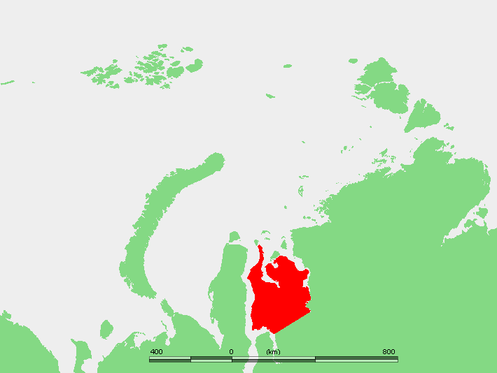
Kolyma Lowland
Image via Wikimedia Commons (author and licence on the file page).

Kolyma Lowland

Lowland · 111,820 km²

Kolyma Lowland is a lowland in Asia, covering an estimated 111,820 km².

The Kolyma Lowland (Russian: Колымская низменность) is a lowland plain in the northeastern parts of Sakha Republic in the basin of the Alazeya, Bolshaya Chukoch'ya and lower reaches of the Kolyma rivers. The lowland is formed by fluvio-lacustrine loam soil about 120 m thick. The climate is subarctic.

Adapted from Wikipedia: Kolyma Lowland (CC BY-SA 4.0).

Feature class
Lowland
Mapped extent
111,820 km²
Size rank
#61 of 231 landforms
Region
Asia
Coordinates
68.5155°, 153.4185°
Summits:
Gora Chen (2,690 m), Gora Khuvkhoitun (2,616 m), Klyuchevskaya Sopka (4,750 m)
Ranges:
Cherskiy Range (Asia), Kolyma Range (Asia)
Settlements:
Palatka (943 km), Magadan (1,002 km), Yakutsk (1,303 km)

View on the live map

More about Kolyma Lowland

Geography

The Kolyma Lowland stretches for 750 kilometers (470 mi) along the Kolyma River from the East Siberian Sea to the Chersky Range, between the Alazeya and Yukagir plateaus. Besides the Kolyma, other rivers in the lowland include the Alazeya, its tributary Rossokha, and the Chukochya. The average elevation of the Kolyma lowland is 100 meters (330 ft) with occasional heights, such as the 512 meters (1,680 ft) high Suor Uyata.

The Kolyma Lowland is part of the wider Yana-Kolyma system of lowlands, which include the Aby to the south of the Polousny Range and the Yana-Indigirka on the northern and western sides.

Sections adapted from Wikipedia: Kolyma Lowland (CC BY-SA 4.0).

Pontic Steppe
Image via Wikimedia Commons (author and licence on the file page).

Pontic Steppe

Plain · 102,190 km²

Pontic Steppe is a plain in Europe, covering an estimated 102,190 km². It extends across Russia, Ukraine, Romania, Bulgaria, Kazakhstan and Moldova.

The Pontic–Caspian steppe extends across Eastern Europe to Central Asia, formed by the Caspian and Pontic steppes. It stretches from the northern shores of the Black Sea (the Pontus Euxinus of antiquity) to the northern area around the Caspian Sea, where it ends at the Ural-Caspian narrowing, which joins it with the Kazakh Steppe in Central Asia, making it a part of the larger Eurasian Steppe. Geopolitically, the Pontic–Caspian Steppe extends from northeastern Bulgaria and southeastern Romania through Moldova, southern and eastern Ukraine, through the North Caucasus of southern Russia, and into the Lower Volga region where it straddles the border of southern Russia and western Kazakhstan. Biogeographically, it is a part of the Palearctic realm, and of the temperate grasslands, savannas, and shrublands biome.

The area corresponds to Cimmeria, Scythia, and Sarmatia of classical antiquity. Across several millennia, numerous tribes of nomadic horsemen used the steppe; many of them went on to conquer lands in the settled regions of Central and Eastern Europe, West Asia, and South Asia.

Adapted from Wikipedia: Pontic–Caspian steppe (CC BY-SA 4.0).

Feature class
Plain
Mapped extent
102,190 km²
Size rank
#63 of 231 landforms
Region
Europe
Countries
Russia, Ukraine, Romania, Bulgaria, Kazakhstan, Moldova
Coordinates
53.2330°, 46.3431°
Summits:
Gora Elbrus (5,642 m), Dombai-Ulgen (4,038 m), Gora Narodnaya (1,895 m)
Ranges:
Pontic Mountains (Asia), Lesser Caucasus (Asia)
Settlements:
Atkarsk (72 km), Balashov (77 km), Krasnoarmeysk (110 km)

View on the live map

More about Pontic Steppe

Geography and ecology

The steppe covers an area of 994,000 km2 (384,000 sq mi) of Central and Eastern Europe, that extends from northeastern Bulgaria and southeastern Romania, through Moldova, and southern and eastern Ukraine, through the Northern Caucasus of southern Russia, and into the Lower Volga region of western Kazakhstan, to the east of the Ural Mountains. It is bounded by the East European forest steppe to the north, a transitional zone of mixed grasslands and temperate broadleaf and mixed forests. To the south, the steppe extends to the Black Sea, except the Crimean and western Caucasus mountains' border with the sea, where the Crimean Submediterranean forest complex defines the southern edge of the steppes.

Sections adapted from Wikipedia: Pontic–Caspian steppe (CC BY-SA 4.0).

Pontic Steppe: Key Facts

Key facts about Pontic Steppe
Area994,000 km²

Facts from Wikidata Q599529 (CC0).

Chukchi Peninsula
Image via Wikimedia Commons (author and licence on the file page).

Chukchi Peninsula

Pen/cape · 98,448 km²

Chukchi Peninsula is a pen/cape in Asia, covering an estimated 98,448 km².

The Chukchi Peninsula (also Chukotka Peninsula or Chukotski Peninsula; Russian: Чуко́тский полуо́стров, Chukotskiy poluostrov, short form Russian: Чуко́тка, Chukotka), at about 66° N 172° W, is the easternmost point of continental Asia.

Adapted from Wikipedia: Chukchi Peninsula (CC BY-SA 4.0).

Feature class
Pen/cape
Mapped extent
98,448 km²
Size rank
#66 of 231 landforms
Region
Asia
Coordinates
66.0941°, -174.1212°
Summits:
Mount Osborn (1,437 m), Denali (6,194 m), Redoubt Volcano (3,108 m)
Ranges:
Brooks Range (North America), Kolyma Range (Asia)
Settlements:
Fairbanks (1,218 km), Anchorage (1,301 km), Palatka (1,852 km)

View on the live map

More about Chukchi Peninsula

Chukchi Peninsula: Key Facts

Key facts about Chukchi Peninsula
Highest pointIskhodnaya
OnChukchi Sea, Bering Strait

Facts from Wikidata Q1002 (CC0).

Western Siberian Plain
Image via Wikimedia Commons (author and licence on the file page).

Western Siberian Plain

Lowland · 93,486 km²

Western Siberian Plain is a lowland in Asia, covering an estimated 93,486 km².

The West Siberian Plain (Russian: Западно-Сибирская равнина, romanized: Zapadno-Sibirskaya ravnina) is a large plain that occupies the western portion of Siberia, between the Ural Mountains in the west and the Yenisei River in the east, and the Altai Mountains on the southeast. Much of the plain is poorly drained and consists of some of the world's largest swamps and floodplains. Important cities include Chelyabinsk, Novosibirsk, Omsk, and Tomsk, as well as Surgut and Nizhnevartovsk.

Winters on the West Siberian Plain are harsh and long. The climate of most of the plain areas is either subarctic or continental. The plain had large petroleum and natural gas reserves. Most of Russia's oil and gas production was extracted from this area during the 1970s and 80s.

Adapted from Wikipedia: West Siberian Plain (CC BY-SA 4.0).

Feature class
Lowland
Mapped extent
93,486 km²
Size rank
#69 of 231 landforms
Region
Asia
Coordinates
65.1775°, 67.4057°
Summits:
Gora Narodnaya (1,895 m), Haltiatunturi (1,328 m), Belukha (4,506 m)
Ranges:
Ural Mountains (Europe), Altay Mountains (Asia)
Settlements:
Salekhard (155 km), Nadym (240 km), Vorkuta (299 km)

View on the live map

More about Western Siberian Plain

Geography

The West Siberian Plain is located east of the Ural Mountains mostly in the territory of Russia. It is one of the Great Russian Regions and has been described as the world's largest unbroken lowland – more than 50 percent is less than 100 m (328 ft) above sea level—and covers an area of about 2.6–2.7 million square kilometres (1.0 million square miles) which is about one third of Siberia. It extends from north to south for 2,500 kilometres (1,600 miles), reaching its maximum width of 1,500 kilometres (930 miles) in its southern part. from the Arctic Ocean to the foothills of the Altai Mountains, and from east to west for 1,900 km (1,181 mi) from the Yenisei River to the Ural Mountains.

Geology

The West Siberian Plain consists mostly of Cenozoic alluvial deposits and is extraordinarily flat. A rise of fifty metres in sea level would cause all land between the Arctic Ocean and the Ob-Irtysh confluence near Khanty-Mansiysk to be inundated (see also Turgai Straits, West Siberian Glacial Lake). It is a region of the Earth's crust that has undergone prolonged subsidence and is composed of horizontal deposits from as much as 65 million years ago. Many of the deposits on this plain result from ice dams that reversed the flow of the Ob and Yenisei rivers, redirecting them into the Caspian Sea, and perhaps the Aral Sea as well.

Sections adapted from Wikipedia: West Siberian Plain (CC BY-SA 4.0).

Kola Peninsula
Image via Wikimedia Commons (author and licence on the file page).

Kola Peninsula

Pen/cape · 89,704 km²

Kola Peninsula is a pen/cape in Europe, covering an estimated 89,704 km².

The Kola Peninsula (Russian: Ко́льский полуо́стров, romanized: Kolsky poluostrov; Kildin Sami: Куэлнэгк нёа̄ррк) is a peninsula in the extreme northwest of Russia, and one of the largest peninsulas of Europe. Constituting the bulk of the territory of Murmansk Oblast, it lies almost completely inside the Arctic Circle and is bordered by the Barents Sea to the north and by the White Sea to the east and southeast. The city of Murmansk, the most populous settlement on the peninsula, has a population of roughly 270,000 residents.

While humans had already settled in the north of the peninsula in the 7th–5th millennium BC, the rest of its territory remained uninhabited until the 3rd millennium BC, when various peoples started to arrive from the south. By the 1st millennium CE only the Sámi people remained. This changed in the 12th century, when Russian Pomors discovered the peninsula's rich resources of game and fish. Soon after, the Pomors were followed by the tribute collectors from the Novgorod Republic, and the peninsula gradually became a part of the Novgorodian lands.

Adapted from Wikipedia: Kola Peninsula (CC BY-SA 4.0).

Feature class
Pen/cape
Mapped extent
89,704 km²
Size rank
#70 of 231 landforms
Region
Europe
Coordinates
67.6315°, 36.0872°
Summits:
Haltiatunturi (1,328 m), Kebnekaise (2,111 m), Oksskolten (1,916 m)
Ranges:
Ural Mountains (Europe), Tatra Mountains (Europe)
Settlements:
Kirovsk (102 km), Apatity (114 km), Monchegorsk (141 km)

View on the live map

More about Kola Peninsula

Geography

The peninsula is located in the far northwest of Russia, almost completely inside the Arctic Circle, and is bordered by the Barents Sea in the north and the White Sea in the east and southeast. Geologically, the peninsula occupies the northeastern edge of the Baltic Shield. The western border of the peninsula stretches along the meridian from the Kola Bay through the valley of the Kola River, Lake Imandra, and the Niva River to the Kandalaksha Gulf, although some sources push it all the way west to Russia's border with Finland.

Under a more restrictive definition, the peninsula covers an area of about 100,000 square kilometers (39,000 sq mi). The northern coast is steep and high, while the southern coast is flat.

History

The Rybachy Peninsula in the north of the Kola Peninsula was already settled in the 7th–5th millennium BCE. In the 3rd–2nd millennium BCE, the peninsula was settled by the peoples who arrived there from the south (the territory of modern Karelia). Bolshoy Oleny Island in the Kola Bay of the Barents Sea is the location of an important Bronze Age archaeological site where ancient DNA has been recovered.

By the end of the 1st millennium CE, the peninsula was settled only by the Sámi people, who did not have their own state, lived in clans ruled by elders, and were engaged mostly in reindeer herding and fishing. In the 12th century, Russian Pomors from the shores of the Onega Bay and in the lower reaches of the Northern Dvina discovered the peninsula and its game and fish riches.

Economy

During the 15th–16th centuries, the main occupations of the Tersky Coast population were Atlantic salmon fishing, seal hunting, and the extraction of salt from the sea water. The salt extraction in Kandalaksha and Kola was mostly carried out by the monasteries in Pechenga and Solovki, and for a long time remained the only "industry" on the peninsula.

By the mid-16th century, Atlantic cod fishing developed on the Murman Coast in the north. The 1560s saw a rapid growth of international trade, with the Russian merchants from different regions of the country arriving to the peninsula to trade with the merchants from Western Europe. In 1585 the trade was moved to Archangel, although the settlement of Kola was still permitted to trade locally produced goods.

Sections adapted from Wikipedia: Kola Peninsula (CC BY-SA 4.0).

Kola Peninsula: Key Facts

Key facts about Kola Peninsula
Area100,000 km²
OnBarents Sea, White Sea

Facts from Wikidata Q165608 (CC0).

Putorana Plateau
Image via Wikimedia Commons (author and licence on the file page).

Putorana Plateau

Plateau · 80,463 km²

Putorana Plateau is a plateau in Asia, covering an estimated 80,463 km².

The Putorana Plateau (Russian: плато Путорана, romanized: plato Putorana) or the Putorana Mountains is a mountainous area in Russia.

It is a large massif or plateau crossed by mountain ranges. The nearest large settlement is Norilsk, where foreign travel is restricted. The city is served by Alykel Airport.

The area of the mountains contains some of the largest known nickel deposits in the world.

Adapted from Wikipedia: Putorana Plateau (CC BY-SA 4.0).

Feature class
Plateau
Mapped extent
80,463 km²
Size rank
#36 of 69 plateaus
Region
Asia
Coordinates
68.7744°, 103.8487°
Summits:
Pik BAM (3,072 m), Gora Chen (2,690 m), Gora Munku-Sardyk (3,491 m)
Ranges:
Verkhoyansk Range (Asia), Ural Mountains (Europe)
Settlements:
Norilsk (622 km), Dudinka (700 km), Noginsk (731 km)

View on the live map

More about Putorana Plateau

Geography

The Putorana Plateau is a high-lying plateau crossed by mountain ranges at the northwestern edge of the Central Siberian Plateau. It is located east of the Yenisei River valley, between 67° and 70° N of latitude, southwest of the Anabar Plateau, north of the Syverma and Tunguska plateaus and south of the North Siberian Lowland. The main subranges of the Putorana are the Keta Range, Lontokoisky Kamen, Kharayelakh Range, Chaya-Ayan, Brus Kamen, and Lama Range, among others. The highest mountain in the range system is Mount Kamen which stands 1,678 m (5,505 ft) above sea level and is also the highest point of the Central Siberian Plateau. Talnikovy Waterfall is reputedly one of the highest waterfalls in Asia.

Climate

The Putorana region is located above the Arctic Circle. The climate is a harsh subarctic, sharply continental, with long, severely cold winters, and short, cool summers. However, in certain lake valleys, such as Lake Lama, there is a somewhat milder microclimate owing to the protection afforded by neighboring ranges from the northern winds. The higher elevations within the plateau transition to a tundra climate.

Spring, summer and autumn fall respectively in the months of June, July, and August, the remaining months are winter with temperatures between −32 °C (−26 °F) and −40 °C (−40 °F). In July, the warmest month, average air temperatures stay around 8 °C (46 °F) and may reach a maximum of 16 °C (61 °F).

Sections adapted from Wikipedia: Putorana Plateau (CC BY-SA 4.0).

Putorana Plateau: Key Facts

Key facts about Putorana Plateau
Elevation1,701 m
Highest pointMount Kamen

Facts from Wikidata Q277576 (CC0).

Lesser Khingan Range
Image via Wikimedia Commons (author and licence on the file page).

Lesser Khingan Range

Range/mtn · 80,374 km²

Lesser Khingan Range is a range/mtn in Asia, covering an estimated 80,374 km². It extends across China and Russia.

Lesser Khingan (Chinese: 小兴安岭; pinyin: Xiǎo Xīng'ān Lǐng; Russian: Малый Хинган, Maly Khingan) is a mountain range in China's Heilongjiang province and the adjacent parts of Russia's Amur Oblast and Jewish Autonomous Oblast.

In Russia, the range is part of the Khingan Nature Reserve.

Adapted from Wikipedia: Lesser Khingan (CC BY-SA 4.0).

Feature class
Range/mtn
Mapped extent
80,374 km²
Size rank
#52 of 216 mountain ranges
Region
Asia
Countries
China, Russia
Coordinates
48.3090°, 129.0911°
Summits:
Pik BAM (3,072 m), Vulkan Alaid (2,339 m), Gora Chen (2,690 m)
Adjacent ranges:
Bureinskiy Range (Asia), Greater Khingan Range (Asia)
Settlements:
Blagoveshchensk (133 km), Belogorsk (169 km), Svobodnyy (227 km)

View on the live map

More about Lesser Khingan Range

Geography

In China, the Khingan mountains are divided into the Greater Khingan and Lesser Khingan. The Lesser Khingan range runs roughly from the northwest to the southeast and separates the valley of the Amur (Heilongjiang) River from that of the Nenjiang River. The mountain range then turns toward the east and north-east, entering Russia. The Amur/Heilongjiang, which is a border river, forms a gorge when crossing the mountain range.

Sections adapted from Wikipedia: Lesser Khingan (CC BY-SA 4.0).

Lesser Khingan Range: Key Facts

Key facts about Lesser Khingan Range
Length400 km

Facts from Wikidata Q404600 (CC0).

Cherskiy Range
Image via Wikimedia Commons (author and licence on the file page).

Cherskiy Range

Range/mtn · 65,480 km²

Cherskiy Range is a range/mtn in Asia, covering an estimated 65,480 km².

The Chersky Range (Russian: Хребет Черского, Yakut: Черскэй хайалара, romanized: Çerskey xayalara) is a chain of mountains in northeastern Siberia between the Yana and Indigirka Rivers. Administratively, the area of the range belongs to the Sakha Republic, although a small section in the east is within Magadan Oblast. The highest peak in the range is the 3,003-metre-tall (9,852 ft) Peak Pobeda, part of the Ulakhan-Chistay Range. The range also includes important places of traditional Yakut culture, such as Ynnakh Mountain (Mat'-Gora) and kigilyakh rock formations.

The Moma Natural Park is a protected area located in the southern zone of the range.

Adapted from Wikipedia: Chersky Range (CC BY-SA 4.0).

Feature class
Range/mtn
Mapped extent
65,480 km²
Size rank
#61 of 216 mountain ranges
Region
Asia
Coordinates
65.6069°, 143.3862°
Summits:
Gora Chen (2,690 m), Gora Khuvkhoitun (2,616 m), Klyuchevskaya Sopka (4,750 m)
Adjacent ranges:
Suntar-Khayata Range (Asia), Verkhoyansk Range (Asia)
Settlements:
Palatka (720 km), Magadan (770 km), Yakutsk (776 km)

View on the live map

More about Cherskiy Range

Climate

The Chersky mountains, along with the neighboring Verkhoyansk Range, have a moderating effect on the climate of Siberia. The ridges obstruct west-moving air flows, decreasing the amount of snowfall in the plains to the west.

History

At some time between 1633 and 1642, Poznik Ivanov ascended a tributary of the lower Lena, crossed the Verkhoyansk Range to the upper Yana, and then crossed the Chersky Range to the Indigirka. The range was sighted in 1926 by Sergei Obruchev (Vladimir Obruchev's son) and named by the Russian Geographical Society after the Polish explorer and geographer Ivan Chersky (or Jan Czerski).

Sections adapted from Wikipedia: Chersky Range (CC BY-SA 4.0).

Cherskiy Range: Key Facts

Key facts about Cherskiy Range
Length1,000 km
Highest pointPeak Pobeda, Sakha
Part ofEastern Siberian Bergland

Facts from Wikidata Q683923 (CC0).
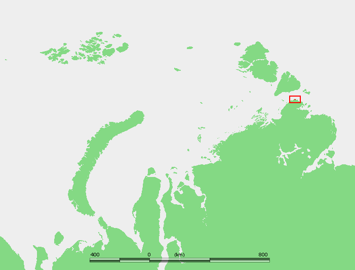
Kolyma Range
Image via Wikimedia Commons (author and licence on the file page).

Kolyma Range

Range/mtn · 54,560 km²

Kolyma Range is a range/mtn in Asia, covering an estimated 54,560 km².

The Kolyma Mountains or Kolyma Upland (Russian: Колымское нагорье, romanized: Kolymskoye Nagorye), is a system of mountain ranges in northeastern Siberia, lying mostly within the Magadan Oblast, along the shores of the Sea of Okhotsk in the Kolyma region. It constitutes the watershed between the basins of Kolyma River and of the Sea of Okhotsk / Pacific Ocean.

The range's highest point is Mount Nevskaya (гора Невская) in the Omsukchan Range at 1,828 meters (5,997 ft).

Adapted from Wikipedia: Kolyma Mountains (CC BY-SA 4.0).

Feature class
Range/mtn
Mapped extent
54,560 km²
Size rank
#78 of 216 mountain ranges
Region
Asia
Coordinates
64.3499°, 163.1070°
Summits:
Gora Khuvkhoitun (2,616 m), Klyuchevskaya Sopka (4,750 m), Gora Chen (2,690 m)
Adjacent ranges:
Cherskiy Range (Asia), Suntar-Khayata Range (Asia)
Settlements:
Palatka (787 km), Magadan (831 km), Petropavlovsk Kamchatskiy (1,281 km)

View on the live map

More about Kolyma Range

Geography

The Kolyma Mountains stretch 1,300 kilometers (810 mi) on a NW-SW alignment and consists of a series of plateaus and ridges punctuated by granite peaks that typically range between 1,500 to 1,800 meters (4,900 to 5,900 ft).

To the west and southwest the Upper Kolyma Highlands are bound by the Seymchan-Buyunda Depression to the north and the Ola river basin to the south. The Yukaghir Highlands, highest point Mount Chubukulakh, rise to the northwest, the Anadyr Highlands to the north and northeast and the Koryak Highlands to the east.

Sections adapted from Wikipedia: Kolyma Mountains (CC BY-SA 4.0).

Kolyma Range: Key Facts

Key facts about Kolyma Range
Length500 km
Highest pointOmsukchan Ridge
Part ofEastern Siberian Bergland

Facts from Wikidata Q1245603 (CC0).

Gyda Peninsula
Image via Wikimedia Commons (author and licence on the file page).

Gyda Peninsula

Pen/cape · 49,006 km²

Gyda Peninsula is a pen/cape in Asia, covering an estimated 49,006 km².

The Gyda Peninsula (Russian: Гыда́нский полуо́стров, romanized: Gydansky poluostrov) is a geographical feature of the Siberian coast in the Kara Sea. It takes its name from the river Gyda, that flows on the peninsula. It is roughly 400 km long and 360 km wide. This wide peninsula lies between the estuaries of the Ob (Gulf of Ob) and Yenisei Rivers (Yenisei Gulf). The southwestern corner of the peninsula is limited by the Taz Estuary, and across the river lies the Yamal Peninsula. The climate in the whole area is arctic and harsh.

Adapted from Wikipedia: Gyda Peninsula (CC BY-SA 4.0).

Feature class
Pen/cape
Mapped extent
49,006 km²
Size rank
#83 of 231 landforms
Region
Asia
Coordinates
70.0202°, 76.2127°
Summits:
Gora Narodnaya (1,895 m), Newtontoppen (1,713 m), Haltiatunturi (1,328 m)
Ranges:
Ural Mountains (Europe), Verkhoyansk Range (Asia)
Settlements:
Nakhodka (258 km), Dudinka (391 km), Novy Urengoy (438 km)

View on the live map

More about Gyda Peninsula

Geography

The Gyda Peninsula is mostly flat, with numerous lakes and rivers. Tanama has its sources in the peninsula. Its ground consists of permafrost and is covered by tundra.

This peninsula has a few arms or subpeninsulas extending northwards into the Kara Sea, where there are some large islands off its shores, including Oleniy, Shokalsky and Vilkitsky Islands. There are two bays in its northern coast, narrow and deep Gydan Bay and smaller Yuratski Bay.

Sections adapted from Wikipedia: Gyda Peninsula (CC BY-SA 4.0).

Gyda Peninsula: Key Facts

Key facts about Gyda Peninsula
Area160,000 km²
OnKara Sea

Facts from Wikidata Q601056 (CC0).

Suntar-Khayata Range
Image via Wikimedia Commons (author and licence on the file page).

Suntar-Khayata Range

Range/mtn · 34,012 km²

Suntar-Khayata Range is a range/mtn in Asia, covering an estimated 34,012 km².

Suntar-Khayata Range (Russian: Сунтар-Хаята, Yakut: Сунтаар Хайата) is a granite mountain range rising along the border of the Sakha Republic in the north with Amur Oblast and Khabarovsk Krai in the south.

The R504 Kolyma Highway passes through the northern part of the range by Kyubeme.

Adapted from Wikipedia: Suntar-Khayata Range (CC BY-SA 4.0).

Feature class
Range/mtn
Mapped extent
34,012 km²
Size rank
#102 of 216 mountain ranges
Region
Asia
Coordinates
61.8845°, 142.3554°
Summits:
Gora Chen (2,690 m), Gora Khuvkhoitun (2,616 m), Klyuchevskaya Sopka (4,750 m)
Adjacent ranges:
Cherskiy Range (Asia), Dzhugdzhur Range (Asia)
Settlements:
Palatka (501 km), Magadan (526 km), Yakutsk (659 km)

View on the live map

More about Suntar-Khayata Range

Geography

The Suntar-Khayata is approximately 450–550 km long and 60 km wide. 2,959 metres (9,708 ft) high Mus-Khaya Mountain, located in the Sakha Republic, is the highest point of the range. Berill Mountain, at 2,933 metres (9,623 ft) is the highest summit in Khabarovsk Krai. Mount Khakandya (Гора Хакандя) is an ultra-prominent peak that is 2,615 metres (8,579 ft) high.

The Suntar-Khayata Range is geographically a southeastern prolongation of the Verkhoyansk Range. Until mid 20th century it was treated as a separate range, together with the Skalisty Range, highest point 2,017 metres (6,617 ft), and the Sette Daban, highest point 2,017 metres (6,617 ft), to the southwest. The Yudoma-Maya Highlands are located to the south of the range and the Upper Kolyma Highlands to the northeast.

Sections adapted from Wikipedia: Suntar-Khayata Range (CC BY-SA 4.0).

Suntar-Khayata Range: Key Facts

Key facts about Suntar-Khayata Range
Highest pointMus-Khaya
Part ofEastern Siberian Bergland

Facts from Wikidata Q733842 (CC0).

Crimea
Image via Wikimedia Commons (author and licence on the file page).

Crimea

Pen/cape · 25,759 km²

Crimea is a pen/cape in Europe, covering an estimated 25,759 km². It extends across Russia and Ukraine.

Crimea ( kry-MEE-ə) is a peninsula in Eastern Europe, on the northern coast of the Black Sea, almost entirely surrounded by the Black Sea and the smaller Sea of Azov. The Isthmus of Perekop connects the peninsula to Kherson Oblast in mainland Ukraine. To the east, the Crimean Bridge, constructed in 2018, spans the Strait of Kerch, linking the peninsula with Krasnodar Krai in Russia. The Arabat Spit, located to the northeast, is a narrow strip of land that separates the Syvash lagoons from the Sea of Azov. Across the Black Sea to the west lies Romania and to the south is Turkey. The population is 2.4 million, and the largest city is Sevastopol. The region, internationally recognised as part of Ukraine, has been under Russian occupation since 2014.

Called the Tauric Peninsula until the early modern period, Crimea has historically been at the boundary between the classical world and the steppe. Greeks colonised its southern fringe and were absorbed by the Roman and Byzantine Empires and successor states while remaining culturally Greek. Some cities became trading colonies of Genoa, until conquered by the Ottoman Empire.

Adapted from Wikipedia: Crimea (CC BY-SA 4.0).

Feature class
Pen/cape
Mapped extent
25,759 km²
Size rank
#99 of 231 landforms
Region
Europe
Countries
Russia, Ukraine
Coordinates
45.3030°, 34.3060°
Summits:
Dombai-Ulgen (4,038 m), Gora Elbrus (5,642 m), Gora Narodnaya (1,895 m)
Ranges:
Transylvanian Alps (Europe), Balkan Mountains (Europe)
Settlements:
Simferopol (41 km), Dzhankoy (49 km), Yevpatoriya (76 km)

View on the live map

More about Crimea

Geography

Covering an area of 27,000 km2 (10,425 sq mi), Crimea is located on the northern coast of the Black Sea and on the western coast of the Sea of Azov; the only land border is shared with Ukraine's Kherson Oblast on the north. Crimea is almost an island and only connected to the continent by the Isthmus of Perekop, a strip of land about 5–7 kilometres (3.1–4.3 mi) wide.

Much of the natural border between the Crimean Peninsula and the Ukrainian mainland comprises the Syvash or "Rotten Sea", a large system of shallow lagoons stretching along the western shore of the Sea of Azov. Besides the isthmus of Perekop, the peninsula is connected to the Kherson Oblast's Henichesk Raion by bridges over the narrow Chonhar and Henichesk straits and over Kerch Strait to the Krasnodar Krai.

History

The recorded history of Crimea begins around 5th century BCE when several Greek colonies were established on its south coast, the most important of which was Chersonesos near modern-day Sevastopol, with Scythians and Tauri in the hinterland to the north. The Tauri gave the name the Tauric Peninsula, which Crimea was called into the early modern period. The southern coast gradually consolidated into the Bosporan Kingdom which was annexed by Pontus in Asia Minor and later became a client kingdom of Rome from 63 BCE to 341 CE.

The south coast remained Greek in culture for almost two thousand years including under Roman successor states, the Byzantine Empire (341–1204 CE), the Empire of Trebizond (1204–1461 CE), and the independent Principality of Theodoro (ended 1475 CE).

Economy

In 2016 Crimea had Nominal GDP of US$7 billion and US$3,000 per capita.

The main branches of the modern Crimean economy are agriculture and fishing oysters pearls, industry and manufacturing, tourism, and ports. Industrial plants are situated for the most part in the southern coast (Yevpatoria, Sevastopol, Feodosia, Kerch) regions of the republic, few northern (Armiansk, Krasnoperekopsk, Dzhankoi), aside from the central area, mainly Simferopol okrug and eastern region in Nizhnegorsk (few plants, same for Dzhankoj) city. Important industrial cities include Dzhankoi, housing a major railway connection, Krasnoperekopsk and Armiansk, among others.

Sections adapted from Wikipedia: Crimea (CC BY-SA 4.0).

Crimea: Key Facts

Key facts about Crimea
Area27,000 km²
Highest pointRoman-Kosh
OnBlack Sea, Sea of Azov

Facts from Wikidata Q7835 (CC0).

Lena Delta
Image via Wikimedia Commons (author and licence on the file page).

Lena Delta

Delta · 23,024 km²

Lena Delta is a delta in Asia, covering an estimated 23,024 km².

The Lena is a river in the Russian Far East and is the easternmost river of the three great rivers of Siberia which flow into the Arctic Ocean, the others being Ob and Yenisey. The Lena River is 4,294 km (2,668 mi) long and has a capacious drainage basin of 2,490,000 km2 (960,000 mi2); thus the Lena is the eleventh-longest river in the world and the longest river entirely within Russia. Geographically, permafrost underlies all the Lena River's catchment, and it is continuous in over 75 percent of the basin.

Adapted from Wikipedia: Lena River (CC BY-SA 4.0).

Feature class
Delta
Mapped extent
23,024 km²
Size rank
#101 of 231 landforms
Region
Asia
Coordinates
72.9047°, 127.4613°
Summits:
Gora Chen (2,690 m), Pik BAM (3,072 m), Gora Khuvkhoitun (2,616 m)
Ranges:
Verkhoyansk Range (Asia), Cherskiy Range (Asia)
Settlements:
Yakutsk (1,212 km), Mirnyy (1,278 km), Norilsk (1,437 km)

View on the live map

More about Lena Delta

History

It is commonly believed that the Lena derives its name from the original Even-Evenk name Elyu-Ene, which means "the Large River".

According to folktales related a century later, in the years 1620–1623 a party of Russian fur hunters under the leadership of Demid Pyanda sailed up Nizhnyaya Tunguska, discovered the Lena, and either carried their boats there or built new ones. In 1623 Pyanda explored some 2,400 kilometres (1,500 mi) of the river from its upper reaches to the central Yakutia. In 1628 Vasily Bugor and 10 men reached the Lena, collected 'yasak' (tribute) from the 'natives' and then founded Kirinsk in 1632. In 1631 the voyevoda of Yeniseysk sent Pyotr Beketov and 20 men to construct a fortress at Yakutsk (founded in 1632).

Sections adapted from Wikipedia: Lena River (CC BY-SA 4.0).

Bureinskiy Range
Image via Wikimedia Commons (author and licence on the file page).

Bureinskiy Range

Range/mtn · 14,223 km²

Bureinskiy Range is a range/mtn in Asia, covering an estimated 14,223 km².

The Bureya Range (Russian: Буреинский хребет, Bureinskiy Khrebet) is a mountain range in the Khabarovsk Krai and Jewish Autonomous Oblast in the southern part of the Russian Far East.

The Dusse-Alin Tunnel on the Baikal Amur Mainline crosses the range to enter the Amgun River valley. The Bastak Nature Reserve, a protected area, is located in the southeastern corner of the range.

Adapted from Wikipedia: Bureya Range (CC BY-SA 4.0).

Feature class
Range/mtn
Mapped extent
14,223 km²
Size rank
#142 of 216 mountain ranges
Region
Asia
Coordinates
51.6689°, 134.8658°
Summits:
Asahi-dake (2,290 m), Paektu-san (2,744 m), Pik BAM (3,072 m)
Adjacent ranges:
Lesser Khingan Range (Asia), Dzhugdzhur Range (Asia)
Settlements:
Komsomolsk na Amure (195 km), Amursk (215 km), Birobidzhan (347 km)

View on the live map

More about Bureinskiy Range

Geography

The Bureya Range consists of a number of separate ridges with a total length of about 400 km and with a maximum height of 2,167 metres (7,110 ft). To the northeast it connects with the Badzhal Range. The range forms the drainage divide of the Bureya, Amgun and Urmi rivers. The sources of the Selemdzha River are located at the northern end, where other three ranges meet the Bureya mountain chain, the Dusse-Alin from the south, the Ezop Range from the west and the Yam-Alin from the north. The Dusse-Alin and Yam-Alin are a northern prolongation of the Bureya Range.

Mount Studencheskaya is located in the southern part of the Bureya Range. At 1,421 metres (4,662 ft), it is the highest point of the Jewish Autonomous Oblast.

Sections adapted from Wikipedia: Bureya Range (CC BY-SA 4.0).

Bureinskiy Range: Key Facts

Key facts about Bureinskiy Range
Length400 km

Facts from Wikidata Q893279 (CC0).

Volga Upland
Image via Wikimedia Commons (author and licence on the file page).

Volga Upland

Plateau · 10,157 km²

Volga Upland is a plateau in Europe, covering an estimated 10,157 km².

The Volga Upland, also known as the Volga Uplands, Volga Hills, or Volga Plateau (Russian: Приволжская возвышенность, romanized: Privolzhskaya vozvyshennost'), is a vast region of the East European Plain in the European part of Russia that lies west of the Volga River and east of the Central Russian Upland.

The uplands lie in the cool continental climate zone, characterised by large fluctuations in seasonal temperatures and generally little rainfall. Outside of the cities in the region, population density is generally between 28 and 129 inhabitants per square mile.

Adapted from Wikipedia: Volga Upland (CC BY-SA 4.0).

Feature class
Plateau
Mapped extent
10,157 km²
Size rank
#61 of 69 plateaus
Region
Europe
Coordinates
54.9313°, 47.6150°
Summits:
Suur Munamagi (318 m), Gora Narodnaya (1,895 m), Dzyarzhynskaya (346 m)
Ranges:
Pontic Mountains (Asia), Lesser Caucasus (Asia)
Settlements:
Kanash (65 km), Alatyr (66 km), Ulyanovsk (84 km)

View on the live map

More about Volga Upland

Geography

The uplands run for approximately 800 kilometres (500 mi) in a southwest-northeasterly direction from Volgograd to Kazan. The Tsimlyansk Reservoir lies at the southwestern end of the Volga Upland, with the Kuybyshev Reservoir at the northeastern end.

The landscape on the Volga Uplands is hilly, and several rivers have cut into it, such as the Khopyor, Medveditsa and the Sura. The Volga–Don Canal cuts through the lowlands between the Volga Uplands to the north and the adjacent Yergeni Hills to the south.

The Volga Uplands themselves are rather sparsely populated, but along their edges and in particular along the banks of the Volga there are several large cities, such as (from north to south) Kazan, Ulyanovsk, Saransk, Penza, Syzran, Saratov and Volgograd.

Sections adapted from Wikipedia: Volga Upland (CC BY-SA 4.0).

Volga Upland: Key Facts

Key facts about Volga Upland
Elevation384 m

Facts from Wikidata Q1414064 (CC0).

Caspian Depression
Image via Wikimedia Commons (author and licence on the file page).

Caspian Depression

Lowland · 7,242 km²

Caspian Depression is a lowland in Europe, covering an estimated 7,242 km². It extends across Russia and Kazakhstan.

The Caspian Depression or the Caspian Lowland is a low-lying flatland region encompassing the northern part of the Caspian Sea, the largest enclosed body of water on Earth. It is the larger northern part of the wider Aral–Caspian Depression around the Aral and Caspian Seas.

The level of the Caspian sea is 28 metres (92 ft) below sea level, however several areas in the depression are even lower, and among them Karagiye near Aktau is the lowest at −132 metres (−433 ft).

Adapted from Wikipedia: Caspian Depression (CC BY-SA 4.0).

Feature class
Lowland
Mapped extent
7,242 km²
Size rank
#127 of 231 landforms
Region
Europe
Countries
Russia, Kazakhstan
Coordinates
46.1563°, 48.1868°
Summits:
Gora Elbrus (5,642 m), Dombai-Ulgen (4,038 m), Gora Narodnaya (1,895 m)
Ranges:
Lesser Caucasus (Asia), Pontic Mountains (Asia)
Settlements:
Astrakhan (21 km), Akhtubinsk (277 km), Elista (301 km)

View on the live map

More about Caspian Depression

Geography

The depression is in the southeastern part of the East European Plain and covers parts of Kazakhstan and Russia. In Kazakhstan it covers parts of Atyrau Region, West Kazakhstan Region, and Mangystau Region. In Russia it covers parts of Dagestan, Kalmykia, Saratov Oblast, Volgograd Oblast, Astrakhan Oblast, and Stavropol Krai. In the north it is bounded by Obshchy Syrt highland; in the west by Volga Upland, Yergeni, and Stavropol Upland; in the east by Ustyurt Plateau and Sub-Ural Plateau (a.k.a. Cis-Ural Plateau, Pre-Ural Plateau, Poduralskoe Plateau) It significantly overlaps with the Ryn Desert.

The Volga River and the Ural River flow into the Caspian Sea through this region. The deltas of the Ural and Volga Rivers are extensive wetlands.

Sections adapted from Wikipedia: Caspian Depression (CC BY-SA 4.0).

Caspian Depression: Key Facts

Key facts about Caspian Depression
Area200,000 km²
Highest pointBolshoye Bogdo

Facts from Wikidata Q737789 (CC0).

Tannu-Ola Range
Image via Wikimedia Commons (author and licence on the file page).

Tannu-Ola Range

Range/mtn · 5,703 km²

Tannu-Ola Range is a range/mtn in Asia, covering an estimated 5,703 km². It extends across Mongolia and Russia.

The Tannu-Ola mountains or Tangdy-Uula mountains are a mountain range in southern Siberia, in the Tuva Republic of Russia. It extends in an east–west direction and curves along the Mongolian border. Its highest peak reaches 3,061 m (10,043 ft). The Tannu-Ola mountains are mentioned in the 13th-century text The Secret History of the Mongols under the name "Tanglu mountains" (唐麓), and also in the JāmiʿAl-tawārīkh of Rashid-al-Din Hamadani (1247–1318) under the name "Toungat mountains" (تنغات). By the Qing dynasty the name has been changed to Tangnu (唐努) mountains, from which the modern name is derived. All names are probably rooted in the old Turkic word taŋ - "wonder, awe, wondrous."

Adapted from Wikipedia: Tannu-Ola mountains (CC BY-SA 4.0).

Feature class
Range/mtn
Mapped extent
5,703 km²
Size rank
#159 of 216 mountain ranges
Region
Asia
Countries
Mongolia, Russia
Coordinates
50.2721°, 91.2388°
Summits:
Gora Munku-Sardyk (3,491 m), Tavan Bogd Uul (4,374 m), Belukha (4,506 m)
Adjacent ranges:
Altay Mountains (Asia), Borohoro Mountains (Asia)
Settlements:
Kyzyl (165 km), Sayanogorsk (396 km), Abakan (450 km)

View on the live map

More about Tannu-Ola Range

Geography

The northern slopes are part of the watershed of the Yenisei River, facing the western Sayan Mountains. The eastern end touches the large watershed of the Selenge River in Mongolia.

The foothills of the southern slopes cross into Mongolian territory. They form the northern limits of a large basin of steppes that extends south to the Mongolian Altay Mountains and includes the salt lake Uvs Nuur. The western end is located near the northern Altay Mountains in the Russian Altai Republic.

Sections adapted from Wikipedia: Tannu-Ola mountains (CC BY-SA 4.0).

Tannu-Ola Range: Key Facts

Key facts about Tannu-Ola Range
Length1,300 km
Part ofAltai Mountains

Facts from Wikidata Q620493 (CC0).

Academy of Sciences Ice Cap
Image via Wikimedia Commons (author and licence on the file page).

Academy of Sciences Ice Cap

Glaciated areas · 5,673 km²

Academy of Sciences Ice Cap is a glaciated areas in Russia, covering an estimated 5,673 km². It is the 21st-largest of the 68 glaciers and ice fields with a mapped extent in YearMaps.

The Academy of Sciences Glacier (Russian: ледник Академии наук; Lednik Akademii Nauk) is a large ice cap on Komsomolets Island, Severnaya Zemlya, Russian Federation.

It is the largest in Severnaya Zemlya and is also the largest single glacier formation of Russia.

Adapted from Wikipedia: Academy of Sciences Glacier (CC BY-SA 4.0).

Feature class
Glaciated areas
Mapped extent
5,673 km²
Size rank
#21 of 68 glaciers and ice fields
Coordinates
80.4887°, 95.0187°
Summits:
Newtontoppen (1,713 m), Gora Narodnaya (1,895 m), Gora Chen (2,690 m)
Ranges:
Ural Mountains (Europe), Verkhoyansk Range (Asia)
Settlements:
Norilsk (1,253 km), Dudinka (1,253 km), Nakhodka (1,498 km)

View on the live map

More about Academy of Sciences Ice Cap

Geography

The Academy of Sciences Glacier is roughly circular in shape with a diameter of about 80 km (50 mi) and an area of 5,570 km2 (2,150 sq mi). It covers almost two thirds of Komsomolets island, except for an unglaciated area at the northern end. Its average height is 692 m (2,270 ft) with a maximum elevation of 749 m (2,457 ft).

This vast ice cap is located on the southern side of the island, stretching from coast to coast, with the Laptev Sea on its eastern side at Krenkel Bay, the Red Army Strait in the south, and the Kara Sea on the west at Zhuravlev Bay.

History

This glacier was named after the Soviet Academy of Sciences by the 1930–1932 expedition to the archipelago led by Georgy Ushakov and Nikolay Urvantsev.

A 724-metre-long (2,375 ft) long ice core was drilled between 1999 and 2001 from a drilling site located near the summit of the Academy of Sciences Glacier.

Sections adapted from Wikipedia: Academy of Sciences Glacier (CC BY-SA 4.0).

Karpinsky Ice Cap
Image via Wikimedia Commons (author and licence on the file page).

Karpinsky Ice Cap

Glaciated areas · 4,253 km²

Karpinsky Ice Cap is a glaciated areas in Russia, covering an estimated 4,253 km². It is the 25th-largest of the 68 glaciers and ice fields with a mapped extent in YearMaps.

Karpinsky Glacier or Karpinsky Ice Cap (Russian: Ледник Карпинского; Lednik Karpinskogo), also known as Mount Karpinsky, is a large ice cap on October Revolution Island, Severnaya Zemlya, Russian Federation.

It was named after Aleksandr Petrovich Karpinsky, a Russian geologist.

Adapted from Wikipedia: Karpinsky Glacier (CC BY-SA 4.0).

Feature class
Glaciated areas
Mapped extent
4,253 km²
Size rank
#25 of 68 glaciers and ice fields
Coordinates
79.5716°, 98.6666°
Summits:
Newtontoppen (1,713 m), Gora Narodnaya (1,895 m), Gora Chen (2,690 m)
Ranges:
Ural Mountains (Europe), Verkhoyansk Range (Asia)
Settlements:
Norilsk (1,175 km), Dudinka (1,182 km), Nakhodka (1,451 km)

View on the live map

More about Karpinsky Ice Cap

Geography

This ice cap has a surface of 2,800 km2 and is the largest of the seven ice caps on October Revolution Island. Its maximum height is 963 m and it is also the highest point in Severnaya Zemlya.

The Karpinsky Ice Cap is located on the eastern side of the island with the Laptev Sea and the Shokalsky Strait on its eastern side. To the north it feeds the Matusevich Fjord, the largest fjord in the archipelago, beyond which lies the Rusanov Glacier; to the southeast, it feeds the head of the smaller Marat Fjord.

To the south of the Karpinsky Glacier lies the University Glacier, which reaches a height of 806 m.

Sections adapted from Wikipedia: Karpinsky Glacier (CC BY-SA 4.0).

Koni Peninsula
Image via Wikimedia Commons (author and licence on the file page).

Koni Peninsula

Pen/cape · 2,212 km²

Koni Peninsula is a pen/cape in Asia, covering an estimated 2,212 km².

The Koni Peninsula projects into the Sea of Okhotsk in Magadan Oblast, in the Russian Far East, and has an area of 103,434 hectares.

Its north-western shores are on the Taui Bay. Its north-eastern shores are on the Odyan Bay; the latter one resolves into the Nerpichya Bay ("Pusa Bay"). The Peninsula's south-eastern shore is on the Zabiyaka Bay. From the Zabiyaka Bay northwards the Siglan Bay makes a notch into the isthmus between the peninsula and the mainland, into the valley of the Siglan River.

The Ola sector of the Magadan Nature Reserve is situated on the peninsula, in its western part. Its eastern border runs from Cape Ploskiy (Плоский, "Flat") in the north approximately south-eastwards along several watersheds down to the mouth of the Antara River (about 9 kilometers east of Cape Bligan (Блиган).) The shores of the reserve are surrounded by the buffer zone, a 2-kilometer wide strip of the sea from Cape Ploskiy to two nameless streams 9km to the east of the Antara River. Like in the Reserve, any human activities (such as hunting, fishing, Laminaria harvesting, etc.) are prohibited.

Adapted from Wikipedia: Koni Peninsula (CC BY-SA 4.0).

Feature class
Pen/cape
Mapped extent
2,212 km²
Size rank
#153 of 231 landforms
Region
Asia
Coordinates
58.9946°, 151.7170°
Summits:
Gora Khuvkhoitun (2,616 m), Klyuchevskaya Sopka (4,750 m), Koryakskaya Sopka (3,456 m)
Ranges:
Suntar-Khayata Range (Asia), Dzhugdzhur Range (Asia)
Settlements:
Magadan (83 km), Palatka (131 km), Petropavlovsk Kamchatskiy (786 km)

View on the live map

More about Koni Peninsula

Koni Peninsula: Key Facts

Key facts about Koni Peninsula
OnSea of Okhotsk

Facts from Wikidata Q30890769 (CC0).

Cape Zhelaniya
Image via Wikimedia Commons (author and licence on the file page).

Cape Zhelaniya

Pen/cape · 2,150 km²

Cape Zhelaniya is a pen/cape in Europe (Arctic Ocean), covering an estimated 2,150 km².

Cape Zhelaniya (Russian: Мыс Желания, Mys Zhelaniya; желание being Russian for 'wish/desire') is a headland in the Russian Federation. It is an important geographical landmark. The area in the vicinity of the cape is a desolate place, exposed to bitter Arctic winters. The cape along with the surrounding part of Novaya Zemlya is protected as part of Russian Arctic National Park.

Adapted from Wikipedia: Cape Zhelaniya (CC BY-SA 4.0).

Feature class
Pen/cape
Mapped extent
2,150 km²
Size rank
#155 of 231 landforms
Region
Europe
Subregion
Arctic Ocean
Coordinates
76.6883°, 68.2876°
Summits:
Newtontoppen (1,713 m), Gora Narodnaya (1,895 m), Haltiatunturi (1,328 m)
Ranges:
Ural Mountains (Europe), Verkhoyansk Range (Asia)
Settlements:
Dudinka (987 km), Vorkuta (1,031 km), Norilsk (1,032 km)

View on the live map

More about Cape Zhelaniya

Geography

Cape Zhelaniya is located at the northern end of Severny Island, the northern island of Novaya Zemlya. This headland is a geographic point of reference to mark the separation between the northern ends of the Barents Sea and the Kara Sea.

It belongs administratively to the Arkhangelsk Oblast of the Russian Federation.

History

The cape was named by Dutch explorer William Barents in 1595 as Den Hoeck der Begeerte, which means "Cape Desire".

There was a Soviet Arctic station in Cape Zhelaniya in World War II which was shelled by the Kriegsmarine during Operation Wunderland.

It became a secret experimental station during the Cold War while a multitude of nuclear tests, including 88 atmospheric ones, were conducted in Novaya Zemlya. It functioned as a weather station until 1994, and since 2005 there has been an automatic meteorological station located here.

Sections adapted from Wikipedia: Cape Zhelaniya (CC BY-SA 4.0).

Cape Zhelaniya: Key Facts

Key facts about Cape Zhelaniya
OnKara Sea

Facts from Wikidata Q2464613 (CC0).

North Siberian Lowland
Image via Wikimedia Commons (author and licence on the file page).

North Siberian Lowland

Lowland · 1,822 km²

North Siberian Lowland is a lowland in Asia, covering an estimated 1,822 km².

The North Siberian Lowland (Russian: Северо-Сибирская низменность, romanized: Severo-Sibirskaya nizmennost; Yakut: Хотугу Сибиир намтала, romanized: Xotugu Sibiir namtala), also known as Taymyr Lowland (Russian: Таймырская низменность, romanized: Taymyrskaya nizmennost), is a plain with a relatively flat relief separating the Byrranga Mountains of the Taymyr Peninsula in the north from the Central Siberian Plateau in the south. To the southeast of the Olenyok basin the lowland merges with the Central Yakutian Lowland.

The territory of the lowland is one of the Great Russian Regions. Administratively it is mostly part of the Krasnoyarsk Krai, with a small section in the Sakha Republic (Yakutia). The main towns are Dudinka, Norilsk and Khatanga.

Adapted from Wikipedia: North Siberian Lowland (CC BY-SA 4.0).

Feature class
Lowland
Mapped extent
1,822 km²
Size rank
#163 of 231 landforms
Region
Asia
Coordinates
72.1401°, 98.1351°
Summits:
Gora Narodnaya (1,895 m), Gora Chen (2,690 m), Pik BAM (3,072 m)
Ranges:
Ural Mountains (Europe), Verkhoyansk Range (Asia)
Settlements:
Norilsk (478 km), Dudinka (529 km), Noginsk (896 km)

View on the live map

More about North Siberian Lowland

Geography

The North Siberian Lowland lies between the lower reaches of the Yenisey and Olenyok rivers in Krasnoyarsk Krai and Yakutia.

It is 1,400 km long and up to 600 km wide. This lowland plain features flat-topped ridges approximately 200-300 m high, which rise over broad and heavily swamped degradations with a large number of thermokarst lakes.

Rivers Pyasina, Taymyra, Kheta and Kotuy flow over the North Siberian Lowland, as well as further east the Khatanga, Popigay, Kuoyka, Beyenchime, Bur, Buolkalakh, as well as the Anabar with its tributaries the Suolama and Udya, and the Uele. There are many lakes in the North Siberian Lowland, the biggest one is Lake Taymyr.

The North Siberian Lowland has deposits of oil, natural gas and coal (Taymyr Basin).

Climate and flora

The climate is subarctic continental with long (7–8 months) cold winters and short cool summers. Average temperature in January is −30 °C (−22 °F) in the West and down to −35 to −37 °C (−31 to −35 °F) in the East. Temperature in July is around 6–10 °C (43–50 °F). Snow cover stays for approximately 265 days. Precipitation is 250–300 millimetres (9.8–11.8 in) per year.

Sparse forest in the west consists mainly of Siberian larch. Eastern parts of the lowland are covered with Dahurian larch. Lichen tundra dominates northern parts of the lowland, while southern parts are full of shrubbery vegetation.

Sections adapted from Wikipedia: North Siberian Lowland (CC BY-SA 4.0).

Volga Delta
Image via Wikimedia Commons (author and licence on the file page).

Volga Delta

Delta · 1,630 km²

Volga Delta is a delta in Europe, covering an estimated 1,630 km². It extends across Russia and Kazakhstan.

The Volga Delta is the largest river delta in Europe and occurs where Europe's largest river system, the Volga River, drains into the Caspian Sea in Russia's Astrakhan Oblast, north-east of the republic of Kalmykia. The delta is located in the Caspian Depression—the far eastern part of the delta lies in Kazakhstan. The delta drains into the Caspian approximately 60 km (37 mi) downstream from the city of Astrakhan.

The Volga delta has grown significantly in the 20th century because of changes in the level of the Caspian Sea. In 1880, the delta had an area of 3,222 km2 (1,244 mi2). Today the Volga Delta covers an area of 27,224 km2 (10,511 mi2) and is approximately 160 km (100 mi) across. It has a classical "delta pattern". The delta lies in the arid climate zone, characterized by very little rainfall. The region receives less than one inch of rainfall in January and July in normal years. Strong winds often sweep across the delta and form linear dunes. Along the front of the delta, one will find muddy sand shoals, mudflats, and coquina banks.

Adapted from Wikipedia: Volga Delta (CC BY-SA 4.0).

Feature class
Delta
Mapped extent
1,630 km²
Size rank
#166 of 231 landforms
Region
Europe
Countries
Russia, Kazakhstan
Coordinates
45.6481°, 47.9976°
Summits:
Gora Elbrus (5,642 m), Dombai-Ulgen (4,038 m), Gora Narodnaya (1,895 m)
Ranges:
Lesser Caucasus (Asia), Pontic Mountains (Asia)
Settlements:
Astrakhan (68 km), Elista (308 km), Makhachkala (310 km)

View on the live map

Ural Mountains
Image via Wikimedia Commons (author and licence on the file page).

Ural Mountains

Range/mtn · 316 km²

Ural Mountains is a range/mtn in Europe, covering an estimated 316 km².

The Ural Mountains ( YOOR-əl), or simply the Urals, are a mountain range in Eurasia that runs north–south mostly through Russia, from the coast of the Arctic Ocean to the river Ural and northwestern Kazakhstan near the Caspian Sea. The mountain range forms part of the conventional boundary between the continents of Europe and Asia, marking the separation between European Russia and Siberia. Vaygach Island and the islands of Novaya Zemlya form continuations of the chain to the north into the Arctic Ocean. The average altitudes of the Urals are around 1,000–1,300 metres (3,300–4,300 ft), the highest point being Mount Narodnaya, which reaches a height of 1,895 metres (6,217 ft).

The mountains lie within the Ural geographical region and significantly overlap with the Ural Federal District and the Ural economic region. Their resources include metal ores, coal, precious and semi-precious stones. Since the 18th century, the mountains have contributed significantly to the mineral sector of the Russian economy. The region is one of the largest centers of metallurgy and heavy industry production in Russia.

Adapted from Wikipedia: Ural Mountains (CC BY-SA 4.0).

Feature class
Range/mtn
Mapped extent
316 km²
Size rank
#195 of 216 mountain ranges
Region
Europe
Coordinates
67.9835°, 66.1629°
Summits:
Gora Narodnaya (1,895 m), Haltiatunturi (1,328 m), Newtontoppen (1,713 m)
Adjacent ranges:
Altay Mountains (Asia), Tannu-Ola Range (Asia)
Settlements:
Vorkuta (105 km), Salekhard (162 km), Inta (338 km)

View on the live map

More about Ural Mountains

Geography and topography

By topography and other natural features, the Urals are divided, from north to south, into the Polar (or Arctic), Nether-Polar (or Sub-Arctic), Northern, Central and Southern parts.

The Polar Urals extend for about 385 kilometers (239 mi) from Mount Konstantinov Kamen in the north to the river Khulga in the south; they have an area of about 25,000 km2 (9,700 sq mi) and a strongly dissected relief. The maximum height is 1,499 m (4,918 ft) at Mount Payer and the average height is 1,000 to 1,100 m (3,300 to 3,600 ft).

The mountains of the Polar Ural have exposed rock with sharp ridges, though flattened or rounded tops are also found.

The Nether-Polar Ural are higher, and up to 150 km (93 mi) wider than the Polar Urals.

Geology

The Urals are among the world's oldest extant mountain ranges. Some have estimated the age to be 250 to 300 million years. Despite this, the elevation of the mountains is unusually high. They formed during the Uralian orogeny due to the collision of the eastern edge of the supercontinent Laurasia with the young and rheologically weak continent of Kazakhstania, which now underlies much of Kazakhstan and West Siberia west of the Irtysh, and intervening island arcs. The collision lasted nearly 90 million years in the late Carboniferous – early Triassic.

Climate

The climate of the Urals is continental. The mountain ridges, elongated from north to south, effectively absorb sunlight thereby increasing the temperature. The areas west of the Ural Mountains are 1–2 °C (1.8–3.6 °F) warmer in winter than the eastern regions because the former are warmed by Atlantic winds whereas the eastern slopes are chilled by Siberian air masses. The average January temperatures increase in the western areas from −20 °C (−4 °F) in the Polar to −15 °C (5 °F) in the Southern Urals and the corresponding temperatures in July are 10 and 20 °C (50 and 68 °F). The western areas also receive more rainfall than the eastern ones by 150–300 mm (5.9–11.8 in) per year. This is because the mountains trap clouds from the Atlantic Ocean.

Ecology

The continuous and intensive economic development of the last centuries has affected the fauna, and wildlife is much diminished around all industrial centers. During World War II, hundreds of factories were evacuated from Western Russia before the German occupation, flooding the Urals with industry. The conservation measures include establishing national wildlife parks. There are nine strict nature reserves in the Urals: the Ilmen, the oldest one, mineralogical reserve founded in 1920 in Chelyabinsk Oblast, Pechora-Ilych in the Komi Republic, Bashkir and its former branch Shulgan-Tash in Bashkortostan, Visim in Sverdlovsk Oblast, Southern Ural in Bashkortostan, Basegi in Perm Krai, Vishera in Perm Krai and Denezhkin Kamen in Sverdlovsk Oblast.

Sections adapted from Wikipedia: Ural Mountains (CC BY-SA 4.0).

Ural Mountains: Key Facts

Key facts about Ural Mountains
Length2,500 km
Highest pointMount Narodnaya

Facts from Wikidata Q35600 (CC0).

Cape Chelyuskin
Image via Wikimedia Commons (author and licence on the file page).

Cape Chelyuskin

Pen/cape · 125 km²

Cape Chelyuskin is a pen/cape in Asia, covering an estimated 125 km².

Cape Chelyuskin (Russian: Мыс Челюскина, Mys Chelyuskina) is the northernmost point of the Eurasian continent (and indeed of any continental mainland), and the northernmost point of mainland Russia. It is situated at the tip of the Taymyr Peninsula, south of Severnaya Zemlya archipelago, in Krasnoyarsk Krai, Russia. The headland has a 17-metre-high (56 ft) light on a framework tower.

Cape Chelyuskin is 1,371 kilometres (852 mi) from the North Pole. Cape Vega is a headland located a little to the west of Cape Chelyuskin. Oscar Bay lies between both capes.

Adapted from Wikipedia: Cape Chelyuskin (CC BY-SA 4.0).

Feature class
Pen/cape
Mapped extent
125 km²
Size rank
#210 of 231 landforms
Region
Asia
Coordinates
77.1985°, 104.4327°
Summits:
Gora Chen (2,690 m), Newtontoppen (1,713 m), Gora Narodnaya (1,895 m)
Ranges:
Ural Mountains (Europe), Verkhoyansk Range (Asia)
Settlements:
Norilsk (1,008 km), Dudinka (1,033 km), Nakhodka (1,359 km)

View on the live map

More about Cape Chelyuskin

Climate

Cape Chelyuskin has a tundra climate (Köppen climate classification ET), with no month having a low above freezing. Winters last year round, but may be broken up during the meteorological summer months by short spells of above average temperatures. Snowfall is usual year round, with every year experiencing snow during every month including summer months. Sunshine hours peak during April, and begin to sharply drop off during the end of July or early August.

History

The cape was first reached in May 1742 by an expedition on land party led by Semion Chelyuskin, and was initially called Cape East-Northern. It was renamed in honour of Chelyuskin by the Russian Geographical Society in 1842, on the 100th anniversary of the discovery.

It was passed on 18 August 1878 by Adolf Erik Nordenskiöld during the first sea voyage through the Northeast Passage.

In 1919 Norwegian explorer Roald Amundsen's ship Maud left behind two men, Peter Tessem and Paul Knutsen, at Cape Chelyuskin after having made winter quarters there. The Maud continued eastwards into the Laptev Sea and the men were instructed to wait for the freeze-up of the Kara Sea and then sledge southwestwards towards Dikson carrying Amundsen's mail. However, these two men disappeared mysteriously.

Sections adapted from Wikipedia: Cape Chelyuskin (CC BY-SA 4.0).

Cape Chelyuskin: Key Facts

Key facts about Cape Chelyuskin
OnKara Sea

Facts from Wikidata Q837325 (CC0).

Dzhugdzhur Range
Image via Wikimedia Commons (author and licence on the file page).

Dzhugdzhur Range

Range/mtn · 48 km²

Dzhugdzhur Range is a range/mtn in Asia, covering an estimated 48 km².

The Dzhugdzhur (Russian: Джугджу́р) or Jugjur, meaning "big bulge" in Evenki, are a mountain range along the western shores of the Sea of Okhotsk, located in Khabarovsk Krai in the far east of Siberia.

The mountains are quite deserted, the one exception being the gold mines that have operated in the range since the 1920s.

Adapted from Wikipedia: Dzhugdzhur (CC BY-SA 4.0).

Feature class
Range/mtn
Mapped extent
48 km²
Size rank
#212 of 216 mountain ranges
Region
Asia
Coordinates
56.7304°, 138.1056°
Summits:
Gora Chen (2,690 m), Pik BAM (3,072 m), Vulkan Alaid (2,339 m)
Adjacent ranges:
Bureinskiy Range (Asia), Suntar-Khayata Range (Asia)
Settlements:
Nikolayevsk na Amure (432 km), Okha (467 km), Komsomolsk na Amure (690 km)

View on the live map

More about Dzhugdzhur Range

Geography

The east range is bound by the northwest coast of the Sea of Okhotsk. To the northwest the range limits with the Yudoma-Maya Highlands, to the southwest with the Stanovoy Range, to the south with the Dzhagdy Range, and to the northeast with the Kolyma Mountains. The Maya, the Maymakan, and the Mati are among the rivers having their source in the range.

Geology

The range was formed by an asymmetrical fold. The southwestern half of the mountains is composed of gneiss and granite from the Precambrian, while the northeast contains Mesozoic shale and limestone as well as Cretaceous and Paleocene igneous rock.

Ecology and climate

The coastal stretch of the range is populated by Japanese stone pine and Dahurian larch. Parts of the range occupied by the Okhotsk-Manchurian taiga ecoregion contain swathes of Jezo spruce up to elevations of 1,300 m.

The climate is wet and cold, with wet rainy summers and severe winters.

Sections adapted from Wikipedia: Dzhugdzhur (CC BY-SA 4.0).

Dzhugdzhur Range: Key Facts

Key facts about Dzhugdzhur Range
Highest pointGora Topko

Facts from Wikidata Q913106 (CC0).

More on Russia

Quick Answers

What is the largest landform in Russia?
Asia, at 46.28M km². Europe is second at 11.24M km². Rankings cover the mountain ranges, deserts and other landforms indexed in YearMaps.
How many mountain ranges, deserts and other landforms are there in Russia?
YearMaps lists 66 mountain ranges, deserts and other landforms for Russia. This is the number mapped in the atlas, not an official national count.