Skip to content
YearMaps
Indonesia · Islands

Largest Islands of Indonesia

Malay Archipelago is the largest of the 38 islands recorded for Indonesia, at 3.91M km², ahead of Greater Sunda Islands at 969,929 km². The full list follows.

How this list is built: Ranked by mapped area. An island divided between countries is listed under each, with the area of the whole island. It covers the islands indexed in YearMaps, drawn from open geospatial data, and is not an exhaustive national register.

Islands Listed
38
Top Ranked
3.91M km²
Malay Archipelago
Second
969,929 km²
Greater Sunda Islands
Profiled Below
36
Photo, encyclopedia text and figures
Largest Islands of Indonesia
#NameArea
1Malay Archipelago3.91M km²
2Greater Sunda Islands969,929 km²
3New Guinea785,443 km²
4Borneo733,858 km²
5Sumatra430,052 km²
6Sulawesi170,803 km²
7Lesser Sunda Islands152,621 km²
8Moluccas140,372 km²
9Java126,357 km²
10Timor28,881 km²
11Halmahera18,295 km²
12Ceram17,423 km²
13Aru Islands15,596 km²
14Sumbawa14,433 km²
15Flores14,371 km²
16Bangka11,740 km²
17Yos Sudarso Island11,680 km²
18Sumba10,876 km²
19Buru8,402 km²
20Sangihe Islands6,087 km²
21Bali5,450 km²
22Lombok4,626 km²
23Belitung4,460 km²
24Madura Island4,442 km²
25Nias4,133 km²
26Siberut3,863 km²
27Taliabu2,944 km²
28Biak2,608 km²
29Wetar2,588 km²
30Morotai2,315 km²
31Alor2,166 km²
32Simeulue1,703 km²
33Natuna Basar1,668 km²
34Talaud Islands994 km²
35South Pagai890 km²
36Batu Islands480 km²
37Enggano397 km²
38Tanimbar Islands107 km²

The Islands of Indonesia in Detail

The 36 islands above that have an encyclopedia article, in the same order, each with its photograph, figures and the places around it.

Greater Sunda Islands
Image via Wikimedia Commons (author and licence on the file page).

Greater Sunda Islands

Island group · 969,929 km²

Greater Sunda Islands is an island group in Asia (Malay Archipelago), covering an estimated 969,929 km². It extends across Brunei, Malaysia and Indonesia. It is the 10th-largest of the 445 islands with a mapped extent in YearMaps.

The Greater Sunda Islands (Indonesian and Malay: Kepulauan Sunda Besar) are four tropical islands situated within the Indonesian Archipelago, in the Pacific Ocean. The islands, Borneo, Java, Sulawesi and Sumatra, are internationally recognised for their ecological diversity and rich culture. Together with the Lesser Sunda Islands to their southeast, they all together comprise the archipelago known as the Sunda Islands.

Mainly part of Indonesia, each island is diverse in its ethnicity, culture and biological attributes. The islands have a long and rich history which has shaped their cultural backgrounds.

Adapted from Wikipedia: Greater Sunda Islands (CC BY-SA 4.0).

Feature class
Island group
Mapped extent
969,929 km²
Size rank
#10 of 445 islands
Region
Asia
Subregion
Malay Archipelago
Countries
Brunei, Malaysia, Indonesia
Coordinates
2.8102°, 119.8558°
Summits:
Bulu Rantekombola (3,455 m), Gunung Tambora (2,722 m), Gunung Binaiya (3,027 m)
Ranges:
Maoke Mountains (Oceania), Barisan Mountains (Asia)
Settlements:
Tarakan (253 km), Bontang (396 km), Palu (413 km)

View on the live map

More about Greater Sunda Islands

Greater Sunda Islands: Key Facts

Key facts about Greater Sunda Islands
Area1,500,000 km²
Highest pointMount Kinabalu
Surrounded byIndian Ocean

Facts from Wikidata Q165481 (CC0).

New Guinea
Image via Wikimedia Commons (author and licence on the file page).

New Guinea

Island · 785,443 km²

New Guinea is an island in Oceania (Melanesia), covering an estimated 785,443 km². It extends across Indonesia and Papua New Guinea. About 53% of the island belongs to Indonesia, and the rest to Papua New Guinea. It is the 11th-largest of the 445 islands with a mapped extent in YearMaps.

New Guinea (Tok Pisin: Niugini; Hiri Motu: Niu Gini; Indonesian: Papua, fossilized Nugini, also known as Papua or historically Irian) is the world's second-largest island, with an area of 785,753 km2 (303,381 sq mi). It has the third-largest remaining rainforest globally, and the highest plant biodiversity of any island.

Located in Melanesia in the southwestern Pacific Ocean, the island is separated from Australia by the 150-kilometre (81-nautical-mile; 93-mile) wide Torres Strait. Both landmasses lie on the same continental shelf, and were united during episodes of low sea level in the Pleistocene glaciations as the combined landmass of Sahul. Numerous smaller islands are located to the west and east. The island's name was given by Spanish explorer Yñigo Ortiz de Retez during his maritime expedition of 1545, due to the perceived resemblance of the indigenous peoples of the island to those in the African region of Guinea.

The eastern half of the island is the major land mass of the nation of Papua New Guinea.

Adapted from Wikipedia: New Guinea (CC BY-SA 4.0).

Feature class
Island
Mapped extent
785,443 km²
Size rank
#11 of 445 islands
Region
Oceania
Subregion
Melanesia
Countries
Indonesia, Papua New Guinea
Coordinates
-7.0509°, 141.3145°
Summits:
Puncak Jaya (4,884 m), Gunung Binaiya (3,027 m), Bulu Rantekombola (3,455 m)
Ranges:
Maoke Mountains (Oceania), New Guinea Highlands (Oceania)
Settlements:
Timika (73 km), Nabire (187 km), Biak (329 km)

View on the live map

More about New Guinea

Geography

New Guinea is an island to the north of the Australian mainland, south of the equator. It is isolated by the Arafura Sea to the west, and the Torres Strait and Coral Sea to the east. Sometimes considered to be the easternmost island of the Indonesian archipelago, it lies north of Australia's Top End, the Gulf of Carpentaria and Cape York Peninsula, and west of the Bismarck Archipelago and the Solomon Islands archipelago. Biologically, New Guinea may also be considered contiguous with northern Australia, as there is a continuity of flora and fauna between the two regions.

History

Archaeological evidence indicates that humans arrived on New Guinea perhaps 60,000 years ago, although this is under debate. They came probably by sea from Southeast Asia during the Last Glacial Period, when the sea was lower and distances between islands shorter.

The first inhabitants, from whom the Papuan people are probably descended, adapted to the range of ecologies and, in time, developed one of the earliest known agricultures. Remains of this agricultural system, in the form of ancient irrigation systems in the highlands of Papua New Guinea, are being studied by archaeologists. Research indicates that the highlands were an early and independent center of agriculture, with evidence of irrigation going back at least 10,000 years.

Biodiversity and ecology

With some 786,000 km2 of tropical land—less than one-half of one percent (0.5%) of the Earth's surface—New Guinea has an immense biodiversity, containing between 5 and 10 percent of the total species on the planet. This percentage is about the same amount as that found in the United States or Australia. A high percentage of New Guinea's species are endemic, and thousands are still unknown to science: probably well over 200,000 species of insect, between 11,000 and 20,000 plant species, and over 650 resident bird species. Most of these species are shared, at least in their origin, with the continent of Australia, which was until fairly recent geological times part of the same landmass (see Australia-New Guinea for an overview).

Demographics

The current population of the island of New Guinea is about fifteen million. Archaeological evidence indicates that humans may have inhabited the island continuously since 50,000 BCE, and first settlement possibly dating back to 60,000 years ago has been proposed. The island is presently populated by almost a thousand different tribal groups and a near-equivalent number of separate languages, which makes New Guinea the most linguistically diverse area in the world. Ethnologue's 14th edition lists 826 languages of Papua New Guinea and 257 languages of Western New Guinea, total 1073 languages, with 12 languages overlapping.

Sections adapted from Wikipedia: New Guinea (CC BY-SA 4.0).

New Guinea: Key Facts

Key facts about New Guinea
Area785,753 km²
Population11,300,000
Highest pointPuncak Jaya
Surrounded byBismarck Sea, Solomon Sea

Facts from Wikidata Q40285 (CC0).

Visiting New Guinea

New Guinea is the second largest non-continental island in the world (with the world's largest being Greenland), situated to the north of Australia. It has a north-south border that divides the island into east and west divisions. The island is also home to the only land border in Oceania, as well as the highest mountain in Oceania too, making up one of the eight Seven summits.

Travel notes adapted from Wikivoyage: New Guinea (CC BY-SA 4.0).

Borneo
Image via Wikimedia Commons (author and licence on the file page).

Borneo

Island · 733,858 km²

Borneo is an island in Asia (Malay Archipelago), covering an estimated 733,858 km². It extends across Indonesia, Malaysia and Brunei. About 72% of the island belongs to Indonesia, and the rest to Malaysia and Brunei. It is the 13th-largest of the 445 islands with a mapped extent in YearMaps.

Borneo () is the third-largest island in the world, with an area of 748,168 km2 (288,869 sq mi), and population of 23,053,723 (2020 national censuses). Situated at the geographic centre of Maritime Southeast Asia, it is one of the Greater Sunda Islands, located north of Java, west of Sulawesi, and east of Sumatra. The island is crossed by the equator, which divides it roughly in half. In Indonesia, the island is also known as Kalimantan, which is also the name of the Indonesian region located on the island. The rest of the island consists of East Malaysia and Brunei.

The geology of Borneo was formed beginning in the Mesozoic. It formed part of Sundaland, a region connected to mainland Asia, until it became isolated by sea level rise at the end of the Last Glacial Period. With seven unique ecoregions, including large expanses of some of the oldest tropical rainforests in the world, Borneo is rich in biodiversity and endemic species.

Archaeological evidence indicates that Borneo has been inhabited by humans for tens of thousands of years.

Adapted from Wikipedia: Borneo (CC BY-SA 4.0).

Feature class
Island
Mapped extent
733,858 km²
Size rank
#13 of 445 islands
Region
Asia
Subregion
Malay Archipelago
Countries
Indonesia, Malaysia, Brunei
Coordinates
0.4493°, 114.1872°
Summits:
Bulu Rantekombola (3,455 m), Gunung Semeru (3,676 m), Gunung Merapi (2,968 m)
Ranges:
Barisan Mountains (Asia), Dângrêk Range (Asia)
Settlements:
Palangkaraya (225 km), Sampit (285 km), Balikpapan (338 km)

View on the live map

More about Borneo

Geography

Borneo was formed through Mesozoic accretion of microcontinental fragments, ophiolite terranes and island arc crust onto a Paleozoic continental core. At the beginning of the Cenozoic, Borneo formed a promontory of Sundaland which partly separated from Asian mainland by the proto-South China Sea. The oceanic part of the proto-South China Sea was subducted during the Paleogene period and a large accretionary complex formed along the northwestern of the island of Borneo.

In the early Miocene uplift of the accretionary complex occurred as a result of underthrusting of thinned continental crust in northwest. The uplift may have also resulted from shortening due to the counter-clockwise rotation of Borneo between 20 and 10 mega-annum (Ma) as a consequence of Australia–Southeast Asia collision.

History

In the Samang Buat Cave, in Lahad Datu, Sabah, archaeological evidence suggests that human settlement dates back to around 46,000 years ago, confirming Lahad Datu as one of the most important prehistoric centres in Southeast Asia. Intriguingly, tools found in Mansuli Valley, also in Lahad Datu, have been dated as early as 235,000 years ago.

In Tingkayu Valley, Kunak, Sabah, archaeological excavations revealed traces of a Palaeolithic community dating from approximately 28,000–30,000 years ago. The site, once a prehistoric lake basin, yielded Hoabinhian stone tools that indicate human activity in the area.

In Niah Cave, Sarawak, human presence has been dated to around 40,000 years ago.

Demographics

Borneo had 23,053,723 inhabitants (in 2020 Censuses), a population density of 30.8 inhabitants per square kilometre (80 inhabitants per square mile). Most of the population lives in coastal cities, although the hinterland has small towns and villages along the rivers.

Borneo is home to a number of different Indigenous peoples and distinct languages and cultures. Dayak is inconsistently used as a collective term for non-Muslim Austronesian Indigenous peoples from Borneo, encompassing the Iban and Bidayuh in East Malaysia, and the Kayan, Kenyah and Ngaju of Kalimantan. Historically, many Dayaks lived in communal longhouses, lacked class structure and practiced shifting cultivation for subsistence.

Economy

Borneo's economy depends mainly on agriculture, logging and mining, oil and gas, and ecotourism. Brunei's economy is highly dependent on the oil and gas production sector, and the country has become one of the largest oil producers in Southeast Asia. The Malaysian states of Sabah and Sarawak are both top exporters of timber. Sabah is also known as the agricultural producer of rubber, cacao, and vegetables, and for its fisheries, while Sabah, Sarawak and Labuan export liquefied natural gas (LNG) and petroleum.

Sections adapted from Wikipedia: Borneo (CC BY-SA 4.0).

Borneo: Key Facts

Key facts about Borneo
Area748,168 km²
Population18,590,000 (2009)
Highest pointMount Kinabalu
Surrounded byPacific Ocean, Sulu Sea

Facts from Wikidata Q36117 (CC0).

Visiting Borneo

Borneo is the third largest non-continental island in the world (after Greenland and New Guinea). The island is located in Southeast Asia, straddling the equator. It's sparsely populated and famous for ancient rainforests filled with wildlife, including several primates and various rare and endangered species. The island also has extensive caves and rivers. In Indonesian, the term Kalimantan is used to refer to the entire island of Borneo, not just the Indonesian-controlled part as in Malay and English.

It is divided into three parts, administered by separate countries:

Some islands that are part of the Philippines — Palawan and the Sulu Islands — are geographically close to Sabah, and have some things in common with Borneo in flora, fauna, history and culture.

Travel notes adapted from Wikivoyage: Borneo (CC BY-SA 4.0).

Sumatra
Image via Wikimedia Commons (author and licence on the file page).

Sumatra

Island · 430,052 km²

Sumatra is an island in Asia (Malay Archipelago), covering an estimated 430,052 km². It is the 23rd-largest of the 445 islands with a mapped extent in YearMaps.

Sumatra () is one of the Sunda Islands of western Indonesia. It is the largest island that is fully within Indonesian territory, as well as the sixth-largest island in the world at 482,286.55 km2 (182,812 mi.2), including adjacent islands such as Simeulue, Nias, the Mentawai Islands, Enggano, the various archipelagoes comprising the Riau Islands Province, Bangka and Belitung and the Krakatoa archipelago.

Sumatra is an elongated landmass spanning a diagonal northwest–southeast axis. The Indian Ocean borders the northwest, west, and southwest coasts of Sumatra, with the island chain of Simeulue, Nias, Mentawai, and Enggano off the western coast. In the northeast, the narrow Strait of Malacca separates the island from the Malay Peninsula, which is an extension of the Eurasian continent.

In the southeast, the narrow Sunda Strait, containing the Krakatoa archipelago, separates Sumatra from Java. The northern tip of Sumatra is near the Nicobar Islands, while off the southeastern coast lie the islands of Bangka and Belitung, Karimata Strait and the Java Sea.

Adapted from Wikipedia: Sumatra (CC BY-SA 4.0).

Feature class
Island
Mapped extent
430,052 km²
Size rank
#23 of 445 islands
Region
Asia
Subregion
Malay Archipelago
Coordinates
-2.0843°, 103.4062°
Summits:
Gunung Kerinci (3,805 m), Gunung Tahan (2,190 m), Gunung Merapi (2,968 m)
Ranges:
Barisan Mountains (Asia), Dângrêk Range (Asia)
Settlements:
Jambi (59 km), Perabumulih (177 km), Palembang (179 km)

View on the live map

More about Sumatra

Geography

The longest axis of the island runs approximately 1,790 km (1,110 mi) northwest–southeast, crossing the equator near the centre. At its widest point, the island spans 435 km (270 mi). The interior of the island is dominated by the Barisan Mountains in the west and swampy plains in the east. Sumatra is the closest Indonesian island to mainland Asia.

To the southeast is Java, separated by the Sunda Strait. To the north is the Malay Peninsula (located on the Asian mainland), separated by the Strait of Malacca. To the east is Borneo, across the Karimata Strait. West of the island is the Indian Ocean.

Sumatra is very prone to earthquakes. The Great Sumatran fault (a strike-slip fault), and the Sunda megathrust (a subduction zone), run the entire length of the island along its west coast.

History

By 692 CE, the Melayu Kingdom was absorbed by Srivijaya. Srivijaya's influence decreased in the 11th century, specifically in the year 1025, after suffering defeat at the hands of the Chola Empire in southern India By the end of the 12th century, Srivijaya had been reduced to a kingdom, and its dominant role in South Sumatra ended with the last king, Ratu Sekekhummong, who founded the milestone of Kepaksian Sekala Brak in the 13th century AD with the Dalom building.

At the same time, the spread of Islam in Indonesia occurred gradually and indirectly, starting from the western regions such as the Sumatra area which became the first place for the spread of Islam in the archipelago, then Java, then to the eastern regions of Indonesia, Sulawesi and Maluku.

Demographics

Sumatra's population as of mid 2025 was estimated to be about 62,259,500 it has about the same number of inhabitants as South Africa, making it the fifth-most populous island in the world. Yet because it is such a large island, it is not densely populated: it has an average of about 129 people per km2.

Sections adapted from Wikipedia: Sumatra (CC BY-SA 4.0).

Sumatra: Key Facts

Key facts about Sumatra
Area473,481 km²
Population60,000,000 (2021)
Highest pointMount Kerinci
Surrounded byIndian Ocean

Facts from Wikidata Q3492 (CC0).

Sulawesi
Image via Wikimedia Commons (author and licence on the file page).

Sulawesi

Island · 170,803 km²

Sulawesi is an island in Asia (Malay Archipelago), covering an estimated 170,803 km².

Sulawesi ( SOO-lə-WAY-see, Indonesian: [ˌsulaˈwesi]; Lontara: ᨔᨘᨒᨓᨙᨔᨗ romanized: Sulawési), also known as Celebes, is an island in Indonesia. One of the four Greater Sunda Islands, and the world's 11th-largest island, it is situated east of Borneo, west of the Maluku Islands, and south of Mindanao and the Sulu Archipelago. Within Indonesia, only Sumatra, Borneo, and Papua are larger in territory, and only Java and Sumatra are more populous.

The landmass of Sulawesi includes four peninsulas: the northern Minahasa Peninsula, the East Peninsula, the South Peninsula, and the Southeast Peninsula. Three gulfs separate these peninsulas: the Gulf of Tomini between the northern Minahasa and East peninsulas, the Gulf of Tolo between the East and Southeast peninsulas, and the Gulf of Boni between the South and Southeast peninsulas. The Makassar Strait runs along the western side of the island and separates the island from Borneo.

Adapted from Wikipedia: Sulawesi (CC BY-SA 4.0).

Feature class
Island
Mapped extent
170,803 km²
Size rank
#41 of 445 islands
Region
Asia
Subregion
Malay Archipelago
Coordinates
-2.0045°, 120.1547°
Summits:
Bulu Rantekombola (3,455 m), Gunung Tambora (2,722 m), Gunung Rinjani (3,726 m)
Ranges:
Maoke Mountains (Oceania), Barisan Mountains (Asia)
Settlements:
Poso (96 km), Palu (127 km), Pinrang (206 km)

View on the live map

More about Sulawesi

Geography

Sulawesi is the world's eleventh-largest island, covering an area of 186,064.34 km2 (71,840 sq mi) (including minor islands administered as part of Sulawesi). The central part of the island is ruggedly mountainous, such that the island's peninsulas have traditionally been remote from each other, with better connections by sea than by road. The three bays that divide Sulawesi's peninsulas are, from north to south, the Tomini, the Tolo and the Boni. These separate the Minahasa or Northern Peninsula, the East Peninsula, the Southeast Peninsula and the South Peninsula.

The Strait of Makassar runs along the western side of the island. The island is surrounded by Borneo to the west, by the Philippines to the north, by Maluku to the east, and by Flores and Timor to the south.

History

A bronze Amaravathi statue was discovered at Sikendeng, South Sulawesi near Karama river in 1921 which was dated to 2nd–7th century AD by Bosch (1933). In 1975, small locally made Buddhist statues from 10th-11th century were also discovered in Bontoharu, on the island of Selayar, South Sulawesi.

Starting in the 13th century, access to prestige trade goods and to sources of iron started to alter long-standing cultural patterns and to permit ambitious individuals to build larger political units. It is not known why these two ingredients appeared together; one was perhaps the product of the other.

In 1367, several identified polities located on the island were mentioned in the Javanese manuscript Nagarakretagama dated from the Majapahit period.

Geology

The island slopes up from the shores of the deep seas surrounding the island to a high and mostly non-volcanic, mountainous interior. Active volcanoes are found in the northern Minahasa Peninsula, stretching north to the Sangihe Islands. The northern peninsula contains several active volcanoes such as Mount Lokon, Mount Awu, Soputan and Karangetang.

According to plate reconstructions, the island is believed to have been formed by the collision of terranes from the Asian Plate (forming the west and southwest) and from the Australian Plate (forming the southeast and Banggai), with island arcs previously in the Pacific (forming the north and east peninsulas).

Sections adapted from Wikipedia: Sulawesi (CC BY-SA 4.0).

Sulawesi: Key Facts

Key facts about Sulawesi
Area174,600 km²
Population18,455,058
Highest pointBuntu Rantemario
Surrounded byPacific Ocean, Banda Sea

Facts from Wikidata Q3812 (CC0).

Visiting Sulawesi

Sulawesi (formerly Celebes) is one of the main islands of Indonesia, and the eleventh largest island in the world. With four spindly arms spinning outward, Sulawesi's spidery shape is easily recognizable.

This enormous island has much to offer the visitor from extraordinary unique cultures, to an under-explored mountainous hinterland, and several truly world class diving spots.

Travel notes adapted from Wikivoyage: Sulawesi (CC BY-SA 4.0).

Lesser Sunda Islands
Image via Wikimedia Commons (author and licence on the file page).

Lesser Sunda Islands

Island group · 152,621 km²

Lesser Sunda Islands is an island group in Asia (Malay Archipelago), covering an estimated 152,621 km². It extends across Indonesia and Timor-Leste.

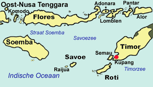
The Lesser Sunda Islands, now known as Nusa Tenggara Islands in Indonesia, is an archipelago in the Indonesian archipelago and Timor Leste. Most of the Lesser Sunda Islands are located within the Wallacea region, except for the Bali province which is west of the Wallace Line and is within the Sunda Shelf. Together with the Greater Sunda Islands to the west, they make up the Sunda Islands. The islands are part of a volcanic arc, the Sunda Arc, formed by subduction along the Sunda Trench in the Java Sea. In 1930 the population was 3,460,059; today over 17 million people live on the islands. Etymologically, the name Nusa Tenggara means 'Southeast Islands' from the words nusa meaning 'island' and tenggara meaning 'southeast'.

The main Lesser Sunda Islands are, from west to east: Bali, Kangean Islands, Lombok, Sumbawa, Flores, Sumba, Savu, Rote, Timor, Atauro, Alor archipelago, Barat Daya Islands, and Tanimbar Islands. Apart from the eastern half of Timor island and Atauro island which constitute the nation of Timor Leste, all the other islands are part of Indonesia.

Adapted from Wikipedia: Lesser Sunda Islands (CC BY-SA 4.0).

Feature class
Island group
Mapped extent
152,621 km²
Size rank
#43 of 445 islands
Region
Asia
Subregion
Malay Archipelago
Countries
Indonesia, Timor-Leste
Coordinates
-7.4912°, 121.7063°
Summits:
Gunung Tambora (2,722 m), Bulu Rantekombola (3,455 m), Gunung Rinjani (3,726 m)
Ranges:
Maoke Mountains (Oceania), Hamersley Range (Oceania)
Settlements:
Maumere (137 km), Ende (153 km), Ruteng (185 km)

View on the live map

More about Lesser Sunda Islands

Geology

The Lesser Sunda Islands consist of two geologically distinct archipelagos. The northern archipelago, which includes Bali, Lombok, Sumbawa, Flores and Wetar, is volcanic in origin. A number of these volcanoes, like Mount Rinjani on Lombok, are still active while others, such as Ilikedeka on Flores, are extinct. The northern archipelago began to be formed during the Pliocene, about 15 million years ago, as a result of the collision between the Australian and the Asian plates. The islands of the southern archipelago, including Sumba, Timor and Babar, are non-volcanic and appear to belong to the Australian plate.

Ecology

The Lesser Sunda Islands differ from the large islands of Java or Sumatra in consisting of many small islands, sometimes divided by deep oceanic trenches. Movement of flora and fauna between islands is limited, leading to the evolution of a high rate of localized species, most famously the Komodo dragon. As described by Alfred Wallace in The Malay Archipelago, the Wallace Line passes between Bali and Lombok, along the deep waters of the Lombok Strait which formed a water barrier even when lower sea levels linked the now-separated islands and landmasses on either side. The islands east of the Lombok Strait are part of Wallacea, and are thus characterised by a blend of wildlife of Asian and Australasian origin in this region.

Sections adapted from Wikipedia: Lesser Sunda Islands (CC BY-SA 4.0).

Lesser Sunda Islands: Key Facts

Key facts about Lesser Sunda Islands
Area87,000 km²
Highest pointRinjani
Surrounded byIndian Ocean

Facts from Wikidata Q3803 (CC0).

Moluccas
Image via Wikimedia Commons (author and licence on the file page).

Moluccas

Island group · 140,372 km²

Moluccas is an island group in Oceania (Melanesia), covering an estimated 140,372 km².

The Maluku Islands ( mə-LUU-koo, -⁠LOO-; Indonesian: Kepulauan Maluku, IPA: [kəpuˈlawan maˈluku]) or the Moluccas ( mə-LUK-əz; Dutch: Molukken [ˌmoːˈlʏkə(n)]) are an archipelago in the eastern part of Indonesia. Tectonically they are located on the Halmahera plate within the Molucca Sea Collision Zone. Geographically located in West Melanesia, the Moluccas have been considered a geographical and cultural intersection of Asia and Oceania.

The islands were known as the Spice Islands because of the nutmeg, mace, and cloves that were exclusively found there, the presence of which sparked European colonial interests in the 16th century.

The Maluku Islands formed a single province from Indonesian independence until 1999, when they were split into two provinces. A new province, North Maluku, incorporates the area between Morotai and Sula, with the arc of islands from Buru and Seram to Wetar remaining within the existing Maluku Province. North Maluku is predominantly Muslim, and its capital is Sofifi on Halmahera island. Maluku province has a larger Christian population, and its capital is Ambon.

Adapted from Wikipedia: Maluku Islands (CC BY-SA 4.0).

Feature class
Island group
Mapped extent
140,372 km²
Size rank
#45 of 445 islands
Region
Oceania
Subregion
Melanesia
Coordinates
-6.2976°, 126.0126°
Summits:
Gunung Binaiya (3,027 m), Bulu Rantekombola (3,455 m), Gunung Tambora (2,722 m)
Ranges:
Maoke Mountains (Oceania), New Guinea Highlands (Oceania)
Settlements:
Dili (256 km), Ambon (376 km), Baubau (387 km)

View on the live map

More about Moluccas

Geography

The Maluku Islands have a total area of 850,000 km2 (330,000 sq mi), 90% of which is sea. There are an estimated 1027 islands. The largest two islands, Halmahera and Seram, are sparsely populated, while the most developed islands, Ambon and Ternate, are small.

The majority of the islands are forested and mountainous. The Tanimbar Islands are dry and hilly, while the Aru Islands are flat and swampy. Mount Binaiya (3,027 m; 9,931 ft) on Seram is the highest mountain. Several islands, such as Ternate (1,721 m; 5,646 ft) and the TNS islands, are volcanoes emerging from the sea with villages sited around their coasts. There have been over 70 serious volcanic eruptions in the last 500 years and earthquakes are common.

History

Australo-Melanesians were the first people to inhabit the islands at least 40,000 years ago. A later migration of Austronesian speakers arrived around 2000 BC.

Archaeological finds in Ternate include a Parvati statue with lotus flowers on the bottom, which indicate the statue is from the Majapahit era and indicate the early period of Hinduism and Buddhism. Other archaeological finds showed possible Arab merchants began to arrive in the fourteenth century, bringing Islam. The conversion to Islam occurred in many islands, especially in the centres of trade, while aboriginal animism persisted in the hinterlands and more isolated islands. Archaeological evidence here relies largely on the occurrence of pigs' teeth, as evidence of pork eating or abstinence therefrom.

Demographics

The population of Maluku Province in 2020 was 1,848,923 and that of North Maluku Province was 1,282,937. Hence the total population of the Maluku Islands as a region in 2020 was 3,131,860.

A long history of trade and seafaring has resulted in a high degree of mixed ancestry in Malukans. Austronesian peoples added to the native Melanesian population around 2000 BC. Melanesian features are strongest in the islands of Kei and Aru and amongst the interior people of the islands Seram and Buru. Later added to this Austronesian-Melanesian mix were some Indian and Arab strain. More recent arrivals include Bugis trader settlers from Sulawesi and Javanese transmigrants.

Economy

Cloves and nutmeg are still cultivated, as are cocoa, coffee and fruit. Fishing is a big industry across the islands but particularly around Halmahera and Bacan. The Aru Islands produce pearls, and Seram exports lobsters. Logging is a significant industry on the larger islands with Seram producing ironwood and teak and ebony are produced on Buru.

Sections adapted from Wikipedia: Maluku Islands (CC BY-SA 4.0).

Moluccas: Key Facts

Key facts about Moluccas
Area74,505 km²
Population1,895,000
Highest pointGunung Binaiya
Surrounded byMolucca Sea

Facts from Wikidata Q3827 (CC0).

Visiting Moluccas

The Maluku Islands, also known as the Moluccas or the Spice Islands, are a region of Indonesia lying between Sulawesi and Papua. They are divided into North Maluku Province and Maluku Province.

These are the famous Spice Islands, which drew Indian, Chinese, Arab and eventually European traders in search of cloves, nutmeg, mace and several other spices that were at the time grown only in these islands. For European traders, these spices were almost as precious as gold. Maluku was the first part of what is now Indonesia to be colonised by Europeans, first the Portuguese, then Spanish and finally the Dutch. As a result, many Moluccans have European names.

The islands are still somewhat off-the-beaten track for travelers. Because of their isolation and lack of infrastructure, some of the small islands are a hidden paradise. Transport can be frustrating, but the combination of pristine reefs, tropical beaches, forest-coated volcanoes, centuries-old forts and charming local culture make the effort worthwhile.

Travel notes adapted from Wikivoyage: Maluku (CC BY-SA 4.0).

Java
Image via Wikimedia Commons (author and licence on the file page).

Java

Island · 126,357 km²

Java is an island in Asia (Malay Archipelago), covering an estimated 126,357 km².

Java is one of the Greater Sunda Islands in the South East Asian country of Indonesia. It is bordered by the Indian Ocean to the south and the Java Sea (a part of Pacific Ocean) to the north. Java is the world's most populous island, home to an estimated 159.2 million people; about 56% of the Indonesian population, while constituting only 7% of the country's land area. Indonesia's capital city, Jakarta, is located on Java's northwestern coast.

Many of the best known events in Indonesian history took place on Java. It was the centre of powerful Hindu-Buddhist empires, the Islamic sultanates, and the core of the colonial Dutch East Indies. Java was also the center of the Indonesian struggle for independence during the 1930s and 1940s. Java dominates Indonesia politically, economically, and culturally. Five of Indonesia's ten UNESCO world heritage sites are located in Java: Ujung Kulon National Park, Borobudur Temple, Prambanan Temple, Yogyakarta, and Sangiran Early Man Site.

Java was formed by volcanic eruptions due to geologic subduction of the Australian Plate under the Sunda Plate.

Adapted from Wikipedia: Java (CC BY-SA 4.0).

Feature class
Island
Mapped extent
126,357 km²
Size rank
#49 of 445 islands
Region
Asia
Subregion
Malay Archipelago
Coordinates
-7.4841°, 111.4129°
Summits:
Gunung Merapi (2,968 m), Gunung Semeru (3,676 m), Gunung Rinjani (3,726 m)
Ranges:
Barisan Mountains (Asia), Hamersley Range (Oceania)
Settlements:
Madiun (20 km), Surakarta (65 km), Kediri (73 km)

View on the live map

More about Java

Geography

Java lies between Sumatra to the west and Bali to the east. Borneo lies to the north, and Christmas Island is to the south. It is the world's 13th largest island. Java is surrounded by the Java Sea to the north, the Sunda Strait to the west, the Indian Ocean to the south and Bali Strait and Madura Strait in the east.

Java is almost entirely of volcanic origin; it contains 38 mountains forming an east–west spine that have at one time or another been active volcanoes. There are 112 volcanoes in all, 35 of which are active. The highest volcano in Java is Mount Semeru, 3,676 metres (12,060 ft). The most active volcano in Java and also in Indonesia is Mount Merapi, 2,930 metres (9,610 ft).

History

Fossilised remains of Homo erectus, popularly known as the "Java Man", dating back 1.3 million years were found along the banks of the Bengawan Solo River.

H. erectus arrived in Eurasia approximately 1.8 million years ago, in an event considered to be the first African exodus. There is evidence that the Java population of H. erectus lived in an ever-wet forest habitat. More specifically the environment resembled a savannah, but was likely regularly inundated ("hydromorphic savanna"). The plants found at the Trinil excavation site included grass (Poaceae), ferns, Ficus, and Indigofera, which are typical of lowland rainforest.

Demographics

Java has been traditionally dominated by an elite class, while the people in the lower classes were often involved in agriculture and fishing. The elite class in Java has evolved over the course of history, as cultural wave after cultural wave immigrated to the island. There is evidence that South Asian emigres were among this elite, as well as Arabian and Persian immigrants during the Islamic eras. More recently, Chinese immigrants have also become part of the economic elite of Java. Although politically the Chinese generally remain sidelined, there are notable exceptions, such as the former governor of Jakarta, Basuki Tjahaja Purnama. Java houses the majority of Indonesia's urban population. Currently, 65% of the island is urbanized.

Economy

Initially the economy of Java relied heavily on rice agriculture. Ancient kingdoms such as the Kingdoms of Sunda, Mataram, and Majapahit were dependent on rice yields and tax. Java was famous for rice surpluses and rice export since ancient times, and rice agriculture contributed to the population growth of the island. Trade with other parts of Asia such as ancient India and China flourished as early as the 4th century, as evidenced by Chinese ceramics found on the island dated to that period. Java also took part in the global trade of Maluku spice from ancient times in the Majapahit era, until well into the Dutch East India Company (VOC) era.

Sections adapted from Wikipedia: Java (CC BY-SA 4.0).

Java: Key Facts

Key facts about Java
Area128,297 km²
Population160,293,748 (2015)
Highest pointSemeru
Surrounded byIndian Ocean, Java Sea

Facts from Wikidata Q3757 (CC0).

Visiting Java

Java (Indonesian: Jawa) is an island in Indonesia. The much smaller but still sizable island of Madura, off the coast of and covered as part of the region of East Java, is also included in this article.

Travel notes adapted from Wikivoyage: Java (CC BY-SA 4.0).

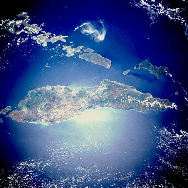
Timor
Image via Wikimedia Commons (author and licence on the file page).

Timor

Island · 28,881 km²

Timor is an island in Asia (Malay Archipelago), covering an estimated 28,881 km². It extends across Timor-Leste and Indonesia. About 47% of the island belongs to Indonesia, and the rest to Timor-Leste.

Timor (Indonesian: Pulau Timor; Portuguese: Ilha de Timor; Tetun: Illa Timór) is an island at the southern end of Maritime Southeast Asia, in the north of the Timor Sea. The name is a variant of timur, Malay for "east"; it is so called because it lies at the eastern end of the Lesser Sunda Islands. Mainland Australia is less than 500 km away, separated by the Timor Sea. The island covers an area of 30,777 square kilometres (11,883 square miles).

With a population of over 3 million people, the island is divided between the sovereign states of Timor-Leste in the eastern part and Indonesia in the western part. The Indonesian part, known as West Timor, is inhabited by around 2 million people and constitutes part of the province of East Nusa Tenggara. Timor-Leste, previously under Indonesian occupation from 1975 to 1999, has a population of around 1.3 million. Within West Timor lies an exclave of Timor-Leste called Oecusse District. The island had previously been divided between the Dutch and Portuguese colonial empires.

Adapted from Wikipedia: Timor (CC BY-SA 4.0).

Feature class
Island
Mapped extent
28,881 km²
Size rank
#99 of 445 islands
Region
Asia
Subregion
Malay Archipelago
Countries
Timor-Leste, Indonesia
Coordinates
-9.7332°, 124.2249°
Summits:
Gunung Tambora (2,722 m), Bulu Rantekombola (3,455 m), Gunung Rinjani (3,726 m)
Ranges:
Maoke Mountains (Oceania), Hamersley Range (Oceania)
Settlements:
Kupang (98 km), Maumere (261 km), Ende (308 km)

View on the live map

More about Timor

Geography

Timor is located north of Australia and Oceania, and is one of the easternmost Sunda Islands and the easternmost of Lesser Sunda Islands. Together with Sumba, Babar and associated smaller islands, Timor forms the southern outer archipelago of the Lesser Sunda Islands with the inner islands of Flores, Alor and Wetar to the north, and beyond them Sulawesi.

Timor is the principal island of the Outer Banda Arc, which is being uplifted by arc-continent collision with the Australian continent. Timor consists mostly of rocks from the Australian continental margin that are accreted to the Banda Arc. It occupies a forearc position in front of the active volcanic arc that forms the islands in the Flores region to the north.

History

The earliest historical record about Timor island is the 13th-century Chinese Zhu Fan Zhi, where it is called Ti-wu and is noted for its sandalwood. In the 14th-century, Javanese Nagarakretagama, Canto 14, Timur is identified as an island within Majapahit's realm. Timor was incorporated into ancient Javanese, Chinese and Indian trading networks of the 14th century as an exporter of aromatic sandalwood, slaves, honey and wax, and was settled by both the Portuguese, in the end of the 16th century, and the Dutch, based in Kupang, in the mid-17th century.

As the nearest island with a European settlement at the time, Timor was the destination of William Bligh and seamen loyal to him following the infamous mutiny on the Bounty in 1789.

Geology

Timor is an aerially exposed portion of the Banda Forearc formed by collision of Eurasian oceanic crust and continental crust of the Australian plate. This is a unique convergent margin where a thick continental margin is forced under thinner oceanic crust. The result is a large accretionary wedge of imbricated thrust sheets composed of Cretaceous and Tertiary distal material of the Australian continental margin thrust on top of Australian continental shelf deposits. Timor is well known for its structural complexity. Debate continues about the nature of deformation of continental crust. Some researchers advocate shallow thin-skinned deformation, while others favor shallow thin-skinned with some basement deformation.

Timor also has potential for significant petroleum development.

Sections adapted from Wikipedia: Timor (CC BY-SA 4.0).

Timor: Key Facts

Key facts about Timor
Area30,777 km²
Population3,368,735 (2023)
Highest pointTatamailau
Surrounded byTimor Sea

Facts from Wikidata Q83067 (CC0).

Visiting Timor

Timor is an elongated island in the Indonesian archipelago, to the north of Australia. The island is divided into two separate territories:

Timor-Leste, an independent republic since 2002

West Timor, part of the Indonesian province of Nusa Tenggara Timur (East Nusa Tenggara)

Travel notes adapted from Wikivoyage: Timor (CC BY-SA 4.0).

Halmahera
Image via Wikimedia Commons (author and licence on the file page).

Halmahera

Island · 18,295 km²

Halmahera is an island in Oceania (Melanesia), covering an estimated 18,295 km².

Halmahera, formerly known as Jilolo, Gilolo, or Jailolo, is the largest island in the Maluku Islands. It is part of the North Maluku province of Indonesia, and Sofifi, the capital of the province, is located on the west coast of the island.

Halmahera has a land area of 17,780 km2 (6,860 sq mi). It is the 7th largest island of Indonesia. It had a population of 162,728 in 1995; by 2010, it had increased to 449,938 for the island itself (excluding the tip which is considered part of the Joronga Islands, but including Gebe and Ju islands) and 667,161 for the island group (including all of South Halmahera and Tidore, but not Ternate). Approximately half of the island's inhabitants are Muslim and half are Christian.

Adapted from Wikipedia: Halmahera (CC BY-SA 4.0).

Feature class
Island
Mapped extent
18,295 km²
Size rank
#112 of 445 islands
Region
Oceania
Subregion
Melanesia
Coordinates
1.5115°, 127.7794°
Summits:
Gunung Binaiya (3,027 m), Mount Apo (2,954 m), Bulu Rantekombola (3,455 m)
Ranges:
Maoke Mountains (Oceania), New Guinea Highlands (Oceania)
Settlements:
Ternate (92 km), Tidore (98 km), Manado (326 km)

View on the live map

More about Halmahera

History

Sparsely populated Halmahera's fortunes have long been closely tied to those of the smaller islands of Ternate and Tidore, both off its west coast. This island was the site of Sultanate of Jailolo, one of the four kingdoms of Maluku (Maloko Kië Raha, of Ternate, Tidore, Bacan, and Jailolo) in the era before Dutch East India Company colonized the entire archipelago. The north of the island is also the base of Loloda Kingdom, one of the earlier 13th century Moluccan kingdoms, but not recognized as one of the prominent four.

During World War II, Halmahera was the site of a Japanese naval base at Kao Bay.

Geology

The volcanic island lies on an island arc that includes the Raja Ampat Islands, all uplifted by the northward migration of the continent of Australia and subduction of the Pacific Plate. Dukono is an active volcano at the north end of the island. Mount Ibu is an active volcano on the island's northwest coast. Ultramafic rocks and ophiolites form the bedrock over large areas of the eastern peninsula.

Ecology

The flightless invisible rail is endemic to the island. The recently discovered palm tree Jailoloa halmaherensis is also endemic to Halmahera.

The naturalist Alfred Russel Wallace visited Halmahera, as described in his 1869 book The Malay Archipelago. He considered the standardwing bird of paradise, Semioptera wallacii, to be his greatest prize. It was in February 1858, on the island of Ternate (or perhaps while on Halmahera itself), between bouts of fever, that Wallace came to the idea of natural selection via the survival of the fittest. Wallace wrote his ideas during the next couple of days, and sent the historical letter to Darwin.

Sections adapted from Wikipedia: Halmahera (CC BY-SA 4.0).

Halmahera: Key Facts

Key facts about Halmahera
Area17,780 km²
Population180,000
Highest pointMount Gamkonora
Surrounded byHalmahera Sea, Molucca Sea

Facts from Wikidata Q201398 (CC0).

Ceram
Image via Wikimedia Commons (author and licence on the file page).

Ceram

Island · 17,423 km²

Ceram is an island in Oceania (Melanesia), covering an estimated 17,423 km².

Seram (formerly spelled Ceram; also Seran or Serang) is the largest and main island of Maluku province of Indonesia, despite Ambon Island's historical importance. It is located just north of the smaller Ambon Island and a few other adjacent islands, such as Saparua, Haruku, Nusa Laut and the Banda Islands.

Adapted from Wikipedia: Seram Island (CC BY-SA 4.0).

Feature class
Island
Mapped extent
17,423 km²
Size rank
#117 of 445 islands
Region
Oceania
Subregion
Melanesia
Coordinates
-3.2731°, 130.2660°
Summits:
Gunung Binaiya (3,027 m), Puncak Jaya (4,884 m), Bulu Rantekombola (3,455 m)
Ranges:
Maoke Mountains (Oceania), New Guinea Highlands (Oceania)
Settlements:
Amahai (147 km), Ambon (235 km), Sorong (292 km)

View on the live map

More about Ceram

Geography and geology

Seram is traversed by a central mountain range, the highest point of which, Mount Binaiya, is covered with dense rain forests. Its remarkably complex geology is because of its location at the meeting of several tectonic microplates, which have been described as "one of the most tectonically complex areas on Earth". Seram falls on its microplate, which has been twisted around by 80° in the last 8 million years by the relatively faster movement of the Papua microplate. Meanwhile, along with the northward push of the Australian Plate, this has resulted in the uplift that gives north-central Seram peaks of over 3000 m. On the island, there are important karst areas. In the mountains, near Sawai, there is the cave Hatu Saka, currently the deepest cave in Indonesia (-388 m).

History

Most central Moluccans consider Seram to be their original ancestral home and it is still known colloquially as Nusa Ina (Mother Island).

In the fifteenth and sixteenth centuries, Seram was generally within the sphere of influence of Ternate, although it was often ruled more directly by the Ternaten vassal state of Buru. The expedition of António de Abreu (as captain) and Francisco Serrão sighted and explored the entire southern coast of Seram in early 1512, for the first time for Europeans. Portuguese missionaries were active there in the 16th century. Dutch trading posts were opened in the early 17th century, and the island came under nominal Dutch control c. 1650.

Ecology

Seram Island is remarkable for its high degree of localised bird endemism. There are 117 species of birds on the island; 14 species and subspecies are endemic, including the eclectus, great-billed and Moluccan king parrot, purple-naped and red lories, salmon-crested cockatoo, Seram masked owl, collared, sacred and lazuli kingfishers, long-crested myna, elegant imperial-pigeon, Seram oriole, metallic starlings and grey-necked and Seram friarbirds.

The mammals found on Seram include Asian murid rodents as well as Australasian marsupials, including the common spotted cuscus and several species of Phalanger. The mountain area of Seram supports the greatest number of endemic mammals of any island in the region.

Economy

Copra, resin, sago, and fish are important products. Oil is produced in the northeast near Bula by CITIC Seram Energy who took over from KUFPEC (Indonesia) Limited in 2006. The Oseil oil field is located onshore in the northeast of the island in the Seram Non-Bula Production Sharing Contract area. The discovery well was drilled in 1993. As of end 2010 the Seram Non-Bula Block had estimated proven oil reserves of 9.7 million barrels. Most production comes from the Jurassic Manusela carbonate formation.

Sections adapted from Wikipedia: Seram Island (CC BY-SA 4.0).

Ceram: Key Facts

Key facts about Ceram
Area70,370 km²
Population218,993
Highest pointGunung Binaiya
Surrounded bySeram Sea, Banda Sea

Facts from Wikidata Q185532 (CC0).

Aru Islands
Image via Wikimedia Commons (author and licence on the file page).

Aru Islands

Island group · 15,596 km²

Aru Islands is an island group in Oceania (Melanesia), covering an estimated 15,596 km².

The Aru Islands Regency (Indonesian: Kabupaten Kepulauan Aru) is a group of about 95 low-lying islands in the Maluku Islands of eastern Indonesia. It also forms a regency of Maluku Province, with a land area of 6,426.77 km2 (2,481.39 sq mi). At the 2011 Census the Regency had a population of 84,138; the 2020 Census produced a total of 102,237, and the official estimate as at mid 2024 was 112,531 (comprising 57,767 males and 54,764 females). Some sources regard the archipelago as part of Asia, while others regard it as part of Melanesia.

Adapted from Wikipedia: Aru Islands Regency (CC BY-SA 4.0).

Feature class
Island group
Mapped extent
15,596 km²
Size rank
#122 of 445 islands
Region
Oceania
Subregion
Melanesia
Coordinates
-6.2376°, 134.4684°
Summits:
Puncak Jaya (4,884 m), Gunung Binaiya (3,027 m), Mount Wilhelm (4,509 m)
Ranges:
Maoke Mountains (Oceania), New Guinea Highlands (Oceania)
Settlements:
Timika (327 km), Nabire (341 km), Biak (591 km)

View on the live map

More about Aru Islands

Geography

The Aru Islands are the easternmost archipelago in Maluku province, and are located in the Arafura Sea south of West Papua (province), New Guinea and north of Australia. The total area of the islands is 6,426.77 km2 (2,481.39 sq mi). The largest island is Tanahbesar (also called Wokam); Dobo, the chief port of the islands, is on Wamar, just off Tanahbesar. The other five main islands are Kola, Kobroor, Maikoor, Koba, and Trangan. Altogether there are some 676 islands, of which 28 are inhabited. The main islands rise to low hills, and are separated by meandering channels. Geologically, unlike the rest of Maluku, the group is part of the Australian continent, along with New Guinea, Tasmania, Waigeo, and Raja Ampat on the Australian Plate.

History

The Aru Islands have a long history as a part of extensive trading networks throughout what is now eastern Indonesia. Precolonial links were especially strong to the Banda Islands, and Bugis and Makasarese traders also visited regularly. The traditional society was not pronounced hierarchical, being based on lineage-based clans where the members shared duties of hospitality and cooperation. These island communities were divided into two ritual bonds called Ursia and Urlima, a socio-political system found in many parts of Maluku. Such alliances were connected to pre-European trade networks.

Demographics

The islands had a population of 84,138 at the 2010 Census; the 2020 Census produced a total of 102,237, and the official estimate as at mid 2024 was 112,531. Most indigenous islanders are of mixed Austronesian and Papuan descent. Fourteen languages – Barakai, Batuley, Dobel, Karey, Koba, Kola, Kompane, Lola, Lorang, Manombai, Mariri, East Tarangan, West Tarangan, and Ujir – are indigenous to Aru. They belong to the Central Malayo-Polynesian languages, and are related to the other languages of Maluku, Nusa Tenggara, and Timor. Ambonese Malay is also spoken on Wamar. All are members of the Austronesian language family.

The population is mostly Christian with a small Muslim minority. Figures cited by Glenn Dolcemascolo for 1993 were approximately 90% Protestant, 6% Catholic, and 4% Muslim.

Economy

Throughout its history, the Aru Islands exported luxury natural products like birds-of-paradise, turtle shells, and pearls to Asia and later Europe. While the islands were positioned within the global trade network, local Aru society was able to preserve its independence and egalitarianism.

Pearl farming continues to provide a major source of income for the islands. The Aru pearl industry has been criticized in the national media for allegedly maintaining exploitative debt structures that bind the local men who dive for pearls to outside boat owners and traders in an unequal relationship.

Sections adapted from Wikipedia: Aru Islands Regency (CC BY-SA 4.0).

Aru Islands: Key Facts

Key facts about Aru Islands
Area8,152 km²
Population100,766
Surrounded byArafura Sea

Facts from Wikidata Q16561 (CC0).

Sumbawa
Image via Wikimedia Commons (author and licence on the file page).

Sumbawa

Island · 14,433 km²

Sumbawa is an island in Asia (Malay Archipelago), covering an estimated 14,433 km².

Sumbawa is an Indonesian island, located in the middle of the Lesser Sunda Islands chain, with Lombok to the west, Flores to the east, and Sumba further to the southeast. Along with Lombok, it forms the province of West Nusa Tenggara, but there have been plans (currently held in abeyance) by the Indonesian government to split the island off into a separate province. Traditionally, the island is known as the source of sappanwood, as well as honey and sandalwood. Its savanna-like climate and vast grasslands are used to breed horses and cattle, as well as to hunt deer.

Sumbawa has an area of 15,448 square kilometres or 5,965 square miles (three times the size of Lombok) with a population (at the 2020 Census) of 1,561,461; the official estimate as at mid-2024 was 1,669,787. It marks the boundary between the islands to the west, which were influenced by religion and culture spreading from India, and the region to the east which was less influenced. In particular, this applies to both Hinduism and Islam.

Adapted from Wikipedia: Sumbawa (CC BY-SA 4.0).

Feature class
Island
Mapped extent
14,433 km²
Size rank
#123 of 445 islands
Region
Asia
Subregion
Malay Archipelago
Coordinates
-8.7153°, 117.2100°
Summits:
Gunung Rinjani (3,726 m), Gunung Tambora (2,722 m), Gunung Semeru (3,676 m)
Ranges:
Hamersley Range (Oceania), Barisan Mountains (Asia)
Settlements:
Praya (101 km), Mataram (119 km), Raba (174 km)

View on the live map

More about Sumbawa

Geography

The island is bounded by bodies of water on all sides; to the west is the Alas Strait, which separates it from Lombok; to the south is the Indian Ocean, with Cempi Bay and Waworada Bay providing major indentations along the south coast; the Sape Strait lies to the east of the island and separates Sumbawa from Flores and the Komodo Islands; the Flores Sea runs the length of the northern coastline, where Saleh Bay creates a major north-central indentation in the island, almost cutting the island in two parts, and other inlets include most notably Bima Bay.

Sumbawa's most distinguishing features are Saleh Bay and the Sanggar Peninsula.

History

The 14th-century Nagarakretagama mentioned several principalities identified to be on eastern Sumbawa; Dompu, Bima, Sape, and one on the Sangeang Api island just off the coast of northeast Sumbawa. Four principalities in western Sumbawa were dependencies of the Majapahit Empire of eastern Java. Because of Sumbawa's natural resources, it was regularly invaded by outside forces – from the Javanese, Balinese, and Makassar, to the Dutch and Japanese. The Dutch first arrived in 1605 but did not effectively rule Sumbawa until the early 20th century.

For a short period, the Balinese kingdom of Gelgel ruled a part of western Sumbawa.

Demographics

Islam, the dominant faith of the island, was introduced by the Makassarese of Sulawesi.

Sumbawa had, historically speaking, three major linguistic groups who spoke languages that were unintelligible to each other. The Sumbawa people centered on the western side of the island speak Basa Semawa (Indonesian: Bahasa Sumbawa) which is similar to the Sasak language from nearby Lombok; the Bima people in the east speak Nggahi Mbojo (Bahasa Bima), which is closer to the languages spoken on Flores and Sumba. They were once separated by the Tambora culture, which spoke a language related to neither. After the demise of Tambora due to the 1815 eruption, local kingdoms based in Sumbawa Besar and Bima became the two focal points of Sumbawa.

Economy

Many of the island residents are at risk of starvation when crops fail due to lack of rainfall. The majority of the population works in agriculture. Tourism is just beginning, with a few surf spots renowned for being world-class, Jelenga and Supersuck Beaches near the mine, as well as Hu'u and Lakey Beach in the Gulf of Cempi.

A large gold and copper mine, Newmont Mining Corporation's Batu Hijau mine began commercial operations in 2000, a decade after the copper and gold were discovered. Newmont holds a 45% stake in the operation through its shareholding in PT Newmont Nusa Tenggara. A local unit of Japan's Sumitomo Corporation has a 35% share. The mine is located in southwest Sumbawa.

Sections adapted from Wikipedia: Sumbawa (CC BY-SA 4.0).

Sumbawa: Key Facts

Key facts about Sumbawa
Area14,386 km²
Population1,330,000
Highest pointTambora
Surrounded byIndian Ocean

Facts from Wikidata Q186367 (CC0).

Visiting Sumbawa

Sumbawa is one of the 13,000+ islands in the Indonesian archipelago. It is a large island to the east of Bali and Lombok. Sumbawa, along with Lombok, is part of West Nusa Tenggara. There are hundreds of small islands in this area in addition to the two major islands.

Sumbawa is known to some tourists for its great waves and sandy white beaches. Due to the somewhat trying process of getting there, the scarcity of cheap tourist facilities, and the absence of clear local sights (which are either unexplored or too expensive to explore), the island is not visited much by non-surfing tourists — which is unfortunate, as parts of the island are quite beautiful.

Travel notes adapted from Wikivoyage: Sumbawa (CC BY-SA 4.0).

Flores
Image via Wikimedia Commons (author and licence on the file page).

Flores

Island · 14,371 km²

Flores is an island in Asia (Malay Archipelago), covering an estimated 14,371 km².

Flores ( FLOR-ess) is one of the Lesser Sunda Islands, a group of islands in the eastern half of Indonesia. Administratively, it forms the largest island in the East Nusa Tenggara Province. The area is 14,250 km2 (5,500 sq mi), similar to Shikoku or Jamaica. Including Komodo and Rinca islands off its west coast (but excluding the Solor Archipelago to the east of Flores), the population was 1,878,875 in the 2020 Census (including various offshore islands); the official estimate as of mid-2024 was 2,014,110. The largest towns are Ende and Maumere. The name Flores is of Portuguese origin, meaning "Flowers".

Flores is located east of Sumbawa and the Komodo Islands, and west of the Solor Islands and the Alor Archipelago. To the southeast is Timor. To the south, across the Sumba Strait, is Sumba Island, and to the north, beyond the Flores Sea, is Sulawesi.

Among all islands containing Indonesian territory, Flores is the 10th most populous after Java, Sumatra, Borneo (Kalimantan), Sulawesi, New Guinea, Bali, Madura, Lombok, and Timor, and also the 10th biggest island of Indonesia.

Adapted from Wikipedia: Flores (CC BY-SA 4.0).

Feature class
Island
Mapped extent
14,371 km²
Size rank
#125 of 445 islands
Region
Asia
Subregion
Malay Archipelago
Coordinates
-8.5327°, 120.4174°
Summits:
Gunung Tambora (2,722 m), Gunung Rinjani (3,726 m), Bulu Rantekombola (3,455 m)
Ranges:
Hamersley Range (Oceania), Maoke Mountains (Oceania)
Settlements:
Ruteng (11 km), Waingapu (126 km), Ende (140 km)

View on the live map

More about Flores

History

Before the arrival of modern humans, Flores was occupied by Homo floresiensis, a small archaic human. The ancestors of Homo floresiensis arrived on the island between 1.3 and 1 million years ago.

As of 2015, partial remains of fifteen individuals have been found by a joint Australian-Indonesian research team, headed by Mike Morwood and Thomas Sutikna, and the dominant consensus is that these remains do represent a distinct species due to anatomical differences from modern humans. The most recent evidence shows that Homo floresiensis likely became extinct 50,000 years ago, around the time of modern human arrival to the archipelago.

Flores was most likely first inhabited by Melanesians at least since 30,000 BC.

Economy

In addition to tourism, the main economic activities on Flores are agriculture, fishing, and seaweed production. The primary food crops being grown on Flores are rice, maize, sweet potato and cassava, while the main cash crops are coffee, coconut, candle nut and cashew. Flores is one of the newest origins for Indonesian coffee. Previously, most Arabica coffee (Coffea arabica) from Flores was blended with other origins. Now, demand is growing for this coffee due to its rich body and sweet, chocolatey, floral, and woody notes.

In the 1980s, cotton crops were encouraged to generate income for the poorer subsistence farmers. It is planted in low-lying areas of the island.

Tourism

The most famous tourist attraction in Flores is the 1,639-metre-high (5,377-foot) Kelimutu volcano, which contains three colored lakes, located in the district of Ende, close to the town of Moni. However, there is also the Inierie volcano near Bajawa. These crater lakes are located in the caldera of a volcano and are fed by a volcanic gas source, resulting in highly acidic water. The colored lakes change colors on an irregular basis, depending on the oxidation state of the lake from bright red to green and blue.

There are snorkeling and diving locations along the north coast of Flores, most notably Maumere and Riung.

Sections adapted from Wikipedia: Flores (CC BY-SA 4.0).

Flores: Key Facts

Key facts about Flores
Area13,540 km²
Population1,831,000 (2010)
Highest pointPoco Likang
Surrounded byIndian Ocean

Facts from Wikidata Q148440 (CC0).

Bangka
Image via Wikimedia Commons (author and licence on the file page).

Bangka

Island · 11,740 km²

Bangka is an island in Asia (Malay Archipelago), covering an estimated 11,740 km².

Bangka is an island lying east of Sumatra, Indonesia. It is administered under the province of the Bangka Belitung Islands, being one of its namesakes alongside the smaller island of Belitung across the Gaspar Strait. The 9th largest island in Indonesia, it had a population of 1,146,581 at the 2020 census; the official estimate as at mid 2023 was 1,191,300. It is the location of the provincial capital of Pangkal Pinang, and is administratively divided into four regencies and a city. The island itself and the surrounding sea suffers considerable environmental damage from its thriving tin mining industry which operates on- and offshore.

Adapted from Wikipedia: Bangka Island (CC BY-SA 4.0).

Feature class
Island
Mapped extent
11,740 km²
Size rank
#138 of 445 islands
Region
Asia
Subregion
Malay Archipelago
Coordinates
-2.6105°, 106.1620°
Summits:
Gunung Kerinci (3,805 m), Gunung Merapi (2,968 m), Gunung Tahan (2,190 m)
Ranges:
Barisan Mountains (Asia), Dângrêk Range (Asia)
Settlements:
Pangkalpinang (59 km), Palembang (162 km), Tanjungpandan (166 km)

View on the live map

More about Bangka

Geography

Bangka is the largest landmass of the province of the Bangka Belitung Islands. It lies just east of Sumatra, separated by the Bangka Strait; to the north lies the South China Sea, to the east, across the Gaspar Strait, is the island of Belitung, and to the south is the Java Sea. It is about 11,831 km2 in area (including offshore islands). Most of its geography consists of lower plains, swamps, small hills, and beaches (including Pasir Padi). It has white pepper fields, many palm trees, rubber trees, and tin mines.

The island's largest city, Pangkal Pinang, is also the capital and largest city of the province. The town of Sungailiat is its second-largest settlement. Mentok (formerly Muntok) is the principal port in the west.

History

During the glacial periods, Bangka was connected to mainland Asia similarly with the larger islands of Java, Sumatra, and Borneo as part of the Sunda Shelf, and got separated once the sea level rose.

The Kota Kapur inscription, dated from 686 CE, was found in Bangka in 1920, showed Srivijayan influence on the island around the 7th century. Later, the island was conquered by an expedition from Majapahit, led by Gajah Mada, which appointed local rulers and established social structures. As the empire declined, Bangka fell into neglect.

Bangka was recorded as Peng-ka hill (彭加山) in the 1436 Xingcha Shenglan, compiled by the Chinese soldier Fei Xin during the treasure voyages of Admiral Zheng He.

Demographics

The majority of the inhabitants are Malays and Chinese, mostly Hakkas. The population is split between those work on the tin mines, palm oil plantations, rubber plantations, fisherman and those who work on pepper farms.

Economy

Since circa 1710, Bangka has been one of the world's main tin-producing centers. Tin production is a government monopoly in Indonesia. There is a tin smelter at Muntok. Indonesia is the second-largest tin producer and exporter in the world. Indonesia's largest tin production is produced on Bangka Island which makes it a strategic area for Indonesia in terms of world tin trade. But heavy tin exploitation caused environmental damage and much of the land suffers from infertility after being turned into (often illegal) tin mine. Irresponsible miners let the mine land become trenches filled with water and the surrounding land becomes arid with nothing to grow. This is a critical environmental issue.

Sections adapted from Wikipedia: Bangka Island (CC BY-SA 4.0).

Bangka: Key Facts

Key facts about Bangka
Area11,413 km²
Population626,955
Surrounded byKarimata Strait

Facts from Wikidata Q188428 (CC0).

Yos Sudarso Island
Image via Wikimedia Commons (author and licence on the file page).

Yos Sudarso Island

Island · 11,680 km²

Yos Sudarso Island is an island in Oceania (Melanesia), covering an estimated 11,680 km².

Kolepom Island or Pulau Yos Sudarso is an island separated by the narrow Muli Strait from the main island of New Guinea. It is part of the Merauke Regency, in the Indonesian province of South Papua. The island is leaf-shaped, about 165 km (103 mi) long with an area of 11,740 km2 (4,530 sq mi). It was known as Frederik Hendrik Island until 1963. Local and alternative names of the island include Dolok and Kimaam. This is the 11th largest island in Indonesia.

With about 11,000 inhabitants, the island's population density is less than 1 per square kilometre (2.5/sq mi). The native population speaks Kolopom languages, including Kimaghima, Ndom, and Riantana/Kimaan. Communities on the island include Kaba, Kimaan, Kladar, Pembre, Wan, and Yomuka. Kimaan (or Kimaam) is the main settlement. It lies in the southeast on the Buaya Strait that separates the smaller island of Komoran from Dolak.

Adapted from Wikipedia: Yos Sudarso Island (CC BY-SA 4.0).

Feature class
Island
Mapped extent
11,680 km²
Size rank
#139 of 445 islands
Region
Oceania
Subregion
Melanesia
Coordinates
-7.8776°, 138.3611°
Summits:
Puncak Jaya (4,884 m), Mount Wilhelm (4,509 m), Gunung Binaiya (3,027 m)
Ranges:
Maoke Mountains (Oceania), New Guinea Highlands (Oceania)
Settlements:
Merauke (235 km), Timika (404 km), Nabire (594 km)

View on the live map

More about Yos Sudarso Island

History

The island was first sighted by Europeans in about January 1606 when Willem Jansz and his crew on the ship Duyfken rounded it on their way to and returning from their discovery of Australia. Duyfken spent considerable time in the bight in between the island and the mainland. Jansz's map of the expedition describes the island as lowland and muddy land and with the name "Tiuri". When rounding the prominent southwest cape, jutting into the Arafura Sea, in 1623, Jan Carstensz named it Valse Kaap (Dutch for "False Cape"), a name retained to date (Indonesian Tanjung Vals, English "Cape Vals").

Sections adapted from Wikipedia: Yos Sudarso Island (CC BY-SA 4.0).

Yos Sudarso Island: Key Facts

Key facts about Yos Sudarso Island
Area11,742 km²
Population11,000
Surrounded byArafura Sea

Facts from Wikidata Q329452 (CC0).

Sumba
Image via Wikimedia Commons (author and licence on the file page).

Sumba

Island · 10,876 km²

Sumba is an island in Asia (Malay Archipelago), covering an estimated 10,876 km².

Sumba (Indonesian: Pulau Sumba), natively also spelt as Humba, Hubba, Suba, or Zuba (in Sumba languages) is an Indonesian island (part of the Lesser Sunda Archipelago group) located in the Eastern Indonesia and administratively part of the East Nusa Tenggara provincial territory. Sumba has a land area of 10,909.55 square kilometres (4,212.20 square miles), about the same size as Jamaica or the island of Hawaii. The population was 686,113 at the 2010 Census and 779,049 at the 2020 Census; the official estimate as of mid-2025 was 852,832. To the northwest of Sumba is Sumbawa, to the northeast, across the Sumba Strait (Selat Sumba), is Flores, to the east, across the Savu Sea (including Savu Island), is Timor, and to the south, across part of the Indian Ocean, is Australia.

Adapted from Wikipedia: Sumba (CC BY-SA 4.0).

Feature class
Island
Mapped extent
10,876 km²
Size rank
#150 of 445 islands
Region
Asia
Subregion
Malay Archipelago
Coordinates
-9.9619°, 120.3690°
Summits:
Gunung Tambora (2,722 m), Gunung Rinjani (3,726 m), Bulu Rantekombola (3,455 m)
Ranges:
Hamersley Range (Oceania), Maoke Mountains (Oceania)
Settlements:
Waingapu (36 km), Ruteng (151 km), Ende (186 km)

View on the live map

More about Sumba

Geography, climate and ecology

The largest town on the island is the main port of Waingapu near the mouth of the Kambaniru River, with a population of 71,752 (including the adjoining district of Kambera) in mid 2023.

The landscape is low, with limestone hills rather than the steep volcanoes of many Indonesian islands. There is a dry season from May to November and a rainy season from December to April. The western side of the island is more fertile and more densely populated than the east.

Although generally thought to be originally part of the Gondwana southern hemisphere supercontinent, recent research suggests that the island might have detached from the South East Asia margin.

History

According to Sumbanese mythology, Flores and Sumba were once connected by the Kataka Lindiwatu (in Sumba languages), an ancient stone bridge built by the native of Sumba and Flores. Due to the high level of socialization around the Kataka Lindiwatu which connected both islands, civilization was thought to arise from around those regions (which nowadays correspond to northern Sumba and to part of East Sumba regency territory). This story belongs to the Sumba oral traditions as was written down by Umbu Pura Woha (2007) in his book Sejarah, Musyawarah dan Adat Istiadat Sumba Timur (lit. 'History, Deliberation and Customs of East Sumba').

Tourism

Tanggedu Waterfall (Air Terjun Tanggedu), 50 kilometres north-west of Waingapu, the capital city of the East Sumba Regency (the itinerary to the waterfall goes through Purukambera on the coast).

Tarimbang Bay, 87 kilometres south-west of Waingapu (three-hour drive), is a surfers paradise with 2- to 3-meter tall waves between June and September.

Watu Mandorak Cove, a white sandy beach with cliffs 42 kilometers south-west of Tambolaka (two-hour drive in the dry season; in the rainy season, the journey takes longer and is not recommended).

Walakiri Beach, 24 km (15 mi) east of Waingapu, for its famed "dancing trees".

The Sumba Hospitality Foundation is located in West Sumba (Sumba Barat).

Sections adapted from Wikipedia: Sumba (CC BY-SA 4.0).

Sumba: Key Facts

Key facts about Sumba
Area10,711 km²
Population611,422
Surrounded byIndian Ocean

Facts from Wikidata Q206368 (CC0).

Buru
Image via Wikimedia Commons (author and licence on the file page).

Buru

Island · 8,402 km²

Buru is an island in Oceania (Melanesia), covering an estimated 8,402 km².

Buru (formerly spelled Boeroe, Boro, or Bouru) is the third largest island within the Maluku Islands of Indonesia. It lies between the Banda Sea to the south and Seram Sea to the north, west of Ambon and Seram islands. The island belongs to Maluku province and includes the Buru and South Buru regencies. Their administrative centers, Namlea and Namrole, respectively, have ports and are the largest towns of the island, served by Namlea Airport and Namrole Airport respectively.

About a third of the population is indigenous, mostly the Buru, but also the Lisela, Ambelau, Kayeli, Masarete, Rana, Wai Apu, and Wai Loa. The rest of population are immigrants from Java and nearby Maluku Islands. Religious affiliation is evenly split between Christianity and Sunni Islam, with some remnants of traditional beliefs. While local languages and dialects are spoken within individual communities, the national Indonesian language is used among the communities and by the administration. Most of the island is covered with forests rich in tropical flora and fauna.

Adapted from Wikipedia: Buru (CC BY-SA 4.0).

Feature class
Island
Mapped extent
8,402 km²
Size rank
#164 of 445 islands
Region
Oceania
Subregion
Melanesia
Coordinates
-3.4288°, 126.6853°
Summits:
Gunung Binaiya (3,027 m), Bulu Rantekombola (3,455 m), Gunung Tambora (2,722 m)
Ranges:
Maoke Mountains (Oceania), New Guinea Highlands (Oceania)
Settlements:
Ambon (171 km), Amahai (251 km), Kendari (457 km)

View on the live map

More about Buru

Geography and geology

Buru island lies between two seas of the Pacific Ocean – Seram Sea (Indonesian: Laut Seram) on the north and Banda Sea (Indonesian: Laut Banda) to the south and west. To the east, it is separated by the Manipa Strait (Indonesian: Selat Manipa) from Seram Island (Indonesian: Pulau Seram). With an area of 9,505 km2 (3,670 sq mi), Buru is the third largest among the Maluku Islands (Indonesian: Kepulauan Maluku) after Halmahera and Seram.

Buru is shaped like an oval, elongated from west to east. The maximum length is about 130 km (81 mi) from east to west and 90 km (56 mi) from north to south. The coastline is smooth, with the only major indentation being Kayeli Bay located on the eastern coast. The bay also has a smooth, oval shape.

History

One of the first mentions of Buru occurred in the Nagarakretagama – an Old Javanese eulogy to Hayam Wuruk, the ruler of the Majapahit Kingdom, dating back to 1365. The island appears in the third line of 15th song in the list of lands subordinate to Majapahit under the name Hutan Kadali.

In the 16th–17th centuries Buru was claimed by the rulers of Ternate island and by the Portuguese; both claims were, however, symbolic, as neither party controlled the island, but only visited it on trade matters. More active were Makassar people from Sulawesi island, who had built fortifications on Buru and forced the natives to grow valuable spices, such as clove.

Climate

The climate is equatorial monsoonal, wet, and in general typical for the Maluku Islands. The rainy season extends from October to April with the highest rainfall in December–February. Despite the relatively small size of the island, its mountainous terrain results in several climatic zones. Apart from temperature reduction with altitude, the temperature variations across these zones are negligible, with the annual average of about 26 °C, However the annual precipitation differs and amounts to 1,400–1,800 mm in the north, 1,800–2,000 mm in the center, 2,000–2,500 mm in the south and 3,000–4,000 mm in the mountains, at elevation above 500 m.

Economy

Economic development of the island was depressed in the late 1990s as a result of the national and regional crisis. The growth resumed in the early 2000s, however, unemployment remains high (9.92% of the population in 2008), and more than 37% of islanders are living below the national poverty line (as of 2008).

The basis of the island's economy is agriculture which contributed 51.22% to the GDP in 2008. The major crop is rice with plantations taking an area of more than 5,700 hectares and yielding about 23,000 tonnes per the year (for 2008) in just Buru Regency. Most rice fields are located on the northern coasts of the island, in the districts of Namlea, Waeapo and Air Buaya.

Sections adapted from Wikipedia: Buru (CC BY-SA 4.0).

Buru: Key Facts

Key facts about Buru
Area8,473 km²
Population124,000
Highest pointMount Kapalatmada
Surrounded bySeram Sea, Banda Sea

Facts from Wikidata Q271030 (CC0).

Sangihe Islands
Image via Wikimedia Commons (author and licence on the file page).

Sangihe Islands

Island group · 6,087 km²

Sangihe Islands is an island group in Asia (Malay Archipelago), covering an estimated 6,087 km².

The Sangihe Islands (also spelled "Sangir", "Sanghir" or "Sangi") – Indonesian: Kepulauan Sangihe – are a group of islands that constitute two regencies within the province of North Sulawesi, in northern Indonesia, the Sangihe Islands Regency (Kabupaten Kepulauan Sangihe) and the Sitaro Islands Regency (Kabupaten Siau Tagulandang Biaro). They are located northeast of Sulawesi between the Celebes Sea and the Molucca Sea, roughly halfway between Sulawesi and Mindanao, in the Philippines; the Sangihes form the eastern limit of the Celebes Sea. The islands combine to total 813 square kilometers (314 sq mi), with many of the islands being actively volcanic with fertile soil and mountains.

The main islands of the group are, north to south, Sangir Besar (or Sangir Island), Siau (or Siao), Tagulandang, and Biaro. The largest island is Sangir Besar and contains an active volcano, Mount Awu (1,320 meters (4,330 ft)). Tahuna is the chief town and port, also hosting the islands' sole airport, Naha Airport.

The area came under Dutch control in 1677 and became part of Indonesia when it declared independence from the Netherlands in 1945.

Adapted from Wikipedia: Sangihe Islands (CC BY-SA 4.0).

Feature class
Island group
Mapped extent
6,087 km²
Size rank
#181 of 445 islands
Region
Asia
Subregion
Malay Archipelago
Coordinates
2.5291°, 125.3709°
Summits:
Mount Apo (2,954 m), Gunung Binaiya (3,027 m), Bulu Rantekombola (3,455 m)
Ranges:
Maoke Mountains (Oceania), New Guinea Highlands (Oceania)
Settlements:
Manado (130 km), Ternate (294 km), Tidore (307 km)

View on the live map

More about Sangihe Islands

Sangihe Islands: Key Facts

Key facts about Sangihe Islands
Highest pointKarangetang
Surrounded byCelebes Sea

Facts from Wikidata Q14630786 (CC0).

Bali
Image via Wikimedia Commons (author and licence on the file page).

Bali

Island · 5,450 km²

Bali is an island in Asia (Malay Archipelago), covering an estimated 5,450 km².

Bali (English: ; Indonesian: ['bali]; Balinese: ᬩᬮᬶ) is an Indonesian island and province and the westernmost of the Lesser Sunda Islands. East of Java and west of Lombok, the province includes the island of Bali and a few smaller offshore islands, notably Nusa Penida, Nusa Lembongan, and Nusa Ceningan to the southeast. The provincial capital, Denpasar, is the most populous city in the Lesser Sunda Islands and the second-largest, after Makassar, in Eastern Indonesia. The Denpasar metropolitan area is the extended metropolitan area around Denpasar. The upland town of Ubud in Greater Denpasar is considered as Bali's cultural centre. The province is Indonesia's main tourist destination, with a significant rise in tourism since the 1980s, and has become the country's area of overtourism. Tourism-related business makes up 80% of the Bali economy.

The island is considered a tourist hotspot.

Bali is the only Hindu-majority province in Indonesia, with 86.40% of the population adhering to Balinese Hinduism. It is renowned for its highly developed arts, including traditional and modern dance, sculpture, painting, leather, metalworking, and music.

Adapted from Wikipedia: Bali (CC BY-SA 4.0).

Feature class
Island
Mapped extent
5,450 km²
Size rank
#186 of 445 islands
Region
Asia
Subregion
Malay Archipelago
Coordinates
-8.3580°, 115.2304°
Summits:
Gunung Rinjani (3,726 m), Gunung Semeru (3,676 m), Gunung Tambora (2,722 m)
Ranges:
Barisan Mountains (Asia), Hamersley Range (Oceania)
Settlements:
Singaraja (31 km), Denpasar (32 km), Kuta (40 km)

View on the live map

More about Bali

Geography

The island of Bali lies 3.2 km (2.0 mi) east of Java, and is approximately 8 degrees south of the equator. Bali and Java are separated by the Bali Strait. East to west, the island is approximately 153 km (95 mi) wide and spans approximately 112 km (70 mi) north to south; administratively it covers 5,590.15 km2 (2,158.37 sq mi), or 5,387.31 km2 (2,080.05 sq mi) excluding offshore Nusa Penida District, which comprises three small islands off the southeast coast of Bali. Its population density was roughly 798 people/km2 (2,070 people/mi2) in mid 2024.

Bali's central mountains include several peaks over 2,000 metres (6,600 feet) in elevation and active volcanoes such as Mount Batur.

History

Bali was inhabited around 2000 BC by Austronesian peoples who migrated originally from the island of Taiwan to Southeast Asia and Oceania through Maritime Southeast Asia. Culturally and linguistically, the Balinese are closely related to the people of the Indonesian archipelago, Malaysia, Brunei, the Philippines, and Oceania. Stone tools dating from this time have been found near the village of Cekik in the island's west.

In ancient Bali, nine Hindu sects existed: the Pasupata, Bhairawa, Siwa Shidanta, Vaishnava, Bodha, Brahma, Resi, Sora, and Ganapatya. Each sect revered a specific deity as its personal Godhead.

Inscriptions from 896 and 911 do not mention a king until 914, when Sri Kesarivarma, a contemporary of the Kesari dynasty in the Kalinga Kingdom of ancient India, is mentioned.

Demographics

The population of Bali was 3,890,757 according to the 2010 census, and 4,317,404 at the 2020 census; the official estimate as at mid 2024 was 4,461,260 (comprising 2,222,440 males and 2,210,820 females). In 2021, the Indonesian Ministry of Tourism estimated that there were 109,801 foreigners living on Bali, with most originating from Russia, United States, Australia, United Kingdom, Germany, Japan, France, Italy, India, and the Netherlands.

A DNA study in 2005 by Karafet et al., found that 84% of Balinese Y-chromosomes are of likely Austronesian origin, 12% of likely Indian origin and 2% of likely Melanesian origin. According to a recent genetic study, the Balinese, together with the Javanese and Sundanese, have a significant admixture of Austroasiatic and Austronesian ancestries.

Economy

In the 1970s, the Balinese economy was largely agriculture-based in terms of both output and employment. Tourism is now the largest single industry in terms of income, and as a result, Bali is one of Indonesia's wealthiest regions. In 2003, around 80% of Bali's economy was tourism related. By the end of June 2011, the rate of non-performing loans of all banks in Bali were 2.23%, lower than the average of Indonesian banking industry non-performing loan rates (about 5%).

Sections adapted from Wikipedia: Bali (CC BY-SA 4.0).

Bali: Key Facts

Key facts about Bali
Area5,780 km²
Population4,362,700 (2021)
Highest pointMount Agung

Facts from Wikidata Q3125978 (CC0).

Visiting Bali

Bali, the famed "Island of the Gods", is the most visited part of Indonesia. Its diverse landscape of mountainous terrain, rugged coastlines and sandy beaches, lush rice terraces and barren volcanic hillsides provide a picturesque backdrop to its colourful, spiritual and unique culture. Five rice terraces and their water temples are recognised as a UNESCO World Heritage Site as "Cultural Landscape of Bali Province: the Subak System as a Manifestation of the Tri Hita Karana Philosophy".

With world-class diving and surfing, a range of natural, cultural and historical attractions, and plentiful accommodation options, it is one of the most popular island destinations in the world. Bali offers something to almost every visitor from the backpacking youth to the ultra-wealthy. Its majority-Hindu population also stands in contrast to much of the rest of majority-Muslim Indonesia.

Travel notes adapted from Wikivoyage: Bali (CC BY-SA 4.0).

Lombok
Image via Wikimedia Commons (author and licence on the file page).

Lombok

Island · 4,626 km²

Lombok is an island in Asia (Malay Archipelago), covering an estimated 4,626 km².

Lombok is an island in West Nusa Tenggara province, Indonesia. It forms part of the chain of the Lesser Sunda Islands, with the Lombok Strait separating it from Bali to the west and the Alas Strait between it and Sumbawa to the east. It is roughly circular, with a "tail" (Sekotong Peninsula) to the southwest, about 70 kilometres (43 miles) across and a total area of about 4,566.54 square kilometres (1,763.15 square miles) including smaller offshore islands, making it similar in size to Trinidad or West Falkland. The provincial capital and largest city on the island is Mataram.

Lombok is somewhat similar in size and density, and shares some cultural heritage with the neighboring island of Bali to the west. However, it is administratively part of West Nusa Tenggara, along with the larger but less densely populated island of Sumbawa to the east. Lombok is surrounded by a number of smaller islands locally called Gili.

The island was home to some 3,168,692 people as recorded in the decennial 2010 census and 3,758,631 in the 2020 Census; the official estimate as at 2024 was 4,056,621. Lomboq is Sasak for straight, honest.

Adapted from Wikipedia: Lombok (CC BY-SA 4.0).

Feature class
Island
Mapped extent
4,626 km²
Size rank
#197 of 445 islands
Region
Asia
Subregion
Malay Archipelago
Coordinates
-8.5429°, 116.3594°
Summits:
Gunung Rinjani (3,726 m), Gunung Tambora (2,722 m), Gunung Semeru (3,676 m)
Ranges:
Hamersley Range (Oceania), Barisan Mountains (Asia)
Settlements:
Praya (21 km), Mataram (25 km), Denpasar (126 km)

View on the live map

More about Lombok

Geography

The island is to the immediate east of the Lombok Strait which marks the biogeographical division between the fauna of the Indomalayan realm and the distinctly different fauna of Australasia; this distinction, known as the "Wallace Line" (or "Wallace's Line") takes its name from Alfred Russel Wallace (1823–1913), who was the first person to comment on the division between the two regions, as well as on the abrupt boundary between the two biomes. Lombok is part of the Lesser Sundas deciduous forests ecoregion.

To the east of Lombok lies the Alas Strait, a narrow body of water separating the island of Lombok from the nearby island of Sumbawa.

History

The 14th century Majapahit manuscript Nagarakretagama canto 14 mentioned "Lombok Mirah" as one of island identified under Majapahit suzerainty. Other than the Babad Lombok document which records the 1257 Samalas eruption, little is known about Lombok before the seventeenth century. Before this time it was made up of numerous competing and feuding petty states, each of which was presided over by a Sasak 'prince'. This disunity was taken advantage of by the neighbouring Balinese who took control of western Lombok in the early seventeenth century.

The Makassarese meanwhile invaded eastern Lombok from their colonies in neighbouring Sumbawa. The Dutch had first visited Lombok in 1674 and the Dutch East India Company concluded its first treaty with the Sasak Princess of Lombok.

Demographics

The island's inhabitants are 85% Sasak, whose ancestors are thought to have migrated from Java in the first millennium BC. Other residents include an estimated 10–15% Balinese, with the small remainder being Chinese-Peranakan Indonesians, Javanese, Sumbawa and Arab Indonesians.

The Sasak population are culturally and linguistically closely related to the Balinese, but unlike the Hindu Balinese, the majority are Muslim and the landscape is punctuated with mosques and minarets. Islamic traditions and holidays influence the Island's daily activities.

In 2008 the Island of Lombok had 866,838 households and an average of 3.635 persons per household.

Economy and politics

Many of the visitors to Lombok and much of the island's goods come across the Lombok Strait by sea or air links from Bali. Only 40 kilometres (25 mi) separate the two islands. Lombok is often marketed as "an unspoiled Bali" or "Bali's sister island". The vast majority of tourists to the island are from the Asia-Pacific region, particularly from nearby Australia. With support from the central government, Lombok and several other islands are being developed as Indonesia's second destination for international and domestic tourism.

Sections adapted from Wikipedia: Lombok (CC BY-SA 4.0).

Lombok: Key Facts

Key facts about Lombok
Area5,435 km²
Population3,352,988 (2014)
Highest pointRinjani
Surrounded byIndian Ocean

Facts from Wikidata Q7564 (CC0).

Visiting Lombok

Lombok is an island in the West Nusa Tenggara province of Indonesia. It is part of the chain of the Lesser Sunda Islands, with the Lombok Strait separating it from Bali to the west and the Alas Strait between it and Sumbawa to the east.

Travel notes adapted from Wikivoyage: Lombok (CC BY-SA 4.0).

Belitung

Island · 4,460 km²

Belitung is an island in Asia (Malay Archipelago), covering an estimated 4,460 km².

Belitung (Belitung Malay: Belitong, formerly Billiton) is an island on the east coast of Sumatra, Indonesia in the Java Sea. It covers 4,776.27 km2 (1,844.1 sq mi) (including offshore islands such as Mendanau Island), and had a population of 309,097 at the 2020 Census; the official estimate as at mid 2025 was 327,835. Administratively, it forms two regencies (Belitung Regency and East Belitung Regency) within the province of Bangka-Belitung Islands. The island is known for its pepper and for its tin. It was in the possession of the United Kingdom from 1812 until Britain ceded control of the island to the Netherlands in the Anglo-Dutch Treaty of 1824. Its main town is Tanjung Pandan. The United Nations Educational, Scientific and Cultural Organization has declared 17 tourist attractions in the Belitung Geopark as a world geopark.

Adapted from Wikipedia: Belitung (CC BY-SA 4.0).

Feature class
Island
Mapped extent
4,460 km²
Size rank
#199 of 445 islands
Region
Asia
Subregion
Malay Archipelago
Coordinates
-2.8136°, 107.8700°
Summits:
Gunung Merapi (2,968 m), Gunung Kerinci (3,805 m), Gunung Semeru (3,676 m)
Ranges:
Barisan Mountains (Asia), Dângrêk Range (Asia)
Settlements:
Tanjungpandan (25 km), Pangkalpinang (208 km), Palembang (347 km)

View on the live map

More about Belitung

Geography

Belitung is a medium-sized island (at about 1,844.13 square miles (4,776.3 km2)), also encompassing smaller adjacent islands, of which Mendanau Island to the west of Belitung is the largest. Belitung consists of moderately-rugged terrain and several hills. The highest point is Mount Tajam, with a height of less than 500 metres (1,600 ft). The maritime boundaries of the province include Bangka Strait to the west, Karimata Strait to the east, Natuna Sea to the north, and the Java Sea to the south. The Gaspar Strait runs north–south (between the islands of Bangka and Belitung), connecting the Java Sea to the Natuna Sea and, further north, the South China Sea. Its surrounding turquoise blue seas are moderately calm and shallow, making for great sailing, snorkeling and swimming.

Economy

Belitung is a source of tin, clay, iron ore and silica sands. The Dutch mining company NV Billiton Maatschappij derives its name from the island's name. Billiton merged with BHP in 2001 to form BHP Billiton.

The island is also a producer of fishery products, pepper, coconut, and palm oil. People work as farmers, fishermen and miners. The island is easily accessible with eight daily 1-hour flights from Jakarta and 2 daily flights, with duration of 30 minutes and 50 minutes each, from Pangkal Pinang.

With white sand beaches and offshore islands as the main drivers, tourism is growing.

The main tourist destinations are beaches and offshore islands/islets. The beaches are Tanjung Tinggi Beach and Tanjung Kelayang Beach, both of which have clear blue water, sand, and rocky beaches.

Sections adapted from Wikipedia: Belitung (CC BY-SA 4.0).

Belitung: Key Facts

Key facts about Belitung
Area4,478 km²
Population160,000
Surrounded byKarimata Strait

Facts from Wikidata Q334771 (CC0).

Visiting Belitung

Belitung (locally called Belitong, formerly Billiton) is one of the two main islands of the Bangka-Belitung province in Indonesia. While its big brother, Bangka, has developed as an economic center, Belitung generally remains a sleepy island. But you may consider that quiet an advantage for a resort destination which can serve as a weekend getaway from the hectic life in Jakarta, or as an alternative to Bali, if it seems too crowded for you.

Travel notes adapted from Wikivoyage: Belitung (CC BY-SA 4.0).

Madura Island
Image via Wikimedia Commons (author and licence on the file page).

Madura Island

Island · 4,442 km²

Madura Island is an island in Asia (Malay Archipelago), covering an estimated 4,442 km².

Madura is an Indonesian island off the northeastern coast of Java. The island has an area of about 4,471.05 square kilometers (1,726.28 mi2), but administratively Madura comprises an area of around 5,408.45 square kilometers (2,088.21 mi2) due to the inclusion of various smaller islands to the east, southeast and north that are part of Madura's easternmost Sumenep Regency. Madura is part of the province of East Java. It is separated from Java by the narrow Madura Strait. The administered area had a density of 773 people per km2 (2,003 per sq. mile) in mid-2024, while the main island had a somewhat higher figure of 862.3 per km2 (2,233 per sq. mile).

Adapted from Wikipedia: Madura (CC BY-SA 4.0).

Feature class
Island
Mapped extent
4,442 km²
Size rank
#200 of 445 islands
Region
Asia
Subregion
Malay Archipelago
Coordinates
-7.0528°, 113.4146°
Summits:
Gunung Semeru (3,676 m), Gunung Merapi (2,968 m), Gunung Rinjani (3,726 m)
Ranges:
Barisan Mountains (Asia), Hamersley Range (Oceania)
Settlements:
Sumenep (48 km), Surabaya (77 km), Probolinggo (83 km)

View on the live map

More about Madura Island

Geography

Madura Island is a relatively flat topography and there is no significant difference in elevation, which makes Madura a badland. Geologically, Madura is part of the northern limestone mountains of Java. The limestone hills in Madura are lower, rougher, and rounder than the hills in northern Java.

History

In 1624, Sultan Agung of Mataram conquered Madura, and the island's government was brought under the Cakraningrats, a single princely line. The Cakraningrat family opposed Central Javanese rule and often conquered large parts of Mataram.

Following the First Javanese War of Succession between Amangkurat III and his uncle, Pangeran Puger, the Dutch gained control of the eastern half of Madura in 1705. Dutch recognition of Puger was influenced by the lord of West Madura, Cakraningrat II, who is thought to have supported Puger's claims in the hope that a new war in central Java would provide the Madurese with a chance to interfere. However, while Amangkurat was arrested and exiled to Ceylon, Puger took the title of Pakubuwono I and signed a treaty with the Dutch that granted them East Madura.

Economy

On the whole, Madura is one of the poorest regions of the East Java province. Unlike Java, the soil is not fertile enough to make it a major agricultural producer. Limited economic opportunities have led to chronic unemployment and poverty. These factors have led to long-term emigration from the island, such that most ethnically Madurese people now do not live on Madura. People from Madura were some of the most numerous participants in government transmigration programs, moving to other parts of Indonesia.

Subsistence agriculture is a mainstay of the economy. Maize is a key subsistence crop, on the island's many small landholdings.

Sections adapted from Wikipedia: Madura (CC BY-SA 4.0).

Madura Island: Key Facts

Key facts about Madura Island
Area4,429 km²
Population3,630,000
Surrounded byIndian Ocean, Java Sea

Facts from Wikidata Q208134 (CC0).

Nias
Image via Wikimedia Commons (author and licence on the file page).

Nias

Island · 4,133 km²

Nias is an island in Asia (Malay Archipelago), covering an estimated 4,133 km².

NEE-əss; Indonesian: Pulau Nias [puˈlau ˈnias], Nias: Tanö Niha [ˈtanə ˈniha]) is an island located off the western coast of Sumatra, Indonesia. Nias is also the name of the archipelago (Kepulauan Nias) of which the island is the centre, but also includes the Batu Islands to the southeast and the small Hinako Islands to the west.

Adapted from Wikipedia: Nias (CC BY-SA 4.0).

Feature class
Island
Mapped extent
4,133 km²
Size rank
#203 of 445 islands
Region
Asia
Subregion
Malay Archipelago
Coordinates
1.0040°, 97.6744°
Summits:
Gunung Kerinci (3,805 m), Gunung Tahan (2,190 m), Khao Luang (1,780 m)
Ranges:
Barisan Mountains (Asia), Dângrêk Range (Asia)
Settlements:
Sibolga (150 km), Padangsidempuan (183 km), Pematangsiantar (267 km)

View on the live map

More about Nias

Geography

Nias Island covers an area of 5,573.27 km2 (2,151.85 sq mi) (including the Batu Islands to the south and minor offshore islands). It is mostly a lowland area rising to around 800 m (2,600 ft) above sea level. There were 756,338 inhabitants on the island (including the Batu Islands and minor offshore islands) at the 2010 Census; at the 2015 Intermediate Census this had risen to 798,506 and the 2020 Census documented a total of 880,550. The official estimate as of mid-2024 was 946,746; it is officially projected to be 962,819 in mid 2025.

History

The first inhabitants of Nias were Australomelanesoid people which can be traced back as early as 10,000 BC. They were later superseded by the Austronesian people which ultimately originated from Taiwan. The name of the island derives from the word used by the islanders to refer to themselves, niha ("human"). In the local language (Li Niha), the island is called Tanö Niha (literally the land of humans).

During World War II, Nias was briefly occupied by an unrecognized Nazi state proclaimed by a group of escaped German prisoners calling themselves the Free Republic of Nias.

On 26 December 2004, the 2004 Indian Ocean earthquake struck a few kilometers north of the island, creating tsunamis as high as 10 m (33 ft). 122 people were killed and hundreds more were rendered homeless.

Sections adapted from Wikipedia: Nias (CC BY-SA 4.0).

Nias: Key Facts

Key facts about Nias
Area5,125 km²
Population788,132 (2014)
Surrounded byIndian Ocean

Facts from Wikidata Q505707 (CC0).

Visiting Nias

Nias (or Pulau Nias, Nias Island) is an island the Indian Ocean off North Sumatra. Isolated yet worldly, the Nias Island chain has been trading since prehistory with other cultures, other islands, and even mainland Asia.

Travel notes adapted from Wikivoyage: Nias (CC BY-SA 4.0).

Siberut
Image via Wikimedia Commons (author and licence on the file page).

Siberut

Island · 3,863 km²

Siberut is an island in Asia (Malay Archipelago), covering an estimated 3,863 km².

Siberut ( see-bə-ROOT) is the largest and northernmost of the Mentawai Islands, located 150 kilometres west of Sumatra in the Indian Ocean. It covers an area of 3,877.9 km2 including at least 33 smaller offshore islands, and had a population of 35,091 at the 2010 Census and 40,220 at the 2020 Census; the official estimate as at mid 2024 was 44,834. A part of Indonesia, the island is the most important home for the Mentawai people. recognized for its unique biodiversity, Siberut was designated a

UNESCO Biosphere Reserve in 1981 whit in area of 403.000 hectares [1]The western half of the island was set aside as the Siberut National Park in 1993. Much of the island is covered with rainforest, but is subject to commercial logging.

Smaller islands adjacent to the southeast coast of Siberut include Masalor, Siloinak, Karamajet and Masokut, the most southern of which lie in the Bunga Laut Strait which separates the island from Sipora to the south.

The island is known for its range of primates, including the Kloss gibbon (Hylobates klossii), pig-tailed langur (Simias concolor), Siberut langur (Presbytis siberu) and Mentawai macaque (Macaca pagensis).

Adapted from Wikipedia: Siberut (CC BY-SA 4.0).

Feature class
Island
Mapped extent
3,863 km²
Size rank
#209 of 445 islands
Region
Asia
Subregion
Malay Archipelago
Coordinates
-1.2173°, 98.8267°
Summits:
Gunung Kerinci (3,805 m), Gunung Tahan (2,190 m), Khao Luang (1,780 m)
Ranges:
Barisan Mountains (Asia), Dângrêk Range (Asia)
Settlements:
Padang (173 km), Padangpanjang (196 km), Bukittinggi (199 km)

View on the live map

More about Siberut

Geography

Siberut Island has a hot and humid tropical rainforest climate, with an annual rainfall of 4,000 mm (157.48 in). Temperatures range from 22 to 31 °C (72–88 °F), and humidity averages 81–85%. The east coast has many islets, bays and coral reefs, and is covered with mangrove forest extending up to 2 km (1.2 mi) wide before giving way to nipah forest; most of the island's communities are situated along the east coast, with the largest being Muara Siberut in the south. The west coast features mainly Barringtonia forests and is difficult to get to because of rough seas and steep cliffs. The hilly interior elevates to 384 metres (1,260 feet), with many streams eventually forming rivers in the sago-grove lowlands and swamp forests. There are also areas of dipterocarp primary forest.

Sections adapted from Wikipedia: Siberut (CC BY-SA 4.0).

Siberut: Key Facts

Key facts about Siberut
Area3,829 km²
Population30,000
Surrounded byIndian Ocean

Facts from Wikidata Q826041 (CC0).

Taliabu
Image via Wikimedia Commons (author and licence on the file page).

Taliabu

Island · 2,944 km²

Taliabu is an island in Asia (Malay Archipelago), covering an estimated 2,944 km².

Taliabu Island Regency (Indonesian: Kabupaten Pulau Taliabu) is a regency in the North Maluku province of Indonesia, consisting primarily of the island of Taliabu, the most western, geographically, of the Sula Archipelago. It is located to the west of Mangole Island and Sanana Island, the two islands which remain part of the former Sula Islands Regency; until 14 December 2012, when it was administratively-separated into its own regency, Taliabu had been a part of the Sula Islands Regency. Presently, Taliabu Island Regency (including minor offshore islands, predominantly to the west and southwest of Taliabu proper) covers roughly 2,775.30 km2 (582 mi2). Taliabu had a population of 47,309 at the 2010 Census and 58,047 at the 2020 Census; the official estimate as of mid-2024 was 66,361 (comprising 33,930 males and 32,431 females).

Adapted from Wikipedia: Taliabu Island Regency (CC BY-SA 4.0).

Feature class
Island
Mapped extent
2,944 km²
Size rank
#226 of 445 islands
Region
Asia
Subregion
Malay Archipelago
Coordinates
-1.8048°, 124.6138°
Summits:
Bulu Rantekombola (3,455 m), Gunung Binaiya (3,027 m), Mount Apo (2,954 m)
Ranges:
Maoke Mountains (Oceania), New Guinea Highlands (Oceania)
Settlements:
Luwuk (224 km), Gorontalo (313 km), Kendari (328 km)

View on the live map

More about Taliabu

History

The establishment of the Taliabu Island Regency was intended to encourage the improvement of services in the fields of government, development and society, as well as the ability to utilize regional potentials for the implementation of regional autonomy, thus it was necessary to enact a law upon the establishment of Taliabu Island Regency within the province of North Maluku.

The legal basis of this law is Undang-Undang Dasar Negara Republik Indonesia Tahun 1945 Article 18, Article 18A, Article 18B, Article 20 and Article 21; Law Number 46 of 1999; Law Number 1 Year 2003; Law Number 32 of 2004; Law Number 33 of 2004; Law Number 27 Year 2009; Law Number 12 of 2011; Law Number 15 of 2011; and Law Number 8 of 2012.

Demographics

The indigenous population living on Taliabu Island consisting of the Mange, Kadai, Siboyo, and Panto peoples who are classified as Taliabu people based on the language used, residential areas, livelihood, etc. In addition, migrants from outside the island also live there, namely the Ambonese, Buru, Tobelo, Galela, Makian, Ternate, Banggai, Butonese, Bajau, Menui, Buginese, Makassarese, and Javanese peoples. On the other hand, the Sula people living on the neighboring islands of Sulabesi and Mangole have inhabited the southern coast of Taliabu for hundreds of years, where the population is estimated to be half the population of the southern coast of Taliabu. However, it was found that the Butonese people are the most numerous on Taliabu Island.

Sections adapted from Wikipedia: Taliabu Island Regency (CC BY-SA 4.0).

Taliabu: Key Facts

Key facts about Taliabu
Area2,913 km²
Population61,376
Surrounded byBanda Sea

Facts from Wikidata Q676084 (CC0).

Biak
Image via Wikimedia Commons (author and licence on the file page).

Biak

Island · 2,608 km²

Biak is an island in Oceania (Melanesia), covering an estimated 2,608 km².

Biak is the main island of Biak Archipelago located in Cenderawasih Bay near the northern coast of Papua, an Indonesian province, and is just northwest of New Guinea. Biak has many atolls, reefs, and corals. In the older literature the island was also called Mysore Island.

The largest population centre is at Kota Biak (Biak City) on the south coast. The rest of the island is thinly populated with small villages.

Biak is part of the Biak Islands (Kepulauan Biak), and is administered by Biak Numfor Regency.

Adapted from Wikipedia: Biak (CC BY-SA 4.0).

Feature class
Island
Mapped extent
2,608 km²
Size rank
#233 of 445 islands
Region
Oceania
Subregion
Melanesia
Coordinates
-0.9987°, 135.9706°
Summits:
Puncak Jaya (4,884 m), Gunung Binaiya (3,027 m), Mount Wilhelm (4,509 m)
Ranges:
Maoke Mountains (Oceania), New Guinea Highlands (Oceania)
Settlements:
Biak (20 km), Manokwari (212 km), Nabire (267 km)

View on the live map

More about Biak

Geography

Biak covers an area of 2,455 km2 (948 sq mi) The island is 72 km (45 mi) long and 37 km (23 mi) wide at its widest point. The highest point is approximately 740 meters elevation, located in the northwest of the island.

The island of Supiori lies close to the northwest, separated from Biak by a narrow, shallow channel called the Sorendi River, running between Sorendiweri Bay in the north and Sorendidori Bay in the south. The smaller Padaido Islands lie south and southeast of Biak.

Collectively Biak, Supiori, the Padaido Islands, and the island of Numfor to the southwest are known as the Schouten Islands, also called the Biak Islands or Geelvink Islands. Biak is the largest island in the group, and the most populated. The islands enclose Cenderawasih Bay on the north.

History

Biak was first sighted by Europeans by the Portuguese navigator Jorge de Menezes in 1526. In his voyage from Malacca to Maluku via northern Borneo, Jorge de Menezes landed at Biak Islands, at the entrance of the Gulf, where he was forced to winter; the island is thenceforth called in Portuguese maps Ilha de Dom Jorge or Ilha onde invernou Dom Jorge, to become, finally, Ilha de S. Jorge.

The archipelago was first mapped in the Portuguese charts of Gaspar Viegas (c. 1537), an anonymous map of 1540, and on the maps of João de Lisboa and of Bartolomeu Velho (c. 1560), and by other Portuguese, Spanish, and Dutch maps.

In World War II, a strategic airfield of the Imperial Japanese Army was located there, serving as a base for operations in the Pacific theatre.

Climate

Biak features a tropical rainforest climate with nearly identical temperatures throughout the course of the year. The average annual temperature in the city is 26 °C (79 °F), which is also generally the average temperature of each day in Biak. The city sees a good amount of precipitation in every month throughout the course of the year, averaging roughly 2,816 millimetres (110.9 in) of precipitation per year. Its driest months November, average a little under 200 millimetres (7.9 in) of rain per month.

Demographics

The Biak people are predominantly Melanesians, though speaking predominantly Austronesian languages and the main religion is Christianity.

In Biak and surrounding regions, many titles relating to jobs in Tidore Sultanate administration became used as clan and family names, which include Korano or Kolano (ultimately from Javanese Klono in Panji), Sanadi or Sangaji (district leader), Mayor which had job to deliver tribute to Tidore. Dimara (village leader), military leaders such as Kapitarau (sea captain) and Kapisa (captain), as well as numerous names with starting element of Rum- such as Rumbiak, Rumbewas, Rumbekwan, have origin in Tidore language, as Rum (house) referred to specific area in palace of Tidore.

Sections adapted from Wikipedia: Biak (CC BY-SA 4.0).

Biak: Key Facts

Key facts about Biak
Area1,904 km²
Surrounded byPacific Ocean

Facts from Wikidata Q855314 (CC0).

Visiting Biak

Biak is the main city on the island of Biak, off the northwest coast of Papua, Indonesia.

The largest population centre of Biak island is in this city, meanwhile the rest of the island is thinly populated with small villages.

Travel notes adapted from Wikivoyage: Biak (CC BY-SA 4.0).

Wetar
Image via Wikimedia Commons (author and licence on the file page).

Wetar

Island · 2,588 km²

Wetar is an island in Asia (Malay Archipelago), covering an estimated 2,588 km².

Wetar is a tropical island which belongs to the Indonesian province of Maluku and is the largest island of the Maluku Barat Daya Islands (literally Southwest Islands) Regency of the Maluku Islands. It lies east of the Lesser Sunda Islands, which include nearby Alor and Timor, but it is politically part of the Maluku Islands. To the south, across the Wetar Strait, lies the island of Timor; at its closest it is 50 km away. To the west, across the Ombai Strait, lies the island of Alor. To the southwest is the very small island of Liran, which is also part of West Wetar District (Kecamatan Wetar Barat) and, further southwest, the small East Timorese island of Atauro. To the north is the Banda Sea and to the east lie Romang and Damar Islands, while to the southeast lie the other principal islands of the Barat Daya Islands. Including Liran and other small offshore islands, Wetar has an area of 2,651.8 km2, and had a population of 7,916 at the 2010 Census and 8,622 at the 2020 Census; the official estimate as at mid 2023 was 11,109. Administratively, Wetar is divided into four of the districts (kecamatan) of the Maluku Barat Daya Regency.

Adapted from Wikipedia: Wetar (CC BY-SA 4.0).

Feature class
Island
Mapped extent
2,588 km²
Size rank
#236 of 445 islands
Region
Asia
Subregion
Malay Archipelago
Coordinates
-7.8024°, 126.4059°
Summits:
Gunung Binaiya (3,027 m), Bulu Rantekombola (3,455 m), Gunung Tambora (2,722 m)
Ranges:
Maoke Mountains (Oceania), Hamersley Range (Oceania)
Settlements:
Dili (124 km), Kupang (407 km), Maumere (470 km)

View on the live map

More about Wetar

Geography

Wetar is 120 km long (measured from to east-most tip to west-most tip), and about 43 km north-to-south. It has an area of approximately 2,651.8 km2. It is surrounded by coral reefs and deep seas. The highest point on the island is 1412 m.

Wetar is part of a volcanic island arc which includes the other Barat Daya Islands and the Banda Islands, created by the collision of the Indo-Australian Plate and the Eurasian Plate. It is not, however, principally of volcanic origin, being instead mainly oceanic crust that has been lifted by the plate collision. The stratovolcano Gunungapi Wetar forms an isolated island to the north of Wetar.

There are a number of gold mines on Wetar, which have been poorly managed and constitute an environmental concern.

Sections adapted from Wikipedia: Wetar (CC BY-SA 4.0).

Wetar: Key Facts

Key facts about Wetar
Area2,600 km²
Population6,127
Surrounded byBanda Sea, Wetar Strait

Facts from Wikidata Q615657 (CC0).

Morotai
Image via Wikimedia Commons (author and licence on the file page).

Morotai

Island · 2,315 km²

Morotai is an island in Oceania (Melanesia), covering an estimated 2,315 km².

Morotai Island Regency (Indonesian: Kabupaten Pulau Morotai) is a regency of North Maluku province, Indonesia, located on Morotai island (Indonesian: Pulau Morotai). It covers an area of 2,336.6 km2 including the smaller Rao Island to the west of Morotai. The population was 52,860 at the 2010 census and 74,436 at the 2020 census; the official estimate as of mid-2023 was 80,566 (comprising 41,461 males and 39,105 females). The population of the southern third of the island, as well as Rao Island, are Galela speakers, while that of the northern two-thirds are Tobalo speakers.

The island in the Halmahera group of eastern Indonesia's Maluku Islands (Moluccas); it is one of Indonesia's northernmost islands. Morotai is a rugged, forested island lying to the north of Halmahera. It has an area of some 2,336.6 km2 (902.2 sq mi), including Rao Island which lies to the west of Morotai and forms an administrative district within the regency. It stretches 80 km (50 mi) north-south and no more than 42 km (26 mi) wide. The island's largest town is Daruba, on the island's south coast. Leo Wattimena Airport is located on the island.

Adapted from Wikipedia: Morotai Island Regency (CC BY-SA 4.0).

Feature class
Island
Mapped extent
2,315 km²
Size rank
#242 of 445 islands
Region
Oceania
Subregion
Melanesia
Coordinates
2.3132°, 128.4570°
Summits:
Gunung Binaiya (3,027 m), Mount Apo (2,954 m), Bulu Rantekombola (3,455 m)
Ranges:
Maoke Mountains (Oceania), New Guinea Highlands (Oceania)
Settlements:
Ternate (208 km), Tidore (213 km), Manado (411 km)

View on the live map

More about Morotai

Geography

Morotai is a rugged, forested island lying to the north of Halmahera. It has an area of some 2,336.6 square kilometres (902.2 sq mi), including Rao Island off the west coast of Morotai. It stretches 80 kilometres (50 mi) north-south and no more than 42 kilometres (26 mi) wide. The regency's largest town is Daruba, on the island's south coast. Almost all of Morotai's numerous villages are coastal settlements; a paved road linking those on the east coast starts from Daruba and will eventually reach Bere-Bere, the principal town on Morotai's east coast, 68 kilometres (42 mi) from Daruba.

History

During the 15th and 16th centuries, Morotai was generally within the sphere of influence of the powerful sultanate on the island of Ternate. It was the core of a larger region, called Moro, that included the island and the coastline of Halmahera closest to Morotai to the south.

In the mid-16th century, the island was also the site of a Portuguese Jesuit mission. The Muslim states on Ternate and Halmahera resented the outpost for its evangelising activities, and managed to drive the mission from the island in 1571, as a part of a larger Portuguese retreat in the region. In the seventeenth century, Ternate further exerted its power over Morotai by repeatedly forcing major parts of the population to move off the island.

Sections adapted from Wikipedia: Morotai Island Regency (CC BY-SA 4.0).

Morotai: Key Facts

Key facts about Morotai
Area1,800 km²

Facts from Wikidata Q17053892 (CC0).

Alor
Image via Wikimedia Commons (author and licence on the file page).

Alor

Island · 2,166 km²

Alor is an island in Asia (Malay Archipelago), covering an estimated 2,166 km².

Alor (Indonesian: Pulau Alor) is the largest island in the Alor Archipelago and is one of the 92 officially listed outlying islands of Indonesia. It is located at the eastern end of the Lesser Sunda Islands chain that runs through southeastern Indonesia, which from the west include such islands as Bali, Lombok, Sumbawa, Komodo, and Flores.

To the east of the island across the Ombai Strait lie the islands of Wetar (in Maluku Province) and Atauro, the latter belonging to East Timor. To the south, across the Strait of Alor, lies the western part of Timor. To the north lies the Banda Sea. To the west lies Pantar and the other islands of the Alor archipelago, and further yet the rest of the Sunda Islands.

Alor Island, as well as the rest of its archipelago, is part of East Nusa Tenggara province.

Adapted from Wikipedia: Alor Island (CC BY-SA 4.0).

Feature class
Island
Mapped extent
2,166 km²
Size rank
#244 of 445 islands
Region
Asia
Subregion
Malay Archipelago
Coordinates
-8.2837°, 124.7520°
Summits:
Gunung Tambora (2,722 m), Bulu Rantekombola (3,455 m), Gunung Binaiya (3,027 m)
Ranges:
Maoke Mountains (Oceania), Hamersley Range (Oceania)
Settlements:
Dili (96 km), Kupang (247 km), Maumere (282 km)

View on the live map

More about Alor

Geography

Alor has an area of about 2,119 km2, making it the largest island of the Alor archipelago. Kalabahi is the only town on the island of Alor, with an estimated population of 19,210 in mid 2023. The variety of goods obtainable in Kalabahi is surprising considering its size and location. The 2010 census recorded the population of the island as 145,125 out of 190,026 in the regency. The 2020 census produced a total of 163,377, and the official estimate as at mid 2025 was 177,006.

Alor is of volcanic origin and has very rugged terrain.

Economy

The island's infrastructure is only weakly built. The inhabitants practice mainly subsistence agriculture. In the villages, vanilla, tamarind, almonds (Canarium) and other nuts are cultivated. In the forests sandalwood is cut down for trade.

The latest geological explorations have discovered valuable resources such as gypsum, kaolin, petroleum, natural gas, tin, gold, and diamonds. Alor's snorkelling and diving may promise an increase in tourism in the future. Alor hosts some of the most healthy and diverse corals in Indonesia and has areas of black volcanic sand for specialized scuba diving interests.

Sections adapted from Wikipedia: Alor Island (CC BY-SA 4.0).

Alor: Key Facts

Key facts about Alor
Area2,120 km²
Population145,299
Surrounded byOmbai Strait

Facts from Wikidata Q1130641 (CC0).

Simeulue
Image via Wikimedia Commons (author and licence on the file page).

Simeulue

Island · 1,703 km²

Simeulue is an island in Asia (Malay Archipelago), covering an estimated 1,703 km².

Simeulue is an island of Indonesia, 150 kilometres (93 mi) off the west coast of Sumatra. It covers an area of 1,754 square kilometre (677 square miles), including minor offshore islands. It had a population of 80,674 at the 2010 census and 92,865 at the 2020 census. The official estimate as at mid 2021 was 93,762.

Simeulue was once a part of West Aceh Regency but was split off in 1999 and became a separate Simeulue Regency. Its capital is Sinabang.

Adapted from Wikipedia: Simeulue (CC BY-SA 4.0).

Feature class
Island
Mapped extent
1,703 km²
Size rank
#258 of 445 islands
Region
Asia
Subregion
Malay Archipelago
Coordinates
2.7497°, 95.8921°
Summits:
Gunung Tahan (2,190 m), Khao Luang (1,780 m), Gunung Kerinci (3,805 m)
Ranges:
Barisan Mountains (Asia), Dângrêk Range (Asia)
Settlements:
Binjai (305 km), Lhokseumawe (305 km), Langsa (314 km)

View on the live map

More about Simeulue

History

In the 17th century Tengku Di brought Islam to the island and the first mosque was built in Salur village.

Simeulue was historically known to European mariners as "Hog Island" and served as a landfall for ships seeking ports on the west coast of Sumatra for the pepper trade. It was also known as "Pulo Oo", or "Coconut Island". Some historians suggest the fictional islands of Lilliput and Blefuscu in Gulliver's Travels (1726) might be described as two of Simeulue's remote islands in the Indian Ocean: Devayan and Sigulai.

In 1901 during the Aceh War the Dutch colonial empire government took control of Simeulue.

Demographics

From the ethnic point of view the inhabitants of Simeulue are similar to the people of neighboring Nias Island. Two languages and a number of dialects are spoken on the island: Simeulue and Sigulai, which are different from the languages spoken in the north of Sumatra. The majority of the island's population is Muslim.

Tourism

Over the past ten years Simeulue has become a popular surfing destination. The southwest-facing portion of the island is home to surf resorts. The island's surf breaks gained international attention when the World Surf League (WSL) Simeulue Pro was held at Dylan's Point.

Sections adapted from Wikipedia: Simeulue (CC BY-SA 4.0).

Simeulue: Key Facts

Key facts about Simeulue
Area1,754 km²
Population82,100
Surrounded byIndian Ocean

Facts from Wikidata Q3809449 (CC0).

Talaud Islands
Image via Wikimedia Commons (author and licence on the file page).

Talaud Islands

Island group · 994 km²

Talaud Islands is an island group in Asia (Malay Archipelago), covering an estimated 994 km².

The Talaud Islands Regency (Indonesian: Kabupaten Kepulauan Talaud) is a regency of North Sulawesi province, Indonesia. The Talaud Islands form an archipelago situated to the northeast of the Minahasa Peninsula, with a land area of 1,251.02 km2. It had a population of 83,434 at the 2010 Census, increasing to 94,521 at the 2020 Census; the official estimate as of mid 2025 was 99,280 (comprising 50,990 males and 48,290 females).

The largest island is Karakelong, on which lies the regency seat in the town of Melonguane. To its south lie the islands of Salibabu and Kabaruan, while the Nanusa group of 7 small islands lies to the northeast of Karakelong, and Miangas island is situated midway between Karakelong and the Philippines. It is one of the three regencies to the north of North Sulawesi that are located between Sulawesi and the Philippines, along with the Sitaro Islands Regency and Sangihe Islands Regency; originally these formed a single regency, but on 10 April 2002 this was split into separate regencies for the Sangihe Islands and for the Talaud Islands.

The island of Miangas is the most northerly in the regency and is widely regarded as the northernmost point of Indonesia.

Adapted from Wikipedia: Talaud Islands Regency (CC BY-SA 4.0).

Feature class
Island group
Mapped extent
994 km²
Size rank
#294 of 445 islands
Region
Asia
Subregion
Malay Archipelago
Coordinates
4.3699°, 126.7888°
Summits:
Mount Apo (2,954 m), Gunung Binaiya (3,027 m), Mount Mantalingajan (2,085 m)
Ranges:
Maoke Mountains (Oceania), New Guinea Highlands (Oceania)
Settlements:
General Santos (263 km), Davao (331 km), Manado (387 km)

View on the live map

More about Talaud Islands

Talaud Islands: Key Facts

Key facts about Talaud Islands
Area1,240 km²

Facts from Wikidata Q17056608 (CC0).

South Pagai
Image via Wikimedia Commons (author and licence on the file page).

South Pagai

Island · 890 km²

South Pagai is an island in Asia (Malay Archipelago), covering an estimated 890 km².

South Pagai (Indonesian: Pagai Selatan) is one of the Mentawai Islands of the west coast of Sumatra in Indonesia. The island is south of North Pagai (or Pagai Utara) Island. The population figure given for South Pagai (box to the right) refers to South Pagai District alone. The largely unpopulated south portion of Sikakap District covers the northern part of South Pagai Island, as well as various small islands in the strait between the two islands (the rest of Sikakap District, with almost all of its district population, forms the southern part of North Pagai Island).

The September 2007 Sumatra earthquakes were located near these islands, producing coastal uplift, enlarging nearby islands and even producing six new ones. The 2010 Mentawai earthquake and tsunami also struck off its southwest coast, causing a tsunami.

Adapted from Wikipedia: South Pagai (CC BY-SA 4.0).

Feature class
Island
Mapped extent
890 km²
Size rank
#305 of 445 islands
Region
Asia
Subregion
Malay Archipelago
Coordinates
-2.9803°, 100.3154°
Summits:
Gunung Kerinci (3,805 m), Gunung Tahan (2,190 m), Gunung Merapi (2,968 m)
Ranges:
Barisan Mountains (Asia), Dângrêk Range (Asia)
Settlements:
Sungaipenuh (158 km), Padang (225 km), Bengkulu (235 km)

View on the live map

More about South Pagai

South Pagai: Key Facts

Key facts about South Pagai
Area900 km²
Surrounded byIndian Ocean

Facts from Wikidata Q1578047 (CC0).

Batu Islands
Image via Wikimedia Commons (author and licence on the file page).

Batu Islands

Island group · 480 km²

Batu Islands is an island group in Asia (Malay Archipelago), covering an estimated 480 km².

The Batu Islands (Batu means "stone" in Indonesian) are an archipelago of Indonesia located in the Indian Ocean, off the west coast of Sumatra, between Nias and Siberut. The three primary islands, of approximately equal size, are Pini, Tanahmasa, and Tanahbala. There are seventy-five smaller islands, of which the largest are Sipika, Tello and Sigata (all off the west coast of Tanahmasa), Simuk (considerably further to the west) and Bojo (to the south of Tanahbala); less than half are inhabited. The total land area of the seven administrative districts is 1,201.1 km2 and the total population was officially estimated at 35,168 as at mid 2024, and projected to rise to 35,547 at mid 2025. The islands are governed as a part of South Nias regency within North Sumatra province. In Indonesian and Malay, batu means rock or stone.

The equator passes through the archipelago, north of Tanahmasa and south of Pini. Administratively, Pini (with offshore islets) forms the Pulau Pulau Batu Timur (East Batu Islands) District of South Nias Regency.

Adapted from Wikipedia: Batu Islands (CC BY-SA 4.0).

Feature class
Island group
Mapped extent
480 km²
Size rank
#334 of 445 islands
Region
Asia
Subregion
Malay Archipelago
Coordinates
-0.4270°, 98.4373°
Summits:
Gunung Kerinci (3,805 m), Gunung Tahan (2,190 m), Khao Luang (1,780 m)
Ranges:
Barisan Mountains (Asia), Dângrêk Range (Asia)
Settlements:
Bukittinggi (214 km), Padangpanjang (220 km), Padang (222 km)

View on the live map

More about Batu Islands

Batu Islands: Key Facts

Key facts about Batu Islands
Area1,154 km²
Population10,500 (2010)
Surrounded byIndian Ocean, Mentawai Strait

Facts from Wikidata Q770646 (CC0).

Enggano

Island · 397 km²

Enggano is an island in Asia, covering an estimated 397 km².

Enggano Island (Pulau Enggano) is about 114 kilometres (71 miles) southwest of Sumatra, Indonesia. It is one of the 92 officially listed outlying islands of Indonesia, though it can also be considered a barrier island of Sumatra.

Adapted from Wikipedia: Enggano Island (CC BY-SA 4.0).

Feature class
Island
Mapped extent
397 km²
Size rank
#346 of 445 islands
Region
Asia
Coordinates
-5.4068°, 102.3006°
Summits:
Gunung Kerinci (3,805 m), Gunung Merapi (2,968 m), Gunung Tahan (2,190 m)
Ranges:
Barisan Mountains (Asia), Dângrêk Range (Asia)
Settlements:
Bengkulu (179 km), Lahat (225 km), Kotabumi (295 km)

View on the live map

More about Enggano

Enggano: Key Facts

Key facts about Enggano
Area397 km²
Population1,420
Surrounded byIndian Ocean

Facts from Wikidata Q1342338 (CC0).

Tanimbar Islands
Image via Wikimedia Commons (author and licence on the file page).

Tanimbar Islands

Island group · 107 km²

Tanimbar Islands is an island group in Oceania (Melanesia), covering an estimated 107 km².

The Tanimbar Islands (Indonesian: Kepulauan Tanimbar; Indonesian pronunciation: [kəpuˌlawan̪ t̪aˈnimbar]), also called Timur Laut (literally, "North East"; Indonesian pronunciation: [ˌt̪imʊr ˈlaʊt̪̚]), are a group of about 65 islands in the Maluku province of Indonesia. The largest and most central of the islands is Yamdena; others include Selaru to the southwest of Yamdena, Larat and Fordata to the northeast, Maru and Molu to the north, and Seira, Wuliaru, Selu, Wotap and Makasar to the west. The Indonesian phrase timur laut means "east of the sea" or "northeast".

The Tanimbar Islands are administered as the Tanimbar Islands Regency (Indonesian: Kabupaten Kepulauan Tanimbar), a regency of Maluku. The Regency covers a land area of 10,166.82 km2, and it had a population of 105,341 at the 2010 census, rising to 123,572 at the 2020 census; the official estimate as at mid 2024 was 132,337. The principal town and administrative centre lies at Saumlaki which (with the suburban North Saumlaki (Saumlaki Utara) and the villages of Olilit and Sifnana) occupies a peninsula in the southeast of Yamdena Island.

Adapted from Wikipedia: Tanimbar Islands (CC BY-SA 4.0).

Feature class
Island group
Mapped extent
107 km²
Size rank
#388 of 445 islands
Region
Oceania
Subregion
Melanesia
Coordinates
-8.3784°, 130.8936°
Summits:
Gunung Binaiya (3,027 m), Puncak Jaya (4,884 m), Bulu Rantekombola (3,455 m)
Ranges:
Maoke Mountains (Oceania), New Guinea Highlands (Oceania)
Settlements:
Darwin (450 km), Dili (585 km), Ambon (598 km)

View on the live map

More about Tanimbar Islands

Tanimbar Islands: Key Facts

Key facts about Tanimbar Islands
Area5,430 km²
Population105,341 (2010)
Surrounded byBanda Sea

Facts from Wikidata Q913624 (CC0).

More on Indonesia

Quick Answers

What is the largest island in Indonesia?
Malay Archipelago, at 3.91M km². Greater Sunda Islands is second at 969,929 km². Rankings cover the islands indexed in YearMaps.
How many islands are there in Indonesia?
YearMaps lists 38 islands for Indonesia. This is the number mapped in the atlas, not an official national count.