
UNESCO World Heritage Sites in Italy
Italy has 56 sites on the UNESCO World Heritage List (52 cultural and 4 natural), the first inscribed in 1979 (rock drawings in Valcamonica). The map below plots every one of them alongside the rest of the List, and each site is written up in full further down the page.
- World Heritage Sites
- 56
- Cultural
- 52
- Natural and Mixed
- 4
- First Inscribed
- 1979
Map of World Heritage Sites in Italy
CulturalNaturalMixedIn DangerLarge dots are in Italy. Click a dot to read about the site.

rock drawings in Valcamonica
Italy · 46.0239° N, 10.3500° E · 4 km² · 60 km from Trento
The rock drawings in Valcamonica (Camonica Valley) are located in the Province of Brescia, Italy, and constitute the largest collections of prehistoric petroglyphs in the world. The collection was recognized by UNESCO in 1979 and was Italy's first recognized World Heritage Site. UNESCO has formally recognized more than 140,000 figures and symbols, but new discoveries have increased the number of catalogued incisions to between 200,000 and 300,000. The petroglyphs are spread on all surfaces of the valley, but concentrated in the areas of Darfo Boario Terme, Capo di Ponte, Nadro, Cimbergo and Paspardo.
Adapted from Wikipedia: Rock Drawings in Valcamonica (CC BY-SA 4.0).
Why rock drawings in Valcamonica Is Listed
- (iii)
- A unique testimony to a cultural tradition or civilisation.
- (vi)
- A direct association with events, ideas or beliefs of universal significance.
More about rock drawings in Valcamonica
UNESCO's Description
Valcamonica, situated in the Lombardy plain, has one of the world's greatest collections of prehistoric petroglyphs – more than 140,000 symbols and figures carved in the rock over a period of 8,000 years and depicting themes connected with agriculture, navigation, war and magic.
From the UNESCO World Heritage Centre (CC BY-SA IGO 3.0).

Historic Centre of Rome, the Properties of the Holy See in that City Enjoying Extraterritorial Rights and San Paolo Fuori le Mura
Italy, Vatican (Holy See) · 41.8928° N, 12.4866° E · 15 km² · 1 km from Rome
Founded, according to legend, by Romulus and Remus in 753 BC, Rome was first the centre of the Roman Republic, then of the Roman Empire, and it became the capital of the Christian world in the 4th century. The World Heritage site, extended in 1990 to the walls of Urban VIII, includes some of the major monuments of antiquity such as the Forums, the Mausoleum of Augustus, the Mausoleum of Hadrian, the Pantheon, Trajan’s Column and the Column of Marcus Aurelius, as well as the religious and public buildings of papal Rome.
Description from the UNESCO World Heritage Centre (CC BY-SA IGO 3.0).
Why Historic Centre of Rome, the Properties of the Holy See in that City Enjoying Extraterritorial Rights and San Paolo Fuori le Mura Is Listed
- (i)
- A masterpiece of human creative genius.
- (ii)
- An important interchange of human values.
- (iii)
- A unique testimony to a cultural tradition or civilisation.
- (iv)
- An outstanding example of a type of building or landscape.
- (vi)
- A direct association with events, ideas or beliefs of universal significance.

Santa Maria delle Grazie
Italy · 45.4658° N, 9.1711° E · 3 km from Milan
Santa Maria delle Grazie (English: "Holy Mary of Grace") is a church and Dominican convent in Milan, northern Italy, and a UNESCO World Heritage Site. The convent contains the mural of The Last Supper by Leonardo da Vinci, which is in the refectory.
Adapted from Wikipedia: Santa Maria delle Grazie, Milan (CC BY-SA 4.0).
Why Santa Maria delle Grazie Is Listed
- (i)
- A masterpiece of human creative genius.
- (ii)
- An important interchange of human values.
More about Santa Maria delle Grazie
UNESCO's Description
The refectory of the Convent of Santa Maria delle Grazie forms an integral part of this architectural complex, begun in Milan in 1463 and reworked at the end of the 15th century by Bramante. On the north wall is The Last Supper , the unrivalled masterpiece painted between 1495 and 1497 by Leonardo da Vinci, whose work was to herald a new era in the history of art.
From the UNESCO World Heritage Centre (CC BY-SA IGO 3.0).
History
Duke of Milan Francesco I Sforza ordered the construction of a Dominican convent and church at the site of a prior chapel dedicated to the Marian devotion of St Mary of the Graces. The main architect, Guiniforte Solari, designed the convent (the Gothic nave), which was completed by 1469. Construction of the church took decades. Duke Ludovico Sforza decided to have the church serve as the Sforza family burial site, and rebuilt the cloister and the apse, both completed after 1490. Ludovico's wife Beatrice was buried in the church in 1497.
The design of the apse of the church has been attributed to Donato Bramante, as his name is inscribed in a piece of marble in the church vaults delivered in 1494. However, some dispute that he worked on the church at all.
Sections adapted from Wikipedia: Santa Maria delle Grazie, Milan (CC BY-SA 4.0).
Key Facts
| Established | 15th century |
|---|---|
| Area | 0 km² |
| Architectural style | Renaissance architecture, Italian Gothic architecture |
Facts from Wikidata Q244952 (CC0).

Historic Centre of Florence
Italy · 43.7731° N, 11.2561° E · 5 km² · 1 km from Florence
The historic centre of Florence is part of quartiere 1 of the Italian city of Florence. This quarter was named a World Heritage Site by UNESCO in 1982.
Built on the site of an Etruscan settlement, Florence, the symbol of the Renaissance, rose to economic and cultural pre-eminence under the Medici in the 15th and 16th centuries. Its 600 years of extraordinary artistic activity can be seen above all in the 13th-century cathedral (Santa Maria del Fiore), the Church of Santa Croce, the Uffizi and the Pitti Palace, the work of great masters such as Giotto, Filippo Brunelleschi, Sandro Botticelli and Michelangelo.
Adapted from Wikipedia: Historic Centre of Florence (CC BY-SA 4.0).
Why Historic Centre of Florence Is Listed
- (i)
- A masterpiece of human creative genius.
- (ii)
- An important interchange of human values.
- (iii)
- A unique testimony to a cultural tradition or civilisation.
- (iv)
- An outstanding example of a type of building or landscape.
- (vi)
- A direct association with events, ideas or beliefs of universal significance.
More about Historic Centre of Florence
UNESCO's Description
Built on the site of an Etruscan settlement, Florence, the symbol of the Renaissance, rose to economic and cultural pre-eminence under the Medici in the 15th and 16th centuries. Its 600 years of extraordinary artistic activity can be seen above all in the 13th-century cathedral (Santa Maria del Fiore), the Church of Santa Croce, the Uffizi and the Pitti Palace, the work of great masters such as Giotto, Brunelleschi, Botticelli and Michelangelo.
From the UNESCO World Heritage Centre (CC BY-SA IGO 3.0).

Piazza del Duomo, Pisa
Italy · 43.7234° N, 10.3948° E · 1 km from Pisa
The Piazza dei Miracoli (Italian: [ˈpjattsa dei miˈraːkoli]; 'Square of Miracles'), formally known as Piazza del Duomo ('Cathedral Square'), is a walled 8.87-hectare (21.9-acre) compound in central Pisa, Tuscany, Italy, recognized as an important center of European medieval art and one of the finest architectural complexes in the world. It was all owned by the Catholic Church and is dominated by four great religious edifices: Pisa Cathedral, the Pisa Baptistery, the Leaning Tower of Pisa (the cathedral's campanile or bell tower), and the Camposanto Monumentale ('Monumental Cemetery'). Partly paved and partly grassed, the Piazza dei Miracoli is also the site of the Ospedale Nuovo di Santo Spirito ('New Hospital of the Holy Spirit'), which now houses the Sinopias Museum (Museo delle Sinopie) and the Cathedral Museum (Museo dell'Opera del Duomo).
The square's popular name was coined by the Italian writer and poet Gabriele D'Annunzio who, in his novel Forse che sì forse che no (1910), described the square as the "prato dei Miracoli", or 'meadow of miracles'. It is also sometimes called the Campo dei Miracoli ('Field of Miracles').
Adapted from Wikipedia: Piazza dei Miracoli (CC BY-SA 4.0).
Why Piazza del Duomo, Pisa Is Listed
- (i)
- A masterpiece of human creative genius.
- (ii)
- An important interchange of human values.
- (iv)
- An outstanding example of a type of building or landscape.
- (vi)
- A direct association with events, ideas or beliefs of universal significance.
More about Piazza del Duomo, Pisa
UNESCO's Description
Standing in a large green expanse, Piazza del Duomo houses a group of monuments known the world over. These four masterpieces of medieval architecture – the cathedral, the baptistry, the campanile (the 'Leaning Tower') and the cemetery – had a great influence on monumental art in Italy from the 11th to the 14th century.
From the UNESCO World Heritage Centre (CC BY-SA IGO 3.0).
Key Facts
| Area | 0.1 km² |
|---|---|
| Architectural style | Romanesque architecture |
Facts from Wikidata Q750245 (CC0).

Venice and its Lagoon
Italy · 45.4333° N, 12.3167° E · 702 km² · 2 km from Venice
Founded in the 5th century and spread over 118 small islands, Venice became a major maritime power in the 10th century. The whole city is an extraordinary architectural masterpiece in which even the smallest building contains works by some of the world's greatest artists such as Giorgione, Titian, Tintoretto, Veronese and others.
Description from the UNESCO World Heritage Centre (CC BY-SA IGO 3.0).
Why Venice and its Lagoon Is Listed
- (i)
- A masterpiece of human creative genius.
- (ii)
- An important interchange of human values.
- (iii)
- A unique testimony to a cultural tradition or civilisation.
- (iv)
- An outstanding example of a type of building or landscape.
- (v)
- An outstanding example of traditional human settlement or land use.
- (vi)
- A direct association with events, ideas or beliefs of universal significance.

Historic Centre of San Gimignano
Italy · 43.4671° N, 11.0428° E · 30 km from Siena
'San Gimignano delle belle Torri' is in Tuscany, 56 km south of Florence. It served as an important relay point for pilgrims travelling to or from Rome on the Via Francigena. The patrician families who controlled the town built around 72 tower-houses (some as high as 50 m) as symbols of their wealth and power. Although only 14 have survived, San Gimignano has retained its feudal atmosphere and appearance. The town also has several masterpieces of 14th- and 15th-century Italian art.
Description from the UNESCO World Heritage Centre (CC BY-SA IGO 3.0).
Why Historic Centre of San Gimignano Is Listed
- (i)
- A masterpiece of human creative genius.
- (iii)
- A unique testimony to a cultural tradition or civilisation.
- (iv)
- An outstanding example of a type of building or landscape.

The Sassi and the Park of the Rupestrian Churches of Matera
Italy · 40.6664° N, 16.6103° E · 10 km² · 54 km from Bari
This is the most outstanding, intact example of a troglodyte settlement in the Mediterranean region, perfectly adapted to its terrain and ecosystem. The first inhabited zone dates from the Palaeolithic, while later settlements illustrate a number of significant stages in human history. Matera is in the southern region of Basilicata.
Description from the UNESCO World Heritage Centre (CC BY-SA IGO 3.0).
Why The Sassi and the Park of the Rupestrian Churches of Matera Is Listed
- (iii)
- A unique testimony to a cultural tradition or civilisation.
- (iv)
- An outstanding example of a type of building or landscape.
- (v)
- An outstanding example of traditional human settlement or land use.
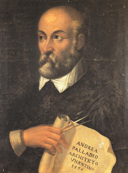
City of Vicenza and the Palladian Villas of the Veneto
Italy · 45.5500° N, 11.5500° E · 3 km² · 45 km from Verona
City of Vicenza and the Palladian Villas of the Veneto is a World Heritage Site in Italy, which protects buildings by the architect Andrea Palladio. UNESCO inscribed the site on the World Heritage List in 1994. At first the site was called "Vicenza, City of Palladio" and only buildings in the immediate area of Vicenza were included.
Various types of buildings were represented in the original site, which included the Basilica Palladiana, Teatro Olimpico and palazzi in the city itself, along with a few villas in the vicinity. However, most of Palladio's surviving villas lay outside the site. In 1996 the site was expanded. Its present name reflects the fact that it includes all the Palladian Villas of the Veneto. City of Vicenza and the Palladian Villas of the Veneto also has some examples of ecclesiastical architecture, including the relatively small church at Maser. In total there are 47 Palladian buildings registered in the UNESCO list in the Veneto region.
There is another important group of urban buildings by Palladio in Venice, a city which also has World Heritage Site status.
Adapted from Wikipedia: City of Vicenza and the Palladian Villas of the Veneto (CC BY-SA 4.0).
Why City of Vicenza and the Palladian Villas of the Veneto Is Listed
- (i)
- A masterpiece of human creative genius.
- (ii)
- An important interchange of human values.
More about City of Vicenza and the Palladian Villas of the Veneto
UNESCO's Description
Founded in the 2nd century B.C. in northern Italy, Vicenza prospered under Venetian rule from the early 15th to the end of the 18th century. The work of Andrea Palladio (1508–80), based on a detailed study of classical Roman architecture, gives the city its unique appearance. Palladio's urban buildings, as well as his villas, scattered throughout the Veneto region, had a decisive influence on the development of architecture. His work inspired a distinct architectural style known as Palladian, which spread to England and other European countries, and also to North America.
From the UNESCO World Heritage Centre (CC BY-SA IGO 3.0).

Crespi d'Adda
Italy · 45.5967° N, 9.5361° E · 1 km² · 16 km from Bergamo
Crespi d'Adda is a village in northern Italy and hamlet (frazione) of Capriate San Gervasio, a municipality in the province of Bergamo, Lombardy. It is a historic settlement and an outstanding example of the 19th and early 20th-century "company towns" built in Europe and North America by enlightened industrialists to meet the workers' needs. The site is still intact and is partly used for industrial purposes, although changing economic and social conditions now threaten its survival. Since 1995 it has been on UNESCO's list of World Heritage Sites.
Adapted from Wikipedia: Crespi d'Adda (CC BY-SA 4.0).
Why Crespi d'Adda Is Listed
- (iv)
- An outstanding example of a type of building or landscape.
- (v)
- An outstanding example of traditional human settlement or land use.
More about Crespi d'Adda
UNESCO's Description
Crespi d'Adda in Capriate San Gervasio in Lombardy is an outstanding example of the 19th- and early 20th-century 'company towns' built in Europe and North America by enlightened industrialists to meet the workers' needs. The site is still remarkably intact and is partly used for industrial purposes, although changing economic and social conditions now threaten its survival.
From the UNESCO World Heritage Centre (CC BY-SA IGO 3.0).
Geography
The village is located by the eastern shore of the river Adda, next to the provincial borders of Bergamo with Milan, south of Capriate San Gervasio. Other nearest settlements are Trezzo sull'Adda, Brembate, Vaprio d'Adda and Canonica d'Adda. It is 19 km (12 mi) from Bergamo and its airport, 30 km (19 mi) from Monza and 47 km (29 mi) from Milan. Nearest motorway exit, "Capriate", is 2 km (1.2 mi) north and is part of the A4 motorway Turin-Trieste.
History
In 1869 Cristoforo Benigno Crespi, a textile manufacturer from Busto Arsizio (Varese), bought the 1-kilometre (0.6 mi) valley between the rivers Brembo and Adda, to the south of Capriate, with the intention of installing a cotton mill on the banks of the Adda.
Cristoforo Crespi introduced the most modern spinning, weaving and finishing processes in his Cotton Mill. The hydroelectric power plant in Trezzo, on the Adda river just a few kilometers upwards, was built up around 1906 for the manufacturer Cristoforo Benigno Crespi. The settlement which was built in 1878 next to the cotton-mill was a village, a residential area provided with social services such as a clinic, a school building, a theatre, a cemetery, a wash-house and a church.
Sections adapted from Wikipedia: Crespi d'Adda (CC BY-SA 4.0).

Ferrara, City of the Renaissance, and its Po Delta
Italy · 44.8378° N, 11.6194° E · 467 km² · 2 km from Ferrara
Ferrara, which grew up around a ford over the River Po, became an intellectual and artistic centre that attracted the greatest minds of the Italian Renaissance in the 15th and 16th centuries. Here, Piero della Francesca, Jacopo Bellini and Andrea Mantegna decorated the palaces of the House of Este. The humanist concept of the 'ideal city' came to life here in the neighbourhoods built from 1492 onwards by Biagio Rossetti according to the new principles of perspective. The completion of this project marked the birth of modern town planning and influenced its subsequent development.
Description from the UNESCO World Heritage Centre (CC BY-SA IGO 3.0).
Why Ferrara, City of the Renaissance, and its Po Delta Is Listed
- (ii)
- An important interchange of human values.
- (iii)
- A unique testimony to a cultural tradition or civilisation.
- (iv)
- An outstanding example of a type of building or landscape.
- (v)
- An outstanding example of traditional human settlement or land use.
- (vi)
- A direct association with events, ideas or beliefs of universal significance.

Historic Centre of Naples
Italy · 40.8514° N, 14.2628° E · 10 km² · 2 km from Naples
The historic centre (Centro Storico) of Naples, Italy, is the oldest part of the city, with a history that spans over 2,700 years.
Almost the entirety of the historic centre, approximately 1021 hectares, was declared a UNESCO World Heritage Site in 1995, and included in the list of historic assets to be protected; its particular uniqueness lying in the almost total conservation and use of its ancient Greek road layout.
Adapted from Wikipedia: Historic Centre of Naples (CC BY-SA 4.0).
Why Historic Centre of Naples Is Listed
- (ii)
- An important interchange of human values.
- (iv)
- An outstanding example of a type of building or landscape.
More about Historic Centre of Naples
UNESCO's Description
From the Neapolis founded by Greek settlers in 470 B.C. to the city of today, Naples has retained the imprint of the successive cultures that emerged in Europe and the Mediterranean basin. This makes it a unique site, with a wealth of outstanding monuments such as the Church of Santa Chiara and the Castel Nuovo.
From the UNESCO World Heritage Centre (CC BY-SA IGO 3.0).
History
The historic centre of Naples bears witness to the historical and artistic evolution of the city, from its first Greek settlement in the 8th century BC along the area overlooking the sea, the re-founding of the same city in a more internal area, constituting the "ancient centre (Centro Storico)", up to the Spanish Baroque city that saw the opening towards the west of the urban nucleus and to that centre of the nineteenth-century cultural elite, with the flowering in the city of numerous noble and bourgeois villas that characterize the whole area of Posillipo and Vomero.
Sections adapted from Wikipedia: Historic Centre of Naples (CC BY-SA 4.0).

Historic Centre of Siena
Italy · 43.3186° N, 11.3317° E · 2 km² · 1 km from Siena
Siena is the embodiment of a medieval city. Its inhabitants pursued their rivalry with Florence right into the area of urban planning. Throughout the centuries, they preserved their city's Gothic appearance, acquired between the 12th and 15th centuries. During this period the work of Duccio, the Lorenzetti brothers and Simone Martini was to influence the course of Italian and, more broadly, European art. The whole city of Siena, built around the Piazza del Campo, was devised as a work of art that blends into the surrounding landscape.
Description from the UNESCO World Heritage Centre (CC BY-SA IGO 3.0).
Why Historic Centre of Siena Is Listed
- (i)
- A masterpiece of human creative genius.
- (ii)
- An important interchange of human values.
- (iv)
- An outstanding example of a type of building or landscape.

Castel del Monte
Italy · 41.0847° N, 16.2709° E · 26 km from Barletta
Castel del Monte (Italian for 'Castle of the Mountain'; Barese: Castidde du Monte) is a 13th-century citadel and castle situated on a hill in Andria in the Apulia region of southeast Italy. It was built during the 1240s by King Frederick II, who had inherited the lands from his mother Constance of Sicily. In the 18th century, the castle's interior marbles and remaining furnishings were removed. It has neither a moat nor a drawbridge and some considered it never to have been intended as a defensive fortress. However, archaeological work has suggested that it originally had a curtain wall.
The castle is famous for its bold octagonal plan, and classicizing details of the architecture. In 1996, Castel del Monte was named a World Heritage Site by UNESCO, which described it as "a unique masterpiece of medieval military architecture". Described by the Enciclopedia Italiana as "the most fascinating castle built by Frederick II", it also appears on the Italian version of the one cent Euro coin.
Adapted from Wikipedia: Castel del Monte, Apulia (CC BY-SA 4.0).
Why Castel del Monte Is Listed
- (i)
- A masterpiece of human creative genius.
- (ii)
- An important interchange of human values.
- (iii)
- A unique testimony to a cultural tradition or civilisation.
More about Castel del Monte
UNESCO's Description
When the Emperor Frederick II built this castle near Bari in the 13th century, he imbued it with symbolic significance, as reflected in the location, the mathematical and astronomical precision of the layout and the perfectly regular shape. A unique piece of medieval military architecture, Castel del Monte is a successful blend of elements from classical antiquity, the Islamic Orient and north European Cistercian Gothic.
From the UNESCO World Heritage Centre (CC BY-SA IGO 3.0).
Description
Because of its relatively small size, it was once considered to be no more than a "hunting lodge", but scholars now believe it originally had a curtain wall and did serve as a citadel. Frederick II was responsible for the construction of many castles in Apulia, but Castel del Monte's geometric design was unique. The fortress is an octagonal prism with an octagonal tower at each corner. The towers were originally some 5 m (16 ft) higher than now, and they should perhaps include a third floor.
Both floors have eight rooms, and an eight-sided courtyard occupies the castle's centre. Each of the main rooms has vaulted ceilings. Three of the corner towers contain staircases. The castle has two entrances, an unobtrusive service entrance and an ornate main entrance.
Location
Castel del Monte is situated on a small hill close to the monastery of Santa Maria del Monte, at an altitude of 540 metres (1,770 ft). When the castle was built, the region was famously fertile with a plentiful supply of water and lush vegetation. It lies in the comune of Andria, province of Barletta-Andria-Trani, occupying the site of an earlier fortress of which no structural remains exist.
A document dating to 1240, in which Frederick II ordered the governor of Capitanata to finish some works in the castle. It was never finished and there is no proof that he used it as a hunting lodge as commonly thought. It was later turned into a prison, used as a refuge during a plague, and finally fell into disrepair.
Sections adapted from Wikipedia: Castel del Monte, Apulia (CC BY-SA 4.0).
Key Facts
| Established | 29 January 1240 |
|---|---|
| Area | 0 km² |
| Architectural style | Gothic architecture |
Facts from Wikidata Q215897 (CC0).

Early Christian Monuments of Ravenna
Italy · 44.4204° N, 12.1962° E · 2 km from Ravenna
Ravenna was the seat of the Roman Empire in the 5th century and then of Byzantine Italy until the 8th century. It has a unique collection of early Christian mosaics and monuments. All eight buildings – the Mausoleum of Galla Placidia, the Neonian Baptistery, the Basilica of Sant'Apollinare Nuovo, the Arian Baptistery, the Archiepiscopal Chapel, the Mausoleum of Theodoric, the Church of San Vitale and the Basilica of Sant'Apollinare in Classe – were constructed in the 5th and 6th centuries. They show great artistic skill, including a wonderful blend of Graeco-Roman tradition, Christian iconography and oriental and Western styles.
Description from the UNESCO World Heritage Centre (CC BY-SA IGO 3.0).
Why Early Christian Monuments of Ravenna Is Listed
- (i)
- A masterpiece of human creative genius.
- (ii)
- An important interchange of human values.
- (iii)
- A unique testimony to a cultural tradition or civilisation.
- (iv)
- An outstanding example of a type of building or landscape.

Historic Centre of the City of Pienza
Italy · 43.0766° N, 11.6790° E · 38 km from Siena
It was in this Tuscan town that Renaissance town-planning concepts were first put into practice after Pope Pius II decided, in 1459, to transform the look of his birthplace. He chose the architect Bernardo Rossellino, who applied the principles of his mentor, Leon Battista Alberti. This new vision of urban space was realized in the superb square known as Piazza Pio II and the buildings around it: the Piccolomini Palace, the Borgia Palace and the cathedral with its pure Renaissance exterior and an interior in the late Gothic style of south German churches.
Description from the UNESCO World Heritage Centre (CC BY-SA IGO 3.0).
Why Historic Centre of the City of Pienza Is Listed
- (i)
- A masterpiece of human creative genius.
- (ii)
- An important interchange of human values.
- (iv)
- An outstanding example of a type of building or landscape.

The Trulli of Alberobello
Italy · 40.7825° N, 17.2369° E · 30 km from Taranto
The trulli , limestone dwellings found in the southern region of Puglia, are remarkable examples of drywall (mortarless) construction, a prehistoric building technique still in use in this region. The trulli are made of roughly worked limestone boulders collected from neighbouring fields. Characteristically, they feature pyramidal, domed or conical roofs built up of corbelled limestone slabs.
Description from the UNESCO World Heritage Centre (CC BY-SA IGO 3.0).
Why The Trulli of Alberobello Is Listed
- (iii)
- A unique testimony to a cultural tradition or civilisation.
- (iv)
- An outstanding example of a type of building or landscape.
- (v)
- An outstanding example of traditional human settlement or land use.

Amalfi Coast
Italy · 40.6333° N, 14.6000° E · 112 km² · 15 km from Salerno
The Amalfi Coast (Italian: Costiera amalfitana [koˈstjɛːra amalfiˈtaːna] or Costa d'Amalfi) is a stretch of coastline overlooking the Tyrrhenian Sea and the Gulf of Salerno. It is located in the Province of Salerno, in the Campania region of southern Italy, south of the Sorrentine Peninsula and north of the Cilentan Coast.
A UNESCO World Heritage Site since 1997, it is one of Italy's most popular seaside destinations. It is named after the town of Amalfi, which has historically been its main geographical and political hub.
Adapted from Wikipedia: Amalfi Coast (CC BY-SA 4.0).
Why Amalfi Coast Is Listed
- (ii)
- An important interchange of human values.
- (iv)
- An outstanding example of a type of building or landscape.
- (v)
- An outstanding example of traditional human settlement or land use.
More about Amalfi Coast
UNESCO's Description
The Amalfi coast is an area of great physical beauty and natural diversity. It has been intensively settled by human communities since the early Middle Ages. There are a number of towns such as Amalfi and Ravello with architectural and artistic works of great significance. The rural areas show the versatility of the inhabitants in adapting their use of the land to the diverse nature of the terrain, which ranges from terraced vineyards and orchards on the lower slopes to wide upland pastures.
From the UNESCO World Heritage Centre (CC BY-SA IGO 3.0).
Geography
Like the rest of the region, the Amalfi Coast has a Mediterranean climate, featuring warm summers and mild winters. It is located on the relatively steep southern shore of the Sorrentine Peninsula, leaving little room for rural and agricultural development. The only land route to the Amalfi Coast is the 40 kilometres (25 mi) long Amalfi Drive (Strada Statale 163) which runs along the coastline from the town of Vietri sul Mare in the east to Positano in the west. Thirteen municipalities are located on the Amalfi Coast, many of them centred on tourism.
History
During the 10th–11th centuries, the Duchy of Amalfi existed on the territory of the Amalfi Coast, centred in the town of Amalfi. The Amalfi coast was later controlled by the Principality of Salerno until Amalfi was sacked by the Republic of Pisa in 1137.
Economy
The Amalfi Coast is known for its production of limoncello liqueur, made between February and October from lemon (Italian: sfusato amalfitano) grown in terraced gardens along the entire coastline. Another typical liqueur is concerto (literally, "concert", derived from the mix of herbs that compose it), a dark rosolio with spicy notes typically produced in Tramonti. Amalfi is also a known maker of a hand-made thick paper called bambagina, symbolic of Italy's traditional technique for paper production and historically used for private writings, legal acts, and revenue stamps. Other notable local products are a particular kind of anchovy (local Italian: alici) from Cetara and the colourful handmade ceramics from Vietri.
Sections adapted from Wikipedia: Amalfi Coast (CC BY-SA 4.0).
Visiting Amalfi Coast
The Amalfi Coast lies in the southwestern region of Campania, Italy. For its extraordinary beauty and its iconic medieval cliffside Mediterranean fishing villages, it is recognized as a UNESCO World Heritage Site.
Travel notes adapted from Wikivoyage: Amalfi Coast (CC BY-SA 4.0).

Archaeological Areas of Pompei, Herculaneum and Torre Annunziata
Italy · 40.7500° N, 14.4833° E · 1 km² · 23 km from Naples
When Vesuvius erupted on 24 August AD 79, it engulfed the two flourishing Roman towns of Pompei and Herculaneum, as well as the many wealthy villas in the area. These have been progressively excavated and made accessible to the public since the mid-18th century. The vast expanse of the commercial town of Pompei contrasts with the smaller but better-preserved remains of the holiday resort of Herculaneum, while the superb wall paintings of the Villa Oplontis at Torre Annunziata give a vivid impression of the opulent lifestyle enjoyed by the wealthier citizens of the Early Roman Empire.
Description from the UNESCO World Heritage Centre (CC BY-SA IGO 3.0).
Why Archaeological Areas of Pompei, Herculaneum and Torre Annunziata Is Listed
- (iii)
- A unique testimony to a cultural tradition or civilisation.
- (iv)
- An outstanding example of a type of building or landscape.
- (v)
- An outstanding example of traditional human settlement or land use.
Archaeological Record: Pompeii & Herculaneum
Buried under meters of volcanic ash and pumice in the 79 CE eruption of Mount Vesuvius, freezing Roman urban frescoes, bakeries, and bathhouses in time.
- Site type
- Preserved Roman Municipality
- Ancient name
- Pompeii
- Ancient province
- Italia (Campania)
- Occupation
- 600 BCE to 79 CE
Pleiades gazetteer: 432873

Cathedral, Torre Civica and Piazza Grande, Modena
Italy · 44.6462° N, 10.9257° E · 1 km from Modena
The magnificent 12th-century cathedral at Modena, the work of two great artists (Lanfranco and Wiligelmus), is a supreme example of early Romanesque art. With its piazza and soaring tower, it testifies to the faith of its builders and the power of the Canossa dynasty who commissioned it.
Description from the UNESCO World Heritage Centre (CC BY-SA IGO 3.0).
Why Cathedral, Torre Civica and Piazza Grande, Modena Is Listed
- (i)
- A masterpiece of human creative genius.
- (ii)
- An important interchange of human values.
- (iii)
- A unique testimony to a cultural tradition or civilisation.
- (iv)
- An outstanding example of a type of building or landscape.

Padova botanical garden
Italy · 45.3995° N, 11.8807° E · 36 km from Venice
The Orto Botanico di Padova is a botanical garden in Padua, in the northeastern part of Italy. Founded in June 1545 by the Venetian Republic, it is the world's oldest academic botanical garden that is still in its original location. The garden – operated by the University of Padua and owned by the Italian government – encompasses roughly 22,000 square meters (240,000 sq ft), and is known for its special collections and historical design.
Adapted from Wikipedia: Orto botanico di Padova (CC BY-SA 4.0).
Why Padova botanical garden Is Listed
- (ii)
- An important interchange of human values.
- (iii)
- A unique testimony to a cultural tradition or civilisation.
More about Padova botanical garden
UNESCO's Description
The world's first botanical garden was created in Padua in 1545. It still preserves its original layout – a circular central plot, symbolizing the world, surrounded by a ring of water. Other elements were added later, some architectural (ornamental entrances and balustrades) and some practical (pumping installations and greenhouses). It continues to serve its original purpose as a centre for scientific research.
From the UNESCO World Heritage Centre (CC BY-SA IGO 3.0).
History
The Garden of Padua was founded upon deliberation of the Senate of the Venetian Republic. It was devoted to the growth of medicinal plants, the so-called "simple plants" (Orto dei semplici – simples were herbs that were used as they are rather than in admixtures) which produced natural remedies, and also to help students distinguish genuine medicinal plants from false ones to prevent misidentifications of plants, as this could lead to severe death and injury in patients.
A circular wall enclosure was built to protect the garden from the frequent night thefts which occurred in spite of severe penalties (fines, prison, exile). The Botanical Garden was steadily enriched with plants from all over the world, particularly from the countries that participated in trade with Venice.
Sections adapted from Wikipedia: Orto botanico di Padova (CC BY-SA 4.0).
Key Facts
| Established | 1545 |
|---|---|
| Area | 0 km² |
Facts from Wikidata Q598892 (CC0).

Portovenere, Cinque Terre, and the Islands (Palmaria, Tino and Tinetto)
Italy · 44.1069° N, 9.7292° E · 47 km² · 69 km from Pisa
The Ligurian coast between Cinque Terre and Portovenere is a cultural landscape of great scenic and cultural value. The layout and disposition of the small towns and the shaping of the surrounding landscape, overcoming the disadvantages of a steep, uneven terrain, encapsulate the continuous history of human settlement in this region over the past millennium.
Description from the UNESCO World Heritage Centre (CC BY-SA IGO 3.0).
Why Portovenere, Cinque Terre, and the Islands (Palmaria, Tino and Tinetto) Is Listed
- (ii)
- An important interchange of human values.
- (iv)
- An outstanding example of a type of building or landscape.
- (v)
- An outstanding example of traditional human settlement or land use.

Residences of the Royal House of Savoy
Italy · 45.0725° N, 7.6858° E · 4 km² · 1 km from Turin
The Residences of the Royal House of Savoy are a group of buildings in Piedmont, northern Italy. It was added to the UNESCO World Heritage Sites list in 1997.
Adapted from Wikipedia: Residences of the Royal House of Savoy (CC BY-SA 4.0).
Why Residences of the Royal House of Savoy Is Listed
- (i)
- A masterpiece of human creative genius.
- (ii)
- An important interchange of human values.
- (iv)
- An outstanding example of a type of building or landscape.
- (v)
- An outstanding example of traditional human settlement or land use.
More about Residences of the Royal House of Savoy
UNESCO's Description
When Emmanuel-Philibert, Duke of Savoy, moved his capital to Turin in 1562, he began a vast series of building projects (continued by his successors) to demonstrate the power of the ruling house. This outstanding complex of buildings, designed and embellished by the leading architects and artists of the time, radiates out into the surrounding countryside from the Royal Palace in the 'Command Area' of Turin to include many country residences and hunting lodges.
From the UNESCO World Heritage Centre (CC BY-SA IGO 3.0).
History
The House of Savoy is an ancient royal family, being founded in year 1003 in the Savoy region (now in Rhône-Alpes, France), later expanding so that by 1720 it reigned over the Kingdom of Sardinia in northwestern Italy. Through its junior branch, the House of Savoy-Carignano, it led the unification of Italy in 1861 and ruled the Kingdom of Italy until the aftermath of World War II. In 1946, King Victor Emanuel III abdicated in favor of his son Umberto II, but after an institutional referendum, the monarchy was abolished, a republic was established, and members of the House of Savoy were required to leave the country.
In 1562, Emmanuel Philibert, Duke of Savoy moved his capital to Turin and commenced a series of building projects using the best architects available at the time.
Sections adapted from Wikipedia: Residences of the Royal House of Savoy (CC BY-SA 4.0).
Key Facts
| Area | 3.7 km² |
|---|
Facts from Wikidata Q461272 (CC0).

Su Nuraxi di Barumini
Italy · 39.7029° N, 8.9999° E · 54 km from Cagliari
Su Nuraxi is a Nuragic archaeological site in Barumini, Sardinia, Italy. Su Nuraxi simply means "The Nuraghe" in Campidanese, the southern variant of the Sardinian language.
Su Nuraxi is a settlement consisting of a seventeenth century BC nuraghe, a bastion of four corner towers plus a central one, and a village inhabited from the thirteenth to the sixth century BC, developed around the nuraghe. They are considered by scholars the most impressive expression of the nuragic civilization and were included in the UNESCO list of World Heritage Sites in 1997 as Su Nuraxi di Barumini.
Adapted from Wikipedia: Su Nuraxi (Barumini) (CC BY-SA 4.0).
Why Su Nuraxi di Barumini Is Listed
- (i)
- A masterpiece of human creative genius.
- (iii)
- A unique testimony to a cultural tradition or civilisation.
- (iv)
- An outstanding example of a type of building or landscape.
More about Su Nuraxi di Barumini
UNESCO's Description
During the late 2nd millennium B.C. in the Bronze Age, a special type of defensive structure known as nuraghi (for which no parallel exists anywhere else in the world) developed on the island of Sardinia. The complex consists of circular defensive towers in the form of truncated cones built of dressed stone, with corbel-vaulted internal chambers. The complex at Barumini, which was extended and reinforced in the first half of the 1st millennium under Carthaginian pressure, is the finest and most complete example of this remarkable form of prehistoric architecture.
From the UNESCO World Heritage Centre (CC BY-SA IGO 3.0).

Valle dei Templi
Italy · 37.2897° N, 13.5900° E · 9 km² · 95 km from Palermo
The Valle dei Templi (Italian: [ˈvalle dei ˈtɛmpli]; Sicilian: Vaddi di li Tempri), or Valley of the Temples, is an archaeological site in Agrigento (ancient Greek: Ακράγας, Akragas), Sicily. It is one of the most outstanding examples of ancient Greek art and architecture of Magna Graecia, and is one of the main attractions of Sicily. The term "valley" is a misnomer, the site being located on a ridge outside the town of Agrigento.
Since 1997, the entire area has been included in the UNESCO World Heritage List. The archaeological and landscape park of the Valle dei Templi, with its 1300 hectares, is the largest archaeological park in Europe and the Mediterranean basin.
Adapted from Wikipedia: Valle dei Templi (CC BY-SA 4.0).
Why Valle dei Templi Is Listed
- (i)
- A masterpiece of human creative genius.
- (ii)
- An important interchange of human values.
- (iii)
- A unique testimony to a cultural tradition or civilisation.
- (iv)
- An outstanding example of a type of building or landscape.
More about Valle dei Templi
UNESCO's Description
Founded as a Greek colony in the 6th century B.C., Agrigento became one of the leading cities in the Mediterranean world. Its supremacy and pride are demonstrated by the remains of the magnificent Doric temples that dominate the ancient town, much of which still lies intact under today's fields and orchards. Selected excavated areas throw light on the later Hellenistic and Roman town and the burial practices of its early Christian inhabitants.
From the UNESCO World Heritage Centre (CC BY-SA IGO 3.0).
Overview
Temple of Concordia, whose name comes from a Latin inscription found nearby, and which was built in the 5th century BC. Turned into a church in the 6th century AD, it is now one of the best preserved in the Valley.
Temple of "Hera", also built in the 5th century BC. It was burnt in 406 BC by the Carthaginians.
Temple of Heracles, who was one of the most venerated deities in the ancient Akragas. It is the most ancient in the Valley: destroyed by an earthquake, it consists today of only eight columns.
Temple of Olympian Zeus, built in 480 BC to celebrate the city-state's victory over Carthage. The use of large-scale atlases characterizes it.
Temple of Castor and Pollux. Despite its remains including only four columns, it is now the symbol of modern Agrigento.
Sections adapted from Wikipedia: Valle dei Templi (CC BY-SA 4.0).

Villa Romana del Casale
Italy · 37.3647° N, 14.3346° E · 60 km from Ragusa
The Villa Romana del Casale (Sicilian: Villa Rumana dû Casali) is a large and elaborate Roman villa or palace located approximately 3 km from the town of Piazza Armerina, Sicily. Excavations have revealed Roman mosaics that according to the Grove Dictionary of Art, are the richest, largest, and most varied collection that remains there, and for which the site was designated as a UNESCO World Heritage Site in 1997. The villa and its artwork date to the early fourth century AD.
The mosaic and opus sectile floors cover some 3,500 m2 and are unique in their excellent state of preservation, due to the landslide and floods that covered the remains.
Although less well-known, an extraordinary collection of frescoes covered not only the walls of the interior rooms, but also the exterior walls of the villa.
Adapted from Wikipedia: Villa Romana del Casale (CC BY-SA 4.0).
Why Villa Romana del Casale Is Listed
- (i)
- A masterpiece of human creative genius.
- (ii)
- An important interchange of human values.
- (iii)
- A unique testimony to a cultural tradition or civilisation.
More about Villa Romana del Casale
UNESCO's Description
Roman exploitation of the countryside is symbolized by the Villa Romana del Casale (in Sicily), the centre of the large estate upon which the rural economy of the Western Empire was based. The villa is one of the most luxurious of its kind. It is especially noteworthy for the richness and quality of the mosaics which decorate almost every room; they are the finest mosaics in situ anywhere in the Roman world.
From the UNESCO World Heritage Centre (CC BY-SA IGO 3.0).
History
The currently visible remains of the villa were constructed in the first quarter of the fourth century AD on the remains of an older villa rustica and are the pars dominica, or master's residence, of a large latifundium or agricultural estate.
It is likely that the nearby settlement of Philosophiana was the centre of production and commercial activities, as well as a rest stop for travellers along the Catania-Agrigento road, as mentioned in the Itinerarium Antonini as a mansio or statio, for those seeking shelter for the night and a change of horses. The latifundium extended to the mouth of the Gela River that is identifiable by the many brick stamps with inscriptions PHIL SOPH.
Sections adapted from Wikipedia: Villa Romana del Casale (CC BY-SA 4.0).

Archaeological Area and the Patriarchal Basilica of Aquileia
Italy · 45.7683° N, 13.3675° E · 2 km² · 35 km from Udine
Aquileia (in Friuli-Venezia Giulia), one of the largest and wealthiest cities of the Early Roman Empire, was destroyed by Attila in the mid-5th century. Most of it still lies unexcavated beneath the fields, and as such it constitutes the greatest archaeological reserve of its kind. The patriarchal basilica, an outstanding building with an exceptional mosaic pavement, played a key role in the evangelization of a large region of central Europe.
Description from the UNESCO World Heritage Centre (CC BY-SA IGO 3.0).
Why Archaeological Area and the Patriarchal Basilica of Aquileia Is Listed
- (iii)
- A unique testimony to a cultural tradition or civilisation.
- (iv)
- An outstanding example of a type of building or landscape.
- (vi)
- A direct association with events, ideas or beliefs of universal significance.

Cilento and Vallo di Diano National Park with the Archeological Sites of Paestum and Velia, and the Certosa di Padula
Italy · 40.2833° N, 15.2667° E · 1,591 km² · 60 km from Potenza
The Cilento is an outstanding cultural landscape. The dramatic groups of sanctuaries and settlements along its three east–west mountain ridges vividly portray the area's historical evolution: it was a major route not only for trade, but also for cultural and political interaction during the prehistoric and medieval periods. The Cilento was also the boundary between the Greek colonies of Magna Graecia and the indigenous Etruscan and Lucanian peoples. The remains of two major cities from classical times, Paestum and Velia, are found there.
Description from the UNESCO World Heritage Centre (CC BY-SA IGO 3.0).
Why Cilento and Vallo di Diano National Park with the Archeological Sites of Paestum and Velia, and the Certosa di Padula Is Listed
- (iii)
- A unique testimony to a cultural tradition or civilisation.
- (iv)
- An outstanding example of a type of building or landscape.

Historic Centre of Urbino
Italy · 43.7250° N, 12.6333° E · 28 km from San Marino
The small hill town of Urbino, in the Marche, experienced a great cultural flowering in the 15th century, attracting artists and scholars from all over Italy and beyond, and influencing cultural developments elsewhere in Europe. Owing to its economic and cultural stagnation from the 16th century onwards, it has preserved its Renaissance appearance to a remarkable extent.
Description from the UNESCO World Heritage Centre (CC BY-SA IGO 3.0).
Why Historic Centre of Urbino Is Listed
- (ii)
- An important interchange of human values.
- (iv)
- An outstanding example of a type of building or landscape.

Hadrian's Villa
Italy · 41.9419° N, 12.7753° E · 1 km² · 25 km from Rome
Hadrian's Villa (Italian: Villa Adriana; Latin: Villa Hadriana) was a monumental villa or palace complex built around AD 120 by emperor Hadrian (r.117–138) near Tivoli, about 20 km from Rome. Its remains are now included in a UNESCO World Heritage Site.
It is one of the most imposing and complex Roman villas known. The complex contains over 30 monumental and scenic buildings arranged on a series of artificial esplanades at different heights and surrounded by gardens decorated with water basins and nymphaea (fountains). The whole complex covers an area of at least a square kilometre, an area larger than the city of Pompeii. In addition to the villa's impressive layout, many of the buildings are considered masterpieces of Roman architecture, making use of striking curved shapes enabled by extensive use of concrete. They were ingenious for the complex symmetry of their ground plans and are considered unrivalled until the arrival of Baroque architecture in the 17th century, initiated by Borromini, who used Hadrian's Villa for inspiration.
Adapted from Wikipedia: Hadrian's Villa (CC BY-SA 4.0).
Why Hadrian's Villa Is Listed
- (i)
- A masterpiece of human creative genius.
- (ii)
- An important interchange of human values.
- (iii)
- A unique testimony to a cultural tradition or civilisation.
More about Hadrian's Villa
UNESCO's Description
The Villa Adriana (at Tivoli, near Rome) is an exceptional complex of classical buildings created in the 2nd century A.D. by the Roman emperor Hadrian. It combines the best elements of the architectural heritage of Egypt, Greece and Rome in the form of an 'ideal city'.
From the UNESCO World Heritage Centre (CC BY-SA IGO 3.0).
History
Several Republican-era villas, one or more of which were possibly inherited by his wife Vibia Sabina, occupied artificial terraces on the site. Hadrian began construction on the villa early in his reign at the end of 118 or the beginning of 119, a few months after his arrival in Rome, as the majority of the first brick stamps are dated to 117 and would have been made in advance.
However, Hadrian spent many years of his reign visiting the empire and his first presence at the Villa is documented in 125 after the return from his first trip. He started using the villa as his official residence around 128 although already in the summer of 125 an official letter was sent by Hadrian from the villa.
Sections adapted from Wikipedia: Hadrian's Villa (CC BY-SA 4.0).

Aeolian Islands
Italy · 38.4967° N, 14.9358° E · 12 km² · 63 km from Messina
The Aeolian Islands ( ee-OH-lee-ən; Italian: Isole Eolie [ˈiːzole eˈɔːlje]; Sicilian: Ìsuli Eoli), sometimes referred to as the Lipari Islands or Lipari group ( LIP-ər-ee, Italian: [ˈliːpari]) after their largest island, are a volcanic archipelago in the Tyrrhenian Sea north of Sicily, said to be named after Aeolus, the mythical ruler of the winds. The islands' inhabitants are known as Aeolians (Italian: Eoliani). The islands had a permanent population of 14,224 at the 2011 census; the latest official estimate is 15,419 as of 1 January 2019. The Aeolian Islands are a popular tourist destination in the summer and attract up to 600,000 visitors annually.
There are seven significant islands: Lipari, Vulcano, Salina, Stromboli, Filicudi, Alicudi and Panarea, and a set of minor islands and rocks.
Adapted from Wikipedia: Aeolian Islands (CC BY-SA 4.0).
Why Aeolian Islands Is Listed
- (viii)
- An outstanding example of major stages of the Earth's history.
More about Aeolian Islands
UNESCO's Description
The Aeolian Islands provide an outstanding record of volcanic island-building and destruction, and ongoing volcanic phenomena. Studied since at least the 18th century, the islands have provided the science of vulcanology with examples of two types of eruption (Vulcanian and Strombolian) and thus have featured prominently in the education of geologists for more than 200 years. The site continues to enrich the field of vulcanology.
From the UNESCO World Heritage Centre (CC BY-SA IGO 3.0).
Geography
The Aeolian Islands are 30 to 80 kilometres (19 to 50 mi) off the north coast of Sicily in the Tyrrhenian Sea. Vulcano is located closest to the Sicilian coast. Lipari and Salina follow to the north, Filicudi and Alicudi to the west, and Panarea and Stromboli to the northeast. In addition to these seven inhabited islands, there are a number of smaller, uninhabited islands and rocky cliffs, such as Basiluzzo, Strombolicchio, Dattilo and Lisca Bianca.
The largest island is Lipari (37.5 km2 [14.5 mi2]), followed by Salina (26.8 km2 [10.3 mi2]), Vulcano (21.2 km2 [8.2 mi2]), Stromboli (12.6 km2 [4.9 mi2]), Filicudi (9.5 km2 [3.7 mi2]) and Alicudi (5.2 km2 [2.0 mi2]). The smallest inhabited island, at 3.4 km2 (1.3 mi2), is Panarea.
Geology
The seven Aeolian Islands, covering an area of 1,600 km2 (620 sq mi), originated in the Tyrrhenian Basin, a great plain at the bottom of the Tyrrhenian Sea. Emissions of lava from depths of up to 3,600 m (11,800 ft) resulted in the formation of the Aeolian Islands, together with Ustica and a series of submarine volcanoes named Magnani, Vavilov, Marsili and Palinuro, as well as two that are unnamed.
The present shape of the Aeolian Islands is the result of volcanic activity over a period of 260,000 years. There are two active volcanoes – Stromboli and Vulcano. Steaming fumaroles and thermal waters are on most of the islands. The volcanic activity has also left the islands with a very fertile soil that is beneficial in the growth of natural flora.
History
The first evidence of Sicilian migration was in Lipari (Castellaro Vecchio culture). The manufacture and commerce of obsidian objects was highly developed until the introduction of metals.
During the Bronze Age, the Aeolians prospered by means of maritime commerce in an area which extended from Mycenae to the British Isles, from where tin was imported. Villages on the Aeolian islands flourished on Capo Graziano (Filicudi), Castello (Lipari), Serro dei Cianfi (Salina), Capo Milazzese (Panarea), and Portella (Salina). All these settlements were destroyed by new Italic invasions in 1250 BC.
According to Diodorus Siculus, the Aeolian Islands were occupied by the Ausones led by Liparus.
Sections adapted from Wikipedia: Aeolian Islands (CC BY-SA 4.0).
Visiting Aeolian Islands
The Aeolian islands (Italian: Isole Eolie, Sicilian: Ìsuli Eoli, Greek: Αιολίδες Νήσοι), aka Lipari Islands, are a group of attractive islands in the Tyrrhenian Sea about 25-50 km north of Sicily in Italy. This diverse group of volcanic islands used to be off the beaten track, but they are becoming more popular and can be very busy during July and August. The islands are inscribed in the UNESCO World Heritage List.
Travel notes adapted from Wikivoyage: Aeolian Islands (CC BY-SA 4.0).

Assisi, the Basilica of San Francesco and Other Franciscan Sites
Italy · 43.0662° N, 12.6224° E · 146 km² · 20 km from Perugia
Assisi, a medieval city built on a hill, is the birthplace of Saint Francis, closely associated with the work of the Franciscan Order. Its medieval art masterpieces, such as the Basilica of San Francesco and paintings by Cimabue, Pietro Lorenzetti, Simone Martini and Giotto, have made Assisi a fundamental reference point for the development of Italian and European art and architecture.
Description from the UNESCO World Heritage Centre (CC BY-SA IGO 3.0).
Why Assisi, the Basilica of San Francesco and Other Franciscan Sites Is Listed
- (i)
- A masterpiece of human creative genius.
- (ii)
- An important interchange of human values.
- (iii)
- A unique testimony to a cultural tradition or civilisation.
- (iv)
- An outstanding example of a type of building or landscape.
- (vi)
- A direct association with events, ideas or beliefs of universal significance.

Verona
Italy · 45.4386° N, 10.9928° E · 4 km² · 0 km from Verona
Verona ( və-ROH-nə; Italian: [veˈroːna] ; Venetian: Verona or Veròna) is the largest city in the region of Veneto in Italy, with a population of 255,139 as of 2026. It is one of the seven provincial capitals of the region, and is also the 2nd-largest city in northeast Italy. The metropolitan area of Verona covers an area of 1,426 km2 (550.58 sq mi) and has a population of 714,310 inhabitants. It is one of the main tourist destinations in Northern Italy because of its artistic heritage and several annual fairs and shows as well as the opera season in the Arena, an ancient Roman amphitheater.
Between the 13th and 14th centuries, the city was ruled by the della Scala family. Under the rule of the family, in particular of Cangrande I della Scala, the city experienced great prosperity, becoming rich and powerful and was surrounded by new walls. The della Scala era is preserved in numerous monuments around Verona.
Three of William Shakespeare's plays are set in Verona: Romeo and Juliet (which also features Romeo's visit to Mantua), The Taming of the Shrew and The Two Gentlemen of Verona.
Adapted from Wikipedia: Verona (CC BY-SA 4.0).
Why Verona Is Listed
- (ii)
- An important interchange of human values.
- (iv)
- An outstanding example of a type of building or landscape.
More about Verona
UNESCO's Description
The historic city of Verona was founded in the 1st century B.C. It particularly flourished under the rule of the Scaliger family in the 13th and 14th centuries and as part of the Republic of Venice from the 15th to 18th centuries. Verona has preserved a remarkable number of monuments from antiquity, the medieval and Renaissance periods, and represents an outstanding example of a military stronghold.
From the UNESCO World Heritage Centre (CC BY-SA IGO 3.0).
Geography
Verona has a humid subtropical climate characteristic of Northern Italy's inland plains, with hot summers and cool, humid winters, even though Lake Garda has a partial influence on the city. The relative humidity is high throughout the year, especially in winter when it causes fog, mainly from dusk until late morning, although the phenomenon has become less and less frequent in recent years.
History
The precise details of Verona's early history remain a mystery along with the origin of its name. One theory is that it was a city of the Euganei, who were obliged to give it up to the Cenomani (550 BC). With the conquest of the Valley of the Po, the Veronese territory became Roman about 300 BC. Verona became a Roman colonia in 89 BC. It was classified as a municipium in 49 BC, when its citizens were ascribed to the Roman tribe Poblilia or Publicia.
The city became important because it was at the intersection of several roads. Stilicho, a military commander in the Roman army, defeated Alaric and his Visigoths here in 402. In 489, Verona was conquered by the Ostrogoths, and the Gothic domination of Italy began. Theoderic the Great was said to have built a palace there.
Economy
AGSM AIM Energia, Air Dolomiti, Banco BPM, Bauli, Calzedonia, doValue, Eurospin, Fedrigoni, Franklin & Marshall (company), Pastificio Rana, Revo, Technital, Veronesi Group, Vicenzi Group and Zuegg.
Examples of Veronese digital economy startups that became mature, well-established companies include RORTOS, a software developer centered on flight simulation products for mobile.
Sections adapted from Wikipedia: Verona (CC BY-SA 4.0).
Visiting Verona
Verona is an historic city with a population of about a quarter of a million in north-eastern Italy's Veneto region. It's most famous as the setting for Shakespeare's Romeo and Juliet and has been inscribed on the UNESCO World Heritage list.
Travel notes adapted from Wikivoyage: Verona (CC BY-SA 4.0).

Villa d'Este
Italy · 41.9625° N, 12.7961° E · 27 km from Rome
The Villa d'Este is a 16th-century villa in Tivoli, near Rome. It is a masterpiece of Italian architecture and garden design, famous for its terraced hillside Italian Renaissance garden and the ingenuity of its architectural features (fountains, ornamental basins, ceilings, etc.), it is an incomparable example of a 16th-century Italian garden, which later had a huge influence on landscape design in Europe. It is now an Italian state museum, and is listed[1] as a UNESCO World Heritage Site since 2001.
Adapted from Wikipedia: Villa d'Este (CC BY-SA 4.0).
Why Villa d'Este Is Listed
- (i)
- A masterpiece of human creative genius.
- (ii)
- An important interchange of human values.
- (iii)
- A unique testimony to a cultural tradition or civilisation.
- (iv)
- An outstanding example of a type of building or landscape.
- (vi)
- A direct association with events, ideas or beliefs of universal significance.
More about Villa d'Este
UNESCO's Description
The Villa d'Este in Tivoli, with its palace and garden, is one of the most remarkable and comprehensive illustrations of Renaissance culture at its most refined. Its innovative design along with the architectural components in the garden (fountains, ornamental basins, etc.) make this a unique example of an Italian 16th-century garden. The Villa d'Este, one of the first giardini delle meraviglie , was an early model for the development of European gardens.
From the UNESCO World Heritage Centre (CC BY-SA IGO 3.0).
History
The Villa was commissioned by Cardinal Ippolito II d'Este (1509–1572), second son of Alfonso I d'Este, the Duke of Ferrara and grandson of Pope Alexander VI through his mother Lucrezia Borgia. The Este family had been lords of Ferrara since 1393, and were famous as patrons of the arts and of the humanist scholars of the Renaissance. As a second son, Ippolito was destined for a career in the church; he was named archbishop of Milan when he was only ten years old. At the age of 27, he was sent to the French court, where he became an advisor to the French King, Francis I, and in 1540 became a member of the King's Private Council. At the age of thirty, at the request of the King, Pope Paul III made d'Este a cardinal.
Sections adapted from Wikipedia: Villa d'Este (CC BY-SA 4.0).
Key Facts
| Area | 0.5 km² |
|---|---|
| Architectural style | Renaissance architecture |
Facts from Wikidata Q746063 (CC0).
Visiting Villa d'Este
Tivoli is a city in Lazio. Its two main attractions, Villa D'Este and Hadrian's Villa, are each individually worth a long journey. Taken together, they make up a memorable day trip from Rome.
Travel notes adapted from Wikivoyage: Tivoli (CC BY-SA 4.0).

Sacri Monti of Piedmont and Lombardy
Italy · 45.9746° N, 9.1696° E · 1 km² · 16 km from Lugano
The Sacri Monti (plural of Sacro Monte, Italian for "Sacred Mountain") of Piedmont and Lombardy are a series of nine calvaries or groups of chapels and other architectural features created in northern Italy during the late sixteenth century and the seventeenth century. They are dedicated to various aspects of the Christian faith and are considered of great beauty by virtue of the skill with which they have been integrated into the surrounding natural landscape of hills, forests and lakes. They also house important artistic materials in the form of wall paintings and statuary. In 2003, they were named as a World Heritage Site.
Adapted from Wikipedia: Sacri Monti of Piedmont and Lombardy (CC BY-SA 4.0).
Why Sacri Monti of Piedmont and Lombardy Is Listed
- (ii)
- An important interchange of human values.
- (iv)
- An outstanding example of a type of building or landscape.
More about Sacri Monti of Piedmont and Lombardy
UNESCO's Description
The nine Sacri Monti (Sacred Mountains) of northern Italy are groups of chapels and other architectural features created in the late 16th and 17th centuries and dedicated to different aspects of the Christian faith. In addition to their symbolic spiritual meaning, they are of great beauty by virtue of the skill with which they have been integrated into the surrounding natural landscape of hills, forests and lakes. They also house much important artistic material in the form of wall paintings and statuary.
From the UNESCO World Heritage Centre (CC BY-SA IGO 3.0).

Etruscan Necropolises of Cerveteri and Tarquinia
Italy · 42.0068° N, 12.1019° E · 3 km² · 27 km from Civitavecchia
These two large Etruscan cemeteries reflect different types of burial practices from the 9th to the 1st century BC, and bear witness to the achievements of Etruscan culture. Which over nine centuries developed the earliest urban civilization in the northern Mediterranean. Some of the tombs are monumental, cut in rock and topped by impressive tumuli (burial mounds). Many feature carvings on their walls, others have wall paintings of outstanding quality. The necropolis near Cerveteri, known as Banditaccia, contains thousands of tombs organized in a city-like plan, with streets, small squares and neighbourhoods. The site contains very different types of tombs: trenches cut in rock; tumuli; and some, also carved in rock, in the shape of huts or houses with a wealth of structural details. These provide the only surviving evidence of Etruscan residential architecture. The necropolis of Tarquinia, also known as Monterozzi, contains 6,000 graves cut in the rock. It is famous for its 200 painted tombs, the earliest of which date from the 7th century BC.
Description from the UNESCO World Heritage Centre (CC BY-SA IGO 3.0).
Why Etruscan Necropolises of Cerveteri and Tarquinia Is Listed
- (i)
- A masterpiece of human creative genius.
- (iii)
- A unique testimony to a cultural tradition or civilisation.
- (iv)
- An outstanding example of a type of building or landscape.

Val d'Orcia
Italy · 43.0667° N, 11.5500° E · 612 km² · 32 km from Siena
The Val d'Orcia or Valdorcia (Italian: [valˈdortʃa]) is a region of Tuscany, Central Italy, which extends from the hills south of Siena to Monte Amiata, between the provinces of Siena and Grosseto. Its gentle, cultivated hills are occasionally broken by gullies and by towns and villages such as Pienza (rebuilt as an "ideal town" in the 15th century under the patronage of Pope Pius II), Radicofani (home to the notorious brigand-hero Ghino di Tacco) and Montalcino (the Brunello di Montalcino is counted among the most prestigious of Italian wines). Its landscape has been depicted in works of art from Renaissance painting to modern photography.
Adapted from Wikipedia: Val d'Orcia (CC BY-SA 4.0).
Why Val d'Orcia Is Listed
- (iv)
- An outstanding example of a type of building or landscape.
- (vi)
- A direct association with events, ideas or beliefs of universal significance.
More about Val d'Orcia
UNESCO's Description
The landscape of Val d’Orcia is part of the agricultural hinterland of Siena, redrawn and developed when it was integrated in the territory of the city-state in the 14th and 15th centuries to reflect an idealized model of good governance and to create an aesthetically pleasing picture. The landscape’s distinctive aesthetics, flat chalk plains out of which rise almost conical hills with fortified settlements on top, inspired many artists. Their images have come to exemplify the beauty of well-managed Renaissance agricultural landscapes. The inscription covers: an agrarian and pastoral landscape reflecting innovative land-management systems; towns and villages; farmhouses; and the Roman Via Francigena and its associated abbeys, inns, shrines, bridges, etc.
From the UNESCO World Heritage Centre (CC BY-SA IGO 3.0).

Syracuse and the Rocky Necropolis of Pantalica
Italy · 37.0594° N, 15.2931° E · 9 km² · 1 km from Siracusa
The site consists of two separate elements, containing outstanding vestiges dating back to Greek and Roman times: The Necropolis of Pantalica contains over 5,000 tombs cut into the rock near open stone quarries, most of them dating from the 13th to 7th centuries BC. Vestiges of the Byzantine era also remain in the area, notably the foundations of the Anaktoron (Prince’s Palace). The other part of the property, Ancient Syracuse, includes the nucleus of the city’s foundation as Ortygia by Greeks from Corinth in the 8th century BC. The site of the city, which Cicero described as ‘the greatest Greek city and the most beautiful of all’, retains vestiges such as the Temple of Athena (5th century BC, later transformed to serve as a cathedral), a Greek theatre, a Roman amphitheatre, a fort and more. Many remains bear witness to the troubled history of Sicily, from the Byzantines to the Bourbons, interspersed with the Arabo-Muslims, the Normans, Frederick II of the Hohenstaufen dynasty (1197–1250), the Aragons and the Kingdom of the Two Sicilies. Historic Syracuse offers a unique testimony to the development of Mediterranean civilization over three millennia.
Description from the UNESCO World Heritage Centre (CC BY-SA IGO 3.0).
Why Syracuse and the Rocky Necropolis of Pantalica Is Listed
- (ii)
- An important interchange of human values.
- (iii)
- A unique testimony to a cultural tradition or civilisation.
- (iv)
- An outstanding example of a type of building or landscape.
- (vi)
- A direct association with events, ideas or beliefs of universal significance.

Genoa: Le Strade Nuove and the system of the Palazzi dei Rolli
Italy · 44.4122° N, 8.9311° E · 0 km from Genoa
Genoa: Le Strade Nuove and the system of the Palazzi dei Rolli is a UNESCO World Heritage Site which includes a number of streets and palaces in the center of Genoa, in Northwestern Italy.
The Strade Nuove (Italian for "New Streets") are a group of streets built by the Genoese aristocracy during the expansion of the city at a time when the Republic of Genoa was at the height of its financial and seafaring power. These are Via Giuseppe Garibaldi (1558–1583, formerly Strada Maggiore or Strada Nuova) and Via Balbi (1602–1620, formerly Strada Balbi), later followed by Via Cairoli (1778–1786, formerly Strada Nuovissima).
The Palazzi dei Rolli (Italian for "Palaces of the Lists") are a group of palaces - most of which also date from the late 16th and early 17th centuries - which were associated to a particular system of ‘public lodging’ in private residences, whereby notable guests on State visit to the Republic were hosted in one of these palaces on behalf of the State.
Adapted from Wikipedia: Genoa: Le Strade Nuove and the system of the Palazzi dei Rolli (CC BY-SA 4.0).
Why Genoa: Le Strade Nuove and the system of the Palazzi dei Rolli Is Listed
- (ii)
- An important interchange of human values.
- (iv)
- An outstanding example of a type of building or landscape.
More about Genoa: Le Strade Nuove and the system of the Palazzi dei Rolli
UNESCO's Description
The Strade Nuove and the system of the Palazzi dei Rolli in Genoa’s historic centre date from the late 16th and early 17th centuries when the Republic of Genoa was at the height of its financial and seafaring power. The site represents the first example in Europe of an urban development project parcelled out by a public authority within a unitary framework and associated to a particular system of ‘public lodging’ in private residences, as decreed by the Senate in 1576. The site includes an ensemble of Renaissance and Baroque palaces along the so-called ‘new streets’ (Strade Nuove). The Palazzi dei Rolli offer an extraordinary variety of different solutions, achieving universal value in adapting to the particular characteristics of the site and to the requirements of a specific social and economic organization. They also offer an original example of a public network of private residences designated to host state visits.
From the UNESCO World Heritage Centre (CC BY-SA IGO 3.0).
History
Between the first half of the 16th century and the first half of the 17th century, the Genoese nobility started a careful town planning to transform the existing medieval city and initiate a sizeable urban expansion to the North. The move to expand the antique palaces and to build new sumptuous ones was driven by the extraordinary wealth that came into the city through prosperous financing activities towards several European powers. In particular, the Genoese aristocracy financed the expensive undertakings of the Spanish Crown, such as the mercenary army that Spain kept in Flanders from 1566 to the peace of Westphalia in 1648.
Sections adapted from Wikipedia: Genoa: Le Strade Nuove and the system of the Palazzi dei Rolli (CC BY-SA 4.0).

Mantua and Sabbioneta
Italy · 45.1594° N, 10.7944° E · 2 km² · 35 km from Verona
Mantua and Sabbioneta represent two aspects of Renaissance town planning: Mantua shows the renewal and extension of an existing city, while some 30 km away, Sabbioneta represents the implementation of the period’s theories about planning the ideal city. Typically, Mantua’s layout is irregular with regular parts showing different stages of its growth since the Roman period and includes many historical buildings, among them an 11th century rotunda and a Baroque theatre. Sabbioneta, created in the second half of the 16th century under the rule of Vespasiano Gonzaga Colonna, can be described as a single-period city and has a right-angle grid layout. Both cities offer exceptional testimonies to the urban, architectural and artistic realizations of the Renaissance, linked through the visions and actions of the ruling Gonzaga family. The two towns are important for the value of their architecture and for their prominent role in the dissemination of Renaissance culture. The ideals of the Renaissance, fostered by the Gonzaga family, are present in the towns’ morphology and architecture.
Description from the UNESCO World Heritage Centre (CC BY-SA IGO 3.0).
Why Mantua and Sabbioneta Is Listed
- (ii)
- An important interchange of human values.
- (iii)
- A unique testimony to a cultural tradition or civilisation.

Longobards in Italy, Places of Power
Italy · 46.0942° N, 13.4331° E · 15 km from Udine
Longobards in Italy: Places of Power (568–774 A.D.) (Italian: Longobardi in Italia: i luoghi del potere) is seven groups of historic buildings that reflect the achievements of the Germanic tribe of the Lombards (also referred to as Longobards), who settled in Italy during the sixth century and established a Lombard Kingdom which ended in 774 A.D.
The groups comprise monasteries, church buildings, and fortresses and became UNESCO World Heritage Sites in June 2011 as they testify "to the Lombards' major role in the spiritual and cultural development of Medieval European Christianity".
Adapted from Wikipedia: Longobards in Italy: Places of Power (568–774 A.D.) (CC BY-SA 4.0).
Why Longobards in Italy, Places of Power Is Listed
- (ii)
- An important interchange of human values.
- (iii)
- A unique testimony to a cultural tradition or civilisation.
- (vi)
- A direct association with events, ideas or beliefs of universal significance.
More about Longobards in Italy, Places of Power
UNESCO's Description
The Longobards in Italy, Places of Power, 568 - 774 A.D. comprises seven groups of important buildings (including fortresses, churches, and monasteries) throughout the Italian Peninsula. They testify to the high achievement of the Lombards, who migrated from northern Europe and developed their own specific culture in Italy where they ruled over vast territories in the 6th to 8th centuries. The Lombards synthesis of architectural styles marked the transition from Antiquity to the European Middle Ages, drawing on the heritage of Ancient Rome, Christian spirituality, Byzantine influence and Germanic northern Europe. The serial property testifies to the Lombards' major role in the spiritual and cultural development of Medieval European Christianity, notably by bolstering the monastic movement.
From the UNESCO World Heritage Centre (CC BY-SA IGO 3.0).

Etna Park
Italy · 37.7653° N, 15.0000° E · 192 km² · 30 km from Catania
Mount Etna is an iconic site encompassing 19,237 uninhabited hectares on the highest part of Mount Etna, on the eastern coast of Sicily. Mount Etna is the highest Mediterranean island mountain and the most active stratovolcano in the world. The eruptive history of the volcano can be traced back 500,000 years and at least 2,700 years of this activity has been documented. The almost continuous eruptive activity of Mount Etna continues to influence volcanology, geophysics and other Earth science disciplines. The volcano also supports important terrestrial ecosystems including endemic flora and fauna and its activity makes it a natural laboratory for the study of ecological and biological processes. The diverse and accessible range of volcanic features such as summit craters, cinder cones, lava flows and the Valle de Bove depression have made the site a prime destination for research and education.
Description from the UNESCO World Heritage Centre (CC BY-SA IGO 3.0).
Why Etna Park Is Listed
- (viii)
- An outstanding example of major stages of the Earth's history.

Medici Villas and Gardens in Tuscany
Italy · 43.8578° N, 11.3042° E · 1 km² · 10 km from Florence
The Medici villas are a series of rural building complexes in Tuscany which were owned by members of the Medici family between the 15th century and the 17th century. The villas served several functions: they were the country palaces of the Medici, scattered over the territory that they ruled, demonstrating their power and wealth. They were also recreational resorts for the leisure and pleasure of their owners; and, more prosaically, they were the centre of agricultural activities on the surrounding estates. In 2013, the Medici villas were added to UNESCO's World Heritage list.
Adapted from Wikipedia: Medici villas (CC BY-SA 4.0).
Why Medici Villas and Gardens in Tuscany Is Listed
- (ii)
- An important interchange of human values.
- (iv)
- An outstanding example of a type of building or landscape.
- (vi)
- A direct association with events, ideas or beliefs of universal significance.
More about Medici Villas and Gardens in Tuscany
UNESCO's Description
Twelve villas and two gardens spread across the Tuscan landscape make up this site which bears testimony to the influence the Medici family exerted over modern European culture through its patronage of the arts. Built between the 15th and 17th centuries, they represent an innovative system of construction in harmony with nature and dedicated to leisure, the arts and knowledge. The villas embody an innovative form and function, a new type of princely residence that differed from both the farms owned by rich Florentines of the period and from the military might of baronial castles. The Medici villas form the first example of the connection between architecture, gardens, and the environment and became an enduring reference for princely residences throughout Italy and Europe. Their gardens and integration into the natural environment helped develop the appreciation of landscape characteristic Humanism and the Renaissance.
From the UNESCO World Heritage Centre (CC BY-SA IGO 3.0).
History
The first Medici villas were the Villa del Trebbio and that at Cafaggiolo, both strong fortified houses built in the 14th century in the Mugello region, the original home of the Medici family. In the 15th century, Cosimo de' Medici built villas designed by Michelozzo at Careggi and Fiesole, still quite severe buildings, but with additional recreational spaces: courtyards, balconies, and gardens. Lorenzo de' Medici spent long periods at the Villa di Careggi. Gradually, Florence became surrounded by a collection of Medici villas, with others in more distant parts of the Grand Duchy of Tuscany.
Sections adapted from Wikipedia: Medici villas (CC BY-SA 4.0).
Key Facts
| Area | 1.3 km² |
|---|
Facts from Wikidata Q574879 (CC0).

The Vineyard Landscape of Piedmont: Langhe-Roero and Monferrato
Italy · 44.6519° N, 7.9942° E · 108 km² · 35 km from Asti
Vineyard Landscape of Piedmont: Langhe-Roero and Monferrato is the official name of a UNESCO World Heritage Site comprising "five distinct wine-growing areas with outstanding landscapes" plus the Castle of Grinzane Cavour in the region of Piedmont, Italy.
The site, which extends over hilly areas of Langhe and Montferrat, is one of the most important wine producing zones in Italy.
Located in the center of Piedmont region (North West of Italy), the site is inscribed as a "cultural landscape", since it is a result of the combined work of nature and man. The site is inscribed in the UNESCO World Heritage List thanks to the outstanding value of its wine culture, which has shaped the landscape over the centuries.
Adapted from Wikipedia: Vineyard Landscape of Piedmont: Langhe-Roero and Monferrato (CC BY-SA 4.0).
Why The Vineyard Landscape of Piedmont: Langhe-Roero and Monferrato Is Listed
- (iii)
- A unique testimony to a cultural tradition or civilisation.
- (v)
- An outstanding example of traditional human settlement or land use.
More about The Vineyard Landscape of Piedmont: Langhe-Roero and Monferrato
UNESCO's Description
This landscape covers five distinct wine-growing areas with outstanding landscapes and the Castle of Cavour, an emblematic name both in the development of vineyards and in Italian history. It is located in the southern part of Piedmont, between the Po River and the Ligurian Apennines, and encompasses the whole range of technical and economic processes relating to the winegrowing and winemaking that has characterized the region for centuries. Vine pollen has been found in the area dating from the 5th century BC, when Piedmont was a place of contact and trade between the Etruscans and the Celts; Etruscan and Celtic words, particularly wine-related ones, are still found in the local dialect. During the Roman Empire, Pliny the Elder mentions the Piedmont region as being one of the most favourable for growing vines in ancient Italy; Strabo mentions its barrels.
From the UNESCO World Heritage Centre (CC BY-SA IGO 3.0).
Description
The site includes five distinct wine-growing areas of outstanding landscapes and the Castle of Grinzane Cavour, an emblematic name in vineyards development and Italian history. It is located in the southern part of Piedmont, between River Po and the Ligurian Apennines. It includes a full range of technical and economic processes related to viticulture and wine-making that characterized the region for centuries. They found in the area also pollen dated to the 5th century BC, when Piedmont was a place of contact and exchange between the Etruscans and Celts: in fact Etruscan and Celtic words, particularly those related to the wine, are still used in the local dialect.
Sections adapted from Wikipedia: Vineyard Landscape of Piedmont: Langhe-Roero and Monferrato (CC BY-SA 4.0).
Key Facts
| Area | 108 km² |
|---|
Facts from Wikidata Q17296768 (CC0).

Arab-Norman Palermo and the Cathedral Churches of Cefalú and Monreale
Italy · 38.1108° N, 13.3531° E · 2 km from Palermo
The Arab-Norman Palermo and the Cathedral Churches of Cefalù and Monreale are a series of nine religious and civic structures located on the northern coast of Sicily dating from the era of the Norman Kingdom of Sicily (1130-1194): two palaces, three churches, a cathedral, and a bridge in Palermo, as well as the cathedrals of Cefalù and Monreale. They have been designated together as a UNESCO World Heritage Site. This dedication took place in 2015.
The new Norman rulers built various structures in what has become known as the Arab-Norman style. They incorporated the best practices of Arab and Byzantine architecture into their own art. Although a different builder constructed each of the sites, they are linked together because of their shared architecture and time period.
On the Friday after these locations gained World Heritage Sites tatus, Italy celebrated with a ceremony. As Palermo Mayor Leoluca Orlando and then Italian president Sergio Mattarella revealed a plaque, various Italian officials and public figures attended at the entrance of the Palazzo dei Normanni which hosts the Sicilian Regional Assembly.
Adapted from Wikipedia: Arab-Norman Palermo and the Cathedral Churches of Cefalù and Monreale (CC BY-SA 4.0).
Why Arab-Norman Palermo and the Cathedral Churches of Cefalú and Monreale Is Listed
- (ii)
- An important interchange of human values.
- (iv)
- An outstanding example of a type of building or landscape.
More about Arab-Norman Palermo and the Cathedral Churches of Cefalú and Monreale
UNESCO's Description
Located on the northern coast of Sicily, Arab-Norman Palermo includes a series of nine civil and religious structures dating from the era of the Norman kingdom of Sicily (1130-1194): two palaces, three churches, a cathedral, a bridge, as well as the cathedrals of Cefalú and Monreale. Collectively, they are an example of a social-cultural syncretism between Western, Islamic and Byzantine cultures on the island which gave rise to new concepts of space, structure and decoration. They also bear testimony to the fruitful coexistence of people of different origins and religions (Muslim, Byzantine, Latin, Jewish, Lombard and French).
From the UNESCO World Heritage Centre (CC BY-SA IGO 3.0).

Ivrea, industrial city of the 20th century
Italy · 45.4575° N, 7.8692° E · 1 km² · 46 km from Turin
The industrial city of Ivrea is located in the Piedmont region and developed as the testing ground for Olivetti, manufacturer of typewriters, mechanical calculators and office computers. It comprises a large factory and buildings designed to serve the administration and social services, as well as residential units. Designed by leading Italian urban planners and architects, mostly between the 1930s and the 1960s, this architectural ensemble reflects the ideas of the Community Movement (Movimento Comunità). A model social project, Ivrea expresses a modern vision of the relationship between industrial production and architecture.
Description from the UNESCO World Heritage Centre (CC BY-SA IGO 3.0).
Why Ivrea, industrial city of the 20th century Is Listed
- (iv)
- An outstanding example of a type of building or landscape.

Padua's fourteenth-century fresco cycles
Italy · 45.4119° N, 11.8796° E · 36 km from Venice
Padua's fourteenth-century fresco cycles is a UNESCO World Heritage Site in Padua, Italy, listed in 2021.
The site comprises eight buildings, both religious and secular, in four clusters. They house fresco cycles that were painted between 1302 and 1397 by several prominent painters: Giotto, Guariento di Arpo, Giusto de' Menabuoi, Altichiero da Zevio, Jacopo d'Avanzi, and Jacopo da Verona. The frescos are innovative in their way of depicting the allegorical narrative and use new way of perspective. Emotions of characters are shown in a realistic manner. In some frescoes, the patron who commissioned them is depicted as one of the characters in a story. This new fresco style formed the inspirational basis for centuries of fresco work in the Italian Renaissance and beyond.
Adapted from Wikipedia: Padua's fourteenth-century fresco cycles (CC BY-SA 4.0).
Why Padua's fourteenth-century fresco cycles Is Listed
- (ii)
- An important interchange of human values.
More about Padua's fourteenth-century fresco cycles
UNESCO's Description
This property is composed of eight religious and secular building complexes, within the historic walled city of Padua, which house a selection of fresco cycles painted between 1302 and 1397 by different artists for different types of patron and within buildings of diverse functions. Nevertheless, the frescos maintain a unity of style and content. They include Giotto’s Scrovegni Chapel fresco cycle, considered to have marked the beginning of a revolutionary development in the history of mural painting, as well as other fresco cycles of different artists, namely Guariento di Arpo, Giusto de’ Menabuoi, Altichiero da Zevio, Jacopo Avanzi and Jacopo da Verona. As a group, these fresco cycles illustrate how, over the course of a century, fresco art developed along a new creative impetus and understanding of spatial representation.
From the UNESCO World Heritage Centre (CC BY-SA IGO 3.0).

porticoes of Bologna
Italy · 44.4914° N, 11.3328° E · 1 km² · 1 km from Bologna
The porticoes of Bologna are an important cultural and architectural heritage of Bologna, Italy and represent a symbol of the city together with the numerous towers. No other city in the world has as many porticoes as Bologna: all together, they cover more than 38 kilometres (24 mi) only in the historic centre, but can reach up to 53 kilometres (33 mi) if those outside the medieval city walls are also considered.
On account of their cultural and artistic significance, in 2021 the porticoes of Bologna have been declared a UNESCO World Heritage Site.
The porticoes of Bologna are similar to the Qi-lou (骑楼) widely found in the cities of southern China and the Gan-gi (雁木) found in the Japanese cities along the Japan Sea.
Adapted from Wikipedia: Porticoes of Bologna (CC BY-SA 4.0).
Why porticoes of Bologna Is Listed
- (iv)
- An outstanding example of a type of building or landscape.
More about porticoes of Bologna
UNESCO's Description
The serial property comprises twelve component parts consisting of ensembles of porticoes and their surrounding built areas, located within the Municipality of Bologna from the 12th century to the present. These portico ensembles are considered to be the most representative among city’s porticoes, which cover a total stretch of 62 km. Some of the porticoes are built of wood, others of stone or brick, as well as reinforced concrete, covering roads, squares, paths and walkways, either on one or both sides of a street. The property includes porticoed buildings that do not form a structural continuum with other buildings and therefore are not part of a comprehensive covered walkway or passage. The porticoes are appreciated as sheltered walkways and prime locations for merchant activities. In the 20th century, the use of concrete allowed the replacement of the traditional vaulted arcades with new building possibilities and a new architectural language for the porticoes emerged, as exemplified in the Barca district. Together, the selected porticoes reflect different typologies, urban and social functions and chronological phases. Defined as private property for public use, the porticoes have become an expression and element of Bologna’s urban identity.
From the UNESCO World Heritage Centre (CC BY-SA IGO 3.0).
History
The porticoes of Bologna were built almost spontaneously, probably in the early Middle Ages, as a projection of private buildings onto public land, in order to increase living spaces. The first historical evidence is from 1041. In a first period the houses were expanded by expanding their upper floors and the creation of wooden projections. Over the years, the jetties increased in size and it was necessary to build support columns beneath to prevent them from collapsing, thus creating the arcades.
In the following centuries, the arcades allowed buildings to accommodate the large influx of students and scholars at the University of Bologna and immigration from the countryside.
Sections adapted from Wikipedia: Porticoes of Bologna (CC BY-SA 4.0).

Evaporitic Karst and Caves of Northern Apennines
Italy · 44.3799° N, 10.3889° E · 37 km² · 48 km from Parma
This serial property is an unusually well-preserved and extensive epigenic gypsum karst terrain. It includes a very high density of caves: over 900 caves in a relatively small area, with over 100 km of caves in total. It is the first and the best studied evaporitic karst in the world, with academic work beginning in the 16th century. It also includes some of the deepest gypsum caves in existence, reaching 265 meters below the surface.
Description from the UNESCO World Heritage Centre (CC BY-SA IGO 3.0).
Why Evaporitic Karst and Caves of Northern Apennines Is Listed
- (viii)
- An outstanding example of major stages of the Earth's history.

Appian Way
Italy · 41.8414° N, 12.5325° E · 50 km² · 8 km from Rome
The Appian Way, also known by its Latin and Italian name,
Via Appia, is one of the earliest and strategically most important Roman roads of the ancient republic. It connected Rome to Brindisi, in southeast Italy. Its importance is indicated by its common name, recorded by Statius, of Appia longarum... regina viarum ('the Appian Way, the queen of the long roads'). The road is named after Appius Claudius Caecus, the Roman censor who, during the Samnite Wars, began and completed the first section as a military road to the south in 312 BC.
In July 2024, the Appian Way entered the UNESCO World Heritage List.
Adapted from Wikipedia: Appian Way (CC BY-SA 4.0).
Why Appian Way Is Listed
- (i)
- A masterpiece of human creative genius.
- (iii)
- A unique testimony to a cultural tradition or civilisation.
- (iv)
- An outstanding example of a type of building or landscape.
- (v)
- An outstanding example of traditional human settlement or land use.
- (vi)
- A direct association with events, ideas or beliefs of universal significance.
More about Appian Way
UNESCO's Description
More than 800 kilometres long, the Via Appia is the oldest and most important of the great roads built by the Ancient Romans. Constructed and developed from 312 BCE to the 4th century CE, it was originally conceived as a strategic road for military conquest, advancing towards the East and Asia Minor. The Via Appia later enabled the cities it connected to grow and new settlements emerged, facilitating agricultural production and trade. This property, composed of 19 component parts, is a fully developed ensemble of engineering works, illustrating the advanced technical skill of Roman engineers in the construction of roads, civil engineering projects, infrastructure and sweeping land reclamation works, as well as a vast series of monumental structures including, for example, triumphal arches, baths, amphitheatres and basilicas, aqueducts, canals, bridges, and public fountains.
From the UNESCO World Heritage Centre (CC BY-SA IGO 3.0).

domus de janas
Italy · 40.0850° N, 8.9510° E · 2 km² · 79 km from Sassari
Domus de Janas (Sardinian for 'House of the Fairies' or, alternatively, 'House of Witches') are a type of pre-Nuragic rock-cut chamber tomb found in Sardinia. They consist of several chambers quarried out by the people of the San Ciriaco through Ozieri cultures and subsequent cultures, resembling houses in their layout.
Built mostly between 3400 and 2700 BC, they date to the late Neolithic, Chalcolithic and early Bronze Age, including the Bell Beaker period. A necropolis of them at the site of Anghelu Ruju, near Alghero, consists of 38 tombs. Other large sites are those of Montessu, near Villaperuccio, and of Sant'Andrea Priu at Bonorva. Many other domus de janas can be found throughout the island, with the exception of Gallura (where the deceased were usually buried in megalithic circles, such as that those of Li Muri).
The shape of the internal chambers can vary from that of a rounded hut with conical or triangular ceiling. The walls are often decorated with reliefs or etchings depicting magical and religious symbols such as spirals, zig-zag motifs and bull's horns. It was discovered that these neolithic murals are arguably the oldest known examples of egg tempera murals.
Adapted from Wikipedia: Domus de Janas (CC BY-SA 4.0).
Why domus de janas Is Listed
- (iii)
- A unique testimony to a cultural tradition or civilisation.
More about domus de janas
UNESCO's Description
This serial property is an ensemble of hypogean burials and necropolises located in Sardinia, created between the 5th and 3rd millennia BCE. These sites reflect the daily life and funerary practices of prehistoric Sardinian communities. The domus de janas, locally known as “fairy houses,” are rock-cut tombs that reflect the funerary practices, spiritual beliefs, and social evolution of Sardinia’s prehistoric communities. These structures feature complex layouts, symbolic decorations, and figurative motifs that testify to the transformation of the relationship between the living and the dead in a society transitioning toward more complex forms of social organization. They represent the most extensive and rich manifestation of hypogean funerary architecture in the western Mediterranean, exemplifying a phenomenon attested by approximately 3,500 hypogea spread across the entire island.
From the UNESCO World Heritage Centre (CC BY-SA IGO 3.0).
Shared With Neighbouring Countries
These sites cross the border. Each is written up on the page of the country UNESCO lists first.
 Ancient and Primeval Beech Forests of the Carpathians and Other Regions of EuropeNatural · 2007 · Albania, Austria, Bosnia and Herzegovina, Bulgaria, Switzerland, Czechia, Germany, Spain, France, Croatia, Italy, North Macedonia, Poland, Slovenia, Slovakia, UkraineRead on the Albania page →
 Rhaetian Railway in the Albula / Bernina LandscapesCultural · 2008 · Switzerland, ItalyRead on the Switzerland page →
 prehistoric pile dwellings around the AlpsCultural · 2011 · Austria, Switzerland, Germany, France, Italy, SloveniaRead on the Austria page →
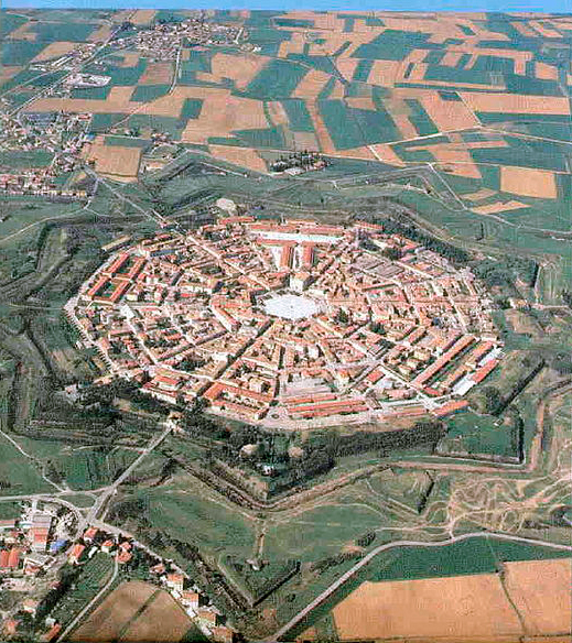 The Venetian Works of defence between 15th and 17th centuriesCultural · 2017 · Croatia, Italy, MontenegroRead on the Croatia page →
 The Great Spa Towns of EuropeCultural · 2021 · Austria, Czechia, Germany, France, United Kingdom, ItalyRead on the Austria page →
World Heritage in Italy: Quick Answers
- How many UNESCO World Heritage Sites are in Italy?
- Italy has 56 World Heritage Sites: 52 cultural and 4 natural. 5 of them are shared with a neighbouring country.
- What was the first World Heritage Site in Italy?
- rock drawings in Valcamonica, inscribed in 1979. The most recent is domus de janas, inscribed in 2025.
- What are the natural World Heritage Sites in Italy?
- Aeolian Islands, Ancient and Primeval Beech Forests of the Carpathians and Other Regions of Europe, Etna Park, Evaporitic Karst and Caves of Northern Apennines.
- Are any World Heritage Sites in Italy in danger?
- None of the World Heritage Sites in Italy is on UNESCO's List of World Heritage in Danger.