Skip to content
YearMaps
China · Landforms

Mountain Ranges, Deserts and Landforms of China

Asia is the largest of the 43 mountain ranges, deserts and other landforms recorded for China, at 46.28M km², ahead of Plateau of Tibet at 3.05M km². The full list follows.

How this list is built: Ranked by mapped area. Covers mountain ranges, deserts, plateaus, named glaciers, plains, basins, peninsulas and capes. One that crosses a border is listed under every country it lies in, with the area of the whole feature. It covers the mountain ranges, deserts and other landforms indexed in YearMaps, drawn from open geospatial data, and is not an exhaustive national register.

Landforms Listed
43
Top Ranked
46.28M km²
Asia
Second
3.05M km²
Plateau of Tibet
Profiled Below
34
Photo, encyclopedia text and figures
Mountain Ranges, Deserts and Landforms of China
#NameArea
1Asia46.28M km²
2Plateau of Tibet3.05M km²
3Indochina Peninsula1.90M km²
4Gobi Desert1.09M km²
5North China Plain463,774 km²
6Tarim Basin423,249 km²
7Tian Shan414,352 km²
8Altay Mountains404,274 km²
9Yungui Plateau373,901 km²
10Manchurian Plain274,247 km²
11Mongolian Plateau249,115 km²
12Greater Khingan Range224,189 km²
13Taklimakan Desert204,900 km²
14Loess Plateau192,840 km²
15Mu Us Desert159,126 km²
16Qinling Mountains135,053 km²
17KARAKORAM Range112,057 km²
18Sichuan Basin110,660 km²
19Pamirs97,312 km²
20Nan Ling Mountains94,351 km²
21Lüliang Mountains85,398 km²
22Lesser Khingan Range80,374 km²
23Taihang Mountains78,536 km²
24Qaidam Basin71,283 km²
25Yangtze Gorges67,113 km²
26Junggar Basin66,471 km²
27Alataw Mountains64,390 km²
28Wuyi Mountains62,754 km²
29Dabie Mountains58,433 km²
30Dalou Mountains52,251 km²
31Hamgyong Mountains46,239 km²
32Shandong Peninsula44,075 km²
33Tarbagatay Range39,343 km²
34Liaodong Peninsula32,054 km²
35Borohoro Mountains27,641 km²
36Himalayas17,334 km²
37Leizhou Peninsula8,512 km²
38Tsangpo Gorge3,124 km²
39Kunlun Mountains1,736 km²
40Hexi Corridor1,651 km²
41ALTUN Mountains665 km²
42Quilian Mountains596 km²
43Yin Mountains429 km²

The Landforms of China in Detail

The 34 mountain ranges, deserts and other landforms above that have an encyclopedia article, in the same order, each with its photograph, figures and the places around it.

Plateau of Tibet
Image via Wikimedia Commons (author and licence on the file page).

Plateau of Tibet

Plateau · 3.05M km²

Plateau of Tibet is a plateau in Asia, covering an estimated 3.05M km². It extends across China, India, Nepal, Pakistan, Bhutan, Afghanistan, Tajikistan and Kyrgyzstan. It is the largest of the 69 plateaus with a mapped extent in YearMaps.

The Tibetan Plateau, also known as the Qinghai–Tibet Plateau, Qingzang Plateau, is a vast elevated plateau located at the intersection of Central, South, and East Asia. Geographically, Tibet is located to the north of the Himalayas and the Indian subcontinent, and to the south of the Tarim Basin and the Mongolian Plateau. Geopolitically, it covers most of the Tibet Autonomous Region, most of Qinghai, the western half of Sichuan, southern Gansu Province, southern Xinjiang Province in Western China, Bhutan, the Indian regions of Ladakh and Lahaul and Spiti (Himachal Pradesh) as well as Gilgit-Baltistan in Pakistan, northwestern Nepal, eastern Tajikistan and southern Kyrgyzstan.

It stretches approximately 1,000 kilometres (620 mi) north to south and 2,500 kilometres (1,600 mi) east to west. It is the world's largest and highest plateau above sea level, with an area of 2,500,000 square kilometres (970,000 sq mi). With an average elevation exceeding 4,500 metres (14,800 ft) and being surrounded by imposing mountain ranges that harbor the world's two highest summits, Mount Everest and K2, the Tibetan Plateau is often referred to as "the Roof of the World".

Adapted from Wikipedia: Tibetan Plateau (CC BY-SA 4.0).

Feature class
Plateau
Mapped extent
3.05M km²
Size rank
#1 of 69 plateaus
Region
Asia
Countries
China, India, Nepal, Pakistan, Bhutan, Afghanistan, Tajikistan, Kyrgyzstan
Coordinates
32.2743°, 87.4953°
Summits:
Geladandong (6,621 m), Nyainqentanglha Feng (7,162 m), Gyala Peri (7,294 m)
Ranges:
Kunlun Mountains (Asia), Khasi Hills (Asia)
Settlements:
Golmud (410 km), Jyekundo (429 km), Lhasa (438 km)

View on the live map

More about Plateau of Tibet

Geology and geological history

The geological history of the Tibetan Plateau is closely related to that of the Himalayas. The Himalayas belong to the Alpine orogeny and are among the younger mountain ranges on the planet, consisting mostly of uplifted sedimentary and metamorphic rock. Their formation is a result of a continental collision or orogeny along the convergent boundary between the Indo-Australian plate and the Eurasian plate.

India began drifting northward from Gondwana in the Upper Cretaceous, about 70 million years ago (Mya), moving at about 15 cm (6 in) per year; its collision with the Eurasian plate is most commonly dated to around 55–50 Mya, near the Paleocene–Eocene boundary, though the exact timing remains debated.

Human history

Archaic Denisovans lived on the plateau from around 200,000 to 40,000 years ago, according to a study published in Nature. Archaeological evidence suggests that the earliest human occupation of the plateau occurred between 30,000 and 40,000 years ago.

Since the plateau's earliest settlement, Tibetan culture has adapted and flourished in the western, southern, and eastern regions. The Changtang is generally too high and cold to support permanent population. The Tibetan Empire existed from the 7th century to the 9th century AD. Nomadic pastoralism, once practiced widely across Asia and Africa, has persisted among these communities on the plateau. Pastoral nomads constitute about 40% of the ethnic Tibetan population.

Description

The Tibetan Plateau is surrounded by the massive mountain ranges of high-mountain Asia. The plateau is bordered to the south by the inner Himalayan range, to the north by the Kunlun Mountains which separate it from the Tarim Basin, and to the northeast by the Qilian Mountains, which separate it from the Hexi Corridor and Gobi Desert. To the east and southeast are the Salween, Mekong, and Yangtze rivers in northwest Yunnan, western Sichuan, and southwest Qinghai. In the west, the rugged Karakoram range of northern Kashmir curves around the plateau's edge. The Indus River originates in the western Tibetan Plateau in the vicinity of Lake Manasarovar.

Sections adapted from Wikipedia: Tibetan Plateau (CC BY-SA 4.0).

Plateau of Tibet: Key Facts

Key facts about Plateau of Tibet
Area2,500,000 km²
Elevation4,500 m

Facts from Wikidata Q179842 (CC0).

Gobi Desert
Image via Wikimedia Commons (author and licence on the file page).

Gobi Desert

Desert · 1.09M km²

Gobi Desert is a desert in Asia, covering an estimated 1.09M km². It extends across China and Mongolia. It is the 2nd-largest of the 58 deserts with a mapped extent in YearMaps.

The Gobi Desert is a large, cold desert and grassland region in southern Mongolia and North China. It is the sixth-largest desert in the world.

The name of the desert comes from the Mongolian word Gov' (Говь, 'dryland'), used to refer to all of the waterless regions in the Mongolian Plateau; the borrowed Chinese term gēbì (戈壁) is used to refer to rocky, semi-deserts such as the Gobi itself rather than sandy deserts.

Adapted from Wikipedia: Gobi Desert (CC BY-SA 4.0).

Feature class
Desert
Mapped extent
1.09M km²
Size rank
#2 of 58 deserts
Region
Asia
Countries
China, Mongolia
Coordinates
41.7290°, 102.2823°
Summits:
Helan Shan (3,540 m), Mazong Shan (2,584 m), Wutai Shan (3,058 m)
Ranges:
Yin Mountains (Asia), Taihang Mountains (Asia)
Settlements:
Wuhai (250 km), Shizuishan (293 km), Bayan Obo (362 km)

View on the live map

More about Gobi Desert

Geography

The Gobi measures 1,600 km (1,000 mi) from southwest to northeast and 800 km (500 mi) from north to south. The desert is widest in the west, along the line joining the Lake Bosten and the Lop Nor (87°–89° east). Its area is approximately 1,295,000 square kilometres (500,000 sq mi).

Gobi includes the long stretch of desert extending from the foot of the Pamirs (77° east) to the Greater Khingan Mountains, 116–118° east, on the border of Manchuria; and from the foothills of the Altay, Sayan, and Yablonoi mountain ranges on the north to the Kunlun, Altyn-Tagh, and Qilian mountain ranges, which form the northern edges of the Tibetan Plateau, on the south.

Climate

The Gobi is overall a cold desert, with frost and occasionally snow occurring on its dunes. Besides being quite far north, it is also located on a plateau roughly 910–1,520 m (2,990–4,990 ft) above sea level, which contributes to its low temperatures. An average of about 194 mm (7.6 in) of rain falls annually in the Gobi. Additional moisture reaches parts of the Gobi in winter as snow is blown by the wind from the Siberian Steppes. These winds may cause the Gobi to reach −40 °C (−40 °F) in winter to 45 °C (113 °F) in summer.

However, the climate of the Gobi is one of great extremes, with rapid changes of temperature of as much as 35 °C (63 °F) in 24-hour spans.

In southern Mongolia, the temperature has been recorded as low as −32.8 °C (−27.0 °F).

Conservation, ecology, and economy

The Gobi Desert is the source of many important fossil finds, including the first dinosaur eggs, twenty-six of which, averaging 23 centimetres (9 in) in length, were uncovered in 1923.

Archeologists and paleontologists have done excavations in the Nemegt Basin in the northwestern part of the Gobi Desert (in Mongolia), which is noted for its fossil treasures, including early mammals, dinosaur eggs, and prehistoric stone implements, some 100,000 years old.

Despite the harsh conditions, these deserts and the surrounding regions sustain many animal species. Some are even unique, including black-tailed gazelles, marbled polecats, wild Bactrian camels, Mongolian wild ass and sandplovers. They are occasionally visited by snow leopards, Gobi bears, and wolves.

History

There is little information about early habitation of the Gobi desert.

Lisa Janz has proposed a system of nomenclature for early Gobi desert habitation. They are Oasis I, Oasis II, Oasis III.

honeycomb imprinted, corded, string paddled, low and high fired pottery with a sand and gravel mixture.

Starting around 8000 cal BP there was a warm wet phase in the Gobi desert.By 7500 cal BP lake levels in the Western Gobi reached their peak. Around this time there was meadow steppe vegetation around lakes. In Ulaan Nuur there may have been shrubby riparian woodlands.

Sections adapted from Wikipedia: Gobi Desert (CC BY-SA 4.0).

Gobi Desert: Key Facts

Key facts about Gobi Desert
Area2,354,460 km²
Highest pointBogd Khan Mountain

Facts from Wikidata Q42070 (CC0).

North China Plain
Image via Wikimedia Commons (author and licence on the file page).

North China Plain

Plain · 463,774 km²

North China Plain is a plain in Asia, covering an estimated 463,774 km².

The North China Plain (simplified Chinese: 华北平原; traditional Chinese: 華北平原; pinyin: Huáběi Píngyuán) is a large-scale downfaulted rift basin formed in the late Paleogene and Neogene and then modified by the deposits of the Yellow River. It is the largest alluvial plain of China. The plain is bordered to the north by the Yanshan Mountains, to the west by the Taihang Mountains, to the south by the Dabie Mountains, and to the east by the Yellow Sea and Bohai Sea. The Yellow River flows through the plain, before its waters empty into the Bohai Sea.

The part of the North China Plain around the banks of the middle and lower Yellow River is commonly referred to as the Central Plain (pinyin: Zhōngyuán). This portion of the North China Plain formed the cradle of Chinese civilization, and is the region from which the Han Chinese people emerged.

Beijing, the capital of China, is located on the northeast edge of the plain, with Tianjin, an important industrial city and commercial port, near its northeast coast. Jinan (the capital of Shandong province) and Zhengzhou (the capital of Henan province) lie on the plain as well, along the banks of the Yellow River.

Adapted from Wikipedia: North China Plain (CC BY-SA 4.0).

Feature class
Plain
Mapped extent
463,774 km²
Size rank
#26 of 231 landforms
Region
Asia
Coordinates
34.2933°, 116.4936°
Summits:
Tianzhu Shan (1,760 m), Hua Shan (2,130 m), Wutai Shan (3,058 m)
Ranges:
Dabie Mountains (Asia), Lüliang Mountains (Asia)
Settlements:
Huaibei (45 km), Xuzhou (63 km), Shanxian (67 km)

View on the live map

More about North China Plain

Climate change

As climate change increases the Earth's average temperature, and has a disproportionate effect on extreme temperatures, it will also increase heat stress felt in areas that are already hot and/or with high humidity. The North China Plain is expected to be highly affected, as the region's extensive irrigation networks result in unusually moist air. In scenarios without aggressive action to stop climate change, the worst heatwaves are projected to become severe enough to cause mass mortality in agricultural labourers working outdoors. Under the most extreme climate change scenario, the warming reached by 2100 would be sufficient to cause such heatwaves across the North China Plain approximately once per decade.

Sections adapted from Wikipedia: North China Plain (CC BY-SA 4.0).

Tarim Basin
Image via Wikimedia Commons (author and licence on the file page).

Tarim Basin

Basin · 423,249 km²

Tarim Basin is a basin in Asia, covering an estimated 423,249 km². It extends across China, Afghanistan, Kyrgyzstan, Pakistan and Tajikistan.

The Tarim Basin is an endorheic basin in Xinjiang, Northwestern China, occupying an area of about 888,000 km2 (343,000 sq mi) and the largest basin in Northwest China. Located in China's Xinjiang region, it is sometimes used synonymously to refer to the southern half of the province, that is, Southern Xinjiang or Nanjiang (Chinese: 南疆; pinyin: Nánjiāng), as opposed to the northern half of the province known as Dzungaria or Beijiang. Its northern boundary is the Tian Shan mountain range and its southern boundary is the Kunlun Mountains on the edge of the Tibetan Plateau. The Taklamakan Desert dominates much of the basin. The historical Uyghur name for the Tarim Basin is Altishahr (Traditional Uyghur: آلتی شهر, Chinese: 六城), which means 'six cities' in Uyghur. The region was also called Little Bukhara or Little Bukharia. The basin is a major area for renewable energy development, particularly solar and wind power, with a focus on utilizing the vast Taklamakan Desert. A high-voltage power loop has been constructed around the basin, collecting energy from various sources and transmitting it to other regions.

Adapted from Wikipedia: Tarim Basin (CC BY-SA 4.0).

Feature class
Basin
Mapped extent
423,249 km²
Size rank
#27 of 231 landforms
Region
Asia
Countries
China, Afghanistan, Kyrgyzstan, Pakistan, Tajikistan
Coordinates
40.0368°, 88.6647°
Summits:
Pik Pobeda (7,439 m), Muztag Feng (6,973 m), Liushi Shan (7,167 m)
Ranges:
Kunlun Mountains (Asia), Borohoro Mountains (Asia)
Settlements:
Kuqa (238 km), Aksu (314 km), Korla (333 km)

View on the live map

More about Tarim Basin

Geography and relation to Xinjiang

Xinjiang consists of two main geographically, historically, and ethnically distinct regions with different historical names, Dzungaria and the Tarim Basin (Altishahr), until it was merged into the Chinese Province of Xinjiang in 1884. At the time of the Qing conquest in 1759, Dzungaria was inhabited by steppe-dwelling, nomadic Mongolic Buddhist Dzungars, while the Tarim Basin (Altishahr) was inhabited by sedentary, oasis-dwelling, Turkic-speaking Uyghur Muslim peasants. Dzungaria and the Tarim Basin were each governed separately until the creation of Xinjiang province.

The Chinese called this the Tien Shan Nan Lu or Tien Shan South Road, as opposed to the Bei Lu north of the mountains. Along it runs the modern highway and railroad while the middle Tarim River is about 100 km south.

Geology

The Tarim Basin is the result of an amalgamation between an ancient microcontinent and the growing Eurasian continent during the Carboniferous to Permian periods, a process which ended in the earliest Triassic with the closure of the Palaeo-Asian Ocean. At present, deformation around the margins of the basin is resulting in the microcontinental crust being pushed under Tian Shan to the north, and Kunlun Shan to the south.

A thick succession of Paleozoic, Mesozoic and Cenozoic sedimentary rocks occupy the central parts of the basin, locally exceeding thicknesses of 15 km (9 mi). The source rocks of oil and gas tend to be mostly Permian mudstones and, less often, Ordovician strata which experienced an intense and widespread early Hercynian karstification.

History

It is speculated that the Tarim Basin may be one of the last places in Asia to have become inhabited: It is surrounded by mountains and irrigation technologies might have been necessary.

The Northern Silk Road on one route bypassed the Tarim Basin north of the Tian Shan mountains and traversed it on three oases-dependent routes: one north of the Taklamakan Desert, one south, and a middle one connecting both through the Lop Nur region.

The northern Tarim route ran from Kashgar via Aksu, Kucha, Korla, through the Iron Gate Pass, then Karasahr, Jiaohe, Turpan, Gaochang and Kumul to Anxi.

The southern Tarim route ran from Kashgar through Yarkant, Karghalik, Pishan, Khotan, Keriya, Niya, Qarqan, Qarkilik, Miran and Dunhuang to Anxi.

Sections adapted from Wikipedia: Tarim Basin (CC BY-SA 4.0).

Tarim Basin: Key Facts

Key facts about Tarim Basin
OnTarim River

Facts from Wikidata Q216622 (CC0).

Tian Shan
Image via Wikimedia Commons (author and licence on the file page).

Tian Shan

Range/mtn · 414,352 km²

Tian Shan is a range/mtn in Asia, covering an estimated 414,352 km². It extends across China, Kyrgyzstan, Kazakhstan and Uzbekistan. It is the 6th-largest of the 216 mountain ranges with a mapped extent in YearMaps.

The Tian Shan, also known as the Tengri Tagh or Tengir-Too, is a large system of mountain ranges in Central Asia. The highest peak is Jengish Chokusu at 7,439 metres (24,406 ft) high and located in Kyrgyzstan. Its lowest point is at the Turpan Depression, which is 154 m (505 ft) below sea level.

The Tian Shan is sacred in Tengrism. Its second-highest peak is known as Khan Tengri, which can be translated as "Lord of the Spirits". At the 2013 Conference on World Heritage, the eastern portion of Tian Shan in western China's Xinjiang Region was listed as a World Heritage Site. The western portion in Kyrgyzstan, Kazakhstan, and Uzbekistan was then listed in 2016.

Adapted from Wikipedia: Tian Shan (CC BY-SA 4.0).

Feature class
Range/mtn
Mapped extent
414,352 km²
Size rank
#6 of 216 mountain ranges
Region
Asia
Countries
China, Kyrgyzstan, Kazakhstan, Uzbekistan
Coordinates
41.6379°, 77.0899°
Summits:
Bogda Feng (5,445 m), Turpan Depression (-154 m), Pik Pobeda (7,439 m)
Adjacent ranges:
Borohoro Mountains (Asia), Kunlun Mountains (Asia)
Settlements:
Korla (132 km), Kuqa (186 km), Shihezi (218 km)

View on the live map

More about Tian Shan

Geography

The Tian Shan range is located north and west of the Taklamakan Desert and directly north of the Tarim Basin. It straddles the border regions of Kazakhstan, Kyrgyzstan, Uzbekistan and Xinjiang in Northwest China. To the south, it connects with the Pamir Mountains, while to north and east, it meets the Altai Mountains of Mongolia.

The Tian Shan range extends eastwards for approximately 2,900 kilometers from Tashkent, Uzbekistan. It forms part of the Himalayan orogenic belt, resulting from the collision of the Indian and Eurasian tectonic plates during the Cenozoic era. The range encompasses the Bogda Shan in the east, as defined by both Western and Chinese cartography.

The Tian Shan's highest peak is Jengish Chokusu (also known as Victory Peak), shared by Kyrgyzstan and China.

Ecology

The Tian Shan holds important forests of Schrenk's spruce (Picea schrenkiana) at altitudes of over 2,000 metres (6,600 ft); the lower slopes have unique natural forests of wild walnuts and apples.

The Tian Shan in its immediate geological past was kept from glaciation due to the "protecting" warm influence of the Indian Ocean monsoon climate. This defined its ecological features which could sustain its distinctive ecosphere. The mountains were subjected to constant geological changes with constantly evolving drainage systems which affected the patterns of vegetation, as well as exposing fertile soil for newly emerging seedlings to thrive in.

Tulips originated in the Tian Shan Mountains. The plant then made its way to Turkey via the Silk Road and became a symbol of the Ottoman Empire.

Sections adapted from Wikipedia: Tian Shan (CC BY-SA 4.0).

Tian Shan: Key Facts

Key facts about Tian Shan
Length2,500 km
Highest pointJengish Chokusu

Facts from Wikidata Q5474 (CC0).

Altay Mountains
Image via Wikimedia Commons (author and licence on the file page).

Altay Mountains

Range/mtn · 404,274 km²

Altay Mountains is a range/mtn in Asia, covering an estimated 404,274 km². It extends across Mongolia, Russia, China and Kazakhstan. It is the 7th-largest of the 216 mountain ranges with a mapped extent in YearMaps.

The Altai Mountains ( ahl-TY) are a mountain range in Central Asia, where Russia, China, Mongolia, and Kazakhstan converge, and where the rivers Irtysh and Ob have their headwaters. The highest summit of the range is Belukha, whose summit reaches 4,506 m (14,783 ft) above sea level. The massif merges with the Sayan Mountains in the northeast, and gradually becomes lower in the southeast, where it merges into the high plateau of the Gobi Desert. In the southwest, it is separated from the higher Tian Shan range by the Junggar Basin. It spans from about 45° to 52° N and from about 84° to 99° E.

The region is inhabited by a sparse but ethnically diverse population, including Turkic peoples, Mongols, and Volga Germans, though predominantly represented by indigenous ethnic minorities of semi-nomadic people. The local economy is based on bovine, sheep, horse husbandry, hunting, agriculture, forestry, and mining. The now discredited Altaic language family takes its name from this mountain range.

Adapted from Wikipedia: Altai Mountains (CC BY-SA 4.0).

Feature class
Range/mtn
Mapped extent
404,274 km²
Size rank
#7 of 216 mountain ranges
Region
Asia
Countries
Mongolia, Russia, China, Kazakhstan
Coordinates
49.8171°, 85.9828°
Summits:
Tavan Bogd Uul (4,374 m), Bogda Feng (5,445 m), Turpan Depression (-154 m)
Adjacent ranges:
Tannu-Ola Range (Asia), Borohoro Mountains (Asia)
Settlements:
Koktokay (35 km), Altay (175 km), Ürümqi (374 km)

View on the live map

More about Altay Mountains

Geography

The Altai Mountains are a system of remote mountains in central Asia that cover an area of 845,000 km2 (326,000 sq mi). The mountains stretch for 2,525 km (1,569 mi) from northwest to southeast.

In the north of the region is the Sailughem Mountains, also known as Kolyvan Altai, which stretch northeast from 49° N and 86° E towards the western extremity of the Sayan Mountains in 51° 60' N and 89° E. Their mean elevation is 1,500–1,750 m (4,920–5,740 ft). The snow-line runs at 2,000 m (6,600 ft) on the northern side and at 2,400 m (7,900 ft) on the southern, and above it the peaks rise some 1,000 m (3,300 ft) higher.

Geology

The Siberian Altai represents the northernmost region affected by the tectonic collision of India into Asia. Extensive fault systems run through the area, including the Kurai fault zone and the recently identified Tashanta fault zone. These fault systems are typically thrusts or right lateral strike-slip faults, some of which are tectonically active. Rock types in the mountains are typically granites and metamorphic schists, and some are highly sheared near to fault zones.

Geologist Victor R. Baker "has discovered past cataclysmic floods in the Altai Mountains of Siberia" from "an even larger glacial lake" than Lake Missoula, which was once thought to have been "the largest ice-dammed lake in the world".

History

The Altai mountains have retained a remarkably stable climate, changing little since the last ice age. In addition the mix of mammals has remained largely the same, with a few exceptions such as extinct mammoths, making it one of the few places on Earth to retain an ice age fauna. Genetic analysis in 2026 also determined that the Altai region served as a likely primary refugium for the woolly rhinoceros, which had originated during the Penultimate Glacial Period, during the warmer period of the Last Interglacial.

The Altai mountains were home to the Denisovan branch of hominids who were contemporaries of Neanderthals and of Homo sapiens (modern humans), descended from Hominids who reached Asia earlier than modern humans.

Sections adapted from Wikipedia: Altai Mountains (CC BY-SA 4.0).

Altay Mountains: Key Facts

Key facts about Altay Mountains
Length2,000 km
Highest pointBelukha Mountain

Facts from Wikidata Q5955 (CC0).

Yungui Plateau
Image via Wikimedia Commons (author and licence on the file page).

Yungui Plateau

Plateau · 373,901 km²

Yungui Plateau is a plateau in Asia, covering an estimated 373,901 km². It is the 9th-largest of the 69 plateaus with a mapped extent in YearMaps.

The Yunnan–Guizhou Plateau or Yungui Plateau (simplified Chinese: 云贵高原; traditional Chinese: 雲貴高原; pinyin: Yúnguì Gāoyuán) is a highland region located in southwest China. The region is primarily spread over the provinces of Yunnan and Guizhou. In the southwest, the Yungui is a true plateau with relatively flatter highland areas, while in the northeast, the Yungui is a generally mountainous area of rolling hills, gorges, and karst topography.

Adapted from Wikipedia: Yunnan–Guizhou Plateau (CC BY-SA 4.0).

Feature class
Plateau
Mapped extent
373,901 km²
Size rank
#9 of 69 plateaus
Region
Asia
Coordinates
26.2122°, 104.0011°
Summits:
Gongga Shan (7,556 m), Fan Si Pan (3,142 m), Daxue Shan (3,500 m)
Ranges:
Dalou Mountains (Asia), Naga Hills (Asia)
Settlements:
Zhanyi (70 km), Lupanshui (93 km), Zhaotang (127 km)

View on the live map

More about Yungui Plateau

Geography

Under the strictest definition, the Yungui Plateau stretches from the Red River Fault in Yunnan in the southwest to the Wuling Mountains in Hunan in the northeast. This plateau region includes most of eastern Yunnan and most of Guizhou. It is common, however, for much of the rest of Yunnan and surrounding highland areas to be referred to as part of the Yunnan–Guizhou Plateau even where there are no plateau-like characteristics.

Under the broader definition of the Yungui Plateau, the provinces would include not only Yunnan and Guizhou but also Gulin County and the southernmost extremes of Sichuan, eastern Chongqing, southwestern Hubei, western Hunan, and northwestern Guangxi.

Located in Southwest China, the Yungui Plateau separates the Sichuan Basin from South China.

Climate and ecology

The climate gradually transitions from drier in the southwest to rainier in the northeast. In east-central Yunnan, parts of the Yungui Plateau experience a semi-arid climate. In most of Guizhou, the climate is classified as humid subtropical. The Yungui Plateau is covered by subtropical evergreen forests for much of its Yunnan portions and by mixed broadleaf forests for the Guizhou portions.

Sections adapted from Wikipedia: Yunnan–Guizhou Plateau (CC BY-SA 4.0).

Manchurian Plain
Image via Wikimedia Commons (author and licence on the file page).

Manchurian Plain

Plain · 274,247 km²

Manchurian Plain is a plain in Asia, covering an estimated 274,247 km².

The Northeast China Plain or Northeast Plain (simplified Chinese: 东北平原; traditional Chinese: 東北平原; pinyin: Dōngběi Píngyuán), also known as the Manchurian Plain or Songliao Plain, is a lowland plain in Northeast Asia located in a vast, elongated basin formed by the Greater Khingan, Lesser Khingan and the Changbai mountain ranges, and forms the main portion of Northeast China (Inner Manchuria or "Inner Northeast"). Covering approximately 350,000 km2 (140,000 sq mi), the Northeast Plain is China's largest plain.

Adapted from Wikipedia: Northeast China Plain (CC BY-SA 4.0).

Feature class
Plain
Mapped extent
274,247 km²
Size rank
#37 of 231 landforms
Region
Asia
Coordinates
44.9259°, 124.5687°
Summits:
Paektu-san (2,744 m), Sorak-san (1,708 m), Chiri-san (1,915 m)
Settlements:
Fuyu (35 km), Daan (67 km), Nongan (73 km)

View on the live map

More about Manchurian Plain

Geography

The Northeast Plain is bounded in the west by the Greater Khingan Range and northern/eastern branches of the Yan Mountains, in the northeast by the Lesser Khingan Range (which separates it from the Zeya–Bureya plains in the Russian Amur Oblast), in the east/southeast by branches of Changbai Mountains (e.g. the Zhangguangcai Range and Qian Mountains, which separates it from the Sanjiang Plain to the northeast) and in the south by the Liaodong Bay of the Bohai Sea. It has a mostly flat topography with an average elevation lower than 200 m (660 ft), and less than 100 m (330 ft) in the southern coastal regions.

History

The Northeast Plain was inhabited by Sushen ethnic groups, who were tribute payers to the Zhou dynasty. The southern Liaohe Plain of the plain was conquered by General Qin Kai of the Yan state in 300 BC, while the northern parts remained sparsely populated by various semi-agrarian/hunter-gatherer peoples collectively known as the Dongyi. After Qin dynasty's unification of China in 221 BC, the southern plains were divided into the commanderies of Liaoxi] and Liaodong, named for their relative positions to a large, untraversable wetland called Liao Mire (simplified Chinese: 辽泽; traditional Chinese: 遼澤; pinyin: Liáo Zé) that existed until the 19th century.

Sections adapted from Wikipedia: Northeast China Plain (CC BY-SA 4.0).

Mongolian Plateau
Image via Wikimedia Commons (author and licence on the file page).

Mongolian Plateau

Plateau · 249,115 km²

Mongolian Plateau is a plateau in Asia, covering an estimated 249,115 km². It extends across Mongolia, Russia and China. It is the 14th-largest of the 69 plateaus with a mapped extent in YearMaps.

The Mongolian Plateau or Altai Plateau is an inland plateau in East Asia covering approximately 3,200,000 square kilometers (1,200,000 mi2). It is bounded by the Greater Hinggan Mountains in the east, the Yin Mountains to the south, the Altai Mountains to the west, and the Sayan and Khentii mountains to the north. The plateau includes the Gobi Desert as well as dry steppe regions. It has an elevation of roughly 1,000 to 1,500 meters (3,300 to 4,900 ft), with the lowest point in Hulunbuir and the highest point in the Altai.

Politically, the plateau spans all of Mongolia, along with parts of China and Russia. Inner Mongolia and parts of the Dzungarian Basin in Xinjiang encompass the Chinese portion of the plateau. In Russia, the plateau forms Transbaikal, part of Buryatia, and the southern Irkutsk Oblast. The Mongolian Plateau comprises the majority of the area known as the Mongol heartland.

Adapted from Wikipedia: Mongolian Plateau (CC BY-SA 4.0).

Feature class
Plateau
Mapped extent
249,115 km²
Size rank
#14 of 69 plateaus
Region
Asia
Countries
Mongolia, Russia, China
Coordinates
46.8553°, 104.3787°
Summits:
Mazong Shan (2,584 m), Helan Shan (3,540 m), Wutai Shan (3,058 m)
Ranges:
Yin Mountains (Asia), Tannu-Ola Range (Asia)
Settlements:
Erenhot (691 km), Bayan Obo (719 km), Baotou (816 km)

View on the live map

More about Mongolian Plateau

Geography

The average elevation of the Mongolian Plateau ranges from 915 to 1,525 meters (3,002 to 5,003 ft) above sea level. The highest point in the plateau is found in Tavan Bogd at 4,374 meters (14,350 ft) above sea level.

Ecology

The ecology of Mongolia is complex, having varying regions of highland and lowland areas. Grazing species such as yaks, Przewalski's horses, domesticated sheep, saiga antelope, Siberian ibex and Argali are common. Predator species include the Eurasian lynx, snow leopards, Corsac foxes as well as carnivorous birds such as the bearded vulture, saker falcon, and the cinereous vulture. Marmots are common throughout the region including the Tarbagan marmot with large parts of its range located in the Mongolian plateau.

History

The plateau was inhabited and conquered by various groups, including (chronologically) the Xiongnu, Xianbei, Göktürks, Tang dynasty, Liao dynasty, Mongol Empire, Yuan dynasty, Northern Yuan dynasty, and Qing dynasty.

Sections adapted from Wikipedia: Mongolian Plateau (CC BY-SA 4.0).

Greater Khingan Range
Image via Wikimedia Commons (author and licence on the file page).

Greater Khingan Range

Range/mtn · 224,189 km²

Greater Khingan Range is a range/mtn in Asia, covering an estimated 224,189 km². It is the 12th-largest of the 216 mountain ranges with a mapped extent in YearMaps.

The Greater Khingan Range or Da Hinggan Range (simplified Chinese: 大兴安岭; traditional Chinese: 大興安嶺; pinyin: Dà Xīng'ān Lǐng; IPA: [tâ ɕíŋ.án.lìŋ]; Old Turkic: 𐰴𐰑𐰺𐰴𐰣:𐰖𐰃𐱁, romanized: Qadïrqan Yïš) is a 1,200-kilometer-long (750 mi) volcanic mountain range in the Inner Mongolia region of Northeast China, and in easternmost part of Mongolia.

It was originally called the Xianbei Mountains, which later became the name of the northern branch of the Donghu, the Xianbei.

Adapted from Wikipedia: Greater Khingan (CC BY-SA 4.0).

Feature class
Range/mtn
Mapped extent
224,189 km²
Size rank
#12 of 216 mountain ranges
Region
Asia
Coordinates
46.8575°, 120.8278°
Summits:
Paektu-san (2,744 m), Wutai Shan (3,058 m), Pik BAM (3,072 m)
Adjacent ranges:
Lesser Khingan Range (Asia), Hamgyong Mountains (Asia)
Settlements:
Arxan (75 km), Ulanhot (129 km), Longjiang (186 km)

View on the live map

More about Greater Khingan Range

Geography

The range extends 1,200 kilometers (750 mi) from north to south. It is the watershed between the Nen and Songhua river systems to the east, and the Amur and its tributaries to the northwest. Cassiterite, a tin ore mined in the range was transported over 1,500 km to the south during the Middle Shang period for bronze production.

Sections adapted from Wikipedia: Greater Khingan (CC BY-SA 4.0).

Greater Khingan Range: Key Facts

Key facts about Greater Khingan Range
Length1,200 km

Facts from Wikidata Q293713 (CC0).

Taklimakan Desert
Image via Wikimedia Commons (author and licence on the file page).

Taklimakan Desert

Desert · 204,900 km²

Taklimakan Desert is a desert in Asia, covering an estimated 204,900 km². It is the 10th-largest of the 58 deserts with a mapped extent in YearMaps.

The Taklamakan Desert ( TAK-lə-mə-KAN) is a desert in northwestern China. Located inside the Tarim Basin in Southern Xinjiang, it is bounded by the Kunlun Mountains to the south, the Pamir Mountains to the west, the Tian Shan range to the north, and the Gobi Desert to the east.

Adapted from Wikipedia: Taklamakan Desert (CC BY-SA 4.0).

Feature class
Desert
Mapped extent
204,900 km²
Size rank
#10 of 58 deserts
Region
Asia
Coordinates
38.8188°, 83.0966°
Summits:
Liushi Shan (7,167 m), Pik Pobeda (7,439 m), Muztag Feng (6,973 m)
Ranges:
Kunlun Mountains (Asia), Tian Shan (Asia)
Settlements:
Kuqa (324 km), Hotan (337 km), Aksu (355 km)

View on the live map

More about Taklimakan Desert

Geography

The Taklamakan Desert has an area of 337,000 km2 (130,000 sq mi), making it slightly smaller than Germany. The desert is part of the Tarim Basin, which is 1,000 kilometres (620 mi) long and 400 kilometres (250 mi) wide. It is crossed at its northern and at its southern edge by two branches of the Silk Road, by which travellers sought to avoid the arid wasteland. It ranks 15th in size in a ranking of the world's largest deserts. Dunes range in height from 60 feet (18 m) up to as much as 300 feet (91 m). The few breaks in this sea of sand are small patches of alluvial clay. Generally, the steeper sides of the dunes face away from the prevailing winds. The Taklamakan, as with all of Outer China, is a land of extremes, with hot summers and cold winters. Sandstorms are likely and dangerous.

Climate

Because it lies in the rain shadow of the Himalayas, the Taklamakan has a cold desert climate. Given its relative proximity with the cold to frigid air masses in Siberia, extreme temperatures are recorded in wintertime, sometimes well below −20 °C (−4 °F), while in summer they can rise up to 40 °C (104 °F). During the 2008 Chinese winter storms episode, the Taklamakan was reported to be covered, for the first time in its recorded history, entirely with a thin layer of snow, reaching 4 centimetres (1.6 in), with a temperature of −26.1 °C (−15 °F) in some observatories.

Its extreme inland position, effectively at the very center of Asia, and thousands of kilometres from any open body of water, accounts for its somewhat wide diurnal temperature variation.

Sections adapted from Wikipedia: Taklamakan Desert (CC BY-SA 4.0).

Taklimakan Desert: Key Facts

Key facts about Taklimakan Desert
Area337,000 km²

Facts from Wikidata Q132956 (CC0).

Loess Plateau
Image via Wikimedia Commons (author and licence on the file page).

Loess Plateau

Plateau · 192,840 km²

Loess Plateau is a plateau in Asia, covering an estimated 192,840 km². It is the 20th-largest of the 69 plateaus with a mapped extent in YearMaps.

The Loess Plateau is a plateau in north-central China formed of loess, a clastic silt-like sediment formed by the accumulation of wind-blown dust. It is located southeast of the Gobi Desert and is surrounded by the Yellow River. It includes parts of the Chinese provinces of Qinghai, Gansu, Shaanxi and Shanxi. The depositional setting of the Chinese Loess Plateau was shaped by the tectonic movement in the Neogene period, after which strong southeast winds caused by the East Asian Monsoon transported sediment to the plateau during the Quaternary period. The three main morphological types in the Loess Plateau are loess platforms, ridges and hills, formed by the deposition and erosion of loess. Most of the loess comes from the Gobi Desert and other nearby deserts. The sediments were transported to the Loess Plateau during interglacial periods by southeasterly prevailing winds and winter monsoon winds. After the deposition of sediments on the plateau, they were gradually compacted to form loess under the arid climate.

The Loess Plateau is one of the largest and thickest loess plateaus in the world.

Adapted from Wikipedia: Loess Plateau (CC BY-SA 4.0).

Feature class
Plateau
Mapped extent
192,840 km²
Size rank
#20 of 69 plateaus
Region
Asia
Coordinates
36.0646°, 108.2327°
Summits:
Hua Shan (2,130 m), Helan Shan (3,540 m), Wutai Shan (3,058 m)
Ranges:
Qinling Mountains (Asia), Lüliang Mountains (Asia)
Settlements:
Tongchuan (131 km), Pingliang (152 km), Xianyang (196 km)

View on the live map

More about Loess Plateau

Geology

There are three main types of morphology in the Loess Plateau. They are loess platform, loess ridges, and loess hills. Loess tableland is flat and with many loess strata. It is mostly located at south Loess Plateau. Loess ridges are formed by erosion and are located at the central Loess Plateau. Loess Hills are conical dunes and are located at the north Loess Plateau. The geomorphology of the Loess Plateau is formed by the erosion and deposition of loess.

In the Loess Plateau, the geomorphology usually changes from rocky mountains to Alluvial plain at piedmont to river valley belt. This pattern keeps repeating from the Northwest to the Southeast of the Loess Plateau.

The height of the rocky mountains is much higher than the loess deposit.

Climate and environment

The population of the Loess Plateau has been increasing since the 1600s. In 2000, the population has increased to 104 million. The rapid population growth has brought some environmental problems to Loess Plateau. For instance, deforestation. People clear the forest to get more land for agriculture activities and use the wood for fuel and building materials. This is the reason why the forest cover has decreased dramatically. There are more and more abnormal and extreme natural hazards in the Loess Plateau. This may be related to the climate and environmental changes.

Different natural hazards connected with the Loess Plateau include dust storms, floods and droughts, locust swarms and landslides.

The number of dust storm events is increasing and they have become stronger.

Sections adapted from Wikipedia: Loess Plateau (CC BY-SA 4.0).

Mu Us Desert
Image via Wikimedia Commons (author and licence on the file page).

Mu Us Desert

Desert · 159,126 km²

Mu Us Desert is a desert in Asia, covering an estimated 159,126 km². It is the 13th-largest of the 58 deserts with a mapped extent in YearMaps.

The Mu Us Desert (Mongolian: ᠮᠠᠭᠤ ᠤᠰᠤ magu usu Ordos: [mʊː ʊsʊ̆] "bad (lacking) water"), also known as the Maowusu Desert (simplified Chinese: 毛乌素沙漠; traditional Chinese: 毛烏素沙漠; pinyin: Máowūsù Shāmò), is a desert in the northern Ordos Plateau in Inner Mongolia, Northwest China. Its southeastern end is crossed by the Ming Great Wall, and it forms the southern portion of the Ordos Desert. The Wuding River drains the area, and then flows into the Ordos Loop of the Yellow River.

Adapted from Wikipedia: Mu Us Desert (CC BY-SA 4.0).

Feature class
Desert
Mapped extent
159,126 km²
Size rank
#13 of 58 deserts
Region
Asia
Coordinates
39.2214°, 108.3553°
Summits:
Helan Shan (3,540 m), Wutai Shan (3,058 m), Hua Shan (2,130 m)
Ranges:
Yin Mountains (Asia), Taihang Mountains (Asia)
Settlements:
Shizuishan (137 km), Wuhai (141 km), Yulin (159 km)

View on the live map

More about Mu Us Desert

Geography

As noted above, the Mu Us Desert forms part of Ordos Plateau and includes part of the Loess Plateau alluvial plain with a concave floor. Exposed sands in the area come from Cretaceous red and grey sandstone. Quaternary sediments include a variety of sand types which are easily moved by the wind. In the south of the Great Wall (see below), sand dunes become more frequent due to damaged vegetation caused mostly by moving sand. Groundwater is present at relatively shallow depth of between 1 and 3 meter below ground level in area between dunes.

The annual mean temperature is between 6.0 and 8.5 °C. The mean annual precipitation is between 250 and 400 mm, of which the majority falls in summer.

History

Research in the Salawusu River Area in 1978 delineated the strata of the Salawusu River in the area of the Mu Us Desert. This suggests that the prehistoric climate was mild and wet with numerous rivers and lakes, yet limited plant life and wildlife in the early stage of the Late Pleistocene age. The climate became dry and cold while eolian sand began to accumulate in the later stage of the Late Pleistocene age. The climate changed again to mild and wet early in the Holocene Epoch as lakes with marsh sediments formed. Later, the climate changed back to dry and cold, allowing a semi-arid steppe landscape to form. These climatic fluctuations were caused by the glacial and interglacial periods of the Northern Hemisphere.

Sections adapted from Wikipedia: Mu Us Desert (CC BY-SA 4.0).

Qinling Mountains
Image via Wikimedia Commons (author and licence on the file page).

Qinling Mountains

Range/mtn · 135,053 km²

Qinling Mountains is a range/mtn in Asia, covering an estimated 135,053 km².

The Qinling (simplified Chinese: 秦岭; traditional Chinese: 秦嶺; pinyin: Qínlǐng) or Qin Mountains, formerly known as the Nanshan ("Southern Mountains"), are a major east–west mountain range in southern Shaanxi Province, China. The mountains mark the divide between the drainage basins of the Yangtze and Yellow River systems, providing a natural boundary between North and South China and support a huge variety of plant and wildlife, some of which is found nowhere else on earth.

To the north is the densely populated Wei River valley, an ancient center of Chinese civilization. To the south is the Han River valley. To the west is the line of mountains along the northern edge of the Tibetan Plateau. To the east are the lower Funiu and Daba Mountains, which rise out of the coastal plain.

The northern side of the range is prone to hot weather, the rain shadow cast by the physical barrier of the mountains dictating that the land to the north has a semi-arid climate, and is consequently somewhat impoverished in regard to fertility and species diversity.

Adapted from Wikipedia: Qinling (CC BY-SA 4.0).

Feature class
Range/mtn
Mapped extent
135,053 km²
Size rank
#32 of 216 mountain ranges
Region
Asia
Coordinates
33.7735°, 110.8747°
Summits:
Hua Shan (2,130 m), Tianzhu Shan (1,760 m), Wutai Shan (3,058 m)
Adjacent ranges:
Lüliang Mountains (Asia), Taihang Mountains (Asia)
Settlements:
Yunxian (107 km), Shiyan (134 km), Dali (143 km)

View on the live map

More about Qinling Mountains

Qinling Mountains: Key Facts

Key facts about Qinling Mountains
Length1,500 km

Facts from Wikidata Q863798 (CC0).

Sichuan Basin
Image via Wikimedia Commons (author and licence on the file page).

Sichuan Basin

Basin · 110,660 km²

Sichuan Basin is a basin in Asia, covering an estimated 110,660 km².

The Sichuan Basin (Chinese: 四川盆地; pinyin: Sìchuān Péndì), formerly transliterated as the Szechwan Basin, sometimes called the Red Basin, is a lowland region in southwestern China. It is surrounded by mountains on all sides and is drained by the upper Yangtze River and its tributaries. The basin is anchored by Chengdu, the capital of Sichuan province, in the west, and the direct-administered municipality of Chongqing in the east. Due to its relative flatness and fertile soils, it is able to support a population of more than 100 million. In addition to being a dominant geographical feature of the region, the Sichuan Basin also constitutes a cultural sphere that is distinguished by its own unique customs, cuisine and dialects. It is famous for its rice cultivation and is often considered the breadbasket of China. In the 21st century its industrial base is expanding with growth in the high-tech, aerospace, and petroleum industries.

Adapted from Wikipedia: Sichuan Basin (CC BY-SA 4.0).

Feature class
Basin
Mapped extent
110,660 km²
Size rank
#62 of 231 landforms
Region
Asia
Coordinates
30.2802°, 105.1770°
Summits:
Gongga Shan (7,556 m), Hua Shan (2,130 m), Hkakabo Razi (5,881 m)
Ranges:
Dalou Mountains (Asia), Qinling Mountains (Asia)
Settlements:
Suining (44 km), Neijiang (79 km), Zigong (105 km)

View on the live map

More about Sichuan Basin

Geography

The Sichuan Basin is an expansive 229,500 km2 (88,600 mi2) lowland region in China that is surrounded by upland regions and mountains. Much of the basin is covered in hilly terrain. The basin covers the eastern third of Sichuan Province and the western half of Chongqing Municipality.

The westernmost section of the Sichuan Basin is the Chengdu Plain, occupied by Chengdu, provincial capital of Sichuan. The Chengdu Plain is largely alluvial, formed by the Min River and other rivers fanning out when entering the basin from the northwest. This flat region is separated from the rest of the basin by the Longquan Mountains. The central portions of the Sichuan Basin are generally rolling, covered by low hills, eroded remnants of the uplifted Sichuan Basin floor.

Geology

The Sichuan Basin forms the rigid northwest edge of the Yangtze tectonic plate. The Yangtze Plate's complex relationship with the surrounding Eurasian Plate is evidenced at its margins. Orogeny formed by the Indian Plate's collision with Eurasia has compressed against the Sichuan Basin's western edge, most notably along the Longmenshan Fault, the epicenter of the 2008 Sichuan Earthquake. The basin's rigidity withstands much of the Tibetan Plateau's eastern movement, but dramatic folds have formed within the Yangtze Plate along the Sichuan Basin's eastern edges. Here, ancient faults interact with the Daba Mountains, themselves a result of pressure between the Yangtze and Eurasian Plates in a perpendicular direction.

Until 6 million years ago, a large lake filled the Sichuan Basin.

Sections adapted from Wikipedia: Sichuan Basin (CC BY-SA 4.0).

Pamirs
Image via Wikimedia Commons (author and licence on the file page).

Pamirs

Range/mtn · 97,312 km²

Pamirs is a range/mtn in Asia, covering an estimated 97,312 km². It extends across Tajikistan, China, Kyrgyzstan, Afghanistan, India and Pakistan.

The Pamir Mountains are a mountain range in Central Asia and South Asia. They are located at a junction with other notable mountain ranges, namely the Tian Shan, the Karakoram, the Kunlun, the Hindu Kush, and the Himalayas. They are among the world's highest mountains.

Much of the range lies in the Gorno-Badakhshan region of Tajikistan. Spanning the border parts of four countries, to the south, they border the Hindu Kush mountains along Afghanistan's Wakhan Corridor in Badakhshan Province and Chitral and Gilgit-Baltistan regions of Pakistan. To the north, they join the Tian Shan mountains along the Alay Valley of Kyrgyzstan. To the east, they extend to the range that includes China's Kongur Tagh, in the "Eastern Pamirs", separated by the Yarkand valley from the Kunlun Mountains.

Since the Victorian era, they have been known as the "Roof of the World", presumably a translation from Persian.

Adapted from Wikipedia: Pamir Mountains (CC BY-SA 4.0).

Feature class
Range/mtn
Mapped extent
97,312 km²
Size rank
#43 of 216 mountain ranges
Region
Asia
Countries
Tajikistan, China, Kyrgyzstan, Afghanistan, India, Pakistan
Coordinates
38.4460°, 72.5858°
Summits:
Pik Pobeda (7,439 m), Liushi Shan (7,167 m), Kailash (6,638 m)
Adjacent ranges:
Tian Shan (Asia), Hindu Kush (Asia)
Settlements:
Kashgar (115 km), Shache (179 km), Hotan (447 km)

View on the live map

More about Pamirs

Geography

The three highest mountains in the Pamirs core are Ismoil Somoni Peak (known from 1932 to 1962 as Stalin Peak, and from 1962 to 1998 as Communism Peak), 7,495 m (24,590 ft); Ibn Sina Peak (still officially known as Lenin Peak in Kyrgyzstan), 7,134 m (23,406 ft); and Peak Korzhenevskaya (Russian: Пик Корженевская, Pik Korzhenevskoi), 7,105 m (23,310 ft). In the Eastern Pamirs, China's Kongur Tagh is the highest at 7,649 m (25,095 ft).

Remark: The summits of the Kongur and Muztagata Group are in some sources counted as part of the Kunlun, which would make Peak Ismoil Somoni the highest summit of the Pamir.

There are many glaciers in the Pamir Mountains, including the 77 km (48 mi) long Vanch-Yakh Glacier, the longest in the former USSR and the longest glacier outside the polar regions.

Tourism

In December 2009, the New York Times featured articles on the possibilities for tourism in the Pamir area of Tajikistan. 2013 proved to be the most successful year ever for tourism in the region and tourism development continues to be the fastest growing economic sector.

Sections adapted from Wikipedia: Pamir Mountains (CC BY-SA 4.0).

Pamirs: Key Facts

Key facts about Pamirs
Length500 km
Area120,000 km²
Highest pointKongur Tagh

Facts from Wikidata Q161750 (CC0).

Lüliang Mountains
Image via Wikimedia Commons (author and licence on the file page).

Lüliang Mountains

Range/mtn · 85,398 km²

Lüliang Mountains is a range/mtn in Asia, covering an estimated 85,398 km².

The Lüliang Mountains are a mountain range in north central China, dividing Shanxi's Fen River valley from the Yellow River. The range forces the Yellow River southwards on the eastern side of the Ordos Loop but tapers off to the south, where the Fen turns west to join the Yellow River before the Qin Mountains turn the combined river sharply eastward at its confluence with the Wei at Tongguan in Shaanxi.

Adapted from Wikipedia: Lüliang Mountains (CC BY-SA 4.0).

Feature class
Range/mtn
Mapped extent
85,398 km²
Size rank
#48 of 216 mountain ranges
Region
Asia
Coordinates
35.5534°, 112.1582°
Summits:
Hua Shan (2,130 m), Wutai Shan (3,058 m), Tianzhu Shan (1,760 m)
Adjacent ranges:
Qinling Mountains (Asia), Taihang Mountains (Asia)
Settlements:
Jincheng (61 km), Linfen (82 km), Houma (86 km)

View on the live map

Lesser Khingan Range
Image via Wikimedia Commons (author and licence on the file page).

Lesser Khingan Range

Range/mtn · 80,374 km²

Lesser Khingan Range is a range/mtn in Asia, covering an estimated 80,374 km². It extends across China and Russia.

Lesser Khingan (Chinese: 小兴安岭; pinyin: Xiǎo Xīng'ān Lǐng; Russian: Малый Хинган, Maly Khingan) is a mountain range in China's Heilongjiang province and the adjacent parts of Russia's Amur Oblast and Jewish Autonomous Oblast.

In Russia, the range is part of the Khingan Nature Reserve.

Adapted from Wikipedia: Lesser Khingan (CC BY-SA 4.0).

Feature class
Range/mtn
Mapped extent
80,374 km²
Size rank
#52 of 216 mountain ranges
Region
Asia
Countries
China, Russia
Coordinates
48.3090°, 129.0911°
Summits:
Paektu-san (2,744 m), Wutai Shan (3,058 m), Helan Shan (3,540 m)
Adjacent ranges:
Bureinskiy Range (Asia), Greater Khingan Range (Asia)
Settlements:
Xinqing (72 km), Yichun (78 km), Nancha (147 km)

View on the live map

More about Lesser Khingan Range

Geography

In China, the Khingan mountains are divided into the Greater Khingan and Lesser Khingan. The Lesser Khingan range runs roughly from the northwest to the southeast and separates the valley of the Amur (Heilongjiang) River from that of the Nenjiang River. The mountain range then turns toward the east and north-east, entering Russia. The Amur/Heilongjiang, which is a border river, forms a gorge when crossing the mountain range.

Sections adapted from Wikipedia: Lesser Khingan (CC BY-SA 4.0).

Lesser Khingan Range: Key Facts

Key facts about Lesser Khingan Range
Length400 km

Facts from Wikidata Q404600 (CC0).

Taihang Mountains
Image via Wikimedia Commons (author and licence on the file page).

Taihang Mountains

Range/mtn · 78,536 km²

Taihang Mountains is a range/mtn in Asia, covering an estimated 78,536 km².

The Taihang Mountains (Chinese: 太行山; pinyin: Tàiháng Shān) are a Chinese mountain range running down the eastern edge of the Loess Plateau in Shanxi, Henan and Hebei provinces. The range extends over 400 kilometers (250 mi) from north to south and has an average elevation of 1,500 to 2,000 m (4,900 to 6,600 ft); its principal peak is Mount Xiaowutai. The Taihang's eastern peak is Mount Cangyan in Hebei; Baishi Mountain forms its northern tip.

Adapted from Wikipedia: Taihang Mountains (CC BY-SA 4.0).

Feature class
Range/mtn
Mapped extent
78,536 km²
Size rank
#53 of 216 mountain ranges
Region
Asia
Coordinates
38.1877°, 113.6312°
Summits:
Wutai Shan (3,058 m), Hua Shan (2,130 m), Helan Shan (3,540 m)
Adjacent ranges:
Lüliang Mountains (Asia), Yin Mountains (Asia)
Settlements:
Yangquan (36 km), Shijianzhuang (76 km), Xinzhou (83 km)

View on the live map

More about Taihang Mountains

History

185 rebels of the Yellow Turban are defeated by the imperial army, but only two months later, the rebellion breaks out again. It spreads to the Taihang Mountains on the western border of Hebei Province.

During the Second Sino-Japanese War, the Taihang Mountains were the site of a successful ambush against Japanese troops by the Eighth Route Army in Huangtuling.

Background

The Taihang Mountains were formed during the Jurassic. Brown forest and Cinnamon soils are found here.

The name of Shanxi Province, meaning "west of the mountains", derives from its location west of the Taihang Mountains. The name of Shandong Province (east of the mountains) originally applied to the area east of the Xiao Mountains, but by the Tang dynasty it refers to the area east of the Taihang Mountains; this entity evolved into the modern-day Shandong Province, though the actual border of the province has moved considerably to the east.

The Hai River system runs through the Taihang Mountains. The Red Flag Canal is located on the south edge of the Taihang Mountains.

Sections adapted from Wikipedia: Taihang Mountains (CC BY-SA 4.0).

Taihang Mountains: Key Facts

Key facts about Taihang Mountains
Length400 km
Highest pointMount Xiaowutai

Facts from Wikidata Q284226 (CC0).

Qaidam Basin
Image via Wikimedia Commons (author and licence on the file page).

Qaidam Basin

Basin · 71,283 km²

Qaidam Basin is a basin in Asia, covering an estimated 71,283 km².

The Qaidam, Tsaidam, or Chaidamu Basin is a hyperarid basin that occupies a large part of Haixi Prefecture in Qinghai Province, China. The basin covers an area of approximately 120,000 km2 (46,000 sq mi), one-fourth of which is covered by saline lakes and playas. Around one third of the basin, about 35,000 km2 (14,000 sq mi), is desert.

Adapted from Wikipedia: Qaidam Basin (CC BY-SA 4.0).

Feature class
Basin
Mapped extent
71,283 km²
Size rank
#74 of 231 landforms
Region
Asia
Coordinates
37.3994°, 93.4086°
Summits:
Geladandong (6,621 m), Muztag Feng (6,973 m), Mazong Shan (2,584 m)
Ranges:
Kunlun Mountains (Asia), Borohoro Mountains (Asia)
Settlements:
Golmud (171 km), Dunhuang (324 km), Yumen (463 km)

View on the live map

More about Qaidam Basin

Geography

Orographically, the Qaidam Basin is a comparatively low area in the northeastern part of the Qinghai–Tibet Plateau. With an elevation of around 3,000 m (10,000 ft), Qaidam forms a kind of shelf between Tibet to the south (around 4,300 m or 14,000 ft) and Gansu to the north (around 1,100 m or 3,500 ft). A low water divide separates the Qaidam Basin proper from that of Qinghai Lake to the east. Despite this lower elevation, Qaidam is still high enough that its mean annual temperature is 2–4 °C (36–39 °F) despite lying on the same latitude as Algeria, Greece, and Virginia in the United States.

The crescent-shaped basin covers an area of approximately 120,000 km2 (46,000 sq mi).

Geological history

Qaidam was part of the North China Craton from at least 1 billion years ago, before breaking off c. 560 million years ago at the end of the Neoproterozoic. It was an island in a shallow sea until uplift beginning around 400 Ma finally rejoined it to the mainland by 200 Ma.

Three-dimensional modeling shows that the present basin has been squeezed to an irregular diamond shape since the beginning of the Cenozoic, with the Indian Plate beginning to impact the ancient Tibetan shoreline somewhere between 55–35 Ma. At first, Qaidam was at a far lower elevation. Pollen found in core samples shows that the Oligocene (34–23 Ma) was relatively humid. A great lake slowly formed in the western basin, which two major tectonic movements raised and cut off from its original sources of sediment.

Sections adapted from Wikipedia: Qaidam Basin (CC BY-SA 4.0).

Yangtze Gorges
Image via Wikimedia Commons (author and licence on the file page).

Yangtze Gorges

Gorge · 67,113 km²

Yangtze Gorges is a gorge in Asia, covering an estimated 67,113 km².

The Three Gorges (simplified Chinese: 三峡; traditional Chinese: 三峽; pinyin: ) are three adjacent and sequential gorges along the middle reaches of the Yangtze River, in the hinterland of the People's Republic of China, known for their scenery.

The Three Gorges—comprising the Qutang, followed by the Wu, and finally the Xiling gorges—span 193 miles (311 km), beginning at Baidicheng of Chongqing in the west and ending at Nanjin Pass at Yichang City, Hubei Province in the east, between which are the Fengjie and Wushan counties of Chongqing, as well as Badong and Zigui counties of Hubei Province.

Adapted from Wikipedia: Three Gorges (CC BY-SA 4.0).

Feature class
Gorge
Mapped extent
67,113 km²
Size rank
#76 of 231 landforms
Region
Asia
Coordinates
30.8450°, 110.9263°
Summits:
Hua Shan (2,130 m), Tianzhu Shan (1,760 m), Gongga Shan (7,556 m)
Ranges:
Qinling Mountains (Asia), Dalou Mountains (Asia)
Settlements:
Yichang (37 km), Zicheng (82 km), Jingmen (114 km)

View on the live map

Junggar Basin
Image via Wikimedia Commons (author and licence on the file page).

Junggar Basin

Basin · 66,471 km²

Junggar Basin is a basin in Asia, covering an estimated 66,471 km².

The Junggar Basin (simplified Chinese: 准噶尔盆地; traditional Chinese: 準噶爾盆地), also known as the Dzungarian Basin or Zungarian Basin, is one of the largest sedimentary basins in Northwest China. It is located in Dzungaria in northern Xinjiang, and enclosed by the Tarbagatai Mountains of Kazakhstan in the northwest, the Altai Mountains of Mongolia in the northeast, and the Heavenly Mountains (Tian Shan) in the south.

The geology of Junggar Basin mainly consists of sedimentary rocks underlain by igneous and metamorphic basement rocks. The basement of the basin was largely formed during the development of the Pangea supercontinent during complex tectonic events from Precambrian to late Paleozoic time. The basin developed as a series of foreland basins – in other words, basins developing immediately in front of growing mountain ranges – from Permian time to the Quaternary period. The basin's preserved sedimentary records show that the climate during the Mesozoic era was marked by a transition from humid to arid conditions as monsoonal climatic effects waned.

The Junggar basin is rich in geological resources (e.g.

Adapted from Wikipedia: Junggar Basin (CC BY-SA 4.0).

Feature class
Basin
Mapped extent
66,471 km²
Size rank
#77 of 231 landforms
Region
Asia
Coordinates
44.9888°, 87.2477°
Summits:
Bogda Feng (5,445 m), Turpan Depression (-154 m), Tavan Bogd Uul (4,374 m)
Ranges:
Borohoro Mountains (Asia), Altay Mountains (Asia)
Settlements:
Shihezi (123 km), Ürümqi (134 km), Karamay (198 km)

View on the live map

More about Junggar Basin

Geology

In Precambrian section was made up of felsic-intermediate granite with the inclusion of greenstones and ophiolites, where the Paleozoic section consists of mainly potassium- and sodium-deficient extrusive rocks. The basalts in the basement which indicated trapped late Paleozoic oceanic crust that came from the mantle.

The sedimentary facies started to be dominant in Permian. The layers continuously deposited fluvial and lacustrine facies until the present day, mostly containing conglomerate, sandstone, siltstone, and mudstone.

Sections adapted from Wikipedia: Junggar Basin (CC BY-SA 4.0).

Wuyi Mountains
Image via Wikimedia Commons (author and licence on the file page).

Wuyi Mountains

Range/mtn · 62,754 km²

Wuyi Mountains is a range/mtn in Asia, covering an estimated 62,754 km².

The Wuyi Mountains or Wuyishan (Chinese: 武夷山; pinyin: Wǔyí Shān; formerly known as Bohea Hills in early Western documents, derived from Hokkien Bú-î-soaⁿ) are a mountain range located in the prefecture of Nanping, in northern Fujian province near the border with Jiangxi province, China. The highest peak in the area is Mount Huanggang at 2,158 metres (7,080 ft) on the border of Fujian and Jiangxi, making it the highest point of both provinces; the lowest altitudes are around 200 metres (660 ft). Many oolong and black teas are produced in the Wuyi Mountains, including Da Hong Pao ('big red robe') and lapsang souchong, and are sold as Wuyi tea. The mountain range is known worldwide for its status as a refugium for several rare and endemic plant species, its dramatic river valleys, and the abundance of important temples and archeological sites in the region, and is a UNESCO World Heritage Site.

The Wuyi Mountains are located between Wuyishan City of the Nanping prefecture in northwest Fujian province, and the city of Wuyishan within Shangrao city in northeast Jiangxi province.

Adapted from Wikipedia: Wuyi Mountains (CC BY-SA 4.0).

Feature class
Range/mtn
Mapped extent
62,754 km²
Size rank
#67 of 216 mountain ranges
Region
Asia
Coordinates
26.5269°, 116.9291°
Summits:
Tianzhu Shan (1,760 m), Yu Shan (3,952 m), Tai Mo Shan (957 m)
Adjacent ranges:
Dabie Mountains (Asia), Qinling Mountains (Asia)
Settlements:
Sanming (73 km), Shaowu (103 km), Nanping (124 km)

View on the live map

More about Wuyi Mountains

Human history and culture

Human settlement on the slopes of Mount Wuyi can be traced back 4,000 years by archeological remains. During the Western Han dynasty, the ancient city of Chengcun was the capital of the Minyue kingdom. In the 7th century, the Wuyi Palace was built for emperors to conduct sacrificial activities, a site that tourists can still visit today. The mountains were an important center of Taoism and later Buddhism. Remains of 35 academies erected from the era of the Northern Song to the Qing dynasty and more than 60 Taoist temples and monasteries have been located. However, most of these remains are very incomplete.

Description

The mountains have been listed since 1999 as a UNESCO World Heritage Site, for cultural, scenic, and biodiversity values.

The site has a total area of 99,975 hectares that is divided into four core parts. Three are ecological: the Nine-bend Stream Ecological Protection Area (36,400 ha) in the centre, flanked by the Wuyishan National Nature Reserve (56,527 ha) to the west and the Wuyishan National Scenic Area (7,000 ha) to the east. The fourth, a cultural preservation area, is the Protection Area for the Remains of the Ancient Han Dynasty (48 ha), about 15 km to the southeast of the others. These core parts are surrounded by an additional buffer zone of 27,888 ha.

Sections adapted from Wikipedia: Wuyi Mountains (CC BY-SA 4.0).

Wuyi Mountains: Key Facts

Key facts about Wuyi Mountains
Area60 km²
Highest pointMount Huanggang

Facts from Wikidata Q207692 (CC0).

Dabie Mountains
Image via Wikimedia Commons (author and licence on the file page).

Dabie Mountains

Range/mtn · 58,433 km²

Dabie Mountains is a range/mtn in Asia, covering an estimated 58,433 km².

The Dabie Mountains (traditional Chinese: 大別山; simplified Chinese: 大别山; pinyin: Dàbié Shān) are a major mountain range located in central China. Running northwest-to-southeast, they form the main watershed between the Huai and Yangtze rivers. The range also marks the boundary between Hubei Province (near Tingqian town) and its neighbors of Henan (to the north) and Anhui (to the east). During the late 1920s and early 1930s, the Dabie Mountains were a stronghold of the Chinese Communist Party and the location of the Eyuwan Soviet.

The western part of the Dabie Mountains has a low elevation of only 1,000–1,300 feet (300–400 meters), though there are a few peaks rising to 3,000 feet (910 meters). The eastern part is higher, averaging more than 3,300 feet (1,000 meters). The highest peak is Baimajian at 1,777 meters (5,830 feet), with several others topping 5,000 feet (1,500 meters) including the 1,729.13 meters (5,673.0 ft) high Tiantangzhai.

Adapted from Wikipedia: Dabie Mountains (CC BY-SA 4.0).

Feature class
Range/mtn
Mapped extent
58,433 km²
Size rank
#74 of 216 mountain ranges
Region
Asia
Coordinates
31.1327°, 115.9791°
Summits:
Tianzhu Shan (1,760 m), Hua Shan (2,130 m), Wutai Shan (3,058 m)
Adjacent ranges:
Wuyi Mountains (Asia), Qinling Mountains (Asia)
Settlements:
Luan (84 km), Macheng (90 km), Anqing (124 km)

View on the live map

More about Dabie Mountains

Geology

Geologically, the Dabie Mountains are characterized by the occurrence of eclogite-facies ultrahigh-pressure metamorphic rocks. Geographically, the range is a complex, stressed structure, making it and the surrounding area subject to earthquakes. In late 2005, a 5.7 magnitude earthquake centered in the northwest corner of Jiangxi province, just south of Jiujiang on the Yangtze killed at least 15 people, injured hundreds, and left several thousand people homeless. It caused tremors in Qichun County in Hubei province and beyond, even reaching as far as the provincial capital of Wuhan.

Sections adapted from Wikipedia: Dabie Mountains (CC BY-SA 4.0).

Dabie Mountains: Key Facts

Key facts about Dabie Mountains
Length270 km
Part ofQinling

Facts from Wikidata Q1156557 (CC0).

Dalou Mountains
Image via Wikimedia Commons (author and licence on the file page).

Dalou Mountains

Range/mtn · 52,251 km²

Dalou Mountains is a range/mtn in Asia, covering an estimated 52,251 km².

The Dalou Mountains (simplified Chinese: 大娄山; traditional Chinese: 大婁山) are a range of limestone mountains running 300 km (190 mi) north east to south west across the Yunnan–Guizhou Plateau spanning Guizhou and Sichuan Provinces, People's Republic of China. At 2,251 m (7,385 ft), Mount Jinfo (金佛山) in Nanchuan District, Chongqing is the highest peak in a range that is also the watershed between the Wu and Chishui rivers.

Adapted from Wikipedia: Dalou Mountains (CC BY-SA 4.0).

Feature class
Range/mtn
Mapped extent
52,251 km²
Size rank
#81 of 216 mountain ranges
Region
Asia
Coordinates
28.4098°, 107.0781°
Summits:
Gongga Shan (7,556 m), Hua Shan (2,130 m), Fan Si Pan (3,142 m)
Adjacent ranges:
Qinling Mountains (Asia), Dabie Mountains (Asia)
Settlements:
Zunyi (80 km), Chongqing (137 km), Luzhou (174 km)

View on the live map

More about Dalou Mountains

Dalou Mountains: Key Facts

Key facts about Dalou Mountains
Length300 km
Highest pointMount Jinfo

Facts from Wikidata Q1158071 (CC0).

Hamgyong Mountains

Range/mtn · 46,239 km²

Hamgyong Mountains is a range/mtn in Asia, covering an estimated 46,239 km². It extends across North Korea and China.

The Hamgyong Mountains (Korean: 함경산맥; Hanja: 咸鏡山脈; RR: Hamgyeong Sanmaek), officially known as the Gangbaekjeonggan and formerly known as the Pepi Shan or Tumen Mountains, is a North Korean mountain range. It lies in the northeast quarter of the country, extending for about 350 kilometers (220 mi) southwest and northeast parallel to the Sea of Japan (East Sea of Korea). Its northern terminus is in the Tumen Valley. To its west are the Kaema Highlands.

The southwestern end of the range, west of its turn northwards to meet the Tumen, is also known as the Pujollyong or Pujonryong Mountains (부전령산맥; 赴戰岭山脈; Bujeollyeong Sanmaek).

Overall, the Hamgyongs are the highest range of mountains on the peninsula. The tallest mountain in the range is Kwanmo Peak (2,540 m), the second-highest after Paektu (China's "Changbai"). Other notable peaks include Du Peak (2,396 m), Gwesang Peak (2,333 m) and Mount Dury (2,303 m). In total, ten major peaks and 62 subsidiary peaks of the mountains in this range are 2,000 m or higher.

Adapted from Wikipedia: Hamgyong Mountains (CC BY-SA 4.0).

Feature class
Range/mtn
Mapped extent
46,239 km²
Size rank
#88 of 216 mountain ranges
Region
Asia
Countries
North Korea, China
Coordinates
41.8625°, 128.8741°
Summits:
Paektu-san (2,744 m), Wutai Shan (3,058 m), Tianzhu Shan (1,760 m)
Adjacent ranges:
Lesser Khingan Range (Asia), Greater Khingan Range (Asia)
Settlements:
Helong (47 km), Yanji (103 km), Tumen (128 km)

View on the live map

Shandong Peninsula
Image via Wikimedia Commons (author and licence on the file page).

Shandong Peninsula

Pen/cape · 44,075 km²

Shandong Peninsula is a pen/cape in Asia, covering an estimated 44,075 km².

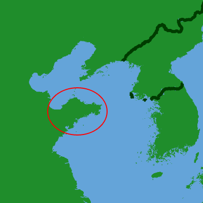
The Shandong Peninsula or Jiaodong (Tsiaotung) Peninsula is a peninsula in Shandong in eastern China, between the Bohai Sea to the north and the Yellow Sea to the south. The latter name refers its location being to the east of Jiaozhou.

Adapted from Wikipedia: Shandong Peninsula (CC BY-SA 4.0).

Feature class
Pen/cape
Mapped extent
44,075 km²
Size rank
#85 of 231 landforms
Region
Asia
Coordinates
36.6266°, 119.7770°
Summits:
Wutai Shan (3,058 m), Tianzhu Shan (1,760 m), Halla-san (1,950 m)
Ranges:
Taihang Mountains (Asia), Lüliang Mountains (Asia)
Settlements:
Pingdu (23 km), Weifang (61 km), Qingdao (77 km)

View on the live map

More about Shandong Peninsula

Geography

The waters bordering the peninsula are Laizhou Bay to the northwest, which opens into the Bohai Sea to the north, which in turn passes through the Bohai Strait to the northeast into the Yellow Sea to the east and south. The peninsula's territory comprises three prefecture-level cities of Shandong: Qingdao in the southwest, Yantai in the north and centre, and Weihai at the eastern tip.

The Shandong Peninsula is the largest peninsula in China. Stretching into the Bohai Sea and the Yellow Sea, it is 290 kilometers long from east to west, 190 kilometers wide from north to south, and 50 kilometers narrow. The total area of Shandong Peninsula is 73,000 square kilometers.

Climate

Shandong Peninsula is surrounded by sea on three sides and has a monsoon climate with four distinct seasons (Köppen: Cwa/Dwa). Due to maritime influence, the climate is relatively mild, in both summer and winter.

History

In the Paleolithic, the Shandong Peninsula area was covered by forest. In the Neolithic, about 7,000 years ago, a large number of Dongyi people inhabited the peninsula. The Dongyi had their own kingdom called the State of Lai. The peninsula later belonged to the State of Qi. The Qi built the Great Wall of Qi, which is partially on the peninsula. During the Han dynasty, the peninsula belonged to the semi-independent feudatory Jiaodong Kingdom.

During the late 19th Century, the Shandong Peninsula served as a base for the Beiyang Fleet. During the First Sino-Japanese War, the port of Weihaiwei was captured by Japan after a 23 day siege.

During the Scramble for China, the German Empire annexed the Kiautschou Bay Leased Territory from 1898 to 1914.

Economy

Shandong Peninsula is the most developed region of the province, and one of the most affluent region in China. As early as the Spring and Autumn period in the 8th century BC, the fishing and salt industries had gradually emerged. During the Warring States period, the iron smelting industry and silk-hemp textile production had already reached a high level. In the Han dynasty, the region became known as the "granary of the East." In the Tang dynasty, Dengzhou and Laizhou were important ports for foreign trade. During the Ming and Qing periods, Jiaozhou was the largest trading port in northern China. After the Opium Wars, the economy developed abnormally, and Qingdao and Weihai were successively occupied by Germany and Britain.

Sections adapted from Wikipedia: Shandong Peninsula (CC BY-SA 4.0).

Shandong Peninsula: Key Facts

Key facts about Shandong Peninsula
OnYellow Sea

Facts from Wikidata Q858306 (CC0).

Liaodong Peninsula
Image via Wikimedia Commons (author and licence on the file page).

Liaodong Peninsula

Pen/cape · 32,054 km²

Liaodong Peninsula is a pen/cape in Asia, covering an estimated 32,054 km².

The Liaodong or Liaotung Peninsula (simplified Chinese: 辽东半岛; traditional Chinese: 遼東半島; pinyin: Liáodōng Bàndǎo) is a peninsula in southern Liaoning province in Northeast China, and makes up the southwestern coastal half of the Liaodong region. It is located between the mouths of the Daliao River (the historical lower section of the Liao River) in the west and the Yalu River in the east, and encompasses the territories of the whole sub-provincial city of Dalian and parts of prefectural cities of Yingkou, Anshan and Dandong.

The word "Liaodong" literally means "Liao region's east", referring initially to the Warring States period Yan commandery of Liaodong, which encompassed an area from modern Liaoning-Jilin border in the north to the Chongchon River on the Korean Peninsula in the south, and from just east of the Qian Mountains to a now-disappeared large wetland between the western banks of middle Liao River and the base of Yiwulü Mountain, historically known as the "Liao Mire" (遼澤, Liáo zé) roughly in between the modern Xinmin, Liaozhong, Tai'an, Panshan and Beizhen).

Adapted from Wikipedia: Liaodong Peninsula (CC BY-SA 4.0).

Feature class
Pen/cape
Mapped extent
32,054 km²
Size rank
#92 of 231 landforms
Region
Asia
Coordinates
40.3584°, 123.1466°
Summits:
Paektu-san (2,744 m), Sorak-san (1,708 m), Chiri-san (1,915 m)
Settlements:
Zhuanghe (77 km), Yingkow (81 km), Anshan (86 km)

View on the live map

More about Liaodong Peninsula

Geography

The Liaodong Peninsula lies on the northern shore of the Yellow Sea, dividing the Liaodong Bay (the largest of the three bays of the Bohai Sea) to its west from the Korea Bay to its east. It forms the southern part of a mountain belt that continues northward in the Changbai Mountains. The part of the mountain range on the peninsula is known as the Qianshan Mountains, named after Qian Mountain in Anshan, which includes Dahei Mountain in Dalian.

History

The Liaodong region was settled since prehistoric times by Neolithic people such as Xinle culture. It later came under the rule of the Gojoseon kingdom, which encompassed the northern Korean Peninsula and the region southeast of the Liao River. In the late 4th century BC, the expanding Chinese State of Yan conquered this region from Gojoseon, and established the Liaodong Commandery.

After the fall of the Yan state, the region was taken over by the short-lived Qin dynasty, and then its prominent successor Han dynasty. After the Han dynasty fragmented at the turn of the 3rd century, the region changed hands between various warlord states such as the Gongsun clan, the nomadic Wuhuan tribe, and finally Cao Wei, before eventually falling under the reunified Western Jin dynasty.

Sections adapted from Wikipedia: Liaodong Peninsula (CC BY-SA 4.0).

Liaodong Peninsula: Key Facts

Key facts about Liaodong Peninsula
OnKorea Bay, Bohai Sea

Facts from Wikidata Q326917 (CC0).

Borohoro Mountains

Range/mtn · 27,641 km²

Borohoro Mountains is a range/mtn in Asia, covering an estimated 27,641 km².

The Borohoro Mountains (Chinese: 博罗科努山; pinyin: Bóluōkēnǔ shān; Wade–Giles: P'o-lo-k'o-nu shan; Kazakh: Борохоро жотасы, Borohoro jotasy) is one of the major ranges of the Tian Shan mountain system. It is almost entirely located within China's Xinjiang Uyghur Autonomous Region, with only a few westernmost peaks being in Kazakhstan.

The Borohoro Range runs in the general west-north-west to east-south-east direction. At its eastern end, southwest of Ürümqi, it joins the main range of the Tian Shan; at the western end, near the China–Kazakhstan border, it joins the Dzungarian Alatau.

The Borohoro Range separates the Dzungarian Basin in the north from the Ili River Basin in the south. Streams flowing from the northern slope of the Borohoro flow toward the Aibi Lake or the Manas Lake; those rising on the southern slope flow toward the Ili River, which flows into Kazakhstan's Lake Balkhash.

The border between Xinjiang's Ili Kazakh Autonomous Prefecture and Bortala Mongol Autonomous Prefecture runs along the Borohoro Range.

A blind thrust fault under the mountain range was the source of the deadly magnitude 7.9 Manasi earthquake.

Adapted from Wikipedia: Borohoro Mountains (CC BY-SA 4.0).

Feature class
Range/mtn
Mapped extent
27,641 km²
Size rank
#110 of 216 mountain ranges
Region
Asia
Coordinates
44.2274°, 82.4722°
Summits:
Pik Pobeda (7,439 m), Pik Karakol (5,216 m), Bogda Feng (5,445 m)
Adjacent ranges:
Tian Shan (Asia), Altay Mountains (Asia)
Settlements:
Yining (97 km), Zharkent (199 km), Karamay (241 km)

View on the live map

More about Borohoro Mountains

Borohoro Mountains: Key Facts

Key facts about Borohoro Mountains
Part ofTianshan Mountains

Facts from Wikidata Q9177711 (CC0).

Himalayas
Image via Wikimedia Commons (author and licence on the file page).

Himalayas

Range/mtn · 17,334 km²

Himalayas is a range/mtn in Asia, covering an estimated 17,334 km². It extends across India, Nepal, Myanmar, China, Pakistan, Afghanistan and Bhutan.

The Himalayas, or Himalaya, is a mountain range in Asia separating the plains of the Indian subcontinent from the Tibetan Plateau. The range has some of the highest peaks on Earth, including the highest, Mount Everest. More than 100 peaks exceeding elevations of 7,200 metres (23,600 feet) above sea level lie in the Himalayas.

The Himalayas span five countries: Nepal, India, China, Bhutan, and Pakistan. The sovereignty of the range in the Kashmir region is disputed among India, Pakistan, and China. The Himalayan range is bordered on the northwest by the Karakoram and Hindu Kush ranges, on the north by the Tibetan Plateau, and on the south by the Indo-Gangetic Plain. Some of the world's major rivers, the Indus, the Ganges, and the Tsangpo–Brahmaputra, rise in the vicinity of the Himalayas, and their combined drainage basin is home to some 600 million people; 53 million people live in the Himalayas. The Himalayas have profoundly shaped the cultures of South Asia and Tibet. Many Himalayan peaks are sacred in Hinduism and Buddhism. The summits of several are off-limits to climbers.

Adapted from Wikipedia: Himalayas (CC BY-SA 4.0).

Feature class
Range/mtn
Mapped extent
17,334 km²
Size rank
#130 of 216 mountain ranges
Region
Asia
Countries
India, Nepal, Myanmar, China, Pakistan, Afghanistan, Bhutan
Coordinates
33.2958°, 76.6989°
Summits:
Liushi Shan (7,167 m), Kailash (6,638 m), Lunpo Gangri (7,095 m)
Adjacent ranges:
Salt Range (Asia), Siwalik Hills (Asia)
Settlements:
Hotan (515 km), Shache (573 km), Kashgar (690 km)

View on the live map

More about Himalayas

Geography and key features

The Himalayas consists of four parallel mountain ranges from south to north: the Sivalik Hills on the south; the Lower Himalayan Range; the Great Himalayas, which is the highest and central range; and the Tibetan Himalayas on the north. The Karakoram are generally considered separate from the Himalayas.

In the middle of the great curve of the Himalayan mountains lie the 8,000 m (26,000-foot) peaks of Dhaulagiri and Annapurna in Nepal, separated by the Kali Gandaki Gorge. The gorge splits the Himalayas into Western and Eastern sections, both ecologically and orographically – the pass at the head of the Kali Gandaki, the Kora La, is the lowest point on the ridgeline between Everest and K2 (the highest peak of the Karakoram range).

Geology

Tectonics, the recurring physical changes that affect the arrangement of the Earth's crust, and plate tectonics, the movement of large regions of the Earth's crust in the manner of planar rigid bodies, are key to understanding the formation of the Himalayas. The Earth's crust rests directly on its mantle. Tectonic plates, comprising the crust and the upper portions of their underlying mantle, are moved around by convection in the asthenosphere. The oceanic crust, found beneath oceans, is, on average, seven kilometres (4.3 mi) thick. It is created from upwelling magma at mid-ocean ridges and predominantly consists of basalt, the principal igneous rock on Earth.

Climate

The physical factors determining the climate in any location in the Himalayas include latitude, altitude, and the relative motion of the Southwest monsoon. From north to south, the mountains cover more than eight degrees of latitude, spanning temperate to subtropical zones. The colder air of Central Asia is prevented from blowing down into South Asia by the physical configuration of the Himalayas. This causes the tropical zone to extend farther north in South Asia than anywhere else in the world. The evidence is unmistakable in the Brahmaputra valley as the warm air from the Bay of Bengal bottlenecks and rushes up past Namcha Barwa, the eastern anchor of the Himalayas, and into southeastern Tibet.

Ecology

The flora and fauna of the Himalayas vary with climate, rainfall, altitude, and soils. The climate ranges from tropical at the base of the mountains to permanent ice and snow at the highest elevations. The amount of yearly rainfall increases from west to east along the southern front of the range. This diversity of altitude, rainfall, and soil conditions, combined with the very high snow line, supports a variety of distinct plant and animal communities. The extremes of high altitude (low atmospheric pressure), combined with extreme cold, favor extremophile organisms.

At high altitudes, the elusive and previously endangered snow leopard is the main predator.

Sections adapted from Wikipedia: Himalayas (CC BY-SA 4.0).

Himalayas: Key Facts

Key facts about Himalayas
Length2,400 km
Area600,000 km²
Highest pointMount Everest

Facts from Wikidata Q5451 (CC0).

Leizhou Peninsula
Image via Wikimedia Commons (author and licence on the file page).

Leizhou Peninsula

Pen/cape · 8,512 km²

Leizhou Peninsula is a pen/cape in Asia, covering an estimated 8,512 km².

The Leizhou Peninsula, alternately romanized as the Luichow Peninsula, is a peninsula in the southernmost part of Guangdong province in South China. As of 2015, the population of the peninsula was 5,694,245. The largest city by population and area on the peninsula is Zhanjiang.

Adapted from Wikipedia: Leizhou Peninsula (CC BY-SA 4.0).

Feature class
Pen/cape
Mapped extent
8,512 km²
Size rank
#122 of 231 landforms
Region
Asia
Coordinates
20.6850°, 110.0508°
Summits:
Wuzhi Shan (1,840 m), Tai Mo Shan (957 m), Ngoc Linh (2,598 m)
Ranges:
Dalou Mountains (Asia), Wuyi Mountains (Asia)
Settlements:
Zhanjiang (67 km), Haikou (76 km), Beihai (132 km)

View on the live map

More about Leizhou Peninsula

Geography

The Leizhou Peninsula is the third largest peninsula in China with an area of c. 8,500 square kilometers (3,300 sq mi) located on the southwestern end of Zhanjiang, Guangdong with the Gulf of Tonkin to the west and the 30 km wide Qiongzhou Strait to the south, separating the peninsula from Hainan Island.

Geologically, basalt terraces account for 43% of the peninsula's area. The rest is divided up between marine terraces (27%) and alluvial plains (17%). Leizhou Peninsula is dotted with a few dormant volcanoes, beaches, and low-lying diluvial plains.

Climate

The peninsula has a humid subtropical climate. The region is under the influence of continental northeastern monsoons and maritime southeastern and southwestern monsoons. Typhoons occasionally occur, both from the Pacific Ocean and the South China Sea. Annual precipitation is 1,400 to 1,700 millimeters (55 to 67 in).

Sections adapted from Wikipedia: Leizhou Peninsula (CC BY-SA 4.0).

Leizhou Peninsula: Key Facts

Key facts about Leizhou Peninsula
OnSouth China Sea

Facts from Wikidata Q875712 (CC0).

Kunlun Mountains
Image via Wikimedia Commons (author and licence on the file page).

Kunlun Mountains

Range/mtn · 1,736 km²

Kunlun Mountains is a range/mtn in Asia, covering an estimated 1,736 km².

The Kunlun Mountains constitute one of the longest mountain chains in Asia, extending for more than 3,000 kilometres (1,900 mi). In the broadest sense, the chain forms the northern edge of the Tibetan Plateau south of the Tarim Basin. Located in Western China, the Kunlun Mountains have been known as the "Forefather of Mountains" in China.

The exact definition of the Kunlun Mountains varies over time. Older sources used Kunlun to mean the mountain belt that runs across the center of China, that is, Altyn Tagh along with the Qilian and Qin Mountains. Recent sources have the Kunlun range forming most of the south side of the Tarim Basin and then continuing east, south of the Altyn Tagh. Sima Qian (Records of the Grand Historian, scroll 123) says that Emperor Wu of Han sent men to find the source of the Yellow River and gave the name Kunlun to the mountains at its source. The name seems to have originated as a semi-mythical location in the classical Chinese text Classic of Mountains and Seas.

Adapted from Wikipedia: Kunlun Mountains (CC BY-SA 4.0).

Feature class
Range/mtn
Mapped extent
1,736 km²
Size rank
#174 of 216 mountain ranges
Region
Asia
Coordinates
37.3417°, 85.1564°
Summits:
Muztag Feng (6,973 m), Liushi Shan (7,167 m), Pik Pobeda (7,439 m)
Adjacent ranges:
Borohoro Mountains (Asia), Tian Shan (Asia)
Settlements:
Hotan (464 km), Korla (495 km), Kuqa (523 km)

View on the live map

More about Kunlun Mountains

Kunlun Mountains: Key Facts

Key facts about Kunlun Mountains
Length3,000 km
Highest pointLiushi Shan

Facts from Wikidata Q187871 (CC0).

Hexi Corridor
Image via Wikimedia Commons (author and licence on the file page).

Hexi Corridor

Geoarea · 1,651 km²

Hexi Corridor is a geoarea in Asia, covering an estimated 1,651 km².

The Hexi Corridor, also known as the Gansu Corridor, is an important historical region located in the modern western Gansu province of China. It refers to a narrow stretch of traversable and relatively arable plain west of the Yellow River's Ordos Loop (hence the name Hexi, meaning 'west of the river'), flanked between the much more elevated and inhospitable terrains of the Mongolian and Tibetan Plateaus. The Hexi Corridor enabled cultural and agricultural exchange between China and Eurasia for several milennia, in both prehistory and as part of the Northern Silk Road after the Han Dynasty.

As part of the Northern Silk Road, running northwest from the western section of the Ordos Loop between Yinchuan and Lanzhou, the Hexi Corridor was the most important trade route in Northwest China. It linked China proper to the historic Western Regions for traders and military incursions into Central Asia. It is a string of oases along the northern edges of the Qilian Mountains and Altyn-Tagh, with the high and desolate Tibetan Plateau further to the south.

Adapted from Wikipedia: Hexi Corridor (CC BY-SA 4.0).

Feature class
Geoarea
Mapped extent
1,651 km²
Size rank
#165 of 231 landforms
Region
Asia
Coordinates
37.7884°, 103.3372°
Summits:
Helan Shan (3,540 m), Mazong Shan (2,584 m), Hua Shan (2,130 m)
Ranges:
Yin Mountains (Asia), Qinling Mountains (Asia)
Settlements:
Wuwei (63 km), Jinchang (129 km), Xining (190 km)

View on the live map

More about Hexi Corridor

Geography

The Hexi Corridor encompasses much of northwestern Gansu province, and is located on the west side of the Yellow River as it runs north around the Ordos Loop (hence the name Hexi, meaning 'west of the river'). The corridor stretches roughly 1,100 kilometres (680 mi) from the Wushao Mountains in the east to Yumen Pass in the west, 100–200 kilometres (60–100 mi) from north to south, ranges from 40–100 kilometres (20–60 mi) in width, and covers an area of approximately 276,000 square kilometres (107,000 mi2) or around 60% of the area of Gansu Province. Its population was 4.82 million people in 2011, representing around 19% of the province's total population.

Geology

The Hexi Corridor is a Cenozoic foreland basin formed over millions of years by the uplift, crustal shortening, and northward advance of the Tibetan Plateau, a landform of which the Hexi Corridor forms the northeastern margin. The region is seismically active, having experienced five earthquakes of magnitude 7 or greater since 180 AD, and is dominated by northwest-trending reverse faults. It is internally divided by three uplifts into four depressions filled with thick fluvial and lacustrine sediment deposited during the Quaternary era.

The area of the present-day Hexi Corridor was successively part of various foreland and strike-slip basins throughout the Paleozoic and early to mid-Mesozoic.

Climate

The dominant climate types in the Hexi Corridor are temperate semi-arid (Köppen: BSk) and temperate arid (Köppen: BWk). The region experiences an average annual temperature of 4–10 °C (39–50 °F) and an average annual precipitation of less than 200 mm (7.9 in) which generally decreases from southwest to northeast. The climate in the Hexi Corridor is heavily influenced by its location at the intersection of a humid zone in the east dominated by the East Asian monsoon and an arid zone in the west dominated by the westerlies, and has varied over thousands to millions of years as a result of Milankovitch cycles.

Climate fluctuations in the Hexi Corridor have historically played a dominant role in shaping human settlement and interaction in the region.

Ecology

The Hexi Corridor spans three ecoregions, with most of its area lying within the Alashan Plateau semi-desert, while its southern portion extends into the Qilian Mountains subalpine meadows and the Qilian Mountains conifer forests. The region contains 11 provincial-level and 10 national-level nature reserves which collectively occupy 28% of the corridor's land area, including three Ramsar-listed wetlands.

The distribution of habitats across the Hexi Corridor broadly follows a north–south gradient determined by precipitation patterns and the position of the Qilian Mountains, the primary source of water in the corridor.

Sections adapted from Wikipedia: Hexi Corridor (CC BY-SA 4.0).

Yin Mountains
Image via Wikimedia Commons (author and licence on the file page).

Yin Mountains

Range/mtn · 429 km²

Yin Mountains is a range/mtn in Asia, covering an estimated 429 km².

The Yin Mountains, also known as the Daqing Mountains, are a mountain range in the Eastern Gobi Desert steppe of the Inner Mongolian Autonomous Region of China. The Yellow River borders the mountains to the south.

Adapted from Wikipedia: Yin Mountains (CC BY-SA 4.0).

Feature class
Range/mtn
Mapped extent
429 km²
Size rank
#193 of 216 mountain ranges
Region
Asia
Coordinates
40.8563°, 110.8184°
Summits:
Wutai Shan (3,058 m), Helan Shan (3,540 m), Hua Shan (2,130 m)
Adjacent ranges:
Taihang Mountains (Asia), Lüliang Mountains (Asia)
Settlements:
Hohhot (71 km), Baotou (87 km), Bayan Obo (124 km)

View on the live map

More about Yin Mountains

Yin Mountains: Key Facts

Key facts about Yin Mountains
Length1,200 km

Facts from Wikidata Q1152132 (CC0).

More on China

Quick Answers

What is the largest landform in China?
Asia, at 46.28M km². Plateau of Tibet is second at 3.05M km². Rankings cover the mountain ranges, deserts and other landforms indexed in YearMaps.
How many mountain ranges, deserts and other landforms are there in China?
YearMaps lists 43 mountain ranges, deserts and other landforms for China. This is the number mapped in the atlas, not an official national count.