Skip to content
YearMaps
Kiribati · Islands

Largest Islands of Kiribati

Phoenix Islands is the largest of the 8 islands recorded for Kiribati, at 117,566 km², ahead of Line Islands at 22,089 km². The full list follows.

How this list is built: Ranked by mapped area. An island divided between countries is listed under each, with the area of the whole island. It covers the islands indexed in YearMaps, drawn from open geospatial data, and is not an exhaustive national register.

Islands Listed
8
Top Ranked
117,566 km²
Phoenix Islands
Second
22,089 km²
Line Islands
Profiled Below
7
Photo, encyclopedia text and figures
Largest Islands of Kiribati
#NameArea
1Phoenix Islands117,566 km²
2Line Islands22,089 km²
3Kiritimati438 km²
4Tarawa84 km²
5Banaba84 km²
6Starbuck84 km²
7Butaritari84 km²
8Vostok83 km²

The Islands of Kiribati in Detail

The 7 islands above that have an encyclopedia article, in the same order, each with its photograph, figures and the places around it.

Phoenix Islands
Image via Wikimedia Commons (author and licence on the file page).

Phoenix Islands

Island group · 117,566 km²

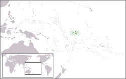
Phoenix Islands is an island group in Oceania (Polynesia), covering an estimated 117,566 km².

The Phoenix Islands, or Rawaki, are a group of eight atolls and two submerged coral reefs that lie east of the Gilbert Islands and west of the Line Islands in the Polynesia sub-region of Oceania, in the central Pacific Ocean north of Samoa. They are part of the Republic of Kiribati. Their combined land area is 28 square kilometres (11 mi2). The only island of any commercial importance is Canton Island (also called Abariringa). The other islands are Enderbury, Rawaki (formerly Phoenix), Manra (formerly Sydney), Birnie, McKean, Nikumaroro (formerly Gardner), and Orona (formerly Hull). The islands had no permanent inhabitants until European colonization, and the current inhabitants descend from the Micronesian Gilbertese people despite the islands' location in the Polynesian Triangle.

The Phoenix Islands Protected Area, established in 2008, is one of the world's largest protected areas and is home to about 120 species of coral and more than 500 species of fish. The Phoenix Islands are uninhabited, except for a few families who live on Canton Island.

Adapted from Wikipedia: Phoenix Islands (CC BY-SA 4.0).

Feature class
Island group
Mapped extent
117,566 km²
Size rank
#51 of 445 islands
Region
Oceania
Subregion
Polynesia
Coordinates
-3.5890°, -172.2010°
Summits:
Mauga Silisili (1,858 m), Lata Mountain (966 m), Tomanivi (1,323 m)
Ranges:
Owen Stanley Range (Oceania), Great Dividing Range (Oceania)
Settlements:
Funafuti (1,096 km), Apia (1,141 km), Labasa (1,697 km)

View on the live map

More about Phoenix Islands

Geography, flora and fauna

Kanton Island (also called Abariringa) is the northernmost island in the Phoenix group and the only inhabited one. It is a narrow ribbon of land 9 km2 (3 sq mi), enclosing a lagoon of approximately 40 km2 (15 sq mi). Kanton is mostly bare coral, covered with herbs, bunch grasses, low shrubs, and a few trees. Its lagoon teems with 153 known species of marine life, including sharks, tuna, stingrays, and eels. Land fauna includes at least 23 bird species, lizards, rats, hermit crabs, and turtles.

In the mid-20th century, Kanton had an important trans-Pacific airport and refueling station called Langton, but its importance declined in the late 1950s with the introduction of long-range jet aircraft. After a brief stint as a U.S. missile-tracking station, the airport fell into disuse.

History of the islands

Evidence suggests that Howland Island was the site of a prehistoric settlement, which may have extended down to Rawaki, Canton, Manra, and Orona—probably in the form of a single community using several adjacent islands. Archaeological sites have been discovered on Manra and Orona that suggest there were two distinct groups of settlers, one from eastern Polynesia and one from Micronesia. The hard life on these isolated islands undoubtedly led either to the extinction or emigration of these settled peoples, in much the same way that other islands in the area (such as Christmas Island and Pitcairn) were abandoned.

These ancient settlements were probably founded around 1000 BC when eastern Melanesians are known to have traveled northward across the water.

Sections adapted from Wikipedia: Phoenix Islands (CC BY-SA 4.0).

Phoenix Islands: Key Facts

Key facts about Phoenix Islands
Area27.9 km²
Population41 (2020)
Surrounded byPacific Ocean

Facts from Wikidata Q271674 (CC0).

Kiritimati
Image via Wikimedia Commons (author and licence on the file page).

Kiritimati

Island group · 438 km²

Kiritimati is an island group in Oceania (Polynesia), covering an estimated 438 km².

Kiritimati (Gilbertese pronunciation: [kiˈrɪsmæs]), also known as Christmas Island, is a Pacific Ocean atoll in the northern Line Islands. It is part of the Republic of Kiribati. The name is derived from the English word "Christmas" written in Gilbertese according to its phonology, in which the combination ti is pronounced /s/.

Kiritimati is one of the world's largest atolls in terms of land area, consisting of about 312.38 km2 (120.61 sq mi) land area and a 328 km2 (127 sq mi) network of lagoons. The atoll is about 150 km (93 mi) in perimeter, while the lagoon shoreline extends for over 48 km (30 mi). Kiritimati comprises over 70% of the total land area of Kiribati, a country encompassing 33 Pacific atolls and islands.

It lies 232 km (144 mi) north of the equator, 2,160 km (1,340 mi) south of Honolulu, and 5,360 km (3,330 mi) from San Francisco. Kiritimati is in the world's furthest forward time zone, UTC+14, and is therefore one of the first inhabited places on Earth to experience New Year's Day (see also Caroline Atoll, Kiribati).

Adapted from Wikipedia: Kiritimati (CC BY-SA 4.0).

Feature class
Island group
Mapped extent
438 km²
Size rank
#342 of 445 islands
Region
Oceania
Subregion
Polynesia
Coordinates
1.8241°, -157.3790°
Summits:
Mauna Kea (4,205 m), Haleakalā (3,055 m), Lata Mountain (966 m)
Ranges:
Sierra Nevada (North America), Klamath Mountains (North America)
Settlements:
Hilo (2,003 km), Wailuku (2,122 km), Honolulu (2,167 km)

View on the live map

More about Kiritimati

Geography

Kiritimati's roughly 328 km2 (127 sq mi) lagoon area opens to the sea in the northwest; Burgle Channel (the entrance to the lagoon) is divided into the northern Cook Island Passage and the southern South Passage. The southeastern part of the lagoon area is partially desiccated. The lagoon area currently consists of a 160 km2 (62 sq mi) main lagoon at Burgle Channel. Southeast of this, the lagoon gradually transitions into a network of subsidiary lagoons, tidal flats, partially hypersaline brine ponds and salt pans which have a total combined area of about 168 km2 (65 sq mi). Thus, the land and lagoon areas can only be given approximately, as no firm boundary exists between the main island body and the salt flats.

History

Kiritimati was initially inhabited by Polynesian people. Radiometric dating from sites on the island place the period of human use between 1250 and 1450 AD. Permanent human settlement on Kiritimati likely didn't occur until 1882. Stratigraphic layers excavated in fire pits show alternating bands of charcoal indicating heavy use and local soil indicating a lack of use. As such, some researchers have suggested that Kiritimati was used intermittently (likely by people from Tabuaeran to the north) as a place to gather resources such as birds and turtles in a similar fashion to the ethnographically documented use of the five central atolls of the Caroline Islands.

Ecology

The flora and the fauna consist of taxa adapted to drought. Terrestrial fauna is scant; there are no truly native land mammals and only one native land bird – Kiribati's endemic reed-warbler, the bokikokiko (Acrocephalus aequinoctialis). The 1957 attempt to introduce the endangered Rimitara lorikeet (Vini kuhlii) has largely failed; a few birds seem to linger on, but the lack of abundant coconut palm forest, on which this tiny parrot depends, makes Kiritimati a suboptimal habitat for this species.

The natural vegetation on Kiritimati consists mostly of low shrubland and grassland. What little woodland exists is mainly open coconut palm (Cocos nucifera) plantation. There are three small woods of catchbird trees (Pisonia grandis), at Southeast Point, Northwest Point, and on Motu Tabu.

Ecology of the reef

Overfishing and pollution have impacted on the ocean surrounding the island. In the ocean surrounding uninhabited islands of the Northern Line Islands, sharks comprised 74% of the top predator biomass (329 g/m2) at Kingman Reef and 57% at Palmyra Atoll (97 g/m2), whereas low shark numbers have been observed at Tabuaeran and Kiritimati.

Green turtles (Chelonia mydas) regularly nest in small numbers on Kiritimati. The lagoon is famous among sea anglers worldwide for its bonefish (Albula glossodonta), and has been stocked with Oreochromis tilapia to decrease overfishing of marine species.

Sections adapted from Wikipedia: Kiritimati (CC BY-SA 4.0).

Kiritimati: Key Facts

Key facts about Kiritimati
Area388 km²
Population7,369 (2020)
Highest pointJoe's Hill
Surrounded byPacific Ocean

Facts from Wikidata Q193331 (CC0).

Visiting Kiritimati

Not to be confused with Christmas Island, an Australian possession in the Indian Ocean.

Kiritimati, also known as Christmas Island has the largest land area (642 km2, 248 mi2) of any coral atoll in the world and by itself represents the majority of the land area of Kiribati.

Travel notes adapted from Wikivoyage: Kiritimati (CC BY-SA 4.0).

Tarawa
Image via Wikimedia Commons (author and licence on the file page).

Tarawa

Island · 84 km²

Tarawa is an island in Oceania (Micronesia), covering an estimated 84 km².

Tarawa is an atoll and the capital of the Republic of Kiribati, in the Micronesia region of the central Pacific Ocean. It comprises North Tarawa, which has 6,629 inhabitants and much in common with other more remote islands of the Gilbert group, and South Tarawa, which has 56,388 inhabitants as of 2015, half of the country's total population. The atoll was the site of the Battle of Tarawa during World War II.

Adapted from Wikipedia: Tarawa (CC BY-SA 4.0).

Feature class
Island
Mapped extent
84 km²
Size rank
#392 of 445 islands
Region
Oceania
Subregion
Micronesia
Coordinates
1.3753°, 173.1044°
Summits:
Mount Popomanaseu (2,335 m), Mount Tabwemasana (1,877 m), Takuan (2,243 m)
Ranges:
Owen Stanley Range (Oceania), New Guinea Highlands (Oceania)
Settlements:
Tarawa (11 km), Majuro (665 km), Funafuti (1,292 km)

View on the live map

More about Tarawa

Geography

Tarawa has a large lagoon, 500 square kilometres (193 square miles) in total area, and a wide reef. The lagoon is widely open to the ocean, with a large ship pass. Although naturally abundant in fish and shellfish of all kinds, marine resources are being strained by the large and growing population. Drought is frequent, but in normal years rainfall is sufficient to maintain breadfruit, papaya and banana trees as well as coconut and pandanus.

North Tarawa consists of a string of islets from Buariki in the north to Buota in the south. The islets are separated in places by wide channels that are best crossed at low tide, and there is a ferry service between Buota and Abatao. Only Buota is connected by road to South Tarawa, via a bridge.

History

In Kiribati mythology, Tarawa represents the primordial earth, existing before Nareau the spider separated the land, ocean, and sky. After naming the sky "karawa" and the ocean "marawa," Nareau referred to the rock upon which Riiki—another deity discovered by Nareau—stood when he raised the sky as "Tarawa." Following this, Nareau went on to create the remaining islands of Kiribati, as well as Samoa.

Gilbertese first settled these islands thousands of years ago, and there have been migrations to and from Gilbert Islands since antiquity.

Evidence from a range of sources, including carbon dating and DNA analyses, confirms that the exploration of the Pacific included settlement of the Gilbert Islands by around 200 BC.

Sections adapted from Wikipedia: Tarawa (CC BY-SA 4.0).

Tarawa: Key Facts

Key facts about Tarawa
Area31 km²
Population70,090 (2020)
Surrounded byPacific Ocean

Facts from Wikidata Q2486 (CC0).

Visiting Tarawa

Tarawa is an atoll in the central Pacific Ocean, and the location of the capital of Kiribati. It is home to about 70,000 people (census, 2020) , more than half of the country's population!

Travel notes adapted from Wikivoyage: Tarawa (CC BY-SA 4.0).

Banaba
Image via Wikimedia Commons (author and licence on the file page).

Banaba

Island · 84 km²

Banaba is an island in Oceania (Micronesia), covering an estimated 84 km².

Banaba (; formerly Ocean Island) is an island of Kiribati in the Pacific Ocean. A solitary raised coral island west of the Gilbert Island Chain, it is the westernmost point of Kiribati, lying 185 miles (298 km) east of Nauru, which is also its nearest neighbour. It has an area of six square kilometres (2.3 sq mi), and the highest point on the island is also the highest point in Kiribati, at 81 metres (266 ft) in height. Along with Nauru and Makatea (French Polynesia), it is one of the important elevated phosphate-rich islands of the Pacific Ocean.

Adapted from Wikipedia: Banaba (CC BY-SA 4.0).

Feature class
Island
Mapped extent
84 km²
Size rank
#393 of 445 islands
Region
Oceania
Subregion
Micronesia
Coordinates
-0.8618°, 169.5455°
Summits:
Mount Popomanaseu (2,335 m), Mount Tabwemasana (1,877 m), Takuan (2,243 m)
Ranges:
Owen Stanley Range (Oceania), New Guinea Highlands (Oceania)
Settlements:
Tarawa (457 km), Majuro (909 km), Funafuti (1,368 km)

View on the live map

More about Banaba

Geography

The woodland of Banaba is now limited to the coastal area and is made up mostly of mangoes, flame trees, guavas, tapioca, and common Kiribati shrubs such as the saltbush. Having been mined for over 80 years, the centre of the island has no soil and is uninhabitable.

The village of Buakonikai ('Te Aonoanne') is now unoccupied. Banaba had three inhabited villages in the 2010 census; Tabwewa, Antereen (also called Tabiang) and Umwa.

Under Köppen's climate classification, Banaba Island features a tropical rainforest climate. Winds between north-east and south-east bring rainfall with large annual and seasonal variability. The period of lowest mean monthly rainfall starts in May and lasts until November. From December until April the monthly rainfall is on average higher than 120 mm.

History

According to Te Rii ni Banaba (The Backbone of Banaba) by Raobeia Ken Sigrah, Banaban oral tradition supports the claim that the people of the Te Aka clan, which originated in Melanesia, were the original inhabitants of Banaba, having arrived before the arrival of later migrations from the East Indies and Kiribati. The name Banaba in the local Gilbertese language is correctly spelled Bwanaba, but the Constitution of Kiribati (12 July 1979) writes Banaba, meaning "hollow land".

Settlement of Banaba began over 2,000 years ago, over the course of at least three waves of migration. Like the indigenous inhabitants of Nauru and Rapa Nui, Banaba was viewed as the buto, the navel or centre, of the world by the Banabans.

Demographics

At the census of 1931, when the production of phosphate was at its highest point, and the headquarters of the entire colony concentrated there, the total population of Ocean Island was of 2,607 inhabitants (1,715 Gilbertese; 65 Elliceans; 129 Europeans; 698 "Mongoloids" [Asians]). After World War II, at the census of 1947, just after relocation of Banabans on Rabi Island in 1945, there were 2,060 left (considering notably the massacre of Banabans at the end of the Japanese occupation). The new ethnic distribution was then the following: 1,351 Gilbertese (the main losses); 441 Polynesians (the main gain from overcrowded Ellice Islands); 138 Europeans; 112 "Mongoloids"; 11 "half-caste" European-Gilbertese; 2 "half-caste" European-Ellicean; 4 "Gilbertese-Mongoloids" and 1 "other races".

Sections adapted from Wikipedia: Banaba (CC BY-SA 4.0).

Banaba: Key Facts

Key facts about Banaba
Area6 km²
Population333 (2020)
Surrounded byPacific Ocean

Facts from Wikidata Q271901 (CC0).

Starbuck
Image via Wikimedia Commons (author and licence on the file page).

Starbuck

Island · 84 km²

Starbuck is an island in Oceania (Polynesia), covering an estimated 84 km².

Starbuck Island (or Volunteer Island) is an uninhabited coral island in the central Pacific, and is part of the Central Line Islands of Kiribati. Its former names include "Barren Island", "Coral Queen Island", "Hero Island", "Low Island", and "Starve Island".

Adapted from Wikipedia: Starbuck Island (CC BY-SA 4.0).

Feature class
Island
Mapped extent
84 km²
Size rank
#395 of 445 islands
Region
Oceania
Subregion
Polynesia
Coordinates
-5.6218°, -155.9112°
Summits:
Mont Orohena (2,241 m), Lata Mountain (966 m), Mauga Silisili (1,858 m)
Ranges:
Southern Alps (Oceania), Owen Stanley Range (Oceania)
Settlements:
Papeete (1,493 km), Apia (1,959 km), Nukualofa (2,703 km)

View on the live map

More about Starbuck

Geography, flora and fauna

Located just east from the geographic center of the Pacific Ocean (4°58′S 158°45′W), and measuring 8.9 kilometres (5.5 miles) east-to-west and 3.5 kilometres (2.2 miles) north-to-south, Starbuck Island has a land area of 1,620 hectares (4,003 acres). It is a low, dry, coral limestone island with a steep beach backed by a 6–8-metre-high (20–26 ft) bank composed of large coral fragments. Several hypersaline lagoons form on the island's eastern side. These occasionally dry up, and are said to be dangerous to approach: one worker during the island's guano-mining days sank up to his neck in salty mud before being rescued.

There is no freshwater on the island, which is one of the drier atolls in the Line Island group. Annual yearly rainfall averages approximately 800 mm (31.5 in).

History

James Henderson, merchant captain of the East India Company ship Hercules, sighted the island in 1819 while sailing from South America to Calcutta, India. Soon after his arrival a local newspaper, The Calcutta Journal (or Political, Commercial, and Literary Gazette), published Henderson's report of three islands which he had encountered during his voyage, but did not state the exact date for his sighting of modern Starbuck Island. Henry Evans Maude estimated that this may have been in early February 1819. The next captain known to have seen it was Obed Starbuck, captain of the whaler Hero out of Nantucket, on September 5, 1823.

The island was sighted again on December 12, 1823 by Obed's first cousin, Valentine Starbuck, the American-born master of the British whaling ship L'Aigle.

Sections adapted from Wikipedia: Starbuck Island (CC BY-SA 4.0).

Starbuck: Key Facts

Key facts about Starbuck
Area16.2 km²
Population0
Surrounded byPacific Ocean

Facts from Wikidata Q911028 (CC0).

Butaritari
Image via Wikimedia Commons (author and licence on the file page).

Butaritari

Island · 84 km²

Butaritari is an island in Oceania (Micronesia), covering an estimated 84 km².

Butaritari is an atoll in the Pacific Ocean island nation of Kiribati. The atoll is roughly four-sided. The south and southeast portion of the atoll comprises a nearly continuous islet. The atoll reef is continuous but almost without islets along the north side. Bikati and Bikatieta islets occupy a corner of the reef at the extreme northwest tip of the atoll. Small islets are found on reef sections between channels on the west side. The lagoon of Butaritari is deep and can accommodate large ships, though the entrance passages are relatively narrow. It is the most fertile of the Gilbert Islands, with relatively good soils (for an atoll) and high rainfall. Butaritari atoll has a land area of 13.49 km2 (5.21 sq mi) and a population of 3,224 as of 2015. During World War II, Butaritari was known by United States Armed Forces as Makin Atoll, and was the site of the Battle of Makin. Locally, Makin is the name of a separate but closest atoll, 3 kilometres (1.6 nmi; 1.9 mi) to the northeast of Butaritari, but close enough to be seen. These two atolls share a dialect of the Gilbertese language.

Adapted from Wikipedia: Butaritari (CC BY-SA 4.0).

Feature class
Island
Mapped extent
84 km²
Size rank
#396 of 445 islands
Region
Oceania
Subregion
Micronesia
Coordinates
3.0506°, 172.8129°
Summits:
Mount Popomanaseu (2,335 m), Mount Tabwemasana (1,877 m), Takuan (2,243 m)
Ranges:
Owen Stanley Range (Oceania), New Guinea Highlands (Oceania)
Settlements:
Tarawa (192 km), Majuro (478 km), Funafuti (1,469 km)

View on the live map

More about Butaritari

Geography

Butaritari is the second most northerly of the Gilbert Islands; 3 kilometres (1.6 nmi; 1.9 mi) to the northeast is Makin. Butaritari was called Makin Atoll by the U.S. military, and present-day Makin was then known as Makin Meang (Northern Makin) or Little Makin to distinguish it. Now that Butaritari has become the preferred name for the larger atoll, speakers tend to drop the qualifier for Makin. Butaritari has also previously been known as Pitt Island, Taritari Island, or Touching Island.

The atoll is roughly four-sided and nearly 30 km (19 mi) across in the east–west direction, and averages about 15 km (9 mi) north to south. The reef is more submerged and broken into several broad channels along the west side. Small islets are found on reef sections between these channels.

History

There are different stories told as to the creation of Butaritari and the other islands in the Southern Gilberts. An important legend in the culture of Butaritari is that spirits who lived in a tree in Samoa migrated northward carrying branches from the tree, Te Kaintikuaba, which translates as the tree of life. It was these spirits, together with Nareau the Wise who created the islands of Tungaru (the Gilbert Islands).

The Spanish expedition led by Pedro Fernandes de Queirós sighted the Buen Viaje (good trip in Spanish) Islands (Butaritari and Makin) on 8 July 1606.

Traditionally, Butaritari and Makin were ruled by a chief or Uea who lived on Butaritari Island.

Economy

Butaritari has rich marine resources, with a large lagoon and wide reef. Butaritari has the greatest potential for agriculture in Kiribati: bananas, breadfruit and papaya grow well, and successful cultivars of pumpkin, cabbage, cucumber, eggplant and other vegetables have been created with assistance from the Taiwan Technical Mission based in South Tarawa. However, most households keep to a subsistence lifestyle and, although food is plentiful, money is often scarce as there are few paid jobs on the island.

Sections adapted from Wikipedia: Butaritari (CC BY-SA 4.0).

Butaritari: Key Facts

Key facts about Butaritari
Area13.5 km²
Population3,250 (2020)
Surrounded byPacific Ocean

Facts from Wikidata Q867325 (CC0).

Vostok
Image via Wikimedia Commons (author and licence on the file page).

Vostok

Island · 83 km²

Vostok is an island in Oceania (Polynesia), covering an estimated 83 km².

Vostok Island is an uninhabited coral island in the central Pacific Ocean, part of the Line Islands belonging to Kiribati. Other names for the island include Anne Island, Bostock Island, Leavitts Island, Reaper Island, Wostock Island or Wostok Island. The island was first sighted in 1820 by the Russian explorer Fabian Gottlieb von Bellingshausen, who named the island for his ship Vostok.

Adapted from Wikipedia: Vostok Island (CC BY-SA 4.0).

Feature class
Island
Mapped extent
83 km²
Size rank
#403 of 445 islands
Region
Oceania
Subregion
Polynesia
Coordinates
-10.0960°, -152.3782°
Summits:
Mont Orohena (2,241 m), Lata Mountain (966 m), Mauga Silisili (1,858 m)
Ranges:
Southern Alps (Oceania), Sierra Nevada (North America)
Settlements:
Papeete (881 km), Apia (2,146 km), Nukualofa (2,732 km)

View on the live map

More about Vostok

Geography, flora and fauna

Vostok covers a land area of 24 hectares (59 acres). Its nearest neighbors are Flint Island, 158 kilometres (98 miles) south-southeast; Caroline Atoll (renamed Millennium Island), 230 kilometres (140 miles) to the east; and Penrhyn, 621 kilometres (386 miles) to the west. It is 1.3 kilometres (0.8 miles) in length, and is triangular-shaped.

Beaches on the island range between 25 and 30 metres (82 and 98 feet) wide, composed of coral sand and rubble. There is no lagoon or fresh water on the island, and no known freshwater lens. Vostok's major portion is covered with a pure stand of Pisonia trees rooted in moist peat soil one meter thick. These trees, with heights of up to 30 metres (98 feet), grow so densely that no other plants can grow beneath them.

History

According to a 1966 article in Pacific Islands Monthly, there is no evidence of Polynesian settlement of Vostok Island prior to European discovery. Cook Islanders from Manihiki and Penrhyn atoll – the nearest inhabited islands to Vostok – interviewed in 1924 reported that they had no name for the island and were unaware of its existence.

The island was first sighted in 1820 by the Russian explorer Fabian Gottlieb von Bellingshausen, who named the island for his ship Vostok (the name means "East" in Russian). Various whalers sighted the island over the following decades and believed it to be undiscovered, giving it the additional names of Stavers Island, Reaper Island, Leavitts Island and Anne Island.

Sections adapted from Wikipedia: Vostok Island (CC BY-SA 4.0).

Vostok: Key Facts

Key facts about Vostok
Area0.2 km²
Population0 (2020)
Surrounded byPacific Ocean

Facts from Wikidata Q976570 (CC0).

More on Kiribati

Quick Answers

What is the largest island in Kiribati?
Phoenix Islands, at 117,566 km². Line Islands is second at 22,089 km². Rankings cover the islands indexed in YearMaps.
How many islands are there in Kiribati?
YearMaps lists 8 islands for Kiribati. This is the number mapped in the atlas, not an official national count.