
Map of Uruguay
Uruguay is a country in South America with its capital at Montevideo, home to about 3.38 million people across 176,215 km². The interactive map below plots 32 cities and towns, 2 rivers, 2 lakes, 1 mountain summits and 7 ports recorded for Uruguay in YearMaps.
- Population
- 3.38 million
- Area
- 176,215 km²
- Capital
- Montevideo
- Continent
- South America
Interactive Map of Uruguay
Centred on Montevideo at 34.8561° S, 56.1730° W. Use the layer panel to switch on rivers, dams, ports, peaks and historical borders.
About Uruguay
Uruguay, officially the Oriental Republic of Uruguay, is a country in southeastern South America. It shares borders with Argentina to its west and southwest and Brazil to its north and northeast, while bordering the Río de la Plata to the south and the Atlantic Ocean to the southeast. It is part of the Southern Cone region of South America. Uruguay covers an area of approximately 176,215 square kilometers (68,037 sq mi). It has a population of almost 3.5 million people, of whom nearly 2 million live in the metropolitan area of its capital and largest city, Montevideo.
The area that became Uruguay was first inhabited by groups of hunter gatherers 13,000 years ago. The first European explorer to reach the region was Juan Díaz de Solís in 1516, but the area was colonized later than its neighbors. At the time of European arrival, the Charrúa were the predominant tribe, alongside other groups such as the Guaraní and the Chaná. However, none of these peoples were socially or politically organized in large groups, which contributed to their decline. Amid territorial disputes, the Portuguese established Colônia do Sacramento in 1680, and the Spanish founded Montevideo as a military stronghold. Uruguay secured its independence between 1811 and 1828, following a four-way struggle involving Portugal, Spain, and later the United Provinces of the Río de la Plata and the Empire of Brazil. In 1830, the country enacted its constitution and was formally established as an independent state.
During the early years following its independence, Uruguay remained subject to foreign influence and intervention, along with a series of internal conflicts and political turmoil. From the second half of the 19th century, the country saw significant waves of European migration—mainly from Spain, Italy, and France—which greatly influenced its demographics and laid the foundation for modern-day Uruguayan culture and society. National politics were dominated by two political parties: the Colorado Party and the National Party, which clashed in several civil wars during the 19th century and are collectively known as the 'Traditional Parties'. In the early 20th century, a series of pioneering economic, labor, and social reforms laid the foundations of an advanced welfare state. Combined with a period of sustained political stability, these developments earned the country the reputation of being the "Switzerland of the Americas".
Summary adapted from Wikipedia: Uruguay (CC BY-SA 4.0).

Geography and Climate of Uruguay
The Spanish founded the city of Montevideo in modern-day Uruguay in 1726 as a military stronghold, and it soon became an important commercial center due to its natural harbor. Argentina initially claimed Uruguay, but Brazil annexed the country in 1821. Uruguay declared its independence in 1825 and secured its freedom in 1828 after a three-year struggle. The administrations of President Jose BATLLE in the early 20th century launched widespread political, social, and economic reforms that established a statist tradition. A violent Marxist urban guerrilla movement named the Tupamaros (or Movimiento de Liberación Nacional-Tupamaros) launched in the late 1960s and pushed Uruguay's president to cede control of the government to the military in 1973. By year-end, the rebels had been crushed, but the military continued to expand its hold over the government. Civilian rule was restored in 1985. In 2004, the left-of-center Frente Amplio (FA) Coalition won national elections that effectively ended 170 years of political control by the Colorado and National (Blanco) parties. The left-of-center coalition retained the presidency and control of both chambers of congress until 2019. Uruguay's political and labor conditions are among the freest on the South American continent.
- Location
- Southern South America, bordering the South Atlantic Ocean, between Argentina and Brazil.
- Climate
- Warm temperate; freezing temperatures almost unknown.
- Terrain
- Mostly rolling plains and low hills; fertile coastal lowland.
- Highest point
- Cerro Catedral 514 m.
- Lowest point
- Atlantic Ocean 0 m.
- Coastline
- 660 km.
- Land borders
- Total: 1,591 km; border countries: Argentina 541 km; Brazil 1,050 km.
- Major rivers
- Rio de la Plata/Parana river mouth (shared with Brazil [s], Argentina, Paraguay) - 4,880 km; Uruguay river mouth (shared with Brazil [s] and Argentina) - 1,610 km note: [s] after country name indicates river source; [m] after country name indicates river mouth.
- Major lakes
- Salt water lake(s): Lagoa Mirim (shared with Brazil) - 2,970 sq km.
- Natural resources
- Arable land, hydropower, minor minerals, fish.
- Land use
- Agricultural land: 81.4% (2023 est.); arable land: 12.6% (2023 est.); permanent crops: 0.2% (2023 est.); permanent pasture: 68.6% (2023 est.); forest: 11.4% (2023 est.); other: 7.3% (2023 est.)
- Natural hazards
- Seasonally high winds (the pampero is a chilly and occasional violent wind that blows north from the Argentine pampas), droughts, floods; because of the absence of mountains, which act as weather barriers, all locations are particularly vulnerable to rapid changes from weather fronts.
- Geographic note
- Second-smallest South American country (after Suriname); most of the low-lying landscape (three-quarters of the country) is grassland, ideal for cattle and sheep.
- Languages
- Spanish (official, Rioplatense is the most widely spoken dialect)
- Religions
- Roman Catholic 36.5%, Protestant 5% (Evangelical (non-specific) 4.6%, Adventist 0.2%, Protestant (non-specific) 0.3%), African American Cults/Umbanda 2.8%, Jehovah's Witness 0.6%, Church of Jesus Christ 0.2%, other 1%, Believer (not belonging to the church) 1.8%, agnostic 0.3%, atheist 1.3%, none 47.3%, unspecified 3.4% Roman Catholic 42%, Protestant 15%, other 6%, agnostic 3%, atheist 10%, unspecified 24% (2023 est.)
- Ethnic groups
- White 87.7%, Black 4.6%, Indigenous 2.4%, other 0.3%, none or unspecified 5% (2011 est.)
- Economy
- High-income, export-oriented South American economy; South America’s largest middle class; low socioeconomic inequality; growing homicide rates; growing Chinese and EU relations; 2019 Argentine recession hurt; key milk, beef, rice, and wool exporter.
From the CIA World Factbook (public domain), archived edition of 2026-01-22. The Factbook is no longer updated, so figures reflect that edition.
Uruguay in Numbers
- Population
- 3.38 million
- GDP
- US$85.3 billion
- GDP per person
- US$25,216
- Life expectancy
- 78.3 years
- Population growth
- -0.06% a year
- Population density
- 19 per km²
- Urban population
- 95.7%
- Surface area
- 176,215 km²
- Forest cover
- 11.5%
- Arable land
- 12.4%
- Access to electricity
- 100.0%
- Internet users
- 92.0%
Indicators from World Bank Open Data (CC BY 4.0). The year under each figure is its reference year.
Uruguay in Depth
History
Human presence in the region now known as Uruguay dates back approximately 13,000 years, with evidence of hunter-gatherer communities. It is estimated that at the time of the first contact with Europeans in the 16th century, there were about 9,000 Charrúa and 6,000 Chaná and some Guaraní island settlements.
There is an extensive archaeological collection of man-made tumuli known as "Cerritos de Indios" in the eastern part of the country, some of them dating back to 5,000 years ago. Very little is known about the people who built them as they left no written record, but evidence has been found in place of indigenous agriculture and of extinct indigenous woolly dogs.
The Portuguese were the first Europeans to enter the region of present-day Uruguay in 1512.
Geography
With 176,214 km2 (68,037 sq mi) of continental land and 125,436 km2 (48,431 sq mi) of territorial waters, Uruguay is the second-smallest sovereign nation in South America (after Suriname) and the third smallest territory (French Guiana is the smallest). The landscape features mostly rolling plains and low hill ranges (cuchillas) with a fertile coastal lowland. Uruguay has 660 km (410 mi) of coastline. The highest point in the country is the Cerro Catedral, whose peak reaches 514 m (1,686 ft) AMSL in the Sierra Carapé hill range. To the southwest is the Río de la Plata, the estuary of the Uruguay River (the river which forms the country's western border).
Economy
In 1991, the country experienced an increase in strikes to obtain wage compensation to offset inflation and to oppose the privatizations desired by the government of Luis Alberto Lacalle. A general strike was called in 1992, and the privatization policy was widely rejected by the referendum. In 1994 and 1995, Uruguay faced economic difficulties caused by the liberalization of foreign trade, which increased the trade deficit. The Montevideo Gas Company and the Pluna airline were turned over to the private sector, but the pace of privatization slowed down in 1996. Uruguay experienced a major economic and financial crisis between 1999 and 2002, principally a spillover effect from the economic problems of Argentina. The economy contracted by 11%, and unemployment climbed to 14–21%.
Demographics
Uruguayans are of predominantly European origin, with 86.0% of the population claiming "white" as their dominant ancestry self-identified in the 2023 census, a decrease from 87.7% over the 2011 census.
Most Uruguayans of European ancestry are descendants of 19th and 20th century immigrants from Spain and Italy, and to a lesser degree France, Germany, and Britain. Earlier settlers had migrated from Argentina. People of African descent make up around ten percent of the total population. There are also important communities of Japanese descent.
Sections adapted from Wikipedia: Uruguay (CC BY-SA 4.0).
Uruguay: Key Facts
| Currency | Uruguayan peso |
|---|---|
| Head of state | Yamandú Orsi |
| Head of government | Yamandú Orsi |
| Form of government | republic, participatory democracy |
| Calling code | +598 |
| Internet domain | .uy |
| Highest point | Cerro Catedral |
| Lowest point | Atlantic Ocean |
| Established | 25 August 1825 |
Facts from Wikidata Q77 (CC0).
History of Uruguay: Empires and States
The atlas records 9 polities whose mapped territory included part of Uruguay, from The Spanish Empire in 1727 CE to 2024 CE. They are listed in the order they first appear.
| Polity | Period here | Extent |
|---|---|---|
| The Spanish Empire | 1727–1810 CE | Most |
| Federal League | 1814–1819 CE | Most |
| Empire of Brazil | 1822–1889 CE | Most |
| Oriental Republic of Uruguay | 1828–2024 CE | Most |
| Riograndense Republic | 1836–1845 CE | A small part |
| Brazilian Republic | 1890–1966 CE | A small part |
| Unitary State of Brazil | 1932–1945 CE | A small part |
| Federated Republic of Brazil | 1967–1986 CE | A small part |
| Republic of Brazil | 1987–2024 CE | A small part |
Historical Maps of Uruguay
Uruguay on the world map in each year one of these states held it:
Derived by testing mapped cities against dated territorial polygons. Dates are when the polygons cover this place, not the polity's whole lifespan, and polities absent from the source dataset are not listed.
Visiting Uruguay
Uruguay is the second-smallest country in South America, wedged between two of the world's largest countries ― Argentina and Brazil.
Known for its colonial-era historic districts in Colonia and Montevideo, amazing beaches on the Atlantic Coast, its socially progressive society, and beef production, Uruguay is a true gem among South American nations, as it boasts a level of stability that few countries on the continent can match.
Travel notes adapted from Wikivoyage: Uruguay (CC BY-SA 4.0).
Largest Cities in Uruguay
32 cities recorded. Ranked by metropolitan population. A port city's harbour is written up on the page of its sea.
| # | Name | Population | Region | Role |
|---|---|---|---|---|
| 1 | Montevideo | 1.51 million | Montevideo | National capital |
| 2 | Rivera | 200,000 | Rivera | Admin-1 capital |
| 3 | Punta del Este | 159,000 | Maldonado | Admin-1 capital |
| 4 | Salto | 105,690 | Salto | Admin-1 capital |
| 5 | Paysandú | 79,016 | Paysandú | Admin-1 capital |
| 6 | Melo | 55,494 | Cerro Largo | Admin-1 capital |
| 7 | Maldonado | 55,478 | Maldonado | Admin-1 capital |
| 8 | Tacuarembó | 54,277 | Tacuarembó | Admin-1 capital |
| 9 | Mercedes | 42,359 | Soriano | Admin-1 capital |
| 10 | Artigas | 41,909 | Artigas | Admin-1 capital |
| 11 | Minas | 41,180 | Lavalleja | Admin-1 capital |
| 12 | San José de Mayo | 36,529 | San José | Admin-1 capital |
| 13 | Durazno | 34,037 | Durazno | Admin-1 capital |
| 14 | Florida | 32,234 | Florida | Admin-1 capital |
| 15 | Treinta y Tres | 27,684 | Treinta y Tres | Admin-1 capital |
| 16 | Rocha | 26,874 | Rocha | Admin-1 capital |
| 17 | Fray Bentos | 23,279 | Río Negro | Admin-1 capital |
| 18 | Bella Unión | 22,723 | Artigas | Populated place |
| 19 | Colonia del Sacramento | 21,714 | Colonia | Admin-1 capital |
| 20 | Trinidad | 21,093 | Flores | Admin-1 capital |
| 21 | Canelones | 19,698 | Canelones | Admin-1 capital |
| 22 | Carmelo | 16,921 | Colonia | Populated place |
| 23 | Santa Lucía | 16,438 | Canelones | Populated place |
| 24 | Paso de los Toros | 13,221 | Tacuarembó | Populated place |
| 25 | Castillos | 7,686 | Rocha | Populated place |
The other 7 (population, region, role)
- Tranqueras · 7,474 · Rivera · Populated place
- Lascano · 6,976 · Rocha · Populated place
- Vergara · 3,998 · Treinta y Tres · Populated place
- La Paloma · 3,230 · Rocha · Populated place
- Aiguá · 2,692 · Maldonado · Populated place
- Baltasar Brum · 2,517 · Artigas · Populated place
- José Batlle y Ordóñez · 2,438 · Lavalleja · Populated place
Highest Mountains in Uruguay
1 mountain recorded. Ranked by summit elevation above sea level. A summit on a border is listed under both countries.
| # | Name | Elevation | Feet | Region |
|---|---|---|---|---|
| 1 | Cerro Catedral | 514 m | 1,686 ft | South America |
Largest Lakes in Uruguay
2 lakes recorded. Ranked by mapped surface area. A lake on a border is listed under each country it lies in, with the area of the whole lake.
| # | Name | Surface Area | Type |
|---|---|---|---|
| 1 | Lagoa Mirim | 3,845 km² | Alkaline Lake |
| 2 | Lago Rincon del Bonete | 1,563 km² | Reservoir |
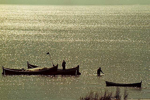
Lagoa Mirim
Alkaline Lake · 3,845 km²
Lagoa Mirim is a alkaline lake in Brazil and Uruguay, with a mapped surface area of about 3,845 km². About 20% of its surface lies in Uruguay, and the rest in Brazil.
Lagoon Mirim (Portuguese, pronounced [miˈɾĩ]) or Merín (Spanish, pronounced [meˈɾin]) is a large estuarine lagoon which extends from southern Rio Grande do Sul state in Brazil into eastern Uruguay. Lagoa Mirim is separated from the Atlantic Ocean by a sandy, partially barren isthmus.
The Jaguarão/Yaguarón, Tacuarí and Cebollatí Rivers empty into Lagoon Mirim, while the São Gonçalo Channel connects it with Lagoa dos Patos to the north.
Adapted from Wikipedia: Lagoon Mirim (CC BY-SA 4.0).
- Surface area
- 3,845 km²
- Area rank
- #54 of 756 indexed
- Type
- Alkaline Lake
- Countries
- Brazil, Uruguay
- Coordinates
- -32.5882°, -52.8051°
Among the 756 water bodies with a mapped extent in YearMaps, Lagoa Mirim ranks #54 by surface area, after Lake Khanka (4,036 km²) and ahead of Dubawnt Lake (3,831 km²). Areas are computed from the mapped outline and are approximate.
- Settlements on the shore:
- Treinta y Tres (88 km), Melo (105 km), Rocha (177 km)
- Other water nearby:
- Lago Rincon del Bonete (1,563 km²)
More about Lagoa Mirim
Location
Lagoon Mirim is about 174 kilometres (108 mi) long by 10 to 35 km (6 to 22 mi) wide and 3,750 km2 (1,450 sq mi) in area. It is more irregular in outline than its larger neighbor to the north, Lagoa dos Patos, and discharges into the latter through São Gonçalo Channel, which is navigable by small boats. Lagoa Mirim has no direct connection to the Atlantic, but the Rio Grande, a tidal channel about 39 km (24 mi) long which connects Lagoon dos Patos to the Atlantic, affords an entrance to the navigable inland waters of both lagoons and several small ports.
Both lagoons are the remains of an ancient depression in the coastline shut in by sand beaches built up by the combined action of wind and oceanic currents.
Sections adapted from Wikipedia: Lagoon Mirim (CC BY-SA 4.0).
Lagoa Mirim: Key Facts
| Surface area | 3,994 km² |
|---|---|
| Maximum depth | 12 m |
| Surface elevation | 1 m |
| Inflows | Cebollatí River, Arroyo de la India Muerta, San Luis River, Jaguarão River, Tacuarí River |
| Outflows | São Gonçalo Channel |
Facts from Wikidata Q876280 (CC0).

Lago Rincon del Bonete
Reservoir · 1,563 km²
Lago Rincon del Bonete is an artificial reservoir in Uruguay, with a mapped surface area of about 1,563 km². It exists because of a dam rather than natural drainage, and was filled in 1945.
The Rincón del Bonete Reservoir is the largest body of fresh water in Uruguay. It is located in the middle of the country in the south part of Tacuarembó Department with a small part of it reaching into the north part of Durazno Department.
Rincón del Bonete is an artificial lake formed by a dam on the course of Río Negro. It was built in 1945 and has a surface of about 1,240 square kilometres (480 sq mi). The dam was overtopping during the 1959 floods, and the hydroelectric facilities damaged.
The riverine tug Don Pancho was assigned to the transport of building materials and supplies from Salto during the construction of the dam, between 1937 and 1946. She was later used to evacuate local residents in the course of the 1959 floods. The vessel was eventually converted into a patrol boat. Don Pancho sank in the waters of the lake in January 2016 though she was raised a few days later.
Adapted from Wikipedia: Rincón del Bonete Reservoir (CC BY-SA 4.0).
- Surface area
- 1,563 km²
- Area rank
- #127 of 756 indexed
- Type
- Reservoir
- Country
- Uruguay
- Impounded
- 1945
- Coordinates
- -32.6938°, -56.0047°
Among the 756 water bodies with a mapped extent in YearMaps, Lago Rincon del Bonete ranks #127 by surface area, after Lake Tuz (1,564 km²) and ahead of Lago Poopó (1,558 km²). Areas are computed from the mapped outline and are approximate.
- Settlements on the shore:
- Durazno (93 km), Tacuarembó (109 km), Trinidad (126 km)
- Other water nearby:
- Lagoa Mirim (3,845 km²), Mar Chiquita (2,102 km²)
Rivers in Uruguay
2 rivers recorded. Listed alphabetically. A river is listed where its mapped reach lies, so long rivers appear under more than one country.
| Name | Type | Also Flows Through |
|---|---|---|
| Negro | River | Brazil |
| Uruguay | River | Brazil, Argentina |
Ports in Uruguay
7 ports recorded. Ranked by approach channel depth, the figure that limits which ships can call. Harbours link to their write-up on the page of the sea or coast they lie on.
| # | Name | Channel Depth | Class | Sea | Max Vessel |
|---|---|---|---|---|---|
| 1 | Colonia | 56.7 m | Very Small | Atlantic Coast of South America | medium vessels |
| 2 | Puerto Sauce | 53 m | Very Small | Atlantic Coast of South America | point_of_interest |
| 3 | Paysandu | 53 m | Small | Atlantic Coast of South America | medium vessels |
| 4 | Fray Bentos | 49.4 m | Very Small | Atlantic Coast of South America | medium vessels |
| 5 | Nueva Palmira | 38.4 m | Very Small | Atlantic Coast of South America | point_of_interest |
| 6 | Montevideo | 34.7 m | Minor | Atlantic Coast of South America | large vessels |
| 7 | Jose Ignacio | 23.8 m | Very Small | Atlantic Coast of South America | point_of_interest |
UNESCO World Heritage Sites in Uruguay
3 World Heritage Sites recorded. Listed by year of inscription, earliest first. Sites shared with another country appear under each.
| # | Name | Inscribed | Type | Criteria |
|---|---|---|---|---|
| 1 | Historic Quarter of the City of Colonia del Sacramento | 1995 | Cultural | (v) |
| 2 | Fray Bentos Industrial Landscape | 2015 | Cultural | (ii) (iv) |
| 3 | Church of Cristo Obrero y Nuestra Señora de Lourdes | 2021 | Cultural | (iv) |
Mountain Ranges, Deserts and Landforms of Uruguay
3 mountain ranges, deserts and other landforms recorded. Ranked by mapped area. Covers mountain ranges, deserts, plateaus, named glaciers, plains, basins, peninsulas and capes. One that crosses a border is listed under every country it lies in, with the area of the whole feature.
| # | Name | Area | Type | Region |
|---|---|---|---|---|
| 1 | South America | 17.91M km² | Continent | South America |
| 2 | Cuchilla Grande | 44,415 km² | Range/mtn | South America |
| 3 | Pampas | 17,857 km² | Plain | South America |

South America
Continent · 17.91M km²
South America is a continent in South America, covering an estimated 17.91M km². It extends across Brazil, Argentina, Chile, Guyana, Venezuela, Ecuador, Suriname, Colombia, Bolivia, Paraguay, Uruguay, France and Peru. It is the 4th-largest of the 231 landforms with a mapped extent in YearMaps.
South America is a continent entirely in the Western Hemisphere and most in the Southern Hemisphere, with a considerably smaller portion in the Northern Hemisphere. It can also be described as the southern subregion of the Americas.
South America is bordered on the west by the Pacific Ocean, on the north and east by the Atlantic Ocean, and on the south by the Drake Passage; North America, the Caribbean Sea lying to the northwest, and the Antarctic Circle, Antarctica, and the Antarctic Peninsula to the south.
The continent includes twelve sovereign countries: Argentina, Bolivia, Brazil, Chile, Colombia, Ecuador, Guyana, Paraguay, Peru, Suriname, Uruguay, and Venezuela; two dependent territories: the Falkland Islands and South Georgia and the South Sandwich Islands; and one internal territory: French Guiana.
The Caribbean South America ABC islands (Aruba, Bonaire, and Curaçao) and Trinidad and Tobago are geologically located on the South-American continental shelf, and thus may be considered part of South America as well.
Adapted from Wikipedia: South America (CC BY-SA 4.0).
- Feature class
- Continent
- Mapped extent
- 17.91M km²
- Size rank
- #4 of 231 landforms
- Region
- South America
- Countries
- Brazil, Argentina, Chile, Guyana, Venezuela, Ecuador, Suriname, Colombia, Bolivia, Paraguay, Uruguay, France, Peru
- Coordinates
- -4.1242°, -64.8745°
- Ranges:
- Cuchilla Grande (South America), Serra Geral (South America)
- Settlements:
- Tacuarembó (78 km), Durazno (135 km), Paysandú (142 km)
More about South America
Geography
South America occupies the southern portion of the Americas. The continent is generally delimited on the northwest by the Darién watershed along the Colombia–Panama border, although some may consider the border instead to be the Panama Canal. Geopolitically and geographically, all of Panama – including the segment east of the Panama Canal in the isthmus – is typically included in North America alone and among the countries of Central America. Almost all of mainland South America sits on the South American Plate.
History
South America is thought to have been first inhabited by humans when people were crossing the Bering Land Bridge (now the Bering Strait) at least 15,000 years ago from the territory that is present-day Russia. They migrated south through North America, and eventually reached South America through the Isthmus of Panama.
Amongst the oldest evidence for human presence in South America is the Monte Verde II site in Chile, suggested to date to around 14,500 years ago. From around 13,000 years ago, the Fishtail projectile point style became widespread across South America, with its disappearance around 11,000 years ago coincident with the disappearance of South America's megafauna.
Economy
Since 1930, the continent has experienced growth and diversification in most economic sectors. Most agricultural and livestock products are destined for the domestic market and local consumption. However, the export of agricultural products is essential for the balance of trade in most countries.
The main agrarian crops are export crops, such as soy and wheat. The production of staple foods such as vegetables, corn or beans is large, but focused on domestic consumption. Livestock raising for meat exports is significant in Argentina, Paraguay, Uruguay and Colombia. In tropical regions the most important crops are coffee, cocoa and bananas, mainly in Brazil, Colombia and Ecuador.
Sections adapted from Wikipedia: South America (CC BY-SA 4.0).
South America: Key Facts
| Area | 17,461,112 km² |
|---|---|
| Highest point | Aconcagua |
| On | Atlantic Ocean, Pacific Ocean |
Facts from Wikidata Q18 (CC0).

Cuchilla Grande
Range/mtn · 44,415 km²
Cuchilla Grande is a range/mtn in South America, covering an estimated 44,415 km².
Cuchilla Grande is a hill range that crosses the east part of Uruguay from north to south. It extends from the south part of Cerro Largo Department, through the departments of Treinta y Tres and Lavalleja and ends in Maldonado Department where it forms its highest peaks.
Adapted from Wikipedia: Cuchilla Grande (CC BY-SA 4.0).
- Feature class
- Range/mtn
- Mapped extent
- 44,415 km²
- Size rank
- #89 of 216 mountain ranges
- Region
- South America
- Coordinates
- -33.6886°, -54.6779°
- Summits:
- Morro da Boa Vista (1,827 m), Cerro Tres Picos (1,243 m), Cerro Tres Kandú (842 m)
- Adjacent ranges:
- Serra Geral (South America), Serra do Mar (South America)
- Settlements:
- Treinta y Tres (58 km), Minas (91 km), Rocha (94 km)
More about Cuchilla Grande
Cuchilla Grande: Key Facts
| Highest point | Cerro Catedral |
|---|
Facts from Wikidata Q1143026 (CC0).

Pampas
Plain · 17,857 km²
Pampas is a plain in South America, covering an estimated 17,857 km². It extends across Argentina, Brazil and Uruguay.
The Pampas (; from Quechua pampa 'plain'), also known as the Pampas Plains, are fertile low grasslands in southern South America that cover more than 1,200,000 km2 (460,000 sq mi) and include the Argentine provinces of Buenos Aires, La Pampa, Santa Fe, Entre Ríos, and Córdoba; all of Uruguay; and Brazil's southernmost state, Rio Grande do Sul. The vast plains are a natural region, interrupted only by the low Ventana and Tandil hills, near Bahía Blanca and Tandil (Argentina), with a height of 1,300 m (4,265 ft) and 500 m (1,640 ft), respectively. This ecoregion has been changed by humans, especially since the release of animals like cattle, pigs, and especially sheep onto these plains.
The climate is temperate, with precipitation of 600 to 1,200 mm (23.6 to 47.2 in) that is more or less evenly distributed throughout the year, making the soils appropriate for agriculture. The area is also one of the distinct physiography provinces of the larger Paraná–Paraguay plain division.
It is considered that the limit of the Pampas plain is to the north with the Atlantic Forest and the Great Chaco Plain, to the west with the Pampas Mountains and the Cuyo Region, and to the south with Patagonia.
Adapted from Wikipedia: Pampas (CC BY-SA 4.0).
- Feature class
- Plain
- Mapped extent
- 17,857 km²
- Size rank
- #104 of 231 landforms
- Region
- South America
- Countries
- Argentina, Brazil, Uruguay
- Coordinates
- -39.1263°, -62.0668°
- Ranges:
- Cuchilla Grande (South America), Serra Geral (South America)
- Settlements:
- Colonia del Sacramento (639 km), Montevideo (706 km), San José de Mayo (714 km)
More about Pampas
History
The arrival of the Spanish colonists on the shores of the Río de la Plata and the foundation of the city of Buenos Aires during the 16th century resulted in the first confrontations between the Spanish and the local Indian tribes, mainly the Querandí. At the end of the 18th century, the Salado River was the boundary between the civilizations.
As European settlers established frontier settlements, the Mapuche raided them for cattle or looted their produce. They drove off the cattle stolen in the incursions (malones) and took them to Chile through the mountain passes. The main trail for this trade was called Camino de los chilenos.
Sections adapted from Wikipedia: Pampas (CC BY-SA 4.0).
States and Provinces of Uruguay
1 first-level divisions with their own map.
Countries Bordering Uruguay
Land and maritime neighbours.
More Maps in South America
Uruguay: Quick Answers
- What is the capital of Uruguay?
- The capital of Uruguay is Montevideo.
- What is the population of Uruguay?
- Uruguay has a population of about 3.38 million, the #134 largest of 225 countries in YearMaps. Source: World Bank, 2025.
- How big is Uruguay?
- Uruguay covers 176,215 km², ranking #92 by area, with about 19 people per square kilometre.
- Which continent is Uruguay in?
- Uruguay is in South America.
- Which countries border Uruguay?
- Uruguay shares a land or maritime border with Brazil, Argentina.
- What is the largest city in Uruguay?
- Montevideo is the largest city in Uruguay, with a metropolitan population of about 1.51 million.
- What is the highest mountain in Uruguay?
- The highest summit recorded for Uruguay in YearMaps is Cerro Catedral at 514 m (1,686 ft). Summits on a border are counted for both countries.
- What is the largest lake in Uruguay?
- The largest lake recorded in or bordering Uruguay is Lagoa Mirim, at roughly 3,845 km².