Skip to content
YearMaps
Brazil · Landforms

Mountain Ranges, Deserts and Landforms of Brazil

South America is the largest of the 25 mountain ranges, deserts and other landforms recorded for Brazil, at 17.91M km², ahead of Amazon Basin at 4.65M km². The full list follows.

How this list is built: Ranked by mapped area. Covers mountain ranges, deserts, plateaus, named glaciers, plains, basins, peninsulas and capes. One that crosses a border is listed under every country it lies in, with the area of the whole feature. It covers the mountain ranges, deserts and other landforms indexed in YearMaps, drawn from open geospatial data, and is not an exhaustive national register.

Landforms Listed
25
Top Ranked
17.91M km²
South America
Second
4.65M km²
Amazon Basin
Profiled Below
14
Photo, encyclopedia text and figures
Mountain Ranges, Deserts and Landforms of Brazil
#NameArea
1South America17.91M km²
2Amazon Basin4.65M km²
3Brazilian Highlands607,538 km²
4Planalto Central484,289 km²
5Guiana Shield348,461 km²
6Planalto Do Mato Grosso162,718 km²
7Pantanal129,097 km²
8Caatingas128,304 km²
9S. do Cachimbo105,510 km²
10Campos Sertão87,291 km²
11S. dos Gradaús81,121 km²
12Chapada do Araripe62,777 km²
13Serra da Ibiapaba31,331 km²
14Serra de Curupira30,030 km²
15Serra do Espinhaço26,648 km²
16Pampas17,857 km²
17Tumuc-Humac Mountains16,058 km²
18S. do Piaui15,271 km²
19Planalto da Borborema15,012 km²
20Serra Acaraí9,194 km²
21Amazon Delta7,311 km²
22Serra Geral2,961 km²
23Serra da Mantiqueira1,238 km²
24Serra do Mar1,008 km²
25S. Dourada19 km²

The Landforms of Brazil in Detail

The 14 mountain ranges, deserts and other landforms above that have an encyclopedia article, in the same order, each with its photograph, figures and the places around it.

South America
Image via Wikimedia Commons (author and licence on the file page).

South America

Continent · 17.91M km²

South America is a continent in South America, covering an estimated 17.91M km². It extends across Brazil, Argentina, Chile, Guyana, Venezuela, Ecuador, Suriname, Colombia, Bolivia, Paraguay, Uruguay, France and Peru. It is the 4th-largest of the 231 landforms with a mapped extent in YearMaps.

South America is a continent entirely in the Western Hemisphere and most in the Southern Hemisphere, with a considerably smaller portion in the Northern Hemisphere. It can also be described as the southern subregion of the Americas.

South America is bordered on the west by the Pacific Ocean, on the north and east by the Atlantic Ocean, and on the south by the Drake Passage; North America, the Caribbean Sea lying to the northwest, and the Antarctic Circle, Antarctica, and the Antarctic Peninsula to the south.

The continent includes twelve sovereign countries: Argentina, Bolivia, Brazil, Chile, Colombia, Ecuador, Guyana, Paraguay, Peru, Suriname, Uruguay, and Venezuela; two dependent territories: the Falkland Islands and South Georgia and the South Sandwich Islands; and one internal territory: French Guiana.

The Caribbean South America ABC islands (Aruba, Bonaire, and Curaçao) and Trinidad and Tobago are geologically located on the South-American continental shelf, and thus may be considered part of South America as well.

Adapted from Wikipedia: South America (CC BY-SA 4.0).

Feature class
Continent
Mapped extent
17.91M km²
Size rank
#4 of 231 landforms
Region
South America
Countries
Brazil, Argentina, Chile, Guyana, Venezuela, Ecuador, Suriname, Colombia, Bolivia, Paraguay, Uruguay, France, Peru
Coordinates
-4.1242°, -64.8745°
Summits:
Pico da Bandeira (2,890 m), Pico Paraná (1,877 m), Pico do Jabre (1,197 m)
Ranges:
Serra da Ibiapaba (South America), Tumuc-Humac Mountains (South America)
Settlements:
Colíder (287 km), Alta Floresta (345 km), Gurupi (431 km)

View on the live map

More about South America

Geography

South America occupies the southern portion of the Americas. The continent is generally delimited on the northwest by the Darién watershed along the Colombia–Panama border, although some may consider the border instead to be the Panama Canal. Geopolitically and geographically, all of Panama – including the segment east of the Panama Canal in the isthmus – is typically included in North America alone and among the countries of Central America. Almost all of mainland South America sits on the South American Plate.

History

South America is thought to have been first inhabited by humans when people were crossing the Bering Land Bridge (now the Bering Strait) at least 15,000 years ago from the territory that is present-day Russia. They migrated south through North America, and eventually reached South America through the Isthmus of Panama.

Amongst the oldest evidence for human presence in South America is the Monte Verde II site in Chile, suggested to date to around 14,500 years ago. From around 13,000 years ago, the Fishtail projectile point style became widespread across South America, with its disappearance around 11,000 years ago coincident with the disappearance of South America's megafauna.

Economy

Since 1930, the continent has experienced growth and diversification in most economic sectors. Most agricultural and livestock products are destined for the domestic market and local consumption. However, the export of agricultural products is essential for the balance of trade in most countries.

The main agrarian crops are export crops, such as soy and wheat. The production of staple foods such as vegetables, corn or beans is large, but focused on domestic consumption. Livestock raising for meat exports is significant in Argentina, Paraguay, Uruguay and Colombia. In tropical regions the most important crops are coffee, cocoa and bananas, mainly in Brazil, Colombia and Ecuador.

Sections adapted from Wikipedia: South America (CC BY-SA 4.0).

South America: Key Facts

Key facts about South America
Area17,461,112 km²
Highest pointAconcagua
OnAtlantic Ocean, Pacific Ocean

Facts from Wikidata Q18 (CC0).

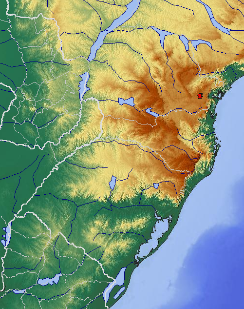
Brazilian Highlands
Image via Wikimedia Commons (author and licence on the file page).

Brazilian Highlands

Plateau · 607,538 km²

Brazilian Highlands is a plateau in South America, covering an estimated 607,538 km². It is the 6th-largest of the 69 plateaus with a mapped extent in YearMaps.

The Brazilian Highlands or Brazilian Plateau (Portuguese: Planalto Brasileiro) is an extensive geographical region covering most of the eastern, southern and central portions of Brazil, in all some 4,500,000 km2 (1,930,511 sq mi) or approximately half of the country's land area. The vast majority of Brazil's population (203.062.512; 2022 census) lives in the highlands or on the narrow coastal region immediately adjacent to it.

Ancient basaltic lava flows gave birth to much of the region. However, the time of dramatic geophysical activity is long past, as there is now no seismic or volcanic activity. Erosion has also played a large part in shaping the Highlands, forming extensive sedimentary deposits and wearing down the mountains.

The Brazilian Highlands are recognized for its great diversity: within the region there are several different biomes, vastly different climatic conditions, many types of soil, and thousands of animal and plant species.

Adapted from Wikipedia: Brazilian Highlands (CC BY-SA 4.0).

Feature class
Plateau
Mapped extent
607,538 km²
Size rank
#6 of 69 plateaus
Region
South America
Coordinates
-25.2135°, -51.6409°
Summits:
Pico Paraná (1,877 m), Morro da Boa Vista (1,827 m), Cerro Tres Kandú (842 m)
Ranges:
Serra do Mar (South America), Serra Geral (South America)
Settlements:
Guarapuava (25 km), Irati (103 km), Porto União (127 km)

View on the live map

More about Brazilian Highlands

Brazilian Highlands: Key Facts

Key facts about Brazilian Highlands
Area4,500,000 km²
Highest pointPico da Bandeira

Facts from Wikidata Q118899 (CC0).

Guiana Shield
Image via Wikimedia Commons (author and licence on the file page).

Guiana Shield

Plateau · 348,461 km²

Guiana Shield is a plateau in South America, covering an estimated 348,461 km². It extends across Venezuela, Guyana, Brazil, France, Suriname and Colombia. It is the 11th-largest of the 69 plateaus with a mapped extent in YearMaps.

The Guiana Shield (French: Plateau des Guyanes, Bouclier guyanais; Dutch: Hoogland van Guyana, Guianaschild; Portuguese: Planalto das Guianas, Escudo das Guianas; Spanish: Escudo guayanés) is one of the three cratons of the South American plate. It is a 1.7 billion-year-old Precambrian geological formation in northeast South America that forms a portion of the northern coast. The higher elevations on the shield are called the Guiana Highlands, which is where the table-like mountains called tepuis are found. The Guiana Highlands are also the source of some of the world's most well-known waterfalls such as Angel Falls, Kaieteur Falls, and Cuquenan Falls.

The Guiana Shield underlies Guyana (previously British Guiana), Suriname (previously Dutch Guiana), and French Guiana (or Guyane), much of southern Venezuela, most of Brazil north of the Amazon River, and parts of eastern Colombia. The first three are called The Guianas, and most of the Guiana Shield coincides with Guiana Island.

Adapted from Wikipedia: Guiana Shield (CC BY-SA 4.0).

Feature class
Plateau
Mapped extent
348,461 km²
Size rank
#11 of 69 plateaus
Region
South America
Countries
Venezuela, Guyana, Brazil, France, Suriname, Colombia
Coordinates
5.8962°, -65.5319°
Summits:
Mount Roraima (2,772 m), Pico da Neblina (3,014 m), Pico do Jabre (1,197 m)
Ranges:
Wilhelmina Gebergte (South America), Tumuc-Humac Mountains (South America)
Settlements:
Boa Vista (204 km), Manaus (863 km), Manacapuru (877 km)

View on the live map

More about Guiana Shield

Geology

The oldest rocks in the shield consist of Archean Imataca Complex, composed of a quartz-feldspar gneiss and subordinate mafic gneiss. The Guri Fault marks the southern boundary of the complex. South of that fault are Early Proterozoic rocks consisting of the metavolcanic Pastora Supergroup and the granitic plutonic Supamo Complex. The Cuchivero Group consists of ash flow tuff and granitic plutonic rocks. The Early to Middle Proterozoic Roraima Group consists of continental clastic sedimentary rocks. These Precambrian sediments include quartz sandstones, quartzites, and conglomerates presumed to be 1.8 to 1.4 Ga in age.

Ecology

The Guiana Shield is one of the world's most biodiverse regions, and has many endemic species. The region houses over 3000 vertebrate species: 1168 fresh water fish, 269 amphibians (54% endemics), 295 reptiles (29%), 1004 birds (7.7%), and 282 mammals (11%). Diversity of invertebrates remains largely undocumented, but there are several species of endemic butterflies and dung beetles.

Plant life is equally rich and 13,367 species of vascular plants have been found, approximately 40% of which is considered endemic. The shield is overlain by the largest expanse of tropical forest on any Precambrian shield area in the world.

Sections adapted from Wikipedia: Guiana Shield (CC BY-SA 4.0).

Guiana Shield: Key Facts

Key facts about Guiana Shield
Highest pointPico da Neblina

Facts from Wikidata Q9309106 (CC0).

Pantanal
Image via Wikimedia Commons (author and licence on the file page).

Pantanal

Wetlands · 129,097 km²

Pantanal is a wetlands in South America, covering an estimated 129,097 km². It extends across Brazil, Bolivia and Paraguay.

The Pantanal (Portuguese pronunciation: [pɐ̃taˈnaw], Spanish pronunciation: [pantaˈnal]) is a natural region encompassing the world's largest tropical wetland area, and the world's largest flooded grasslands. It is located mostly within the Brazilian state of Mato Grosso do Sul, but it extends into Mato Grosso and portions of Bolivia and Paraguay. It sprawls over an area estimated at between 140,000 and 195,000 km2 (54,000 and 75,000 sq mi). Various subregional ecosystems exist, each with distinct hydrological, geological, and ecological characteristics; up to 12 of them have been defined.

Roughly 80% of the Pantanal floodplains are submerged during the rainy seasons, nurturing a biologically diverse collection of aquatic plants and helping to support a dense array of animal species.

Adapted from Wikipedia: Pantanal (CC BY-SA 4.0).

Feature class
Wetlands
Mapped extent
129,097 km²
Size rank
#56 of 231 landforms
Region
South America
Countries
Brazil, Bolivia, Paraguay
Coordinates
-18.3780°, -56.2597°
Summits:
Pico Paraná (1,877 m), Morro da Boa Vista (1,827 m), Pico da Bandeira (2,890 m)
Ranges:
Serra Geral (South America), Serra do Mar (South America)
Settlements:
Corumbá (148 km), Cáceres (248 km), Aquidauana (276 km)

View on the live map

More about Pantanal

Geography and geology

The Pantanal covers about 140,000–160,000 km2 (54,000–62,000 sq mi) of gently sloped basin that receives runoff from the upland areas (the Planalto highlands) and slowly releases the water through the Paraguay River and tributaries. The formation is a result of the large, concave, pre-Andean depression of the Earth's crust, related to the Andean orogeny of the Tertiary. It constitutes an enormous internal river delta, in which several rivers flowing from the surrounding plateau merge, depositing their sediments and erosion residues, which have been filling the large depression area of the Pantanal. This area is also one of the distinct physiographic provinces of the larger Parana-Paraguay Plain area, which encompasses a total of 1.5×10^6 km2 (580,000 sq mi).

Sections adapted from Wikipedia: Pantanal (CC BY-SA 4.0).

Pantanal: Key Facts

Key facts about Pantanal
Area879 km²

Facts from Wikidata Q157603 (CC0).

Caatingas
Image via Wikimedia Commons (author and licence on the file page).

Caatingas

Desert · 128,304 km²

Caatingas is a desert in South America, covering an estimated 128,304 km². It is the 16th-largest of the 58 deserts with a mapped extent in YearMaps.

Caatinga (; [kaaˈt͡ʃĩɡɐ]) is a type of semi-arid tropical vegetation, and an ecoregion characterized by this vegetation in interior northeastern Brazil. The name "Caatinga" comes from the Old Tupi word ka'atinga, meaning 'white forest' (ka'a = 'forest, vegetation'; tinga = 'white').

The Caatinga is a xeric shrubland and thorn forest, which consists primarily of small, thorny trees that shed their leaves seasonally. Cacti, thick-stemmed plants, thorny brush, and arid-adapted grasses make up the ground layer. Most vegetation experiences a brief burst of activity during the three-month-long rainy season.

The Caatinga falls entirely within earth's tropical zone and is one of six major biomes of Brazil. It covers 912,529 km², nearly 10% of Brazil's territory. It is home to 26 million people and over 2,000 species of plants, fish, reptiles, amphibians, birds, and mammals.

The Caatinga is the only exclusively Brazilian biome, which means that a large part of its biological heritage cannot be found anywhere else on the planet.

Adapted from Wikipedia: Caatinga (CC BY-SA 4.0).

Feature class
Desert
Mapped extent
128,304 km²
Size rank
#16 of 58 deserts
Region
South America
Coordinates
-7.6981°, -37.3481°
Summits:
Pico do Jabre (1,197 m), Pico da Bandeira (2,890 m), Pico Paraná (1,877 m)
Ranges:
Serra da Ibiapaba (South America), Serra da Mantiqueira (South America)
Settlements:
Patos (76 km), Arcoverde (86 km), Caicó (140 km)

View on the live map

More about Caatingas

Geography

The Caatinga covers the interior portion of northeastern Brazil bordering the Atlantic seaboard (save for a fringe of Atlantic Forest), extending across nine states: Piauí, Ceará, Rio Grande do Norte, Paraíba, Pernambuco, Alagoas, Sergipe, Bahia, and parts of Minas Gerais. Altogether, the Caatinga comprises 850,000 km², about 10% of the surface area of Brazil. By comparison, it is over nine times the surface area of Portugal, whence came Brazil's early European settlers.

Located between 3°S 45°W and 17°S 35°W, the Caatinga experiences irregular winds from all directions. Rainfall is thus intermittent but intense, totaling 20–80 cm (7.9–31.5 in) on average.

Climate

During the dry winter periods there is no foliage or undergrowth, as plants try to conserve water. Roots protrude through the surface of the stony soil, to absorb water before it is evaporated. Leaves fall off the trees to reduce transpiration. With all the foliage and undergrowth dead during the drought periods and all the trees having no leaves the Caatinga has a yellow-grey, desert-like look. During the peak periods of drought the Caatinga's soil can reach temperatures of up to 60 °C.

The drought usually ends in December or January, when the rainy season starts. Immediately after the first rains, the grey, desert-like landscape starts to transform and becomes completely green within a few days. Small plants start growing in the now moist soil and trees grow back their leaves.

Ecology

The Caatinga harbors a unique biota. To date, between 932 - 1,000 vascular plant species, 187 species of bees, 240 species of fish, 167 reptile and amphibian species, 510 bird species across 62 families, and 148 mammal species have been recorded in the Caatinga, with endemism levels varying from 9 percent in birds to 57 percent in fishes. The true proportion of endemic species of the Caatinga may be higher than is currently known, as 80% of surveyed areas were surveyed poorly, and 41% of the region has never been surveyed by scientists at all.

The Caatinga does not correspond to a single type of vegetation, but rather a broad mosaic. Nonetheless, all vegetative structure is adapted to the xeric climate.

Sections adapted from Wikipedia: Caatinga (CC BY-SA 4.0).

Chapada do Araripe
Image via Wikimedia Commons (author and licence on the file page).

Chapada do Araripe

Plateau · 62,777 km²

Chapada do Araripe is a plateau in South America, covering an estimated 62,777 km².

The Chapada do Araripe, also known as the Serra do Araripe, is a chapada (plateau) in northeastern Brazil. The chapada forms the boundary of Ceará and Pernambuco states, and forms the watershed between the Jaguaribe River of Ceará, which flows northward into the Atlantic, and the much larger basin of the São Francisco River of Pernambuco and neighboring states, which drains eastward into the Atlantic. The Santana Formation, which is rich with fossils from the early Cretaceous, lies at the base of the chapada.

Adapted from Wikipedia: Chapada do Araripe (CC BY-SA 4.0).

Feature class
Plateau
Mapped extent
62,777 km²
Size rank
#41 of 69 plateaus
Region
South America
Coordinates
-7.2621°, -40.6283°
Summits:
Pico do Jabre (1,197 m), Pico da Bandeira (2,890 m), Julianatop (1,230 m)
Ranges:
Serra da Ibiapaba (South America), Serra da Mantiqueira (South America)
Settlements:
Picos (92 km), Crato (133 km), Juazeiro do Norte (144 km)

View on the live map

More about Chapada do Araripe

Ecology

The landscape surrounding the Chapada is mostly Caatinga, a semi-arid shrubland and savanna that covers most of northeastern Brazil's interior. On the Chapada's northeastern slope is an enclave of tropical moist forest. Rainfall here exceeds 1000 mm annually, and the landscape is lush and green in contrast to the surrounding Caatinga. This moist forest enclave includes several forest types, mostly Atlantic semi-deciduous moist forest composed of four distinct layers. Emergent trees grow more than 30 m tall, above a canopy layer where species of legumes, mahogany, and family Apocynaceae predominate. The moist forests are mostly similar in composition to the Atlantic Forest, with some elements from the Amazon and Cerrado.

Sections adapted from Wikipedia: Chapada do Araripe (CC BY-SA 4.0).

Chapada do Araripe: Key Facts

Key facts about Chapada do Araripe
Elevation851 m

Facts from Wikidata Q5072889 (CC0).

Serra da Ibiapaba
Image via Wikimedia Commons (author and licence on the file page).

Serra da Ibiapaba

Range/mtn · 31,331 km²

Serra da Ibiapaba is a range/mtn in South America, covering an estimated 31,331 km².

The Serra de Ibiapaba (Ibiapaba mountains) also known as Serra Grande, Chapada da Ibiabapa e Cuesta da Ibiapaba, is an upland in northeastern Brazil, which lies on the boundary of Piauí and Ceará states. The range runs north and south, extending from near the Atlantic coast in the north to connect with the Serra do Araripe, which forms the southern boundary of Ceará. The Poti River bisects the range, and the southern portion, between the Poti and the Serra do Araripe, is also known as the Serra Grande.

An attractive region for natural wealth which was already inhabited by various indigenous groups. People who lived already negotiating several natural products with European peoples, such as the French before them the arrival of the Portuguese. Initially inhabited by tabajaras and tapuias Indians, as the Iracema Indian woman who was bathing in the Bica do Ipú (Spout of Ipu) was fairly portrayed in the Iracema book by José de Alencar.

In the highlands of Ibiabapa are located the towns of Viçosa do Ceará, Tianguá, Ubajara, São Benedito, Guaraciaba do Norte and Ibiapina. The elevation ranges around 700 to 850 meters above sea level.

Adapted from Wikipedia: Serra da Ibiapaba (CC BY-SA 4.0).

Feature class
Range/mtn
Mapped extent
31,331 km²
Size rank
#104 of 216 mountain ranges
Region
South America
Coordinates
-5.2847°, -41.0657°
Summits:
Pico do Jabre (1,197 m), Pico da Bandeira (2,890 m), Julianatop (1,230 m)
Adjacent ranges:
Tumuc-Humac Mountains (South America), Wilhelmina Gebergte (South America)
Settlements:
Crateús (46 km), Ipú (114 km), Tauá (115 km)

View on the live map

Pampas
Image via Wikimedia Commons (author and licence on the file page).

Pampas

Plain · 17,857 km²

Pampas is a plain in South America, covering an estimated 17,857 km². It extends across Argentina, Brazil and Uruguay.

The Pampas (; from Quechua pampa 'plain'), also known as the Pampas Plains, are fertile low grasslands in southern South America that cover more than 1,200,000 km2 (460,000 sq mi) and include the Argentine provinces of Buenos Aires, La Pampa, Santa Fe, Entre Ríos, and Córdoba; all of Uruguay; and Brazil's southernmost state, Rio Grande do Sul. The vast plains are a natural region, interrupted only by the low Ventana and Tandil hills, near Bahía Blanca and Tandil (Argentina), with a height of 1,300 m (4,265 ft) and 500 m (1,640 ft), respectively. This ecoregion has been changed by humans, especially since the release of animals like cattle, pigs, and especially sheep onto these plains.

The climate is temperate, with precipitation of 600 to 1,200 mm (23.6 to 47.2 in) that is more or less evenly distributed throughout the year, making the soils appropriate for agriculture. The area is also one of the distinct physiography provinces of the larger Paraná–Paraguay plain division.

It is considered that the limit of the Pampas plain is to the north with the Atlantic Forest and the Great Chaco Plain, to the west with the Pampas Mountains and the Cuyo Region, and to the south with Patagonia.

Adapted from Wikipedia: Pampas (CC BY-SA 4.0).

Feature class
Plain
Mapped extent
17,857 km²
Size rank
#104 of 231 landforms
Region
South America
Countries
Argentina, Brazil, Uruguay
Coordinates
-39.1263°, -62.0668°
Summits:
Morro da Boa Vista (1,827 m), Pico Paraná (1,877 m), Pico da Bandeira (2,890 m)
Ranges:
Cuchilla Grande (South America), Serra Geral (South America)
Settlements:
Santa Vitória do Palmar (997 km), Jaguarão (1,070 km), Santana do Livramento (1,093 km)

View on the live map

More about Pampas

History

The arrival of the Spanish colonists on the shores of the Río de la Plata and the foundation of the city of Buenos Aires during the 16th century resulted in the first confrontations between the Spanish and the local Indian tribes, mainly the Querandí. At the end of the 18th century, the Salado River was the boundary between the civilizations.

As European settlers established frontier settlements, the Mapuche raided them for cattle or looted their produce. They drove off the cattle stolen in the incursions (malones) and took them to Chile through the mountain passes. The main trail for this trade was called Camino de los chilenos.

Sections adapted from Wikipedia: Pampas (CC BY-SA 4.0).

Tumuc-Humac Mountains
Image via Wikimedia Commons (author and licence on the file page).

Tumuc-Humac Mountains

Range/mtn · 16,058 km²

Tumuc-Humac Mountains is a range/mtn in South America, covering an estimated 16,058 km². It extends across Suriname, France and Brazil.

The Tumuk Humak Mountains (Dutch: Toemoek-Hoemakgebergte, Portuguese: Serra do Tumucumaque, French: Monts Tumuc Humac) are a mountain range in South America, stretching about 120 kilometers (75 mi) east–west in the border area between Brazil in the south and Suriname and French Guiana in the north. In the language of the Apalam and Wayana peoples, Tumucumaque means "the mountain rock symbolizing the struggle between the shaman and the spirits". The range is very remote and almost inaccessible.

Both the Maroni and Oyapock rivers rise in the Tumuk Humak Mountains. The Maroni (Dutch: Marowijne) forms the entire (disputed) border between Suriname and French Guiana, and the Oyapock (Portuguese: Oiapoque) most of the border between French Guiana and Brazil.

The Tumuk Humak Mountains are part of the Tumucumaque Uplands of the Guiana Shield. They are geographically important because they form the divide between the biogeographical system of the Amazon Basin and that of the Atlantic coastal area of the Guianas. The Tumuk Humak plateau is covered primarily with lowland and plateau forests.

Adapted from Wikipedia: Tumuk Humak Mountains (CC BY-SA 4.0).

Feature class
Range/mtn
Mapped extent
16,058 km²
Size rank
#135 of 216 mountain ranges
Region
South America
Countries
Suriname, France, Brazil
Coordinates
2.3696°, -54.3244°
Summits:
Mount Roraima (2,772 m), Pico da Neblina (3,014 m), Pico do Jabre (1,197 m)
Adjacent ranges:
Wilhelmina Gebergte (South America), Serra da Ibiapaba (South America)
Settlements:
Vila Velha (329 km), Laranjal do Jari (385 km), Macapá (412 km)

View on the live map

More about Tumuc-Humac Mountains

Tumuc-Humac Mountains: Key Facts

Key facts about Tumuc-Humac Mountains
Highest pointBellevue de l'Inini

Facts from Wikidata Q1457996 (CC0).

Planalto da Borborema
Image via Wikimedia Commons (author and licence on the file page).

Planalto da Borborema

Plateau · 15,012 km²

Planalto da Borborema is a plateau in South America, covering an estimated 15,012 km².

The Borborema Plateau (Portuguese Planalto da Borborema, also known as the Serra da Borborema) is a plateau in northeastern Brazil which extends across the states of Pernambuco, Paraíba, and Rio Grande do Norte. The plateau is the northeasternmost portion of the Brazilian Highlands and is the most relevant watershed of its region. It ranges approximately 400 kilometres (250 mi) from north to south and 200 kilometres (120 mi) from east to west. More than 100 rivers originate from the plateau, including the Moxotó, Mundaú, Pajeú, Paraíba do Norte, Seridó, and Una.

The Borborema Plateau serves as an orographic barrier, despite its relatively low elevation, against the moist easterly winds of the Atlantic Ocean. Areas west of the plateau, which make up part of the sertão, are arid and prone to drought. The Pajeú River, the largest tributary of the São Francisco River, originates from the Borborema.

Adapted from Wikipedia: Borborema Plateau (CC BY-SA 4.0).

Feature class
Plateau
Mapped extent
15,012 km²
Size rank
#60 of 69 plateaus
Region
South America
Coordinates
-8.6971°, -35.9007°
Summits:
Pico do Jabre (1,197 m), Pico da Bandeira (2,890 m), Pico Paraná (1,877 m)
Ranges:
Serra da Ibiapaba (South America), Serra da Mantiqueira (South America)
Settlements:
Caruaru (47 km), Garanhuns (69 km), Barreiros (78 km)

View on the live map

More about Planalto da Borborema

Planalto da Borborema: Key Facts

Key facts about Planalto da Borborema
Elevation335 m

Facts from Wikidata Q2740752 (CC0).

Amazon Delta
Image via Wikimedia Commons (author and licence on the file page).

Amazon Delta

Delta · 7,311 km²

Amazon Delta is a delta in South America, covering an estimated 7,311 km².

The Amazon Delta (Portuguese: delta do Amazonas) is a vast river delta formed by the Amazon River and the Tocantins River (through the Pará River distributary channel) in northern South America. It is located in the Brazilian states of Amapá and Pará and encompasses the Marajó Archipelago, with Marajó Island as its largest island. The region is 160,000 km2 and has 49 towns, with most of these being small towns with less than 20,000 inhabitants. The main cities located in the vicinity are Belém and Macapá, each with its respective metropolitan area.

It is the largest river delta in the world. It releases one fifth of the total amount of freshwater that is discharged into the earths oceans, into the Atlantic Ocean, with some estimating that equates to 200,000 litres a second. The area has wetlands, streams, lagoons and rich ecosystems and biodiversity. It is a vital area for wildlife, with extensive mangroves in wetland forests, that cover an area of 38,304 km2 of the delta, with 75% of Brazil's mangroves located in the Amazon Delta.

Adapted from Wikipedia: Amazon Delta (CC BY-SA 4.0).

Feature class
Delta
Mapped extent
7,311 km²
Size rank
#126 of 231 landforms
Region
South America
Coordinates
-0.0275°, -48.6600°
Summits:
Julianatop (1,230 m), Mount Roraima (2,772 m), Pico do Jabre (1,197 m)
Ranges:
Tumuc-Humac Mountains (South America), Wilhelmina Gebergte (South America)
Settlements:
Belém (159 km), Salinópolis (160 km), Castanhal (162 km)

View on the live map

More about Amazon Delta

Climate

The Amazon Delta has a tropical climate with high humidity and high temperatures. It has a wet season with frequent flooding and a dry season where the delta dries out. The wet season is considered to be January to June, with precipitation peaking in February, March and April. The dry season is July to December, with September, October and November seeing the least rainfall. Extreme flooding occurred in 2009, 2012, 2021, and 2022. These seasons shape the environment of the Amazon Delta and the life in it, such as the water buffalo for which Marajó Island is well known, three-toed sloth, capybara, giant anteater, giant otter, jaguar and pink river dolphins.

Sections adapted from Wikipedia: Amazon Delta (CC BY-SA 4.0).

Serra Geral
Image via Wikimedia Commons (author and licence on the file page).

Serra Geral

Range/mtn · 2,961 km²

Serra Geral is a range/mtn in South America, covering an estimated 2,961 km².

The Serra Geral (General Mountains) is a mountain range in southern Brazil, constituting the southern portion of the Serra do Mar system which runs along Brazil's southeastern coast. The Serra Geral runs parallel to the Atlantic coast in Santa Catarina and northern Rio Grande do Sul states, separating a narrow coastal plain from an interior plateau. The coastal plain is characterized by short rivers and frequent lagoons and bays, and lies within the humid tropical Serra do Mar coastal forests ecoregion.

The plateau to the west of the range is drained by tributaries of the Uruguay River, including the Pelotas and Canoas, and by the Jacuí River and its tributaries, which drains south into the Lagoa dos Patos of Rio Grande do Sul.

The Serra Geral is home to Aparados da Serra National Park and Serra Geral National Park, which are notable for their enormous canyons.

The plateau is the coldest part of Brazil, with frequent frosts and yearly snow, being home to the montane Araucaria moist forests. It is on Santa Catarina's portion of the Serra Geral where Brazil's coldest towns, Urubici, Urupema, São Joaquim and Bom Jardim da Serra, are located.

Adapted from Wikipedia: Serra Geral (CC BY-SA 4.0).

Feature class
Range/mtn
Mapped extent
2,961 km²
Size rank
#170 of 216 mountain ranges
Region
South America
Coordinates
-29.6989°, -53.4817°
Summits:
Morro da Boa Vista (1,827 m), Cerro Tres Kandú (842 m), Pico Paraná (1,877 m)
Adjacent ranges:
Cuchilla Grande (South America), Serra do Mar (South America)
Settlements:
Santa Maria (31 km), Cachoeira do Sul (66 km), Santa Cruz do Sul (101 km)

View on the live map

More about Serra Geral

Serra Geral: Key Facts

Key facts about Serra Geral
Highest pointMorro da Igreja

Facts from Wikidata Q1121658 (CC0).

Serra da Mantiqueira
Image via Wikimedia Commons (author and licence on the file page).

Serra da Mantiqueira

Range/mtn · 1,238 km²

Serra da Mantiqueira is a range/mtn in South America, covering an estimated 1,238 km².

The Mantiqueira Mountains (Portuguese: Serra da Mantiqueira [literally: Mantiqueira Mountains Chain]) are a mountain range in Southeastern Brazil, with parts in the states of São Paulo, Minas Gerais and Rio de Janeiro.

The name shows the range's great importance as a source of drinking water, and the waters supply a large number of cities in the southeast of Brazil. From its brooks are formed the Jaguari River, which supplies the northern region of Greater São Paulo; most left-bank tributaries of the Paraíba do Sul River, which crosses a densely populated and highly industrialized region; and the Grande River, which is the source of the Paraná River, one of the longest in South America and the river with the world's largest hydroelectric output, through a series of power plants way down the river to Argentina and Paraguay.

Many springs of mineral water lie in the regions of Caxambu and São Lourenço in Minas Gerais, and Campos do Jordão and Serra Negra in São Paulo.

Adapted from Wikipedia: Mantiqueira Mountains (CC BY-SA 4.0).

Feature class
Range/mtn
Mapped extent
1,238 km²
Size rank
#178 of 216 mountain ranges
Region
South America
Coordinates
-22.5121°, -42.5883°
Summits:
Pico da Bandeira (2,890 m), Pico Paraná (1,877 m), Morro da Boa Vista (1,827 m)
Adjacent ranges:
Serra do Mar (South America), Serra Geral (South America)
Settlements:
Nova Friburgo (28 km), Petrópolis (63 km), Niterói (68 km)

View on the live map

More about Serra da Mantiqueira

Altitudes and climate

Pedra da Mina – 2,798 m (9,180 ft), between Passa Quatro (Minas Gerais), Lavrinhas and Queluz (São Paulo); only recently discovered by GPS measurement to be the highest point in the range, as well the highest of São Paulo state and the third highest in Minas Gerais.

Pico das Agulhas Negras – 2,792 m (9,160 ft), in the Itatiaia National Park, between the states of Minas Gerais and Rio de Janeiro; formerly thought to be the highest in the range.

Pico dos Três Estados – 2,665 m (8,743 ft), between the former two peaks, on the border tripoint of the states of Minas Gerais, São Paulo and Rio de Janeiro.

Pico dos Marins – 2,421 m (7,942 ft), near Piquete, São Paulo, formerly incorrectly considered the state's highest point.

Ecology

The Serra da Mantiqueira is a part of the Atlantic Forest ecosystem. Despite the clearing of the land for livestock raising, the difficult access to many areas has made possible for sanctuaries of well-preserved forest to still exist, with trees such as the jacarandá, Spanish cedar, canjerana, guatambu, ipê, canela, angico, jequitibá, and also the araucaria, more typical of subtropical South America but found in the area because of altitude. At its closest point, the region is only 100 km (62 mi) from the city of São Paulo.

Sections adapted from Wikipedia: Mantiqueira Mountains (CC BY-SA 4.0).

Serra da Mantiqueira: Key Facts

Key facts about Serra da Mantiqueira
Length500 km
Highest pointPedra da Mina

Facts from Wikidata Q200635 (CC0).

Serra do Mar
Image via Wikimedia Commons (author and licence on the file page).

Serra do Mar

Range/mtn · 1,008 km²

Serra do Mar is a range/mtn in South America, covering an estimated 1,008 km².

The Serra do Mar (Portuguese: [ˈsɛʁɐ du ˈmaʁ]; Portuguese for 'Sea Range') is a 1,500-kilometre-long (930 mi) system of mountain ranges and escarpments in Southeastern Brazil.

Adapted from Wikipedia: Serra do Mar (CC BY-SA 4.0).

Feature class
Range/mtn
Mapped extent
1,008 km²
Size rank
#180 of 216 mountain ranges
Region
South America
Coordinates
-27.5589°, -48.6209°
Summits:
Morro da Boa Vista (1,827 m), Pico Paraná (1,877 m), Cerro Tres Kandú (842 m)
Adjacent ranges:
Serra Geral (South America), Serra da Mantiqueira (South America)
Settlements:
Florianópolis (10 km), Brusque (57 km), Itajaí (74 km)

View on the live map

More about Serra do Mar

Geography

The Serra do Mar runs parallel to the Atlantic Ocean coast from the state of Espírito Santo to southern Santa Catarina, although some literature includes the Serra Geral in the Serra do Mar, in which case the range would extend to northeastern Rio Grande do Sul.

The main escarpment forms the boundary between the sea-level littoral and the inland plateau (planalto), which has a mean altitude of 500 to 1,300 metres (1,600 to 4,300 ft). This escarpment is part of the Great Escarpment that runs along much of the eastern coast of Brazil south from the city of Salvador, Bahia.

Natural history

At the time of the European discovery of Brazil (1500), the Serra do Mar supported a rich and highly diversified ecosystem, composed mainly of lush tropical rain forest, called Atlantic Forest (Mata Atlântica). Due to urbanization and deforestation, however, most of the forest cover has been destroyed and what little cover remains is almost exclusively on the steep escarpments facing the sea.

A chain of national and state parks, ecological stations and biological reserves now protect the Mata Atlântica and its biological heritage, but acid rain, pollution, poachers, clandestine loggers, forest fires, and encroachment by urban areas and farms are still causing active destruction, particularly in the areas around cities.

Sections adapted from Wikipedia: Serra do Mar (CC BY-SA 4.0).

Serra do Mar: Key Facts

Key facts about Serra do Mar
Length1,500 km
Highest pointPico Maior de Friburgo

Facts from Wikidata Q559784 (CC0).

More on Brazil

Quick Answers

What is the largest landform in Brazil?
South America, at 17.91M km². Amazon Basin is second at 4.65M km². Rankings cover the mountain ranges, deserts and other landforms indexed in YearMaps.
How many mountain ranges, deserts and other landforms are there in Brazil?
YearMaps lists 25 mountain ranges, deserts and other landforms for Brazil. This is the number mapped in the atlas, not an official national count.