
Map of Dominica
Dominica is a country in North America with its capital at Roseau, home to about 65,871 people across 751 km². The interactive map below plots 1 cities and towns, 1 mountain summits and 2 ports recorded for Dominica in YearMaps.
- Population
- 65,871
- Area
- 751 km²
- Capital
- Roseau
- Continent
- North America
Interactive Map of Dominica
Centred on Roseau at 15.3010° N, 61.3870° W. Use the layer panel to switch on rivers, dams, ports, peaks and historical borders.
About Dominica
Dominica officially the Commonwealth of Dominica, is an island country in the Caribbean. It is part of the Windward Islands chain in the Lesser Antilles archipelago in the Caribbean Sea. The capital, Roseau, is located on the western side of the island. Dominica's closest neighbours are two constituent territories of the European Union, both overseas departments of France: Guadeloupe to the northwest and Martinique to the south-southeast. Dominica comprises a land area of 750 km2 (290 sq mi), and the highest point is Morne Diablotins, at 1,448 m (4,751 ft) in elevation. The population was 71,293 at the 2011 census.
The island was settled by the Arawak arriving from South America in the fifth century. The Kalinago displaced the Arawak by the 15th century. Christopher Columbus is said to have passed the island on Sunday, 3rd November 1493. It was later colonised by Europeans, predominantly by the French from 1690 to 1763. The French enslaved West Africans and transported them to Dominica to work on coffee plantations. Great Britain took possession in 1763 after the Seven Years' War and continued the legacy of forced labor to gain wealth, and gradually established English as its official language. The island gained independence as a republic in 1978.
Dominica has been nicknamed the "Nature Island of the Caribbean" for its natural environment. It is the youngest island in the Lesser Antilles, and is still being formed by Geothermal-Volcanic activity, as evidenced by the world's second-largest hot spring, called Boiling Lake. The island has lush mountainous rainforests and is the home of many rare plants, animals, and bird species. There are dry shrubland areas in some of the western coastal regions, but heavy rainfall occurs inland. The Sisserou Parrot, also known as the imperial amazon, is critically endangered and found only on Dominica. It is the island's national bird and is featured on the National flag, making Dominica one of the two sovereign nations whose official flag features the color purple. The country is a member of the Commonwealth of Nations, the United Nations, the Organization of American States, the Organisation internationale de la Francophonie, the Organisation of Eastern Caribbean States and the Non-Aligned Movement.
Summary adapted from Wikipedia: Dominica (CC BY-SA 4.0).

Geography and Climate of Dominica
Dominica was the last of the Caribbean islands to be colonized by Europeans, due chiefly to the fierce resistance of the native Caribs. France ceded possession to Britain in 1763, and Dominica became a British colony in 1805. Slavery ended in 1833, and in 1835, the first three men of African descent were elected to the legislative assembly of Dominica. In 1871, Dominica became first part of the British Leeward Islands and then the British Windward Islands until 1958. In 1967, Dominica became an associated state of the UK, formally taking responsibility for its internal affairs, and the country gained its independence in 1978. In 1980, Dominica's fortunes improved when Mary Eugenia CHARLES -- the first female prime minister in the Caribbean -- replaced a corrupt and tyrannical administration, and she served for the next 15 years. In 2017, Hurricane Maria passed over the island, causing extensive damage to structures, roads, communications, and the power supply, and largely destroying critical agricultural areas.
- Location
- Caribbean, island between the Caribbean Sea and the North Atlantic Ocean, about halfway between Puerto Rico and Trinidad and Tobago.
- Climate
- Tropical; moderated by northeast trade winds; heavy rainfall.
- Terrain
- Rugged mountains of volcanic origin.
- Highest point
- Morne Diablotins 1,447 m.
- Lowest point
- Caribbean Sea 0 m.
- Coastline
- 148 km.
- Land borders
- Total: 0 km.
- Natural resources
- Timber, hydropower, arable land.
- Land use
- Agricultural land: 33.3% (2023 est.); arable land: 8% (2023 est.); permanent crops: 22.7% (2023 est.); permanent pasture: 2.7% (2023 est.); forest: 76.6% (2023 est.); other: 0% (2023 est.)
- Natural hazards
- Flash floods are a constant threat; destructive hurricanes can be expected during the late summer months volcanism: Dominica lies in the middle of the volcanic-island arc of the Lesser Antilles that extends from the island of Saba in the north to Grenada in the south; of the 16 volcanoes that make up this arc, five are located on Dominica, more than any other island in the Caribbean: Morne aux Diables (861 m), Morne Diablotins (1,430 m), Morne Trois Pitons (1,387 m), Watt Mountain (1,224 m), which last erupted in 1997, and Morne Plat Pays (940 m); the two best-known volcanic features on Dominica, the Valley of Desolation and the Boiling Lake thermal areas, lie on the flanks of Watt Mountain, and both are popular tourist destinations.
- Geographic note
- Known as "The Nature Island of the Caribbean" due to its lush and varied flora and fauna, which are protected by an extensive natural park system; the most mountainous of the Lesser Antilles, its volcanic peaks are cones of lava craters and include Boiling Lake, the second-largest thermally active lake in the world.
- Languages
- English (official), French patois.
- Religions
- Roman Catholic 52.7%, Protestant 29.7% (includes Seventh Day Adventist 6.7%, Pentecostal 6.1%, Baptist 5.2%, Christian Union Church 3.9%, Methodist 2.6%, Gospel Mission 2.1%, other Protestant 3.1%), Jehovah's Witness 1.3%, Rastafarian 1.1%, other 4.3%, none 9.4%, unspecified 1.4% (2011 est.)
- Ethnic groups
- African descent 84.5%, mixed 9%, Indigenous 3.8%, other 2.1%, unspecified 0.6% (2011 est.)
- Economy
- Highly agrarian OECS island economy; ECCU-member state; large banana exporter; improved oversight of its citizenship-by-investment program; emerging ecotourism, information and communications, and education industries.
From the CIA World Factbook (public domain), archived edition of 2026-01-22. The Factbook is no longer updated, so figures reflect that edition.
Dominica in Numbers
- Population
- 65,871
- GDP
- US$723.9 million
- GDP per person
- US$10,989
- Life expectancy
- 71.3 years
- Population growth
- -0.51% a year
- Population density
- 88 per km²
- Urban population
- 74.0%
- Surface area
- 751 km²
- Forest cover
- 76.4%
- Arable land
- 7.3%
- Access to electricity
- 100.0%
- Internet users
- 82.0%
Indicators from World Bank Open Data (CC BY 4.0). The year under each figure is its reference year.
Dominica in Depth
History
Dominica first emerged from the sea during the Oligocene Epoch approximately 26 million years ago, making it the last Caribbean island to be formed by volcanic activity along the Lesser Antilles Volcanic Arc. The island remains volcanically active, with geothermal features reflecting ongoing magmatic processes beneath its surface.
Dominica's precolonial Indigenous inhabitants were the Kalinago people, who are thought to have driven out the previous Arawak population. However, this may be a partial misconception as ancestral Kalinago narratives mention the two groups coexisting and intermarrying. The Arawak were not the primary Indigenous group. It is believed that before them were a group of paleo-Indians who arrived towards the end of the late Pleistocene period.
Geography
Dominica is an island nation in the Caribbean Sea, the northernmost of the Windward Islands (though it is sometimes considered the southernmost of the Leeward Islands). The size of the country is about 750 km2 (289.5 sq mi) and it is about 47 km (29 mi) long and 26 km (16 mi) wide.
Known as "The Nature Island of the Caribbean" due to its lush scenery and varied flora and fauna, Dominica is largely covered by rainforest and is home to the world's second-largest hot spring, Boiling Lake. Within its borders lie two ecoregions: Windward Islands' moist forests and Windward Islands' xeric scrub.
Economy
Dominica's currency is the East Caribbean Dollar. In 2008, Dominica had one of the lowest per capita gross domestic product (GDP) rates of Eastern Caribbean states. The country nearly had a financial crisis in 2003 and 2004, but Dominica's economy grew by 3.5% in 2005 and 4.0% in 2006, following a decade of poor performance. Growth in 2006 was attributed to gains in tourism, construction, offshore and other services, and some sub-sectors of the banana industry. Around this time the International Monetary Fund (IMF) praised the Government of Dominica for its successful macroeconomic reforms, but also pointed out remaining challenges, including the need for further reductions in public debt, increased financial sector regulation, and market diversification.
Demographics
The population of Dominica recorded in its census of June 1844 was 22,649.
Most Dominicans are of African descent. There is a growing mixed population along with a small European-origin minority who are mostly descendants of French and British colonists and some people of Irish descent who were indentured servants. A small number of Lebanese, Syrians and East Asians also reside on the island. Dominica is the only eastern Caribbean island that still has a population of pre-Columbian native Kalinago (previously called Caribs), who were exterminated or driven from neighbouring islands.
Sections adapted from Wikipedia: Dominica (CC BY-SA 4.0).
Dominica: Key Facts
| Currency | Eastern Caribbean dollar |
|---|---|
| Official language | English |
| Head of state | Sylvanie Burton |
| Head of government | Roosevelt Skerrit |
| Calling code | +1767 |
| Internet domain | .dm |
| Highest point | Morne Diablotins |
| Lowest point | Caribbean Sea |
| Established | 1978 |
Facts from Wikidata Q784 (CC0).
History of Dominica: Empires and States
The atlas records 5 polities whose mapped territory included part of Dominica, from Kingdom of France in 1718 CE to 2024 CE. They are listed in the order they first appear.
| Polity | Period here | Extent |
|---|---|---|
| Kingdom of France | 1718–1782 CE | Nearly all |
| New France | 1718–1782 CE | Nearly all |
| British Colonial Empire | 1762–1995 CE | Nearly all |
| The British Empire | 1762–1995 CE | Nearly all |
| Commonwealth of Dominica | 1979–2024 CE | Nearly all |
Historical Maps of Dominica
Dominica on the world map in each year one of these states held it:
Derived by testing mapped cities against dated territorial polygons. Dates are when the polygons cover this place, not the polity's whole lifespan, and polities absent from the source dataset are not listed.
Visiting Dominica
Dominica is a Caribbean island country. It is referred to as the "Nature Island of the Caribbean" due to its spectacular, lush, and varied flora and fauna, which are protected by an extensive national park system. The most mountainous island of the Lesser Antilles, its volcanic peaks are cones of lava craters and include Boiling Lake, the second-largest thermally active lake in the world.
Travel notes adapted from Wikivoyage: Dominica (CC BY-SA 4.0).
Largest Cities in Dominica
1 city recorded. Ranked by metropolitan population. A port city's harbour is written up on the page of its sea.
| # | Name | Population | Region | Role |
|---|---|---|---|---|
| 1 | Roseau | 23,336 | Saint George | National capital |
Highest Mountains in Dominica
1 mountain recorded. Ranked by summit elevation above sea level. A summit on a border is listed under both countries.
| # | Name | Elevation | Feet | Region |
|---|---|---|---|---|
| 1 | Morne Diablotins | 1,447 m | 4,747 ft | North America |
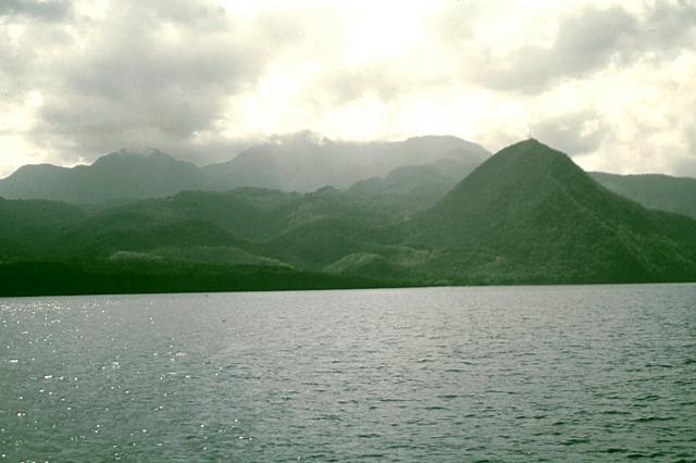
Morne Diablotins
Mountain · 1,447 m
Morne Diablotins is a mountain rising to 1,447 metres (4,747 ft) in Dominica, in the North America region. From PeakBagger.com, with kind permission..
Morne Diablotins is the highest mountain on the Caribbean island of Dominica, and the island's largest and highest volcano. It is the second highest mountain in the Lesser Antilles. Its summit is 1,447 m (4,747 ft) above sea level. It last erupted c. 30,000 years ago.
It takes approximately three hours to reach Morne Diablotins' summit. The first recorded scaling of Morne Diablotin was in the late 1860s, by Scottish physician John Imray.
Adapted from Wikipedia: Morne Diablotins (CC BY-SA 4.0).
- Elevation
- 1,447 m (4,747 ft)
- Global rank
- #504 of 641 indexed
- Region
- North America (#97)
- Subregion
- West Indies
- Country
- Dominica
- Coordinates
- 15.5000°, -61.4000°
Of the 641 named summits indexed in YearMaps, Morne Diablotins ranks #504 by elevation, below La Soufrière (1,467 m) and above Puig Mayor (1,445 m).
- Ranges:
- Wilhelmina Gebergte (South America), Tumuc-Humac Mountains (South America)
- Neighbouring summits:
- Montagne Pelée (1,397 m), Soufrière Hills Volcano (914 m), Mount Obama (402 m)
- Settlements below:
- Roseau (22 km), Pointe-à-Pitre (84 km), Fort-de-France (105 km)
More about Morne Diablotins
Location
Morne Diablotins is located within Morne Diablotin National Park. It is located in the northern interior of the island, about 24 kilometres (15 mi) north of Dominica's capital Roseau and about 10 kilometres (6.2 mi) southeast of Portsmouth, the island's second-largest town. The mountain's runoff is the source of the Toulaman River.
Sections adapted from Wikipedia: Morne Diablotins (CC BY-SA 4.0).
Morne Diablotins: Key Facts
| Topographic prominence | 1,447 m |
|---|
Facts from Wikidata Q1638549 (CC0).
Ports in Dominica
2 ports recorded. Ranked by approach channel depth, the figure that limits which ships can call. Harbours link to their write-up on the page of the sea or coast they lie on.
| # | Name | Channel Depth | Class | Sea | Max Vessel |
|---|---|---|---|---|---|
| 1 | Roseau | 5.5 m | Very Small | Caribbean Sea | large vessels |
| 2 | Portsmouth | — | Very Small | Caribbean Sea | large vessels |
UNESCO World Heritage Sites in Dominica
1 World Heritage Site recorded. Listed by year of inscription, earliest first. Sites shared with another country appear under each.
| # | Name | Inscribed | Type | Criteria |
|---|---|---|---|---|
| 1 | Morne Trois Pitons National Park | 1997 | Natural | (viii) (x) |
Countries Bordering Dominica
Land and maritime neighbours.
More Maps in North America
Dominica: Quick Answers
- What is the capital of Dominica?
- The capital of Dominica is Roseau.
- What is the population of Dominica?
- Dominica has a population of about 65,871, the #204 largest of 225 countries in YearMaps. Source: World Bank, 2025.
- How big is Dominica?
- Dominica covers 751 km², ranking #191 by area, with about 88 people per square kilometre.
- Which continent is Dominica in?
- Dominica is in North America.
- Which countries border Dominica?
- Dominica shares a land or maritime border with Venezuela.
- What is the largest city in Dominica?
- Roseau is the largest city in Dominica, with a metropolitan population of about 23,336.
- What is the highest mountain in Dominica?
- The highest summit recorded for Dominica in YearMaps is Morne Diablotins at 1,447 m (4,747 ft). Summits on a border are counted for both countries.