
Vasco da Gama’s Voyage to India (1497–1499)
Vasco da Gama left Lisbon in July 1497 and swung far out into the South Atlantic, more than three months out of sight of land, before rounding the Cape of Good Hope. With a pilot taken on at Malindi he crossed the Arabian Sea to Calicut in May 1498, opening the first sea route from Europe to Asia. Scurvy killed more than half his men on the way home.
42,065 km mapped17 stops
Route Map of da Gama’s voyage
- Route from recorded positions
- 1Numbered stop (see the itinerary)
- Ship on the map: carrack with castles fore and aft (Age of Discovery), sailing as a fleet of 4
- Ships of the fleet lost: 1 at stop 6, 1 at stop 15
Lines are drawn by YearMaps between the recorded stops, kept at sea around Natural Earth coastlines. They show the order and general track of the voyage, not the exact course steered. How the maps are made.
About da Gama’s voyage
The Portuguese discovery of the sea route to India was the first recorded trip directly from Europe to the Indian subcontinent, via the Cape of Good Hope. Under the command of the Portuguese explorer Vasco da Gama, it was undertaken during the reign of King Manuel in 1497–1499. It is one of the most important events of the Age of Discovery and the Portuguese Empire, and it initiated the Portuguese maritime trade on the Malabar Coast and other parts of the Indian Ocean, the military presence and settlements of the Portuguese in Goa and Bombay.
From Wikipedia: Portuguese discovery of the sea route to India (CC BY-SA 4.0).
Itinerary: 17 Stops
In order of the voyage. Numbers match the map; select a stop to show it there.
Lisbon (Restelo)
DepartureFour ships leave from the beach at Restelo.
Canary Islands
PassageThe fleet passes the Canaries.
Santiago, Cape Verde
Port of callLast water and wood before the open ocean.
St. Helena Bay
LandfallAfter 93 days out of sight of land on the volta do mar, the longest ocean passage yet made by Europeans.
Cape of Good Hope
PassageThe fleet rounds the Cape after several attempts.
Mossel Bay (São Brás)
Port of callThe supply ship is broken up and burned.
Natal
PassageDa Gama names the coast Natal for Christmas Day.
Quelimane (Rio dos Bons Sinais)
Port of callA month of repairs; scurvy breaks out.
Mozambique Island
Port of callFirst contact with the Swahili and Arab trade world. Relations sour quickly.
Mombasa
Port of callHostile reception; the fleet leaves.
Malindi
Port of callThe sultan of Malindi provides a pilot who knows the monsoon route to India.
Kappad, near Calicut
LandfallThe fleet anchors off Calicut after 23 days crossing the Arabian Sea.
Anjediva Island
Port of callRepairs before the return crossing, begun against the monsoon.
Malindi
Port of callA crossing of 132 days; thirty men die of scurvy.
São Brás, Mossel Bay
Port of callThe São Rafael has been burned for lack of crew.
Santiago, Cape Verde
Port of callDa Gama leaves the Berrio to go ahead with his dying brother Paulo.
Lisbon
ArrivalDa Gama enters Lisbon in triumph; the Berrio had arrived on 10 July.
Sources: Álvaro Velho’s Roteiro (journal), via Wikipedia: Portuguese discovery of the sea route to India.
Vasco da Gama’s Voyage to India in Depth
Preparations of the trip
The plan for working on the Cape Route to India was charted by King John II of Portugal as a cost-saving measure in the trade with Asia and also an attempt to monopolize the spice trade. Adding to the increasingly influential Portuguese maritime presence, John II craved for trade routes and for the expansion of the Kingdom of Portugal which had already been transformed into an Empire. However, the project was not realized during his reign. It was his successor, King Manuel I, who designated Vasco da Gama for this expedition, while maintaining the original plan.
However, this development was not viewed well by the upper classes. In the Cortes de Montemor-o-Novo of 1495, an opposite view was visible over the journey that John II had so painstakingly prepared. This point of view was contented with the trade with Guinea and North Africa and feared the challenges posed by the maintenance of any overseas territories, and the cost involved in the launching and maintenance of sea lanes. This position is embodied in the character of The Old Man of Restelo that appears in Os Lusíadas of the Portuguese epic poet Luís Vaz de Camões, who opposed the boarding of the armada. Os Lusíadas is often regarded as the most important work of Portuguese literature. The work celebrates the discovery of a sea route to India by the Portuguese explorer Vasco da Gama.
Manuel I did not share that opinion.
The context
Spices were always considered the gold of the Indies. Cinnamon, ginger, cloves, black pepper, and turmeric had long been products which were difficult to obtain in Europe and were brought in by caravans and experienced merchants coming from the East.
A merchant of Lisbon describes the overland spice route as follows: Only the markets of Venice and Genoa then scattered these spices all over Europe, great in cost, and without guaranteed arrival. Since the late 19th century, a popular theory emerged that the capture of the city of Constantinople by the Ottomans in 1453 caused the trade of Venice and Genoa with the East to reduce to a great degree. So the theory goes: the advantage of the Portuguese to establish a sea route therefore virtually free of assault – however, covered in perils in the sea – showed itself rewarding and outlined a large income to the Portuguese Crown in the future.
Around the year 1481, João Afonso of Aveiro attempted to undertake an exploration of the kingdom of Benin, and gathered information about an almost legendary prince Ogané, whose kingdom was located far to the east of Benin. He was thought to be Christian and one who enjoyed great respect and power. It was said the Benin kingdom where Ogané had his headquarters was twenty moons away in distance, which, according to the account of João de Barros, corresponds to two hundred fifty leagues.
The navy
The crews comprised up to 170 men. The sailors had sailing charts marked with the positions of the African coast known until then, quadrants, astrolabes of various sizes, tables with calculations – such as astronomical tables of Abraham Zacuto – needle and bobs. One of the ships was carrying supplies sufficient for three years: biscuits, beans, dried meats, wine, flour, olive oil, pickles and other pharmacy items. Also planned were continuous replenishment along the coast of Africa. The trip to India was performed by three ships and another ship that carried supplies. These three ships had a captain and a pilot. The ship of groceries had only a captain. Two ships also had a scribe or writer. The first ship had a master.
The voyage
Thus began the expedition on 8 July 1497. The Lisbon shipping line to Cabo Verde was the usual one and the Indian Ocean is described by Álvaro Velho thus: "The coastal route until Malindi and direct passage from this port to Calicut". During this expedition, the latitudes were determined by solar observation, as stated by João de Barros.
Reports of the Daily Board (Diários de Bordo) of the ships note many unique experiences. Also found were a rich flora and fauna. Contact was made near the bay of St. Helena with tribes who ate sea lions, whales, gazelle meat and herbal roots; They walked covered with fur and their weapons were simple wooden spears of Zambujo and animal horns; They saw tribes who played rustic flutes in a coordinated manner, which was a surprising sight for the Europeans. Scurvy (vitamin C deficiency) affected the crew. They crossed into Mozambique with palm trees yielding coconuts.
Despite the adversities of a trip of this scale, the crew retained their curiosity and courage to achieve the feat and get along with people they encountered. To gather pace, they raided ships in search of pilots. With the prisoners, the Captain-General could trade, or put them to work.
It is known, thanks to the Portuguese humanist philosopher Damião de Góis, that during the trip five padrões were set in place. São Rafael, in the Bons Sinais river; São Jorge, Mozambique; the Holy Spirit in Malindi; Santa Maria, in Ilhéus, and São Gabriel, in Calicut.
Arrival in Calicut
On 17 May 1498 the fleet reached Kappakadavu, near Calicut, in the current Indian state of Kerala, thus having established the route via the Indian Ocean and managing to open the sea route from Europe to India.
Negotiations with the local governor, Samutiri Manavikraman Raja, Zamorin of Calicut, were difficult. Vasco da Gama's efforts to obtain favorable commercial terms have been hampered by the different cultures and the low value of their gifts – in the West it was customary for kings to offer presents to the foreign envoys; in the East the kings were expected to be impressed with rich offerings. Goods presented by the Portuguese proved insufficient to impress the Zamorin and representatives of the Zamorin mocked their offers, while the Arab merchants already established there resisted the possibility of unwanted competition.
Vasco da Gama's perseverance made him nevertheless initiate negotiations between himself and the Zamorin, who was pleased with the letters of King Manuel I. Finally, Vasco da Gama managed to get an ambiguous letter of concession rights to trade.
The Portuguese eventually were able to sell their goods at a low price in order to acquire small amounts of spices and jewels to take to their kingdom. However the fleet eventually departed without warning after the Zamorin insisted that they left all their assets as collateral. Vasco da Gama kept his goods, but left a few Portuguese with orders to start a trading post.
Back in Portugal
On 12 July 1499, after more than two years since the beginning of this expedition, the caravel Berrio entered into the river Tagus, commanded by Nicolau Coelho, with the news that thrilled Lisbon: the Portuguese had finally reached India by sea. Vasco da Gama had fallen behind on Terceira Island, preferring to stay on with his brother who was seriously ill, thus foreclosing the celebrations and congratulations by the news.
Of the ships involved, only the São Rafael (St. Raphael) did not return. It was burnt due to its inability to maneuver, as a result of the reduced number of the crew as a result of diseases which killed about half the crew, such as scurvy which was felt acutely while crossing the Indian Ocean. Only 55 of the 148 men who were part of the armada survived the trip.
Vasco da Gama returned home on 31 August and was received by King Manuel I with contentment. He assigned him the title of Don and great rewards.
Manuel I hastened to break the news to the kings of Spain, both as a display of pride as also to warn that both the routes would be explored by the Portuguese Crown.
With the opening of the sea route to the East Indies by the Portuguese, the fall of the Venetian monopoly on the spice trade in Europe was inevitable and the resulting drop in prices of spices contributed to the commercial development of the continent.
Sections adapted from Wikipedia: Portuguese discovery of the sea route to India (CC BY-SA 4.0).
Pictures of da Gama’s voyage
13 images from Wikimedia Commons. Select one to enlarge it.
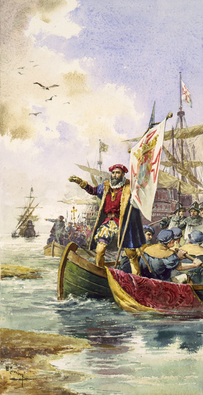
This figure illustrates the path of Vasco da Gama heading for the first time to India (black) as well as the trips of Pêro da Covilhã (orange) and Afonso de Paiva (blue). The path common to both is the green line.Nuno Tavares, based on BlankMap-World.png. Based on informations from many sources, including Wikipedia. · CC BY-SA 3.0 · Commons "Departure of Vasco da Gama to India", by Roque Gameiro, in Quadros da História de Portugal ("Pictures of the History of Portugal", 1917).Roque Gameiro · Public domain · Commons Image of Prester John, enthroned, in a map of East Africa from Queen Mary's AtlasDiogo Homem · Public domain · Commons Prester John mapAbraham Ortelius · Public domain · Commons Extent of Silk Route/Silk Road. Red is land route and the blue is the sea/water route.Whole_world_-_land_and_oceans_12000.jpg: NASA/Goddard Space Flight Center derivative work: Splette (talk) · Public domain · Commons Vasco da Gama, circa 1460-1524António Manuel da Fonseca · Public domain · Commons Vasco da Gama apresenta a D. Manuel as primícias da Índia.unknown, see source for details · Public domain · Commons Vasco da Gama, anonymous portrait, c. 1525Sailko · CC BY 3.0 · Commons Kites are a common site in between the merry children in Kozhiode beach.Mr 037 · CC BY-SA 4.0 · Commons മിഠായിത്തെരുവ്, കോഴിക്കോട്, കേരളംSai K shanmugam · CC BY-SA 4.0 · Commons This is the aerial view of the campus taken from one of the water towers.Own work · Public domain · Commons Night view of Parking BayFaizvvk · CC BY-SA 4.0 · Commons HiLITE City is the first and largest mixed-use development projects in Calicut. HiLITE City caters HiLITE Business Park (Office & Commercial Spaces for rent), HiLITE Mall and HiLITE Residential projects.Vinodpaulcalicut · CC BY-SA 4.0 · Commons
Frequently Asked Questions
How long did da Gama’s voyage take?
It took place in 1497–1499, from Lisbon (Restelo) to Lisbon. The surviving sources do not give exact dates for both ends.
How far did da Gama’s voyage travel?
The route as mapped here, through all 17 stops, is about 42,065 km (22,713 nautical miles). It follows the recorded stops at sea and is a reconstruction, so the true distance sailed was longer.
Who led da Gama’s voyage?
Vasco da Gama, sponsored by Kingdom of Portugal (Manuel I).
What ships were used on da Gama’s voyage?
São Gabriel, São Rafael, Berrio, Supply ship.
Where did da Gama’s voyage start and end?
It started at Lisbon (Restelo) (8 July 1497) and ended at Lisbon (September 1499).
What did da Gama’s voyage achieve?
First voyage directly from Europe to India by sea, opening the Cape Route.