
Whangaehu
Whangaehu is a mapped river in the YearMaps hydrographic index. River courses organise settlement, agriculture and frontier-making more durably than any political boundary, and this reach is indexed against the dams, lakes and cities within its catchment.
- Feature Class
- River
- Coordinates
- -39.66°, 175.42°
About Whangaehu
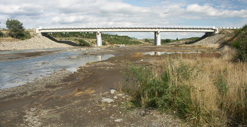
The Whangaehu River is a large river in the central North Island of New Zealand. Its headwaters are the crater lake of Mount Ruapehu on the central plateau, and it flows into the Tasman Sea eight kilometres southeast of Whanganui. Due to the high acidity of the water coming from the crater lake, water is not diverted from the headwaters for the Tongariro Power Scheme. Instead, it bypasses the Waihianoa Aqueduct via a ford.
Encyclopedic summary adapted from Wikipedia: Whangaehu River (CC BY-SA 4.0).
Whangaehu in Depth
Geology
The river is often poisoned with toxic chemicals from the volcanic activity in and around Mount Ruapehu. The upper part of the river begins as the meltwater from a small glacier. When hot water from the lake spills, it quickly melts the ice and snow in the glacier forming a cave-like tunnel.
Sections adapted from Wikipedia: Whangaehu River (CC BY-SA 4.0).
Whangaehu: Key Facts
| Length | 161 km |
|---|---|
| Source | Crater Lake |
| Mouth | Tasman Sea |
| Tributaries | Wahianoa River |
Facts from Wikidata Q1490262 (CC0).
Major River Dossiers
Hand-written studies of the great river systems of history.
Connected Reaches
Nearby watercourses in the same drainage network.
Water Bodies in the Catchment
Settlements Along the Reach
Hydraulic Infrastructure Nearby
Surrounding Terrain
Whangaehu: Quick Answers
- Where is Whangaehu?
- Whangaehu is located in New Zealand, at 39.6579° S, 175.4212° E.
- Are there dams on the Whangaehu?
- No dam on the Whangaehu is recorded in the YearMaps dam index, which covers major structures only.