
Severnaya Dvina
Severnaya Dvina is a mapped river in the YearMaps hydrographic index, part of the Northern Dvina system. River courses organise settlement, agriculture and frontier-making more durably than any political boundary, and this reach is indexed against the dams, lakes and cities within its catchment.
- Feature Class
- River
- System
- Northern Dvina
- Coordinates
- 62.62°, 43.53°
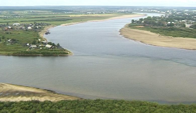
About Severnaya Dvina
The Northern Dvina is a river in northern Russia flowing through Vologda Oblast and Arkhangelsk Oblast into the Dvina Bay of the White Sea. Along with the Pechora River to the east, it drains most of Northwest Russia into the Arctic Ocean. It should not be confused with the Western Dvina (Daugava), to which it is not connected.
The principal tributaries of the Northern Dvina are the Vychegda (right), the Vaga (left), and the Pinega (right).
Encyclopedic summary adapted from Wikipedia: Northern Dvina (CC BY-SA 4.0).
Severnaya Dvina in Depth
Physical geography
The length of the Northern Dvina is 744 kilometres (462 mi). Together with its major tributary, the Sukhona, it is 1,302 kilometres (809 mi) long – about as long as the Rhine in central and western Europe. The area of its basin is 357,052 square kilometres (137,859 mi2).
The river basin of the Northern Dvina includes the major parts of the Vologda and the Arkhangelsk Oblasts, as well as areas in the western part of the Komi Republic and in the northern part of the Kirov Oblast, and minor areas in the north of Yaroslavl and Kostroma Oblasts. The cities of Arkhangelsk and Vologda, as well as many smaller towns, many of those of significant historical importance such as Veliky Ustyug, Totma, Solvychegodsk, and Kholmogory, are located in the river basin of the Northern Dvina.
History
The area was populated by Finnic peoples and then colonized by the Novgorod Republic. The only exception was Veliky Ustyug, which was part of Vladimir-Suzdal Principality. The rest of the Northern Dvina basin was controlled by Novgorod. Veliky Ustyug has been first mentioned in the chronicles in 1207, Shenkursk — in 1229, Solvychegodsk was founded in the 14th century. In the 13th century the Novgorod merchants already reached the White Sea. The area was initially attractive because of fur trading.
Sections adapted from Wikipedia: Northern Dvina (CC BY-SA 4.0).
Severnaya Dvina: Key Facts
| Length | 744 km |
|---|---|
| Average discharge | 3,490 m³/s |
| Drainage basin | 357,000 km² |
| Source | Yug |
| Mouth | Dvina Bay |
| Tributaries | Vaga, Emtsa, Vychegda, Uftyuga, Vaenga, Yorga, Nizhnyaya Toyma, Pinega |
Facts from Wikidata Q8187 (CC0).
Major River Dossiers
Hand-written studies of the great river systems of history.
Connected Reaches
Nearby watercourses in the same drainage network.
Water Bodies in the Catchment
Settlements Along the Reach
Hydraulic Infrastructure Nearby
Surrounding Terrain
Severnaya Dvina: Quick Answers
- Where is Severnaya Dvina?
- Severnaya Dvina is located in Russia, at 62.6183° N, 43.5319° E.
- Are there dams on the Severnaya Dvina?
- No dam on the Severnaya Dvina is recorded in the YearMaps dam index, which covers major structures only.
- Which river system is the Severnaya Dvina part of?
- The Severnaya Dvina is part of the Northern Dvina system.