
Lena
Lena is a mapped river in the YearMaps hydrographic index. River courses organise settlement, agriculture and frontier-making more durably than any political boundary, and this reach is indexed against the dams, lakes and cities within its catchment.
- Feature Class
- River
- Coordinates
- 60.41°, 116.84°
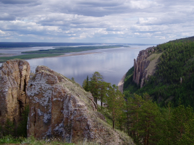
About Lena
The Lena is a river in the Russian Far East and is the easternmost river of the three great rivers of Siberia which flow into the Arctic Ocean, the others being Ob and Yenisey. The Lena River is 4,294 km (2,668 mi) long and has a capacious drainage basin of 2,490,000 km2 (960,000 mi2); thus the Lena is the eleventh-longest river in the world and the longest river entirely within Russia. Geographically, permafrost underlies all the Lena River's catchment, and it is continuous in over 75 percent of the basin.
Encyclopedic summary adapted from Wikipedia: Lena River (CC BY-SA 4.0).
Lena in Depth
Course
The Lena originates at 1,640 meters (5,381 ft) of elevation in the Baikal Mountains, 7 kilometres (4 mi) west of Lake Baikal, south of the Central Siberian Plateau. The Lena flows north-east and traverses the Lena-Angara Plateau, then is joined by three tributary rivers: (i) the Kirenga, (ii) the Vitim, and (iii) the Olyokma. From Yakutsk, the Lena River enters the Central Yakutian Lowland and flows north until joined by the eastern tributary, the Aldan River, and the western tributary, the Vilyuy River. Afterwards, the Lena bends westwards and northwards, flowing between the mountains of the Kharaulakh Range to the east (part of the Verkhoyansk Range) and the mountains of the Chekanovsky Ridge to the west.
History
It is commonly believed that the Lena derives its name from the original Even-Evenk name Elyu-Ene, which means "the Large River".
According to folktales related a century later, in the years 1620–1623 a party of Russian fur hunters under the leadership of Demid Pyanda sailed up Nizhnyaya Tunguska, discovered the Lena, and either carried their boats there or built new ones. In 1623 Pyanda explored some 2,400 kilometres (1,500 mi) of the river from its upper reaches to the central Yakutia. In 1628 Vasily Bugor and 10 men reached the Lena, collected 'yasak' (tribute) from the 'natives' and then founded Kirinsk in 1632. In 1631 the voyevoda of Yeniseysk sent Pyotr Beketov and 20 men to construct a fortress at Yakutsk (founded in 1632).
Sections adapted from Wikipedia: Lena River (CC BY-SA 4.0).
Lena: Key Facts
| Length | 4,294 km |
|---|---|
| Average discharge | 16,350 m³/s |
| Drainage basin | 2,490,000 km² |
| Source | Baikal Mountains |
| Mouth | Laptev Sea |
| Drainage system | Lena basin |
| Tributaries | Vitim, Olyokma, Vilyuy, Kirenga, Aldan, Batamay, Menkere, Muna |
Facts from Wikidata Q46841 (CC0).
Major River Dossiers
Hand-written studies of the great river systems of history.
Connected Reaches
Nearby watercourses in the same drainage network.
Water Bodies in the Catchment
Settlements Along the Reach
Hydraulic Infrastructure Nearby
Surrounding Terrain
Lena: Quick Answers
- Where is Lena?
- Lena is located in Russia, at 60.4059° N, 116.8431° E.
- Are there dams on the Lena?
- No dam on the Lena is recorded in the YearMaps dam index, which covers major structures only.