Karelia
Geoarea · 200,349 km²
Karelia is a geoarea in Europe, covering an estimated 200,349 km². It extends across Russia and Finland.
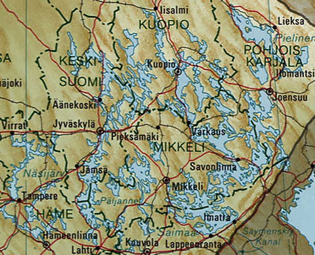
Karelia (; Karelian and Finnish: Karjala [ˈkɑrjɑlɑ]; Livvi: Karjal; Russian: Каре́лия, romanized: Kareliya [kɐˈrʲelʲɪjə], historically Коре́ла, Korela [kɐˈrʲelʲə]; Swedish: Karelen [kɑˈreːlen]) is a cultural region and area in Northern Europe of historical significance for Russia (including the Soviet era), Finland, and Sweden. It is divided between northwestern Russia (the federal subjects of the Republic of Karelia and Leningrad Oblast) and Finland (the regions of South Karelia, North Karelia, and the eastern portion of Kymenlaakso).
Adapted from Wikipedia: Karelia (CC BY-SA 4.0).
- Feature class
- Geoarea
- Mapped extent
- 200,349 km²
- Size rank
- #41 of 231 landforms
- Region
- Europe
- Countries
- Russia, Finland
- Coordinates
- 62.1296°, 32.6811°
- Summits:
- Haltiatunturi (1,328 m)
- Ranges:
- Tatra Mountains (Europe), Harz (Europe)
- Settlements:
- Joensuu (21 km), Savonlinna (108 km), Kuopio (129 km)
More about Karelia
Geography
Karelia stretches from the White Sea coast to the Gulf of Finland. It contains the two largest lakes in Europe, Lake Ladoga and Lake Onega. The Karelian Isthmus is located between the Gulf of Finland and Lake Ladoga. The highest point of Karelia, the 576-metre-high (1,890 ft) Nuorunen, is located on the Russian side of the Maanselkä hill region.
The border between Karelia and Ingria, the land of the closely related Ingrian people, had originally been the Neva River itself but later on it was moved northward into the Karelian isthmus to follow the Sestra River (Russian: Сестра), today in the Saint Petersburg metropolitan area, but in 1812–1940 the Russo-Finnish border.
History
During the Early Middle Ages, settlers from western Finland mixed with the local population to form the Karelian ethnic group. Possible migration from elsewhere may also have contributed to the Karelian ethnic composition.
Archeological evidence indicates that Karelian inhabitation was highest along the western shore of Lake Ladoga and the Karelian Isthmus, with multiple cemeteries and other archeological discoveries dating from AD 600 to AD 800. In South Karelia, the number of archeological discoveries from this time period is lower, though permanent inhabitation was nonetheless present. Lappee, South Karelia has been continuously inhabited for approximately 2,000 years. In North Karelia, only one archeological discovery from this time period has been found, dating to the eighth century.
Tourism
Russian Karelia is a regular destination for international tourism due to its unique architectural, cultural and historical sites such as Kizhi and Valaam. The region is visited by tourists in both summer and winter when possible activities include riding in a sled behind a dog team and running from the banya to an ice hole and back. Summer hikers can visit the Kivach waterfall or the Demon's Chair plateau.
In South Karelia, Lappeenranta is a popular destination for Russian tourists, with 1.5 million visiting annually. Imatrankoski in Imatra has been a tourist attraction since the late 18th century, when the Empress of Russia Catherine the Great visited the site in 1772.
Koli National Park in North Karelia began receiving tourists when Karelianism became a major trend.
Sections adapted from Wikipedia: Karelia (CC BY-SA 4.0).