Skip to content
YearMaps
Ethiopia · Landforms

Mountain Ranges, Deserts and Landforms of Ethiopia

Africa is the largest of the 8 mountain ranges, deserts and other landforms recorded for Ethiopia, at 29.41M km², ahead of Ethiopian Highlands at 638,304 km². The full list follows.

How this list is built: Ranked by mapped area. Covers mountain ranges, deserts, plateaus, named glaciers, plains, basins, peninsulas and capes. One that crosses a border is listed under every country it lies in, with the area of the whole feature. It covers the mountain ranges, deserts and other landforms indexed in YearMaps, drawn from open geospatial data, and is not an exhaustive national register.

Landforms Listed
8
Top Ranked
29.41M km²
Africa
Second
638,304 km²
Ethiopian Highlands
Profiled Below
5
Photo, encyclopedia text and figures
Mountain Ranges, Deserts and Landforms of Ethiopia
#NameArea
1Africa29.41M km²
2Ethiopian Highlands638,304 km²
3Somali Peninsula295,787 km²
4Great Rift Valley96,671 km²
5Danakil3,542 km²
6Eastern Desert835 km²
7Ahmar Mountains258 km²
8Ogaden41 km²

The Landforms of Ethiopia in Detail

The 5 mountain ranges, deserts and other landforms above that have an encyclopedia article, in the same order, each with its photograph, figures and the places around it.

Ethiopian Highlands
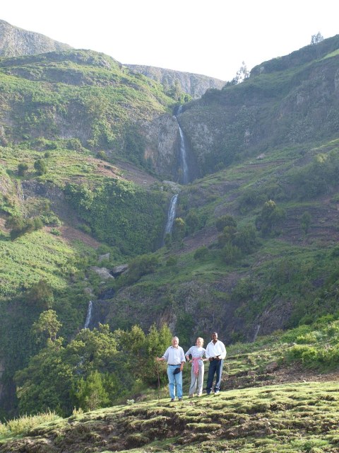
Image via Wikimedia Commons (author and licence on the file page).

Ethiopian Highlands

Range/mtn · 638,304 km²

Ethiopian Highlands is a range/mtn in Africa, covering an estimated 638,304 km². It extends across Ethiopia and Eritrea. It is the 4th-largest of the 216 mountain ranges with a mapped extent in YearMaps.

The Ethiopian Highlands, also known as the Abyssinian Highlands, is a rugged mass of mountains extending from Ethiopia to Eritrea in Northeast Africa. It forms the largest continuous area of its elevation in the continent, with little of its surface falling below 1,500 m (4,900 ft), while the summits reach heights of up to 4,550 m (14,930 ft). It is sometimes called the "Roof of Africa" due to its height and large area. Ethiopia is the only country in the region with such a high elevated surface. This elevated surface is bisected diagonally by the Great East African Rift System which extends from Syria to Mozambique across the East African Great Lakes. Most of the Ethiopian Highlands are part of central and northern Ethiopia, with the Eritrean Highlands as its northernmost portion. The Ethiopia-Yemen Continental Flood Basalts are shared between the Horn of Africa and highlands of Upper Yemen along with the cultural, historical, and genetic ties of the two regions on opposite sides of the Red Sea.

Adapted from Wikipedia: Ethiopian Highlands (CC BY-SA 4.0).

Feature class
Range/mtn
Mapped extent
638,304 km²
Size rank
#4 of 216 mountain ranges
Region
Africa
Countries
Ethiopia, Eritrea
Coordinates
9.3181°, 37.3081°
Summits:
Gugu (3,626 m), Mount Batu (4,307 m), Ras Dejen (4,533 m)
Adjacent ranges:
Ahmar Mountains (Africa), Ogo Mountains (Africa)
Settlements:
Hagere Hiywet (38 km), Addis Ababa (79 km), Giyon (83 km)

View on the live map

More about Ethiopian Highlands

Physical geography

The Highlands are divided into northwestern and southeastern portions by the Main Ethiopian Rift, which contains a number of salt lakes. The northwestern portion, known as the Abyssinian Massif, includes the Semien Mountains, part of which has been designated the Simien Mountains National Park. Its summit, Ras Dashen (4,550 m), is the highest peak in Ethiopia. Lake Tana, the source of the Blue Nile, also lies in the northwestern portion of the Ethiopian Highlands.

The southeastern portion is known as the Harar Massif. It's bounded in the west, by the fault line of the Rift Valley, in the east, by the Ogaden Lowlands and in the south, by the Elkerie and Borena Lowlands. Its highest peaks are located in the Bale Zone of Ethiopia's Oromia Region.

Geology

The Ethiopian Highlands began to rise 75 million years ago, as magma from the Earth's mantle uplifted a broad dome of the ancient rocks of the Arabian-Nubian Shield. The opening of the Great Rift Valley split the dome of the Ethiopian Highlands into three parts; the mountains of the southern Arabian Peninsula are geologically part of the ancient Ethiopian Highlands, separated by the rifting which created the Red Sea and Gulf of Aden and separated Africa from Arabia.

Around 30 million years ago, a flood basalt plateau began to form, piling layers upon layers of voluminous fissure-fed basaltic lava flows. Most of the flows were tholeiitic, save for a thin layer of alkali basalts and minor amounts of felsic (high-silica) volcanic rocks, such as rhyolite.

Climate

Spatial distribution of temperature in Ethiopia is determined primarily by altitude and latitude. Altitude is the main factor that determines the spatial distribution of temperature in Ethiopia. Ethiopia lies within the tropics, a zone of maximum insolation, where every place has overhead sun twice a year. However, considerable portions of Ethiopia are highland areas, and their altitudes give them non-tropical temperatures. Ethiopia's tropical climate occur in lowlands at the country's peripheries. The predominant climate of the Ethiopian Highlands is the Alpine climate.

Because the highlands elevate Ethiopia, located close to the equator, this has resulted in giving this country an unexpectedly temperate climate.

Ecology

The Ethiopian Highlands share a similar flora and fauna to other mountainous regions of Africa; this distinctive flora and fauna is known as Afromontane, but from the time of the last ice age the region has been populated with some Eurasian (palearctic) flora. The habitats are somewhat different on either side of the Great Rift Valley which splits the highlands.

At lower elevations, the highlands are surrounded by tropical savannas and grasslands, including the Sahelian acacia savanna to the northwest and the East Sudanian savanna to the west.

Sections adapted from Wikipedia: Ethiopian Highlands (CC BY-SA 4.0).

Ethiopian Highlands: Key Facts

Key facts about Ethiopian Highlands
Highest pointRas Dashen

Facts from Wikidata Q319288 (CC0).

Danakil
Image via Wikimedia Commons (author and licence on the file page).

Danakil

Desert · 3,542 km²

Danakil is a desert in Africa, covering an estimated 3,542 km². It extends across Eritrea, Djibouti and Ethiopia.

The Danakil Desert (or Afar Desert) is a desert in northeast Ethiopia, southern Eritrea, and northwestern Djibouti. Situated in the Afar Triangle, it stretches across 136,956 square kilometres (52,879 mi2) of arid terrain. It is inhabited by a few Afar, who engage in salt mining. The area is known for its volcanoes and extreme heat, with daytime temperatures surpassing 50 °C (122 °F). Less than 25 mm (1 in) of rainfall occurs each year. The Danakil Desert is one of the lowest and hottest places on Earth.

Adapted from Wikipedia: Danakil Desert (CC BY-SA 4.0).

Feature class
Desert
Mapped extent
3,542 km²
Size rank
#48 of 58 deserts
Region
Africa
Countries
Eritrea, Djibouti, Ethiopia
Coordinates
11.7116°, 43.0740°
Summits:
Ras Dejen (4,533 m), Moussa Ali (2,021 m), Gugu (3,626 m)
Ranges:
Ahmar Mountains (Africa), Ethiopian Highlands (Africa)
Settlements:
Adigrat (63 km), Mekele (79 km), Aksum (137 km)

View on the live map

More about Danakil

Geology

Local geology is characterized by volcanic and tectonic activity, various climate cycles, and discontinuous erosion. The basic geological structure of this area was caused by the movement of tectonic plates as Africa moved away from Asia. Mountain chains formed and were eroded again during the Paleozoic. Inundations by the sea caused the formation of layers of sandstone, and limestone was deposited further offshore. As the land rose again, further sandstone formed above the limestone. Further tectonic shifts caused lava to pour out of cracks and cover the sedimentary deposits.

The Danakil Desert has a number of lakes formed by lava flows that dammed up several valleys. Among these is Lake Afrera, which has thick saline crusts on its banks.

Climate

Dallol (92 metres below sea level), has the highest average temperature recorded on earth. Dallol features an extreme version of a hot desert climate (Köppen climate classification BWh) typical of the Danakil Desert. Dallol is the hottest place year-round on the planet and currently holds the record high average temperature for an inhabited location on Earth, where an average annual temperature of 34.6 °C (94.3 °F) was recorded between the years 1960 and 1966. The annual average high temperature is 41.2 °C (105.4 °F) and the hottest month has an average high of 46.7 °C (116.1 °F). The highest temperature ever recorded is 49 °C (121 °F).

Sections adapted from Wikipedia: Danakil Desert (CC BY-SA 4.0).

Danakil: Key Facts

Key facts about Danakil
Area136,956 km²

Facts from Wikidata Q141513 (CC0).

Eastern Desert
Image via Wikimedia Commons (author and licence on the file page).

Eastern Desert

Desert · 835 km²

Eastern Desert is a desert in Africa, covering an estimated 835 km². It extends across Egypt, Eritrea, Sudan and Ethiopia.

The Eastern Desert (known archaically as Arabia or the Arabian Desert) is the part of the Sahara Desert that is located east of the Nile River. It spans 223,000 square kilometres (86,000 sq mi) of northeastern Africa and is bordered by the Gulf of Suez and the Red Sea to the east, and the Nile River to the west. It extends through Egypt, Eritrea, Ethiopia, and the Sudan. The Eastern Desert consists of a mountain range which runs parallel to the coast (known as the Red Sea Hills), wide sedimentary plateaus extending from either side of the mountains and the Red Sea coast. The rainfall, climate, vegetation and animal life sustained in the desert varies between these different regions. The Eastern Desert has been a mining site for building materials, as well as precious and semi-precious metals, throughout history. It has historically contained many trade routes leading to and from the Red Sea, including the Suez Canal.

Adapted from Wikipedia: Eastern Desert (CC BY-SA 4.0).

Feature class
Desert
Mapped extent
835 km²
Size rank
#52 of 58 deserts
Region
Africa
Countries
Egypt, Eritrea, Sudan, Ethiopia
Coordinates
26.9205°, 33.9860°
Summits:
Ras Dejen (4,533 m), Moussa Ali (2,021 m), Gugu (3,626 m)
Ranges:
Lebanon Mountains (Asia), Taurus Mountains (Asia)
Settlements:
Aksum (1,505 km), Adigrat (1,516 km), Mekele (1,598 km)

View on the live map

More about Eastern Desert

Geography

Between 100 and 35 million years ago the area that is now the Eastern Desert was underwater, covered by the Tethys Ocean. During the Oligocene period, around 34 million years ago, the land began to tilt and the coastline was pushed back to the north and west. Concurrently, the basement complex to the east was uplifted, forming the mountain range of the Desert. In this same sequence of land movements, a rift which is now the Red Sea was opened up.

The mountain range of the Eastern Desert runs between 80 and 137 kilometres (50 and 85 mi) inland from and parallel to the Red Sea Coast. It has peaks around 1,500 metres (4,900 ft) above sea level. The southern mountains are predominantly composed of igneous rock while the mountains to the north are composed of limestone.

Climate

The Eastern Desert has a semi-arid/arid/hyper-arid climate. On average, the region usually receives less than 25 millimetres (0.98 in) of rainfall per year in infrequent patterns. Most of the rainfall occurs during the winter months around the mountains. The mountains can create a rain shadow for the rest of the Desert, contributing to the arid environment.

Average temperatures are between 14 and 21 °C (57 and 70 °F) in winter (November–March) and 23.1 and 23.1 °C (73.6 and 73.6 °F) in summer (May–September). The weather is typically sunny; however, sandstorms can occur, usually between March and June. The storms (khamsins) are caused by tropical air moving up from Sudan, accompanied by strong winds and higher temperatures.

History

The earliest signs of humans in the desert was found in the form of flint tools from 250,000 BC.

Around 25,000 BC, the land underwent significant climatic change which transformed the grassy plains into desert. This made the land much less habitable, driving nomads which had inhabited what is now the Eastern Desert towards the Nile River.

Trade routes from the Nile to the Red Sea were established through the Desert. Notably, there was a route between the Nile River and Mersa Gawasis, an ancient Egyptian port. There were also many mines and quarries along this route. Boats were carried in pieces across the desert through the wadis and then set up once they reached the port to embark on expeditions.

Sections adapted from Wikipedia: Eastern Desert (CC BY-SA 4.0).

Ahmar Mountains
Image via Wikimedia Commons (author and licence on the file page).

Ahmar Mountains

Range/mtn · 258 km²

Ahmar Mountains is a range/mtn in Africa, covering an estimated 258 km².

The Ahmar Mountains is a mountain range of the Ethiopian Highlands, located in the eastern Oromia Region of Ethiopia.

The range has an average elevation of 2,965 metres (9,728 ft) above sea level.

The mountain range is located approximately 11 km (7 mi) south of Dire Dawa, 12 km (7 mi) from Jijiga by road.

Adapted from Wikipedia: Ahmar Mountains (CC BY-SA 4.0).

Feature class
Range/mtn
Mapped extent
258 km²
Size rank
#197 of 216 mountain ranges
Region
Africa
Coordinates
9.6648°, 42.9573°
Summits:
Moussa Ali (2,021 m), Gugu (3,626 m), Shimbiris (2,414 m)
Adjacent ranges:
Ogo Mountains (Africa), Ethiopian Highlands (Africa)
Settlements:
Jijiga (39 km), Harar (96 km), Dire Dawa (121 km)

View on the live map

More about Ahmar Mountains

Climate

Elevation is the major factor in temperature levels, with the higher areas, on average, 10 °C (50 °F) cooler, day or night. The temperature drops to roughly 50–53 °F (10–12 °C) at night.

Numerous rock formations are found here. The Jubba and Shabelle rivers have their origins in this mountain range.

Sections adapted from Wikipedia: Ahmar Mountains (CC BY-SA 4.0).

Ahmar Mountains: Key Facts

Key facts about Ahmar Mountains
Highest pointKundudo

Facts from Wikidata Q2895205 (CC0).

Ogaden
Image via Wikimedia Commons (author and licence on the file page).

Ogaden

Geoarea · 41 km²

Ogaden is a geoarea in Africa, covering an estimated 41 km².

Ogaden (pronounced and often spelled Ogadēn; Somali: Ogaadeen, Amharic: ውጋዴ/ውጋዴን) is one of the historical names used for the modern Somali Region. It is also natively referred to as Soomaali Galbeed (lit. 'Western Somalia'). The region forms the eastern portion of Ethiopia and borders Somalia.

The Ogaden is a vast plateau located to the south and southeast of the Ethiopian Highlands, and is overwhelmingly inhabited by Somali people. It represents the westernmost region inhabited by the Somalis in the Horn of Africa. It is largely a semi-arid region and encompasses the plains between the border of Somalia and Ethiopia, extending towards the southeastern highlands, where larger cities like Harar and Dire Dawa are located near. The Ogaden is known for its oil and gas reserves.

The Ogaden region has been defined by over a century of popular revolts and armed Somali self-determination movements following a process of annexation that began with the invasion of the region by the Ethiopian Empire in the 1890s and concluded with the final British handovers of the region in the mid-1950s.

Adapted from Wikipedia: Ogaden (CC BY-SA 4.0).

Feature class
Geoarea
Mapped extent
41 km²
Size rank
#221 of 231 landforms
Region
Africa
Coordinates
8.6251°, 43.2009°
Summits:
Gugu (3,626 m), Moussa Ali (2,021 m), Mount Batu (4,307 m)
Ranges:
Ahmar Mountains (Africa), Ogo Mountains (Africa)
Settlements:
Jijiga (92 km), Harar (139 km), Dire Dawa (182 km)

View on the live map

More about Ogaden

Geography

The Somali Region, the second largest region in Ethiopia is around 300,000 square kilometres (120,000 sq mi), and borders Djibouti, Kenya and Somalia. Important towns include Jijiga, Degahbur, Gode, Kebri Dahar, Fiq, Shilabo, Kelafo, Werder and Danan.

The Ogaden is part of the Somali Acacia–Commiphora bushlands and thickets ecoregion. It has been a historic habitat for the endangered African wild dog, Lycaon pictus; However, this canid is thought by some to have been extirpated from Ogaden.

The Ogaden is a plateau, with an elevation above sea level that ranges from 1,500 metres (4,900 ft) in the northwest, falling to about 300 metres (980 ft) along the southern limits and the Wabi Shebelle valley.

History

There are few historical texts written about the people who lived in what is known today as the Somali Region, sometimes referred to as "The Ogaden" region of Ethiopia. The vast majority of the inhabitants today are Muslim and ethnically homogenous. In its early history, the Ogaden was inhabited by Harla, a now extinct people. Harla are linked to the Harari and Somali Ogaden clan. The region became one of the earliest footholds for the spread of Islam into Africa. At the time, rivalries between the established Muslims in the Ogaden were recurring with those of the littoral in Zeila.

The Ogaden region was part of the Ifat Sultanate in the 13th century and later the Adal Sultanate in the 15th century.

Sections adapted from Wikipedia: Ogaden (CC BY-SA 4.0).

Ogaden: Key Facts

Key facts about Ogaden
Area327,068 km²

Facts from Wikidata Q137555 (CC0).

More on Ethiopia

Quick Answers

What is the largest landform in Ethiopia?
Africa, at 29.41M km². Ethiopian Highlands is second at 638,304 km². Rankings cover the mountain ranges, deserts and other landforms indexed in YearMaps.
How many mountain ranges, deserts and other landforms are there in Ethiopia?
YearMaps lists 8 mountain ranges, deserts and other landforms for Ethiopia. This is the number mapped in the atlas, not an official national count.