
Des Moines
Des Moines is a mapped river in the YearMaps hydrographic index. River courses organise settlement, agriculture and frontier-making more durably than any political boundary, and this reach is indexed against the dams, lakes and cities within its catchment.
- Feature Class
- River
- Coordinates
- 42.31°, -93.95°
About Des Moines
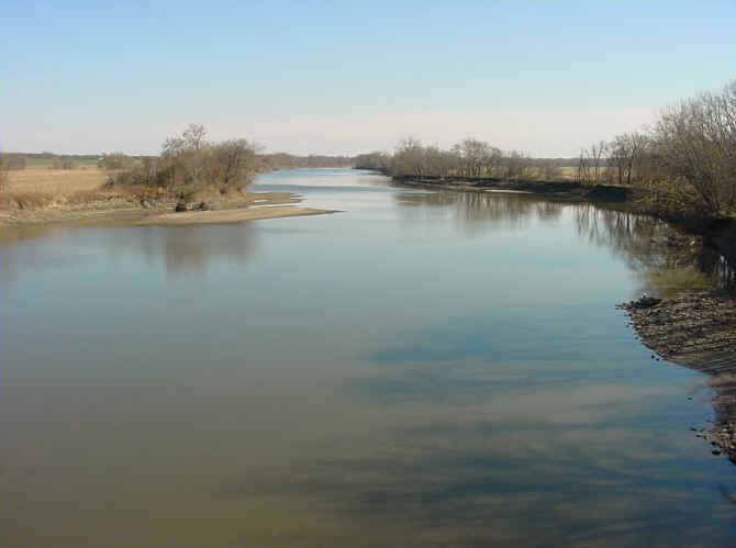
The Des Moines River ( ) is a tributary of the Mississippi River in the upper Midwestern United States that is approximately 525 miles (845 km) long from its farther headwaters. The largest river flowing across the state of Iowa, it rises in southern Minnesota and flows across Iowa from northwest to southeast, passing from the glaciated plains into the unglaciated hills, transitioning near the capital city of Des Moines in the center of the state. The river continues to flow in a southeastern direction away from Des Moines, flowing directly into the Mississippi River. The Des Moines River forms a short portion of Iowa's border with Missouri between Lee County, Iowa and Clark County, Missouri.
The city of Des Moines, Iowa, was named for the river.
Encyclopedic summary adapted from Wikipedia: Des Moines River (CC BY-SA 4.0).
Des Moines in Depth
History
One of the earliest French maps that depicts the Des Moines (1703) refers to it as "R. des Otentas", which translates to "River of the Otoe"; the Otoe Tribe lived in the interior of Iowa in the 18th century. The Meskwaki and Sauk people referred to the river as "Ke-o-shaw-qua" (Hermit's River), from which Keosauqua, Iowa, derives its name. The Dakota Indians, who lived near its headwaters in present-day Minnesota, referred to it as "Inyan Shasha" in their Siouan language. Another Siouan name was "Eah-sha-wa-pa-ta," or "Red Stone" river, possibly referring to the bluffs at Red Rock or the reddish Sioux Quartzite bedrock near its headwaters.
The origin of the name Des Moines is obscure. Early French explorers named it La Rivière des Moines, literally meaning "River of the Monks".
Sections adapted from Wikipedia: Des Moines River (CC BY-SA 4.0).
Des Moines: Key Facts
| Length | 845 km |
|---|---|
| Average discharge | 246 m³/s |
| Drainage basin | 38,340 km² |
| Mouth | Mississippi River |
| Drainage system | Des Moines River drainage basin |
| Tributaries | Boone River, Raccoon River, Beaver Creek, Competine Creek, Lizard Creek, Middle River, North River, South River |
Facts from Wikidata Q492787 (CC0).
Major River Dossiers
Hand-written studies of the great river systems of history.
Connected Reaches
Nearby watercourses in the same drainage network.
Water Bodies in the Catchment
Settlements Along the Reach
Hydraulic Infrastructure Nearby
Surrounding Terrain
Des Moines: Quick Answers
- Where is Des Moines?
- Des Moines is located in United States, at 42.3082° N, 93.9497° W.
- Are there dams on the Des Moines?
- No dam on the Des Moines is recorded in the YearMaps dam index, which covers major structures only.