Skip to content
YearMaps
Spain · Landforms

Mountain Ranges, Deserts and Landforms of Spain

PeníNsula IbéRica is the largest of the 5 mountain ranges, deserts and other landforms recorded for Spain, at 581,401 km², ahead of Sierra Morena at 29,398 km². The full list follows.

How this list is built: Ranked by mapped area. Covers mountain ranges, deserts, plateaus, named glaciers, plains, basins, peninsulas and capes. One that crosses a border is listed under every country it lies in, with the area of the whole feature. It covers the mountain ranges, deserts and other landforms indexed in YearMaps, drawn from open geospatial data, and is not an exhaustive national register.

Landforms Listed
5
Top Ranked
581,401 km²
PeníNsula IbéRica
Second
29,398 km²
Sierra Morena
Profiled Below
2
Photo, encyclopedia text and figures
Mountain Ranges, Deserts and Landforms of Spain
#NameArea
1PeníNsula IbéRica581,401 km²
2Sierra Morena29,398 km²
3Cord. Cantábrica27,599 km²
4S. Nevada22,482 km²
5Pyrenees20,678 km²

The Landforms of Spain in Detail

The 2 mountain ranges, deserts and other landforms above that have an encyclopedia article, in the same order, each with its photograph, figures and the places around it.

Sierra Morena
Image via Wikimedia Commons (author and licence on the file page).

Sierra Morena

Range/mtn · 29,398 km²

Sierra Morena is a range/mtn in Europe, covering an estimated 29,398 km².

The Sierra Morena is one of the main systems of mountain ranges in Spain. It stretches for 450 kilometres from east to west across the south of the Iberian Peninsula, forming the southern border of the Meseta Central plateau and providing the watershed between the valleys of the Guadiana to the north and the west, and the Guadalquivir to the south.

Its highest summit is the 1,332 m high Bañuela. Other notable peaks are Corral de Borros 1,312 m and Cerro de la Estrella 1,298 m.

The name Sierra Morena has a strong legendary reputation in Spanish culture and tradition, with myths about bandits (Los bandidos de Sierra Morena), a giant snake (El Saetón de Sierra Morena) and a child brought up by wolves (Marcos Rodríguez Pantoja), among others. This range is also mentioned in the famous Mexican song "Cielito Lindo" and in one of the most well known traditional Spanish songs, "Soy Minero", interpreted by Antonio Molina.

Adapted from Wikipedia: Sierra Morena (CC BY-SA 4.0).

Feature class
Range/mtn
Mapped extent
29,398 km²
Size rank
#109 of 216 mountain ranges
Region
Europe
Coordinates
38.0655°, -5.7033°
Summits:
Rock of Gibraltar (426 m), Mulhacén (3,479 m), Pico de Almanzor (2,592 m)
Adjacent ranges:
Er Rif (Africa), Moyen Atlas (Africa)
Settlements:
Seville (77 km), Córdoba (84 km), Mérida (109 km)

View on the live map

More about Sierra Morena

Ecology

The Sierra Morena is one of the last habitats of the endangered Iberian lynx.

Other charismatic animals of the region include the Iberian wolf (2019 declared extinct regionally by the Large Carnivore Initiative for Europe), Wild boar, Red deer, the Spanish imperial eagle and the Golden eagle. Among the amphibians, wells and ponds in many areas of the range provide a habitat for the near-threatened Iberian ribbed newt.

A National Geographic Channel documentary film featuring an overview of some of the region's wildlife was produced in 2015.

History

The ranges of Sierra Morena have valuable deposits of copper, gold, silver, iron, lead, mercury, and other metals, some of which have been exploited since prehistoric times.

The ancient Iberians used the mountain passes as a passage between the high plateau in the north and the Guadalquivir basin.

The bleak Sierra Morena mountains were also notorious in former times for being a haunt of bandits and highwaymen. The Nuevas Poblaciones de Sierra Morena y Andalucía administrative division was started in 1767 during the reign of Charles III of Spain in order to populate the mountainous zone. As a consequence the area around La Carolina was settled with farmers that included German, Swiss and Flemish families.

Description

The Sierra Morena stretches for 450 km in an E-W direction from the high course of the Guadalmena River in the Sierra del Relumbrar until northwestern Huelva Province, extending into Portugal. The system is the result of the uplift produced by the pressure of the northward-moving African Plate. It is made up of hard Paleozoic rocks such as granite and quartzite, as well as softer materials such as slate and gneiss.

Its name, roughly meaning 'dark range', is likely derived from the dark color of some of the rocks and vegetation of the ranges that make up the mountainous system. It is also mentioned as Sierra Mariánica in some documents.

Sections adapted from Wikipedia: Sierra Morena (CC BY-SA 4.0).

Sierra Morena: Key Facts

Key facts about Sierra Morena
Length400 km
Highest pointSierra Madrona

Facts from Wikidata Q686362 (CC0).

Pyrenees
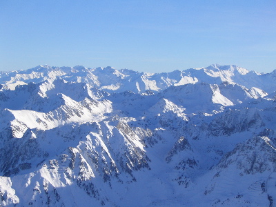
Image via Wikimedia Commons (author and licence on the file page).

Pyrenees

Range/mtn · 20,678 km²

Pyrenees is a range/mtn in Europe, covering an estimated 20,678 km². It extends across France, Spain and Andorra.

The Pyrenees is a mountain range in southwestern Europe, straddling the France–Spain border. The Pyrenees extend nearly 500 kilometres (310 mi) from their union with the Cantabrian Mountains to Cap de Creus on the Mediterranean coast, reaching a maximum elevation of 3,404 metres (11,168 ft) at the peak of Aneto, in Huesca, Spain.

The main crest mostly forms a political divide between the states of Spain and France, with the microstate of Andorra sandwiched in between. Historically, the Crown of Aragon and the Kingdom of Navarre extended on both sides of the mountain range.

Adapted from Wikipedia: Pyrenees (CC BY-SA 4.0).

Feature class
Range/mtn
Mapped extent
20,678 km²
Size rank
#124 of 216 mountain ranges
Region
Europe
Countries
France, Spain, Andorra
Coordinates
42.5744°, 2.5416°
Summits:
Pico de Aneto (3,404 m), Moncayo (2,313 m), Torre de Cerredo (2,648 m)
Adjacent ranges:
Jura (Europe), Sierra Morena (Europe)
Settlements:
Tarragona (179 km), Barcelona (181 km), Mataró (181 km)

View on the live map

More about Pyrenees

Geography

The Spanish Pyrenees are part of the following provinces, from east to west: Girona, Barcelona and Lleida (all in Catalonia), Huesca and Zaragoza (both in Aragon), Navarra (in Navarre) and Gipuzkoa (in the Basque Country).

The French Pyrenees are part of the following départements, from east to west: Pyrénées-Orientales (also known as Northern Catalonia), Aude, Ariège, Haute-Garonne, Hautes-Pyrénées, and Pyrénées-Atlantiques (the latter two of which include the Pyrenees National Park).

The independent principality of Andorra is sandwiched in the eastern portion of the mountain range between the Spanish Pyrenees and French Pyrenees.

Physiographically, the Pyrenees may be divided into three sections: the Atlantic (or Western), the Central, and the Eastern Pyrenees.

Geology

The Pyrenees are older than the Alps: their sediments were first deposited in coastal basins during the Paleozoic and Mesozoic eras. During Ediacaran to Ordovician times, Pyrenees were located at the Northwest margin of Gondwana, where they formed a lateral continuity of neighbouring areas, such as the Montagne Noire and the Mouthoumet massifs and Southwestern territory of Sardinia. Between 100 and 150 million years ago, during the Early Cretaceous Period, the Bay of Biscay fanned out, pushing present-day Spain against France and applying intense compressional pressure to large layers of sedimentary rock. The intense pressure and uplifting of the Earth's crust first affected the eastern part and moved progressively to the entire chain, culminating in the Eocene Epoch.

Climate

The amount of precipitation the range receives, including rain and snow, is much greater in the western than in the eastern Pyrenees because of the moist air that blows in from the Atlantic Ocean over the Bay of Biscay. After dropping its moisture over the western and central Pyrenees, the air is left dry over the eastern Pyrenees. The winter average temperature is −2 °C (28 °F).

Sections of the mountain range vary in more than one respect. There are some glaciers in the western and snowy central Pyrenees, but there are no glaciers in the eastern Pyrenees because there is insufficient snowfall to cause their development.

Sections adapted from Wikipedia: Pyrenees (CC BY-SA 4.0).

Pyrenees: Key Facts

Key facts about Pyrenees
Length491 km
Area19,000 km²
Highest pointAneto

Facts from Wikidata Q12431 (CC0).

More on Spain

Quick Answers

What is the largest landform in Spain?
PeníNsula IbéRica, at 581,401 km². Sierra Morena is second at 29,398 km². Rankings cover the mountain ranges, deserts and other landforms indexed in YearMaps.
How many mountain ranges, deserts and other landforms are there in Spain?
YearMaps lists 5 mountain ranges, deserts and other landforms for Spain. This is the number mapped in the atlas, not an official national count.