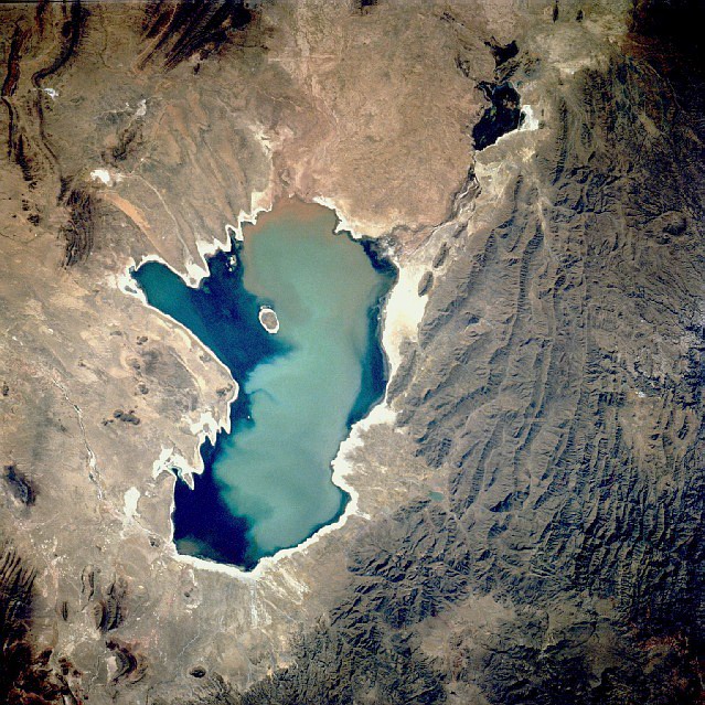
Lago Titicaca
Lake · 8,135 km²
Lago Titicaca is a lake in Peru and Bolivia, with a mapped surface area of about 8,135 km². About 38% of its surface lies in Bolivia, and the rest in Peru.
Lake Titicaca (; Spanish: Lago Titicaca [ˈlaɣo titiˈkaka]; Quechua: Titiqaqa and Aymara: Titiqaqa) is a large lake in the Andes mountains on the border of Bolivia and Peru. It is often called the highest navigable lake in the world. It is often listed as a freshwater lake, though its waters are slightly brackish. Titicaca is the largest lake in South America, both in terms of the volume of water and surface area. It is the 18th largest lake in the world. It has a surface elevation of 3,812 m (12,507 ft).
Adapted from Wikipedia: Lake Titicaca (CC BY-SA 4.0).
- Surface area
- 8,135 km²
- Area rank
- #25 of 756 indexed
- Type
- Lake
- Countries
- Peru, Bolivia
- Coordinates
- -15.7370°, -69.5127°
Among the 756 water bodies with a mapped extent in YearMaps, Lago Titicaca ranks #25 by surface area, after Lake Eyre North (8,144 km²) and ahead of Lake Athabasca (8,047 km²). Areas are computed from the mapped outline and are approximate.
- Other water nearby:
- Lago Poopó (1,558 km²)
More about Lago Titicaca
Geology
The Tinajani Basin, in which Lake Titicaca lies, is an intermontane basin. This basin is a pull-apart basin created by strike-slip movement along regional faults starting in the late Oligocene and ending in the late Miocene. The initial development of the Tinajani Basin is indicated by volcanic rocks, which accumulated between 27 and 20 million years ago within this basin. They lie upon an angular unconformity which cuts across pre-basin strata. Lacustrine sediments of the Lower Tinajani Formation, which are exposed within the Tinajani Basin, demonstrate the presence of a pre-Quaternary, ancestral Lake Titicaca within it between 18 and 14 million years ago (Mya).
Ecology
The lake holds large populations of water birds and was designated as a Ramsar Site on August 26, 1998. It has also been designated an Important Bird Area (IBA), in both Bolivia and Peru, by BirdLife International because it supports significant populations of many bird species. Several threatened species such as the huge Titicaca water frog and the flightless Titicaca grebe are largely or entirely restricted to the lake.
Overview
The lake is located at the northern end of the endorheic Altiplano basin high in the Andes on the border of Peru and Bolivia. The western part of the lake lies within the Puno Region of Peru, and the eastern side is located in the Bolivian La Paz Department.
The lake consists of two nearly separate subbasins connected by the Strait of Tiquina, which is 800 m (2,620 ft) across at the narrowest point. The larger subbasin, Lago Grande (also called Lago Chucuito), has a mean depth of 135 m (443 ft) and a maximum depth of 284 m (932 ft). The smaller subbasin, Wiñaymarka (also called Lago Pequeño, "little lake"), has an average depth of 9 m (30 ft) and a maximum depth of 40 m (131 ft). The overall average depth of the lake is 107 m (351 ft).
Five major river systems feed into Lake Titicaca.
Climate
Lake Titicaca has a cold subtropical highland climate. The average annual precipitation is 610 mm (24 in) mostly falling in summer thunderstorms. Winters are dry with very cold nights and mornings and warm afternoons.
The cold sources and winds over the lake give it an average surface temperature of 10 to 14 °C (50 to 57 °F). In the winter (June – September), mixing occurs with the deeper waters, which are always between 10 and 11 °C (50 and 52 °F). Below are the average temperatures of the town of Juliaca, in the northern part of the lake.
Sections adapted from Wikipedia: Lake Titicaca (CC BY-SA 4.0).
Lago Titicaca: Key Facts
| Surface area | 8,372 km² |
|---|---|
| Maximum depth | 489 m |
| Volume | 893 km³ |
| Surface elevation | 3,812 m |
| Inflows | Suches River, Ramis River, Coata River, Huancané River, Ilave River |
| Outflows | yuca guasi, evaporation |
| Drainage system | Titicaca basin |
Facts from Wikidata Q35342 (CC0).