
Map of Bandundu
Bandundu is a first-level division of DR Congo. Its largest mapped city is Kikwit, with about 637,736 people in the metropolitan area. The interactive map below is centred on Bandundu, and the tables list its 11 mapped cities along with the lakes nearest to them.
- Cities Mapped
- 11
- Largest City
- Kikwit
- Country
- DR Congo
Interactive Map of Bandundu
About Bandundu
Bandundu is one of eleven former provinces of the Democratic Republic of the Congo. It bordered the provinces of Kinshasa and Bas-Congo to the west, Équateur to the north, and Kasai-Occidental to the east. The provincial capital is also called Bandundu (formerly Banningstad/Banningville).
Summary adapted from Wikipedia: Bandundu Province (CC BY-SA 4.0).
Bandundu in Depth
History
Bandundu was formed in 1966 by merging the three post-colonial political regions: Kwilu, Kwango, and Mai-Ndombe. Under the 2006 constitution, Bandundu was to be broken up again into the aforementioned political regions.
This finally took place in the 2015 repartitioning. Kwilu province was formed by combining the Kwilu district and the cities of Bandundu and Kikwit, Kwango province from the Kwango district, and Mai-Ndombe province by combining the Plateaux and Mai-Ndombe districts.
Geography
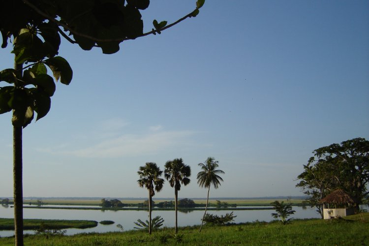
The landscape of Bandundu province consisted primarily of plateaus covered in savanna, cut by rivers and streams that are often bordered by thick forest.
The province was bisected by the Kasai River, which flows into the Congo River on the province's western boundary.
Lake Mai-Ndombe is the largest lake, with this lake and the surrounding swamp forest forming the southern portion of the Tumba-Ngiri-Maindombe Ramsar wetlands.
Economy
Most villages are situated on the higher ground, with the villagers practicing shifting slash-and-burn agriculture in the valleys. The main crops are manioc (cassava), maize, squash, and beans.
The villagers raise chickens, ducks, goats, sheep and cattle, and supplement their diet with fish and bushmeat. A few Indian and Chinese business people selling electronics, such as cell phones, televisions and sound systems, have opened shop recently.
Sections adapted from Wikipedia: Bandundu Province (CC BY-SA 4.0).
Bandundu: Key Facts
| Population | 5,201,000 (1998) |
|---|---|
| Area | 295,658 km² |
| Capital | Bandundu |
| Established | 1966 |
Facts from Wikidata Q671442 (CC0).
History of Bandundu: Empires and States
The atlas records 3 polities whose mapped territory included part of Bandundu, from Belgian Congo in 1890 CE to 2024 CE. They are listed in the order they first appear.
| Polity | Period here |
|---|---|
| Belgian Congo | 1890–1959 CE |
| Democratic Republic of the Congo | 1960–2024 CE |
| Zaire | 1973–1995 CE |
Historical Maps of Bandundu
Bandundu on the world map in each year one of these states held it:
Derived by testing mapped cities against dated territorial polygons. Dates are when the polygons cover this place, not the polity's whole lifespan, and polities absent from the source dataset are not listed.
Largest Cities in Bandundu
11 cities mapped. Ranked by metropolitan population. A port city's harbour is written up on the page of its sea.
| # | Name | Population | Region | Role |
|---|---|---|---|---|
| 1 | Kikwit | 637,736 | Bandundu | Populated place |
| 2 | Bandundu | 118,211 | Bandundu | Admin-1 capital |
| 3 | Kahemba | 50,000 | Bandundu | Populated place |
| 4 | Bulungu | 48,344 | Bandundu | Populated place |
| 5 | Inongo | 40,113 | Bandundu | Populated place |
| 6 | Mangai | 37,188 | Bandundu | Populated place |
| 7 | Mushie | 33,062 | Bandundu | Populated place |
| 8 | Bolobo | 27,862 | Bandundu | Populated place |
| 9 | Kasongo-Lunda | 20,060 | Bandundu | Populated place |
| 10 | Kenge | 241 | Bandundu | Populated place |
| 11 | Lusanga | 177 | Bandundu | Populated place |
Largest Lakes in Bandundu
1 lake mapped. Ranked by mapped surface area. A lake on a border is listed under each country it lies in, with the area of the whole lake. Assigned by the nearest mapped city, so features near the boundary may belong to a neighbouring division.
| # | Name | Surface Area | Type |
|---|---|---|---|
| 1 | Lac Mai-Ndombe | 2,000 km² | Lake |
Bandundu: Quick Answers
- Where is Bandundu?
- Bandundu is a first-level division of DR Congo, in Africa. Its mapped cities centre on 4.3840° S, 17.7315° E.
- What is the largest city in Bandundu?
- Kikwit is the largest city mapped in Bandundu, with a metropolitan population of about 637,736.
- How many cities are in Bandundu?
- YearMaps maps 11 cities and towns in Bandundu, with a combined metropolitan population of about 1.01 million. This counts mapped settlements, not every municipality.
- What is the largest lake in Bandundu?
- The largest lake mapped in or beside Bandundu is Lac Mai-Ndombe, at about 2,000 km².