Skip to content
YearMaps
Afghanistan · Mountains

Highest Mountains in Afghanistan

Nowshak is the highest of the 5 mountains recorded for Afghanistan, at 7,492 m, ahead of Shah Fuladi at 5,048 m. The full list follows.

How this list is built: Ranked by summit elevation above sea level. A summit on a border is listed under both countries. It covers the mountains indexed in YearMaps, drawn from open geospatial data, and is not an exhaustive national register.

Mountains Listed
5
Top Ranked
7,492 m
Nowshak
Second
5,048 m
Shah Fuladi
Profiled Below
4
Photo, encyclopedia text and figures
Highest Mountains in Afghanistan
#NameElevation
1Nowshak7,492 m
2Shah Fuladi5,048 m
3Sikaram4,755 m
4Kuh-e Jang Qal'eh4,171 m
5Khyber Pass1,070 m

The Mountains of Afghanistan in Detail

The 4 mountains above that have an encyclopedia article, in the same order, each with its photograph, figures and the places around it.

Nowshak
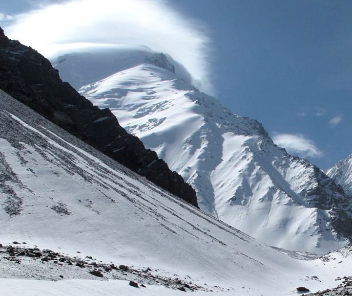
Image via Wikimedia Commons (author and licence on the file page).

Nowshak

Mountain · 7,492 m

Nowshak is a mountain rising to 7,492 metres (24,580 ft) in Afghanistan and Pakistan, in the Asia region. The summit stands on the border between them. From PeakBagger.com, with kind permission..

Noshaq, (Pashto: نوشاخ/نوشک)also called Noshakh or Nowshakh, is a 7,492 m (24,580 ft) high peak in the Hindu Kush mountain range lying on the border of Afghanistan and Pakistan. It is the highest mountain in Afghanistan, the second highest in the Hindu Kush after Tirich Mir, and the 52nd highest in the world. It is also the westernmost 7,000 m (22,966 ft) peak in the world.

The south and eastern sides of the mountain are in Pakistan whereas the north and west sides are in Afghanistan. The easiest access to Noshaq is from the village of Qazideh in the Wakhan District of Badakhshan Province in Afghanistan. Foreigners are required to have an Afghan visa, including a special permission letter from Afghanistan's Ministry of Information and Culture.

Adapted from Wikipedia: Noshaq (CC BY-SA 4.0).

Elevation
7,492 m (24,580 ft)
Global rank
#14 of 641 indexed
Region
Asia (#14)
Countries
Afghanistan, Pakistan
Coordinates
36.4221°, 71.7811°

Of the 641 named summits indexed in YearMaps, Nowshak ranks #14 by elevation, below Pik Imeni Ismail Samani (7,495 m) and above Pik Pobeda (7,439 m).

Ranges:
Hindu Kush (Asia), Pamirs (Asia)
Neighbouring summits:
Khyber Pass (1,070 m), Sikaram (4,755 m), Shah Fuladi (5,048 m)
Settlements below:
Feyzabad (133 km), Asadabad (182 km), Taloqan (203 km)

View on the live map

More about Nowshak

Climbing history

Noshaq main was first climbed by a Japanese expedition on 17 August 1960, led by Professor Yajiro Sakato. Other members of the expedition were Goro Iwatsubo and Toshiaki Sakai. The climb followed the normal Afghanistan approach, the West ridge from the Qazideh Glacier.

Noshaq East, Noshaq Central and Noshaq West were first climbed in 1963 by Austrians Dr. Gerald Gruber and Rudolf Pischenger.

The Tiroler Hindukusch-Ski-Expedition of Akademischer Alpenklub Innsbruck (Austria) made the first ski descent from the summit of Noshaq in 1970. The famous meteorologist Karl Gabl was a member of the team.

The first winter ascent was 13 February 1973 by Tadeusz Piotrowski and Andrzej Zawada, members of a Polish expedition, via the north face.

Sections adapted from Wikipedia: Noshaq (CC BY-SA 4.0).

Nowshak: Key Facts

Key facts about Nowshak
Topographic prominence2,024 m
Mountain rangeHindu Kush

Facts from Wikidata Q271700 (CC0).

Shah Fuladi
Image via Wikimedia Commons (author and licence on the file page).

Shah Fuladi

Mountain · 5,048 m

Shah Fuladi is a mountain rising to 5,048 metres (16,562 ft) in Afghanistan, in the Asia region.

The Baba Mountain range (Pashto: بابا غر Bâbâ Ǧar; Persian: کوه بابا Kōh-i Bābā; or Kūh-e Bābā; Kōh or Kūh meaning ′mountain′, Bābā meaning ′father′) is the western extension of the Hindu Kush, and the origin of Afghanistan's Kabul, Arghandab, Helmand, Farah, Hari, Murghab, Balkh, and Kunduz rivers. The mountain range is crowned by Foladi peak (or Shah Fuladi) rising 5048 m (some old maps and dictionaries: 5143 m) above sea level, and is located south of Bamyan.

The Koh-e Firoz plateau merges farther to the west by gentle gradients into the Paropamise, and which may be traced across the Hari River to Mashad. To the southwest of the culminating peaks, long spurs divide the upper tributaries of the Helmand River, and separate its basin from that of the Farah River. These spurs retain a considerable altitude, marked by peaks exceeding 11,000 ft (3,400 m). They sweep in a broad band of roughly parallel ranges to the southwest, preserving their general direction till they abut on the Great Registan desert to the west of Kandahar, where they terminate in a series of detached and broken anticlines whose sides are swept by a sea of encroaching sand.

Adapted from Wikipedia: Koh-i-Baba (CC BY-SA 4.0).

Elevation
5,048 m (16,562 ft)
Global rank
#60 of 641 indexed
Region
Asia (#38)
Country
Afghanistan
Coordinates
34.6421°, 67.6277°

Of the 641 named summits indexed in YearMaps, Shah Fuladi ranks #60 by elevation, below Mount Ararat (5,137 m) and above Mount Blackburn (4,996 m).

Ranges:
Sulaiman Range (Asia), Hindu Kush (Asia)
Neighbouring summits:
Sikaram (4,755 m), Khyber Pass (1,070 m), Ayrybaba (3,137 m)
Settlements below:
Bamian (22 km), Mayda Shahr (109 km), Ghazni (140 km)

View on the live map

More about Shah Fuladi

Shah Fuladi: Key Facts

Key facts about Shah Fuladi
Mountain rangeHindu Kush

Facts from Wikidata Q2886920 (CC0).

Sikaram
Image via Wikimedia Commons (author and licence on the file page).

Sikaram

Mountain · 4,755 m

Sikaram is a mountain rising to 4,755 metres (15,600 ft) in Afghanistan and Pakistan, in the Asia region. The summit stands on the border between them. From PeakBagger.com, with kind permission..

Mount Sikaram (Pashto, Dari, Urdu: سیکرم) is a mountain on the Afghanistan–Pakistan border, south of the Kabul River and Khyber Pass. At 4,755 m (15,600 ft), it is the highest peak of the Spīn Ghar, or Safēd Kōh, mountain range.

Adapted from Wikipedia: Mount Sikaram (CC BY-SA 4.0).

Elevation
4,755 m (15,600 ft)
Global rank
#69 of 641 indexed
Region
Asia (#41)
Countries
Afghanistan, Pakistan
Coordinates
34.0400°, 69.9001°

Of the 641 named summits indexed in YearMaps, Sikaram ranks #69 by elevation, below Mount Blanc (4,807 m) and above Klyuchevskaya Sopka (4,750 m).

Ranges:
Sulaiman Range (Asia), Hindu Kush (Asia)
Neighbouring summits:
Khyber Pass (1,070 m), Shah Fuladi (5,048 m), Nowshak (7,492 m)
Settlements below:
Jalalabad (66 km), Gardiz (80 km), Kabul (85 km)

View on the live map

More about Sikaram

History

1878: British forces were victorious over Afghan forces and seized control of the Peiwar Pass in the Battle of Peiwar Kotal.

1878-1879: British surveyor George Batley Scott climbed the mountain during a campaign to survey Afghanistan.

Location

Mount Sikaram is located north of the village of Peshawar in the Kurram District of Pakistan’s Khyber Pakhtunkhwa province. Its parent range, Spīn Ghar, connects directly with the Shandūr offshoot of the Hindu Kush mountain system. Atop the range, temperatures can fall below 0 °C (32 °F) at any time of the year.

A small valley on the slope of Mount Sikaram encompasses a number of villages, settlements, and tribal regions—many of them historically significant—including Peiwar, Alizai, Tari Mangal, Narai, Speena Shaga, and Khewas. The Gawi Pass, also known as the Peiwar Kotal Pass, runs between the Kurram Valley and Afghanistan's Aryub Valley; it connects the Paktia Province of Afghanistan with the Kurram District of Khyber Pakhtunkhwa province in the former FATA region of Pakistan.

Sections adapted from Wikipedia: Mount Sikaram (CC BY-SA 4.0).

Sikaram: Key Facts

Key facts about Sikaram
Topographic prominence2,295 m
Mountain rangeSafēd Kōh

Facts from Wikidata Q3631196 (CC0).

Khyber Pass
Image via Wikimedia Commons (author and licence on the file page).

Khyber Pass

Pass · 1,070 m

Khyber Pass is a pass rising to 1,070 metres (3,510 ft) in Afghanistan and Pakistan, in the Asia region. The summit stands on the border between them.

The Khyber Pass is a mountain pass in the Khyber District of the Pakistani province of Khyber Pakhtunkhwa, along the international border with Afghanistan. It connects the town of Landi Kotal to the Valley of Peshawar at Jamrud by traversing part of the White Mountains. Since it was part of the ancient Silk Road, it has been a vital trade route between Central Asia and the Indian subcontinent and a strategic military choke point for various states that controlled it. The Khyber Pass is considered one of the most famous mountain passes in the world.

Adapted from Wikipedia: Khyber Pass (CC BY-SA 4.0).

Elevation
1,070 m (3,510 ft)
Global rank
#550 of 641 indexed
Region
Asia (#188)
Countries
Afghanistan, Pakistan
Coordinates
34.0984°, 71.0978°

Of the 641 named summits indexed in YearMaps, Khyber Pass ranks #550 by elevation, below Mont Bengoué (1,070 m) and above Chilkoot Pass (1,067 m).

Ranges:
Sulaiman Range (Asia), Hindu Kush (Asia)
Neighbouring summits:
Sikaram (4,755 m), Nowshak (7,492 m), Shah Fuladi (5,048 m)
Settlements below:
Jalalabad (72 km), Asadabad (85 km), Kabul (182 km)

View on the live map

More about Khyber Pass

Geography and demography

Along Asian Highway 1 (AH1), the summit of the pass at Landi Kotal lies 5 km (3 mi) inside Pakistan, descending 460 m (1,510 ft) into the Peshawar Valley at Jamrud, about 30 km (19 mi) from the Afghan border, traversing part of the Spin Ghar mountains. The pass starts at Kadam near Jamrud, 18 km (11 mi) west of Peshawar. The total length of the pass proper is 25 mi (40 km) from Jamrud to Landi Kotal, although the lesser section of the pass runs for additional 8 mi (13 km) westwards until the town of Lōya Daka, in Afghanistan. The height of the summit is 3,373 ft (1,028 m).

To the north of the Khyber Pass lies the country of the Shalmani tribe and Mullagori tribe. To the south is Afridi Tirah, while the inhabitants of villages in the Pass itself are Afridi clansmen.

Ancient history

A number of historical invasions of the Indian subcontinent have been through the Khyber Pass, such as those of Darius I, Ardashir I, Shapur I and Anushirvan, and later, Mongols such as Duwa, Qutlugh Khwaja and Kebek. Prior to the Kushan era, the Khyber Pass was not a widely used trade route.

The pass has been traversed by military expeditions launched by empires such as the Achaemenids and Sassanids, as well as by nomadic invaders from Central Asia, including the Saka, Yuezhi, and White Huns. Indian empires rarely extended their control beyond the pass, with the Maurya king Chandragupta being an exception.

The Khyber Pass has witnessed the spread of Greek influence into India and the expansion of Buddhism in the opposite direction.

Sections adapted from Wikipedia: Khyber Pass (CC BY-SA 4.0).

Khyber Pass: Key Facts

Key facts about Khyber Pass
Mountain rangeSafēd Kōh

Facts from Wikidata Q191333 (CC0).

More on Afghanistan

Quick Answers

What is the highest mountain in Afghanistan?
Nowshak, at 7,492 m. Shah Fuladi is second at 5,048 m. Rankings cover the mountains indexed in YearMaps.
How many mountains are there in Afghanistan?
YearMaps lists 5 mountains for Afghanistan. This is the number mapped in the atlas, not an official national count.