
The Qhapaq Ñan (Great Inca Road System)
The peerless 30,000-kilometer Inca road network scaling the dizzying spine of the Andes mountains, united by chasqui relay runners and grass suspension bridges.
Places Along the Qhapaq Ñan (Great Inca Road System)

Commercial Genesis & Spatial Network
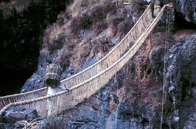
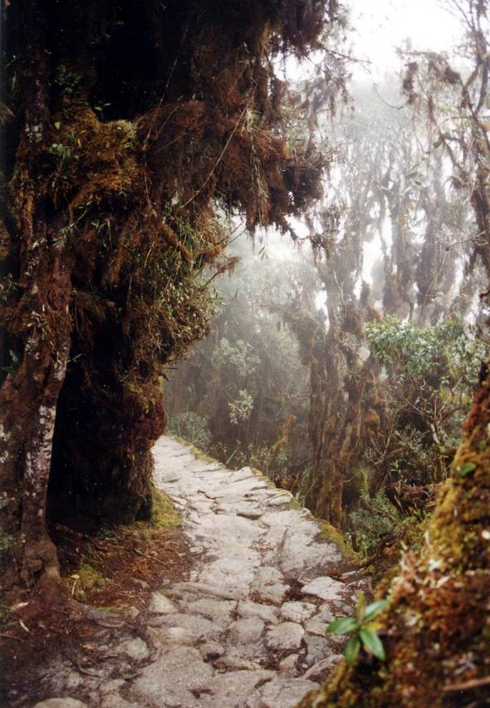
Constructed without the wheel, iron tools, or draft animals larger than the llama, the Qhapaq Ñan is one of the greatest engineering feats in human history. Comprising two parallel north-south trunk routes (the Andean Highland Highway and the Coastal Highway) interlinked by transverse lateral roads, it scaled altitudes exceeding 5,000 meters. Paved with fitted stone blocks, terraced stairways, and woven ichu-grass suspension bridges (q’eswachaka), it allowed the Sapa Inca to govern a 4,000-km realm.
Economic Impact & Cultural Diffusion
Enabled the state-controlled redistributive economy of the Tawantinsuyu, moving tribute goods between tambo supply waystations and funding imperial granaries.
Logistics, Caravanserais & Overland Hazards
- ▲Extreme Andean altitude sickness (soroche) across passes above 4,800 meters
- ▲Chasqui messenger relay runners capable of transmitting quipu messages 240 km in a single day
- ▲Annual ritual rebuilding of woven grass rope bridges across sheer canyon chasms
- ▲Careful staging of llama pack trains, limited to carrying ~30-40 kg over rocky stone stairways
Custodial Empires & Polities
Sovereign states that safeguarded, taxed, or maintained garrisons along this route: